Embed Size (px)
Citation preview
Qualityfrom WPH Earth Observation
11 December 2019, Vienna, Austria1
Magdalena Mleczko, Marek Morze, Przemysław Slesinski
ESSnet Big Data Pilots II, Pilot Track Meeting
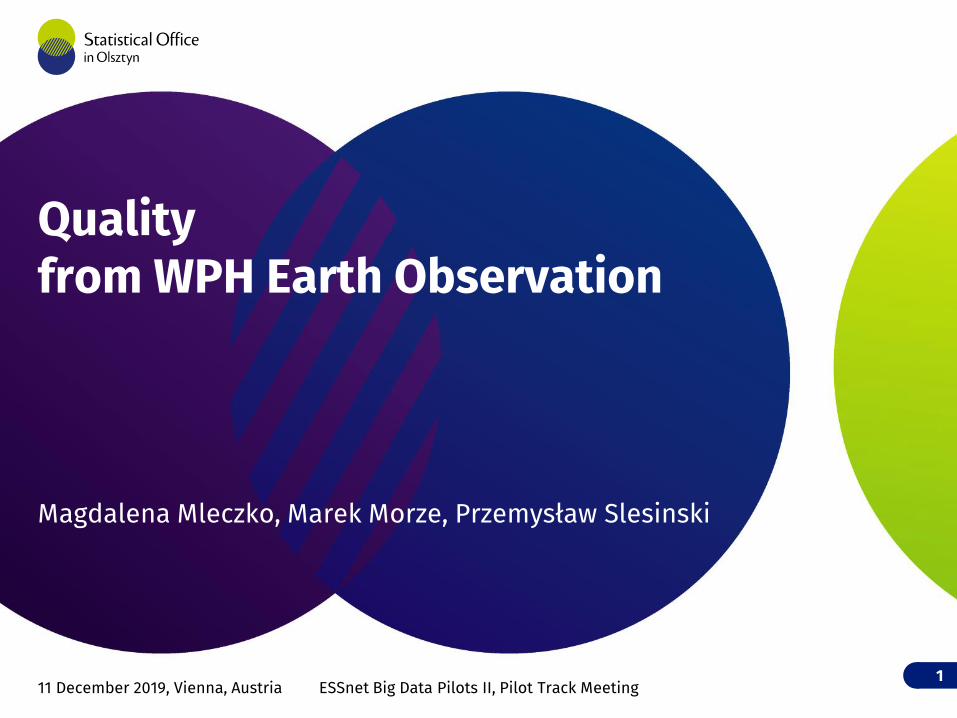
Methodological framework
2
State of the Art
Statistical product definition
Data collection
Pilot production
Pre-works STAGE 1 STAGE 4
Main data processing- Methods and
procedure description
- Data processing
STAGE 3
Data source & Toolkit- Data sources
review
- Data access condition
- Toolkit and software
Quality assessment of collected data
Test site definition
Main findings
Quality assessment of results
Results analysis
IT Infrastructure for collecting data
IT Infrastructure for main data processing
Data pre-processing
STAGE 2
Quality assessment of pre-processed data
IT Infrastructure for pre-processing data
Metadata of collected data
Metadata of pre-processed data
Metadata of results
Assessment of the data timeliness, ensuring continuity of data sources and statistical information for longer time period
Validation
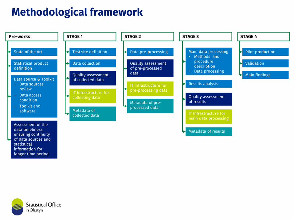
S.03 Statistical Representation
3
Thematic field
Case study
Main specification of final product
DescriptionStatistical indicator
Basic research (experimental
and theoretical research) =
analysis
Support/improvement of existing
systems for statistical
production
Agriculture
CS1 + • Types of crops and their acreage
CS2 + • The agricultural area under vegetation cover in winter
CS3 + • Identified crops on small parcels.
Build-up area
CS4 +• Open space for public divided
into the streets, the green open public spaces and others open public spaces.
CS5 + • Build-up area
CS6 + • Quality of urban life
Land coverCS7 +
• Land cover maps which provides a list of points from TERUTI sample where land cover likely changed since 2017.
CS8 + • Land cover
Settlements,Enumeration Areasand Forestry
CS9 + +
• updated version of the geography of the Settlements and Enumeration Areas for Census 2021,
• indicator of the total of eucalyptus plantation
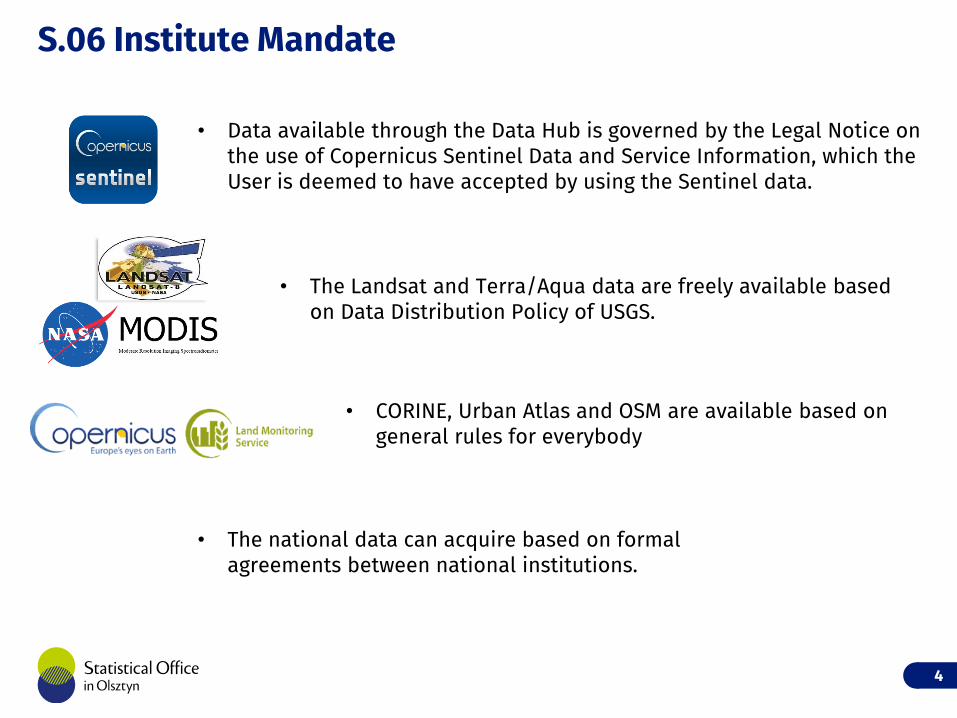
S.06 Institute Mandate
4
• Data available through the Data Hub is governed by the Legal Notice on the use of Copernicus Sentinel Data and Service Information, which the User is deemed to have accepted by using the Sentinel data.
• The Landsat and Terra/Aqua data are freely available based on Data Distribution Policy of USGS.
• CORINE, Urban Atlas and OSM are available based on general rules for everybody
• The national data can acquire based on formal agreements between national institutions.
S.07A Privacy
• Used EO data are freely available for anyone.
• Only some data from paying agencies can contain sensitive information/personal information.
• For statistic production in agriculture mapping we don’t need personal information.
• Personal information should be removed by paying agencies on sharing stage to avoid problem with legal or ethical issues.
5
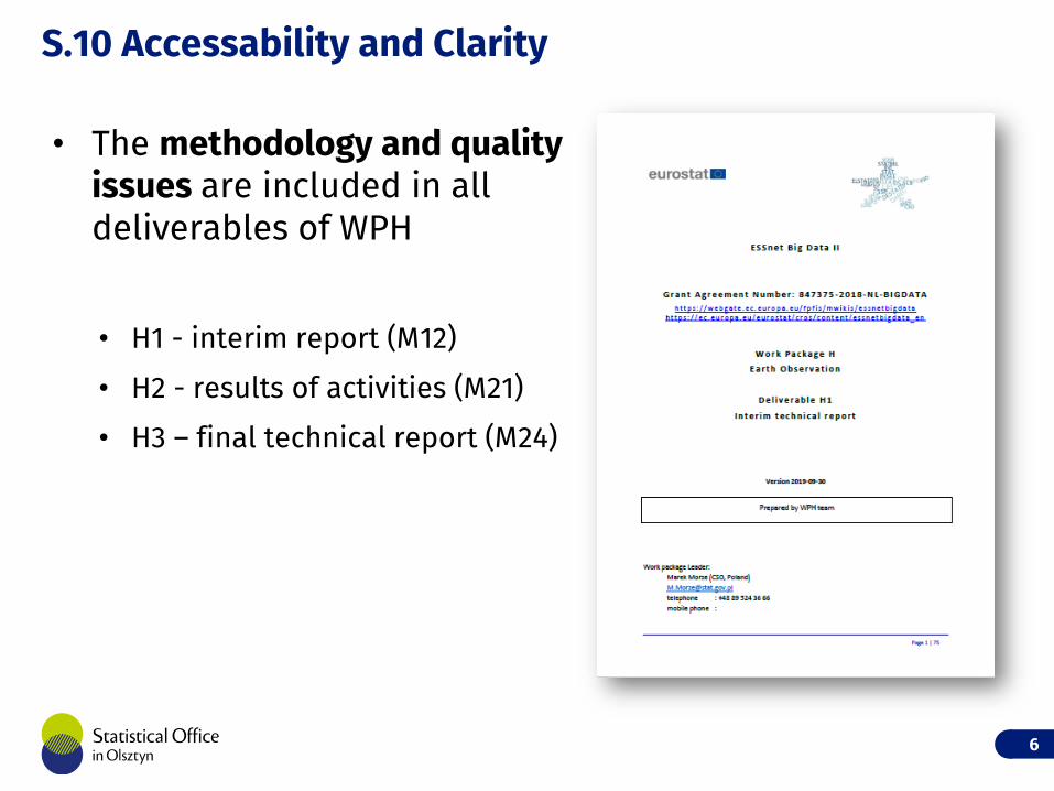
S.10 Accessability and Clarity
• The methodology and qualityissues are included in alldeliverables of WPH
• H1 - interim report (M12)
• H2 - results of activities (M21)
• H3 – final technical report (M24)
6
S.12 Relevance
• Added value trough new data source
• EO data can facilitate and improve the mandatory statistical registers. easier and faster statistical production
• The important value is fact that Earth Observation sources provide continuously, timely, accurate and with global coverage acquisitions. wider coverage
• The example of added value is that EO data can replace an existing methods of crops acreage or IDGs indicator estimation more reliable
7
S.13 Accuracy and Reliability
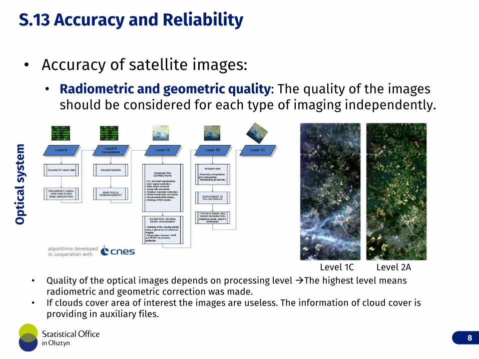
• Accuracy of satellite images:• Radiometric and geometric quality: The quality of the images
should be considered for each type of imaging independently.
8
• Quality of the optical images depends on processing level The highest level means radiometric and geometric correction was made.
• If clouds cover area of interest the images are useless. The information of cloud cover is providing in auxiliary files.
Op
tica
l sys
tem
Level 1C Level 2A
S.13 Accuracy and Reliability
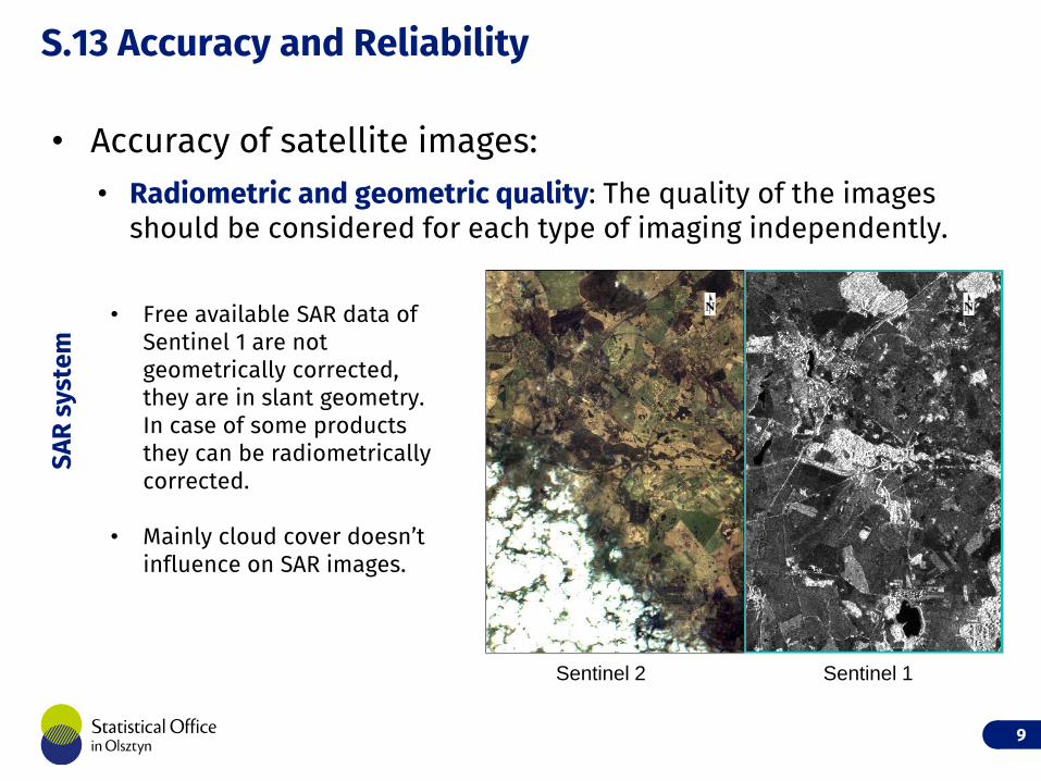
• Accuracy of satellite images:• Radiometric and geometric quality: The quality of the images
should be considered for each type of imaging independently.
9
• Free available SAR data of Sentinel 1 are not geometrically corrected, they are in slant geometry. In case of some products they can be radiometrically corrected.
• Mainly cloud cover doesn’t influence on SAR images.
SAR
sys
tem
Sentinel 2 Sentinel 1
S.13 Accuracy and Reliability
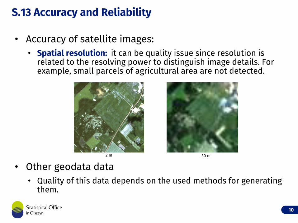
• Accuracy of satellite images:• Spatial resolution: it can be quality issue since resolution is
related to the resolving power to distinguish image details. For example, small parcels of agricultural area are not detected.
• Other geodata data• Quality of this data depends on the used methods for generating
them.
10
30 m2 m
S.13 Accuracy and Reliability
• Using machine learning algorithms the digital image classification is performed.
• Accuracy assessment of image classification is presented as confusion matrix, with parameters like• overall accuracy,
• KIA index,
• producer and user accuracy
11
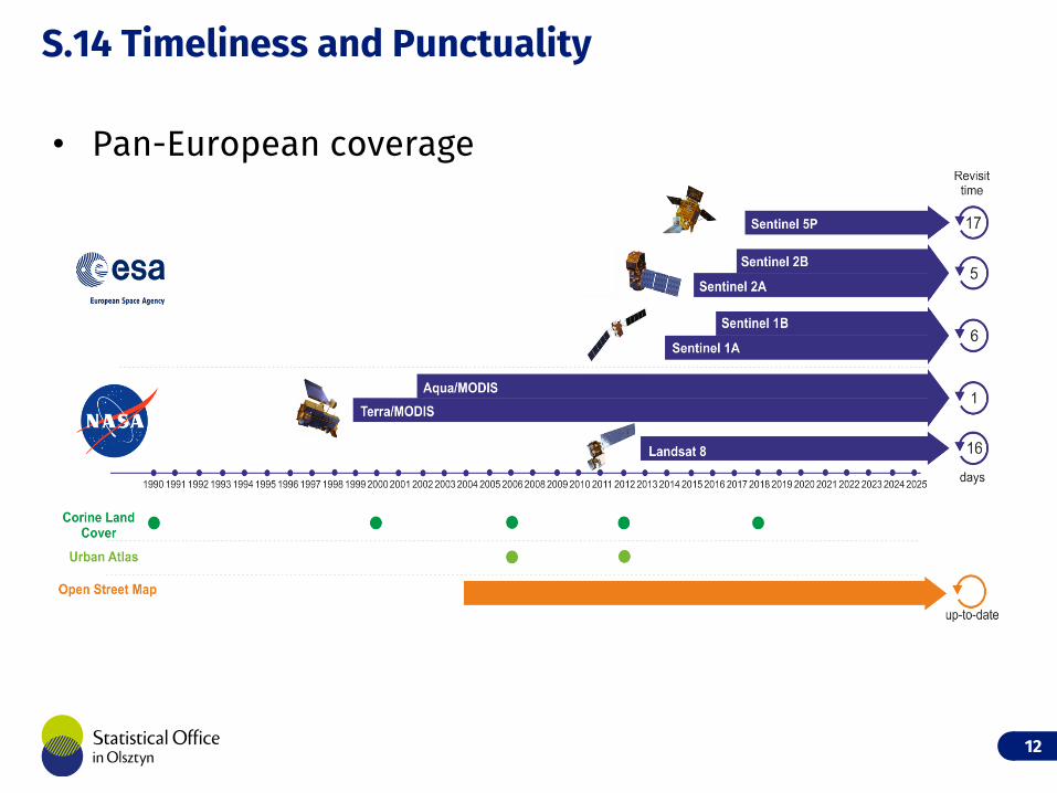
S.14 Timeliness and Punctuality
12
• Pan-European coverage
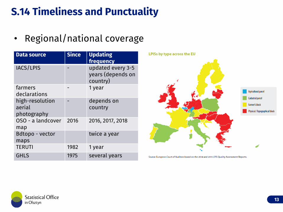
S.14 Timeliness and Punctuality
13
Data source Since Updating frequency
IACS/LPIS - updated every 3-5 years (depends on country)
farmers declarations
- 1 year
high-resolution aerial photography
- depends on country
OSO - a landcover map
2016 2016, 2017, 2018
Bdtopo - vector maps
twice a year
TERUTI 1982 1 year
GHLS 1975 several years
• Regional/national coverage
S.16 Cost and burden
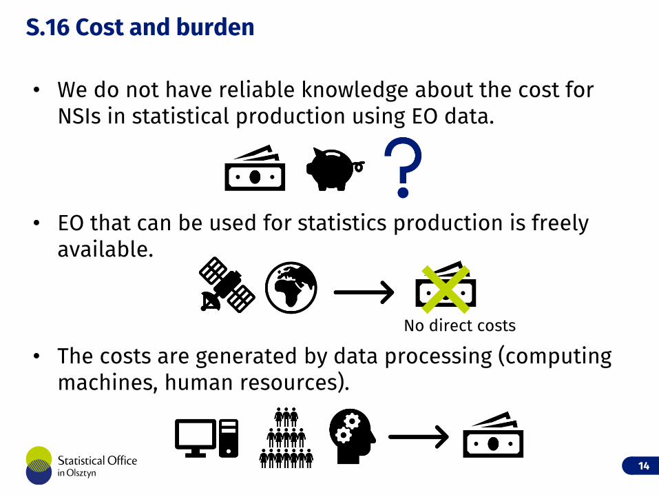
• We do not have reliable knowledge about the cost for NSIs in statistical production using EO data.
• EO that can be used for statistics production is freely available.
• The costs are generated by data processing (computing machines, human resources).
14
No direct costs
S.18 Statistical Processing
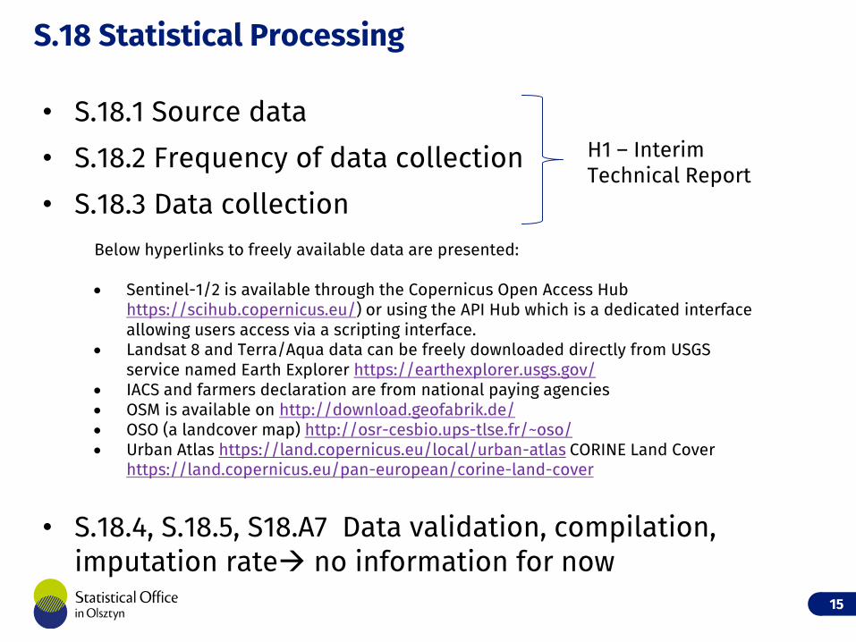
• S.18.1 Source data
• S.18.2 Frequency of data collection
• S.18.3 Data collection
• S.18.4, S.18.5, S18.A7 Data validation, compilation, imputation rate no information for now
15
Below hyperlinks to freely available data are presented:
Sentinel-1/2 is available through the Copernicus Open Access Hub https://scihub.copernicus.eu/) or using the API Hub which is a dedicated interface allowing users access via a scripting interface.
Landsat 8 and Terra/Aqua data can be freely downloaded directly from USGS service named Earth Explorer https://earthexplorer.usgs.gov/
IACS and farmers declaration are from national paying agencies OSM is available on http://download.geofabrik.de/ OSO (a landcover map) http://osr-cesbio.ups-tlse.fr/~oso/ Urban Atlas https://land.copernicus.eu/local/urban-atlas CORINE Land Cover
https://land.copernicus.eu/pan-european/corine-land-cover
H1 – Interim Technical Report
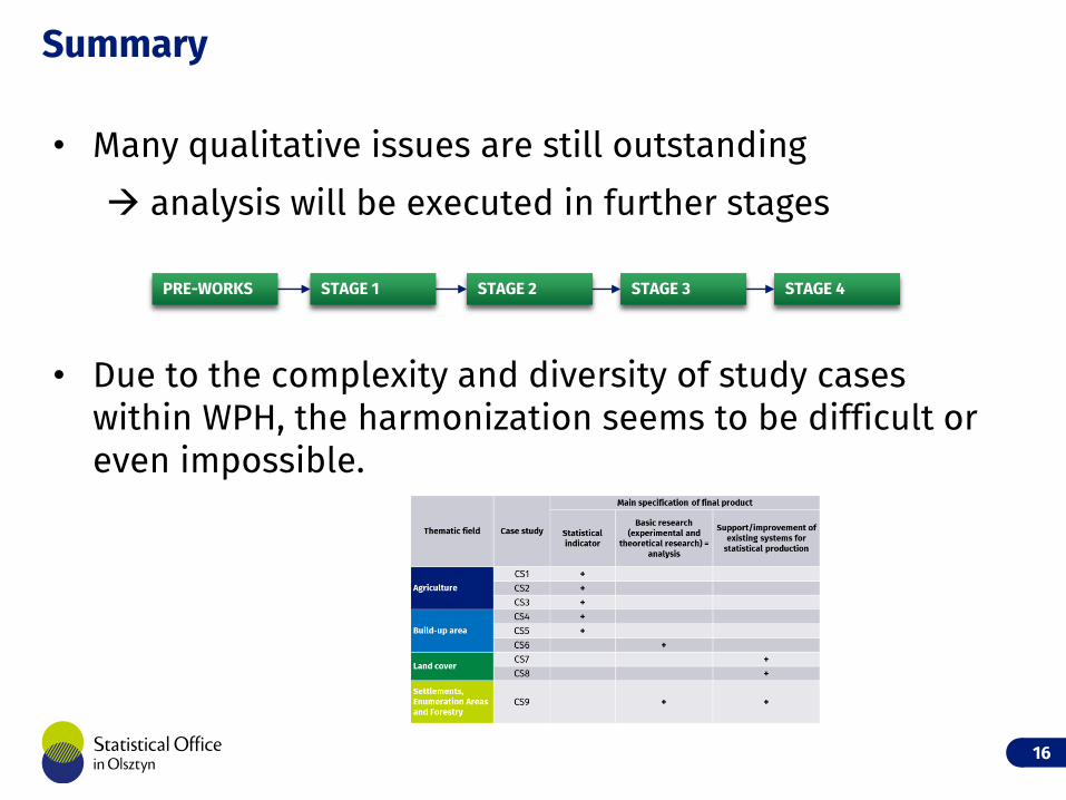
• Many qualitative issues are still outstanding
analysis will be executed in further stages
• Due to the complexity and diversity of study cases within WPH, the harmonization seems to be difficult or even impossible.
Summary
16
PRE-WORKS STAGE 1 STAGE 4STAGE 3STAGE 2