Embed Size (px)
Citation preview
Report of theCommunity ConservationResilience Initiative in
Sabah, Malaysia

Country report on Sabah, MalaysiaCommunity Conservation Resilience Initiative (CCRI)April 2018
Author: Lysandra Chin Voon Oi
Editor: Holly Jonas
For more information: http://globalforestcoalition.org/resources/supporting-community-conservation/
Cover photo: Efforts have been made by communities to replant damaged areas with mangrove trees.
PACOS Trust/GFCC
The production of this country report has been made possible thanks to the support of the Commonwealth
Foundation, the Christensen Fund and the German International Climate Initiative (IKI). The German Federal
Ministry for the Environment, Nature Conservation and Nuclear Safety (BMU) supports this initiative on the basis
of a decision adopted by the German Bundestag. The participatory community assessments reflected in this
report have been made possible thanks to the communities themselves, Sungai Eloi, Kiau, Alutok, Mengkawago
and Teriany, the PACOS Trust team, and in particular Gordon John Thomas, Doris Losimbang, Nasiri Sabiah, Sintiah
Samanding, Kinilius Sadampal and Anne Lasimbang, our Executive Director.
Disclaimer:
The information contained in the case studies in this report has been provided by the national group responsible.
As such, the report does not necessarily reflect the opinion or position of GFC, its donors or other contributors.
© Global Forest Coalition, April 2018

ACRONYMS & ABBREVIATIONS
BMU Federal Ministry for the Environment, Nature Conservation and Nuclear Safety
CBD Convention on Biological DiversityCCA Community Conserved AreaCCRI Community Conservation Resilience InitiativeEIA Environmental Impact AssessmentFPIC Free, prior and informed consentG6 Gabungan 6 Kampung (combined group of six villages in Pitas)GEF-SGP Global Environment Facility Small Grants ProgrammeGOMPITO Momogompi, Moinigolig, Tinungkusan om Kotolunan Tokou (Kiau)GSI Global Support Initiative for ICCAsICCA Indigenous peoples’ and community conserved territories and areasJOAS Jaringan Orang Asal SeMalaysia (Indigenous Peoples Network of Malaysia)NGO Non-governmental organizationNTFP Non-timber forest productPACOS Partners of Community Organizations in SabahSDGs Sustainable Development GoalsUN United NationsUNESCO United Nations Educational, Scientific and Cultural Organization
1
Contents1.0 Introduction............................................................................................3
2.0 Geographical Location of the CCRI............................................................3
2.1 Overview of the Communities Involved in the CCRI in Sabah.....................5
3.0 Methodology..........................................................................................6
3.1 Coordination and Facilitation..............................................................6
3.2 Identification of Communities, including FPIC.......................................6
3.3 Strategic Visioning and Planning.........................................................6
3.4 Capacity-building Workshops.............................................................7
3.5 Community Exchanges and Skill-shares............................................10
3.7 Baselines and Assessments.............................................................12
3.8 Visioning, Strategic Planning and Consolidation..................................13
3.9 Strategic Advocacy and Engagement................................................13
4.0 Findings of the Community Assessments.................................................14
4.1 Sungai Eloi.......................................................................................14
4.2 Alutok...............................................................................................17
4.3 Kiau.................................................................................................19
4.4 Mengkawago.....................................................................................22
4.5 Terian...............................................................................................25
5.0 Recommendations................................................................................28
6.0 Conclusion...........................................................................................30
References..................................................................................................31
2
1.0 Introduction
The Community Conservation Resilience Initiative (CCRI) in Malaysia was undertaken in thestate of Sabah by Partners of Community Organizations in Sabah (PACOS) Trust, acommunity-based organization dedicated to supporting indigenous communities in Sabahwith over 30 years of experience. Beginning with an initial seed grant from the Global ForestCoalition in 2015 as part of the CCRI, PACOS embarked on a three-year project (2015-2017) with independent funding secured from the Commonwealth Foundation. The overallaim was to increase the resilience of indigenous peoples’ customary institutions and naturalresource stewardship systems in Sabah through constructive engagement with decision-making processes that affect them. Involving five communities from different parts of Sabah,each facing different issues, the project set out to document customary institutions andnatural resource stewardship systems, to strengthen local and international networks, and toengage with policy- and decision-makers to improve implementation of supportive laws aswell as promote legal and institutional reform. Through this process, it was hoped that thecommunities would have greater capacity to implement their self-determined plans andpriorities, and that regional and international networks, as well as State and internationallaws, policies and institutions, would recognize and support their resource stewardshipsystems.
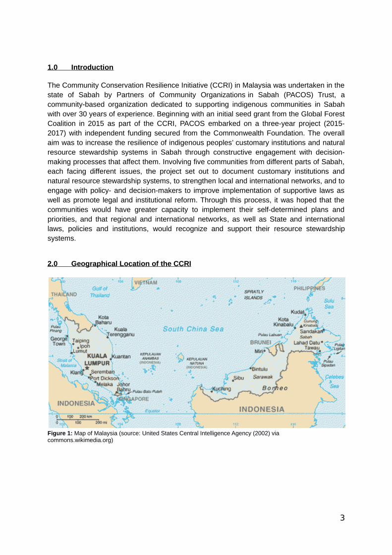
2.0 Geographical Location of the CCRI
Figure 1: Map of Malaysia (source: United States Central Intelligence Agency (2002) via commons.wikimedia.org)
3

Figure 2: Map of Sabah and its administrative divisions (source: Kawaputra via commons.wikimedia.org).
Located in the northernmost part of the island of Borneo, Sabah is the second largest amongthe thirteen states in Malaysia, covering an area of 73,904 square kilometres. Separatedfrom Peninsular Malaysia by the South China Sea, Sabah borders the Malaysian state ofSarawak in the west and Indonesia’s Kalimantan in the south. Sabah is normally hot andhumid throughout the year with an average rainfall between 1800 mm to 4000 mm annuallydepending on the region; the southeastern part of Sabah receives the lowest and thewestern mountainous slopes the highest (Tongkul, 2002).
Sabah is richly endowed with forests with about 60 percent (4.5 million hectares) of its totalland area under forest cover (Tongkul, et al., 2013). This ranges from forest vegetation foundin coastal beach and mangrove forests to the dipterocarp forest in lowland areas andmontane forests in mountainous regions (Globinmed, 2015). According to Tongkul (2002),Sabah has an estimated 10,000 species of wild plant species, a majority of which arealready named and described scientifically but a significant number are still unknown orinadequately described. The natural ecosystems in Sabah also support a diverse range offauna from mountains to coasts, including many endemic as well as threatened andendangered species. Notable species include the orangutan, proboscis monkey, sun bear,dugong, Sumatran rhino, Borneo pygmy elephant and clouded leopard, all of which areincluded in the IUCN Red List.
Based on the national census in 2010, roughly about 62 percent of the 3.2 million people inSabah are natives (bumiputera). That population includes more than 30 ethnic groups thatspeak more than 50 languages and 80 dialects (Tongkul, 2002). Most of these indigenouspeoples live in rural areas and depend on the land, forests and water to sustain theirtraditional livelihoods (Tongkul, et al., 2013).
4
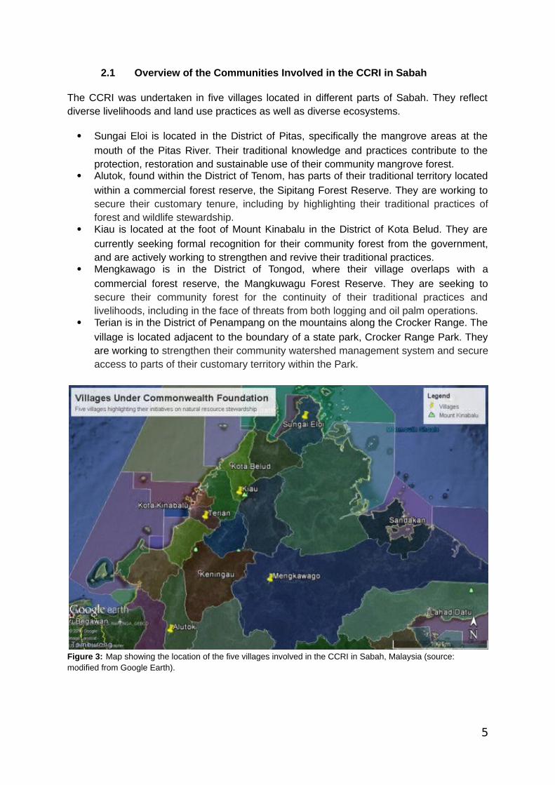
2.1 Overview of the Communities Involved in the CCRI in Sabah
The CCRI was undertaken in five villages located in different parts of Sabah. They reflectdiverse livelihoods and land use practices as well as diverse ecosystems.
Sungai Eloi is located in the District of Pitas, specifically the mangrove areas at the
mouth of the Pitas River. Their traditional knowledge and practices contribute to theprotection, restoration and sustainable use of their community mangrove forest.
Alutok, found within the District of Tenom, has parts of their traditional territory located
within a commercial forest reserve, the Sipitang Forest Reserve. They are working tosecure their customary tenure, including by highlighting their traditional practices offorest and wildlife stewardship.
Kiau is located at the foot of Mount Kinabalu in the District of Kota Belud. They are
currently seeking formal recognition for their community forest from the government,and are actively working to strengthen and revive their traditional practices.
Mengkawago is in the District of Tongod, where their village overlaps with a
commercial forest reserve, the Mangkuwagu Forest Reserve. They are seeking tosecure their community forest for the continuity of their traditional practices andlivelihoods, including in the face of threats from both logging and oil palm operations.
Terian is in the District of Penampang on the mountains along the Crocker Range. The
village is located adjacent to the boundary of a state park, Crocker Range Park. Theyare working to strengthen their community watershed management system and secureaccess to parts of their customary territory within the Park.
Figure 3: Map showing the location of the five villages involved in the CCRI in Sabah, Malaysia (source: modified from Google Earth).
5
3.0 Methodology
Overall, the CCRI was built on years of community organising work with PACOS Trust. Thiswas essential to the process as it meant that PACOS staff already had strong relationshipswith the communities and had invested in building the capacity of community organisationson an ongoing basis. The assessment process, as summarised below, was guided by thekey elements of the CCRI methodology.
3.1 Coordination and Facilitation
In coordinating and facilitating the CCRI, the PACOS team guided the communities throughthe process and ensured that inputs were from the communities themselves. This meantbeing mindful and impartial as facilitators and respecting the communities' needs,perspectives and time. In line with the CCRI's emphasis on open communication and mutualsharing and learning, group activities and discussions were at the core of workshops andmeetings, with not only men but also women, and youth encouraged to participate togetherand share their views and perspectives. The PACOS team guided and encouraged thecommunity to document and present their own discussions wherever feasible, with anemphasis on confidence building. Community members presented their work betweensmaller groups in community-specific workshops, between communities in centralizedworkshops, at regional and international workshops and to high-ranking government officialssuch as the Chief Justice of Sabah and Sarawak.
3.2 Identification of Communities, including FPIC
As members of PACOS Trust and JOAS (Jaringan Orang Asal SeMalaysia, the IndigenousPeoples Network of Malaysia), the communities involved in the assessment have beenexposed to various workshops and discussions to map out the sustainability of their villages.The communities were proposed by PACOS based on the presence of a strong communityorganisation as well as the diversity of their struggles for their native customary rights, oftheir traditional knowledge and customary practices (concerning mangroves, rivers, forestsand customary territories), and of the applicable laws relating to the environment and naturalresources.
PACOS’ coordinators then discussed the CCRI with each community, shared informationabout the methodology and potential benefits and risks in the local language andencouraged a community process of free, prior and informed consent (FPIC). The CCRI wasframed as an opportunity and platform for the communities to continue their ongoingstruggles to protect their lands and traditional practices.
3.3 Strategic Visioning and Planning
After the selection and FPIC process, the communities went through a process ofpreliminary visioning and planning to discuss their situations and what could be done tostrengthen their customary stewardship systems. PACOS facilitated community-levelstrategic visioning and planning meetings in each of the five communities from late February
6
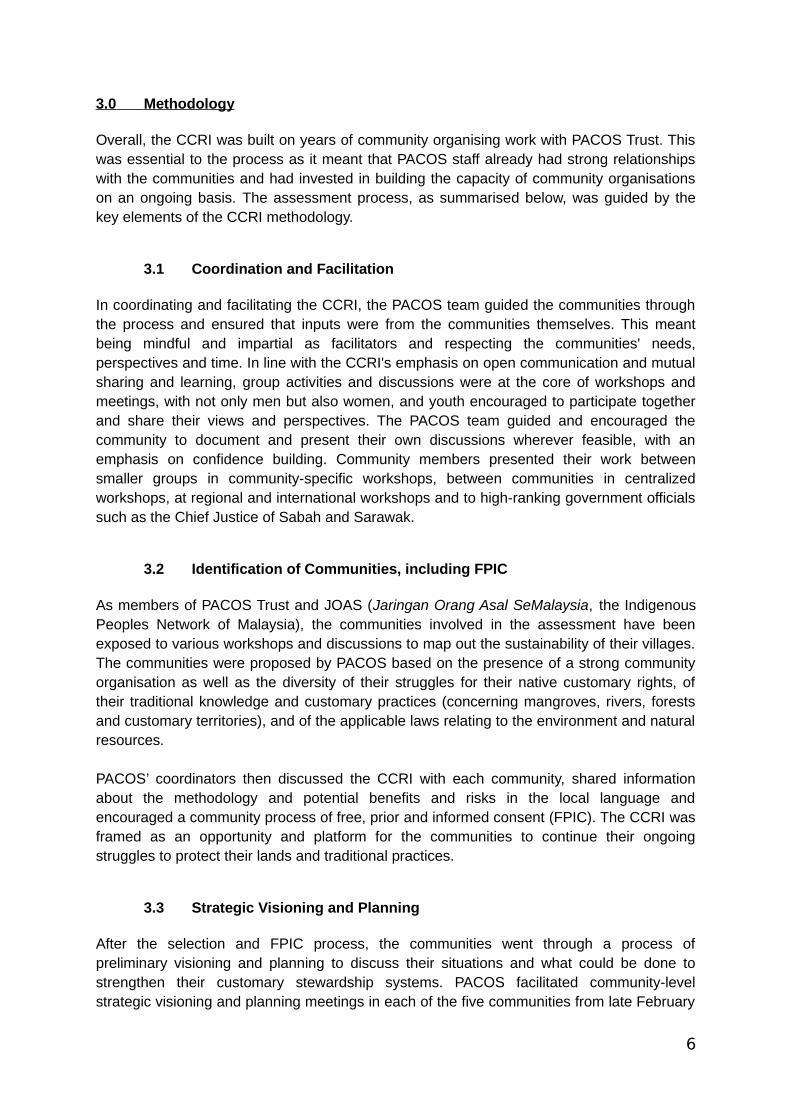
to mid-March 2015 to discuss the project overall, the natural resources in the community, thethreats and challenges faced by the community regarding these resources and the steps thatcould be taken to overcome them. Among the threats and challenges identified by thecommunities included loss of resources for their livelihoods, medicine and handicrafts, use ofpesticides and chemicals, loss of traditional knowledge concerning natural resources, loss ofterritories due to totally protected areas and industrial development projects such as damsand plantations, and decreasing wildlife populations. One of the solutions suggested was todo proper documentation of their stewardship and management systems to strengthenrecognition of the communities’ stakes in their land and territories. This provided a strongbasis for the CCRI. Each community formed their own plans and teams for carrying out theirassessments and related activities.
Figure 4: The Alutok community discussing the roles and responsibilities of community members in carrying out the documentation (credit: PACOS Trust).
3.4 Capacity-building Workshops
With strong emphasis on participatory and multimedia community documentation of theirown practices, capacity-building was seen as essential to the assessment process. Methodssuch as sketching, community mapping, interviews, and photo and video documentationwere addressed in one or more of capacity-building workshops carried out over the course ofthe project. Each capacity-building workshop also prepared the communities for the next partof the assessment process and in developing their community protocols. Among theworkshops conducted were:
7
i. CCRI Capacity-Building Workshop (National)
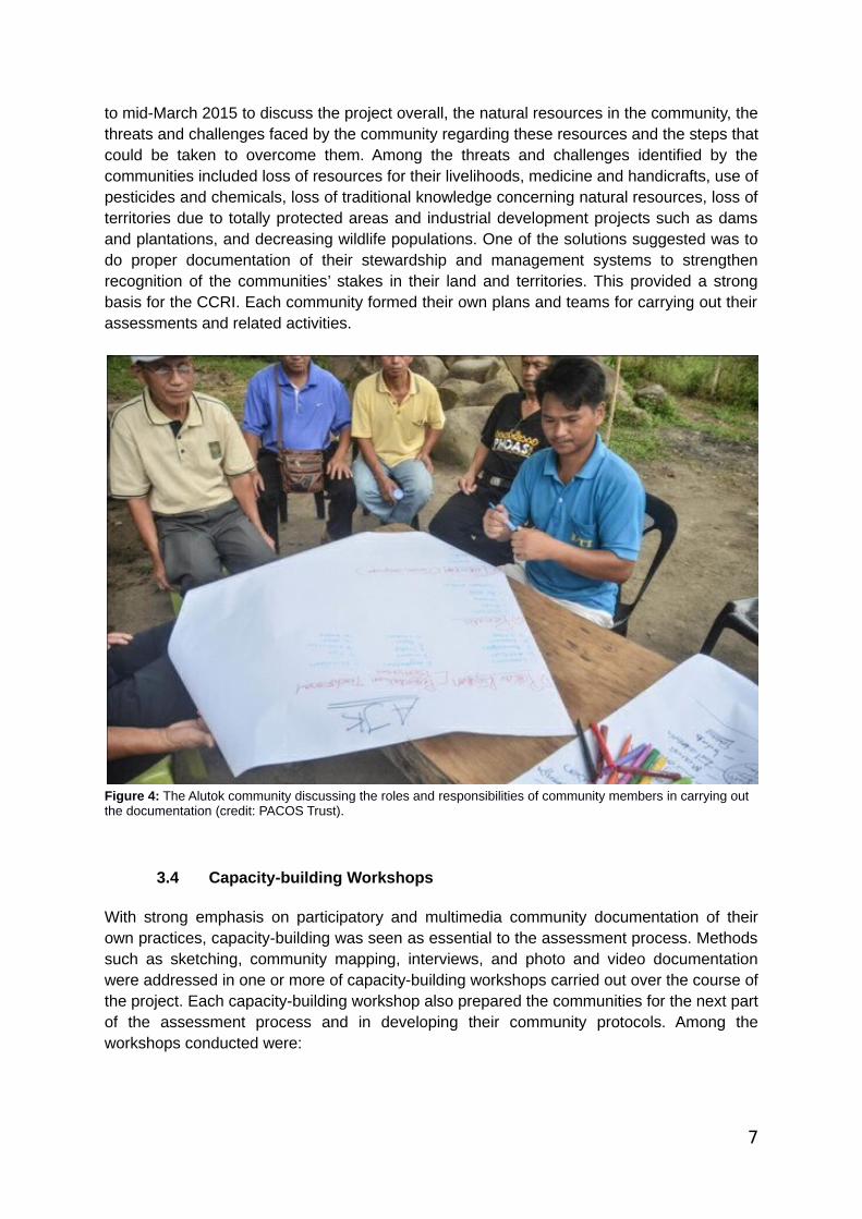
The CCRI capacity-building workshop was framed as a national workshop on communityconservation and the Sustainable Development Goals (SDGs) and held in conjunction withMalaysia’s World Indigenous Peoples’ Day celebration in August 2016. Although theworkshop was primarily for indigenous peoples from across Malaysia, the 187 participantsalso included indigenous representatives from Thailand, Nepal, Myanmar and Cambodia, aswell as two representatives from the Malaysian office of the Global Environment FacilitySmall Grants Programme (GEF-SGP), one from the German Embassy and two from theGlobal Forest Coalition (which co-funded the workshop through a grant from the GermanBMU). The workshop included presentations on the SDGs, how they relate to indigenouspeoples’ rights and how indigenous peoples can get involved in the SDG process; anintroduction to the CCRI; gender roles in conservation; and community initiatives from Sabahand Sarawak on protecting and stewarding their natural resources. Interactive discussionsand breakout groups led to participants identifying relevant initiatives as well as threats intheir villages, and how they protect their natural resources. Several villages, especially inPeninsular Malaysia, expressed an interest in becoming more involved in such initiatives. Akey outcome of the workshop was an agreement to develop a network or working group inMalaysia about ICCAs and community conservation resilience and to seek funding fromGEF-SGP Malaysia.
Figure 5: Group discussion during the breakout session (credit: PACOS Trust).
8
ii. Paralegals and the Environment Workshop
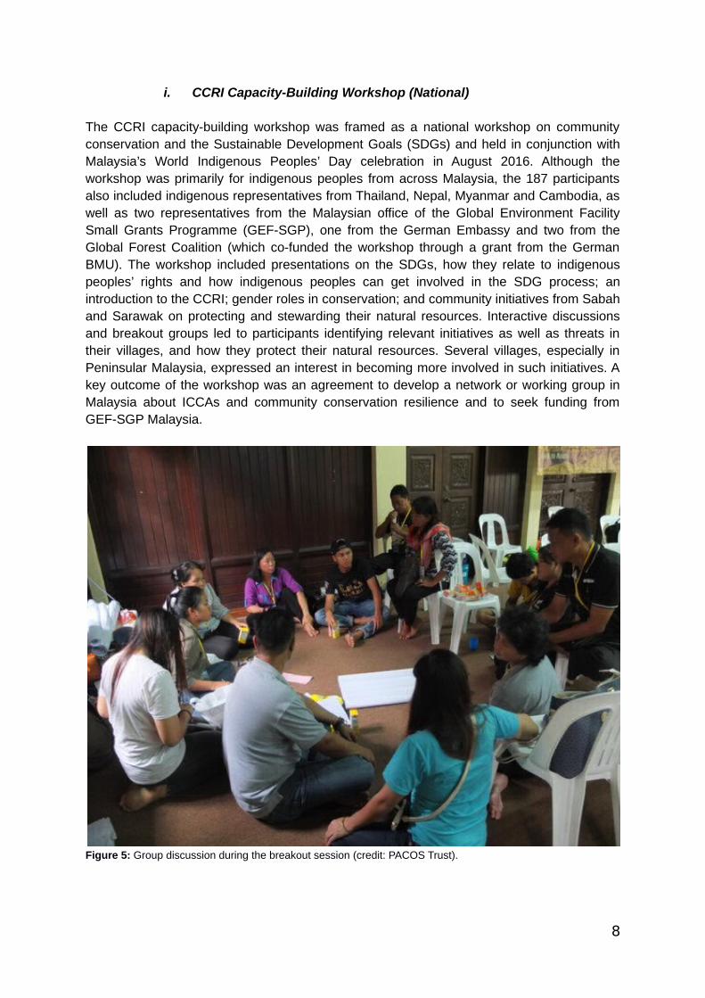
This workshop provided an introduction to local and international laws relating to indigenouspeoples’ rights to manage and protect their resources and how these laws affect them, usinga creative sketch mapping exercise (see Figure 6 below). The participants increased theirunderstanding of how to apply these laws to defend their rights to manage and protect theirresources. By the end of the workshop, the participants produced preliminary strategies fordefending their rights and achieving their plans and priorities, which were subsequentlyshared and pursued with their respective communities.
Figure 6: During the workshop, communities were asked to sketch a map of their territories and the related customary laws attached to them. After learning about local and international laws, they were asked to look at this map once again to see how these laws coincide with their customary laws (credit: PACOS Trust).
iii. Strategic Planning and Basic Advocacy Training Workshop
The objectives of this workshop were to reflect and further refine the community determinedplans and priorities formulated during the previous paralegal workshop, and to introduceadvocacy methods to gain recognition of their stewardship systems and their NativeCustomary Rights or customary territories.
iv. Visioning and Planning Workshop
In this workshop, the communities ruminated on what is important to them and their hopesfor the future. Through visioning exercises, they drew how they would like their communitiesto be in 10, 20 or 50 years. The communities then made plans on how they can achieve thisvision by reflecting on the challenges they are facing and their strengths and weaknesses.
9

3.5 Community Exchanges and Skill-shares
In addition to the capacity-building workshops, five community exchanges and skill-shareswere held in Sabah. Each of the five communities involved in the CCRI hosted an exchangeand shared information about their respective issues, methods and strategies, providingexposure and promoting solidarity between the communities.
i. Alutok: Field visit to areas in the village to experience Murut Tahol culture,including the community managed river, the women’s handicraft group andsacred sites (stone carvings).
ii. Sungai Eloi: Field visit to the community mangrove forest where thecommunities learned about the efforts to protect the mangrove from large-scaleshrimp farming.
iii. Terian: Field visit to the Ulu Papar blockade where the Ulu Papar (includingTerian) communities shared how they manage their watersheds and also theirexperience and challenges with resisting the proposed dam.
iv. Kiau: Field visit to the Kiau community forest where the community shared aboutthe traditional practices of Mamason and Mamatang that are to be performedbefore entering the forest and the special forest language to be used while in theforest.
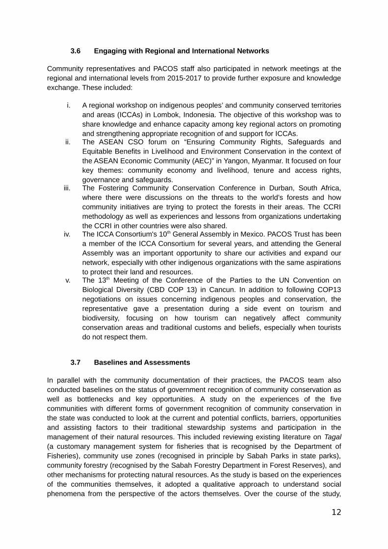
v. Mengkawago: Field visit to the community forest where the other communitiessaw how the Mengkawago community practises wild honey collection and theeffects of deforestation faced by the community.
Figure 7: A community member from Terian explaining their river and tributary network in the Ulu Papar area during the field visit to Ulu Papar blockade (credit PACOS Trust).
10
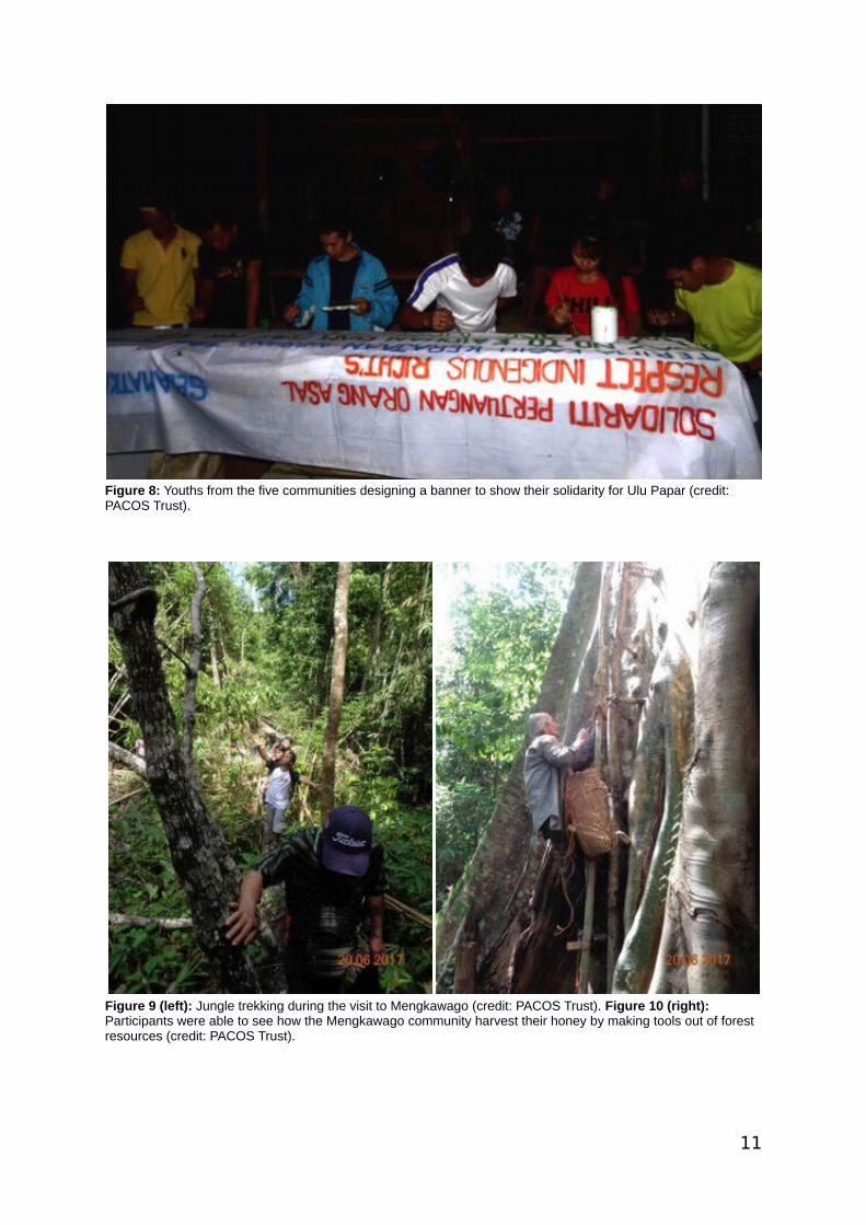
Figure 8: Youths from the five communities designing a banner to show their solidarity for Ulu Papar (credit: PACOS Trust).
Figure 9 (left): Jungle trekking during the visit to Mengkawago (credit: PACOS Trust). Figure 10 (right): Participants were able to see how the Mengkawago community harvest their honey by making tools out of forest resources (credit: PACOS Trust).
11
3.6 Engaging with Regional and International Networks
Community representatives and PACOS staff also participated in network meetings at theregional and international levels from 2015-2017 to provide further exposure and knowledgeexchange. These included:
i. A regional workshop on indigenous peoples’ and community conserved territoriesand areas (ICCAs) in Lombok, Indonesia. The objective of this workshop was toshare knowledge and enhance capacity among key regional actors on promotingand strengthening appropriate recognition of and support for ICCAs.
ii. The ASEAN CSO forum on “Ensuring Community Rights, Safeguards andEquitable Benefits in Livelihood and Environment Conservation in the context ofthe ASEAN Economic Community (AEC)” in Yangon, Myanmar. It focused on fourkey themes: community economy and livelihood, tenure and access rights,governance and safeguards.
iii. The Fostering Community Conservation Conference in Durban, South Africa,where there were discussions on the threats to the world’s forests and howcommunity initiatives are trying to protect the forests in their areas. The CCRImethodology as well as experiences and lessons from organizations undertakingthe CCRI in other countries were also shared.
iv. The ICCA Consortium's 10th General Assembly in Mexico. PACOS Trust has beena member of the ICCA Consortium for several years, and attending the GeneralAssembly was an important opportunity to share our activities and expand ournetwork, especially with other indigenous organizations with the same aspirationsto protect their land and resources.
v. The 13th Meeting of the Conference of the Parties to the UN Convention onBiological Diversity (CBD COP 13) in Cancun. In addition to following COP13negotiations on issues concerning indigenous peoples and conservation, therepresentative gave a presentation during a side event on tourism andbiodiversity, focusing on how tourism can negatively affect communityconservation areas and traditional customs and beliefs, especially when touristsdo not respect them.
3.7 Baselines and Assessments
In parallel with the community documentation of their practices, the PACOS team alsoconducted baselines on the status of government recognition of community conservation aswell as bottlenecks and key opportunities. A study on the experiences of the fivecommunities with different forms of government recognition of community conservation inthe state was conducted to look at the current and potential conflicts, barriers, opportunitiesand assisting factors to their traditional stewardship systems and participation in themanagement of their natural resources. This included reviewing existing literature on Tagal(a customary management system for fisheries that is recognised by the Department ofFisheries), community use zones (recognised in principle by Sabah Parks in state parks),community forestry (recognised by the Sabah Forestry Department in Forest Reserves), andother mechanisms for protecting natural resources. As the study is based on the experiencesof the communities themselves, it adopted a qualitative approach to understand socialphenomena from the perspective of the actors themselves. Over the course of the study,
12

semi-structured interviews and focus group discussions were conducted where individualswere chosen based on their involvement in the community conservation initiatives. Thesample also included government officials in the departments with jurisdiction over thedifferent forms of recognition and representatives from NGOs to include a broader range ofperspectives on how the different forms of recognition have been handled.
A Sabahan lawyer-in-training was contracted to undertake a legal review as part of thebaseline. As a detailed legal review on ICCAs was already undertaken from 2010-2012 (Vaz,2012), the PACOS Trust team decided that it would make more sense to draw from thatreview and focus specifically on the five communities. For each community, the ‘new’ legalreview includes information on legislative obstacles to recognition as well as opportunities forlegal recognition of their respective ICCAs. This helped inform the advocacy strategies ofeach community. As PACOS Trust and the same five communities are now involved in theGlobal Support Initiative for ICCAs (GSI) with SGP-Malaysia funding, an updated legalreview for the whole of Malaysia will be undertaken in the coming months. This will follow acomprehensive methodology similar to the 2012 review.
3.8 Visioning, Strategic Planning and Consolidation
All of the documentation from the assessment process, including the various workshops andgroup discussions, were then consolidated and culminated into a community protocol foreach of the five communities, which set out each community’s story, struggles andrecommendations. Drawing from their vision of how they want their future to look like andwhat they think needs to be done in order to achieve it, these community protocols also wentthrough a process of verification and validation as the communities reviewed and reflectedon how they wanted the protocols to be framed and what key messages they wanted topresent. The community protocols are now being used as tools for the communities tocommunicate and engage with external actors.
3.9 Strategic Advocacy and Engagement
Although advocacy efforts are still underway and expected to continue well into the future, sofar they have included meetings with policy- and decision-makers such as localassemblymen and government officials; awareness-raising activities such as poster andphoto exhibitions at public events and conferences; participating in state and regional policyprocesses on social forestry; and participating in international policy fora such as the UNConvention on Biological Diversity (CBD) and UN Permanent Forum on Indigenous Issues.
Representatives from the communities have presented their findings and draft protocols tothe Chief Justice of Sabah and Sarawak, Tan Sri Richard Malanjum, and other members ofthe judiciary. The Chief Justice has been very supportive of the work undertaken andsubsequently began a larger process of documenting customary laws across the mainIndigenous groups in Sabah.
In addition, one community (Sungai Eloi) hosted a fact-finding mission as part of the 6th
Regional Conference on Human Rights and Agribusiness in Southeast Asia, held from 2-4November 2016 in Sabah; their case was mentioned in the Conference Resolution and in a
13
letter sent to the Chief Minister. It was also independently covered in an article byenvironmental news site Mongabay (Harbinson, 2017).
4.0 Findings of the Community Assessments
4.1 Sungai Eloi
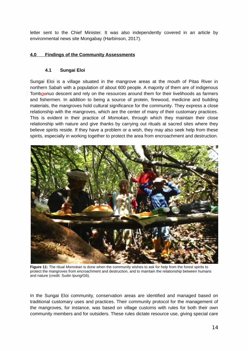
Sungai Eloi is a village situated in the mangrove areas at the mouth of Pitas River innorthern Sabah with a population of about 600 people. A majority of them are of indigenousTombounuo descent and rely on the resources around them for their livelihoods as farmersand fishermen. In addition to being a source of protein, firewood, medicine and buildingmaterials, the mangroves hold cultural significance for the community. They express a closerelationship with the mangroves, which are the center of many of their customary practices.This is evident in their practice of Momokan, through which they maintain their closerelationship with nature and give thanks by carrying out rituals at sacred sites where theybelieve spirits reside. If they have a problem or a wish, they may also seek help from thesespirits, especially in working together to protect the area from encroachment and destruction.
Figure 11: The ritual Momokan is done when the community wishes to ask for help from the forest spirits to protect the mangroves from encroachment and destruction, and to maintain the relationship between humans and nature (credit: Sudin Ipung/G6).
In the Sungai Eloi community, conservation areas are identified and managed based ontraditional customary uses and practices. Their community protocol for the management ofthe mangroves, for instance, was based on village customs with rules for both their owncommunity members and for outsiders. These rules dictate resource use, giving special care
14
to limiting activities that may affect availability of resources, including those that arehazardous or cause overharvesting. Certain areas in the forest are also restricted from anyresource collection. The protocol also states what must be observed when entering themangrove area. Visitors who wish to enter the community mangrove forest are required toobtain permission based on FPIC and with respect to indigenous peoples’ rights. Thosefound to have violated the rules set forth in the community protocol will be fined by thecommunity and are required to replace the resource that has been affected.
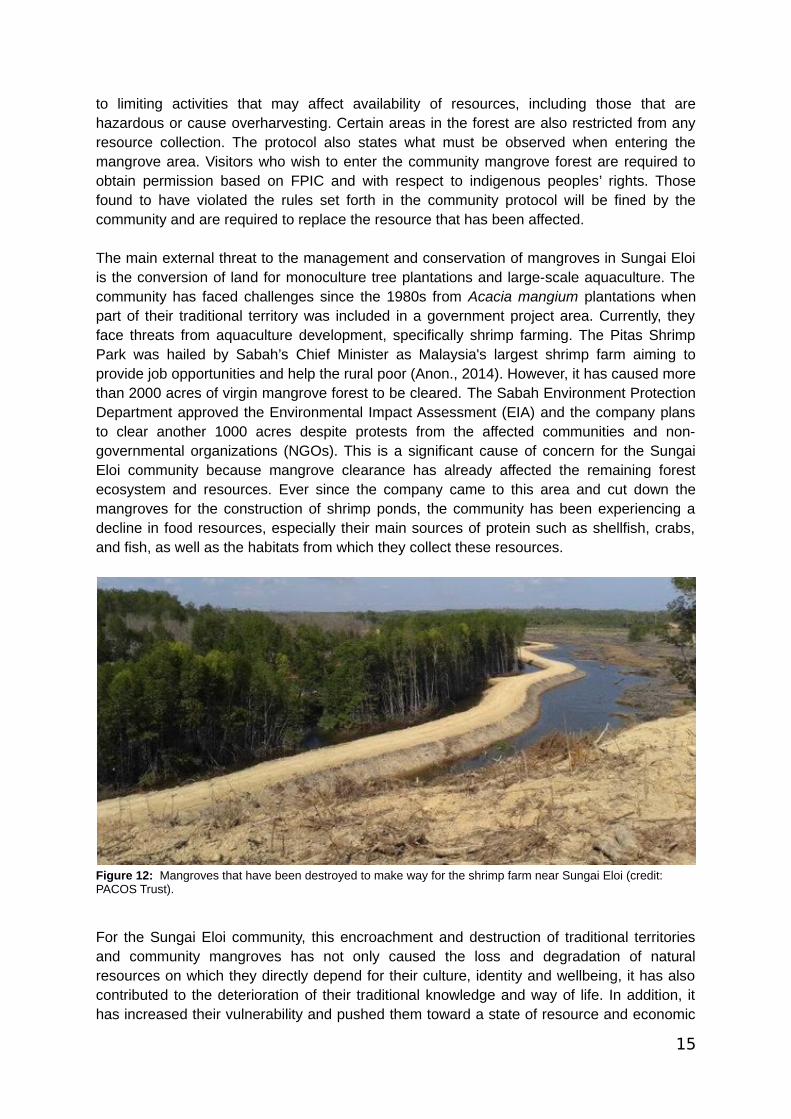
The main external threat to the management and conservation of mangroves in Sungai Eloiis the conversion of land for monoculture tree plantations and large-scale aquaculture. Thecommunity has faced challenges since the 1980s from Acacia mangium plantations whenpart of their traditional territory was included in a government project area. Currently, theyface threats from aquaculture development, specifically shrimp farming. The Pitas ShrimpPark was hailed by Sabah’s Chief Minister as Malaysia's largest shrimp farm aiming toprovide job opportunities and help the rural poor (Anon., 2014). However, it has caused morethan 2000 acres of virgin mangrove forest to be cleared. The Sabah Environment ProtectionDepartment approved the Environmental Impact Assessment (EIA) and the company plansto clear another 1000 acres despite protests from the affected communities and non-governmental organizations (NGOs). This is a significant cause of concern for the SungaiEloi community because mangrove clearance has already affected the remaining forestecosystem and resources. Ever since the company came to this area and cut down themangroves for the construction of shrimp ponds, the community has been experiencing adecline in food resources, especially their main sources of protein such as shellfish, crabs,and fish, as well as the habitats from which they collect these resources.
Figure 12: Mangroves that have been destroyed to make way for the shrimp farm near Sungai Eloi (credit: PACOS Trust).
For the Sungai Eloi community, this encroachment and destruction of traditional territoriesand community mangroves has not only caused the loss and degradation of naturalresources on which they directly depend for their culture, identity and wellbeing, it has alsocontributed to the deterioration of their traditional knowledge and way of life. In addition, ithas increased their vulnerability and pushed them toward a state of resource and economic
15

poverty despite the aquaculture project’s stated aim of poverty eradication. Their rights asindigenous peoples have not been respected as there was no FPIC process and they werenot consulted properly in any of the decision-making processes that have affected theirtraditional territories. Only a select few members of the community in certain positions wereconsulted, namely, government elected village chiefs and leaders who are in support of theproject.
To combat the encroachment, the Sungai Eloi community decided to reach out to othervillages nearby who are also affected by the project. This culminated in the formation of anaction committee called G6 (Gabungan 6 Kampung), a network of six villages. Through thisG6, they are trying to promote the environmental, social and cultural importance of themangroves and their management and protection of the mangroves so that they may appealto the company, state government and related agencies to stop the clearing of themangroves and assist with restoration. They have also worked on a voluntary basis toreplant some of the trees that were cleared by the companies. They have tried to introducetheir traditional practices, especially Momokan, to outsiders – including the company, theDistrict Officer and various government agencies – to show that they are taking care of theland and natural resources as an ICCA. Community members are also raising awarenessabout their struggles at regional and international meetings related to human rights andbiodiversity conservation.
In terms of defending their land directly against encroachment, they are using theircommunity protocol, which lists rules to follow for the protection and conservation of theirmangroves, to inform and educate community members and others. The Sungai Eloicommunity has even engaged with the media to share their story and inform the public ofwhat is at stake (Teh, 2016; Harbinson, 2017). In addition to exploring legal options, they aimto have dialogue sessions together with the company as well as the government in order toundergo a process of negotiation, problem-solving and increased understanding betweenthem about what needs to be done to resolve the issues in a respectful and equitable way.As the federal government is funding the aquaculture project and the EIA system has beenineffective to date, the community’s resistance is likely to continue to be an uphill battle.Some community members have already faced threats to their resistance, including beingtaken to the police station after making statements to the media and being chased awayfrom exhibitions.
16
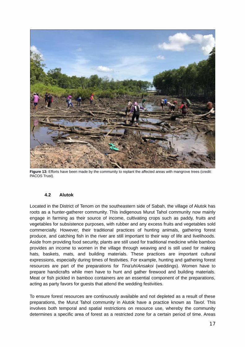
Figure 13: Efforts have been made by the community to replant the affected areas with mangrove trees (credit: PACOS Trust).
4.2 Alutok
Located in the District of Tenom on the southeastern side of Sabah, the village of Alutok hasroots as a hunter-gatherer community. This indigenous Murut Tahol community now mainlyengage in farming as their source of income, cultivating crops such as paddy, fruits andvegetables for subsistence purposes, with rubber and any excess fruits and vegetables soldcommercially. However, their traditional practices of hunting animals, gathering forestproduce, and catching fish in the river are still important to their way of life and livelihoods.Aside from providing food security, plants are still used for traditional medicine while bambooprovides an income to women in the village through weaving and is still used for makinghats, baskets, mats, and building materials. These practices are important culturalexpressions, especially during times of festivities. For example, hunting and gathering forestresources are part of the preparations for Tina'uh/Ansakoi (weddings). Women have toprepare handicrafts while men have to hunt and gather firewood and building materials.Meat or fish pickled in bamboo containers are an essential component of the preparations,acting as party favors for guests that attend the wedding festivities.
To ensure forest resources are continuously available and not depleted as a result of thesepreparations, the Murut Tahol community in Alutok have a practice known as Tavol. Thisinvolves both temporal and spatial restrictions on resource use, whereby the communitydetermines a specific area of forest as a restricted zone for a certain period of time. Areas
17
chosen for Tavol are usually hunting, water catchment or community forest areas whilefarming land and areas for daily resource use are excluded. This process of land useplanning and zoning relies on village elders and experts to provide knowledge aboutboundaries and historical areas and on women for areas of daily resource use. An area canonly be determined as a Tavol area when it is mutually agreed by the community as a wholeto prevent internal conflict or problems. The period of restriction also needs to be discussedcollectively and is based on community needs and whether the resources are sufficient fortheir preparations. Management of Tavol is under the authority of the village chief who isresponsible for announcing the implementation of any Tavol to everyone in the village aswell as communities in surrounding villages on matters such as the Tavol boundaries and itstime period, to whom the Tavol applies and punishments involved for violators to preventtrespassing. Nobody is allowed to enter a Tavol area except the family who requested it fortheir festivity preparations.
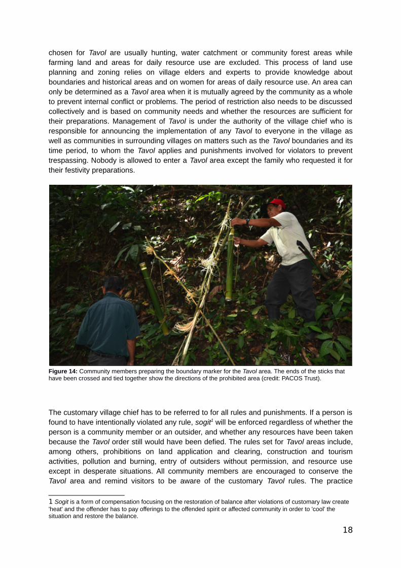
Figure 14: Community members preparing the boundary marker for the Tavol area. The ends of the sticks that have been crossed and tied together show the directions of the prohibited area (credit: PACOS Trust).
The customary village chief has to be referred to for all rules and punishments. If a person isfound to have intentionally violated any rule, sogit1 will be enforced regardless of whether theperson is a community member or an outsider, and whether any resources have been takenbecause the Tavol order still would have been defied. The rules set for Tavol areas include,among others, prohibitions on land application and clearing, construction and tourismactivities, pollution and burning, entry of outsiders without permission, and resource useexcept in desperate situations. All community members are encouraged to conserve theTavol area and remind visitors to be aware of the customary Tavol rules. The practice
1 Sogit is a form of compensation focusing on the restoration of balance after violations of customary law create 'heat' and the offender has to pay offerings to the offended spirit or affected community in order to 'cool' the situation and restore the balance.
18
cultivates collective cooperation and responsibility because the success of anyimplementation of Tavol depends on the cooperation of every individual in the community.Community members’ observance contributes to the maintenance of traditional systems andcustomary law as well as sustainable use of the wildlife and other resources in the forest.
The main challenge the Alutok community is facing now in conserving their community forestis from encroachment, both by outsiders and also individuals in the community. The forestsof their traditional territory have been included in a state forest reserve. As a Class II ForestReserve, it is held in concession by a company and set aside for commercial purposes. Asthe Sabah Forest Enactment 1968 prohibits any human activities in forest reserves withoutpermission, the community is barred from entering their forest and they face the possibility oflosing their community forest to deforestation for monoculture plantations of Acaciamangium. They are already experiencing biodiversity loss from deforestation and have alsoexperienced flash floods and mudslides in the past from the logging. In addition, thecommunity also faces threats from illegal poaching by outsiders and a lack of awarenessamong some community members of the importance of protecting the forest. Anothersignificant internal challenge is the migration of youths out of the village, as they areincreasingly losing touch with traditional customs and practices that are still only knownorally and have not been thoroughly documented.
To combat these challenges, the Alutok community has documented their traditionalknowledge to be used as references for the younger generations and to educate others thatindigenous peoples’ knowledge has value and can contribute to sustainable use of naturalresources. They are currently trying to promote and gain recognition and support for theirTavol system as a good practice for resource stewardship. For example, they are trying togarner support from and improve their relationships with government officials and thecompany holding the forest reserve concession through discussions and dialogues. Inaddition, they have tried to improve their forest management efforts through capacity-building workshops, documentation, community mapping, making an inventory of resources,and forming an action committee to monitor the implementation of Tavol and raiseawareness among the community and youth of its importance. They also plan to increaseexposure and understanding of laws relating to the preservation and conservation of Tavol.Through all of these efforts, they hope to show and change public perception, especiallyamong government officials and key decision-makers, that indigenous peoples are notdestructive but can contribute to the stewardship, conservation and sustainable use of theenvironment through their customary practices.
4.3 Kiau
Kiau is an indigenous Dusun village located at the foot of Mount Kinabalu in the District ofKota Belud. About 1,400 people live in this village, the majority of whom are of Dusun Tindaldescent. Agriculture is still the main source of income and livelihoods for many of thevillagers here, not only for subsistence purposes (hill paddy, maize, banana) but also forcommercial purposes (pineapple, lemongrass, cacao, yam), although export growth islimited due to the remoteness of Kiau and the high transport costs involved. Some villagersare also involved in the tourism industry, especially in community-based tourism and aslicensed mountain guides because of their proximity to Mount Kinabalu and Kinabalu Park.
19

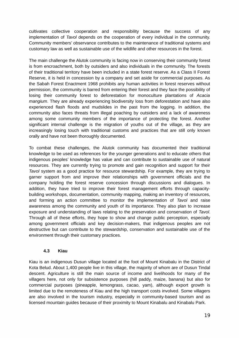
Figure 15: View of Mount Kinabalu from the village (credit: PACOS Trust).
The Dusun people regard the forest as important to their identity. Traditionally, the forestfunctioned as a source of food and medicine. However, the Kiau community goes into theforest not only to gather resources but also to be with nature. They believe that the forestspirits and nature itself must be respected and that humans and nature have a close andreciprocal relationship. They only take what they need from the forest, including hunting andgathering forest products, for personal use and not commercial use. The community hasrules to ensure that all forest resources – from the plants and animals to the bugs, soil andwater – are protected.
Notably, the community has formed their own conservation area: Hutan Simpan KomunitiKg. Kiau (Kiau Community Forest Conservation Area) is a 1024-acre forest area set aside asa heritage area for sustainably managing and protecting their forests. They are also trying torevitalize and strengthen their traditional forest practices such as the use of Dusun forestterms (Boros Puru) and giving respect to the forest spirits (Mamatang and Mamason). BorosPuru, Mamatang and Mamason invoke deep appreciation and respect for the forest, itsresources and the spirits of ancestors that live there. The forest is believed to be sensitive tothe actions and behaviour of people that enter it. Accordingly, the ritual Mamatang orMamason has to be performed before entering the forest. The purpose of this ritual is toinform the forest spirits of the reason for entering forest and to request protection throughoutthe time spent in the forest. Mamatang has to be performed when the purpose of the visit isto collect resources while Mamason is for when there is no intent to acquire resources butsimply to spend time deep in nature. The Kiau community also believes that before thecreation of their village, the forest spirits had told them to speak in the forest language that isunderstood by them when entering the forest. As a result, use of the forest language, BorosPuru, is compulsory when in the forest. The villagers believe that if the knowledge of forest
20

language is lost, the forest will be disappointed and will not provide any resources. Lack ofrespect for the forest language or talking inappropriately might cause bad weather and anindividual might even feel their body ache or feel lost while in the forest.
Together with their community organization, GOMPITO (short for MomoGOMPI, Moningolig,Tinungkusan om Kotolunan Tokou, which means preserving and maintaining culturalheritage, customs, traditions and nature), the Kiau community monitors and manages theforest and restrict resource access. They have also formulated a protocol to govern resourceuse. The protocol employs a combination of customary rules used by their forefathers inrelation to the forests (such as Boros Puru and Mamatang) and other rules of conductderived from their discussions of how to sustainably manage their forests to ensure thecontinuity of resources and its ecological value and spiritual and cultural importance. Theserules have been formally documented since 2000. Offenses and violations of the protocolhave to be referred to the Board of Trustees for the community forest. Offenders have to paysogit and are fined according to the village customary laws.
Currently, the Kiau community forest is facing pressure from insecure tenure. Thecommunity forest is still legally State Land after having been gazetted within and thenexcised from a state park, Kinabalu Park. As State Land, the area is open to land titleapplications and thus, the community forest has little protection from outsiders and is at riskof encroachment. There have already been attempts by a few interested parties to gainownership of the land, including for tourism development. This is why the Kiau communitybelieve that legal recognition of their community forest is vital. If they lose the area tooutsiders, their access to the forest and the related traditional knowledge as well as cultureembedded in it will be lost. Rich in biodiversity, the community forest is also threatened byillegal poaching and trading of rare orchids by outsiders. Internally, there are also concernsabout cultural continuity and transfer of knowledge as youths in the village lack exposure totraditional practices due to mainstream religion, modernization and migration.
The Kiau community believe that formal recognition of their conservation initiative is the mostimportant step in securing their relationship with, access to and management of the forest.They are currently in the process of applying for a Native Reserve title under Section 78 ofthe Sabah Land Ordinance for their community forest area. The community, especiallyGOMPITO, have actively met to discuss this issue with relevant parties such as the SabahDepartment of Lands and Surveys, the District Office, and their elected parliamentrepresentive.
In addition to efforts to secure land rights, the community is also involved in the KinabaluEcolinc Project, an initiative led by Sabah Parks that aims to form an ecological corridorbetween state parks through the establishment of Community Conserved Areas (CCAs)2
(Sabah Parks, 2018). As Sabah Parks is a state government agency, this move to worktogether strengthens their efforts to gain recognition of their community forest and itsgovernance. To further support this, the Kiau community plans to continue documenting theirpractices, update their community protocol and meet with relevant government agencies topresent their protocol and seek recognition.
2 Sabah Parks has chosen to use the term CCA (i.e., not explicitly including “indigenous”) instead of ICCA. For more information on the Kinabalu Ecolinc Project, please see Sabah Parks, 2018.
21
The community is also working to revitalize their customs to ensure the close relationship ofthe community with their cultural heritage. GOMPITO, for instance, has carried out youthcamps to provide exposure to Boros Puru and the forest among the youth in the communityand they have been working on producing written documentation of their traditionalknowledge, including of medicinal herbs, and the flora and fauna found in the forest. Theyhave already established an herb garden and mini museum featuring their traditionalhandicrafts, musical instruments and hunting traps.
4.4 Mengkawago
Mengkawago is a village located 270 kilometres from Kota Kinabalu in the District of Tongodin the heart of Sabah. Boasting a history of about 300 years, it has a population ofapproximately 600 residents who mostly come from the sub-ethnic indigenous group SungaiRumanau. Their history and occupancy is evident through their ancestral graves and old fruittrees still maintained to this day. These fruit trees are remnants of their tradition of planting afruit tree whenever a new house was built in the village. This marks ownership and alsoprovides fruits and shade. Trees remain standing longer than houses and can continue toexist as territorial markers when the houses are gone. The main socio-economic activities ofthis village include agriculture, hunting and gathering forest products. What someoneproduces in their plot of land is used for their own needs but if there is any surplus, it may besold in the village market or even distributed within the community to ensure everybody haswhat they need. Now, with better road access, goods can be sold outside the village. TheMengkawago community relies on the forest not only for food but also for their water supply(water catchments), building materials, handicrafts (for daily use as well as decorativepurposes) and medicine. They have a vast knowledge of the plants around them and theiruses. Many of these plants have medicinal properties that are still useful for the communityto this day despite having access to modern clinics. They believe that modern medicinecannot completely replace their traditional knowledge of herbal remedies.
Ingaladan or “use and protect” is one of the main principles underpinning how theMengkawago community manages their resources. This is important because, like thecommunity in Kiau, they view their relationship with the forest as close and reciprocal. If theforest is not cared for, they not only lose their source of food, water, materials andmedicines, but also their knowledge and culture.
22
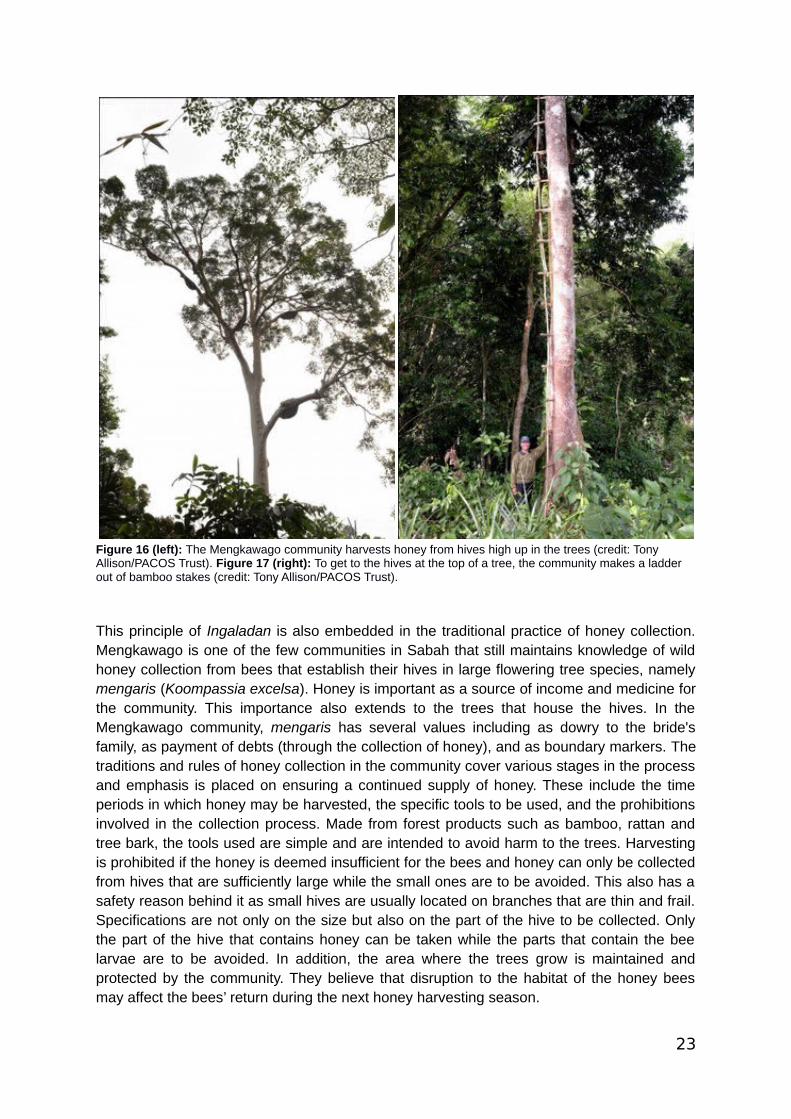
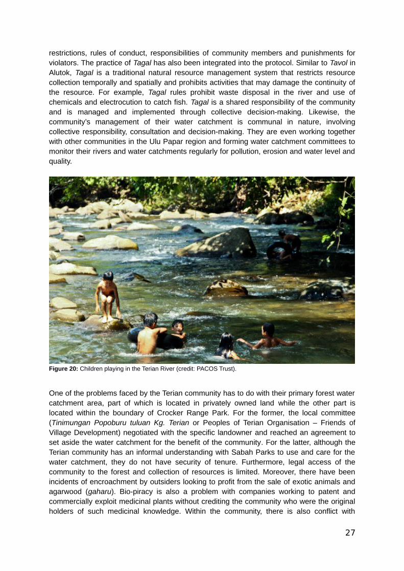
Figure 16 (left): The Mengkawago community harvests honey from hives high up in the trees (credit: Tony Allison/PACOS Trust). Figure 17 (right): To get to the hives at the top of a tree, the community makes a ladder out of bamboo stakes (credit: Tony Allison/PACOS Trust).
This principle of Ingaladan is also embedded in the traditional practice of honey collection.Mengkawago is one of the few communities in Sabah that still maintains knowledge of wildhoney collection from bees that establish their hives in large flowering tree species, namelymengaris (Koompassia excelsa). Honey is important as a source of income and medicine forthe community. This importance also extends to the trees that house the hives. In theMengkawago community, mengaris has several values including as dowry to the bride'sfamily, as payment of debts (through the collection of honey), and as boundary markers. Thetraditions and rules of honey collection in the community cover various stages in the processand emphasis is placed on ensuring a continued supply of honey. These include the timeperiods in which honey may be harvested, the specific tools to be used, and the prohibitionsinvolved in the collection process. Made from forest products such as bamboo, rattan andtree bark, the tools used are simple and are intended to avoid harm to the trees. Harvestingis prohibited if the honey is deemed insufficient for the bees and honey can only be collectedfrom hives that are sufficiently large while the small ones are to be avoided. This also has asafety reason behind it as small hives are usually located on branches that are thin and frail.Specifications are not only on the size but also on the part of the hive to be collected. Onlythe part of the hive that contains honey can be taken while the parts that contain the beelarvae are to be avoided. In addition, the area where the trees grow is maintained andprotected by the community. They believe that disruption to the habitat of the honey beesmay affect the bees’ return during the next honey harvesting season.
23
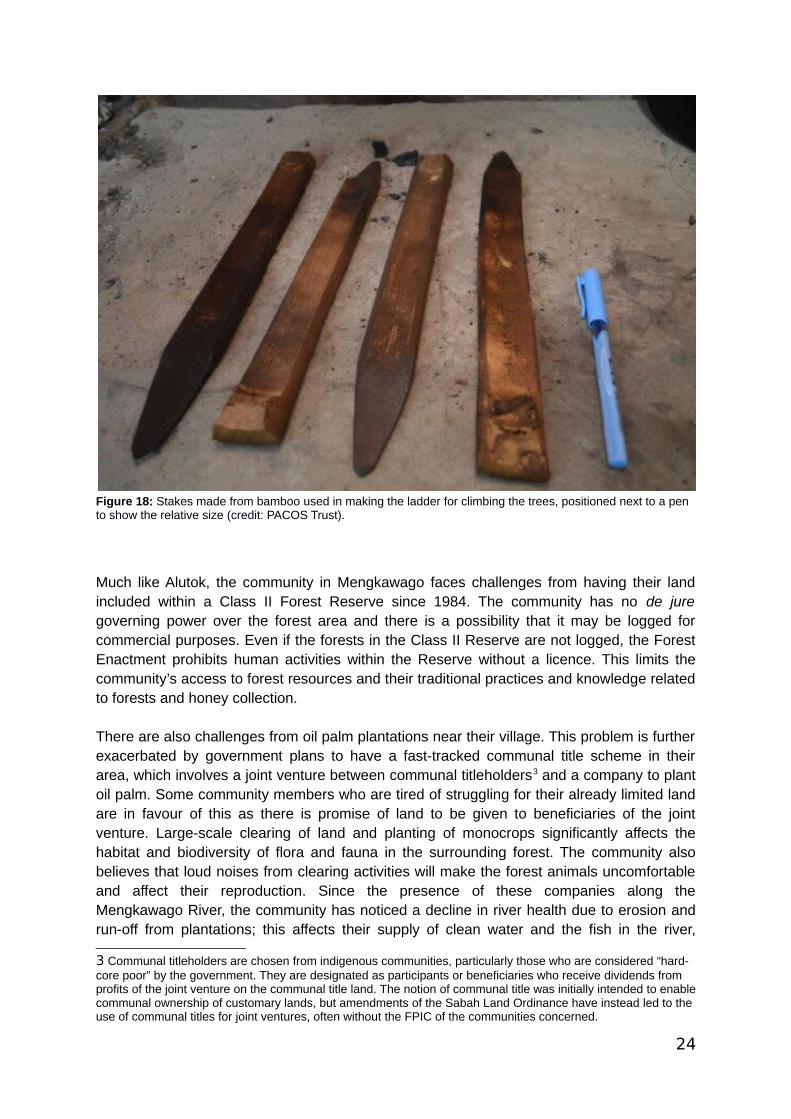
Figure 18: Stakes made from bamboo used in making the ladder for climbing the trees, positioned next to a pen to show the relative size (credit: PACOS Trust).
Much like Alutok, the community in Mengkawago faces challenges from having their landincluded within a Class II Forest Reserve since 1984. The community has no de juregoverning power over the forest area and there is a possibility that it may be logged forcommercial purposes. Even if the forests in the Class II Reserve are not logged, the ForestEnactment prohibits human activities within the Reserve without a licence. This limits thecommunity’s access to forest resources and their traditional practices and knowledge relatedto forests and honey collection.
There are also challenges from oil palm plantations near their village. This problem is furtherexacerbated by government plans to have a fast-tracked communal title scheme in theirarea, which involves a joint venture between communal titleholders3 and a company to plantoil palm. Some community members who are tired of struggling for their already limited landare in favour of this as there is promise of land to be given to beneficiaries of the jointventure. Large-scale clearing of land and planting of monocrops significantly affects thehabitat and biodiversity of flora and fauna in the surrounding forest. The community alsobelieves that loud noises from clearing activities will make the forest animals uncomfortableand affect their reproduction. Since the presence of these companies along theMengkawago River, the community has noticed a decline in river health due to erosion andrun-off from plantations; this affects their supply of clean water and the fish in the river,
3 Communal titleholders are chosen from indigenous communities, particularly those who are considered “hard-core poor” by the government. They are designated as participants or beneficiaries who receive dividends from profits of the joint venture on the communal title land. The notion of communal title was initially intended to enablecommunal ownership of customary lands, but amendments of the Sabah Land Ordinance have instead led to the use of communal titles for joint ventures, often without the FPIC of the communities concerned.
24
especially breeding areas. In addition, the community faces problems with communicationwith government agencies, encroachment of illegal poachers for profit or entertainment, andmigration of youth from the village for education and work.
The community of Mengkawago hopes to show the importance and multiple values of theforest area and to secure legal recognition and protection of their customary lands, practicesand livelihoods. To date, they have successfully completed their community mapping,community profile and documentation of historical sites. They are also in the process ofdocumenting their traditional practice of honey collection as an example of customarycommunity forest stewardship. By harvesting honey sustainably, the community is alsoprotecting the surrounding forest area and therefore providing broader environmentalbenefits.
The community hopes that they can advocate to key decision-makers and garner recognitionand support for their customary practices and community protocols related to foreststewardship and sustainable use. Communicating their practices and ways of life as mutuallybeneficial for the community and for conservation could help ease tensions between thecommunity and the Sabah Forestry Department; both parties would like to conserve the areabut the latter has not yet embraced the community as an ally in forest stewardship. Thecommunity is also very interested in building their capacity to protect their water catchmentsand formulating a management plan to ensure uninterrupted clean supply of water in thelong term to the village.
4.5 Terian
Terian is located near the boundary of Crocker Range Park in the District of Penampang,around 16 kilometres from Donggongon Town. Situated in a hilly area, the village is fairlyisolated with poor access to gravel and paved roads. The main access to the village is via afoot pathway, well known as the Salt Trail, which may take up to 6-8 hours of hiking throughthick forests. For the indigenous Dusun people there, agricultural land is important to theirlivelihoods, as many are farmers who depend on agriculture as their main source of income.The forest also provides for the daily needs of the community. The remoteness of theirvillage has made it all the more important for them to be self-sufficient and rely on theresources available to them. Traditional medicine from the forest is vital, especially in termsof access to health care. It is far more affordable than visiting the nearest town, which entailscostly transport and medical fees. The community also uses traditional handicrafts forconstruction, agriculture, recreation and other needs, made from resources found in theforest. Part of their income also comes from the sale of these handicrafts. Most importantly,they depend on the Terian River and water catchment areas around their village for cleanwater, irrigation, and electricity provided by a micro-hydro turbine.
25

Figure 19: Aerial view of Terian village (credit: JOAS).
For the Terian community, without productive land and natural resources, the existence oftheir culture and even the community itself would be called into question. The continuity andmanagement of available resources is thus crucially important. Like Mengkawago, theyobserve the concept of Gompi-Guno or “use and care” in their traditional resourcestewardship practices where they only take what is needed and what is used will bereplanted or given time to regenerate. Resources are conserved so as to ensure continuedaccess and availability.
One form of Gompi-Guno practiced by the community is in their management of watercatchment areas. The Terian community believes that anyone who pollutes the river will getretribution from the river spirits. This is based on the belief that springs and bodies of waterin water catchment areas have spirits that act as the guardians of that area and will bringillness to those who disturb or damage it. The community has voluntarily set aside 180hectares of primary forest as a water catchment area. Not only that, every river tributary hasalso been designated as a water catchment area that cannot be developed. Even the landsurrounding these conserved areas have strict conditions on what activities may be allowed.
To ensure these water catchment areas are protected, the community has drafted acommunity protocol based on the traditional knowledge of elders in the village, detailing the
26
restrictions, rules of conduct, responsibilities of community members and punishments forviolators. The practice of Tagal has also been integrated into the protocol. Similar to Tavol inAlutok, Tagal is a traditional natural resource management system that restricts resourcecollection temporally and spatially and prohibits activities that may damage the continuity ofthe resource. For example, Tagal rules prohibit waste disposal in the river and use ofchemicals and electrocution to catch fish. Tagal is a shared responsibility of the communityand is managed and implemented through collective decision-making. Likewise, thecommunity’s management of their water catchment is communal in nature, involvingcollective responsibility, consultation and decision-making. They are even working togetherwith other communities in the Ulu Papar region and forming water catchment committees tomonitor their rivers and water catchments regularly for pollution, erosion and water level andquality.
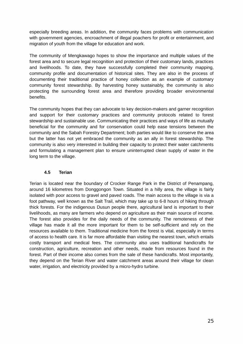
Figure 20: Children playing in the Terian River (credit: PACOS Trust).
One of the problems faced by the Terian community has to do with their primary forest watercatchment area, part of which is located in privately owned land while the other part islocated within the boundary of Crocker Range Park. For the former, the local committee(Tinimungan Popoburu tuluan Kg. Terian or Peoples of Terian Organisation – Friends ofVillage Development) negotiated with the specific landowner and reached an agreement toset aside the water catchment for the benefit of the community. For the latter, although theTerian community has an informal understanding with Sabah Parks to use and care for thewater catchment, they do not have security of tenure. Furthermore, legal access of thecommunity to the forest and collection of resources is limited. Moreover, there have beenincidents of encroachment by outsiders looking to profit from the sale of exotic animals andagarwood (gaharu). Bio-piracy is also a problem with companies working to patent andcommercially exploit medicinal plants without crediting the community who were the originalholders of such medicinal knowledge. Within the community, there is also conflict with
27
individuals who seek short-term economic advancement through cultivation or sale ofcommunity land that is otherwise set aside for conservation.
The most pressing issue for the community at the moment is the Sabah Water Department’splanned construction of a massive water reservoir dam for the purpose of supplying water toareas in Kota Kinabalu City and the District of Tuaran. The proposed location of the dam is inthe Ulu Papar area and would submerge a 12-km2 area. Even if Terian may not be in thearea to be submerged, the dam would still involve the gazettement of another 350 km2 to beused as a water catchment reserve. If this happened, the villagers would be forciblyrelocated and would lose their stewardship of the land, forests, watershed and rivers as wellas their identity, history, culture and livelihoods that are tied to the landscape.
The community has taken several measures in response to the proposed dam. They havetried proposing alternatives with less ecological impact such as using micro-hydro turbines.Memoranda have been sent to relevant government authorities advising against proceedingwith the project and underscoring the ramifications it would have to the communities living inthe area as well as the surrounding environment. They have held workshops with NGOs andmet with government agencies to share their views and demands. When they were notrespected, blockades were set up to block entry to the village, especially when EIAconsultants were alleged to have used unethical tactics to obtain data favourable to theproject proponent.
The community’s main strategy in resisting the proposed dam focused on showcasing theirsustainable management of natural resources based on their traditional knowledge, notably,their water catchment management practices which contribute to the continual supply ofclean water. It is hoped that by documenting and communicating their traditional knowledgeand practices, they will be able to convince the government to re-evaluate their decision tobuild the dam. They plan to provide a copy of their watershed management protocols torelevant government agencies, including the Native Court. They want their protocols to berecognized legally and adhered to by all, from both within and outside the village.
As for the issue of limited access to the forest due to overlapping boundaries with CrockerRange Park, the community has been working together with Sabah Parks to establish aCommunity Use Zone where the community would be allowed to continue their subsistenceactivities while managing the area together with Sabah Parks. However, this has yet to cometo fruition. More broadly, the Crocker Range Park and surrounding areas – including UluPapar – was declared as a UNESCO Biosphere Reserve in 2014 (UNESCO, 2014). Thisdesignation could provide an opportunity to engage with UNESCO over the concerns withthe dam, though more pervasive challenges remain with government financing and approvalprocesses for the dam.
5.0 Recommendations
The communities involved in the CCRI identified the following recommendations, withsupport from PACOS Trust. A common recommendation across all of the communities is toseek recognition of their community protocols from the Native Court, especially where the
28
state legal system has fallen short in its recognition of customary law and traditionalknowledge and practices.
Sg. Eloi: Any further development of the shrimp farm should be halted to prevent further
damage of the mangroves. The Environment Protection Department should retract theEIA clearance for the aquaculture project and undertake a proper public review, with fulland effective participation of the villages in that area. The project developers shouldrestore or at the very least pay for restoration of the mangroves destroyed. More broadly,an independent review should be undertaken of the impacts of the federal and stategovernments’ “poverty eradication” programmes (such as the shrimp farming project).The community should be allowed to determine what form of development is appropriateto their way of life. Government agencies, especially the Forestry Department, the Landsand Surveys Department and the Native Court, should formally recognize thecommunity’s protocols and customary laws for protecting and sustainably using theirmangroves. Another legal option being considered is to work with the Drainage andIrrigation Department to recognise Water Conservation Areas in the community’smangrove areas.
Alutok: The Sabah Forestry Department should excise the community forest from the
Class II Forest Reserve or reclassify it as a domestic forest reserve (Class III) anddevolve governance and management responsibilities to the community, based onIndigenous knowledge and practices. This arrangement should not impose anyrequirements to clear the forest under the guise of ‘poverty eradication’. At the very least,a co-management agreement should be established with the community for thecommunity forest.
Kiau: Sabah Parks should continue to assist with efforts to recognise the community’s
conservation practices but should do so in ways that are tailored to each community inthe Ecolinc (corridor) area, including by considering the pros and cons of NativeReserves and other forms of legal recognition more fully with the community beforeproceeding with gazettement. Sabah Parks and companies interested in tourismoperations in the area should also assist the community in setting up eco-tourisminitiatives in accordance with the community’s protocol and development plans. Anotheroption being considered is to work with the Sabah Forestry Department to demarcateand gazette their community forest reserve in accordance with the community’s protocol,as the Forestry Department has more political clout than Sabah Parks.
Mengkawago: Similar to Alutok, the Sabah Forestry Department should excise the
community’s traditional territory from the Forest Reserve and grant the community formalownership. A possible alternative is to reclassify it as a Class III forest reserve anddevolve governance and management responsibilities to the community, based onIndigenous knowledge and practices. At the very least, the Forestry Department,concessionaire and community should establish a co-management agreement to allowthe community secure access to forest products for their subsistence use and to protectthe trees on which the honey bees depend. An additional option being considered tosupport their livelihoods is to work with the Forestry Department’s Social Forestry Unit toestablish a local enterprise for the harvested honey.
29
Terian: The state government should immediately halt plans to build the Kaiduan Dam
and identify alternatives for addressing the city’s water supply needs, including byretrofitting pipes to stop leakages. Sabah Parks and the Ministry of Tourism, Culture andEnvironment should play a more active role in supporting the communities in Ulu Paparto resist the dam and should leverage the designation of the UNESCO BiosphereReserve to recognise the communities’ contributions to water catchment stewardshipand biodiversity conservation more broadly, and the need for sustainable economicactivities in the area. This could include legally recognising Water Conservation Areasand Community Use Zones. The community’s watershed management protocols shouldbe formally recognized and supported by all relevant government agencies.
6.0 Conclusion
Through the CCRI process, the five communities have documented their customary lawsand traditional knowledge previously only known orally in the hopes of ensuring thecontinuity of their traditional knowledge and practices, and also demonstrating that they arecapable of managing resources sustainably. This process has also facilitated the visioning ofthe communities’ self-determined plans and priorities, especially in the long term, initiating aprocess of engagement with key decision-makers through their community protocols anddemonstration of good practices.
Although the communities involved have demonstrated their resilience and ability to bestewards of their customary territories, significant challenges threaten their territories andpractices in both the short- and long-term. Consolidating their community protocols willprovide a clear basis for targeted dialogues and negotiation with government agencies andother stakeholders. Different government agencies can usefully implement existingprovisions in policy and legal frameworks to recognise and support the communities.However, several weaknesses may need to be addressed for this to be effective, includingpossible conflicts of interest, ensuring recognition is appropriate, management effectiveness,effective participation and decision makers within the community, limits of coordination andjurisdiction, and research and education (Lasimbang, 2016).
30
REFERENCES
Anon., 2014. Largest prawn farm to create 3,000 jobs. The Star, [online] 21 December.Available at: <http://www.thestar.com.my/news/nation/2014/12/21/largestprawnfarmtocreate3000jobs/> [Accessed 12 October 2016].
Cooke, F. M., and Hussin, R., 2014. Biodiversity conservation and its social implications: Thecase of Indigenous and Community Conserved Areas in Sabah, Malaysia. Suvannabhumi,[e-journal] 6(2), pp.3-18. Available through: ResearchGate website<https://www.researchgate.net/publication/272508671> [Accessed 31 March 2016].
Globinmed, 2015. Article 2: Biodiversity of flora in Malaysia. [online] Available at:<http://www.globinmed.com/index.php?option=com_content&view=article&id=104182:biodiversity-of-flora-2&catid=268&Itemid=319&showall=1&limitstart=> [Accessed 23 February 2018].
Harbinson, R., 2017. Communities struggle to save Sabah’s shrinking mangroves.Mongabay, [online] 13 September. Available at: <https://news.mongabay.com/2017/09/communities-struggle-to-save-sabahs-shrinking-mangroves/> [Accessed 04 March 2018].
Lasimbang, J., 2016. Tagal Hutan: Can a policy framework help its promotion?
Sabah Parks, 2018. Kinabalu Ecolinc Project. [online] Available at:<http://www.sabahparks.org.my/discover-us/kinabalu-ecolinc-project> [Accessed 04 March2018].
Teh, M., 2016. Villagers want help to protect mangrove swamps in Pitas. New Sabah Times,[online] 28 April. Available at: <http://www.newsabahtimes.com.my/nstweb/print/5948>[Accessed 26 September 2016].
Tongkul, F, 2002. Traditional systems of indigenous peoples of Sabah, Malaysia: Wisdomaccumulated through generations. Penampang: PACOS Trust.
Tongkul, F., Lasimbang, C., Lasimbang, A. and Chin Jr, P., 2013. Traditional knowledge andSFM: experience from Malaysia. Unasylva, [e-journal] 64(240), pp.41-49. Available through:FAO website < http://www.fao.org/docrep/018/i3364e/i3364e06.pdf> [Accessed 23 February2018].
United Nations Educational, Scientific and Cultural Organization (UNESCO), 2014. CrockerRange. [online] Available at: <http://www.unesco.org/new/en/natural-sciences/environment/ecological-sciences/biosphere-reserves/asia-and-the-pacific/malaysia/crocker-range/>[Accessed 04 March 2018]
Vaz, J., 2012. An analysis of international law, national legislation, judgements, andinstitutions as they interrelate with territories and areas conserved by indigenous peoplesand local communities, Report no.15 Malaysia. [pdf] Available at:
31

<http://naturaljustice.org/wp-content/uploads/2015/09/Asia-Regional-Malaysia.pdf>[Accessed 13 February 2018].
32