Embed Size (px)
Citation preview
Alicja Karpinska, RSS Surveyor
James Morrison, UAV Pilot & Surveyor
Callum Harkness, Principal Production Consultant
• Remote Sensing Techniques• UAV• HAPS
© Ordnance Survey | Official
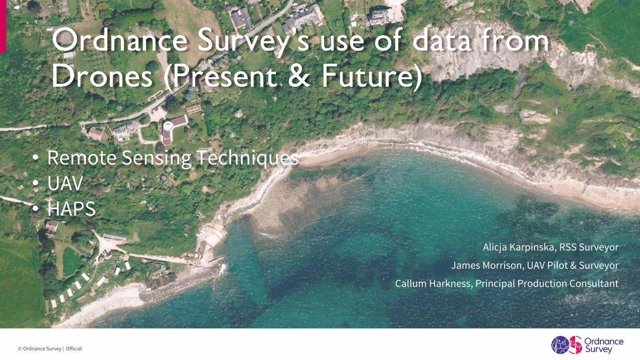
UAVField SurveyAirborne nadir camera systems
Stereo processing
Topography Imagery Layer OS Terrain 5 (DTM) BuildingHeight Attributes
© Ordnance Survey | Official
Remote Sensing Techniques
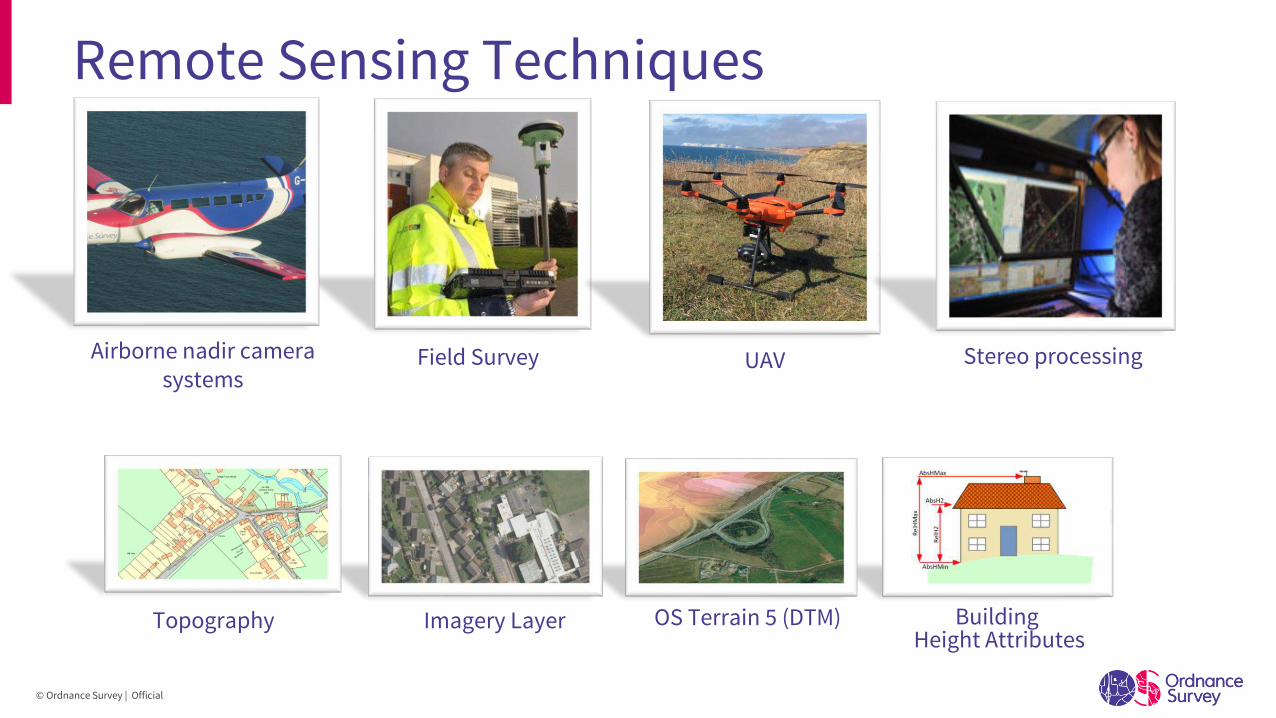
Comparison of data capture methods
Very High
Low Medium Very HighHigh
Extremely High
High
Medium
Low
Revisit Frequency
/ Coverage Area
Detail
© Ordnance Survey | Official
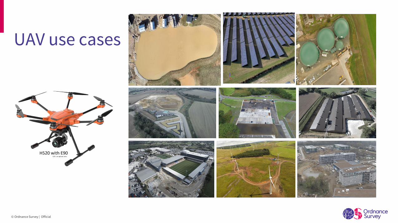
UAV use cases
© Ordnance Survey | Official
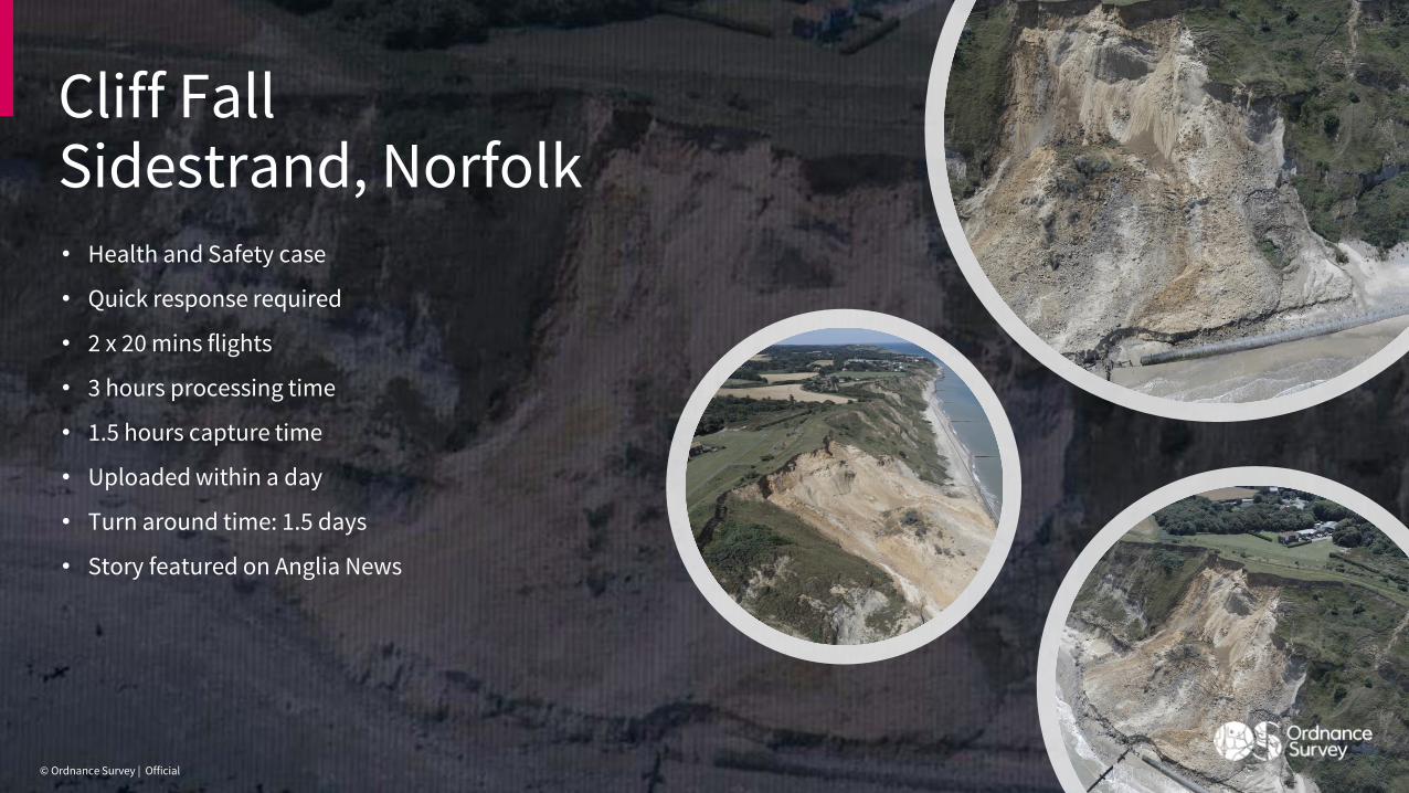
Cliff FallSidestrand, Norfolk• Health and Safety case
• Quick response required
• 2 x 20 mins flights
• 3 hours processing time
• 1.5 hours capture time
• Uploaded within a day
• Turn around time: 1.5 days
• Story featured on Anglia News
© Ordnance Survey | Official
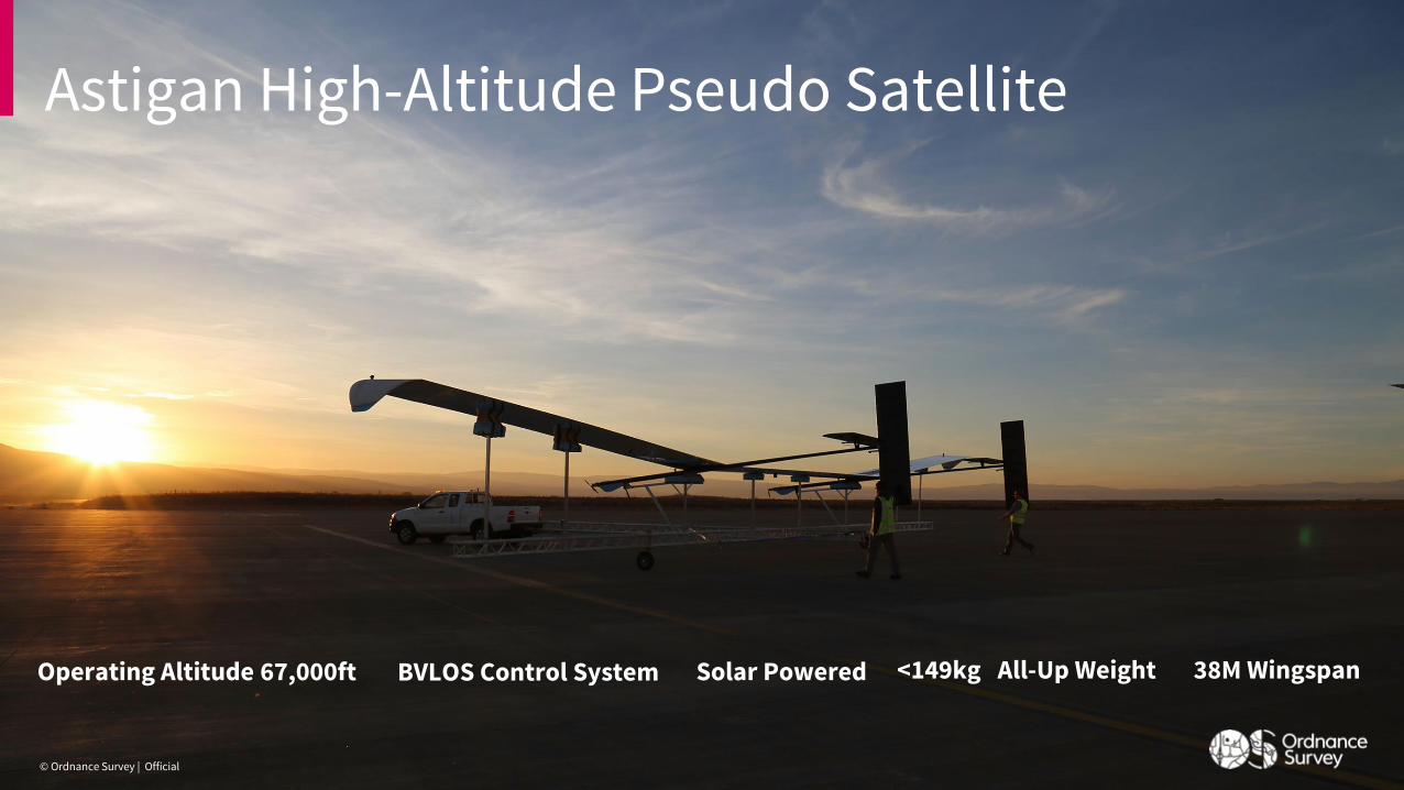
Astigan High-Altitude Pseudo Satellite
© Ordnance Survey | Official
38M WingspanOperating Altitude 67,000ft Solar Powered <149kg All-Up WeightBVLOS Control System
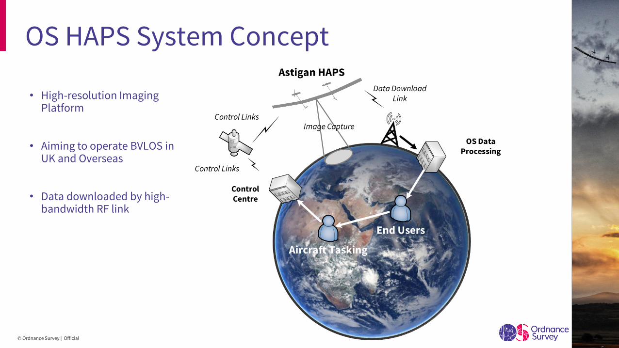
OS HAPS System Concept
• High-resolution Imaging Platform
• Aiming to operate BVLOS in UK and Overseas
• Data downloaded by high-bandwidth RF link
Control Links
Data Download
Link
Astigan HAPS
OS Data
Processing
Control
Centre
Aircraft Tasking
End Users
Control Links
Image Capture
© Ordnance Survey | Official
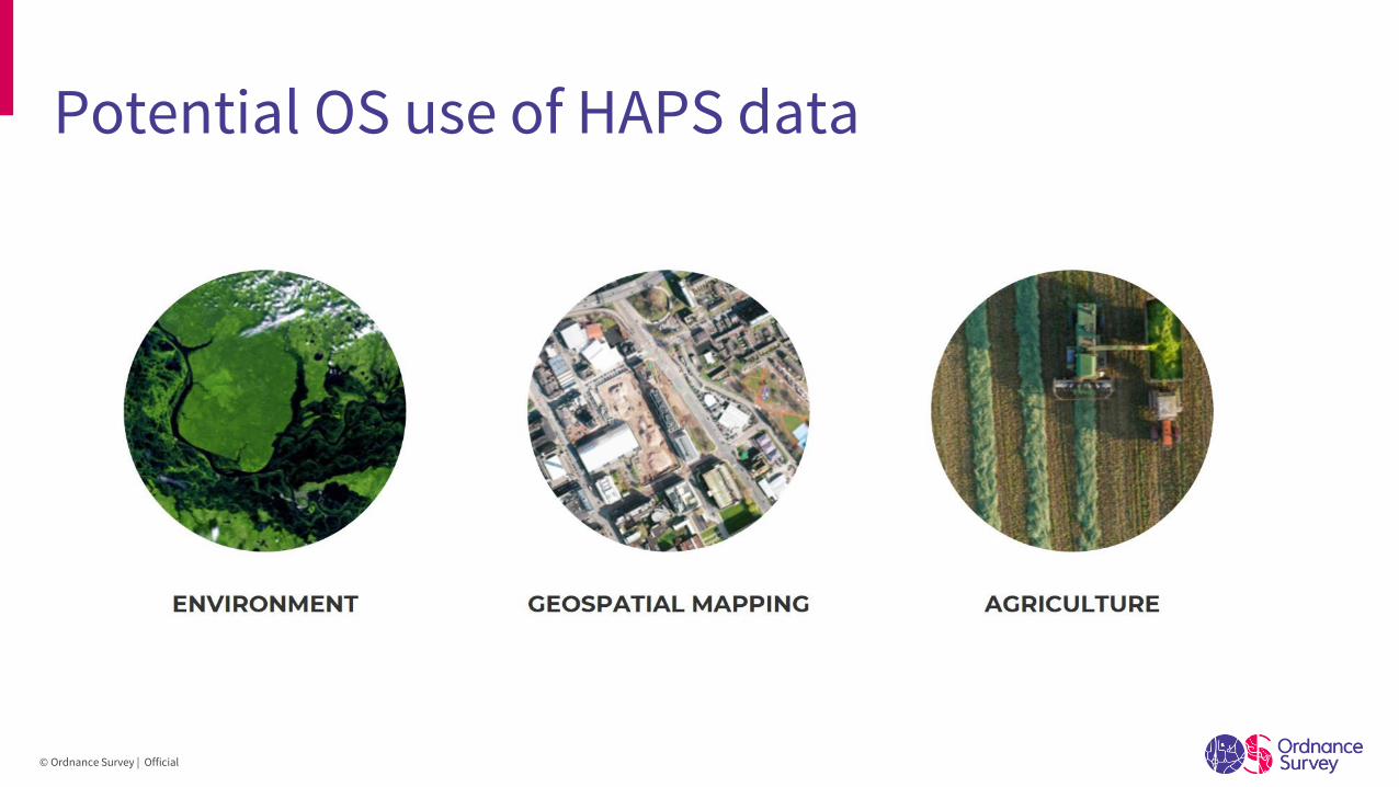
Potential OS use of HAPS data
© Ordnance Survey | Official
Alicja Karpinska, RSS Surveyor
James Morrison, UAV Pilot & Surveyor
Callum Harkness, Principal Production Consultant
Any questions?
© Ordnance Survey | Official