Embed Size (px)
Citation preview
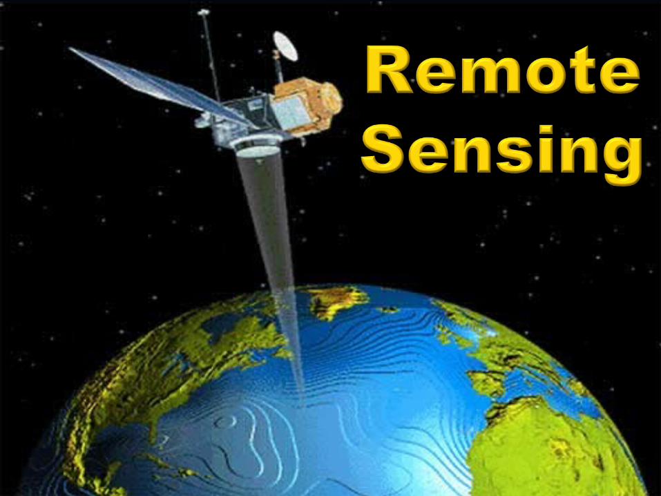
Remote SensingRemote Sensing
Space-based Earth exploration and planetary Space-based Earth exploration and planetary exploration began with the International exploration began with the International Geophysical Year (IGY) which was also the Geophysical Year (IGY) which was also the beginning of the space race (1957)beginning of the space race (1957)
IGY was an 18-month international scientific IGY was an 18-month international scientific research project that spanned 1957-1958research project that spanned 1957-1958 Research included Earth sciences: aurora and Research included Earth sciences: aurora and
airglow, cosmic rays, geomagnetism, gravity, airglow, cosmic rays, geomagnetism, gravity, ionospheric physics, longitude and latitude ionospheric physics, longitude and latitude determinations (precision mapping), meteorology, determinations (precision mapping), meteorology, oceanography, seismology and solar activityoceanography, seismology and solar activity
Remote SensingRemote Sensing
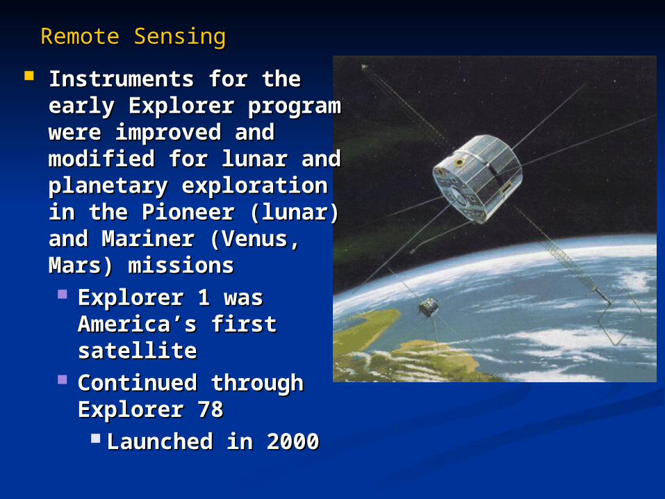
Instruments for the early Instruments for the early Explorer program were Explorer program were improved and modified for improved and modified for lunar and planetary lunar and planetary exploration in the Pioneer exploration in the Pioneer (lunar) and Mariner (Venus, (lunar) and Mariner (Venus, Mars) missionsMars) missions Explorer 1 was America’s Explorer 1 was America’s
first satellitefirst satellite Continued through Continued through
Explorer 78 Explorer 78 Launched in 2000Launched in 2000
Remote SensingRemote Sensing
Remote sensing is traditionally used for Remote sensing is traditionally used for Earth observation, but also applies to Earth observation, but also applies to planetary explorationplanetary exploration The same or similar or instruments used for bothThe same or similar or instruments used for both
Measurements at a distance use Measurements at a distance use electromagnetic (EM) sensorselectromagnetic (EM) sensors Radio, microwaveRadio, microwave IRIR VisibleVisible UVUV
Remote SensingRemote Sensing
Sampling (in situ) measurementsSampling (in situ) measurements
Generally for accurate measurements of Generally for accurate measurements of composition and abundance composition and abundance
Include:Include: Mass spectrometersMass spectrometers Atmospheric particle detectorsAtmospheric particle detectors Surface analysisSurface analysis
Particle and EM radiation detectorsParticle and EM radiation detectors
Remote SensingRemote Sensing
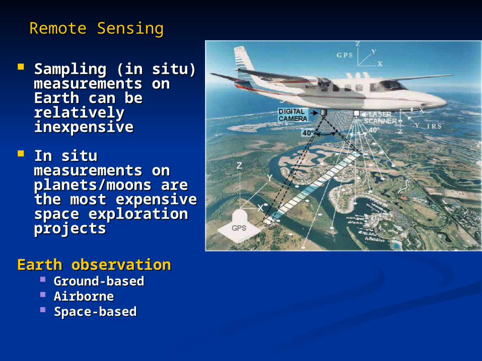
Sampling (in situ) Sampling (in situ) measurements on measurements on Earth can be relatively Earth can be relatively inexpensive inexpensive
In situ measurements In situ measurements on planets/moons are on planets/moons are the most expensive the most expensive space exploration space exploration projectsprojects
Earth observation Earth observation Ground-basedGround-based AirborneAirborne Space-basedSpace-based
Remote SensingRemote Sensing
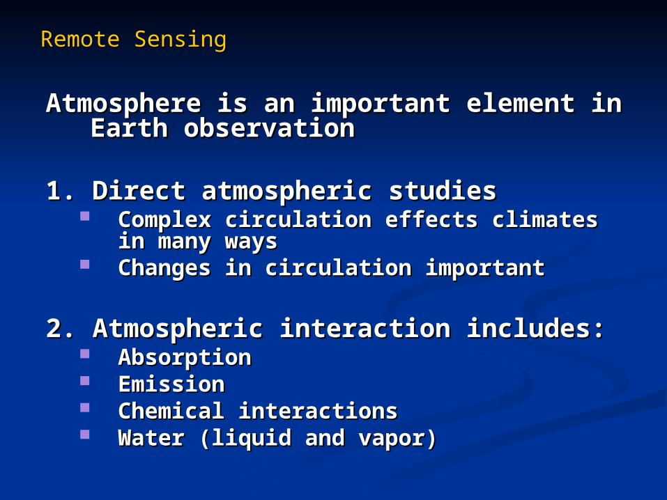
Atmosphere is an important element in Earth Atmosphere is an important element in Earth observationobservation
1. Direct atmospheric studies1. Direct atmospheric studies Complex circulation effects climates in many Complex circulation effects climates in many
waysways Changes in circulation importantChanges in circulation important
2. Atmospheric interaction includes:2. Atmospheric interaction includes: AbsorptionAbsorption EmissionEmission Chemical interactionsChemical interactions Water (liquid and vapor)Water (liquid and vapor)
Remote SensingRemote Sensing
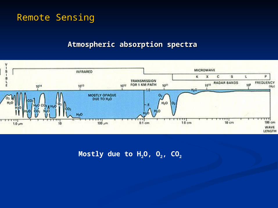
Atmospheric absorption spectraAtmospheric absorption spectra
Mostly due to H2O, O2, CO2
Remote SensingRemote Sensing
Space-based observationsSpace-based observations
EM radiation sensors include:EM radiation sensors include:
Imaging dataImaging data
Spectral dataSpectral data
Spectral imaging dataSpectral imaging data Color television is an example of Color television is an example of
sequential spectral (color) imagessequential spectral (color) images
Remote SensingRemote Sensing
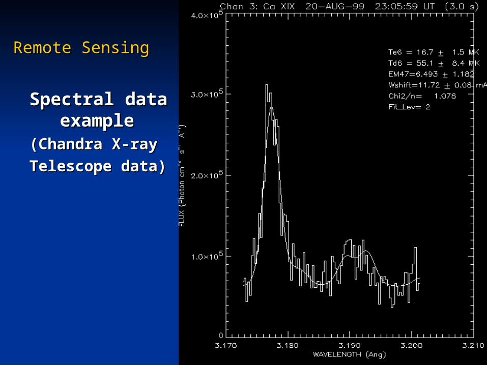
Spectral data Spectral data exampleexample
(Chandra X-ray (Chandra X-ray
Telescope data)Telescope data)
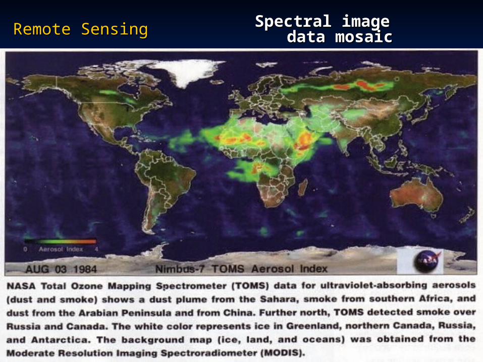
Remote SensingRemote Sensing Spectral image Spectral image data mosaicdata mosaic
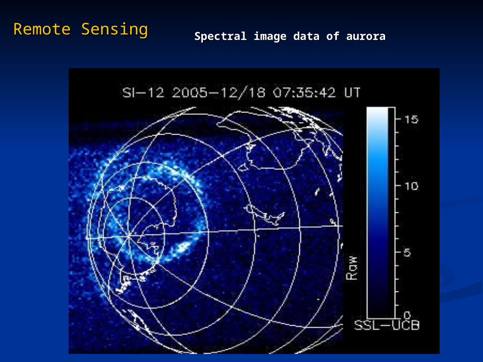
Remote SensingRemote SensingSpectral image data of auroraSpectral image data of aurora
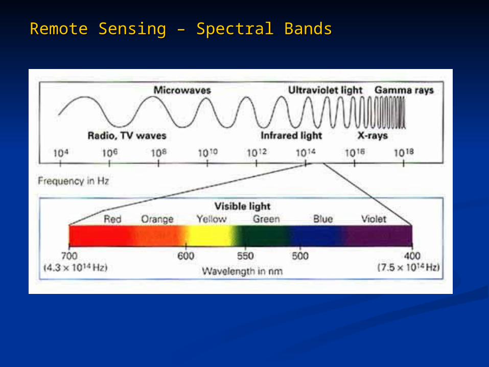
Remote Sensing – Spectral BandsRemote Sensing – Spectral Bands
Remote Sensing – Spectral BandsRemote Sensing – Spectral Bands
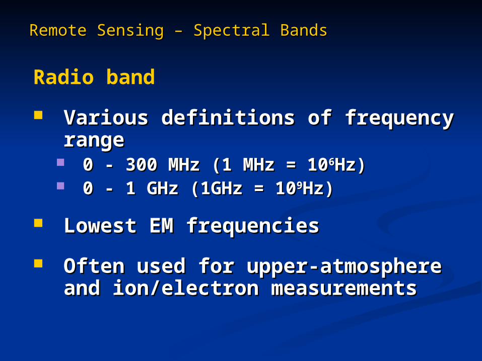
Radio band
Various definitions of frequency rangeVarious definitions of frequency range 0 - 300 MHz (1 MHz = 100 - 300 MHz (1 MHz = 1066Hz)Hz) 0 - 1 GHz (1GHz = 100 - 1 GHz (1GHz = 1099Hz)Hz)
Lowest EM frequenciesLowest EM frequencies
Often used for upper-atmosphere and Often used for upper-atmosphere and ion/electron measurements ion/electron measurements
Remote Sensing – Spectral BandsRemote Sensing – Spectral Bands
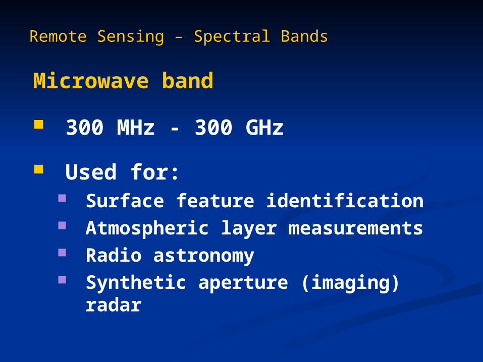
Microwave band
300 MHz - 300 GHz
Used for: Surface feature identification Atmospheric layer measurements Radio astronomy Synthetic aperture (imaging) radar
Remote Sensing – Spectral BandsRemote Sensing – Spectral Bands
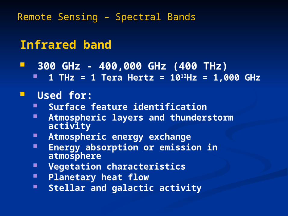
Infrared band
300 GHz - 400,000 GHz (400 THz) 1 THz = 1 Tera Hertz = 1012Hz = 1,000 GHz
Used for: Surface feature identification Atmospheric layers and thunderstorm activity Atmospheric energy exchange Energy absorption or emission in atmosphere Vegetation characteristics Planetary heat flow Stellar and galactic activity
Remote Sensing – Spectral BandsRemote Sensing – Spectral Bands
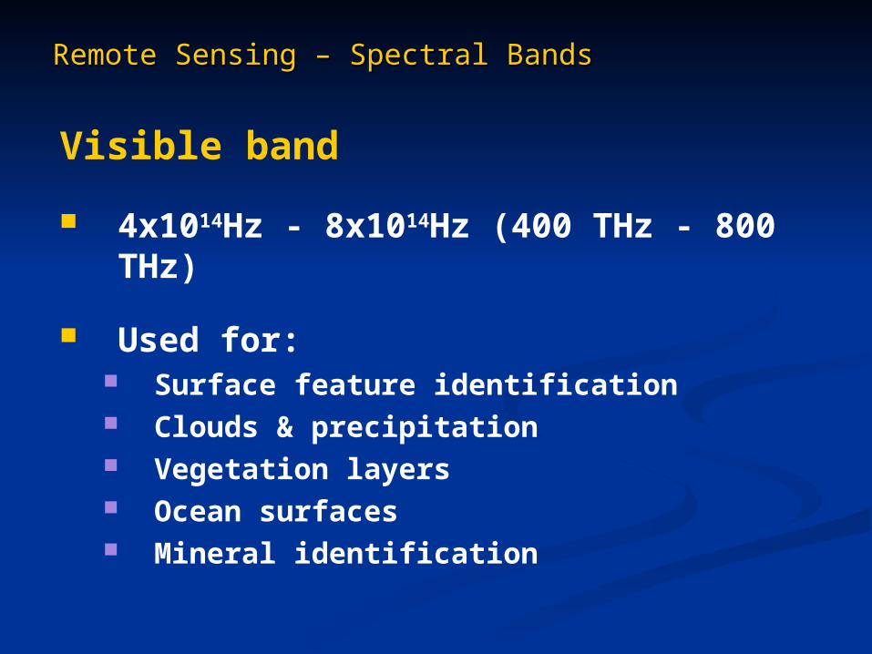
Visible band
4x10¹⁴Hz - 8x10¹⁴Hz (400 THz - 800 THz)
Used for: Surface feature identification Clouds & precipitation Vegetation layers Ocean surfaces Mineral identification
Remote Sensing – Spectral BandsRemote Sensing – Spectral Bands
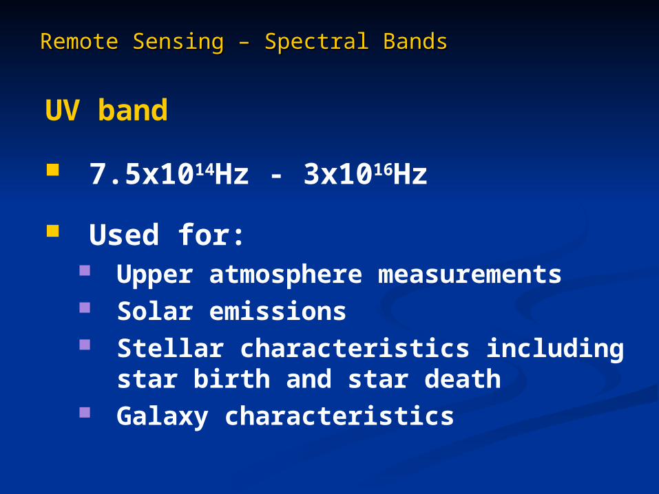
UV band
7.5x10¹⁴Hz - 3x10¹⁶Hz
Used for: Upper atmosphere measurements Solar emissions Stellar characteristics including star birth
and star death Galaxy characteristics
Remote Sensing – Spectral BandsRemote Sensing – Spectral Bands
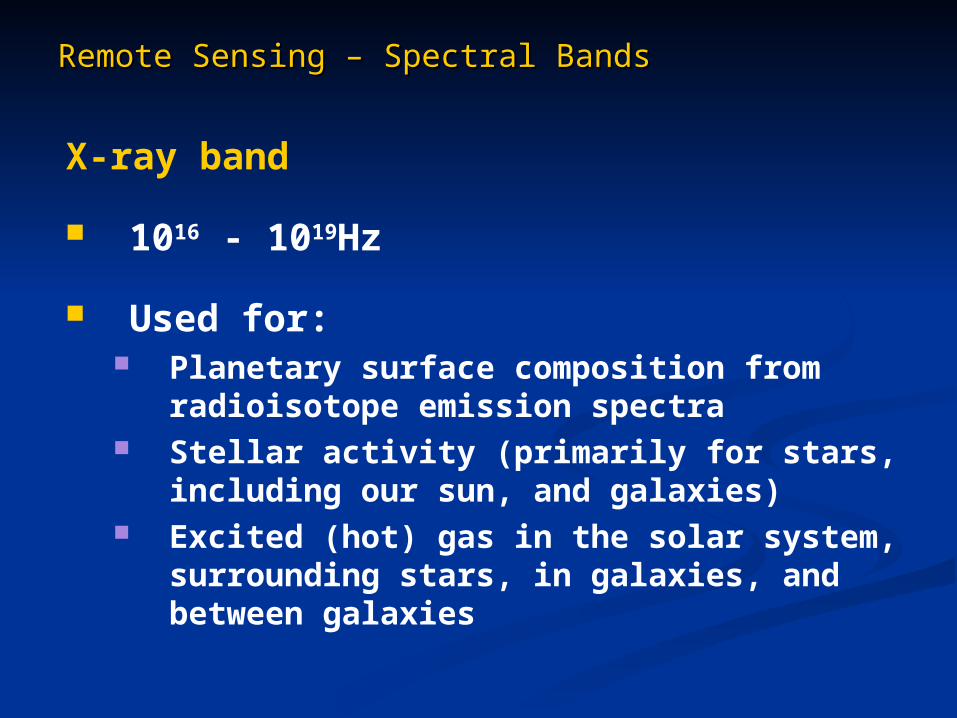
X-ray band
1016 - 1019Hz
Used for: Planetary surface composition from
radioisotope emission spectra Stellar activity (primarily for stars, including our
sun, and galaxies) Excited (hot) gas in the solar system,
surrounding stars, in galaxies, and between galaxies
Remote Sensing – Spectral BandsRemote Sensing – Spectral Bands
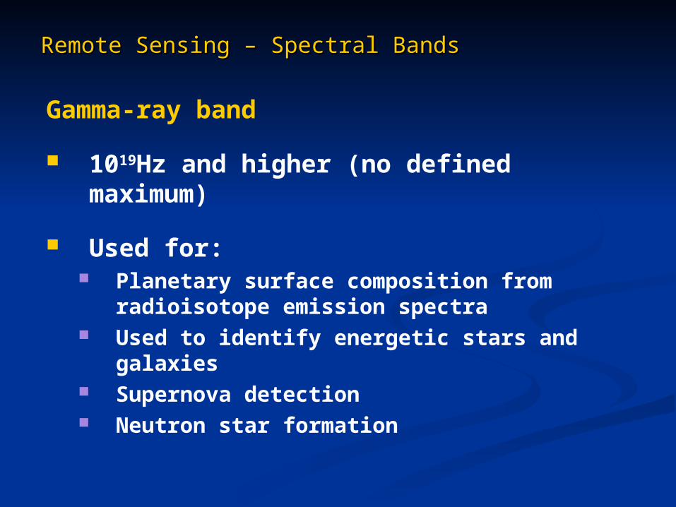
Gamma-ray band
1019Hz and higher (no defined maximum)
Used for: Planetary surface composition from
radioisotope emission spectra Used to identify energetic stars and galaxies Supernova detection Neutron star formation

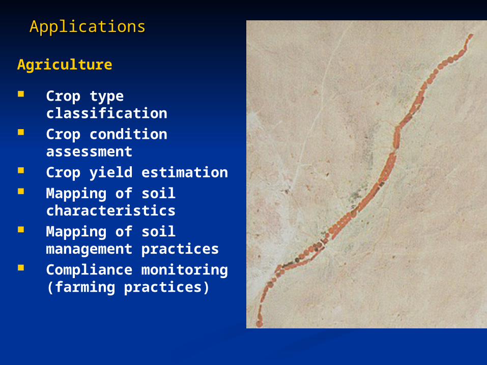
ApplicationsApplications
Agriculture
Crop type classification Crop condition
assessment Crop yield estimation Mapping of soil
characteristics Mapping of soil
management practices Compliance monitoring
(farming practices)
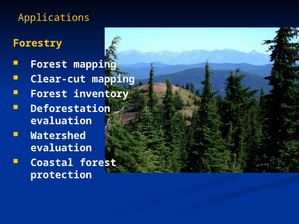
ApplicationsApplications
Forestry
Forest mapping Clear-cut mapping Forest inventory Deforestation
evaluation Watershed evaluation Coastal forest
protection
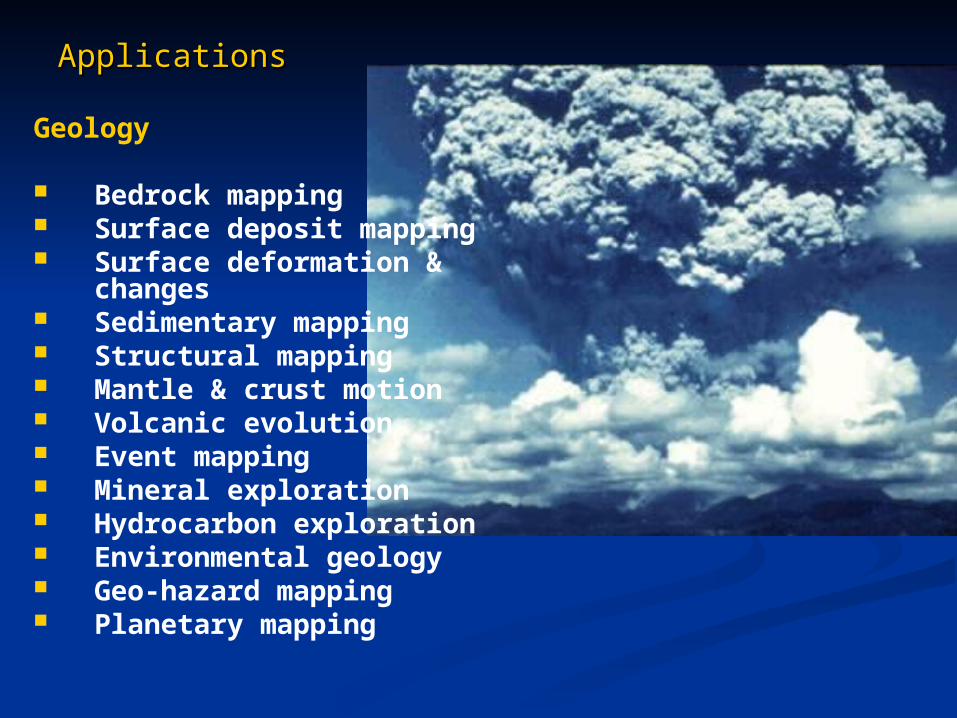
ApplicationsApplications
Geology
Bedrock mapping Surface deposit mapping Surface deformation &
changes Sedimentary mapping Structural mapping Mantle & crust motion Volcanic evolution Event mapping Mineral exploration Hydrocarbon exploration Environmental geology Geo-hazard mapping Planetary mapping
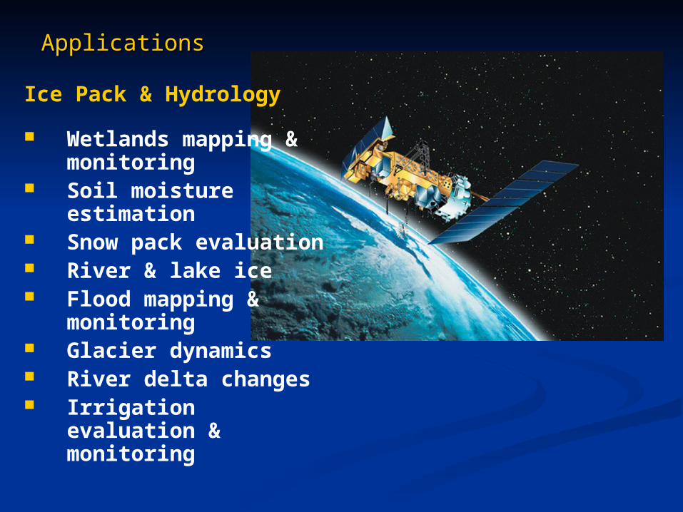
ApplicationsApplications
Ice Pack & Hydrology
Wetlands mapping & monitoring
Soil moisture estimation
Snow pack evaluation River & lake ice Flood mapping &
monitoring Glacier dynamics River delta changes Irrigation evaluation &
monitoring
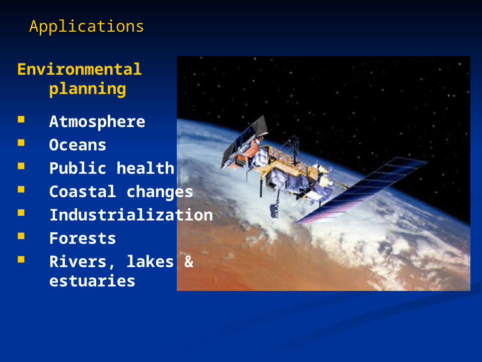
ApplicationsApplications
Environmental planning
Atmosphere Oceans Public health Coastal changes Industrialization Forests Rivers, lakes &
estuaries
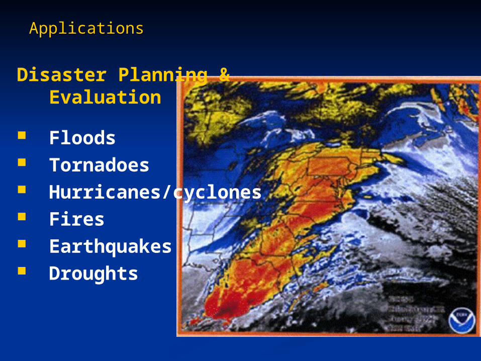
ApplicationsApplications
Disaster Planning & Evaluation
Floods Tornadoes Hurricanes/cyclones Fires Earthquakes Droughts
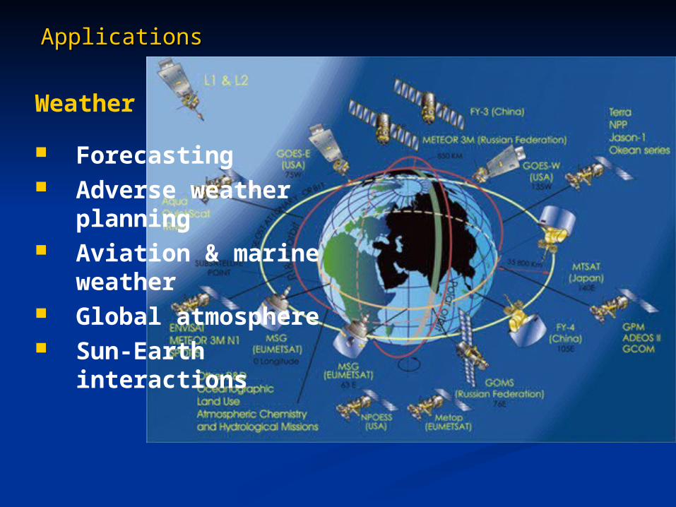
ApplicationsApplications
Weather
Forecasting Adverse weather
planning Aviation & marine
weather Global atmosphere Sun-Earth
interactions
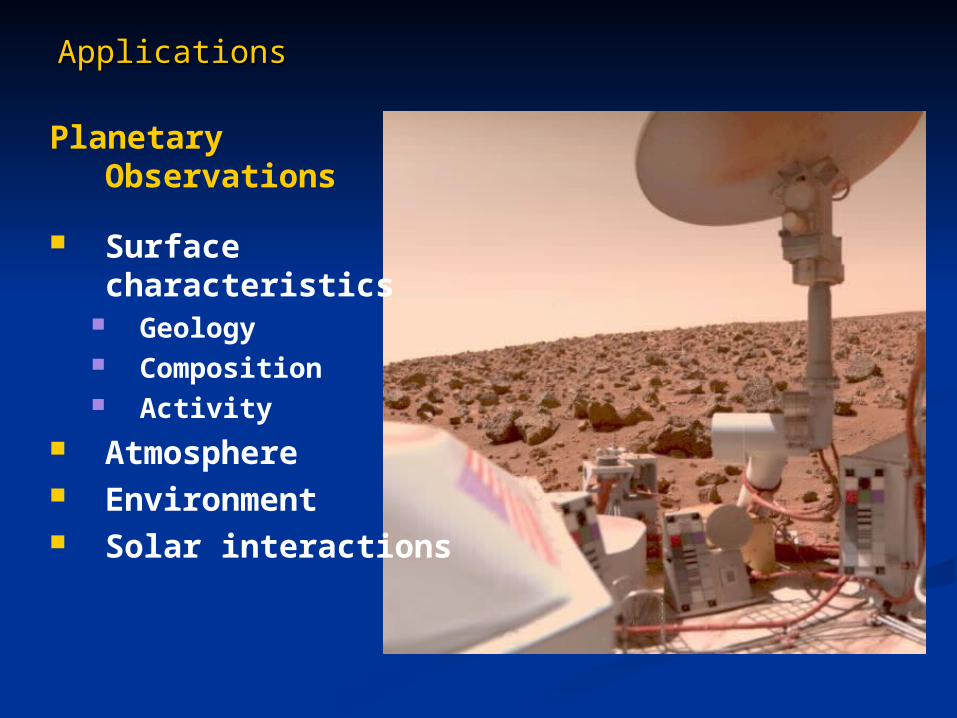
ApplicationsApplications
Planetary Observations
Surface characteristics
Geology Composition Activity
Atmosphere Environment Solar interactions