Embed Size (px)
Citation preview
Remote Sensing and GIS at Guilford Courthouse National Military Park (GUCO) The Sequel! {hope you saw Jacob Turner’s Award winning paper yesterday}
2013 North Carolina Geographic Information Systems Conference Roy Stine UNCG
Project Goals
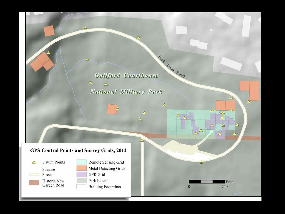
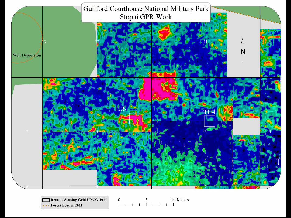
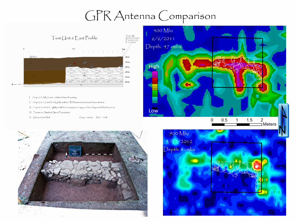
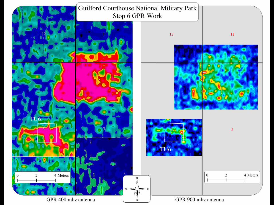
• To use multiple methods of remote sensing; including a Ground Penetrating Radar (GPR) and a dual flux gate gradiometer , to help place excavation units and facilitate data recovery.
• Help locate the original Guilford Courthouse and possibly the third Continental Line.
• Education: for both the students and the general public.
Project Notes • Methods of remote sensing; including a Ground
Penetrating Radar (GPR) and a dual fluxgate gradiometer and aerial photographs.
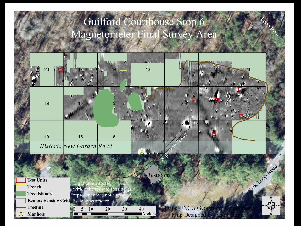
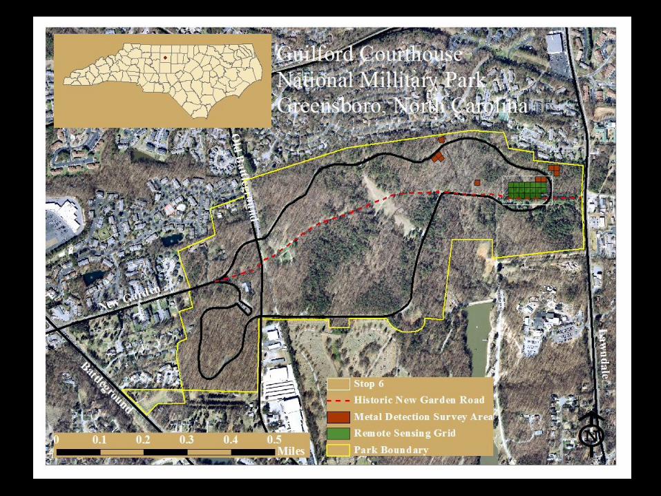
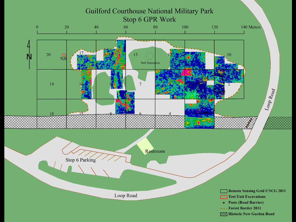
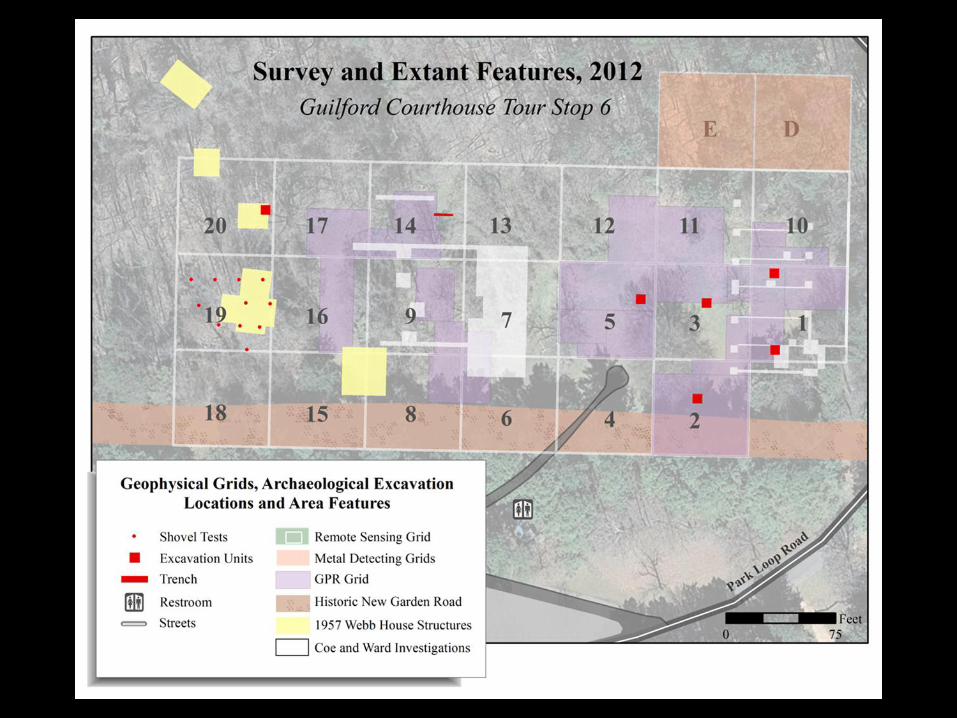
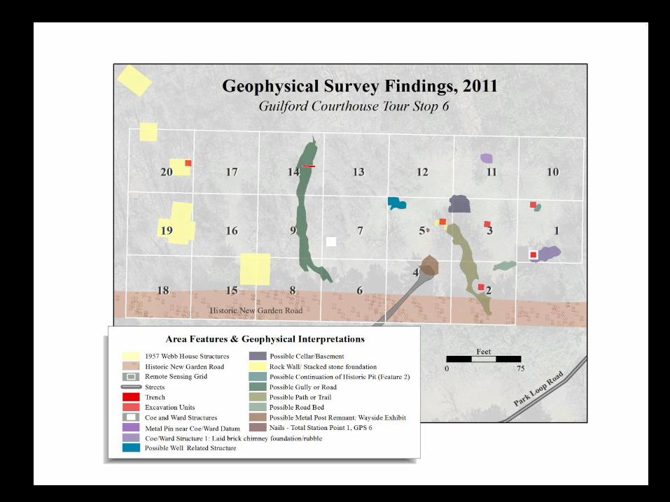
• Metal detecting 3,800 square meters, Magnetometer 4,605 square meters, GPR 2,714 square meters
• Over 120 anomalies recorded and mapped
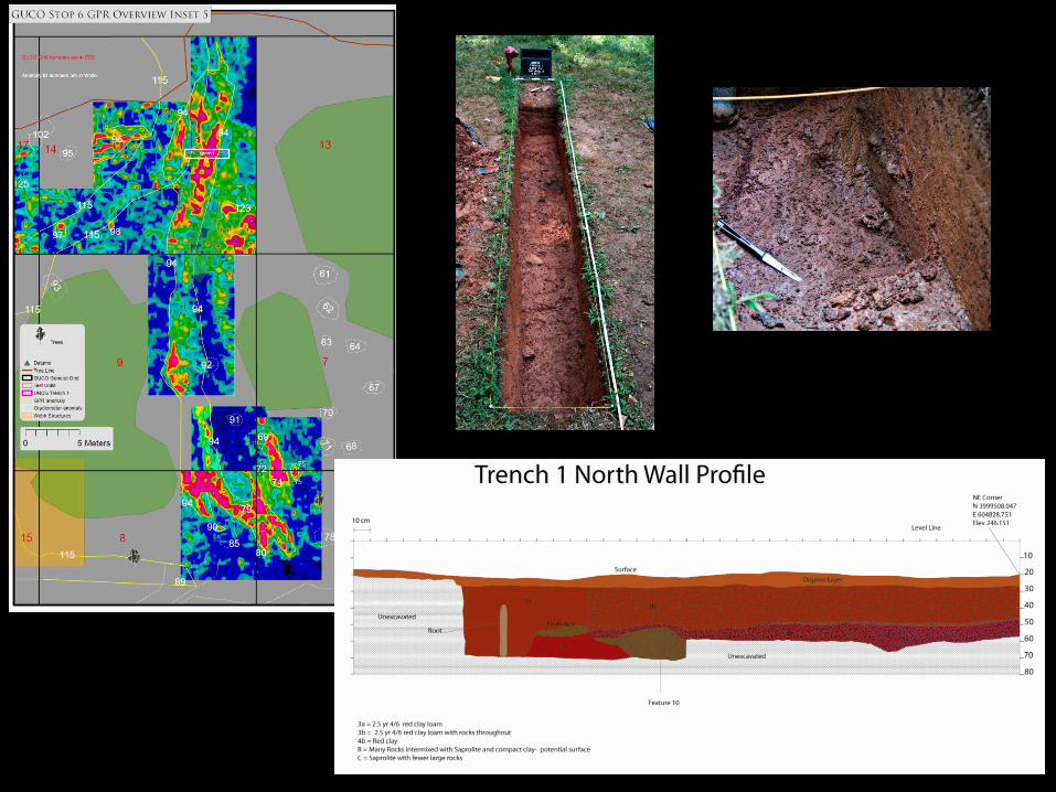
• Six 2x2 m units were excavated, one 4x.5 m trench and eleven 50x50 cm shovel tests
• Approximately 10,000 artifacts are being washed, catalogued, preserved and analyzed

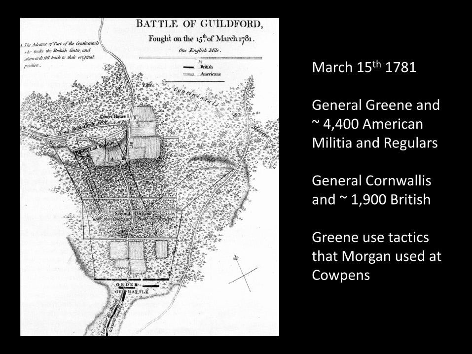
March 15th 1781 General Greene and ~ 4,400 American Militia and Regulars General Cornwallis and ~ 1,900 British Greene use tactics that Morgan used at Cowpens
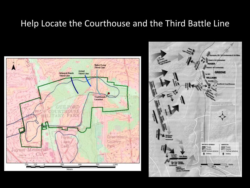
Help Locate the Courthouse and the Third Battle Line
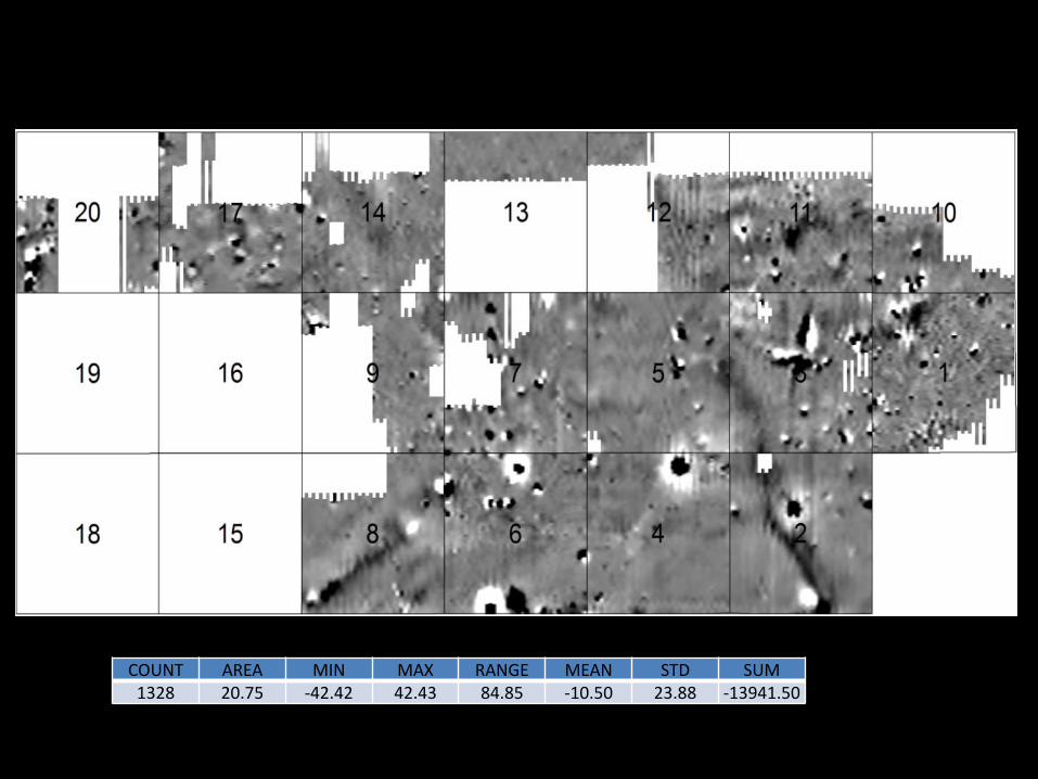
COUNT AREA MIN MAX RANGE MEAN STD SUM 1328 20.75 -42.42 42.43 84.85 -10.50 23.88 -13941.50
High
Low
Conclusion
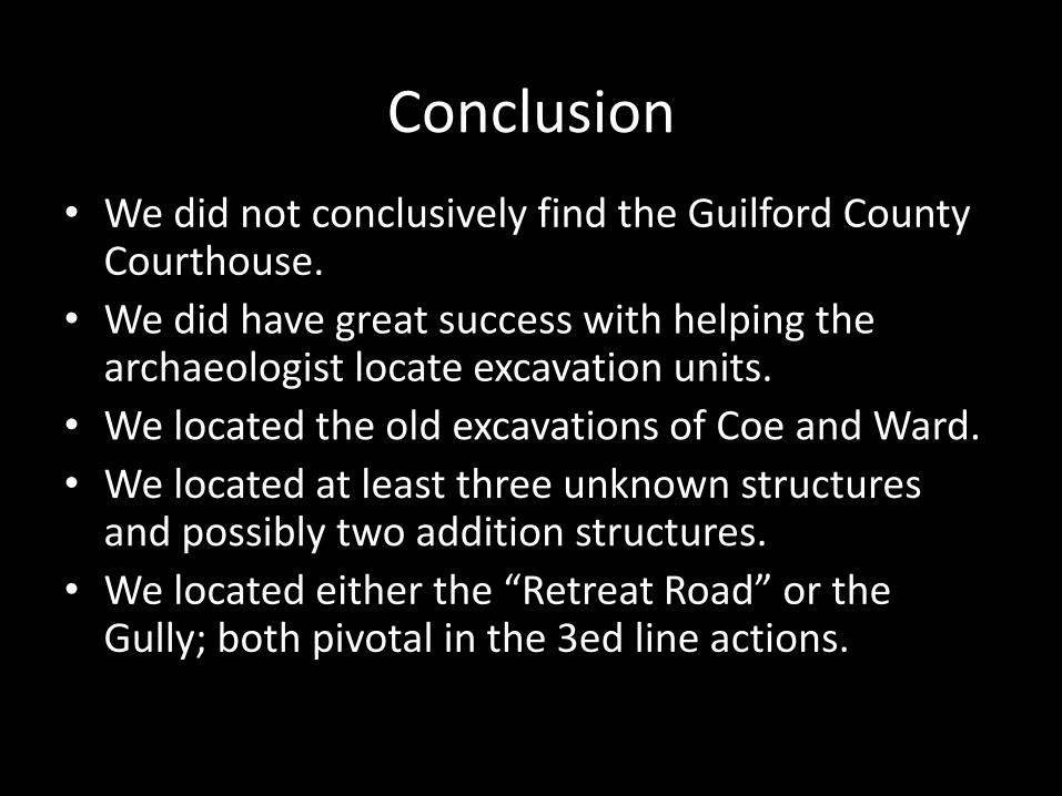
• We did not conclusively find the Guilford County Courthouse.
• We did have great success with helping the archaeologist locate excavation units.
• We located the old excavations of Coe and Ward.
• We located at least three unknown structures and possibly two addition structures.
• We located either the “Retreat Road” or the Gully; both pivotal in the 3ed line actions.
Where to Next? Raster is faster but vector is corrector – or is it?
Continuous versus Discrete survey
Statistical analysis (PCA)
Image processing
Kvamme 2006 (Integrating Multidimensional Geophysical Data)
Combining the data, statistical, image processing and GIS analysis
• Graphic overlay, photo-interpretation
• Binary maps
• Boolean logic (intersection – union)
• Principal Components – Factor Analysis
• Classification
Acknowledgements
• This project was funded by:
• The National Park Service - Guilford Courthouse National Military Park
• The Guilford Battleground Company
• The Tannenbaum-Sternburger Foundation.
• Special thanks to my field assistant Jacob Turner, Dr. Liz Nelson for cartographic support, my graduate students and undergraduate students that helped on the project
Thank you – Questions?
• Really we have time for questions
• This is the last session
• On the last day and
• This is the last paper
• You’re next chance will not come until 2015
• Hey we can go to a bar and discuss it… • Besides if the UNCG lawyer will not sign a standard EULA for my software
(one which all the other UNC system lawyers have signed) I’ll be fired, and have to live under a bridge
• I’ll hang out on a street corner with a sign “will image process for food”
• Anyone want hire a softwareless remote sensor GIS type guy?
• Will work for software?
• Will image process for greyhound kibbles