Embed Size (px)
Citation preview
Recent Megalithic Finds from Nemmara Region, Palakkad District, Kerala
Sujana Stephen1 1. Archaeological Survey of India, Bangalore Circle, 5th Floor, F Wing, Kendriya Sadan,
17th Main Road, Koramangala, Bangalore – 560034, Karnataka, India (Email: [email protected])
Received: 19 August 2016; Accepted: 13 September 2016; Revised: 11 October 2016 Heritage: Journal of Multidisciplinary Studies in Archaeology 4 (2016): 312-324
Abstract: The recent archaeological investigations in the Nemmara region located in the southern most part of Palakkad district, Kerala has brought to light new megalithic burial sites thus pushing back the antiquity of the region to Iron Age –Early Historic period. Some observations on the finds are annotated in this article.
Keywords: Megaliths, Nemmara, Palakkad, Burials, Exploration, Iron Age, Early Historic
Introduction Megalithic burials are part of the cultural remains of Iron Age -Early Historic period and in Kerala, in the absence of discovery of habitation sites, they are the sole indicator that provides information on the socio-cultural and economic aspects of the contemporary society. Kerala has the distinction of having diverse burial types such as menhirs, dolmens, cists, stone circles, rock cut chambers, urn burials, hoodstones, kudakkals and topikkals. Palakkad district located almost at the centre of Kerala has various epithets such as the gateway to Kerala, the granary of Kerala and the land of palmyras and paddy fields. The presence of Palakkad Gap, a low natural mountain pass or gap of 32 to 40 km width in the 960 km long Western Ghats is the most influential factor for the unique geographical and cultural characteristics of the district.
The Palakkad Gap is the chief corridor connecting Kerala to Tamil Nadu and other parts of India, and thus played a crucial role in cultural, political, linguistic and commercial integration of South India. It is responsible for high summer temperature than in other parts of the state and also for the heavy rainfall during both south west and north east monsoon seasons. More than 164 megalithic sites are reported so far from this distinct ecological region, of which 63 are single burial sites and 101 are multiple burial sites (Darsana, 2010: 102). The burial types include urns, cists, dolmens, menhirs, rock cut caves, kudakkals and topikkals (Darsana, 2010: 103).
Stephen 2016: 312-324
313
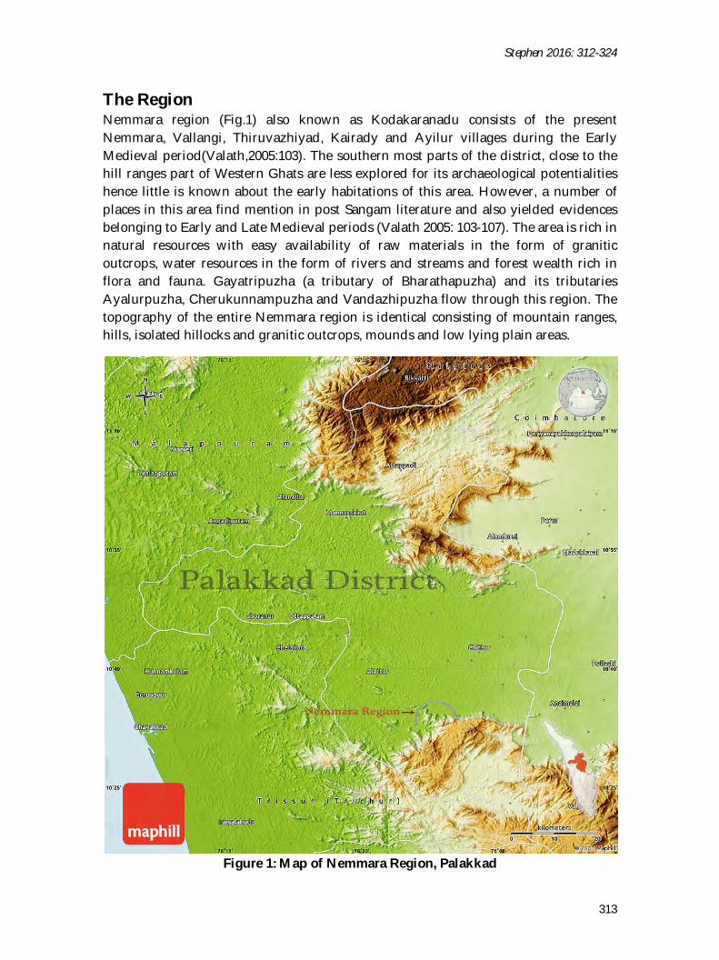
The Region Nemmara region (Fig.1) also known as Kodakaranadu consists of the present Nemmara, Vallangi, Thiruvazhiyad, Kairady and Ayilur villages during the Early Medieval period(Valath,2005:103). The southern most parts of the district, close to the hill ranges part of Western Ghats are less explored for its archaeological potentialities hence little is known about the early habitations of this area. However, a number of places in this area find mention in post Sangam literature and also yielded evidences belonging to Early and Late Medieval periods (Valath 2005: 103-107). The area is rich in natural resources with easy availability of raw materials in the form of granitic outcrops, water resources in the form of rivers and streams and forest wealth rich in flora and fauna. Gayatripuzha (a tributary of Bharathapuzha) and its tributaries Ayalurpuzha, Cherukunnampuzha and Vandazhipuzha flow through this region. The topography of the entire Nemmara region is identical consisting of mountain ranges, hills, isolated hillocks and granitic outcrops, mounds and low lying plain areas.
Figure 1: Map of Nemmara Region, Palakkad
ISSN 2347 – 5463 Heritage: Journal of Multidisciplinary Studies in Archaeology 4: 2016
314
Research History The first reference to sites in this area was made in 1882 by Robert Sewell in Lists of the Antiquarian Remains in The Presidency of Madras (Sewell 1882: 253). The village to village survey conducted by ASI and the reports published in Indian Archaeology- A Review also brought to light many new sites (IAR 1970-71: 17, IAR 1978-79:10, 27, IAR 2002-03: 141).Vallath’s“Study of the Place Names in Palakkad District”(2005) also provides a list of the megalithic sites of the region. The available data on the megaliths of this region was collected and analysed by Jenee Peter (2002) in her doctoral thesis “Dimensions of Megalithic Culture of Kerala in Relation to Peninsular India: An Interdisciplinary Approach”. Another important study that focused on this region was Shinu Abraham’s doctoral thesis “Social Complexity in Early Tamilakam: Sites and Ceramics from the Palaghat Gap, Kerala” (2002). This study analysed the inter-site and intra-site variability and ceramic assemblages of the region and brought out a new anthropological model.
Pallassena, Pallavur, Kudallur, Pothundy, Muthalamada, Vandithavalam, Chittalancheri, Kollengode, Konnampara, Elavancheri, Panagattiri, Pallavur and Paliyamangalam are the important Iron Age-Early Historic sites reported from this region and its neighbourhood. All these sites have a continuous occupation up to the modern times. Pallassena, Kollengode, Kanimangalam, Cheramangalam and Nemmara-Vallangi are the important historical sites of this region which find mention in ancient literature.
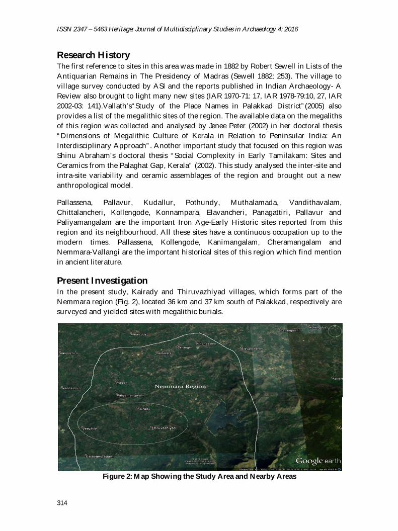
Present Investigation In the present study, Kairady and Thiruvazhiyad villages, which forms part of the Nemmara region (Fig. 2), located 36 km and 37 km south of Palakkad, respectively are surveyed and yielded sites with megalithic burials.
Figure 2: Map Showing the Study Area and Nearby Areas
Stephen 2016: 312-324
315
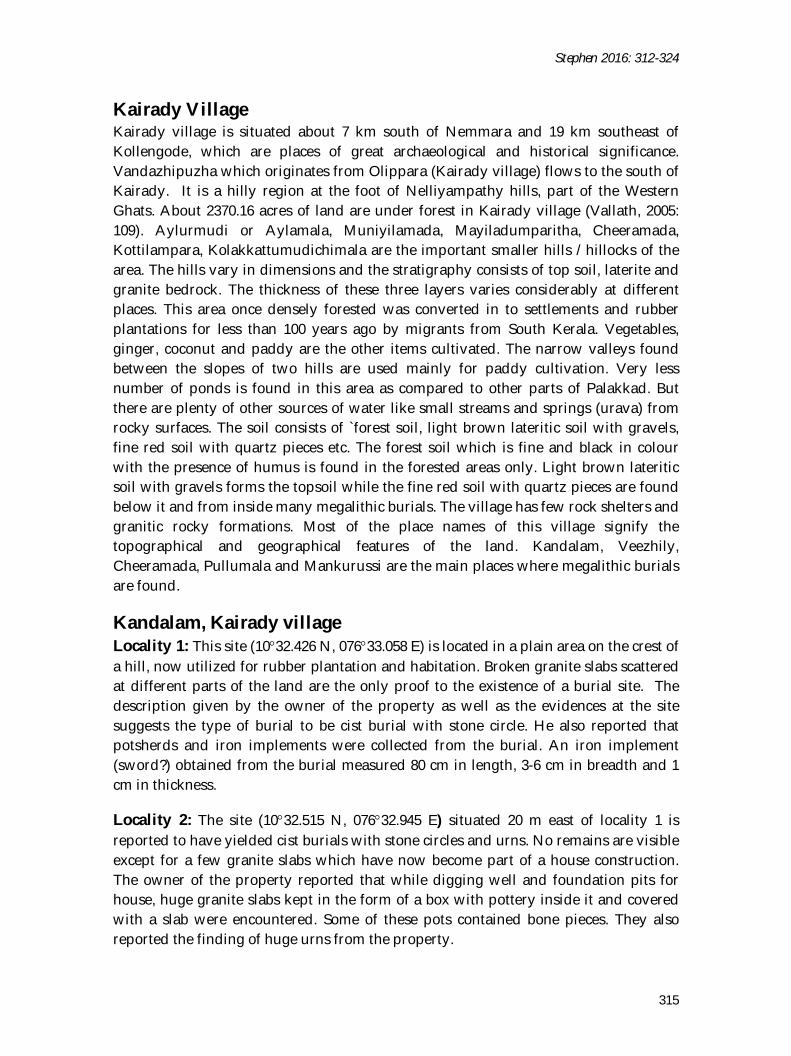
Kairady Village Kairady village is situated about 7 km south of Nemmara and 19 km southeast of Kollengode, which are places of great archaeological and historical significance. Vandazhipuzha which originates from Olippara (Kairady village) flows to the south of Kairady. It is a hilly region at the foot of Nelliyampathy hills, part of the Western Ghats. About 2370.16 acres of land are under forest in Kairady village (Vallath, 2005: 109). Aylurmudi or Aylamala, Muniyilamada, Mayiladumparitha, Cheeramada, Kottilampara, Kolakkattumudichimala are the important smaller hills / hillocks of the area. The hills vary in dimensions and the stratigraphy consists of top soil, laterite and granite bedrock. The thickness of these three layers varies considerably at different places. This area once densely forested was converted in to settlements and rubber plantations for less than 100 years ago by migrants from South Kerala. Vegetables, ginger, coconut and paddy are the other items cultivated. The narrow valleys found between the slopes of two hills are used mainly for paddy cultivation. Very less number of ponds is found in this area as compared to other parts of Palakkad. But there are plenty of other sources of water like small streams and springs (urava) from rocky surfaces. The soil consists of `forest soil, light brown lateritic soil with gravels, fine red soil with quartz pieces etc. The forest soil which is fine and black in colour with the presence of humus is found in the forested areas only. Light brown lateritic soil with gravels forms the topsoil while the fine red soil with quartz pieces are found below it and from inside many megalithic burials. The village has few rock shelters and granitic rocky formations. Most of the place names of this village signify the topographical and geographical features of the land. Kandalam, Veezhily, Cheeramada, Pullumala and Mankurussi are the main places where megalithic burials are found.
Kandalam, Kairady village Locality 1: This site (1032.426 N, 07633.058 E) is located in a plain area on the crest of a hill, now utilized for rubber plantation and habitation. Broken granite slabs scattered at different parts of the land are the only proof to the existence of a burial site. The description given by the owner of the property as well as the evidences at the site suggests the type of burial to be cist burial with stone circle. He also reported that potsherds and iron implements were collected from the burial. An iron implement (sword?) obtained from the burial measured 80 cm in length, 3-6 cm in breadth and 1 cm in thickness.
Locality 2: The site (1032.515 N, 07632.945 E) situated 20 m east of locality 1 is reported to have yielded cist burials with stone circles and urns. No remains are visible except for a few granite slabs which have now become part of a house construction. The owner of the property reported that while digging well and foundation pits for house, huge granite slabs kept in the form of a box with pottery inside it and covered with a slab were encountered. Some of these pots contained bone pieces. They also reported the finding of huge urns from the property.
ISSN 2347 – 5463 Heritage: Journal of Multidisciplinary Studies in Archaeology 4: 2016
316
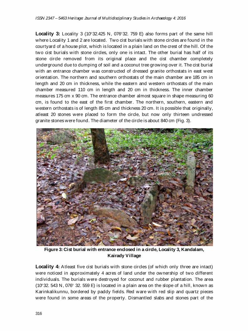
Locality 3: Locality 3 (1032.425 N, 07632. 759 E) also forms part of the same hill where Locality 1 and 2 are located. Two cist burials with stone circles are found in the courtyard of a house plot, which is located in a plain land on the crest of the hill. Of the two cist burials with stone circles, only one is intact. The other burial has half of its stone circle removed from its original place and the cist chamber completely underground due to dumping of soil and a coconut tree growing over it. The cist burial with an entrance chamber was constructed of dressed granite orthostats in east west orientation. The northern and southern orthostats of the main chamber are 185 cm in length and 20 cm in thickness, while the eastern and western orthostats of the main chamber measured 110 cm in length and 20 cm in thickness. The inner chamber measures 175 cm x 90 cm. The entrance chamber almost square in shape measuring 60 cm, is found to the east of the first chamber. The northern, southern, eastern and western orthostats is of length 85 cm and thickness 20 cm. It is possible that originally, atleast 20 stones were placed to form the circle, but now only thirteen undressed granite stones were found. The diameter of the circle is about 840 cm (Fig. 3).
Figure 3: Cist burial with entrance enclosed in a circle, Locality 3, Kandalam,
Kairady Village
Locality 4: Atleast five cist burials with stone circles (of which only three are intact) were noticed in approximately 4 acres of land under the ownership of two different individuals. The burials were destroyed for coconut and rubber plantation. The area (1032. 543 N, 076 32. 559 E) is located in a plain area on the slope of a hill, known as Karinkalikunnu, bordered by paddy fields. Red ware with red slip and quartz pieces were found in some areas of the property. Dismantled slabs and stones part of the
Stephen 2016: 312-324
317
burials are found scattered at the site. The evidences from the site indicate that there existed large number of megalith burials. Cist burial with and without stone circle are the main type of burial found in this area.
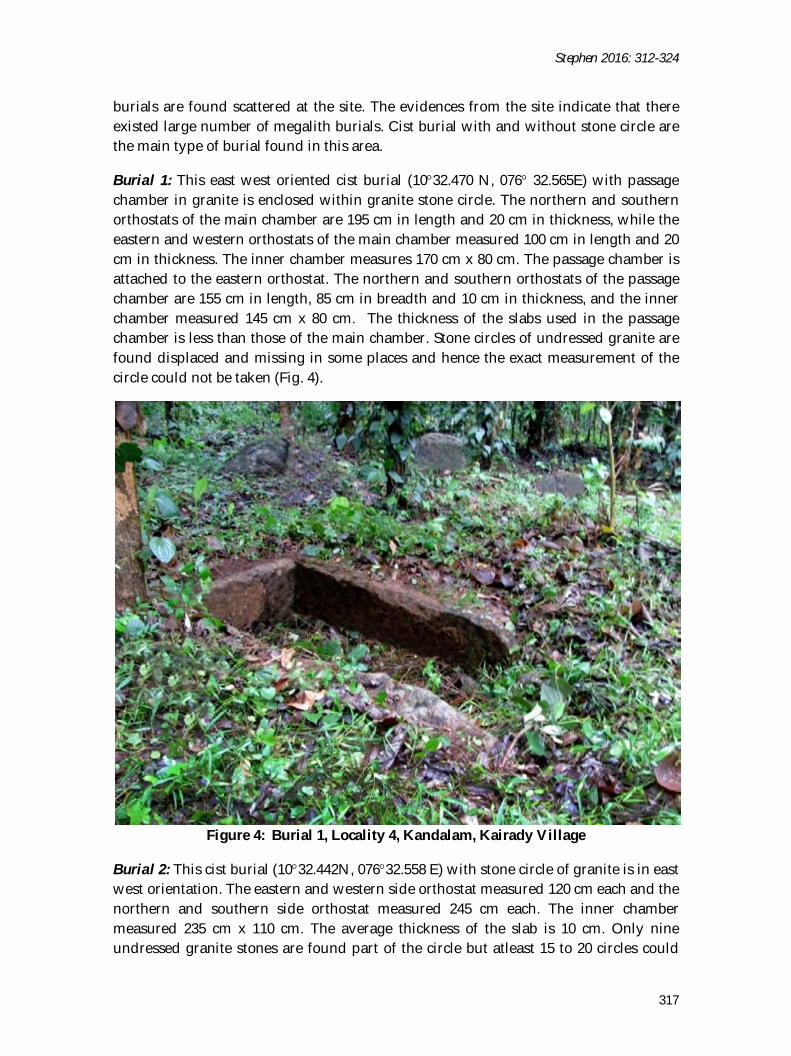
Burial 1: This east west oriented cist burial (1032.470 N, 076 32.565E) with passage chamber in granite is enclosed within granite stone circle. The northern and southern orthostats of the main chamber are 195 cm in length and 20 cm in thickness, while the eastern and western orthostats of the main chamber measured 100 cm in length and 20 cm in thickness. The inner chamber measures 170 cm x 80 cm. The passage chamber is attached to the eastern orthostat. The northern and southern orthostats of the passage chamber are 155 cm in length, 85 cm in breadth and 10 cm in thickness, and the inner chamber measured 145 cm x 80 cm. The thickness of the slabs used in the passage chamber is less than those of the main chamber. Stone circles of undressed granite are found displaced and missing in some places and hence the exact measurement of the circle could not be taken (Fig. 4).
Figure 4: Burial 1, Locality 4, Kandalam, Kairady Village
Burial 2: This cist burial (1032.442N, 07632.558 E) with stone circle of granite is in east west orientation. The eastern and western side orthostat measured 120 cm each and the northern and southern side orthostat measured 245 cm each. The inner chamber measured 235 cm x 110 cm. The average thickness of the slab is 10 cm. Only nine undressed granite stones are found part of the circle but atleast 15 to 20 circles could
ISSN 2347 – 5463 Heritage: Journal of Multidisciplinary Studies in Archaeology 4: 2016
318
have been originally present. The total diameter of the burial is 9.23 m and the stones used in the circle are 75-80 cm in length and height 70 cm. Since the rest of the area on the western side of the chamber was buried under ground, the presence of a passage chamber, if any, could not be traced.
Burial 3: The third cist burial (1032.463N, 07632.571 E) was found with only eastern and western orthostats visible above the ground and it measures 100 cm in length. The possible length of the northern and southern orthostats as discerned from the placement of eastern and western orthostats is 145 cm. Another displaced slab part of the same burial was found attached to a modern wall.
Veezhily, Kairady Village Locality 1: This locality (1032. 518 N, 07632. 056 E - 1032.474 N, 07632.947 E) consists of about 1 1/4 acres of land from where cists with stone circles were completely destroyed for rubber plantation. No evidence was found, except a few broken granite slabs lying scattered. The owner of the property reported that there existed atleast 6 burials and pots, bowls, iron implements including swords, black beads with white bands were obtained from various burials. A broken slab found measured 170-178 cm in length, 115 cm in breadth and 15 cm in thickness. The site is located on the slope of the hill, where localities 1, 2 and 3 of Kandalam are found.
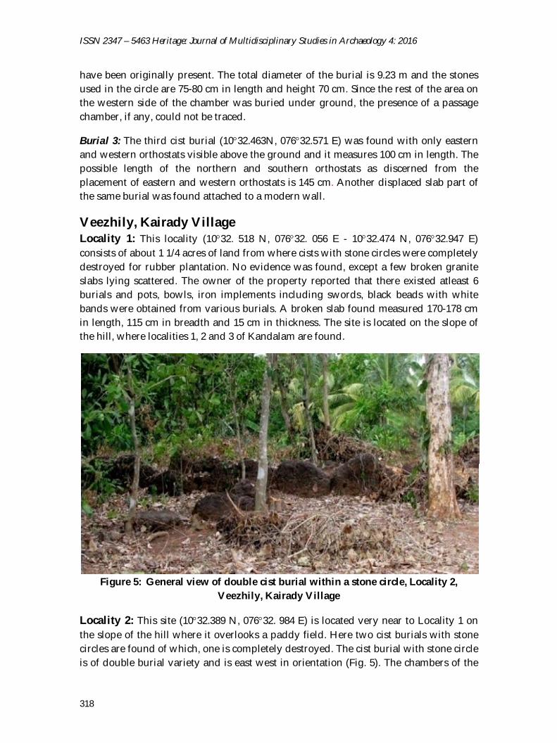
Figure 5: General view of double cist burial within a stone circle, Locality 2,
Veezhily, Kairady Village
Locality 2: This site (1032.389 N, 07632. 984 E) is located very near to Locality 1 on the slope of the hill where it overlooks a paddy field. Here two cist burials with stone circles are found of which, one is completely destroyed. The cist burial with stone circle is of double burial variety and is east west in orientation (Fig. 5). The chambers of the
Stephen 2016: 312-324
319
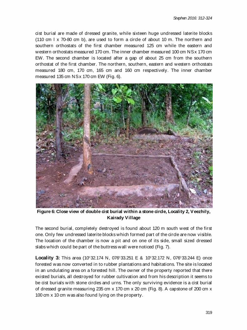
cist burial are made of dressed granite, while sixteen huge undressed laterite blocks (110 cm l x 70-80 cm b), are used to form a circle of about 10 m. The northern and southern orthostats of the first chamber measured 125 cm while the eastern and western orthostats measured 170 cm. The inner chamber measured 100 cm NS x 170 cm EW. The second chamber is located after a gap of about 25 cm from the southern orthostat of the first chamber. The northern, southern, eastern and western orthostats measured 180 cm, 170 cm, 165 cm and 160 cm respectively. The inner chamber measured 135 cm NS x 170 cm EW (Fig. 6).
Figure 6: Close view of double cist burial within a stone circle, Locality 2, Veezhily,
Kairady Village
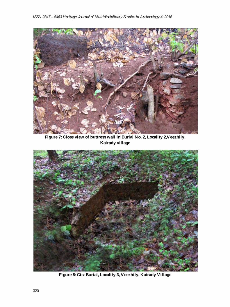
The second burial, completely destroyed is found about 120 m south west of the first one. Only few undressed laterite blocks which formed part of the circle are now visible. The location of the chamber is now a pit and on one of its side, small sized dressed slabs which could be part of the buttress wall were noticed (Fig. 7).
Locality 3: This area (1032.174 N, 07633.251 E & 1032.172 N, 07633.244 E) once forested was now converted in to rubber plantations and habitations. The site is located in an undulating area on a forested hill. The owner of the property reported that there existed burials, all destroyed for rubber cultivation and from his description it seems to be cist burials with stone circles and urns. The only surviving evidence is a cist burial of dressed granite measuring 235 cm x 170 cm x 20 cm (Fig. 8). A capstone of 200 cm x 100 cm x 10 cm was also found lying on the property.
ISSN 2347 – 5463 Heritage: Journal of Multidisciplinary Studies in Archaeology 4: 2016
320
Figure 7: Close view of buttress wall in Burial No. 2, Locality 2,Veezhily,
Kairady village
Figure 8: Cist Burial, Locality 3, Veezhily, Kairady Village
Stephen 2016: 312-324
321
Pullumala, Kairady Village Two cists with stone circles are found on the slope of a forested hill locally known as Pullumala, overlooking the Payyacode-Adiperanda road and Vandazhi river. The river is flowing approximately 40 m south of the site. The road has been made by cutting a part of the hill. Soil erosion had resulted in almost complete burial of the cist chambers. It seems that there exist more burials in the interior of the forest.
Burial 1: The cist burial with stone circles (1032.607 N, 07632.284 E) found here is 450 cm in diameter. The chamber is completely buried under the ground except for a slab of about 35 cm and hence more details cannot be discerned. Both the chamber and the circles are made of granite. An inner packing with undressed granite stones similar to that of the circle is also present in the burial.
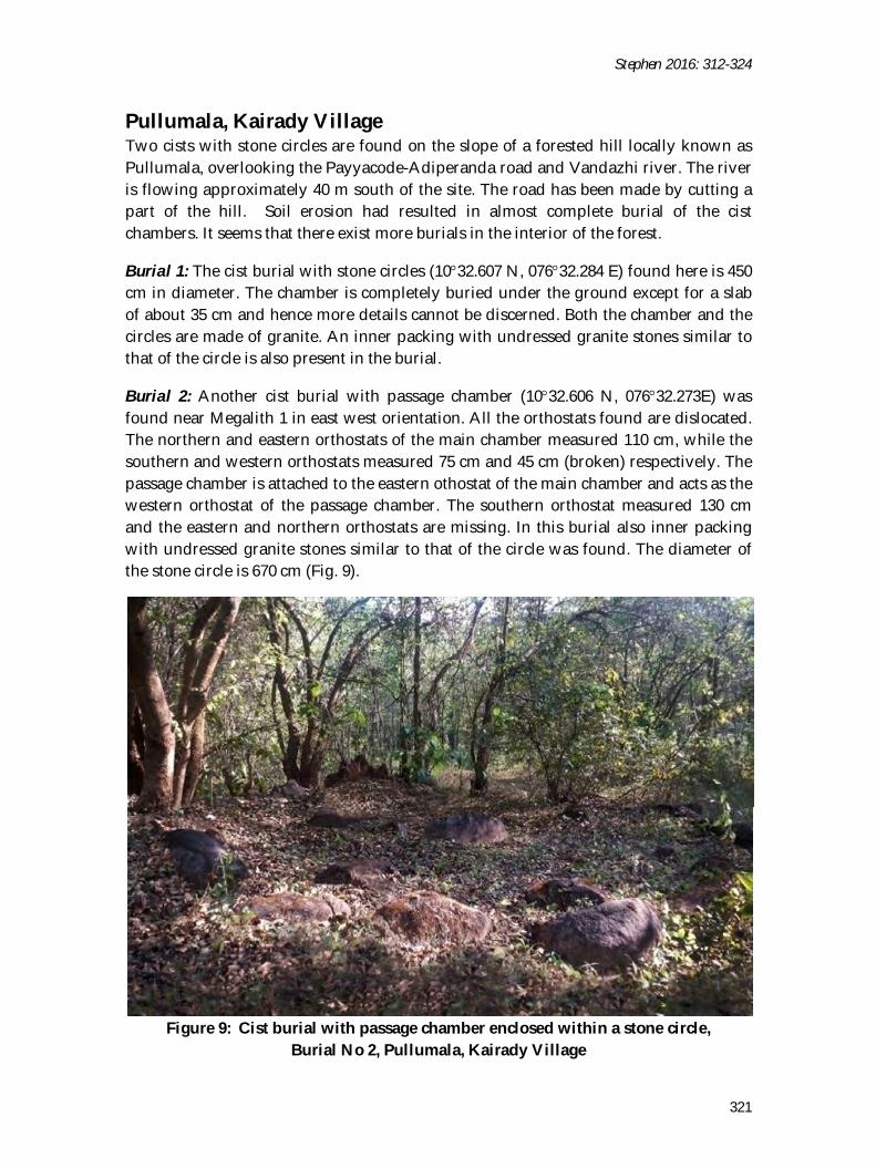
Burial 2: Another cist burial with passage chamber (1032.606 N, 07632.273E) was found near Megalith 1 in east west orientation. All the orthostats found are dislocated. The northern and eastern orthostats of the main chamber measured 110 cm, while the southern and western orthostats measured 75 cm and 45 cm (broken) respectively. The passage chamber is attached to the eastern othostat of the main chamber and acts as the western orthostat of the passage chamber. The southern orthostat measured 130 cm and the eastern and northern orthostats are missing. In this burial also inner packing with undressed granite stones similar to that of the circle was found. The diameter of the stone circle is 670 cm (Fig. 9).
Figure 9: Cist burial with passage chamber enclosed within a stone circle,
Burial No 2, Pullumala, Kairady Village
ISSN 2347 – 5463 Heritage: Journal of Multidisciplinary Studies in Archaeology 4: 2016
322
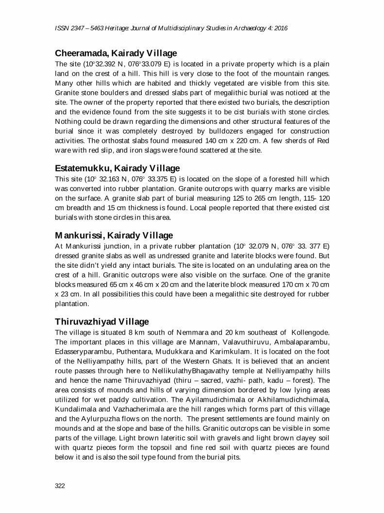
Cheeramada, Kairady Village The site (1032.392 N, 07633.079 E) is located in a private property which is a plain land on the crest of a hill. This hill is very close to the foot of the mountain ranges. Many other hills which are habited and thickly vegetated are visible from this site. Granite stone boulders and dressed slabs part of megalithic burial was noticed at the site. The owner of the property reported that there existed two burials, the description and the evidence found from the site suggests it to be cist burials with stone circles. Nothing could be drawn regarding the dimensions and other structural features of the burial since it was completely destroyed by bulldozers engaged for construction activities. The orthostat slabs found measured 140 cm x 220 cm. A few sherds of Red ware with red slip, and iron slags were found scattered at the site.
Estatemukku, Kairady Village This site (10 32.163 N, 076 33.375 E) is located on the slope of a forested hill which was converted into rubber plantation. Granite outcrops with quarry marks are visible on the surface. A granite slab part of burial measuring 125 to 265 cm length, 115- 120 cm breadth and 15 cm thickness is found. Local people reported that there existed cist burials with stone circles in this area.
Mankurissi, Kairady Village At Mankurissi junction, in a private rubber plantation (10 32.079 N, 076 33. 377 E) dressed granite slabs as well as undressed granite and laterite blocks were found. But the site didn’t yield any intact burials. The site is located on an undulating area on the crest of a hill. Granitic outcrops were also visible on the surface. One of the granite blocks measured 65 cm x 46 cm x 20 cm and the laterite block measured 170 cm x 70 cm x 23 cm. In all possibilities this could have been a megalithic site destroyed for rubber plantation.
Thiruvazhiyad Village The village is situated 8 km south of Nemmara and 20 km southeast of Kollengode. The important places in this village are Mannam, Valavuthiruvu, Ambalaparambu, Edasseryparambu, Puthentara, Mudukkara and Karimkulam. It is located on the foot of the Nelliyampathy hills, part of the Western Ghats. It is believed that an ancient route passes through here to NellikulathyBhagavathy temple at Nelliyampathy hills and hence the name Thiruvazhiyad (thiru – sacred, vazhi- path, kadu – forest). The area consists of mounds and hills of varying dimension bordered by low lying areas utilized for wet paddy cultivation. The Ayilamudichimala or Akhilamudichchimala, Kundalimala and Vazhacherimala are the hill ranges which forms part of this village and the Aylurpuzha flows on the north. The present settlements are found mainly on mounds and at the slope and base of the hills. Granitic outcrops can be visible in some parts of the village. Light brown lateritic soil with gravels and light brown clayey soil with quartz pieces form the topsoil and fine red soil with quartz pieces are found below it and is also the soil type found from the burial pits.
Stephen 2016: 312-324
323
Karimkulam, Thiruvazhiyad Village Karimkulam (1033.291 N, 07634.806 E) is a place located on a small hill with a stratigraphic sequence of topsoil, laterite and granite bed rock. The thickness of these deposits varies and in some places the laterite layer is not present. The burials are situated in a house plot at Karimkulam Junction on the side of Karimkulam-Adiperanda road. It is on the slope of the hill which is habited and under cultivation, mainly rubber plantations. Another important megalithic site of Paliyamangalam (1033’ 845” N, 076 33’ 979”) is situated 2 km to the north of this site. A modern canal flows on the northern side of the site. Granitic outcrops can be seen nearby and the site has a stratigraphic sequence consisting of topsoil deposit of about 50 cm to 100 cm above a granite bedrock. Here cist with stone circles are found and are completely destroyed. One broken slab part of the orthostat measuring 147 cm in length, 55-82 cm breadth and 13 cm thickness was also found. Undressed granite stones part of the circle, measuring about 80 cm, was also found lying at the site.
Uravanchira or Mudikura, Thiruvazhiyad Village The name Uravanchira is due to the existence of large number of uravas (streams coming out of rocks or from the surface of earth) at this place in olden days. Local people reported the existence of cist burials at many localities here. The burials are found on the slope of a mound (1033.593 N, 07635.036 E) overlooking wet paddy fields. Dressed granite slabs and undressed stones, of various sizes, part of the burials were found lying on the ground. Red ware pottery was also collected from the site. A cist burial was found completely destroyed and from the pit line it is inferred that the orthostats measures approximately 200 cm x 150 cm x 20 cm. The burial pit has fine red soil, while the topsoil is light brown lateritic soil.
Kalchady, SC Settlement, Thiruvazhiyad Village The site is located in an undulated area (1031.366 N, 07636.134 E) on the slope of a forested hill. Granite outcrops are visible at many parts of the site. The northern side of the site has a low lying marshy land. A single cist with stone circle was found on the pathway leading to the SC settlement. All the stone circles were dismantled during the construction of the pathway. Only part of the orthostats was visible above the ground. The eastern and western orthostats are 142 cm (broken) and 250 cm in length and 20 cm in thickness. The northern and southern orthostats are found missing, while parts of orthostat slabs are visible at many places on the surface. The available measurement of the inner chamber is 250 cm x 100 cm x 20 cm. The burial could be of the type, cist with passage chamber as discerned from the evidences.
Karimbara This locality is on a hill and most of the areas are now under rubber plantation. Many local people reported the existence of cist burials with stone circles in their property (1032.090 N, 07635. 545 E), which had been destroyed for construction and cultivation activities. The evidence of burials is reported from the plain areas on the crest of the
ISSN 2347 – 5463 Heritage: Journal of Multidisciplinary Studies in Archaeology 4: 2016
324
hill. Evidences of quarrying were found in many areas mostly at the vicinity of the site. Apart from this, two quarries were found at Paliyamangalam in Ayalur village (1033’ 658” N, 07634’ 057” E) and Chakrayinuram in Thiruvazhiyad village (1033’ 120” N, 07635’ 317” E).
Summary and Conclusion Most of the megalithic sites in Nemmara region are located on the slope of the hills. Cist burials with and without stone circles are the only type of burial found during explorations from this area. Eventhough no urn burials were found during explorations, local people had reported the finding of urn burials at many places in the region. The cist burials found were of different varieties such as cist with entrance chamber, double cist burials and rectangular cist burials with passage chamber. All varieties of cist burials except, the rectangular shaped cists are encountered in the neighbouring areas of Nemmara region such as Elavanchery, Panangattiri, Kudalur etc. The typology and architectural features of the burials in the explored region are akin to each other. No large clusters such as those reported from Elavanchery and Panangattiri were found in this region instead a dispersed pattern was observed. The maximum number of burials found in a locality, as observed from the available evidences and reports of the local people, does not exceed 15 numbers. On the whole, similarity is noticed in the location, distribution pattern, typology and architectural features of megalithic burials in the region. However, large areas are left unexplored due to inaccessibility and even in the explored regions the visibility is restricted due to thick vegetation. The archaeological evidences of this region are facing rapid destruction due to modern activities. The interior forest areas which are not probed are more likely to have megalithic burials and demands further intensive archaeological research.
References Abraham, Shinu. 2002. Social Complexity in Early Tamilakam: Sites and Ceramics from
the Palaghat Gap, Kerala, India. Unpublished Phd Thesis. Pennsylvania: University of Pennsylvania.
Darsana, S.B. 2010. Megalithic Burials of Iron Age-Early Historic Kerala: An Overview. Man and Environment Vol. XXXV (2): 98-117.
Peter, Jenee. 2002. Dimensions of Megalithic Culture of Kerala in Relation to Peninsular India: An Interdisciplinary Approach. Unpublished Ph.D. Thesis. Vadodara: The Maharaja Sayajirao University of Baroda.
Valath, V. V. K. 2005. Study of the Place Names in Palakkad District. Thrissur: Kerala Sahitya Academy.