Embed Size (px)
Citation preview

ReCap Photo
Photogrammetry
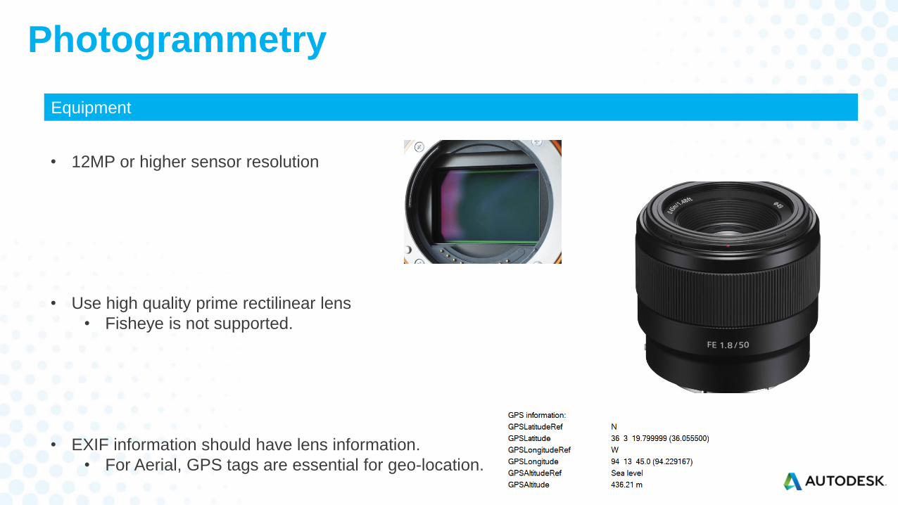
Equipment
• 12MP or higher sensor resolution
• Use high quality prime rectilinear lens
• Fisheye is not supported.
• EXIF information should have lens information.
• For Aerial, GPS tags are essential for geo-location.
Photogrammetry
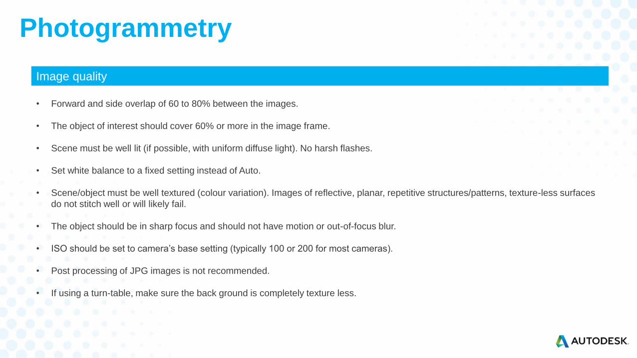
Image quality
• Forward and side overlap of 60 to 80% between the images.
• The object of interest should cover 60% or more in the image frame.
• Scene must be well lit (if possible, with uniform diffuse light). No harsh flashes.
• Set white balance to a fixed setting instead of Auto.
• Scene/object must be well textured (colour variation). Images of reflective, planar, repetitive structures/patterns, texture-less surfaces
do not stitch well or will likely fail.
• The object should be in sharp focus and should not have motion or out-of-focus blur.
• ISO should be set to camera’s base setting (typically 100 or 200 for most cameras).
• Post processing of JPG images is not recommended.
• If using a turn-table, make sure the back ground is completely texture less.
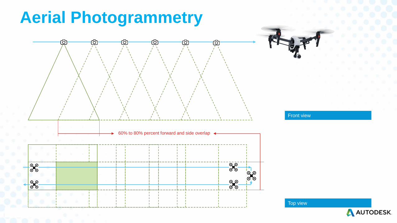
Aerial Photogrammetry
60% to 80% percent forward and side overlap
Top view
Front view
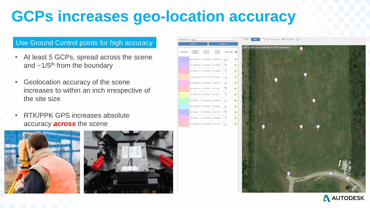
GCPs increases geo-location accuracy
Use Ground Control points for high accuracy
• At least 5 GCPs, spread across the scene
and ~1/5th from the boundary
• Geolocation accuracy of the scene
increases to within an inch irrespective of
the site size
• RTK/PPK GPS increases absolute
accuracy across the scene
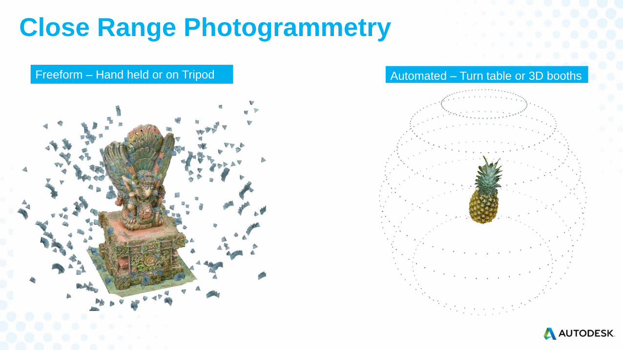
Close Range Photogrammetry
Freeform – Hand held or on Tripod Automated – Turn table or 3D booths
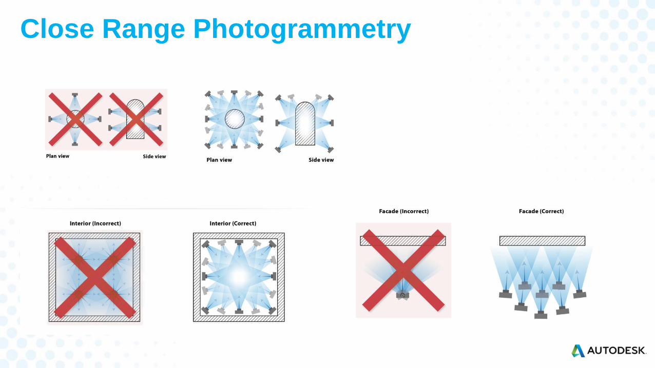
Close Range Photogrammetry
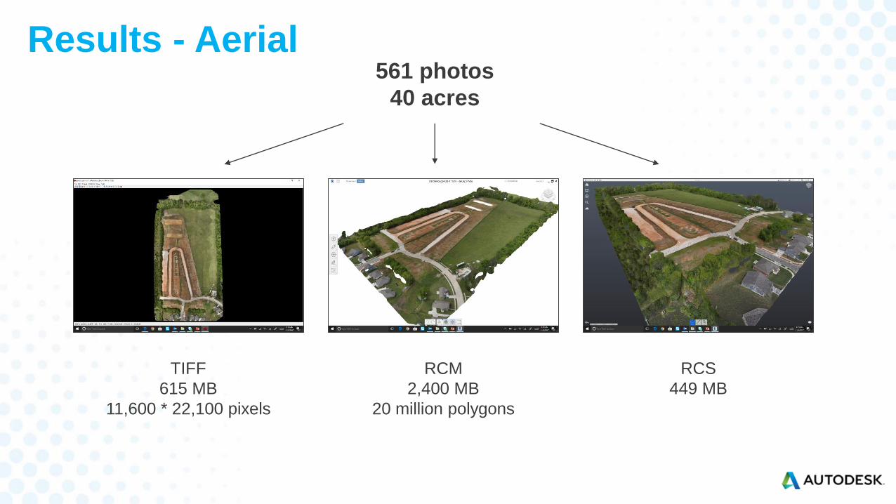
Results - Aerial
RCM
2,400 MB
20 million polygons
RCS
449 MB
TIFF
615 MB
11,600 * 22,100 pixels
561 photos
40 acres
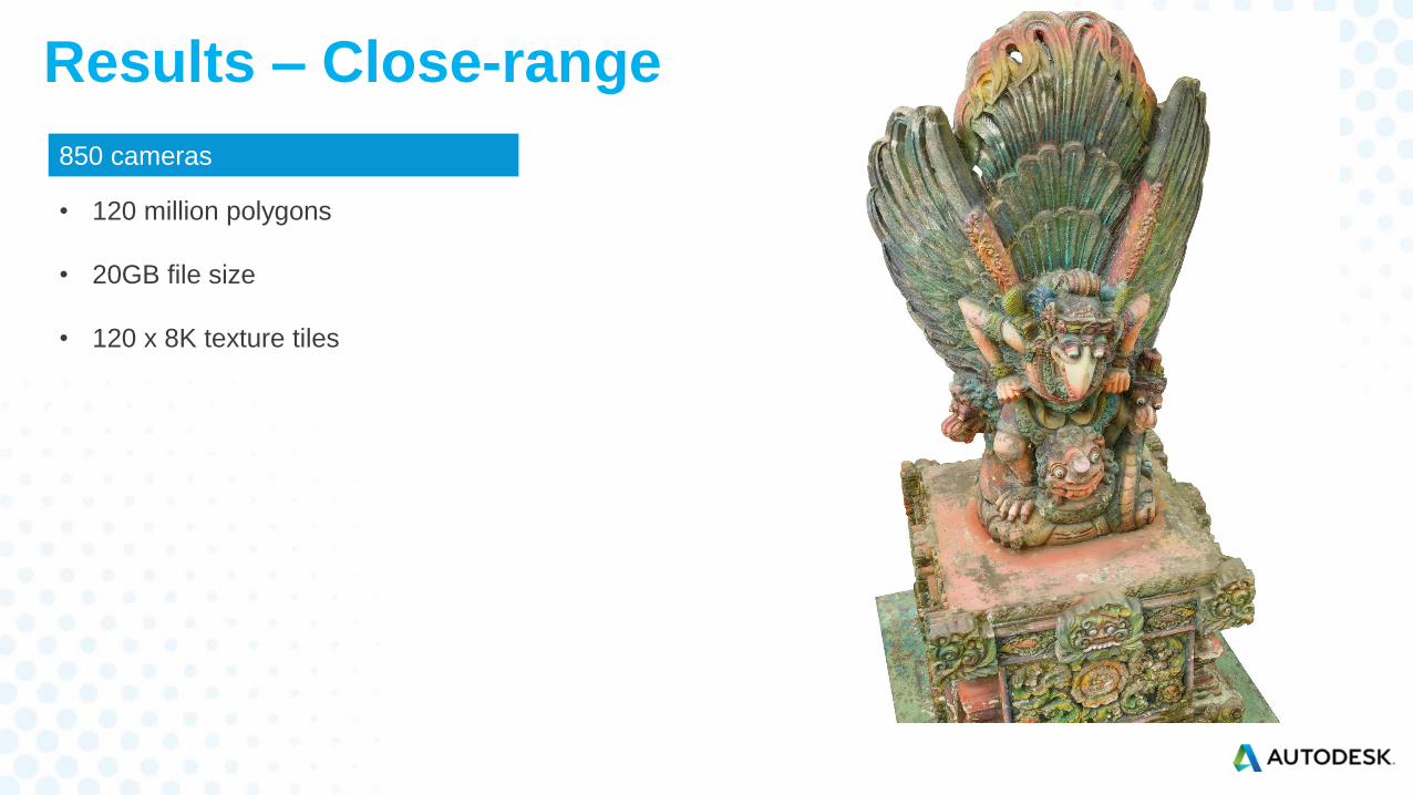
Results – Close-range
• 120 million polygons
• 20GB file size
• 120 x 8K texture tiles
850 cameras

Autodesk and the Autodesk logo are registered trademarks or trademarks of Autodesk, Inc., and/or its subsidiaries and/or affiliates in the USA and/or other countries. All other brand names, product names, or trademarks belong to their respective holders.
Autodesk reserves the right to alter product and services offerings, and specifications and pricing at any time without notice, and is not responsible for typographical or graphical errors that may appear in this document.
© 2017 Autodesk. All rights reserved.