Embed Size (px)
Citation preview
June 22nd, 2010 2010 NASA Earth Science
Technology Forum
Real-Time Robotic Surveying for Unexplored Arctic Terrain
Lonnie T. Parker Dr. Ayanna Howard
Human-Automation Systems Laboratory School of Electrical & Computer Engineering
Georgia Institute of Technology
June 22nd, 2010 2010 NASA ESTF
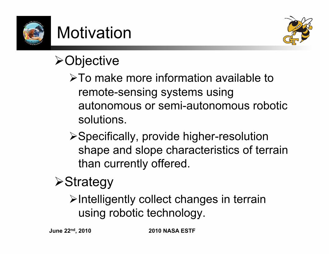
Motivation Objective
To make more information available to remote-sensing systems using autonomous or semi-autonomous robotic solutions.
Specifically, provide higher-resolution shape and slope characteristics of terrain than currently offered.
Strategy Intelligently collect changes in terrain
using robotic technology.
June 22nd, 2010 2010 NASA ESTF
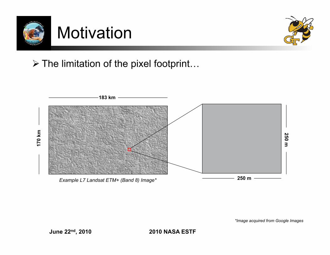
Motivation
*Image acquired from Google Images
The limitation of the pixel footprint…
Example L7 Landsat ETM+ (Band 8) Image* 250 m
250 m
183 km
170
km
June 22nd, 2010 2010 NASA ESTF
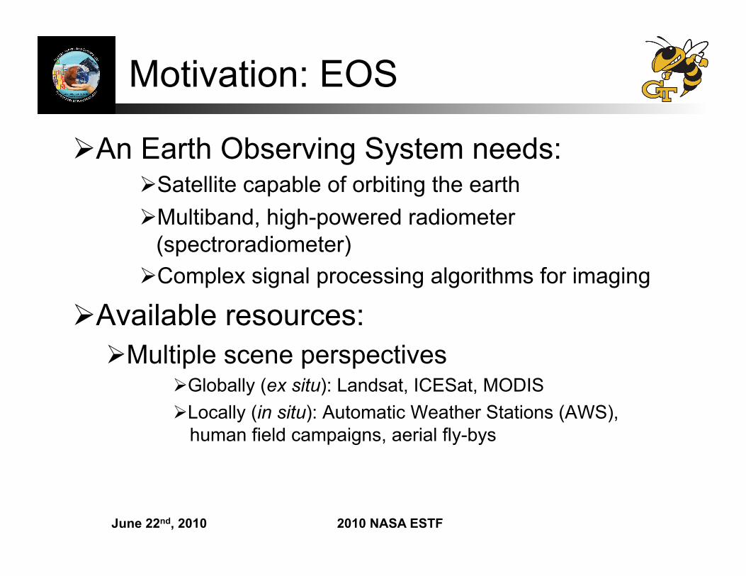
Motivation: EOS
An Earth Observing System needs: Satellite capable of orbiting the earth Multiband, high-powered radiometer
(spectroradiometer) Complex signal processing algorithms for imaging
Available resources: Multiple scene perspectives
Globally (ex situ): Landsat, ICESat, MODIS Locally (in situ): Automatic Weather Stations (AWS),
human field campaigns, aerial fly-bys
June 22nd, 2010 2010 NASA ESTF
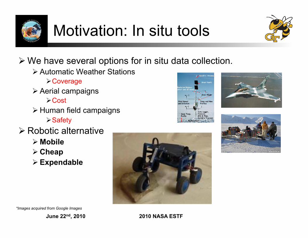
Motivation: In situ tools
We have several options for in situ data collection. Automatic Weather Stations
Coverage Aerial campaigns
Cost Human field campaigns
Safety Robotic alternative
Mobile Cheap Expendable
*Images acquired from Google Images
June 22nd, 2010 2010 NASA ESTF
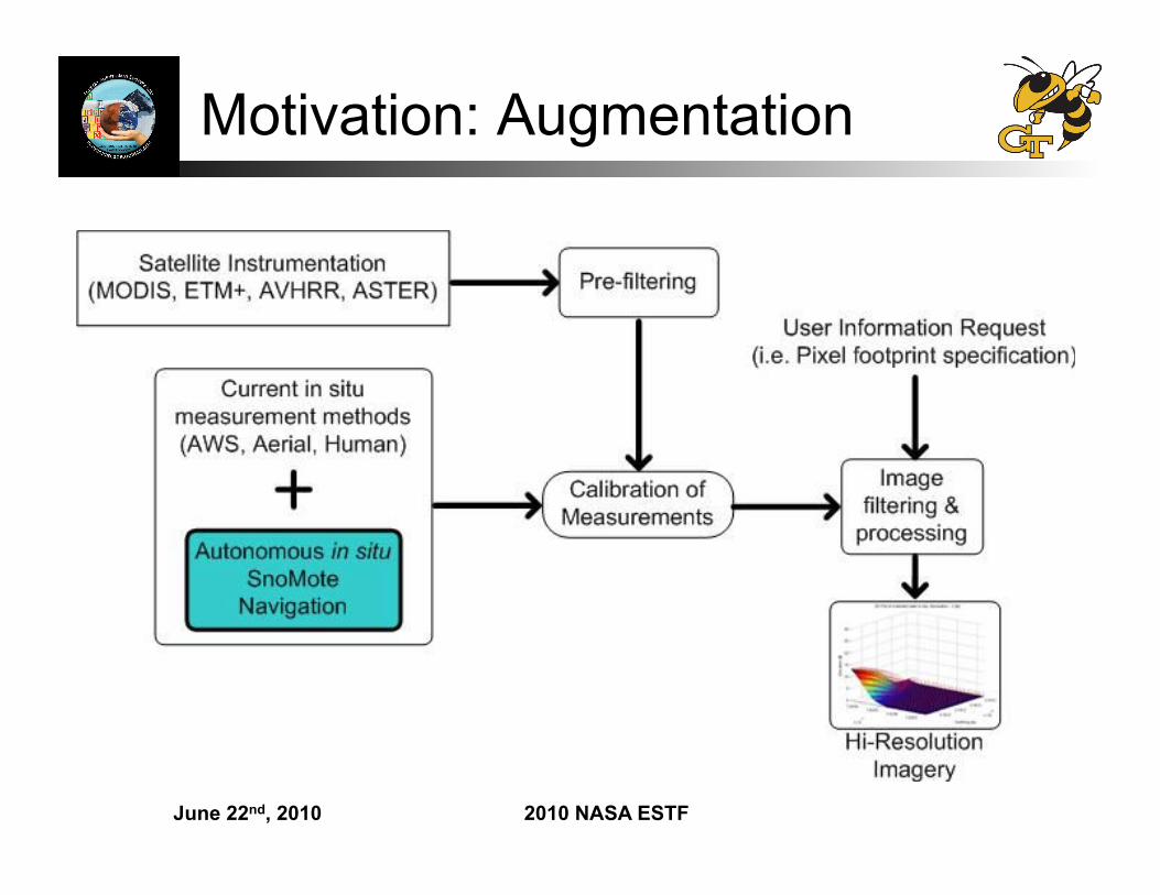
Motivation: Augmentation
June 22nd, 2010 2010 NASA ESTF
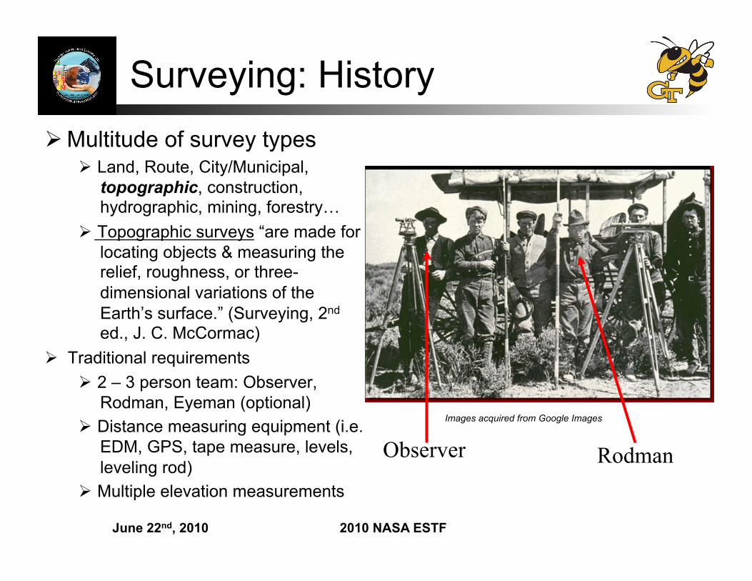
Surveying: History Multitude of survey types
Land, Route, City/Municipal, topographic, construction, hydrographic, mining, forestry…
Topographic surveys “are made for locating objects & measuring the relief, roughness, or three-dimensional variations of the Earth’s surface.” (Surveying, 2nd ed., J. C. McCormac)
Traditional requirements 2 – 3 person team: Observer,
Rodman, Eyeman (optional) Distance measuring equipment (i.e.
EDM, GPS, tape measure, levels, leveling rod)
Multiple elevation measurements
Images acquired from Google Images
Observer Rodman
June 22nd, 2010 2010 NASA ESTF
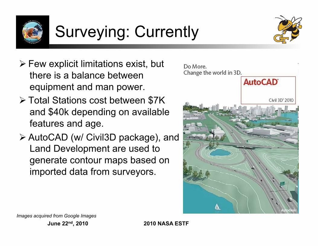
Surveying: Currently
Few explicit limitations exist, but there is a balance between equipment and man power.
Total Stations cost between $7K and $40k depending on available features and age.
AutoCAD (w/ Civil3D package), and Land Development are used to generate contour maps based on imported data from surveyors.
Images acquired from Google Images
June 22nd, 2010 2010 NASA ESTF
Surveying
Defining in’s and out’s of surveying Contacted surveyor companies to interview about modern
surveying methods Boundary Zone Inc.
Key issues: Measurement location selection and curvature Control Point Vs Checkerboard Method Curvature is defined via estimating contours
Less control points Less information available More information is better…even if the customer (i.e.
scientist) doesn’t realize it…
June 22nd, 2010 2010 NASA ESTF
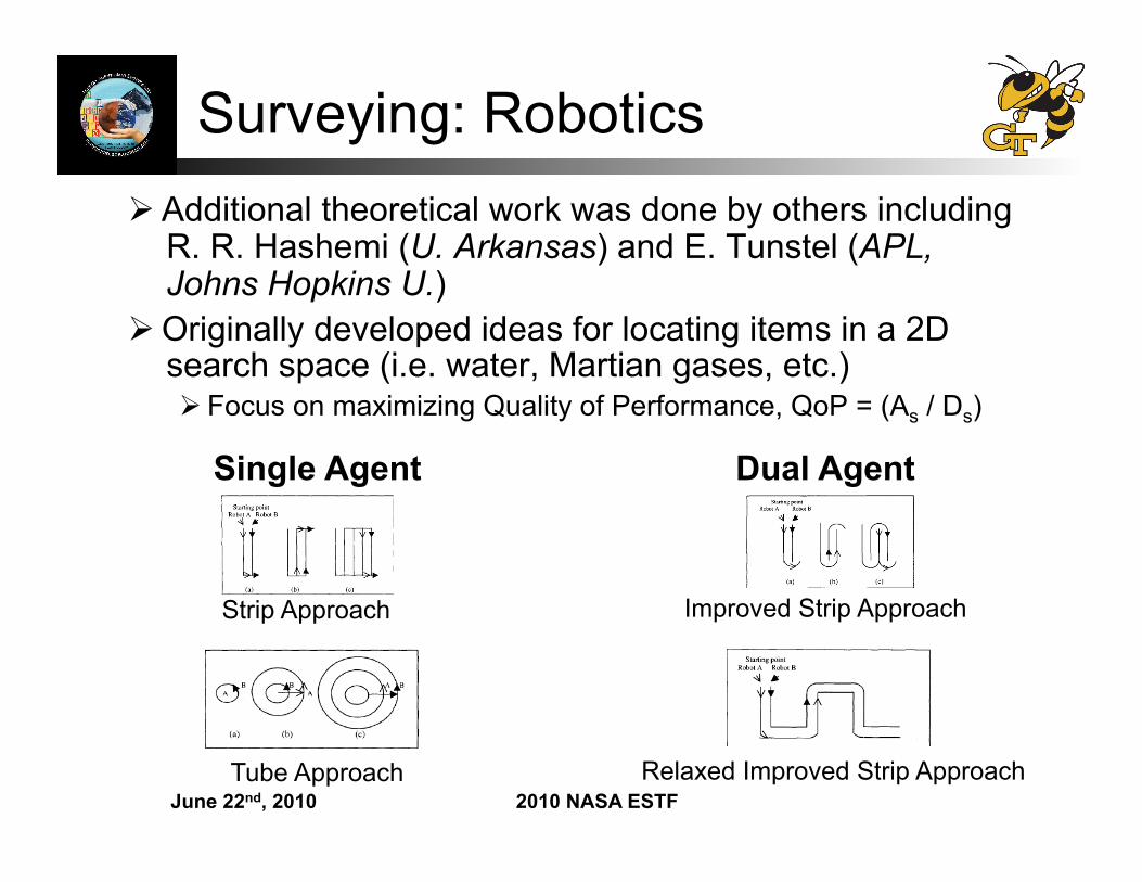
Surveying: Robotics Additional theoretical work was done by others including
R. R. Hashemi (U. Arkansas) and E. Tunstel (APL, Johns Hopkins U.)
Originally developed ideas for locating items in a 2D search space (i.e. water, Martian gases, etc.) Focus on maximizing Quality of Performance, QoP = (As / Ds)
Strip Approach
Tube Approach
Single Agent Dual Agent
Improved Strip Approach
Relaxed Improved Strip Approach
June 22nd, 2010 2010 NASA ESTF
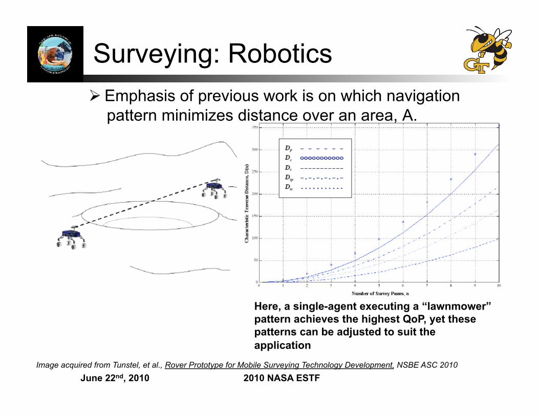
Surveying: Robotics Emphasis of previous work is on which navigation
pattern minimizes distance over an area, A.
Here, a single-agent executing a “lawnmower” pattern achieves the highest QoP, yet these patterns can be adjusted to suit the application
Image acquired from Tunstel, et al., Rover Prototype for Mobile Surveying Technology Development, NSBE ASC 2010
June 22nd, 2010 2010 NASA ESTF
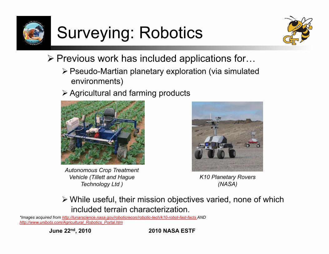
Surveying: Robotics Previous work has included applications for…
Pseudo-Martian planetary exploration (via simulated environments)
Agricultural and farming products
While useful, their mission objectives varied, none of which included terrain characterization.
*Images acquired from http://lunarscience.nasa.gov/roboticrecon/robotic-tech/k10-robot-fast-facts AND http://www.unibots.com/Agricultural_Robotics_Portal.htm
K10 Planetary Rovers (NASA)
Autonomous Crop Treatment Vehicle (Tillett and Hague
Technology Ltd )
June 22nd, 2010 2010 NASA ESTF
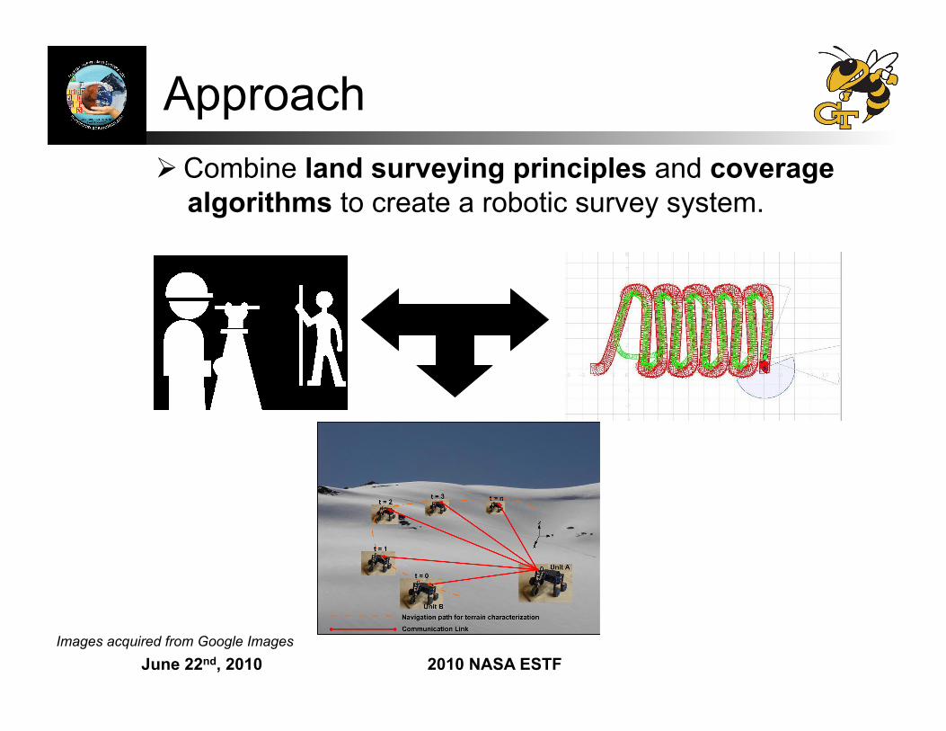
Approach Combine land surveying principles and coverage
algorithms to create a robotic survey system.
Images acquired from Google Images
June 22nd, 2010 2010 NASA ESTF
Approach Claim: If surveyors base control point selection on changes in
terrain elevation, robots should do the same, but do so more intelligently.
Presume we know… A measurement of the maximum height and minimum depth of a
terrain. We only survey areas exhibiting a range of angular orientations.
θmin < PitchTerrain < θmax φmin < RollTerrain < φmax
GPS is available so as to assign sensed information with a sufficiently known location.
Problems that this research can address: Obtaining a more accurate measurement of curvature. Developing a specific approach to increase information gain in lieu
of manually increasing the number of measurements.
June 22nd, 2010 2010 NASA ESTF
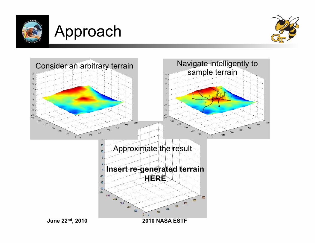
Approach
Insert re-generated terrain HERE
Approximate the result
Consider an arbitrary terrain Navigate intelligently to sample terrain
June 22nd, 2010 2010 NASA ESTF
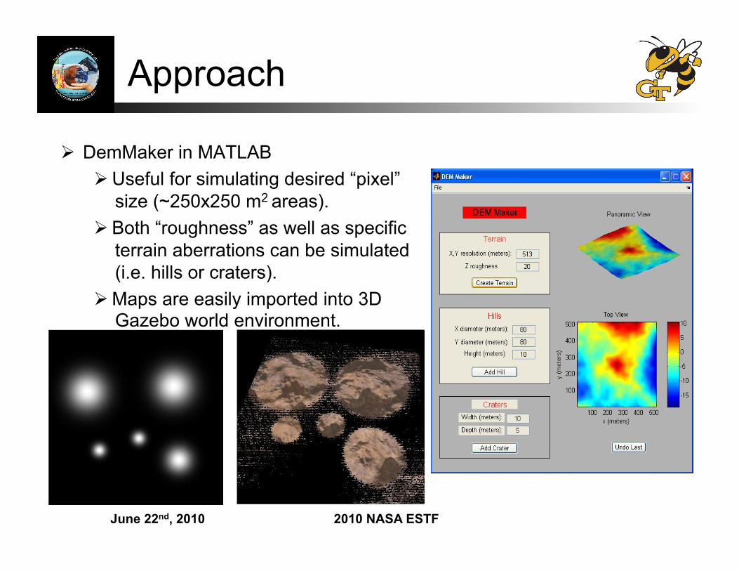
Approach
DemMaker in MATLAB Useful for simulating desired “pixel”
size (~250x250 m2 areas).
Both “roughness” as well as specific terrain aberrations can be simulated (i.e. hills or craters).
Maps are easily imported into 3D Gazebo world environment.
June 22nd, 2010 2010 NASA ESTF
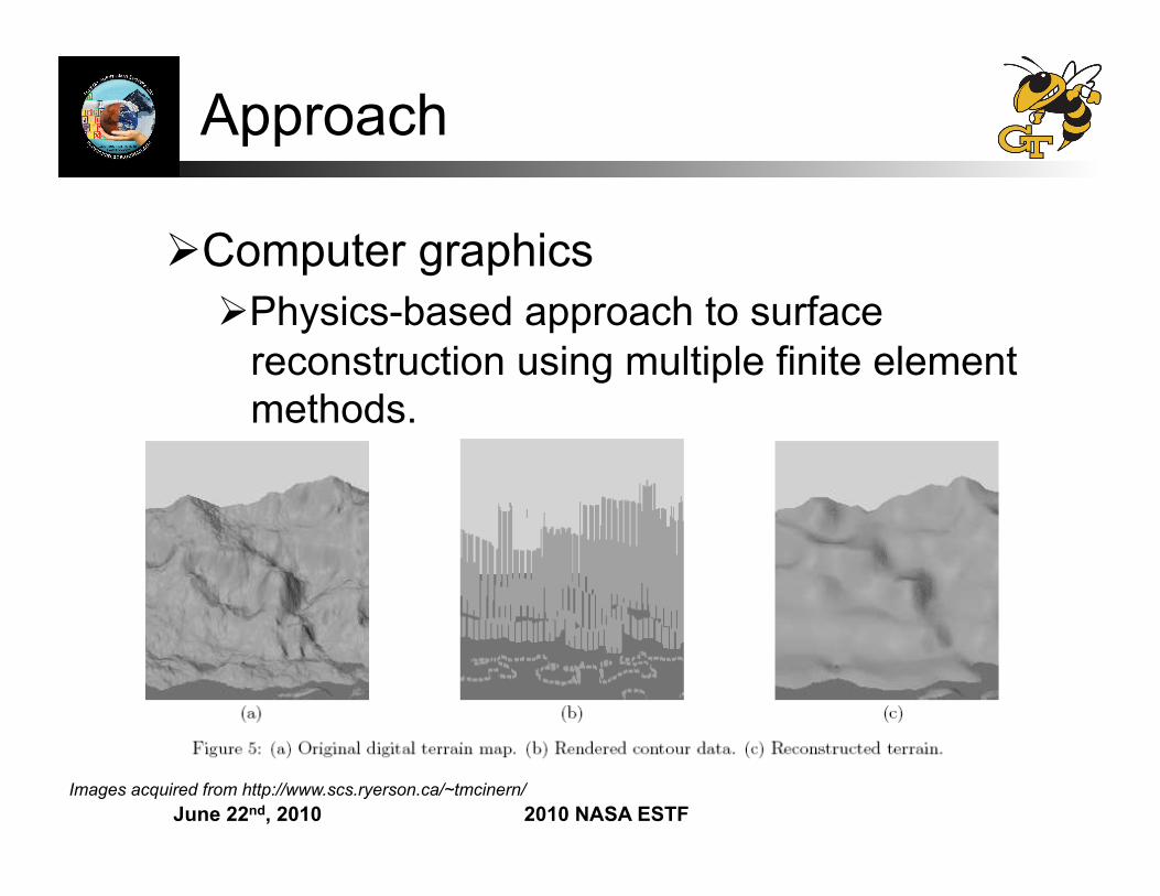
Approach
Computer graphics Physics-based approach to surface
reconstruction using multiple finite element methods.
Images acquired from http://www.scs.ryerson.ca/~tmcinern/
June 22nd, 2010 2010 NASA ESTF
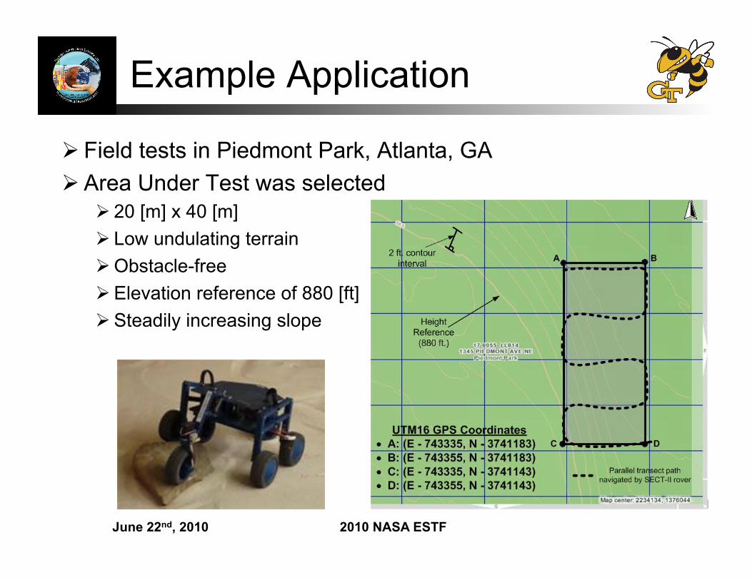
Example Application
Field tests in Piedmont Park, Atlanta, GA Area Under Test was selected
20 [m] x 40 [m] Low undulating terrain Obstacle-free Elevation reference of 880 [ft] Steadily increasing slope
June 22nd, 2010 2010 NASA ESTF
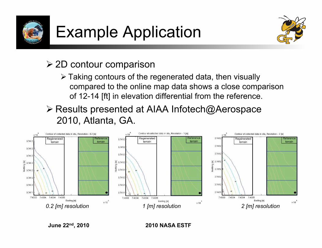
Example Application
2D contour comparison Taking contours of the regenerated data, then visually
compared to the online map data shows a close comparison of 12-14 [ft] in elevation differential from the reference.
Results presented at AIAA Infotech@Aerospace 2010, Atlanta, GA.
0.2 [m] resolution 1 [m] resolution 2 [m] resolution
June 22nd, 2010 2010 NASA ESTF
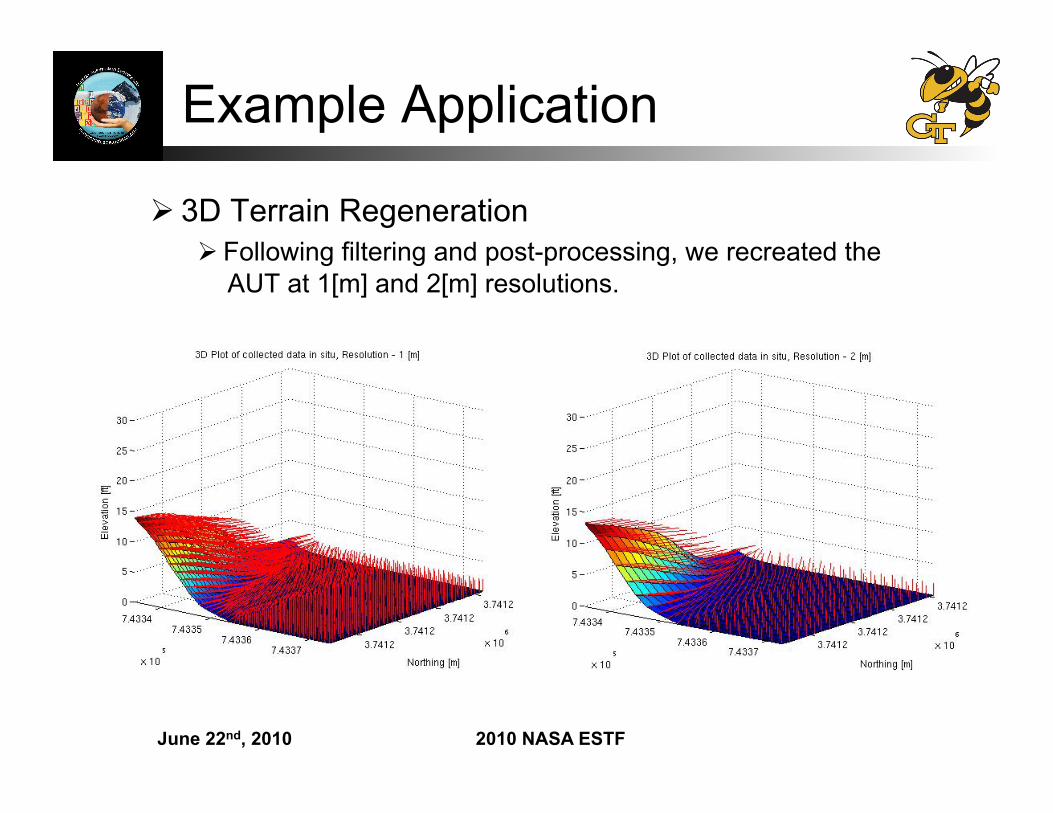
Example Application
3D Terrain Regeneration Following filtering and post-processing, we recreated the
AUT at 1[m] and 2[m] resolutions.
June 22nd, 2010 2010 NASA ESTF
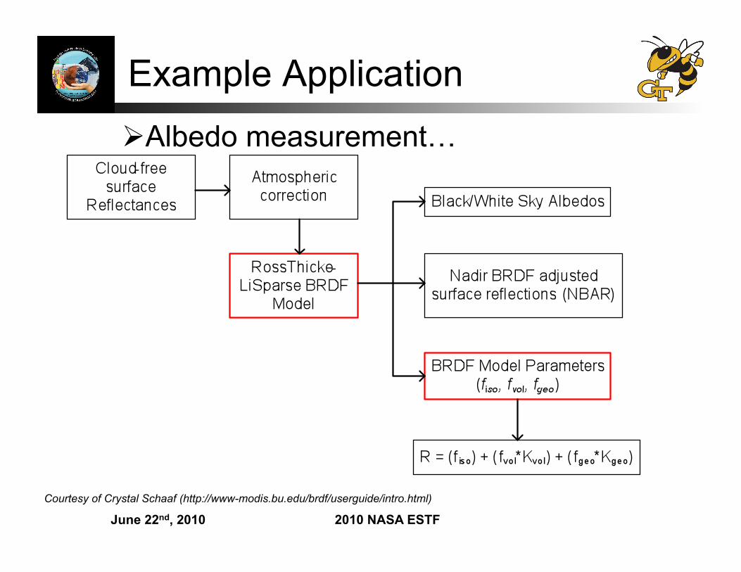
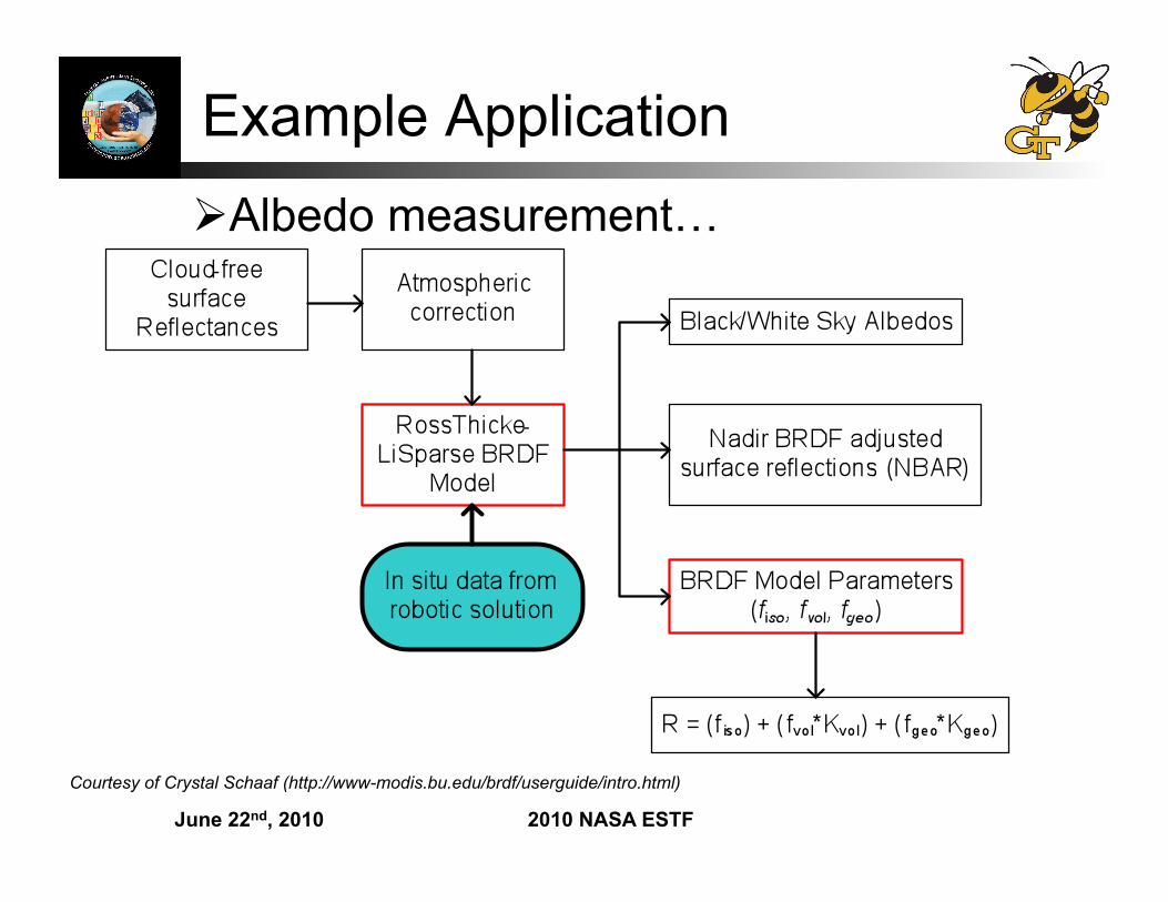
Example Application Albedo measurement…
Courtesy of Crystal Schaaf (http://www-modis.bu.edu/brdf/userguide/intro.html)
June 22nd, 2010 2010 NASA ESTF
Example Application Albedo measurement…
Courtesy of Crystal Schaaf (http://www-modis.bu.edu/brdf/userguide/intro.html)
June 22nd, 2010 2010 NASA ESTF
SnoMote Project Previous arctic robotics projects involve
developing a single large expensive robot. CoolRobot (Dartmouth) Nomad (CMU) MARVIN (U. of Kansas)
Multi-agent systems require the development of potentially dozens of agents. Inexpensive design Consumer-grade sensing Agent loss is tolerated
Agents must still have significant terrain traversing capabilities.
June 22nd, 2010 2010 NASA ESTF
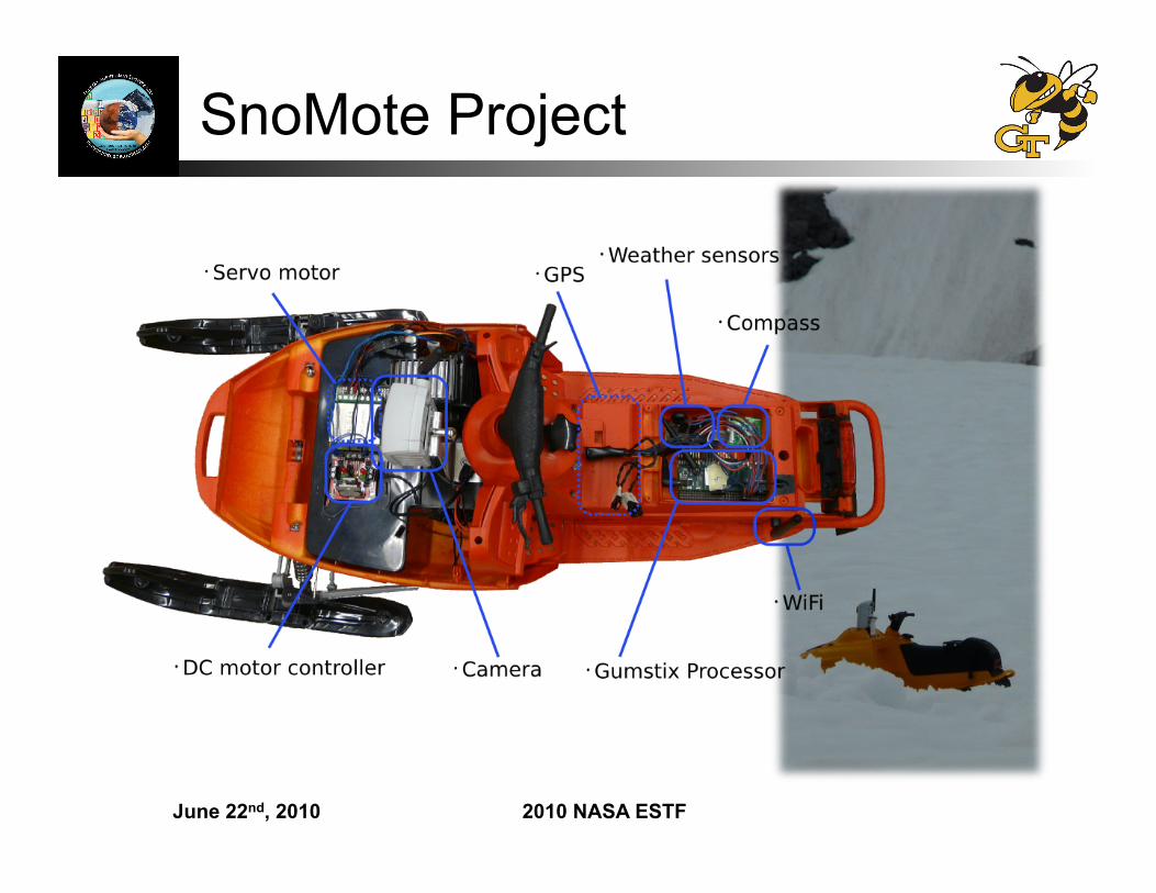
SnoMote Project
June 22nd, 2010 2010 NASA ESTF
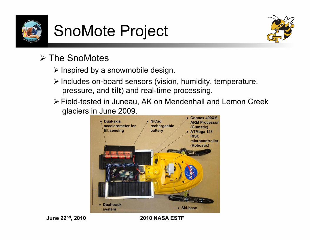
SnoMote Project The SnoMotes
Inspired by a snowmobile design. Includes on-board sensors (vision, humidity, temperature,
pressure, and tilt) and real-time processing. Field-tested in Juneau, AK on Mendenhall and Lemon Creek
glaciers in June 2009.
June 22nd, 2010 2010 NASA ESTF
Observations: Decadal Survey Relevant projects
Deformation, Ecosystem Structure, and Dynamics of Ice (DESDynI) To record the response of ice sheets to climate change.
Gravity Recovery and Climate Experiment (GRACE-II) Spacio-temporal fluctuations of the Earth’s mass distribution.
Ice, Cloud, and land Elevation Satellite (ICESat-II) Altimetry measurements to determine the contribution of terrestrial ice
cover to global sea levels.
All benefit from increased bandwidth of information afforded by robotic technology.
June 22nd, 2010 2010 NASA ESTF
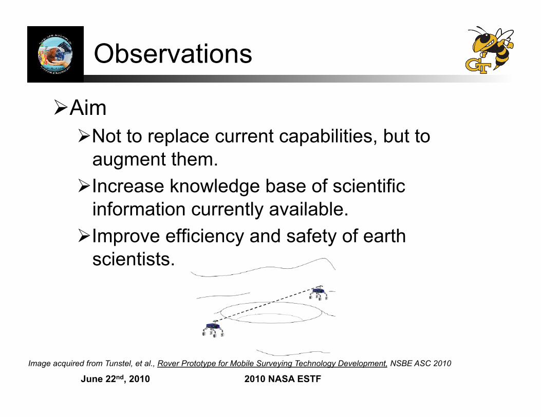
Observations
Aim Not to replace current capabilities, but to
augment them. Increase knowledge base of scientific
information currently available. Improve efficiency and safety of earth
scientists.
Image acquired from Tunstel, et al., Rover Prototype for Mobile Surveying Technology Development, NSBE ASC 2010
June 22nd, 2010 2010 NASA ESTF
References Center for Remote Sensing, Boston University Larsen, C., Motyka, R., Arendt, A., Echelmeyer, K., and Geissler, P., “Glacier changes in southeast Alaska
and northwest British Columbia and contribution to sea level rise,” Journal of Geophysical Research, Vol. 112, 2007.
Roujean, J. L., “A Bidirectional Reflectance Model of the Earth’s Surface for the Correction of Remote Sensing Data,” Journal of Geophysical Research, Vol. 97, 1992, pp. 20,455 – 20,468.
Lucht, W., Schaaf, C. B., and Strahler, A. H., “An Algorithm for the Retrieval of Albedo from Space Using Semiempirical BRDF Models,” IEEE Transactions on Geoscience and Remote Sensing, Vol. 38, 2000, pp. 977 – 996.
Wanner, W., Li, X., and Strahler, A. H., “On the derivation of kernels for kernel-driven models of bidirectional reflectance,” Journal of Geophysical Research, Vol. 100, 1995, pp. 21,077 – 21,089.
Coll, C., Caselles, V., Galve, J., Valor, E., Niclos, R., Sanchez, J., and Rivas, R., “Ground measurements for the validation of land surface temperatures derived from AATSR and MODIS data,” Remote Sensing of Environment, Vol. 97, No. 3, 2005, pp. 288–300.
J. Stroeve, J. E. Box, F. Gao, S. Liang, A. Nolan, C. Schaaf, “Accuracy Assessment of the MODIS 16-day albedo product for snow: comparisons with Greenland in situ measurements”, Remote Sensing of Environment, 94, 46-60, 2005
V. B. Spikes, G. S. Hamilton, “GLAS calibration-validation sites established in West Antarctica,” 30th International Symposium of Remote Sensing of the Environment (submitted), Nov. 2003
Website: http://www-modis.bu.edu/brdf/product.html PPT: MODIS BRDF/Albedo Products from Terra and Aqua, BU, Dept. of Geography
June 22nd, 2010 2010 NASA ESTF
References cont… McCormac, J. C., Surveying, Prentice-Hall, 1985. Whyte, W. S. and Paul, R. E., Basic Metric Surveying, Butterworth and Company, 1985. Anderson, M. O., Kinoshita, R. A., McKay, M. D., Willis, W. D., Gunderson, R. W., and Flann, N. S., “Mobile
Robotic Teams Applied to Precision Agriculture,” 8th International Topical Meeting on Robotics and Remote Systems, Idaho Falls, ID,
1999. Fong, T., Allan, M., Bouyssounouse, X., Bualat, M. G., Deans, M. C., Edwards, L., Fluckiger, L., Keely, L.,
Lee, S. Y., Lees, D., To, V., and Utz, H., “Robotic Site Survey at Haughton Crater,” 9th Int. Symposium on Artificial Intelligence, Robotics and Automation in Space, Los Angeles, CA, 2008.
Fong, T. W., Bualat, M., Edwards, L., Flueckiger, L., Kunz, C., Lee, S. Y., Park, E., To, V., Utz, H., Ackner, N., Armstrong-Crews, N., and Gannon, J., “Human-Robot Site Survey and Sampling for Space Exploration,” AIAA Space 2006, September 2006.
Tunstel, E., Anderson, G. T., and Wilson, E. E., “Autonomous Mobile Surveying for Science Rovers using In Situ Distributed Remote Sensing,” IEEE Int. Conference on Systems, Man, and Cybernetics, Pasedena, CA, 2007.
Tunstel, E., Dolan, J., Fong, T. W., and Schreckenghost, D., “Mobile Robotic Surveying Performance for Planetary Surface Site Characterization,” Performance Evaluation and Benchmarking of Intelligent Systems, edited by E. Tunstel and E. Messina, Springer, August 2009.
Hashemi, R. R., Jin, L., Anderson, G. T., Wilson, E., and Clark, M. R., “A Comparison of Search Patterns for Cooperative Robots Operating in Remote Environment,” IEEE Int. Conference on Information Technology: Coding and Computing, Las Vegas, NV, 2001.
Hashemi, R. R., Jin, L., Jones, S., Owens, D., and Anderson, G., “A Rule-Based System for Localization of Water on the Surface of Mars,” IEEE Int. Conference on Information Technology: Coding and Computing, Las Vegas, NV, 2001.
Williams, S., Parker, L. T., and Howard, A. M., “Calibration and Validation of Earth-Observing Sensors using Deployable Surface-Based Sensor Networks,” IEEE Journal of Selected Topics in Earth Observations and Remote Sensing, 2009.
June 22nd, 2010 2010 NASA ESTF
Thank you… NASA ESTO, Applied Information
Systems Technology Program Science, Mathematics and Research for
Transformation (SMART) Fellowship Stephen Williams, Georgia Tech
June 22nd, 2010 2010 NASA ESTF
Questions?