Embed Size (px)
Citation preview
FGDC – FEDERAL GEODETIC CONTROL SUBCOMMITTEE
METHODOLOGY WORK GROUP-JOE EVJEN CHAIR
DEVELOPMENT OF USER GUIDELINES AND DEVELOPMENT OF USER GUIDELINES AND INVOLVEMENT OF THE NATIONAL GEODETIC INVOLVEMENT OF THE NATIONAL GEODETIC SURVEY INSURVEY IN EMERGING REAL TIME GEODETIC EMERGING REAL TIME GEODETIC
POSITIONING METHODSPOSITIONING METHODS
WEDNESDAY FEBRUARY 13, 2007BILL HENNING
REAL TIME POSITIONING
“ IT DEPENDS”
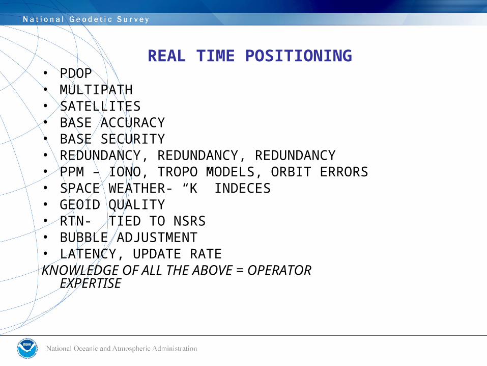
REAL TIME POSITIONING• PDOP• MULTIPATH• SATELLITES• BASE ACCURACY• BASE SECURITY• REDUNDANCY, REDUNDANCY, REDUNDANCY• PPM – IONO, TROPO MODELS, ORBIT ERRORS• SPACE WEATHER- “K” INDECES• GEOID QUALITY• RTN- TIED TO NSRS• BUBBLE ADJUSTMENT• LATENCY, UPDATE RATEKNOWLEDGE OF ALL THE ABOVE = OPERATOR
EXPERTISE
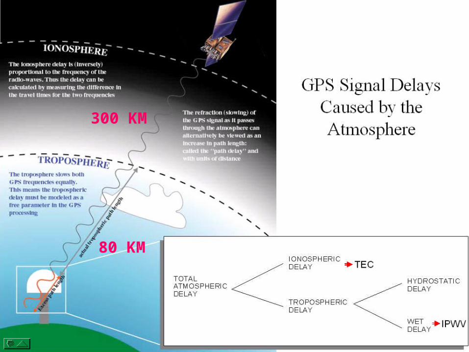
80 KM
300 KM
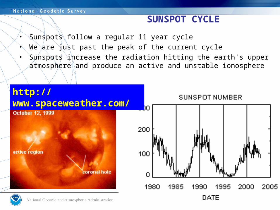
SUNSPOT CYCLE
• Sunspots follow a regular 11 year cycle• We are just past the peak of the current cycle• Sunspots increase the radiation hitting the earth's upper
atmosphere and produce an active and unstable ionosphere
http://www.spaceweather.com/
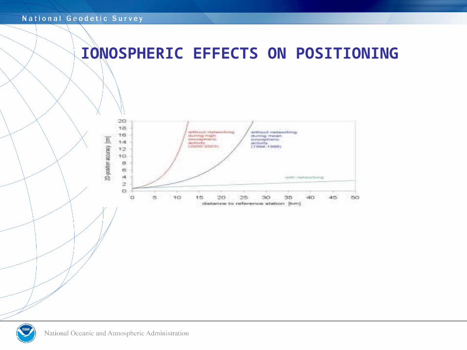
IONOSPHERIC EFFECTS ON POSITIONING
Ionospheretroposphere
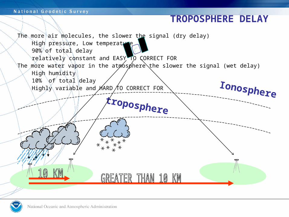
TROPOSPHERE DELAY
The more air molecules, the slower the signal (dry delay)High pressure, Low temperature 90% of total delayrelatively constant and EASY TO CORRECT FOR
The more water vapor in the atmosphere the slower the signal (wet delay)High humidity10% of total delayHighly variable and HARD TO CORRECT FOR
WHO USES REAL TIME POSITIONING ?
INTELLIGENT TRANSPORTATION PRECISION AGRICULTURE CONSTRUCTION & MACHINE CONTROL SURVEYING & ENGINEERING GIS – EMERGENCY PLANNING,INFRASTRUCTURE,ENVIRONMENTAL, PHOTOGRAMMETRIC CONTROL SCIENCE & ACADEMIA- DEFORMATION STUDIES, EARTHQUAKE & SUBSIDENCE STUDIES, CRUSTAL MOVEMENT, ATMOSPHERIC STUDIES, ETC.
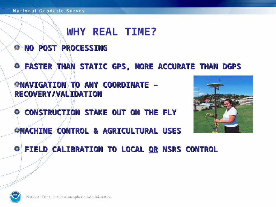
WHY REAL TIME? NO POST PROCESSINGNO POST PROCESSING
FASTER THAN STATIC GPS, MORE ACCURATE THAN DGPSFASTER THAN STATIC GPS, MORE ACCURATE THAN DGPS
NAVIGATION TO ANY COORDINATE – NAVIGATION TO ANY COORDINATE – RECOVERY/VALIDATIONRECOVERY/VALIDATION
CONSTRUCTION STAKE OUT ON THE FLYCONSTRUCTION STAKE OUT ON THE FLY
MACHINE CONTROL & AGRICULTURAL USESMACHINE CONTROL & AGRICULTURAL USES
FIELD CALIBRATION TO LOCAL FIELD CALIBRATION TO LOCAL OROR NSRS CONTROL NSRS CONTROL
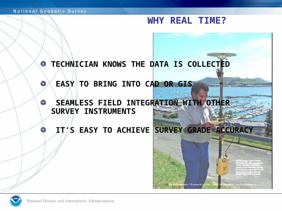
WHY REAL TIME?
TECHNICIAN KNOWS THE DATA IS COLLECTED
EASY TO BRING INTO CAD OR GIS
SEAMLESS FIELD INTEGRATION WITH OTHER SURVEY INSTRUMENTS
IT’S EASY TO ACHIEVE SURVEY GRADE ACCURACY
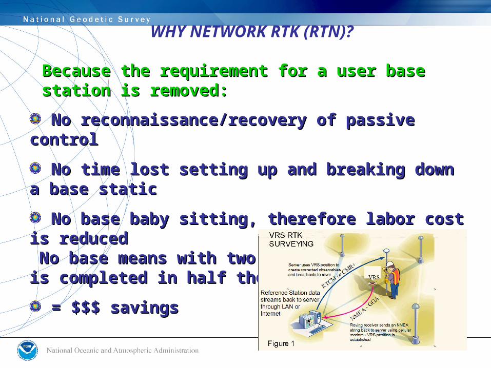
WHY NETWORK RTK (RTN)?
No reconnaissance/recovery of passive controlNo reconnaissance/recovery of passive control
No time lost setting up and breaking down a base No time lost setting up and breaking down a base staticstatic
No base baby sitting, therefore labor cost is reducedNo base baby sitting, therefore labor cost is reduced No base means with two rovers the project is No base means with two rovers the project is completed in half the timecompleted in half the time
= $$$ savings= $$$ savings
Because the requirement for a user base Because the requirement for a user base station is removed:station is removed:
WHY NETWORK RTK (RTN)?
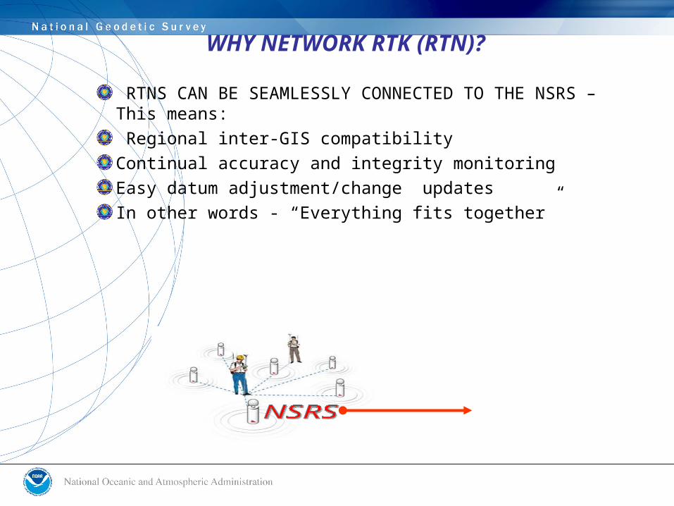
RTNS CAN BE SEAMLESSLY CONNECTED TO THE NSRS – This means: Regional inter-GIS compatibilityContinual accuracy and integrity monitoringEasy datum adjustment/change updatesIn other words - “Everything fits together”
WHY NETWORK RTK (RTN)?
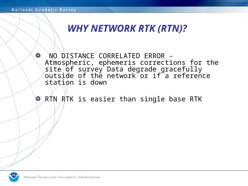
NO DISTANCE CORRELATED ERROR - Atmospheric, ephemeris corrections for the site of survey Data degrade gracefully outside of the network or if a reference station is down
RTN RTK is easier than single base RTK
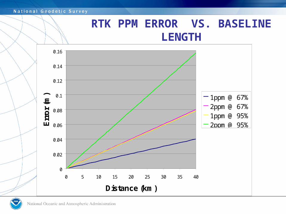
RTK PPM ERROR VS. BASELINE LENGTH
0
0.02
0.04
0.06
0.08
0.1
0.12
0.14
0.16
0 5 10 15 20 25 30 35 40
Distance (km)
Err
or
(m) 1ppm @ 67%
2ppm @ 67%1ppm @ 95%2ppm @ 95%
THE ROLE OF THE NGS IN SUPPORT OF RTN
• The NGS should provide real time RAW data streams (via NTRIP) from a subset of the National CORS network- perhaps in a 200 Km spacing grid. These data streams will aid in the establishment, validation and monitoring of the RTNs by network administrators. NO CORRECTORS
• The NGS could assess and accredit proposed or even current RTN reference station sites for obstructions, multipath, positional integrity - in short, for anything that might affect optimal performance of the RTN.
• Additionally, NOAA/NGS could stream satellite ephemerides, satellite clock parameters, iono and tropo models and even crustal motion models for public use.
• The NGS, continuing its role in support of accurate, reliable positioning, would study temporal macro variations in positions (seasonal, daily, ocean loading, atmospheric loading, subsidence, tectonic, etc.) and would study phenomena affecting accurate positioning (satellite orbits, refraction, multipath, antenna phase centers, geoid, etc.)
THE ROLE OF THE NGS IN SUPPORT OF RTN
• Since there are no sanctioned guidelines for establishing an RTN, the NGS should strongly encourage that a REPRESENTATIVE SAMPLING of the RTN stations become a National CORS or Coop CORS
• ORIGINAL coordinate derivations for any RTN start up should be reviewed by the NGS to ensure compatibility with the NSRS at the datum tie level (2-cm Horizontal , 4-cm vertical).
• The NGS should monitor or review areas where RTNs are merging or overlapping with others- perhaps managed by separate entities- to ensure coordinate compatibility. This will reduce liability and add to the general public welfare for work done based upon these RTNs.
THE ROLE OF THE NGS IN RTN
• The NGS should monitor and archive data and metadata from the RTN master stations. Each RTN station should provide a periodic OPUS solution, perhaps weekly, to the NGS where it could be integrated through OPUS-DB. These data and metadata should be a part of the NSRS at some level and therefore accessible to the public.
• Metadata specs should be developed. These might include pictures, dates, station details, etc.- similar to the National CORS network.
THOUGHTS TO PONDER
With or without NGS involvement and support services, RTN will blanket the USA.
There exists no cohesive national policy, guidelines, standards, specifications, metadata archiving nor database management for RTN.
The public deserves independent QA/QC on this new utility of the GNSS that impacts their lives.
• Testing for TEC cut-offs• Testing for baseline lengths• Minimum field conditions• Minimum field procedures• Positional Accuracy goals – 95% confidence of achieving
2-cm H, 4-cm V
THE ROLE OF THE NGS IN REAL TIME POSITIONING
= 1. “NGS User Guidelines for Single Base GNSS Real Time Positioning” 2. “NGS User Guidelines for GNSS Real Time Positioning in RTN” 3. “NGS Guidelines for GNSS RTN Administrators”
= 1. “NGS User Guidelines for Single Base GNSS Real Time Positioning” 2. “NGS User Guidelines for GNSS Real Time Positioning in RTN” 3. “NGS Guidelines for GNSS RTN Administrators”
DYNAMIC DOCUMENTS:
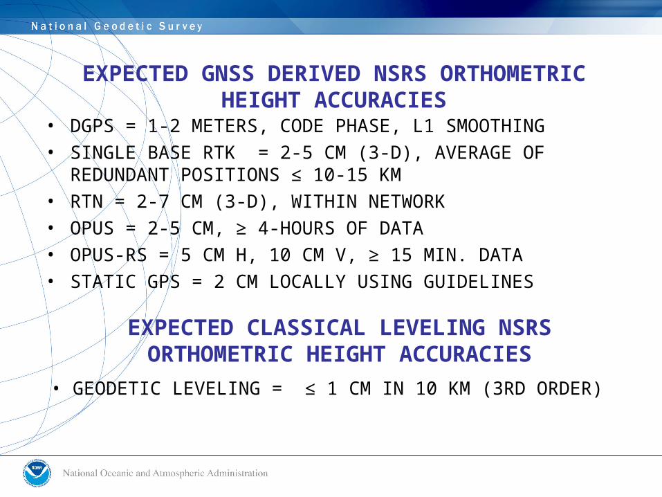
EXPECTED GNSS DERIVED NSRS ORTHOMETRIC HEIGHT ACCURACIES
• DGPS = 1-2 METERS, CODE PHASE, L1 SMOOTHING• SINGLE BASE RTK = 2-5 CM (3-D), AVERAGE OF
REDUNDANT POSITIONS ≤ 10-15 KM• RTN = 2-7 CM (3-D), WITHIN NETWORK• OPUS = 2-5 CM, ≥ 4-HOURS OF DATA• OPUS-RS = 5 CM H, 10 CM V, ≥ 15 MIN. DATA• STATIC GPS = 2 CM LOCALLY USING GUIDELINES
• GEODETIC LEVELING = ≤ 1 CM IN 10 KM (3RD ORDER)
EXPECTED CLASSICAL LEVELING NSRS ORTHOMETRIC HEIGHT ACCURACIES