Embed Size (px)
Citation preview
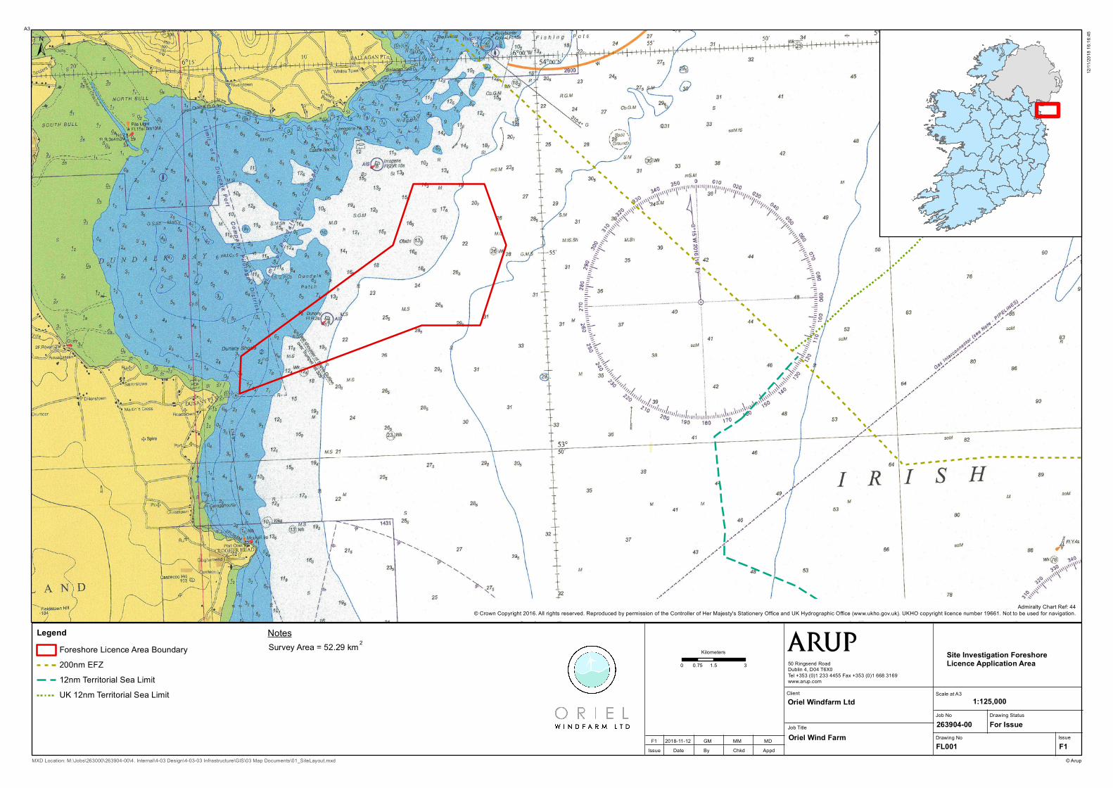
LegendForeshore Licence Area Boundary200nm EFZ12nm Territorial Sea LimitUK 12nm Territorial Sea Limit
0 1.5 30.75
Kilometers
±
© Arup
A3
MXD Location: M:\Jobs\263000\263904-00\4. Internal\4-03 Design\4-03-03 Infrastructure\GIS\03 Map Documents\01_SiteLayout.mxd
12/11
/2018
16:16
:45
Job No263904-00Drawing No IssueFL001 F1
Drawing StatusFor Issue
Site Investigation Foreshore Licence Application Area
Scale at A31:125,000
Job Title
ClientOriel Windfarm Ltd
Oriel Wind Farm
Issue Date By Chkd AppdF1 2018-11-12 GM MM MD
Admiralty Chart Ref: 44© Crown Copyright 2016. All rights reserved. Reproduced by permission of the Controller of Her Majesty's Stationery Office and UK Hydrographic Office (www.ukho.gov.uk). UKHO copyright licence number 19661. Not to be used for navigation.
Survey Area = 52.29 kmNotes
2
50 Ringsend RoadDublin 4, D04 T6X0Tel +353 (0)1 233 4455 Fax +353 (0)1 668 3169www.arup.com