Embed Size (px)
Citation preview
THE ORIGINAL OF ME DOCUMENT RECORDED AS FOLLOWS;
STATE OF HAWAII
OFFICE OF THE ASSISTANT REGISTRAR, LAND COURT
STATE Oi• (Bureau of Conveyances)
The original of this document was recorded as follows:
BURFAU OF CONVEYANCES
DATE Doc 2009-178129
Doc 3917143
DATE C'TI 965,030 — NOV 19,2009 02:00 PM
DOCUM OCIUMOK.
NOV 19, 2009 02:00 PM D
14 V
LAND COURT SYSTEM
REGULAR SYSTEM
After Recordation, Return By Mail ( )
To: Department of Hawaiian Home Lands Attn: Mr. Micah A. Kane, Chairman Hawaiian Homes Commission P.O. Box 1879 Honolulu, HI 96805
Pick up ( )
Tax Map Key Nos: 1-9-4-08:10 and 1-9-6-03:44
Total Pages: 12
QUITCLAIM DEED
AR00119905
QUITCLAIM DEED
Portion of Former Ewa Junction Drum Storage Facility Waiawa, Ewa, Oahu, Hawaii
GSA Control No. 9-N-HI-0808
THIS INDENTURE is made this twenty ninth (29th) day of June, 2009, by and between the UNITED STATES OF AMERICA, acting by and through the Administrator of General Services ("GRANTOR") and the DEPARTMENT OF HAWAIIAN HOME LANDS of the STATE OF HAWAII ("GRANTEE") pursuant to and under the authority of the Hawaiian Home Lands Recovery Act, Public Law 104-42, and the Federal Property and Administrative Services Act of 1949 as amended, 40 USC 101 et seq., and applicable regulations, rules and orders promulgated thereunder.
GRANTOR hereby remises, releases and quitclaims unto the GRANTEE all of its right, title, and interest in that certain real property situated on Oahu, State of Hawaii, as more particularly described on the attached "Exhibit A" ("the PROPERTY"), together with all improvements thereon.
TO HAVE AND TO HOLD the PROPERTY together with all the privileges and appurtenances thereto belonging unto GRANTEE, its successor and assigns, forever.
THIS CONVEYANCE IS SUBJECT TO THE FOLLOWING:
All covenants, reservations, easements, restrictions, and rights, recorded and unrecorded, in favor of public and/or private entities and/or individuals, for public roads, highways, streets, railroads, power lines, telephone lines and equipment, pipelines, drainage, sewer and water mains and lines, public utilities, and other rights-of-way, including, but not limited to, the specific easements, reservations, rights and covenants described herein, and/or any title documents pertaining to the property, and also including any of the foregoing rights pertaining to any facts which a physical inspection or accurate survey of the property may disclose.
The PROPERTY is conveyed "As Is" and "Where Is" without reservation, warranty, or guarantee of any kind (except as expressly stated in the Hazardous Substance Covenant immediately below), as to any matter related to the conveyance including, but not limited to, the quantity, quality, character, condition, size, habitability or kind of the PROPERTY or any fixtures attached to the PROPERTY or that the same is in a condition or fit to be used for the purpose for which intended by the GRANTEE. GRANTEE covenants that GRANTEE has inspected, is aware of, and accepts the condition of the PROPERTY.
HAZARDOUS SUBSTANCE ACTIVITY COVENANT
AR00119906
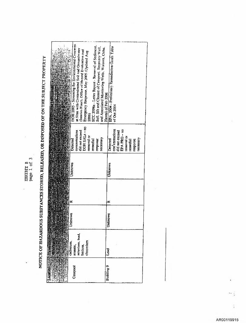
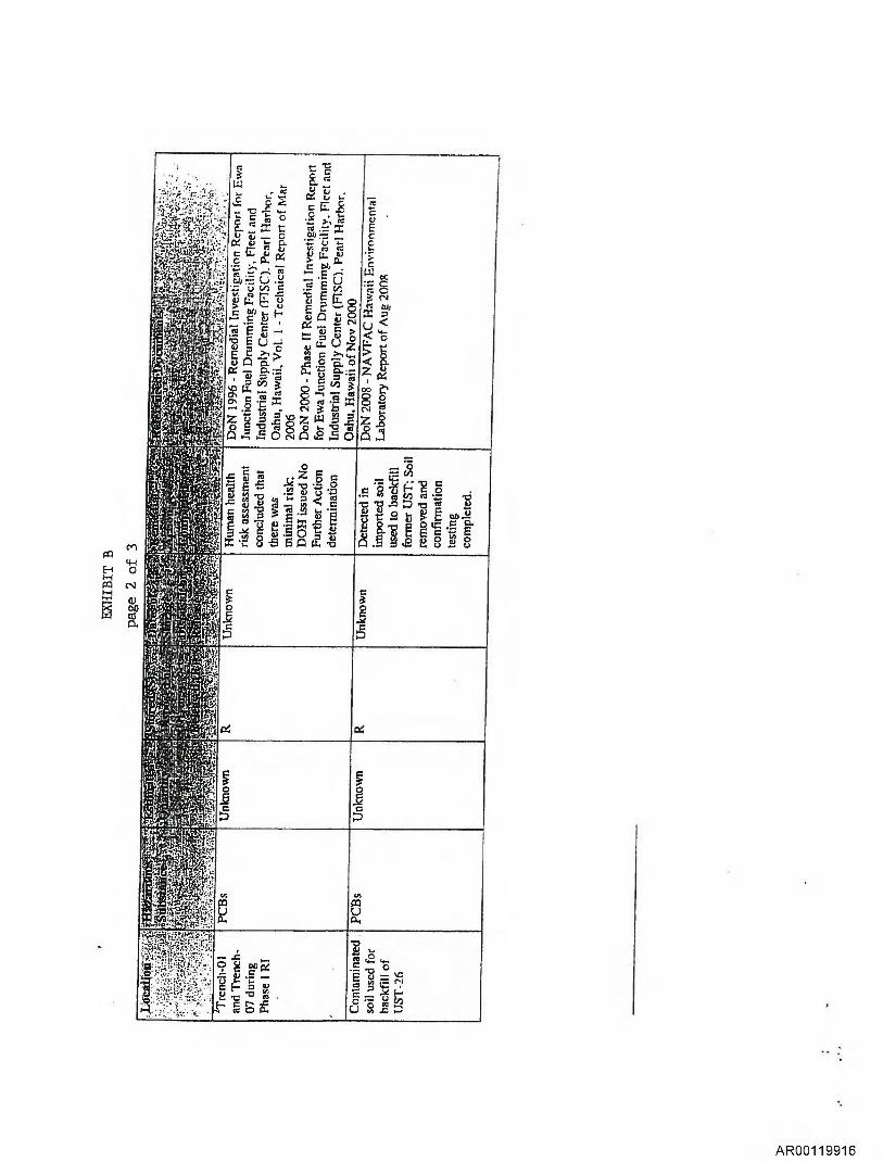
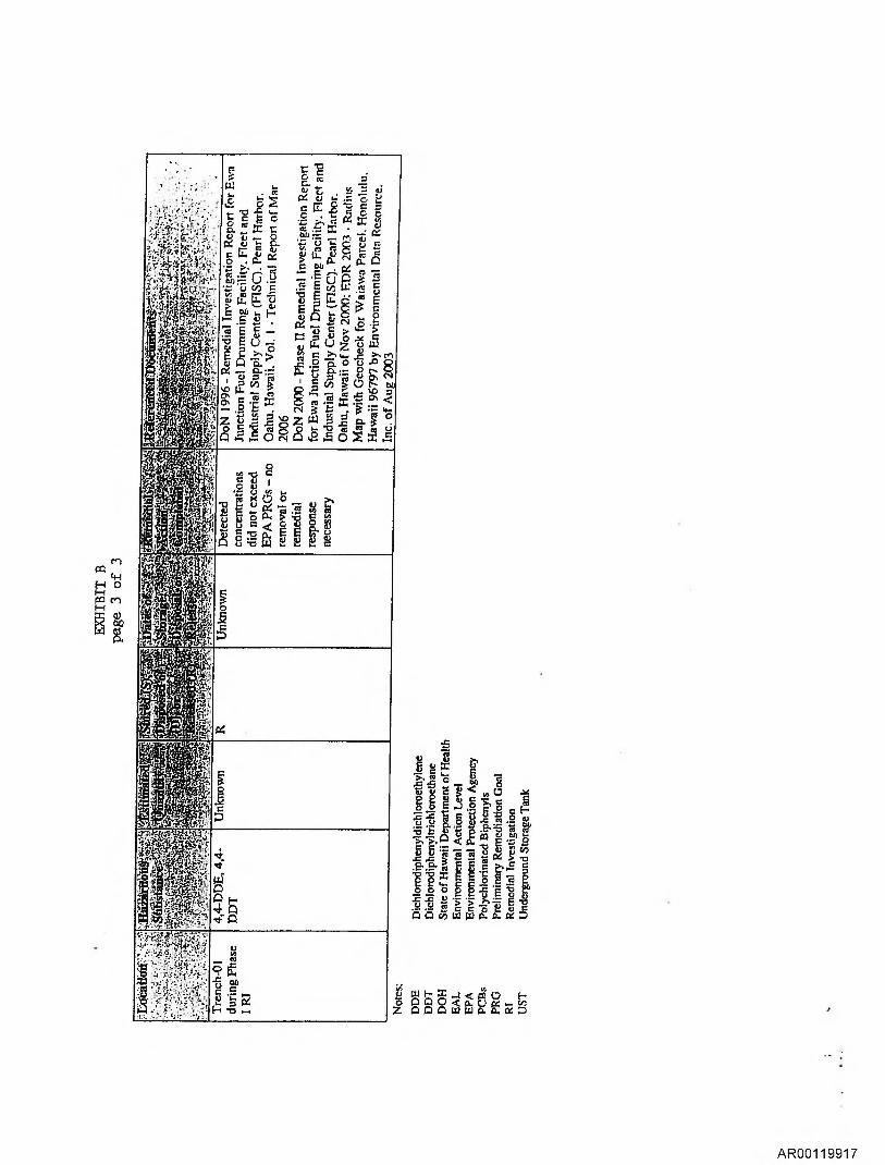
(A) NOTICE. Pursuant to 40 CFR 373.2 and Section 120(h)(3)(A)(i) of the Comprehensive Environmental Response, Compensation and Liability Act of 1980, as amended (CERCLA)(42 USC 9620(h)(3)(A)(i), and based upon a complete search of agency files, the United States gives notice that Exhibit B provides the following information: (1) the type and quantity of hazardous substances that were known to have been released or disposed of or stored for one year or more on the PROPERTY; (2) the time such storage, release, or disposal took place; and (3) a description of remedial action taken, if any.
(B) COVENANT. GRANTOR warrants that all remedial action necessary to protect human health and the environment has been taken before the date of this conveyance. GRANTOR warrants that it shall take any additional response action found to be necessary after the date of this conveyance regarding hazardous substances located on the Property on the date of this conveyance.
This covenant shall not apply:
(1) in any case in which GRANTEE, its successor(s) or assign(s), or any successor in interest to the Property or part thereof is a Potentially Responsible Party (PRP) with respect to the Property immediately prior to the date of this conveyance; OR
(2) to the extent that such additional response action or part thereof found to be necessary is the result of an act or failure to act of the GRANTEE, its successor(s) or assign(s), or any party in possession after the date of this conveyance that either:
(i) results in a release or threatened release of a hazardous substance that was not located on the Property on the date of this conveyance; OR
(ii) causes or exacerbates the release or threatened release of a hazardous substance located on the PROPERTY as of the date of this conveyance.
(C) ACCESS. GRANTOR reserves a tight of access to all portions of the Property for environmental investigation, remediation or other corrective action. This reservation includes the right to use available utilities at reasonable cost to GRANTOR. These rights shall be exercisable in any case in which a remedial action, response action or corrective action is found to be necessary after the date of this conveyance, or in which access is necessary to carry out a remedial action, response action, or corrective action on adjoining property. Pursuant to this reservation, the United States of America, and its respective officers, agents, employees, contractors and subcontractors shall have the right (upon reasonable advance written notice to the record title owner) to enter upon the Property and conduct investigations and surveys, to include drilling, test-pitting, borings, data and records compilation and other activities related to environmental investigation, and to carry out remedial or removal actions as required or necessary, including but not limited to the installation and operation of monitoring wells, pumping wells, and
AR00119907
Name. Notar State of: ashington
treatment facilities. Any such entry, including such activities, responses or remedial actions, shall be coordinated with record title owner and shall be performed in a manner that minimizes interruption with activities of authorized occupants.
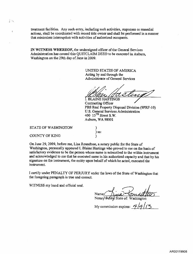
IN WITNESS WHEREOF, the undersigned officer of the General Services Administration has caused this QUITCLAIM DEED to be executed in Auburn, Washington on the 29th day of June in 2009.
UNITED STATES OF AMERICA Acting by and through the Administrator of General Services
"e2-4 I. BLAINE HASTINGS Contracting Officer PBS Real Property Disposal Division (9PRF-10) U.S. General Services Administration 400 l5 Street S.W. Auburn, WA 98001
STATE OF WASHINGTON ) ss:
COUNTY OF KING
On June 29, 2009, before me, Lisa Roundtree, a notary public for the State of Washington, personally appeared I. Blaine Hastings who proved to me on the basis of satisfactory evidence to be the person whose name is subscribed to the within instrument and acknowledged to me that he executed same in his authorized capacity and that by his signature on the instrument, the entity upon behalf of which he acted, executed the instrument.
I certify under PENALTY OF PERJURY under the laws of the State of Washington that the foregoing paragraph is true and correct.
WITNESS my hand and official seal.
My commission expires: /1 //3
AR00119908
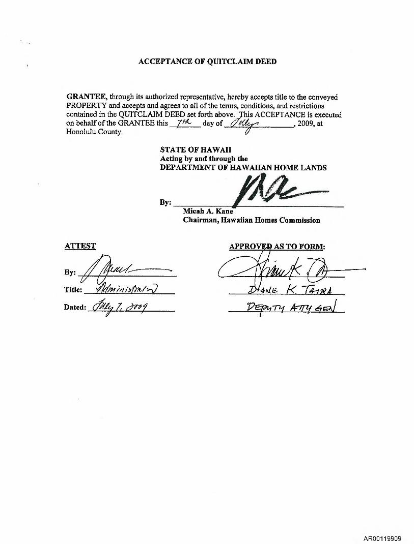
ACCEPTANCE OF QUITCLAIM DEED
GRANTEE, through its authorized representative, hereby accepts title to the conveyed PROPERTY and accepts and agrees to all of the terms, conditions, and restrictions contained in the QUITCLAIM DEED set forth above. This ACCEPTANCE is executed on behalf of the GRANTEE this pi- day of "‘e , 2009, at Honolulu County.
STATE OF HAWAII Acting by and through the DEPARTMENT OF HAWAIIAN HOME LANDS
By: Micah A. Kane Chairman, Hawaiian Homes Commission
ATTEST
By: —
Title: )46i2/7/V)z6n)
Dated: 01 7 d-/-07
Per47-21 4-77-z1'
AR00119909
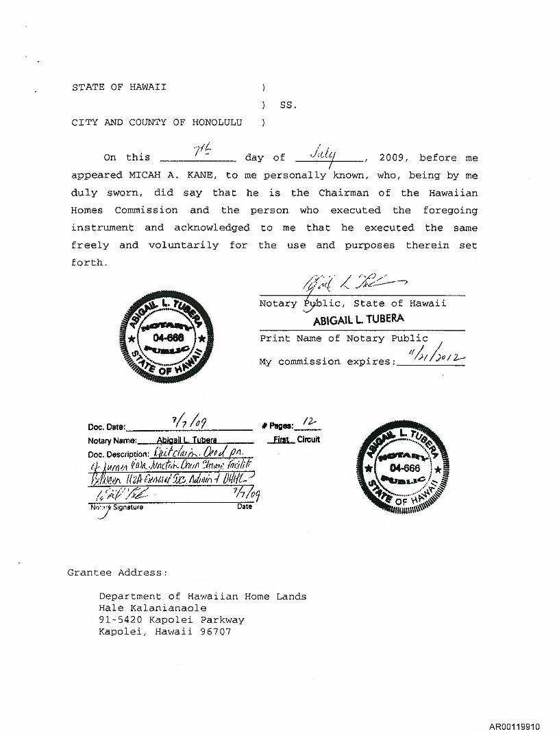
STATE OF HAWAII
) SS.
CITY AND COUNTY OF HONOLULU
/4 On this
7 day of OW7 , 2009, before me
appeared MICAH A. KANE, to me personally known, who, being by me
duly sworn, did say that he is the Chairman of the Hawaiian
Homes Commission and the person who executed the foregoing
instrument and acknowledged to me that he executed the same
freely and voluntarily for the use and purposes therein set
forth.
/,
Notary ;blic, State of Hawaii
ABIGAIL L TUBERA
Print Name of Notary Public
My commission expires:
Doc. Date: ?A /Op # Pages:
Notary Name: Abigail L. Tubera au Circuit
Doc. Description: Ogoi 3O/1.
A tnnivem (04:L./it/dirk (hull flaity. iYiitliVA
4`,; eV'' 777/6,
No_.7.. Signature Date
Grantee Address:
Department of Hawaiian Home Lands Hale Kalanianaole 91-5420 Kapolei Parkway Kapolei, Hawaii 96707
earirAlift;A
04-666 1*1 . s,... -.
...■tkle.
nano
AR00119910
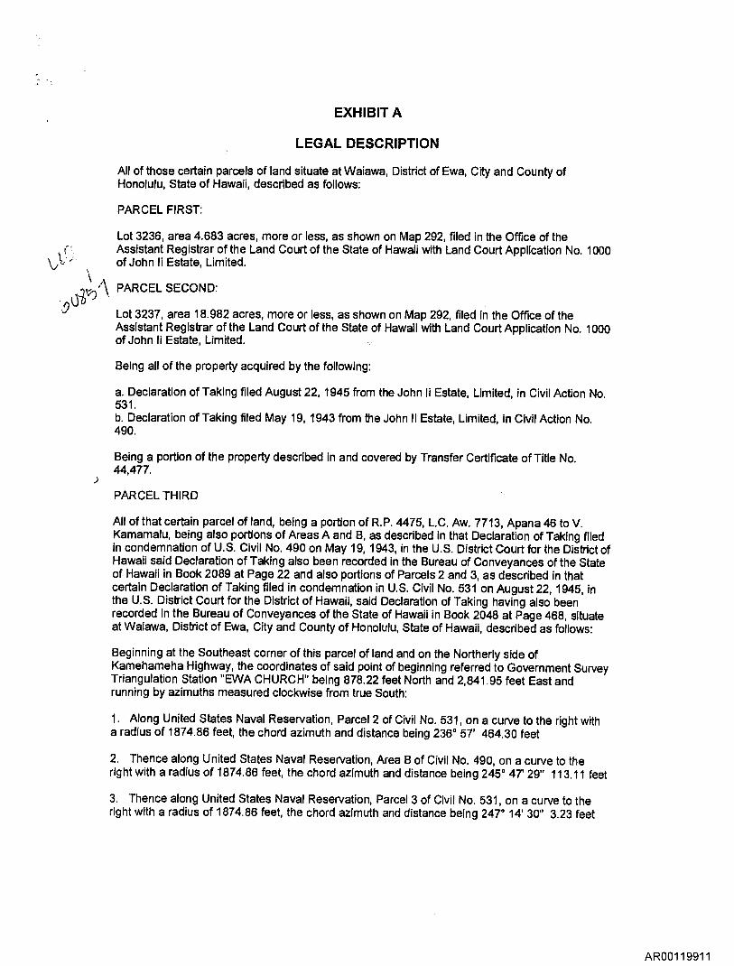
EXHIBIT A
LEGAL DESCRIPTION
All of those certain parcels of land situate at Waiawa, District of Ewa, City and County of Honolulu, State of Hawaii, described as follows:
PARCEL FIRST:
Lot 3236, area 4.683 acres, more or less, as shown on Map 292, filed in the Office of the Assistant Registrar of the Land Court of the State of Hawaii with Land Court Application No. 1000 of John Ii Estate, Limited.
PARCEL SECOND:
Lot 3237, area 18.982 acres, more or less, as shown on Map 292, filed in the Office of the Assistant Registrar of the Land Court of the State of Hawaii with Land Court Application No. 1000 of John Ii Estate, Limited.
Being all of the property acquired by the following:
a. Declaration of Taking filed August 22, 1945 from the John Ii Estate, Limited, in Civil Action No. 531. b. Declaration of Taking filed May 19, 1943 from the John Ii Estate, Limited, in Civil Action No. 490.
Being a portion of the property described in and covered by Transfer Certificate of Title No. 44,477.
PARCEL THIRD
All of that certain parcel of land, being a portion of R.P. 4475, L.C. Aw. 7713, Apana 46 to V. Kamamalu, being also portions of Areas A and B, as described in that Declaration of Taking filed in condemnation of U.S. Civil No. 490 on May 19, 1943, in the U.S. District Court for the District of Hawaii said Declaration of Taking also been recorded in the Bureau of Conveyances of the State of Hawaii in Book 2089 at Page 22 and also portions of Parcels 2 and 3, as described in that certain Declaration of Taking filed in condemnation in U.S. Civil No. 531 on August 22, 1945, in the U.S. District Court for the District of Hawaii, said Declaration of Taking having also been recorded in the Bureau of Conveyances of the State of Hawaii in Book 2048 at Page 468, situate at Waiawa, District of Ewa, City and County of Honolulu, State of Hawaii, described as follows:
Beginning at the Southeast corner of this parcel of land and on the Northerly side of Kamehameha Highway, the coordinates of said point of beginning referred to Government Survey Triangulation Station "EWA CHURCH" being 878.22 feet North and 2,841.95 feet East and running by azimuths measured clockwise from true South:
1. Along United States Naval Reservation, Parcel 2 of Civil No. 531, on a curve to the right with a radius of 1874.86 feet, the chord azimuth and distance being 236° 57' 464.30 feet
2. Thence along United States Naval Reservation, Area B of Civil No. 490, on a curve to the right with a radius of 1874.86 feet, the chord azimuth and distance being 245° 47' 29" 113.11 feet
3. Thence along United States Naval Reservation, Parcel 3 of Civil No. 531, on a curve to the right with a radius of 1874.86 feet, the chord azimuth and distance being 247° 14' 30" 3.23 feet
AR00119911
4. 327° 22' 50.62 feet
5. 327° 22' 284.03 feet along land conveyed to the State of Hawaii, Department of Transportation by Deed dated November 23, 1965
6. 327° 22' 38.20 feet along land conveyed to the University of Hawaii by Quitclaim Deed dated October 13, 1965 and recorded in Liber 5188 at Page 327
7. 247° 24' 50.00 feet along land conveyed to the University of Hawaii by Quitclaim Deed dated October 13, 1965 and recorded in Liber 5188 at Page 327
8. 327° 53' 426.70 feet along land conveyed to the University of Hawaii by Quitclaim Deed dated October 13, 1965 and recorded in Liber 5188 at Page 327
9. 52° 32' 120.60 feet along land conveyed to the University of Hawaii by Quitclaim Deed dated October 13, 1965 and recorded in Liber 5188 at Page 327
10. 0° 46' 993.60 feet along land conveyed to the University of Hawaii by Quitclaim Deed dated October 13, 1965 and recorded in Liber 5188 at Page 327
11. 321° 28' 74.32 feet along land conveyed to the University of Hawaii by Quitclaim Deed dated October 13, 1965 and recorded in Liber 5188 at Page 327
12. 50° 20' 30" 491.59 feet along the remainder of R.P. 4475, L.C. Aw. 7713, Apana 46 to V. Kamamalu
13. 55° 29' 278.00 feet along land conveyed to Herbert K Horita Realty, Inc., by Quitclaim Deed dated November 1, 1966 and recorded in Liber 5698 at Page 408
14. 65° 50' 8.33 feet along land conveyed to Herbert K. Horita Realty, Inc., by Quitclaim Deed dated November 1, 1966 and recorded in Liber 5698 at Page 408
15. 171° 31' 1,444.87 feet along Lot 3237 of Land Court Application 1000
16. 171° 31' 520.69 feet along Lot 3236 of Land Court Application 1000
17. 171° 31' 10.51 feet along Lot 3-D-2-A of Land Court Application 1000 to the point of beginning and containing an area of 32.211 acres, more or less.
Being all of the property acquired by the following:
a. Declaration of Taking filed August 22, 1945 from the John Ii Estate, Limited, in Civil Action No. 531.
b. Declaration of Taking filed May 19, 1943 from the John Ii Estate, Limited, in Civil Action No. 490.
RESERVATIONS, RESTRICTIONS AND EASEMENTS AS TO PARCEL FIRST:
A. Rights reserved to the John Ii Estate, Limited, a Hawaiian corporation and its successors, assigns or lessees for the operation, maintenance, and repair of irrigation ditches and pipelines, as described and set forth in said Declaration of Taking in Civil 531, dated August 22, 1945, filed in said Office of the Assistant Registrar of the Land Court of the Territory of Hawaii (now State) of Hawaii, as Document No. 113531 and also recorded in the Bureau of Conveyances of the State of Hawaii in Book 2048 at Page 468.
AR00119912
B. Easement(s) for the purpose(s) shown below and rights incidental thereto as set forth in a document;
In favor of: the State of Hawaii, Department of Transportation Purpose: right-of-way for a controlled access highway together with a restriction of access rights Recorded: in the Office of the Assistant Registrar of the Land Court of the State of
Hawaii, as Document No. 495622 and also recorded in the Bureau of Conveyances of the State of Hawaii in Book 6905 at Page 231, dated November 29, 1968.
Affects: land herein described
C. Restriction of access rights, as shown on Map 146, as set forth by Land Court Order No. 19981 in favor of the State of Hawaii and as contained in that certain Deed dated July 23, 1962 filed as Document No. 295886, as set forth by Land Court Order No. 30857, filed November 6, 1969.
RESTRICTIONS AND EASEMENTS AS TO PARCEL SECOND:
A. Easement 1199, as shown on Map 365, for transmission of sources of energy, as shown on Map 365 as set forth by Land Court Order No. 36573.
B. Easement(s) for the purpose(s) shown below and rights incidental thereto as set forth in a document;
In favor of: the State of Hawaii, Department of Transportation Purpose: Easement 1199, for an Energy Corridor Recorded: in the Office of the Assistant Registrar of the Land Court of the State of
Hawaii, as Document No. 710054 and also recorded in the Bureau of Conveyances of the State of Hawaii in Book 10445 at Page 313, dated November 26, 1974.
Affects: land herein described
C. Restriction of access rights, as shown on Map 292, as set forth by Land Court Order No. 30857.
RESTRICTIONS, RESERVATIONS, AND EASEMENTS AS TO PARCEL THIRD
A. Rights reserved to the Trustees of the Bernice P. Bishop Estate and their successors in trust and the beneficiaries of said trust estate, their heirs and assigns, tenants ad lessees for the use, operation and maintenance of a underground water pipeline, together with the right of ingress and egress, as described and set forth in said Amended Declaration of Taking in Civil 490, dated August 9, 1945, filed in said Office of the Assistant Registrar of theLand Court of the Territory (now State) of Hawaii, as Document No. 97278 and also recorded in the Bureau of Conveyances of the State of Hawaii in Book 2089 at Page 26.
B. Rights reserved to the John Ii Estate, Limited, a Hawaiian corporation and its successors, assigns or lessees for the operation, maintenance, and repair of irrigation ditches and pipelines, as described and set forth in said Declaration of Taking in Civil 531, dated August 22, 1945, filed in said Office of the Assistant Registrar of the Land Court of the Territory of Hawaii (now State) of Hawaii, as Document No. 113531 and also recorded in the Bureau of Conveyances of the State of Hawaii in Book 2048 at Page 468.
C. Easement(s) for the purpose(s) shown below and rights incidental thereto as set forth in a document;
AR00119913
In favor of: State of Hawaii, Department of Transportation Purpose: controlled access highway Recorded: in the Bureau of Conveyances of the State of Hawaii, in Liber 5645 at
Page 41, dated April 5, 1967. Affects: land herein described
D. Easement(s) for the purpose(s) shown below and rights incidental thereto as set forth in a document;
In favor of: the State of Hawaii, Department of Transportation Purpose: right-of-way for a controlled access highway together with a restriction of
access rights Recorded: in the Office of the Assistant Registrar of the Land Court of the State of
Hawaii, as Document No. 495622 and also recorded in the Bureau of Conveyances of the State of Hawaii in Book 6905 at Page 231, dated November 29, 1968.
Affects: land herein described
E. Easement(s) for the purpose(s) shown below and rights incidental thereto as set forth in a document;
In favor of: the State of Hawaii Purpose: storm drain Recorded: in the Bureau of Conveyances of the State of Hawaii, in Liber 6918 at
Page 420, dated February 6, 1970. Affects: land herein described
F. Easement(s) for the purpose(s) shown below and rights incidental thereto as set forth in a document;
In favor of: the State of Hawaii, Department of Transportation Purpose: Easement 1199, for an Energy Corridor Recorded: in the Office of the Assistant Registrar of the Land Court of the State of
Hawaii, as Document No. 710054 and also recorded in the Bureau of Conveyances of the State of Hawaii in Book 10445 at Page 313, dated November 26, 1974.
Affects: land herein described
G. Road Parcel 6, area 0.062 acre, as shown on Tax Map.
H. Road Parcel 5, area 0.294 acre, as shown on Tax Map.
I. Drain Easement, area 7,592 square feet, as shown on Tax Map.
J. Easement 2, 10 feet wide) as shown on Tax Map.
K. Easement A, area 0.316 acre, more or less, for water pipeline purposes, as shown on Tax Map.
L. Easement for right of way, as shown on Tax Map.
AR00119914
rn
pa 4-I 0
:14
DO
H 2
005
- Sc
reen
ing
for
En
v im
nmen
tal C
once
rric
at
Site
s w
it h C
onta
min
a ted
So
il an
d G
roun
dw
ate
r (I
nte
r im
Fin
al)
. O
ffic
e o
f 1
4n
eti
r d E
va
lua
t ion a
nd
E
mer
g enc
y R
esp c
Ince
. May
200
5 ( U
p da t
e d A
ug
2006
) E
CC
200
6a-
Let
ter
Rep
ort -
Rem
ova l
of
Sed
imen
t.
0 •
0 5
r
,
P':0.7 ....2.:...
g c4
L r
ic, • L..", ,
,. .F.7
i.z .4 :I
. ,S
0 .5 P
P /
..
..g .2 •0
c *CI
g Ai .= d *E
E = E = g II T.: 2 la
t
-0- 0 F.- g u
-0— .....
0. t.. .
= CO
AR00119915
c
U r-- 2 -o
• F.
• oc
8
C-) '.- • < a "6
< §. • g
oo
8 $3 csi z
0 ..z g
-5 .-'41,2 '43
2 < to, C Cn • •••
"Ny4 •E c vs z 8 .6 -0
0
AR00119916
0 cz
•4, t . 4 =6 :C] P..
CLui-.-Z,L-1 c.E ?,9 r...T ,-t .9...tc2,9
r Q..— ..„a E -4s
k't.0.E. .r.;t7. ,0-1. , )• 0.0.— .1eLLA. ,, 46 em
•
—U- .4:ticnu .5EE—r5wc ;EM -5 "BM - 11 g• ;. ,.. gg cm,..F...
■— . ..c.6) . & ...6,,,,,, 8 , 'ZEE— t EL),-;z:
.1 >
c`si,,, o-° Q
8 g.-, . 1., oc.r.Z Ott—=4-4 <
zt1.4.8Azw ° os, m 5 0,,,,..6 a.,4oNaa4oX=4
c Cci ,
Cu
g v, .2 g BC- Q88 cLI :° 8 '4 < c ga.P, w o mm, At.)-ct4EE S
u 7,ct 4) •
111Hfi c :10 .E 21. 6:rd) o2 2..11 42 =0 la41 ¢1 Pifg BEL.m.,,,Twric* t,c;IY,Mg1,
eg.0 b 4 g ?TE E527q O 009g2VE. ,2
•
' '")-2 V- g-457"2ou ACc*WW0.0.W
V 01-464%."<0.Ug ce; Z C2 CI U2 U7 cL ne.2
AR00119917