Embed Size (px)
Citation preview
New York City Department of Transportation January 21, 2015
2015 Queens Boulevard Roosevelt Ave to 73rd St
Safety Workshop

Tonight’s Workshop • Limits: Roosevelt Ave to 73rd St
• DOT to host workshops for additional sections along Queens Blvd
PS 11

Why We’re Here
• Longstanding community requests for improvements
• Vision Zero priority corridor
• Need local knowledge
• Want to make improvements in 2015

• Table discussion • Data packet explanation • Pinpoint problem areas on map • Discussion of issues • Identify top points
• Share table input with everyone
Workshop Format

Collecting Additional Input
Send to NYC DOT at [email protected] or mail to the NYC DOT Queens Borough Commissioner’s Office
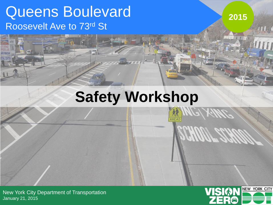
Queens Subway Map

Queens Bus Map
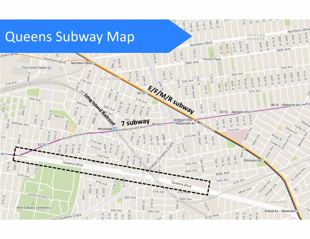
Queens Bike Map
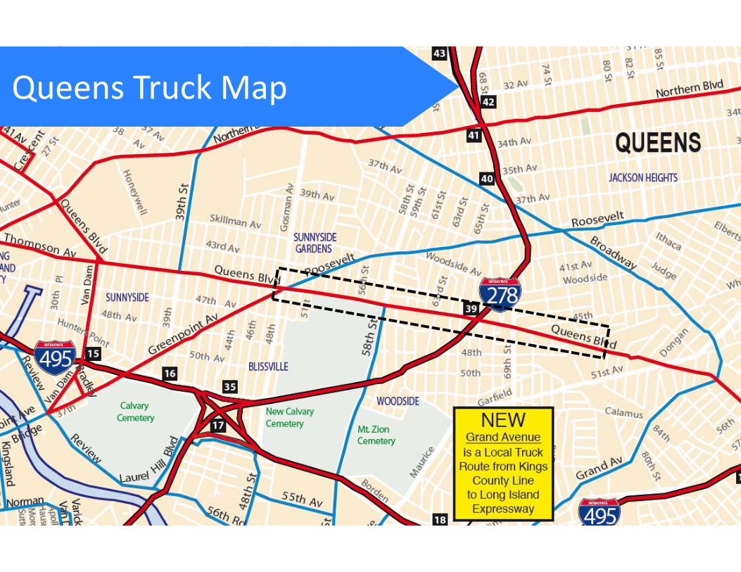
Queens Truck Map

Existing ConditionsService roads
Fencing
Slip lanes
Wide road / Long crossing distances

Behavior
Aggressive turning / failure to yield
SpeedingMidblock crossing
Double parking / weaving on service roads

Safety Data: Queens Boulevard Ranks in the top 10 percent of Queens streets for severe injuries and fatalities
per mile (2009‐2013 crash data) 6 total fatalities along 1.3 mile corridor since 2009, highest concentration Majority of pedestrians (64%) hit at intersections, while crossing with the signal Majority of cyclists (76%) hit at intersections Vehicle occupant injuries associated with:
• Rear end crashes (36%)• Right angle crashes (20%)• Left turn crashes (9%)
75 26 142
65 563
20
52
Total injuries
2009‐2013
Severe Injuries + Fatalities 2009‐2013
28
Total Injuries and Fatalities
1
54
124
202
2
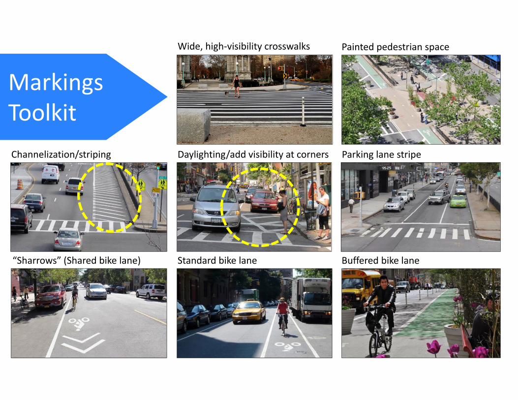
MarkingsToolkit
Painted pedestrian space
Channelization/striping
Standard bike lane Buffered bike lane
Daylighting/add visibility at corners Parking lane stripe
Wide, high‐visibility crosswalks
“Sharrows” (Shared bike lane)

Median tip extension/widening
Curb/sidewalk extensionExpanded center median* (in turn bay, with turn ban)
Concrete Toolkit
*Can include tree pits
Queens Blvd & 67 Ave
Queens Blvd & 62 Dr
Queens Blvd & 69 St

Traffic Control Toolkit
Plastic bollardsTurn bansStop controls and parking regulations
Street reversals/ one‐way conversions New signal construction Signal timing changes
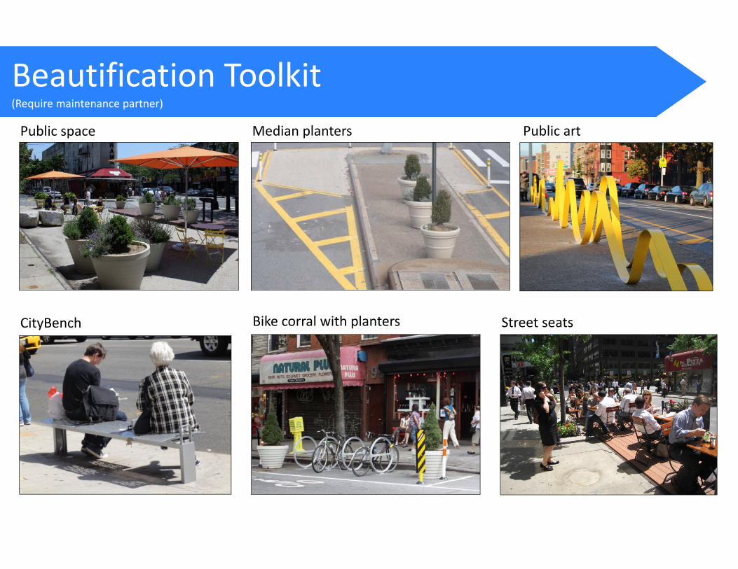
Beautification Toolkit(Require maintenance partner)
Public space
CityBench
Median planters
Bike corral with planters
Public art
Street seats

Map Exercise
Use the large map to identify locations where DOT should focus improvement efforts. Use the toolkits to guide your suggestions. Please be as specific as possible.
Brownsville/East New York, Brooklyn2014 community workshop
Jamaica Bay Greenway, Brooklyn2014 community workshop
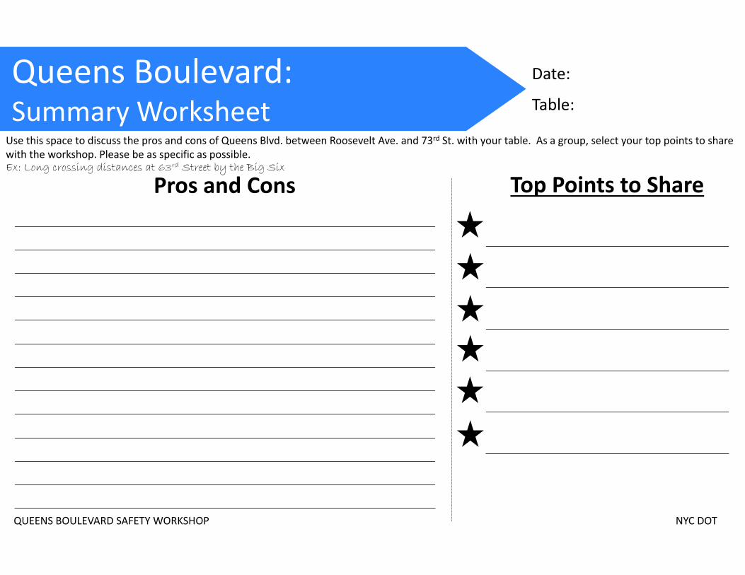
Queens Boulevard: Summary Worksheet
Pros and Cons Top Points to Share
Use this space to discuss the pros and cons of Queens Blvd. between Roosevelt Ave. and 73rd St. with your table. As a group, select your top points to share with the workshop. Please be as specific as possible.Ex: Long crossing distances at 63rd Street by the Big Six
Date:
Table:
QUEENS BOULEVARD SAFETY WORKSHOP NYC DOT