Embed Size (px)
Citation preview
QUANTIFICATION OF SUBMERGED SEAGRASS TOTAL ABOVEGROUND
BIOMASS FOR MALAYSIAN COASTAL WATERS USING REMOTE
SENSING DATA
SYARIFUDDIN BIN MISBARI
UNIVERSITI TEKNOLOGI MALAYSIA
QUANTIFICATION OF SUBMERGED SEAGRASS TOTAL ABOVEGROUND
BIOMASS FOR MALAYSIAN COASTAL WATERS USING REMOTE
SENSING DATA
SYARIFUDDIN BIN MISBARI
A thesis submitted in fulfilment of the
requirements for the award of the degree of
Doctor of Philosophy (Remote Sensing)
Faculty of Geoinformation and Real Estate
Universiti Teknologi Malaysia
FEBRUARY 2017
iii
ACKNOWLEDGEMENT
I am so grateful to Allah S.W.T for His mercy and for constantly grant me
the bravery and patience to solve all the problems during this period. I am honored to
present this thesis as a gift to the people that continuously expressed their support
and encouraged me to do my best in completing this thesis.
Special thanks to my father, Mr.Misbari Bin Danaem, my mother, Mrs.
Juhanah Binti Syafie. Thank you for every bit of your prayers and encouragement. I
am so motivated because of your prayers and supports. Thank you to my younger
brothers, Salihuddin Bin Misbari and Misrudi Bin Misbari for being patient and
always supporting me. Thank you also to my relatives for their great supports.
Thank you so much to my supervisor, Professor Sr. Dr. Mazlan Hashim for
the good guidance and moral support. Thank you to my lecturers including Dr.
Teruhisa Komatsu from University of Tokyo, Japan and Mr. Samsudin Ahmad, my
special friend, seniors including Nurul Nadiah and Norin Nazira, my Japanese’s
friends, Shuhei Ito and Ayaka Morimoto from Tokyo Metropolitan University for
helping me during seagrass data collection at Merambong area and Tinggi Island, my
juniors and my fellow friends for their kindness for helping me in accomplishing this
thesis. Thank you also for their prayers and motivation. Thank you very much.

iv
ABSTRACT
Multi-species of seagrass forms dense benthic communities in the coastal
clear (Case 1) and less clear water (Case 2) in Malaysia. There are two types of
seagrass, i.e. intertidal and submerged, which can easily be found in Malaysia.
Satellite remote sensing data is an effective tool to be used in many marine
applications, including monitoring seagrass distribution at large area coverage. The
emphasizes of this thesis is to determine the best two steps satellite-based approach
for mapping submerged seagrass and quantifying aboveground biomass at
Merambong area and Pulau Tinggi, Johor. Multi-platforms satellite data that has
different data specifications have been used at both Case 1 (water dominated by
phytoplankton) and Case 2 (water concentrated with water floating substances and
sediments). The satellite data used for Merambong are GeoEye-1, Worldview-2,
ALOS AVNIR-2, Landsat-8 OLI and Landsat-5 TM, while the satellite data for
Pulau Tinggi are Worldview-2, ALOS AVNIR-2, Landsat-8 OLI and Landsat-5 TM.
The robustness of seagrass detecting techniques, namely Depth Invariant Index (DII)
and Bottom Reflectance Index (BRI) on remotely sensed data at different water
clarity have been tested. Both techniques require measurement of radiance, deep-
water radiance and ratio of attenuation coefficients while BRI needs few additional
elements from nautical chart and tide calendar to attain information of the sea bottom
depth during satellite passes. Ground truth data has intensively been collected at both
study areas to validate and assess the finding of this study. Comparative assessment
and analysis between both techniques revealed that BRI is best to be used on
Landsat-8 OLI (93.2% user accuracy) in Case 2 water while (95.0% user accuracy)
in Case 1 water to identify submerged seagrass. An empirical model has been
developed to devise quantification of aboveground biomass and the temporal
changes by associating insitu seagrass coverage data with BRI value on the satellite
images. Submerged seagrass biomass quantification using remotely sensed data is
feasible in Case 2 water at required scale and accuracy (>80%), depending on the
field data sufficiency, technique and choice of satellite data. In conclusion, Landsat-
8 OLI with 16-bits quantization level produces more accurate results than
Worldview-2 and GeoEye-1. It is able to cover a large area of study, hence it is very
useful for spatio-temporal seagrass biomass monitoring project by local policy
makers and related agencies.
v
ABSTRAK
Rumput laut berbilang spesies membentuk komuniti padat hidupan bentos di
perairan pantai jernih (Kes 1) dan kurang jernih (Kes 2) di Malaysia. Terdapat dua
jenis rumput laut, iaitu separa tenggelam dan tenggelam sepenuhnya boleh dijumpai
di Malaysia. Data satelit penderiaan jauh adalah mekanisma yang efektif dalam
pelbagai aplikasi marin, termasuk pemantauan taburan rumput laut meliputi kawasan
yang luas. Tesis ini menekankan dua langkah terbaik berasaskan satelit bagi
pemetaan rumput laut tenggelam dan pengiraan biojisim atas tanah di kawasan
Merambong dan Pulau Tinggi, Johor. Beberapa data satelit yang berbeza
spesifikasinya telah digunakan untuk perairan Kes 1 (air didominasi dengan
fitoplankton) dan perairan Kes 2 (air berkepekatan tinggi dengan bahan terampai dan
sedimen). Data satelit yang digunakan di Merambong ialah GeoEye-1, Worldview-2,
ALOS AVNIR-2, Landsat-8 OLI dan Landsat-5 TM, manakala data satelit yang
digunakan di Pulau Tinggi ialah Worldview-2, ALOS AVNIR-2, Landsat-8 OLI dan
Landsat-5 TM. Keteguhan teknik pengesanan rumput laut iaitu indek kedalaman
tidak berubah (DII) dan indek pemantulan dasar (BRI) telah diuji ke atas data
penderiaan jauh dalam tahap kejernihan air yang berlainan. Kedua-dua teknik
memerlukan pengukuran nilai radian pembalikan sinar, radian air dalam dan nisbah
koefisien pengurangan cahaya dalam air, manakala BRI memerlukan beberapa
elemen tambahan daripada carta nautika dan kalendar pasang surut air bagi
mengetahui kedalaman dasar laut ketika satelit melintas. Data sebenar di lapangan
dikutip secara intensif di kedua-dua kawasan kajian bertujuan mengesahkan dan
menilai hasil kajian. Penilaian perbandingan dan analisa di antara kedua-dua teknik
menunjukkan bahawa BRI lebih baik digunakan ke atas data Landsat-8 OLI (93.2%
ketepatan pengguna) di kawasan perairan Kes 2 manakala (95.0% ketepatan
pengguna) di perairan Kes 1 bagi mengenal pasti rumput laut yang tenggelam
sepenuhnya. Sebuah model empirikal dibangunkan bagi pengiraan biojisim rumput
laut atas tanah dan perubahan berkala dengan menghubungkait litupan rumput laut di
lapangan dengan nilai BRI imej satelit. Pengiraan biojisim rumput laut tenggelam
sepenuhnya menggunakan imej penderiaan jauh adalah boleh dilaksanakan di
perairan Kes 2 pada skala yang dikehendaki dan ketepatan (>80%), bergantung
kepada kecukupan data lapangan, teknik dan pemilihan data satelit. Kesimpulannya,
Landsat-8 OLI yang mempunyai 16-bit tahap kuantisasi menghasilkan keputusan
yang lebih tepat berbanding Worldview-2 dan GeoEye-1. Ia berupaya merangkumi
kawasan kajian yang luas, maka ia sangat berguna bagi projek pemantauan berkala
biojisim rumput laut oleh penggubal polisi tempatan dan agensi-agensi berkaitan.
vi
TABLE OF CONTENTS
CHAPTER TITLE PAGE
DECLARATION ii
ACKNOWLEDGEMENT iii
ABSTRACT iv
ABSTRAK v
TABLE OF CONTENTS vi
LIST OF TABLES x
LIST OF FIGURES xiii
LIST OF ABBREVIATIONS xvii
LIST OF APPENDICES xx
1 INTRODUCTION 1
1.1 Background 1
1.2 Seagrass Total Aboveground Biomass (STAGB) 2
1.3 Problem Statement 5
1.4 Objectives of Study 7
1.5 Scope of Study 8
1.6 Significance of Study 10
1.7 Study Area 12
1.8 Structure of Thesis 16
2 SEAGRASS BIOMASS MAPPING 18
2.1 Introduction 18
2.2 Seagrass Ecosystem 19
2.3 Seagrass Detection Using Satellite Image 24
2.4 STAGB Quantification Using Insitu Method 26
2.5 Current Remote Sensing Techniques For STAGB
Quantification 30
vii
2.6 Strength and Constraint of STAGB Quantification Techniques 40
2.7 Spatial Resolution of Satellite Image and STAGB Changes 44
2.8 Gap Analysis of STAGB Quantification 46
2.9 Chapter Summary 50
3 METHODOLOGY 51
3.1 Introduction 51
3.2 General Flow Chart of Study 51
3.2.1 Flow Chart of Empirical-based STAGB
Quantification 53
3.3 Data Collection 54
3.3.1 Remote Sensing Satellite Data 55
3.3.2 Field Data Collection 59
3.4 Image Pre-processing 65
3.4.1 Subset Image 65
3.4.2 Geometric Correction 65
3.4.3 Atmospheric Correction and Image Masking 67
3.4.4 Sun Glint Removal 69
3.4.5 Radiometric Correction 70
3.5 Image processing 74
3.5.1 Ground Data Processing 74
3.5.2 Satellite Data Processing 77
3.5.3 Seagrass Biomass Mapping on Satellite Data 78
3.5.3.1 Empirical-based Method: Depth
Invariant Index (DII) 78
3.5.3.2 Bottom Reflectance Index (BRI) 80
3.5.4 Image Classification 84
3.5.5 Allometric Approach 85
3.5.6 Depth Influence on Submerged Seagrass
Detection 87
3.5.7 Difference Analysis for STAGB Changes 88
3.6 Post-processing and Final Output 90
3.7 Chapter Summary 92
viii
4 RESULTS: SUBMERGED SEAGRASS DETECTION
USING SATELLITE IMAGES 93
4.1 Introduction 93
4.2 Results of Image Pre-processing 94
4.2.1 Result of Subset Images 94
4.2.2 Results of Atmospheric Correction
and Image Masking 98
4.2.3 Result of Geometric Correction 102
4.2.4 Result of Sun Glint Removal 103
4.2.5 Results of DN to Radiance Conversion 109
4.3 Submerged Seagrass Distribution Using DII 112
4.4 Submerged Seagrass Distribution Using BRI 129
4.5 Chapter Summary 148
5 RESULTS: SUBMERGED SEAGRASS TOTAL
ABOVEGROUND BIOMASS AND ACCURACY
ASSESSMENT 149
5.1 Introduction 149
5.2 Submerged STAGB over Merambong Shoal and Tinggi Island
Using Empirical-based Quantification Approach 150
5.3 Allometric Approach of Submerged STAGB
Quantification Using Remote Sensing Data 158
5.4 Multi-temporal Data of Landsat Images on Seagrass
Changes at Strait of Johor 165
5.4.1 Merambong Seagrass Changes From 1989 to 2014 166
5.4.2 STAGB Changes From 2009 to 2013 in Merambong
Shoal 174
5.4.3 Submerged STAGB Changes over Tinggi Island 186
5.5 Multi-platform Satellites Data on Different Scales of
Submerged STAGB Quantification 192
5.6 Validation Using SONAR Measurement 193
5.7 Chapter Summary 196
6 CONCLUSION 197
6.1 Conclusion 197
6.2 Recommendations 199

ix
REFERENCES 200
Appendices A-C 214-216
x
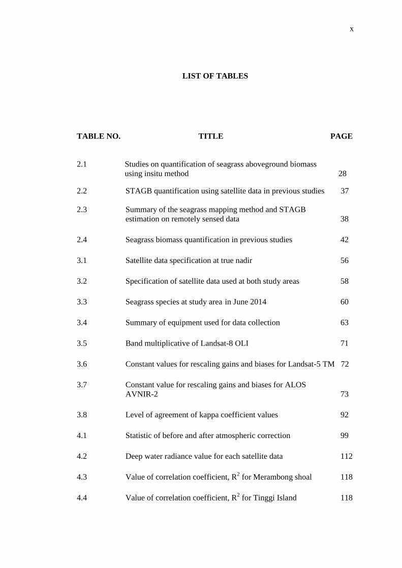
LIST OF TABLES
TABLE NO. TITLE PAGE
2.1 Studies on quantification of seagrass aboveground biomass
using insitu method 28
2.2 STAGB quantification using satellite data in previous studies 37
2.3 Summary of the seagrass mapping method and STAGB
estimation on remotely sensed data 38
2.4 Seagrass biomass quantification in previous studies 42
3.1 Satellite data specification at true nadir 56
3.2 Specification of satellite data used at both study areas 58
3.3 Seagrass species at study area in June 2014 60
3.4 Summary of equipment used for data collection 63
3.5 Band multiplicative of Landsat-8 OLI 71
3.6 Constant values for rescaling gains and biases for Landsat-5 TM 72
3.7 Constant value for rescaling gains and biases for ALOS
AVNIR-2 73
3.8 Level of agreement of kappa coefficient values 92
4.1 Statistic of before and after atmospheric correction 99
4.2 Deep water radiance value for each satellite data 112
4.3 Value of correlation coefficient, R2 for Merambong shoal 118
4.4 Value of correlation coefficient, R2 for Tinggi Island 118
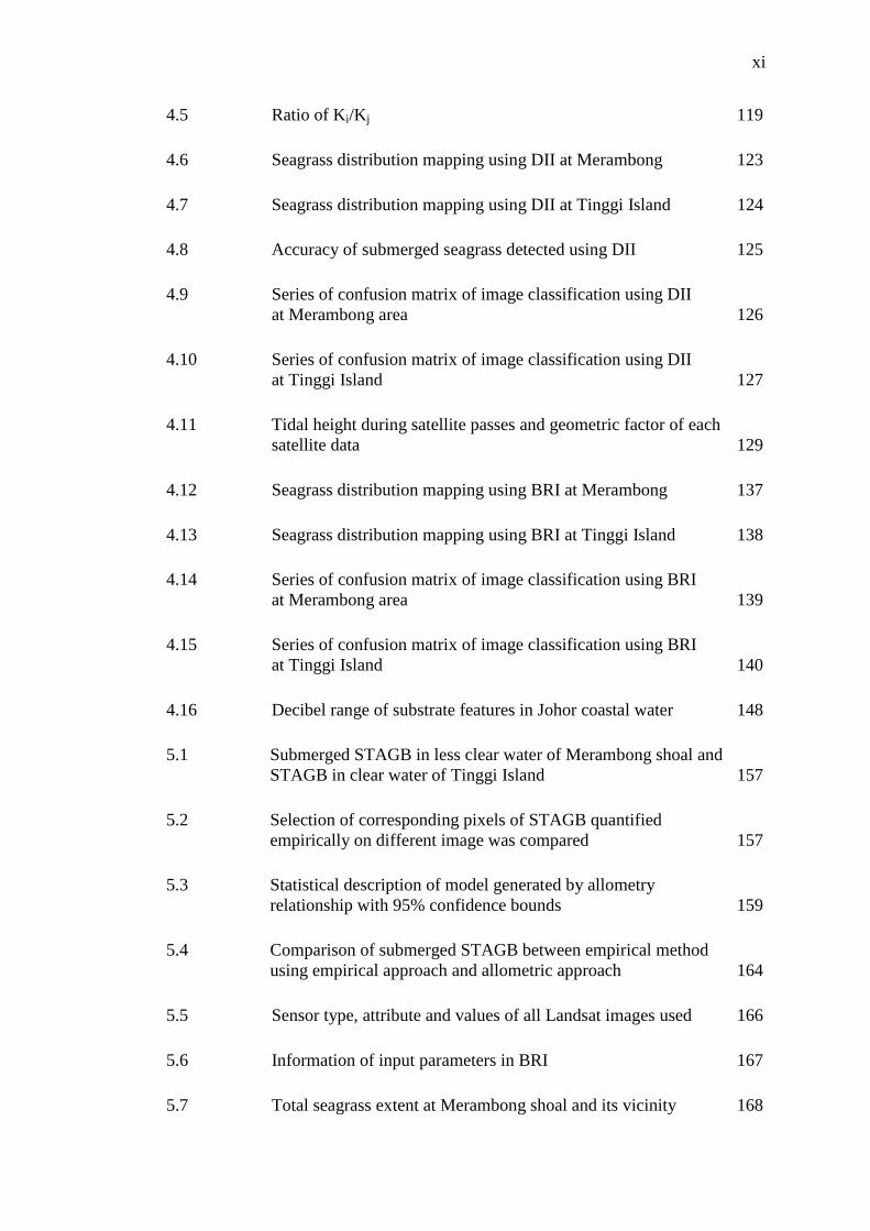
xi
4.5 Ratio of Ki/Kj 119
4.6 Seagrass distribution mapping using DII at Merambong 123
4.7 Seagrass distribution mapping using DII at Tinggi Island 124
4.8 Accuracy of submerged seagrass detected using DII 125
4.9 Series of confusion matrix of image classification using DII
at Merambong area 126
4.10 Series of confusion matrix of image classification using DII
at Tinggi Island 127
4.11 Tidal height during satellite passes and geometric factor of each
satellite data 129
4.12 Seagrass distribution mapping using BRI at Merambong 137
4.13 Seagrass distribution mapping using BRI at Tinggi Island 138
4.14 Series of confusion matrix of image classification using BRI
at Merambong area 139
4.15 Series of confusion matrix of image classification using BRI
at Tinggi Island 140
4.16 Decibel range of substrate features in Johor coastal water 148
5.1 Submerged STAGB in less clear water of Merambong shoal and
STAGB in clear water of Tinggi Island 157
5.2 Selection of corresponding pixels of STAGB quantified
empirically on different image was compared 157
5.3 Statistical description of model generated by allometry
relationship with 95% confidence bounds 159
5.4 Comparison of submerged STAGB between empirical method
using empirical approach and allometric approach 164
5.5 Sensor type, attribute and values of all Landsat images used 166
5.6 Information of input parameters in BRI 167
5.7 Total seagrass extent at Merambong shoal and its vicinity 168
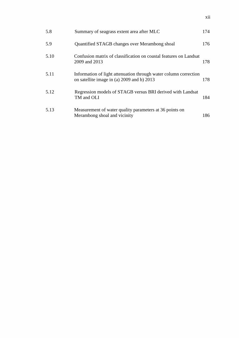
xii
5.8 Summary of seagrass extent area after MLC 174
5.9 Quantified STAGB changes over Merambong shoal 176
5.10 Confusion matrix of classification on coastal features on Landsat
2009 and 2013 178
5.11 Information of light attenuation through water column correction
on satellite image in (a) 2009 and b) 2013 178
5.12 Regression models of STAGB versus BRI derived with Landsat
TM and OLI 184
5.13 Measurement of water quality parameters at 36 points on
Merambong shoal and vicinity 186
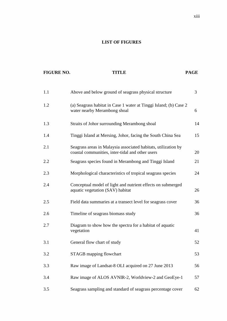
xiii
LIST OF FIGURES
FIGURE NO. TITLE PAGE
1.1 Above and below ground of seagrass physical structure 3
1.2 (a) Seagrass habitat in Case 1 water at Tinggi Island; (b) Case 2
water nearby Merambong shoal 6
1.3 Straits of Johor surrounding Merambong shoal 14
1.4 Tinggi Island at Mersing, Johor, facing the South China Sea 15
2.1 Seagrass areas in Malaysia associated habitats, utilization by
coastal communities, inter-tidal and other users 20
2.2 Seagrass species found in Merambong and Tinggi Island 21
2.3 Morphological characteristics of tropical seagrass species 24
2.4 Conceptual model of light and nutrient effects on submerged
aquatic vegetation (SAV) habitat 26
2.5 Field data summaries at a transect level for seagrass cover 36
2.6 Timeline of seagrass biomass study 36
2.7 Diagram to show how the spectra for a habitat of aquatic
vegetation 41
3.1 General flow chart of study 52
3.2 STAGB mapping flowchart 53
3.3 Raw image of Landsat-8 OLI acquired on 27 June 2013 56
3.4 Raw image of ALOS AVNIR-2, Worldview-2 and GeoEye-1 57
3.5 Seagrass sampling and standard of seagrass percentage cover 62
xiv
3.6 Sun glints on Geo-Eye-1 image 70
3.7 Enhalus acoroides and its leaf blades from one root 75
3.8 Measurement of seagrass physical characteristics 75
3.9 Tracking lines of data collection using SONAR 77
3.10 Processes of water column correction using DII 80
3.11 Sun and satellite zenith angles on air and water 82
3.12 FOV of satellite 83
3.13 Conceptual diagram of allometric approach 86
3.14 Conceptual diagram of seagrass at different depth information 88
3.15 Coastal area where seagrass meadow was found to be tested 91
4.1 Subset of satellite images at Merambong area 94
4.2 Subset of satellite images at Tinggi Island area 96
4.3 Visual appearance of band 1, band 2 and band 3 of both
Landsat-5 TM and Landsat-8 OLI 98
4.4 Masked images of Merambong area 99
4.5 Masked images of Tinggi Island area 101
4.6 Relationship of sun glint DN GeoEye-1 and visible bands 104
4.7 Sun-glint removal results for visible bands and all bands of
GeoEye-1 at Merambong 105
4.8 Sun-glint removal results for visible bands and (d) all bands of
Worldview-2 at Merambong 106
4.9 Result of sun glint removal for Tinggi Island on Worldview-2 107
4.10 DN of radiance conversion at Merambong area 109
4.11 DN of radiance conversion at Tinggi Island 111
xv
4.12 Scatter plot between transformed measured radiance, X values
from pair band in Merambong shoal 114
4.13 Scatter plot between transformed measured radiance, X values
from pair band in Tinggi Island 116
4.14 DII images of Merambong shoal and Tinggi Island 120
4.15 Computation of attenuation coefficient at Merambong shoal 130
4.16 Computation of attenuation coefficient at Tinggi Island 132
4.17 BRI of blue and red visible band at Merambong shoal 133
4.18 BRI of blue and red visible band at Tinggi Island 135
4.19 Overall accuracy of seagrass mapping at both study areas 141
4.20 Comparison of PA and UA of DII and BRI at Merambong
and Tinggi Island 143
4.23 Side-scan SONAR towing lines 146
5.1 Relationship between BRIb and STAGB at Merambong 151
5.2 Relationship between BRIb and STAGB at Tinggi Island 152
5.3 STAGB of Merambong shoal using Landsat-5 ETM+ image 153
5.4 STAGB of Tinggi Island using Landsat-5 ETM+ image 153
5.5 STAGB of Merambong shoal using Landsat-8 OLI image 154
5.6 STAGB of Tinggi Island using Landsat-8 OLI image 154
5.7 STAGB of Merambong shoal using ALOS-AVNIR 2 image 154
5.8 STAGB of Tinggi Island using ALOS-AVNIR 2 image 155
5.9 STAGB of Merambong shoal using Worldview-2 155
5.10 STAGB of Tinggi Island using Worldview-2 image 156
5.11 STAGB of Merambong shoal using GeoEye-1 image 156
xvi
5.12 Seagrass coverage is indirectly proportional to BRI value 161
5.13 Raw scenes of Landsat TM and OLI from 1989 to 2014 166
5.14 Dynamic distribution of seagrass 1989-2014 in south Johor 167
5.15 Dynamic of submerged seagrass cover, focused on Merambong
shoal 168
5.16 Photos of devastating impact of adjacent reclamation area 172
5.17 Seagrass occurrence at Johor Straits in (a) 2009 and (b) 2013 175
5.18 STAGB changes on seagrass bed of Merambong shoal between
2009 and 2013 176
5.19 Collection of sea bottom features (non-seagrass) information 177
5.20 Typical scenes of Merambong mixed seagrass species during
submerged and exposed 180
5.21 BRI exponential relationships to various water depths in both
Landsat TM and OLI 182
5.22 BRI versus STAGB measured empirically from satellite image 183
5.23 Insitu seagrass biomass compared to satellite-based estimation 185
5.24 Submerged STAGB changes over Tinggi Island 187
5.25 Dissolved oxygen (in mg/L unit) at both study area 189
5.26 Water turbidity (in NTU unit) over Merambong are 189
5.27 Salinity (in ppt unit) at both study area 190
5.28 Sea temperature (in 0C unit) at both study area 191
5.29 Total dissolved solids (in g/L unit) at both study area 191
5.30 BRI-based seagrass coverage at Merambong shoal with SONAR
input 194
5.31 Location and frequency of dugong sighted by fishermen 196

xvii
LIST OF ABBREVIATIONS
ALI - Advanced Land Imager
ANOVA - Analysis of Variance
ASTER - Advance Satellite Thermal and Emission Spectroradiometer
AVNIR - Advanced Visible and Near Infrared band
BRI - Bottom Reflectance Index
CASI - Compact Airborne Spectrographic Imager
CC - Cloud Coverage
CDOM - Color Dissolved Organic Material
CV - Coefficient of Variance
DII - Depth Invariant Index
DN - Digital Number
DW - Dry Weight
ETM - Enhance Thematic Mapper
GCP - Ground Control Point
GIS - Geographical Information System
GPS - Global Positioning System
IPCC - International Policy of Climate Change
ISODATA - Iterative Self-Organizing Data Analysis Technique
IUCN - International United of Coastal and New Energy
LAI - Leaf Area Index
LED - Light Electronic Device
LULC - Land-use Land Cover
LULUCF - Land Use, Land-Use Change and Forestry

xviii
MLC - Maximum Likelihood Classifier
MODIS - Moderate Resolution Imaging Spectrometer
MSS - Multispectral Sensor
NDVI - Normalized Different Vegetation Index
NIR - Near Infrared
NOAA - Navigation Oceanographic and Atmospheric Agency
NTU - Nephelone Turbidity Unit
OLI - Observe Land Imager
PAN - Panchromatic
PCA - Principal Component Analysis
PTP - Port of Tanjung Pelepas
RAAN - Right Ascension of Ascending Node
RMSE - Root Mean Square Error
ROI - Region of Interest
SAMSON - Spectroscopic Aerial Mapping System On-board Navigation
SAR - Synthetic Aperture Radar
SE - Standard Error
SNR - Signal-to-Noise Ratio
SONAR - Sound and Navigation Ranging
SPM - Suspended Particle Matter
SOS - Save Our Seahorse
SPOT - Systeme Probatoire de I’Observation de la Terre
STAGB - Seagrass Total Aboveground Biomass
SST - Sea Surface Temperature
SWIR - Short Wave Infrared
TAGB - Total Aboveground Biomass
TDS - Total Dissolved Solids
xix
TIR - Thermal Infrared
TM - Thematic Mapper
TOA - Top of Atmosphere
UAV - Unmanned Aerial Vehicle
UN - United Nation
UNESCO - United Nation Environment,Science and Culture Organization
USD - United State Dollar
USGS - United State of Geographical Survey
WCMC - World Conservation Monitoring Centre
WGS - World Geographic System
WQI - Water Quality Index
WV-2 - Worldview-2
xx
LIST OF APPENDICES
APPENDIX TITLE PAGE
A Fieldwork sheet for ground truth data collection 214
B Biodiversity richness at seagrass bed 215
C Seagrass aboveground biomass (dry weight) 216
CHAPTER 1
INTRODUCTION
1.1 Background
Seagrass forms dense submerged vegetative communities in shallow water in
global coastal environment. Seagrasses are the only aquatic flowering plant that are
able to grow submerged in the marine environment (Den, 1970) from low to high
biomass content that needs to be quantified. At the present time, at least 60 species
(Green and Short, 2003) of submerged aquatic vegetation including seagrass,
macroalgae and microalgae were reported to exist in global coastal water.
Functioning as natural ecosystem engineers (Jones et al., 1998), seagrasses are
angiosperm aquatic plants that are vital for coastal environment. A number of
scientific reports state that seagrass meadows offer a diverse ecosystem services
(Unsworth, 2014; Short, 2011; Orth, 2006; Mumby; 1997) such as dampening of
flow, oxygenation of the water and sediments, help in maintaining water quality,
stabilization of the sediments from the land, provision of a nursery and spawning
grounds for numerous species and are a direct food resource for a number of species.
Globally, seagrass meadows can be found in most shallow on-shore areas
(den Hartog, 1970). They also provide nursery habitat for copious juvenile fish and
invertebrates, feeding grounds for endangered marine species like dugongs and sea
turtles and protection against coastal erosion (Nagelkerken et al., 2000; Costanza et
al., 1997; Bell and Pollard, 1989; Orth et al., 1984). However, natural and
2
anthropogenic disturbances are key factors of global seagrass declination (Green and
Short, 2003). Human activities and extreme natural disasters have significantly
increased water turbidity and nutrient concentrations thus degrading the seagrass
ecosystem (Yang and Yang, 2009). These are considered as being the primary cause
of seagrass losses (Duarte, 2002; Short and Echeverria, 1996). As seagrass adapts
well in coastal water, remote sensing satellite can be employed to monitor its
changes over large areas (Kirkman, 1996).
1.2 Seagrass Total Aboveground Biomass (STAGB)
Seagrass Total Aboveground Biomass (STAGB) is defined as the biomass of
seagrass body parts growing above the sea floor, excluding continuous and ramified
roots. According to the IPCC Good Practice Guidance for Land Use, Land-Use
Change and Forestry (LULUCF) in 2003, aboveground biomass is all living biomass
above the soil including stem, stump, branches, bark, seeds, and foliage. For this
purpose, the wet and dry weight of above part of multi-species seagrass is measured
in the laboratory before and after drying process using oven at a specific time and
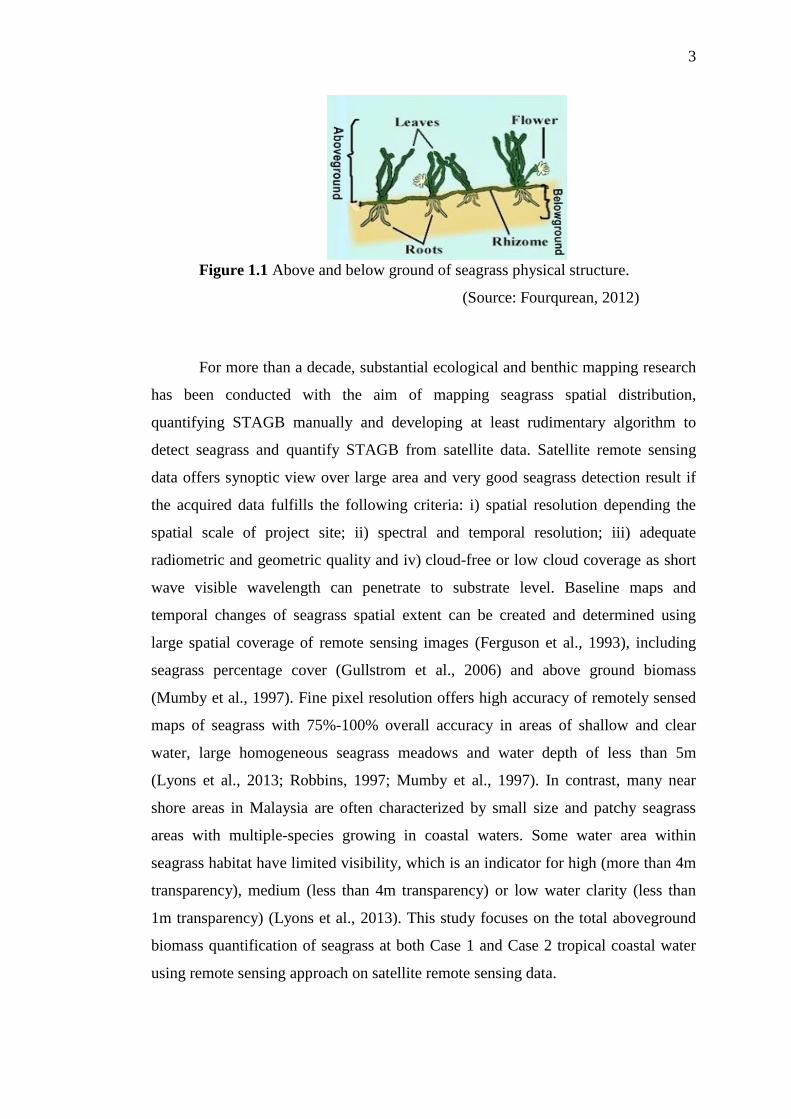
temperature. The physical seagrass structure is shown in Figure 1.1 to distinguish
below and above parts of seagrass in their natural habitats. Compared to intertidal
seagrass, the quantification of aboveground biomass of submerged seagrass remains
a challenge in remote sensing field. The loss of seagrass indicates the reduction of
total biomass of submerged aquatic vegetation that plays an important role to marine
species and coastal ecosystem. Seagrass biomass information is very valuable for
managing and appraising marine environment including ocean carbon, ocean
sedimentation, fisheries industry and sustainability of many ecosystems, since the
respond of seagrass to environmental alterations is quick.
3
Figure 1.1 Above and below ground of seagrass physical structure.
(Source: Fourqurean, 2012)
For more than a decade, substantial ecological and benthic mapping research
has been conducted with the aim of mapping seagrass spatial distribution,
quantifying STAGB manually and developing at least rudimentary algorithm to
detect seagrass and quantify STAGB from satellite data. Satellite remote sensing
data offers synoptic view over large area and very good seagrass detection result if
the acquired data fulfills the following criteria: i) spatial resolution depending the
spatial scale of project site; ii) spectral and temporal resolution; iii) adequate
radiometric and geometric quality and iv) cloud-free or low cloud coverage as short
wave visible wavelength can penetrate to substrate level. Baseline maps and
temporal changes of seagrass spatial extent can be created and determined using
large spatial coverage of remote sensing images (Ferguson et al., 1993), including
seagrass percentage cover (Gullstrom et al., 2006) and above ground biomass
(Mumby et al., 1997). Fine pixel resolution offers high accuracy of remotely sensed
maps of seagrass with 75%-100% overall accuracy in areas of shallow and clear
water, large homogeneous seagrass meadows and water depth of less than 5m
(Lyons et al., 2013; Robbins, 1997; Mumby et al., 1997). In contrast, many near
shore areas in Malaysia are often characterized by small size and patchy seagrass
areas with multiple-species growing in coastal waters. Some water area within
seagrass habitat have limited visibility, which is an indicator for high (more than 4m
transparency), medium (less than 4m transparency) or low water clarity (less than
1m transparency) (Lyons et al., 2013). This study focuses on the total aboveground
biomass quantification of seagrass at both Case 1 and Case 2 tropical coastal water
using remote sensing approach on satellite remote sensing data.
4
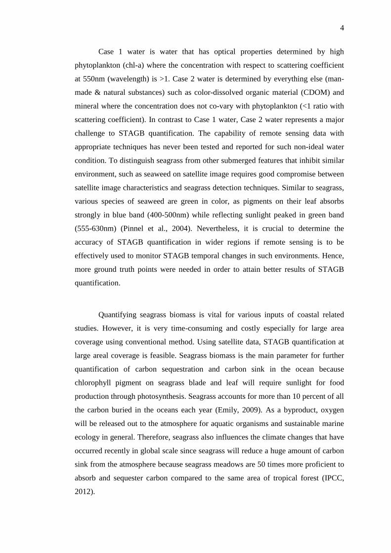
Case 1 water is water that has optical properties determined by high
phytoplankton (chl-a) where the concentration with respect to scattering coefficient
at 550nm (wavelength) is >1. Case 2 water is determined by everything else (man-
made & natural substances) such as color-dissolved organic material (CDOM) and
mineral where the concentration does not co-vary with phytoplankton (<1 ratio with
scattering coefficient). In contrast to Case 1 water, Case 2 water represents a major
challenge to STAGB quantification. The capability of remote sensing data with
appropriate techniques has never been tested and reported for such non-ideal water
condition. To distinguish seagrass from other submerged features that inhibit similar
environment, such as seaweed on satellite image requires good compromise between
satellite image characteristics and seagrass detection techniques. Similar to seagrass,
various species of seaweed are green in color, as pigments on their leaf absorbs
strongly in blue band (400-500nm) while reflecting sunlight peaked in green band
(555-630nm) (Pinnel et al., 2004). Nevertheless, it is crucial to determine the
accuracy of STAGB quantification in wider regions if remote sensing is to be
effectively used to monitor STAGB temporal changes in such environments. Hence,
more ground truth points were needed in order to attain better results of STAGB
quantification.
Quantifying seagrass biomass is vital for various inputs of coastal related
studies. However, it is very time-consuming and costly especially for large area
coverage using conventional method. Using satellite data, STAGB quantification at
large areal coverage is feasible. Seagrass biomass is the main parameter for further
quantification of carbon sequestration and carbon sink in the ocean because
chlorophyll pigment on seagrass blade and leaf will require sunlight for food
production through photosynthesis. Seagrass accounts for more than 10 percent of all
the carbon buried in the oceans each year (Emily, 2009). As a byproduct, oxygen
will be released out to the atmosphere for aquatic organisms and sustainable marine
ecology in general. Therefore, seagrass also influences the climate changes that have
occurred recently in global scale since seagrass will reduce a huge amount of carbon
sink from the atmosphere because seagrass meadows are 50 times more proficient to
absorb and sequester carbon compared to the same area of tropical forest (IPCC,
2012).

5
1.3 Problem Statement
Existing requirement of seagrass biomass quantification is very important
and estimations have been done in tropical and temperate seagrass habitat. However,
the previous work is limited to intertidal seagrass area in clear water only because
the destructive sampling of seagrass biomass was done during low tide and clear
water apparently enabling seagrass mapping using simple remote sensing approaches
such as image enhancement method and zonal analysis. Nevertheless, seagrass
occupies 0.1% of total ocean floor is expected to consist of more than 60%
submerged as opposed to intertidal (UNEP-WCMC, 2005). Hence, two gaps are
remained. Although satellite images have been used, the submerged seagrass has still
not been detected in less clear water. In addition, there is still no such attempt for
quantitative submerged STAGB in less clear water using water column correction
technique on satellite images.
One of the critical issues regarding submerged seagrass detection using
remote sensing approach is suitability of spatial resolution on different water clarity.
Lack of study emphasized the detection of submerged seagrass in less clear water for
large area, especially in Malaysia. Although seagrass is able to be detected using
established water column correction and mapping of its extent is frequently reported
in many studies, a method for submerged seagrass habitat in Case 2 coastal water
from satellite remote sensing data is not generated. As a result, the suitability of
satellite data characteristics for STAGB quantification for different scale and
accuracy has never been revealed. Satellite data ranging from medium (30m) to fine
resolution scale (less than 1 m) for seagrass is assessed to test the robustness of
detection techniques at different water case. Furthermore, limited number of study
has been conducted using digital satellite image as the main tool for STAGB
quantification. Empirical model on STAGB estimation in Malaysia from two water
column correction techniques, namely Depth Invariant Index (DII) and Bottom
Reflectance Index (BRI) on satellite images, has rarely been explored, thus are
intended to be assessed in this study. Moreover, evaluation of differences of STAGB
in clear and less clear water in synoptic scale is rarely reported, even in ground-
6
based approach. Thus, devastation of seagrass meadow in Malaysia at such scale has
not been assessed until now.
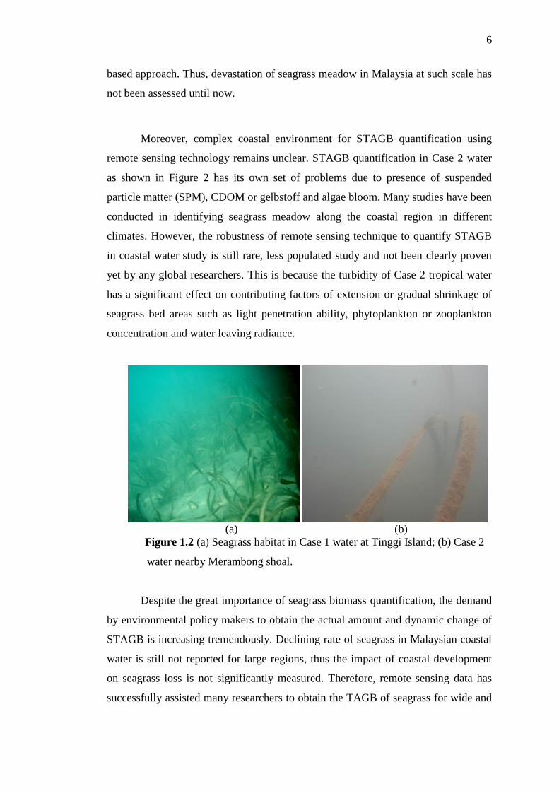
Moreover, complex coastal environment for STAGB quantification using
remote sensing technology remains unclear. STAGB quantification in Case 2 water
as shown in Figure 2 has its own set of problems due to presence of suspended
particle matter (SPM), CDOM or gelbstoff and algae bloom. Many studies have been
conducted in identifying seagrass meadow along the coastal region in different
climates. However, the robustness of remote sensing technique to quantify STAGB
in coastal water study is still rare, less populated study and not been clearly proven
yet by any global researchers. This is because the turbidity of Case 2 tropical water
has a significant effect on contributing factors of extension or gradual shrinkage of
seagrass bed areas such as light penetration ability, phytoplankton or zooplankton
concentration and water leaving radiance.
(a) (b)
Figure 1.2 (a) Seagrass habitat in Case 1 water at Tinggi Island; (b) Case 2
water nearby Merambong shoal.
Despite the great importance of seagrass biomass quantification, the demand
by environmental policy makers to obtain the actual amount and dynamic change of
STAGB is increasing tremendously. Declining rate of seagrass in Malaysian coastal
water is still not reported for large regions, thus the impact of coastal development
on seagrass loss is not significantly measured. Therefore, remote sensing data has
successfully assisted many researchers to obtain the TAGB of seagrass for wide and
7
shorter time interval to avoid the high cost and time consumption. However, before
satellite data was intensively used, conventional methods that require harvesting of
seagrass from their habitat have been practiced widely. It is impractical to be
operationalized in a long-term practice.
The following are the main research question focused in this study:
i. What is the influence of medium to fine spatial resolution of satellite images
on the accuracy of submerged seagrass detection?
ii. Can STAGB be quantified in both Case 1 and Case 2 coastal waters using
remote sensing approach?
iii. How can the changes of STAGB be feasibly quantified using multi-temporal
remote sensing data?
These research questions are motivation for exploring the feasibility of various
specifications of remotely sensed data for submerged seagrass detection and STAGB
quantification in both clear and less clear water.
1.4 Objectives of Study
The main aim of the research is to map submerged seagrass using remote
sensing approach on multi-platforms of remotely sensed data and to quantify
submerged STAGB from satellite remote sensing image.
To ensure the research aim is successfully achieved, the specific objectives of
study are:
i. To examine and analyze satellite spatial resolution suitable for mapping
spatial distribution of submerged seagrass.
ii. To devise method for quantifying total aboveground biomass of seagrass in
Case 1 and Case 2 tropical coastal water using remote sensing.
8
iii. To devise spatio-temporal quantification of STAGB using satellite multi-
temporal image for detection of STAGB changes.
1.5 Scope of Study
The study has several scopes:
i) Subtidal seagrass habitat
Submerged seagrass specifically referred to seagrass grows under the water
that is not exposed in any time even in the lowest low tide in the area and such area
is called subtidal area. This means that the detection must compensate for water
column correction model as it is not exposed. Using satellite-based approach, not
only are continuous dense seagrass meadow but also, patchy seagrass was
considered in STAGB quantification since water column correction model will
correct water column effect on all satellite data. The compensation for water column
correction is based on DII and BRI as both models set the mathematical solution in
detecting submerged seagrass and STAGB. This is the main gap in remote sensing
that has not been reported quantitatively for submerged STAGB in less clear water.
ii) Suitability of spatial resolution of satellite images
In this study, satellite image of medium to fine spatial resolution of optical
passive satellite sensor that consist of Landsat-5 TM, Landsat-8 OLI , ALOS
AVNIR-2, Worldview-2 and GeoEye-1are used for submerged STAGB
quantification. All these digital images have unique specifications in terms of spatial
resolution, spectral resolution, radiometric resolution and temporal resolution, which
provide a comparative result at different spatial scale. This information is described
in detail in Chapter 3. All these images were selected because the suitability of
different spatial resolution and other characteristics for submerged seagrass detection
was assessed by confusion matrix. The focus is to determine the best spatial
resolution to enable STAGB quantification at large or small spatial scale. Low
9
spatial resolution images such as MODIS (250m-1km), NOAA series (1km) and
SeaWIFS (1km) are not fit in this study to quantify such small seagrass features from
space since very large pixel size tends to underestimate seagrass presence compared
to homogeneity properties shown by non-seagrass features, causing pixel
misclassification. Close-range remote sensing such as SONAR is only used as a
supporting data in validation process because it is collected from ground level that
has more accurate measurement than satellite view.
iii) Water column correction model
Water column correction models, namely BRI and DII model for STAGB
quantification, are important in this study. Both established models were selected
because both are effective to be used in correcting water column effect for
submerged seagrass detection in any levels of water clarity, but must have good
compensation with depth. Determination of most suited model for seagrass detection
on different spatial resolution was done through statistical inference. The focus of
this approach is to generate STAGB quantification empirically from the detected
spot of submerged seagrass. In this study, the method is newly introduced since no
such attempt has been made to quantify TAGB for submerged seagrass in less clear
water. All the results are validated using ground truth points at both study areas and
statistical justification including overall accuracy, kappa statistic, user accuracy,
determination coefficient (R2), root mean square error (RMSE); is provided to assess
the accuracy of seagrass detection and submerged STAGB quantification.
iv) Mixed-species seagrass biomass quantification
In this study, although seagrass occurrence may consist of more than one
species, all the species are termed as seagrass. The quantification of STAGB is not
specific to a particular species since the tropical coastal water has high richness of
seagrass species and only multispectral satellite images were used in this study. In
order to differentiate seagrass species, it is out of scope of this study as we do not
use narrowband satellite data such as hyperspectral images such as ALI Hyperion
that enable such differentiation of species. It is not used in this study because the
10
technique is only tested on particular visible band on multispectral satellite images
and hyperspectral image is difficult to obtain with low cloud coverage at these areas.
In this study, there is an assumption that the biomass quantify at the ground for small
seagrass species is relatively uniform. Only Enhalus acoroides shows significant
difference in physical structure among seagrass species in terms of the long leaf
blades. For ground based measurement, only one standard guideline sampling
designed by McKenzie and Campbell (2002) which also practiced by Save Our
Seahorse (SOS) organization is used in recoding the percentage of seagrass coverage
within a designed quadrat during ground data collection at study site. This is
described in more detail in Chapter 3. SOS is a periodic three-day environmental
program organized by local environmentalist conducted on Merambong shoal to
increase the awareness of public community like school students to save seahorses
that live on seagrass meadow.
v) Only seagrass aboveground biomass
Only the morphological structure of above sea floor seagrass, including
leaves, shoots, stem, and branch are considered to be quantified using satellite
remote sensing image although roots and rhizome of certain species of seagrass have
higher biomass content. Allometric quantification approach would consider
biological physical structure of different species of seagrass. The quantification
would be derived by voxel-based technique. Below part of the seagrass body
structure is not considered for biomass quantification.
1.6 Significance of Study
Sustainability of coastal would support security of fishing resources in order
to safeguard protein source and food security of the world. In order to do that,
coastal conservation has been emphasized and this is within the millennium goal of
Unite Nation (UN) where each country including Malaysia rectifies some authority
management for coastal conservation. At global scale, seagrass biomass information
11
is crucial in managing ocean productivity and mitigating unpredicted natural hazards
due to climate change. Seagrass is very important in economy and ecology, similar
to forest and coral reefs. A recent study estimated the annual economic value of
seagrass bed is at US$19 000 per hectare (Unsworth and Cullen, 2013). Malaysia is
well known for their mega-diversity of flora and fauna in coastal environment,
including frequent sightings of dugong at the Straits of Johor because seagrass is
their primary food source.
At regional scale, this study provides information of submerged seagrass in
Malaysia to be integrated with information of another country in south-east Asia
since this region has high number of seagrass species. To ensure coastal area is ideal
for seagrass habitat, Malaysia takes many initiatives to improve such as gazette
Marine Park, commercial fishery activities and policy managed and regulated by
government agencies such as Department of Environment, continuity of fish
resources and food security of the country. One of the main sources of blue carbon is
seagrass biomass since seagrass requires a sufficient amount of light to synthesize
food through photosynthesis by consuming carbon dioxide. Biomass is the
absorption and accumulation of carbon into organic matter and is 50% contributed
by carbon (Brown et al., 1997). At local scale, this study is benefited to related
government agency, local authorities, fishery departments and research institutes to
plan for conservation and restoration of seagrass habitat sustainability. The
capability of receiving an average of 12 hours of intense sunlight a day serves great
potential of plant biomass energy, carbon sequestration and carbon sink information
to be explored, especially to cope with the problem of global warming and weak
ecosystem sustainability in this country. Therefore, in desiring to create remarkable
contribution in this field of knowledge, this study is purposely conducted to
introduce new approach of STAGB quantification techniques for Case 1 and Case 2
water using satellite data where it is the novelty of this study.
Under National Environmental Act 1974, Malaysia is intended to reduce
carbon emission in 2020 by 40%. Using remote sensing approach, this study
provides a better approach to achieve the mission by quantification of submerged
STAGB in any level of water clarity with implementation of remote sensing
12
knowledge to avoid massive destructive sampling of their natural habitat. In fact, this
study help to cut the cost and shorten the time required to quantify seagrass biomass
while concurrently preserving their presence in nature. Through this study, a report
based on the STAGB and seagrass extent trend of changes over few years for both
seagrass habitat at different water clarity is written to confirm the coastal health
status. This report will help marine agency to analyse the impact of vast coastal
development and mitigate plans for conservation and preservation of seagrass habitat
for fisheries, stabilize water clarity and sustain the ecological marine of nearby
coastline and its vicinity.
In addition, this study provides suggestions related to STAGB sampling and
technical operation on various resolutions of remote sensing data to yield the best
reliable approaches for STAGB quantification using remotely sensed data. This
study also served to enable people without prior knowledge of seagrass to obtain
better understanding and information of the importance of seagrass in marine
ecology and coastal environment sustainability. This study helps to inform people
how critical the marine ecology is due to the sharp reduction of the extent of seagrass
and STAGB in the present situation because seagrass is very important in reducing
the excessive carbon dioxide in the atmosphere. Thus, quantification of STAGB
leads in assisting the action of controlling the tremendous impact of global warming
phenomenon by releasing more oxygen to the atmosphere through seagrass blade
and leaf. Moreover, this study is expected to raise peoples' awareness of seagrass
habitat conservation and coastal ecosystem in the long term by taking effective
actions as suggested by the international and local expertise.
1.7 Study Area
Merambong shoal is located Northeast of Merambong Island, one of the most
significant natural marine frontiers between Malaysia and Singapore as shown in
Figure 1.3. It is 1.8 km from north to south and up to 200 m from east to west
located in the Straits of Johor, Malaysia, situated at latitude of 01o
19.979’ North and
13
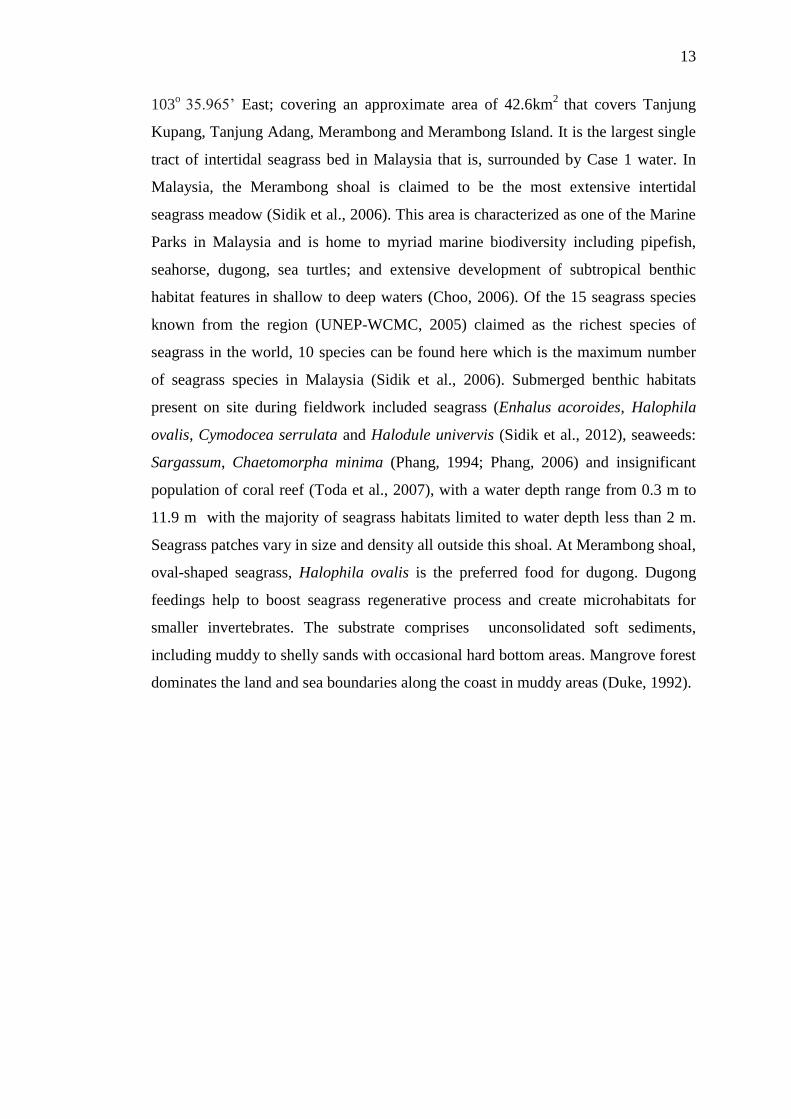
103o 35.965’ East; covering an approximate area of 42.6km
2 that covers Tanjung
Kupang, Tanjung Adang, Merambong and Merambong Island. It is the largest single
tract of intertidal seagrass bed in Malaysia that is, surrounded by Case 1 water. In
Malaysia, the Merambong shoal is claimed to be the most extensive intertidal
seagrass meadow (Sidik et al., 2006). This area is characterized as one of the Marine
Parks in Malaysia and is home to myriad marine biodiversity including pipefish,
seahorse, dugong, sea turtles; and extensive development of subtropical benthic
habitat features in shallow to deep waters (Choo, 2006). Of the 15 seagrass species
known from the region (UNEP-WCMC, 2005) claimed as the richest species of
seagrass in the world, 10 species can be found here which is the maximum number
of seagrass species in Malaysia (Sidik et al., 2006). Submerged benthic habitats
present on site during fieldwork included seagrass (Enhalus acoroides, Halophila
ovalis, Cymodocea serrulata and Halodule univervis (Sidik et al., 2012), seaweeds:
Sargassum, Chaetomorpha minima (Phang, 1994; Phang, 2006) and insignificant
population of coral reef (Toda et al., 2007), with a water depth range from 0.3 m to
11.9 m with the majority of seagrass habitats limited to water depth less than 2 m.
Seagrass patches vary in size and density all outside this shoal. At Merambong shoal,
oval-shaped seagrass, Halophila ovalis is the preferred food for dugong. Dugong
feedings help to boost seagrass regenerative process and create microhabitats for
smaller invertebrates. The substrate comprises unconsolidated soft sediments,
including muddy to shelly sands with occasional hard bottom areas. Mangrove forest
dominates the land and sea boundaries along the coast in muddy areas (Duke, 1992).
14
Figure 1.3 Straits of Johor surrounding Merambong shoal. Depth (blue line) is in
meter.
Tanjung Piai and Pulai River were gazetted as a Ramsar site in 2003 and
recognized as a Wetland of International Importance while Merambong shoal and
Merambong Island are unprotected and vulnerable to the incessant development
looming nearby. The water temperature remains 28oC to 29
oC throughout the year
with moderate water clarity, typical for an area with hectic coastal urbanization, busy
shipping lanes of Tanjung Pelepas Port and sand dredging activity. It is intensively
used for many scientific research activities. In addition, coastal development,
including large port area, power plant project, vast development on the opposite site
of Singapore and man-made island called ‘Banker Island’ are very close to
Merambong shoal. Threats from human activities such as sand mining, oil pollution,
transportation avenues and land reclamation for port facilities have destroyed most
of these habitats (Sidik et al., 2006).
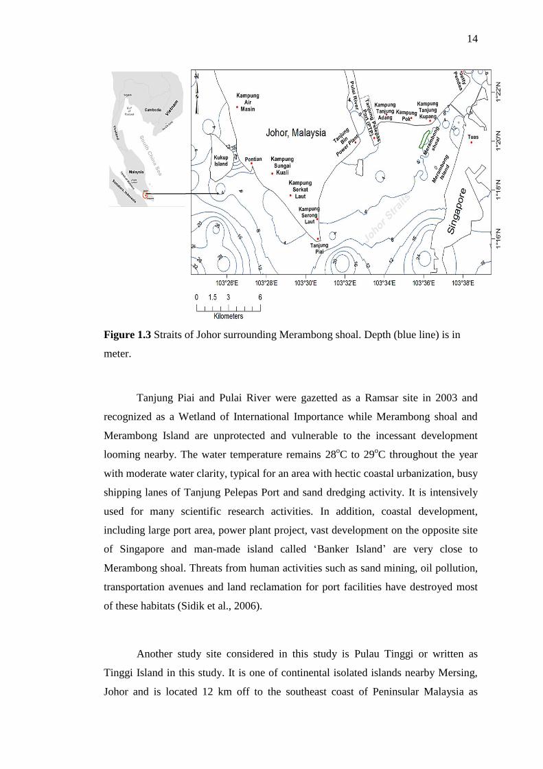
Another study site considered in this study is Pulau Tinggi or written as
Tinggi Island in this study. It is one of continental isolated islands nearby Mersing,
Johor and is located 12 km off to the southeast coast of Peninsular Malaysia as
15
shown in Figure 1.4. Submerged features such as seagrass, coral reefs, seaweed and
aquatic life are easily observed visually in shallow waters of less than 8 m since the
water is very clear, categorized as Case 1 water where chlorophyll-a is dominant
element in the water, with less sediment and dissolved material. Relatively, Tinggi
Island water is deeper than Merambong Island as the subtidal seagrass habitat can be
found as deep as 40 m. Only 5 to 7 seagrass species namely Thalassia hempirichii,
Cymodocea rotundata, Syringodium isoetifolium, Halophila ovalis and Cymodocea
serrulata, can be found here, which is less than the number of seagrass species that
can be found at Merambong area. Seagrass patches around this area have various
size. Compared to Merambong, many coral reefs can easily be found here especially
at northern part of the island and along the white sandy area. In 1994, the Malaysian
government gazetted Tinggi Island and a few adjacent continental islands as Marine
Park under Fisheries Act 1985 (Amended, 1993). Hence, no significant and intensive
construction work could be seen here which further leads to preservation of natural
marine ecology including seagrass meadow and its density. This study site is
important as a comparative site to Merambong area to analyse their differences and
similarities in terms of capability of remote sensing knowledge for seagrass
distribution and STAGB quantification in both Case 1 and Case 2 water.
Figure 1.4 Tinggi Island at Mersing, Johor, facing the South China Sea.

16
1.8 Structure of Thesis
This thesis encompasses six chapters. Chapter 1 presents the main issue of
seagrass aboveground biomass, a background explanation of the topic of study,
objectives, scope, significant contribution and a succinct methodology of this study.
In addition, this section gives a general illustration of what the study is all about and
specifically explains the reason why this study should be conducted which is to
contribute new knowledge and ideas to the related field especially for shallow
substrate, in the context of remote sensing for seagrass aboveground biomass study
in tropical region. Hence, this section effectively introduces seagrass aboveground
biomass quantification using remotely sensed data as the main topic and specific
mission of the study that needs to be accomplished.
Chapter 2 focused on summarization of a detailed description of background
information on the research topic, including basic concepts of seagrass biomass
study in relation to remote sensing data and conventional method, significant
components of the study, previous studies and the expansion of related fields in
global scale, ranging from ground-based techniques to satellite data utilization by
existing techniques to be implemented. The strength and drawbacks of the current
techniques in previous studies are also discussed in Chapter 2.
The research methodology and all the data involved in the study is
structurally emphasized in detail in Chapter 3. The technique selected is described
briefly and the sequence of utilization of remote sensing data for the research is
explained in detail from pre-processing, processing and post processing stages.
The findings and results after the implementation of the methodology and
selected data for this study will be displayed and discussed in Chapter 4 and Chapter
5. Quantitative and descriptive analysis is carried out thoroughly to justify and

17
provide a better understanding of the correlation between result presentations with
the objectives of the research as mentioned earlier in the thesis.
In Chapter 6, the summary and conclusion of the research are examined and
recommendation for future research is briefly suggested. Appendix pages show the
field sheet of this study, dry biomass measurement and marine biodiversity that
found in study area.
REFERENCES
Armstrong, R.A (1993). Remote Sensing of Submerged Vegetation Canopies For
Biomass Estimation. International Journal of Remote Sensing, 14, 621-627.
Andrew, W. S., Jessica, R. L., David, P. F., and Guy G. (2008). Evaluation of a
Single-Beam Sonar System to Map Seagrass at Two Sites in Northern Puget
Sound, Washington. Scientific Investigations Report 2008-2009, U.S.
Geological Survey, Virginia.
Asaeda, T., Trung V.K., Manatunge, J. and Truong V.B. (2001), Modeling
Macrophyte–nutrient–phytoplankton Interactions in Shallow Eutrophic Lakes
and The Evaluation of Environmental Impacts, Ecological Engineering, 16
(3), 341-357.
Bach, S. S. (1998) Species Composition and Plant Performance of Mixed Seagrass
Beds Along A Siltation Gradient at Cape Bolinao, The Philippines, Marine
Ecology Progress Series, 174, 247-356.
Barille, L., Robin,M., Harin,N., Bargain,A. and Launeau,P. (2010) Increase In
Seagrass Distribution at Bourgneuf Bay (France) Detected by Spatial Remote
Sensing. Aquatic Botany, 92, 185-194.
Bell, J., Fonseca, M.S. and Stafford N.B.(2006). Seagrass Ecology: New
Contributions From A Landscape Perspective, Seagrasses: Biology, Ecology
and Conservation, 625-645.
Bell, S.S., and Pollard R.A. (1989) Faunal Response to Fragmentation in Seagrass
Habitats: Implications For Seagrass Conservation. Biology Conservation,
100, 115-123.
Boer, K. E., Fong, A. R. Armitage and Cohen, R. A. (2000). Elevated Nutrient
Content of Tropical MacroalgaeIncreases Rates of Herbivory In Coral,
Seagrass, and Mangrove Habitats. Coral Reefs, 20, 530-538.
Borum, J., Duarte, C.M., Krause-Jensen and Tina M. G. (2004). European
Seagrasses: An Introduction to Monitoring and Management. EU Project
Monitoring and Managing of European Seagrasses (M&MS), 7, 281-310.
202
Brinkman, A. G., Philippart C.J.M. and Holtrop G., 1994, Mesocosms and
Ecosystem Modeling, Vie et Milieu, 44, 29-37.
Brown, S., A.J.R., Lugo (1997). Estimating Biomass and Biomass Change of
Tropical Forests. FAO Forestry Paper, 134. Rome, FAO.
Campbell, S. (2006). Journal of Experimental Marine Biology and Ecology, 330,
455-468.
Campbell, S., Miller, C., Steven, A., Stephens, A. (2003). Photosynthetic Responses
of Two Temperate Seagrass Across A Water Quality Gradient Using
Chlorophyll Fluorescence. Journal of Experimental Marine Biological and
Ecology, 291, 57-78.
Carlo, G. and Kenworthy, W.J. (2008). Evaluation of Aboveground and
Belowground Biomass Recovery in Physically Disturbed Seagrass
Beds.Oecologia,158, 285-298.
Chander, G., Markham B. and Barsi J. (2007). Revised Landsat-5 Thematic Mapper
Radiometric Calibration. IEEE Geoscience and Remote Sensing Letters, 4(3),
208-220.
Chesapeake Bay Program (2000).Chesapeake Bay Submerged Aquatic Vegetation
Water Quality and Habitat Based Requirements and Restoration Targets, A
Second Technical Synthesis. Australia.
Cho, H.J. (2007). Depth‐variant Spectral Characteristics of Submersed Aquatic
Vegetation Detected by Landsat 7 ETM+, International Journal of Remote
Sensing, 28 (7), 1455-1467.
Choo, C.K. (2006). SOS Volunteer Handbook (1st ed.) Kuala Terengganu, Malaysia:
Department of Marine Science, University of Science and Technology
Malaysia (KUSTEM).
Coen, L.D. (1995). A Review of The Potential Impacts Of Mechanical Harvesting
On Subtidal and Intertidal Shellfish Resources. Marine Resources Research
Institute Report, Department of Natural Resources, Charleston, 23, 172.
Costanza, R., d'Arge, R., de Groot, R., Farber, S., Grasso, M., Hannon, B., Limburg,
K., Naeem, S., O'Neill, R.V., Paruelo, J., Raskin, R.G., Sutton, P., and den
Belt, M., (1997). The Value of The World's Ecosystem Services and Natural
Capital. Nature, 387, 253-260.

203
Deepak, R. M., Narumalani S., Rundquist D., Merlin, L. and Perk R. (2006).
Enhancing The Detection and Classification of Coral Reef and Associated
Benthic Habitats: A Hyperspectral Remote Sensing Approach. Journal of
Geophysical Research, 112, 319-432.
Dennison, W. C., G. J. Marshall, And C. Wigand. (1989). Effect Of ‘‘Brown Tide’’
Shading on Eelgrass (Zostera marina) Distribution. Coastal and Estuarine
Studies, 1, 675-692.
Dekker, A., Brando V.E., andAnstee J.M (2005), Retrospective Seagrass Change
Detection in A Shallow Coastal Tidal Australian Lake. Remote Sensing of
Environment, 97, 415-433.
Den, Hartog. (1970). The Seagrasses of the World. North-Holland, Amsterdam,
Netherland, 176.
Digital Globe (2010).Worldview-2 Imagery Products: Product Guide. Digital
GlobeTM
, Inc., Longmont, Colorado.
Downing, J. A. and Anderson, M. R. (1985). Estimating the Standing Biomass of
Aquatic Macrophytes. Canada Journal of Fish Aquatic Science, 42, 1860-
1869.
Duarte, C.M. and Kirkman, H. (2001).Methods For the Measurement of Seagrass
Abundance and Depth Distribution. Global seagrass research methods,
Short, F. and Coles, R. (Eds.) Elsevier Science BV, Amsterdam.
Duarte, C.M. (2002). The Future of Seagrass Meadows. Environment Conservation,
29, 192-206.
Duarte, C. M. (1991). Allometric Scaling of Seagrass Form and Productivity. Marine
Ecology Progress Series, 77, 289-300.
Duke, N.C. (1992). Mangrove Floristics and Biogeography. In: Tropical Man-grove
Ecosystems, Robertson, A.I. and Alongi, D.M. (eds.), American Geophysical
Union, Washington, D.C. (USA), 63-100.
Echavarria, H. H., Lee, K.S., Solana E., Franco E. (2009), Formal Analysis and
Evaluation of Allometric Methods For Estimating Aboveground Biomass of
Eelgrass. Annals of Applied Biology, 159, 503-515.
204
Edwards, A. J., Mumby P. J., Green E. P. and Clark C. D. (1999). Lesson 6:
Mapping the Major Inshore Marine Habitats of the Caicos Bank by
Multispectral Classification using Landsat TM. In Edwards A. J.
Applications of Satellite and Airborne Image Data to Coastal Management.
137-150.
Elkalay, K., Constantin F., Nikos S., Anne G., Sylvie G., Gilles L., Jean-Henri H.
(2003). A Model of The Seasonal Dynamics of Biomass and Production of
The Seagrass Posidonia Oceanica In The Bay of Calvi. Ecological
Modelling, 167, 1-18.
Emily, P. (2009). Carbon Sequestration by Coastal Marine Habitats: Important
Missing Sinks. The Management of Natural Coastal Carbon Sinks. New
York.
Fonseca, M.S., Kenworthy,W.J., Griffith,E., Hall,M.O., Finkbeiner,M. and Bell,
S.S. (2008) Factors Influencing Landscape Pattern of the Seagrass Halophila
decipiens in An Oceanic Setting. Estuary Coastal Shelf Science, 76, 163–
174.
Fourqurean, J.W and Zieman, J.C. (2012).Photosynthesis, Respiration and Whole
Plant Carbon Budget of the seagrass Thalassiatestudinum.Marine Ecology
Program, 69, 161-170.
Fourqurean, J. W., Duarte, C. M., Kennedy, H., Marba, N. and Holmer, M. (2012).
Seagrass Ecosystems As A Globally Significant Carbon Stock. Nature
Geoscience, 5 (7), 505-509.
Fourqurean, W. (2009, 2th
May). Seagrass Ecosystems as A Globally Significant
Carbon Stock, British Daily Mail, 12.
Ferguson, R.L., Wood, L.L., and Graham, D.B. (1993) Monitoring Spatial Change in
Seagrass Habitat with Aerial Photography. Photogrammetry Engineering and
Remote Sensing, 59, 1033-1038.
Giuseppe, D.C. and Kenworthy W.J. (2008).Evaluation of Aboveground and
Belowground Biomass Recovery in Physically Disturbed Seagrass Beds.
Oecologia, 158, 285-298.
Gordon, H.R.; Clark, D.K. (1994). Clear Water Radiances For Atmospheric
Correction of Coastal Zone Color Scanner Imagery. Application of Optical
Sensor, 20, 4175-4180.
205
Green, E., Mumby, J., Alasdair, E., Clark, C. (2000).The Acquisition, Correction and
Calibration of Remotely Sensed Data. Remote Sensing Handbook for
Tropical Coastal Management, 89-105, New York, Unesco Publishing.
Green, E. P.and Short, F.T. (2003).World Atlas of Seagrasses. University of
California Press, Berkeley, California.
Gullstrom, M., Lunden, B., Bodin, M., Kangwe, J., Ohman, M.C., Mtolera, M.S.P.
and Bjork, M. (2006). Assessment of Changes in The Seagrass dominated
Submerged Vegetation of Tropical Chwaka Bay (Zanzibar) Using Satellite
Remote Sensing. Estuarine Coastal and Shelf Science, 67 (3), 399-408.
Hamburg, S. P. and Homann, P. S. (1986). Utilization of Growth Parameters of
Eelgrass, Zostera marina, for Productivity Estimates under Laboratory and
Insitu Conditions. Marine Biology, 93 (2), 299-303.
Harris, L. A., Duarte C. M. and S. W. Nixon (2006). Allometric Laws and Prediction
in Estuarine and Coastal Ecology. Estuaries and Coasts, 29 (2), 2006, 340-
344.
Hashim, M., Yahya, N.N., Misbari, S. (2014). New Algorithm For Seagrass Biomass
Estimation, Proceedings of 34th Asian Conference on Remote Sensing, 22-
24, October 2013, Indonesia.
Hashim, M., Rahman, A. R.,Mazlani, M. and Rasib, A. W. (2001). Spectral
Characteristics of Seagrass With Landsat TM in Northern Sabah Coastline,
Malaysia.Proceedings of 12th
Asian Conference on Remote Sensing, 15-18
September, Singapore.
Hashim, M. and Abdullah, A. and Rasib, A. W. (2000). Extracting Ocean Colour and
Seagrass Information From Remote Sensing Data: Opportunities and
Limitations. Malaysian Journal of Remote Sensing and GIS, 1, 13-20.
Hashim, M. and Abdullah, A. and Rasib, A. W. (1997). Integration of Remote
Sensing-GIS Techniques For Mapping Seagrass and Ocean Colour of
Malaysian Coasts. Proceedings of Asian Conference on Remote Sensing 1997,
Kuala Lumpur, Malaysia.
Hill, V.J., Richard C. Z., Bissett W. P., Dierssen H., David D. R. K.( 2014).
Evaluating Light Availability, Seagrass Biomass, and Productivity Using
Hyperspectral Airborne Remote Sensing in Saint Joseph’s Bay, Florida.
Estuaries and Coasts, 34-45.
206
Hedley, J. D., Harborne, A. R., Mumby, P. J. (2005). Technical Note: Simple and
Robust Removal of Sun Glint For Mapping Shallow-Water Benthos.
International Journal of Remote Sensing, 26, 2107-2112.
Hemminga, M.A. and Duarte, C.M. (2000). Seagrass Ecology: Cambridge
University Press, Cambridge, 298.
Hochberg, E. J., Andre´Foue¨T. S. and Tyler, M.R. (2003). Sea Surface Correction
of High Spatial Resolution Ikonos Images To Improve Bottom Mapping in
Near-Shore Environments. IEEE Transactions on Geoscience and Remote
Sensing, 41, 1724-1729.
Holmer, M., Andersen, F.O., Holmboe, N., Kristensen, E. and Thonghtam, N. 2001.
Spatial And Temporal Variability in Benthic Processes Along A Mangrove
Forest-Seagrassbed Transect Near the Bangrong Mangrove, Thailand.
Wetlands Ecology and Management, 9, 141-158.
Holmes, K.W., Kyriakidis, P.C., Chadwick, O.A., Soares, J.V., Roberts, D.A. (2007)
Multi-Scale Variability in Tropical Soil Nutrients Following Land-Cover
Change. Biogeochemistry, 74, 173–203.
United Nations Environment Programme-World Conservation Monitoring Centre,
UNEP-WCMC, (2010). Ocean Data Viewer, Washington, United State.
Intergovernmental Panel on Climate Change, IPCC.(2003). Good Practice Guidance
for Land Use, Land-Use Change and Forestry. National Greenhouse Gas
Inventories Programme, New York, United State.
Intergovernmental Panel on Climate Change,IPCC,(2012). Guidelines for National
Greenhouse Gas Inventories, 4, Kanagawa, Japan.
International Union for the Conservation of Nature,IUCN.(2012). IUCN Red List of
Threatened Species.
Japan Aerospace Exploration Agency (2008).ALOS Data Users Handbook: Revision
C, Tokyo,Japan.
Jensen J.R. (1996). Introductory Digital Image Processing (2nd
ed.), New Jersey:
Prentice Hall.
Johnson, E.A. and Williams, S.L. (1982). Sexual Reproduction In Seagrasses :
Reports For Five Caribbean Species With Details. Journal of Sciences, 18,
61-70.
207
Jones, R.J., Hoegh-Guldberg, O., Larkum, A.W.D. and Schreiber, U.
(1998).Temperature-induced Bleaching of Corals Begins with Impairment of
the CO2 Fixation Mechanism in Zooxanthellae. Plant Cell Environment, 21,
1219-1230.
Katharine, C. K. and Jason C. N. (2014) Estimates of Aboveground Biomass from
Texture Analysis of Landsat Imagery. Remote Sensing, 6, 6407-6422
Kirk, J. T. O. (1994). Light and Photosynthesis in Aquatic Ecosystems. Cambridge.
U.K, Cambridge University Press.
Kirkman (1996). Estimation of the Absorption and the Scattering Coefficients of
Natural Waters by Use of Underwater Irradiance Measurements. Applied
Optics. 33 (15), 3276-3278.
Koch, E.W. (1994). Hydrodynamics, Diffusion-boundary Layers and Photosynthesis
of the Seagrasses Thalassia testudinum and Cymodocea nodosa. Marine
Biology, 118, 767-776.
Komatsu, T. and Yamano, H. (2000). Influence of Seagrass Vegetation on Bottom
Topography and Sediment Distribution on A Small Spatial Scale in the
Dravuni Island Lagoon, Fiji, Biologia Marina Mediterranea, 7, 243-246.
Komatsu, T., Mikami A., Sultana S., Ishida K., Hiraishi T. and Tatsukawa K. (2003).
Hydro-acoustic Methods as a Practical Tool for Cartography of Seagrass
Beds of Otsuchi, Marine Science, 28, 72-79.
Kratzer, S., Harvey, T., Philipson, P. (2014). The Use of Ocean Color Remote
Sensing Inintegrated Coastal Zone Management-A Case Study From
Himmerfjarden, Sweden, Marine Policy, 43, 29-39.
Krause-Jensen D., Pedersen, MF., Jensen, C. (2003). Regulation of Eelgrass (Zostera
marina) Cover Along Depth Gradients in Danish Coastal Waters. Estuaries,
26 (4A), 866-877.
Krause-Jensen, D., Greve, T.M., Nielsen, K. (2004). Eelgrass as A Bioindicator
under the Euroopean Water Framework Directive. Water Resource
Management, 19, 63-75.
Kutser, T., Vahtmae, E., Roelfsema, C. M. and Metsamaa, L. (2007). Photo-library
Method for Mapping Seagrass Biomass.Estuarine, Coastal and Shelf Science,
75, 559-563.
208
LaSalle, M. A. (1990). Physical and Chemical Alterations Associated with Dredging.
In: C. A. Simenstad (Ed.). Effects of Dredging On Anadromous Pacific Coast
Fishes Workshop Proceedings. Washington, Springer-Verlag, 78-92.
Lee, K.S., Park S. R. and Kim, J.B. (2005). Production Dynamics of the Eelgrass,
Zostera marina in Two Bay Systems on the South Coast of the Korean
Peninsula. Marine Biology, 147 (5), 1091-1108.
Lin, H. and Shao, K. (1998). Temporal Changes in The Abundance and Growth of
Intertidal Thalassia hemprichii Seagrass Beds in Southern Taiwan. Botanical
Bulletin of Academia Sinica, 39, 191-198.
Longstaff, B.J. and Dennison, W.C. (1999). Seagrass Survival During Pulsed
Turbidity Events: The Effects of Light Deprivation on The Seagrasses
Halodule pinifolia and Halophila ovalis. Aquatic Botany, 65, 105-121.
Lyzenga, D.R. (1981). Remote Sensing of Bottom Reflectance and Water
Attenuation Parameters in Shallow Water using Aircraft and Landsat Data.
International Journal of Remote Sensing. 2 (1), 71-82.
Lyzenga, D. R. (1978). Passive Remote Sensing Techniques for Mapping Water
Depth and Bottom Features. Applied Optics. 17, 379-383.
Manikandan S., Ganesapandian S. and Parthiban K. (2011). Distribution and
Zonation of Seagrasses in the Palk Bay, Southeastern India, Journal of
Fisheries and Aquatic Science, 6 (2), 178-185.
Mats, B., International Union for Conservation of Nature, IUCN-UNESCO. (2012).
Coasts-Managing Complex Systems. Available at http://www.unesco.org/csi/
coastse.pdf.
McKenzie, L.J. and Campbell, S.J. (2002). Surviving The Summer Heat: Seagrass
Burns As Corals Bleach, Seagrass-Watch News, 19, 1-12.
McLeod, I.M. (2009). A Review of Land-Based Effects On Coastal Fisheries and
Supporting Biodiversity in New Zealand. New Zealand Aquatic Environment
and Biodiversity Report, 37, 100.
Mellors, J.E. (1991). An Evaluation of A Rapid Visual Technique For Estimating
Seagrass Biomass. Aquatic Botany., 42, 67-73.
Miller G. W., Punshnik, J. C. and Welkie G. W. (1984). Iron Chlorosis, A
Worldwide Problem, The Relation to Chlorophyll Biosynthesis To Iron.
Journal of Plant Nutrient. 7, l-22.
209
Mount, R. (2007). The Application of Digital Aerial Photography To Shallow Water
Seabed Mapping and Monitoring-How Deep Can You See?, Wollongong
Papers on Maritime Policy, 14, 139-156
Misbari, S. and Hashim, M. (2016). Change Detection of Submerged Seagrass
Biomass, Remote Sensing, 8 (3), 200-229.
Misbari, S., Hashim, M. (2015). Temporal and Spatial Dynamics of Submerged
Seagrass at Merambong, Johor Using Landsat Data, Proceedings of 36th
Asian Conference on Remote Sensing, Manila, Philippines, 312-324.
Misbari, S., Hashim, M. (2014).Evaluation of Median Filtering Impact on Satellite-
Based Submerged Seagrass Mapping Accuracy in Tropical Coastal Water,
Proceedings of 35th
Asian Conference of Remote Sensing, Nay Phi Taw,
Myanmar, 202-2011.
Mumby, P. J., Green E. P., Edwards, C. D. (1997). Measurement of Seagrass
Standing Crop Using Satellite and Digital Airborne Remote Sensing.Marine
Ecology. Progress Series,159, 51-60.
Nagelkerken, I.,Dorenbosch, M.,Verberk C., van der Velde, G. and Morinière, E.
(2000). Day-Night Shifts of Fishes Between Shallow-Water Biotopes of A
Caribbean Bay, With Emphasis on The Nocturnal Feeding of Haemulidae
and Lutjanidae. Marine Ecology Progress Series, 194, 55-64.
Nayak S. (2002). Use of Satellite Data in Coastal Mapping, Indian Cartographer,
22, 147-156.
Newel, R. and Koch E.W. (2004). Modeling Seagrass Density and Distribution in
Response to Changes in Turbidity Stemming From Bivalve Filtration and
Seagrass Sediment Stabilization, Estuaries, 27 (5), 793-806.
Nepf, H. M. 1999. Drag, Turbulence and Diffusion in Flow Through Emergent
Vegetation. Water Resources Research, 35, 479-489.
Norhadi Ismail (1993), Preliminary Study of the Seagrass Flora of Sabah,Malaysia.
Journal of Tropical Agriculture Science, 16 (2), 111-118.
Olesen, B., Sand-Jensen, K. (2002) Seasonal Acclimatation of Eelgrass Zostera
Marina Growth To Light. Marine Ecology Program, 94, 91-99.
Orth, R. and Moore, K. (2006). Chesapeake Bay: An Unprecedented Decline in
Submerged Aquatic Vegetation. Science, 222, 51-53.

210
Orth, R. J., Heck K.L. and Montfrans J. (1984). Faunal Communities in Seagrass
Beds: A Review of the Influence of Plant Structure and Prey Characteristics
On Predator-Prey Relationships. Estuaries, 7, 339-350.
Paynter, C. J. and Engels, M. (2001).Biomass, Productivity and Density of The
Seagrass Thalassia testudinum at three sites in Cahuita National Park, Costa
Rica. Revision of Biological Tropica, 49, 265-272.
Phang S. M. (2006) Seaweed Resource in Malaysia: Current Status and Future
Prospects. Aquatic Ecosystem Health and Management, 9, 185-202.
Phang, S. M. (1994). New records of Malaysian Marine Algae, Hydrobiologia, 285,
123-129.
Phinn, S., Roelfsema, C., Dekker, A., Brando, V. and Anstee, J. (2008). Mapping
Seagrass Species, Cover and Biomass in Shallow Waters: An Assessment of
Satellite Multi-Spectral and Airborne Hyperspectral Imaging Systems in
Moreton Bay (Australia). Remote Sensing of Environment, 112, 3413-3425.
Pinnel, N., Heege, T. and Zimmermann, S. (2004). Spectral Discrimination of
Submerged Macrophytes in Lakes Using Hyperspectral Remote Sensing
Data. SPIE Proceedings Ocean Optics XVII, 1-15.
Robbins, B.D. and Bell, S.S. (1997). Dynamics of A Subtidal Landscape: Seasonal
and Annual Change in Relation To Water Depth. Ecology, 81 (5), 1193-1205.
Roelfsema, C.M., Phinn, S.R., Udy, N., Maxwell, P. (2009). An Integrated Field and
Remote Sensing Approach for Mapping Seagrass Cover, Moreton Bay,
Australia. Journal of Spatial Science, 54, 45-62.
Ruiz, J.M. and Romero, J. (2003). Effects of Disturbances Caused By Coastal
Constructions on Spatial Structure, Growth Dynamics and Photosynthesis of
the Seagrass Posidonia oceanica. Marine Pollution Bulletin, 46, 1523-1533.
Rutten, K. (2007). Studies on The Biomass, Diversity and Nutrient Relationships of
Macroalgae and Seagrasses in Lake Illawarra, New South Wales, Australia.
Doctor Philosophy, University of Wollongong.
Satellite Imaging Corporation, Remote Sensing Technology Center of Japan. (2014)
Official website. Accessed on May 2014.
Sagawa, T., Boisnier, E., Komatsu, T., Mustapha, K. B., Hattour, A., Kosaka, N.,
Miyazaki, S. (2010). Using Bottom Surface Reflectance To Map Coastal
Marine Areas: A New Remote Sensing Method. International Journal of
Remote Sensing, 31, 3051-3064.
211
Schneider, P., Janusz, B. and Agustin, M. (2003). A New Approach For Surveying
Submerged Aquatic Vegetation in Shallow Coastal Waters: Application of
Digital Echosounder Technique For Ecosystem Management. The
International Geoinformatic Journal, 7, 41-55.
Seagrass Monitoring System (SMS) (2013). Report available online,
www.sms.si.edu. Accessed on January 2014.
Shi, X. Chen, L., Zhu, C. and Wang, X. (2008). Preliminary Discussion on the Sea
Water Quality Status in the 2008 Olympics Boat-sailing Field and Adjacent
Area. Marine Science Bulletin, 9 (2), 90-96.
Short, F.T. and Coles (2001). Global Seagrass Research Methods, 1st Edition,
Marine Biology and Ecology, Elsevier Science.
Short F.T (2005), Report of UNEP-World Conservation Monitoring Centre, New
York, United State.
Short, F.T. and Echeverria.W. (1996).Natural and Human-Induced Disturbance of
Seagrasses. Environmental Conservation, 23,17-27.
Sidik, J. B., Muta Hara, Z. and Arshad, A. (2006). Distribution and Significance of
Seagrass Ecosystems in Malaysia. Aquatic Ecosystem Health and
Management, 9, 203-214.
Sidik, J. B. and Muta Hara, Z. (2002). Seagrasses in Malaysia. World Atlas of
Seagrasses. California University Press. Chapter 14, 166-176.
Sidik, J. B., Muta Hara, Z. and Kawaguchi, S. (2012). Historical Review of Seagrass
Research in Malaysia Before 2001. Coastal Marine Science, 35 (1), 157-168.
Sidik, J. B. (1994). Status of seagrass resources in Malaysia. Eds 1 ASEAN-
Australia on Living Coastal Resources, Townsville, Australia. 283-290.
Solana A. E., Brobon D. J. and Echavarria H. A. (1998). A General Allometric
Model For Blade Production in Zostera marina L., Bulletin of Southern
California Academy of Sciences, 97, 39-48.
Taylor, M. (2005). IKONOS Planetary Reflectance and Mean Solar Exoatmospheric
Irradiance, IKONOS Planetary Reflectance QSOL Rev.1. Report available
online (http://www.geoeye.com/products/imagery/ikonos/spctral.htm).
Accessed on May 2014.
Teixeira, K. J., Savage Van M., Allen A. P. and Gillooly J. F. (2009). Allometry and
Metabolic Scaling in: Ecology. Encyclopedia of Life Sciences (ELS), John
Willey & Sons Ltd., Chichester.
212
Thursby G. B. and Harlin, M.I.M. (1984). Interaction of Leaves and Roots of
Ruppia maritirna in the Uptake of Phosphate, Ammonia and Nitrate. Marine
Biology, 83, 61-67.
Tong, P.H. and Phan, M.H. (2005). Some Pre-Analysis Techniques of Remote
Sensing Images For Land-Used in Mekong Delta. The International
Geoinformatic Journal, 5, 25-29.
Toda, T., Okashita, T., Maekawa, T., Kee, A. A. A., Rajuddin, M. M. K., Nakajima,
R., Chen, W., Takahashi, K. T., Othman, R., Terazaki, M. (2007).
Community Structures of Coral Reefs Around Peninsular Malaysia. Journal
of Oceanography, 63, 113-123.
Tolan, J. M., Holt, S. A. and Onuf C. P. (1997). Distribution and Community
Structure of Ichthyoplankton in Laguna Madre Seagrass Meadows: Potential
Impact of Seagrass Species Change. Estuaries, 20, 450-464.
Tomasko, D.A., Dawes, C.J., Fortes, M.D., Largo, D.B. and Alava, M.N. (1990).
Observations on A Multi-Species Seagrass Meadow Offshore of Negros
Oriental, Republic of the Philippines. Botanica Marina, 36, 303-311.
Townsend, M. and Thrush, S. (2010).Ecosystem Functioning, Goods and Services in
the Coastal Environment. Auckland Regional Council Technical Report
2010/033, New Zealand, 233-236.
Unsworth R. and Cullen L. (2013). Biodiversity, Ecosystem Services and The
Conservation of Seagrass Meadows. Chapter 8, Cambridge, Cambridge
University Press.
United Nation of Environmental Protection-World Conservation and Management
Centre, UNEP-WCMC. (2005). New York, United State.
USGS Website (2013). Official website: www.usgs.gov. Accessed on November
2013.
Victoria J. Hill, Richard C. Zimmerman, W. Paul Bissett, Heidi Dierssen& David D.
R. (2014). Evaluating Light Availability, Seagrass Biomass, and Productivity
Using Hyperspectral Airborne Remote Sensing in Saint Joseph’s Bay,
Florida, Estuaries and Coasts, 12, 45-68.
213
Wabnitz, C.C., Andréfouët. S., Torres-Pulliza.D., Müller-Karger. F.E. and Kramer,
P.A. (2008). Regional-scale Seagrass Habitat Mapping in The Wider
Caribbean Region Using Landsat Sensors: Applications To Conservation and
Ecology. Remote Sensing of Environment, 112, 3455-3467.
Walker, D.I, Kendrick G. A., and McComb, A. J. (2006).Decline and Recovery of
Seagrass Ecosystems-The Dynamics of Change. Ecology and Conservation,
551-565.
White, T. (1994). Monitoring a Watershed: Nationwide Turbidity Testing in
Australia. Volunteer Monitor, 6, 22-23.
West, R. J., Thorogood, C. A. Walford, T. R. and Williams, R. J. (1990). An
Estuarine Inventory of New South Wales, Australia. Fisheries Bulletin 2,
Department of Agriculture New South Wales, Australia.
Wicaksono, P. (2013). The Effect of Sunglint on Satellite-Based Benthic Habitat
Identification. International Journal of Advanced Research in Computer and
Communication Engineering, 1 (6), 364-370.
William,D. (2012, 2th
May). British Daily Mail, University of Maryland, 10.
Williams, S.J., Dodd D., and Gohm K.K.( 2003). Coasts in Crisis.United States
Geological Survey Circulation, 1075, 32-36.
Yang, D. and Yang, C., (2009).Detection of Seagrass Distribution Changes from
1991 to 2006 in Xincun Bay, Hainan with Satellite Remote Sensing. Sensors,
9, 830-844.
Zimmermann N.E. (2001). Sim Test Swiss Federal Research Institute WSL,
Birmensdorf, Switzerland. Retrieved on May 2011 from
http://www.wsl.ch/staff/niklaus.zimmermann/programs/progs/simtest.pdf


![[2016] 5 LNS 64 Legal Network Series - Amazon Web Services · 2021. 3. 9. · sepertimana disenaraikan dalam jadual 3, Enakmen Pemeliharaan Hidupan Liar 1997 tanpa dokumen pemilikan](https://img.pdfslide.us/doc/110x75/61458c6207bb162e665fc16e/2016-5-lns-64-legal-network-series-amazon-web-services-2021-3-9-sepertimana.jpg)


![Sains (Tahun 6) Unit 1: Interaksi Antara Hidupan [Dwibahasa-Bilingual]](https://img.pdfslide.us/doc/110x75/55cf9e03550346d033b049db/sains-tahun-6-unit-1-interaksi-antara-hidupan-dwibahasa-bilingual.jpg)