Embed Size (px)
Citation preview
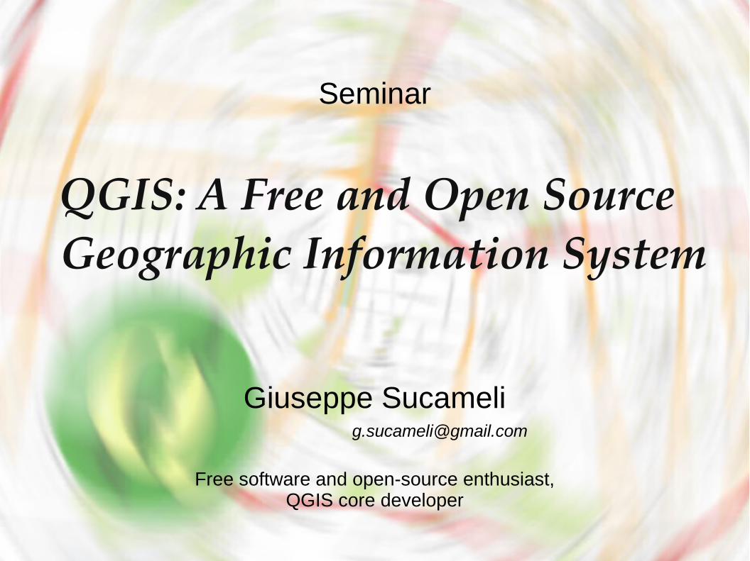
QGIS: A Free and Open Source QGIS: A Free and Open Source Geographic Information SystemGeographic Information System
Giuseppe Sucameli
Seminar
Free software and open-source enthusiast,QGIS core developer
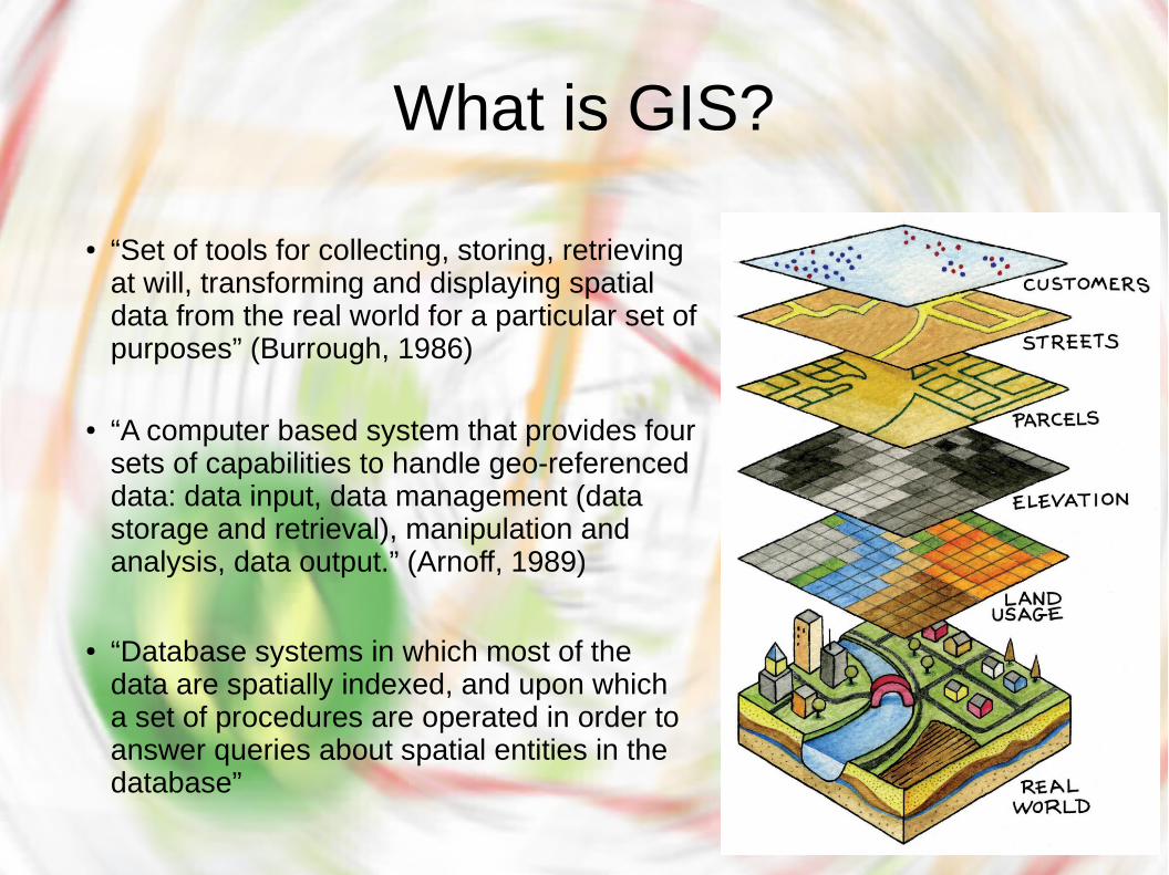
What is GIS?
● “Set of tools for collecting, storing, retrieving at will, transforming and displaying spatial data from the real world for a particular set of purposes” (Burrough, 1986)
● “A computer based system that provides four sets of capabilities to handle geo-referenced data: data input, data management (data storage and retrieval), manipulation and analysis, data output.” (Arnoff, 1989)
● “Database systems in which most of the data are spatially indexed, and upon which a set of procedures are operated in order to answer queries about spatial entities in the database”
Advantages of GIS
● Improve Organizational Integration
● Better decision making
● Visual analysis
GIS technology can be integrated into any enterprise information system framework.
● More employment opportunity
GIS integrates hardware, software, and data for capturing, managing, analyzing, and displaying all forms of geographically referenced information.
A GIS helps you answer questions and solve problems by looking at your data in a way that is quickly understood and easily shared.
GIS allows us to view, understand, question, interpret, and visualize data in many ways that reveal relationships, patterns, and trends in the form of maps, globes, reports, and charts
● Integration with EIS

Components of GIS
● Hardware
● Software
● People
Geographic data and related tabular data can be collected in-house or purchased from a commercial data provider.
● Method
It consists of the computer system on which the GIS software will run.
GIS software provides the functions and tools needed to store, analyze, and display geographic information.
GIS users range from technical specialists who design and maintain the system to those who use it to help them perform their everyday work.
● Data
GIS operates according to a well-designed plan and business rules, which are the models and operating practices unique to each organization.
GFOSS● Desktop GIS
● Web map servers
● Framework and libraries
PostGIS, SpatiaLite
QGIS, GRASS GIS, gvSIG, OpenJUMP, uDig, SAGA GIS
GeoServer, Mapnik, MapServer
● Spatial DBMS
Web: OpenLayers, Leafletjs
Non-Web: GDAL/OGR, GeoTools, Orfeo toolbox
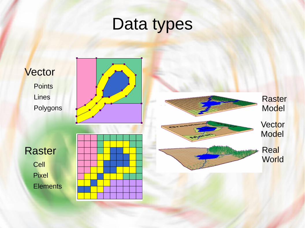
Data types
Vector
Raster
Points
Cell
Lines
Polygons
Pixel
Elements
RasterModel
VectorModel
RealWorld
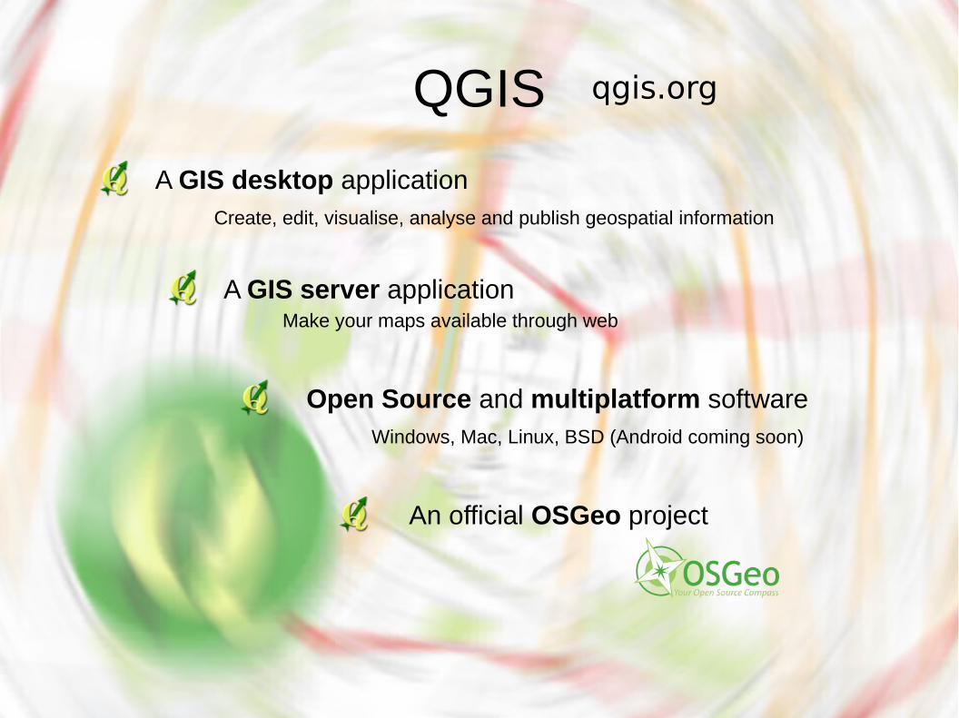
QGIS
A GIS desktop application
Open Source and multiplatform software
An official OSGeo project
qgis.org
Windows, Mac, Linux, BSD (Android coming soon)
Create, edit, visualise, analyse and publish geospatial information
A GIS server applicationMake your maps available through web
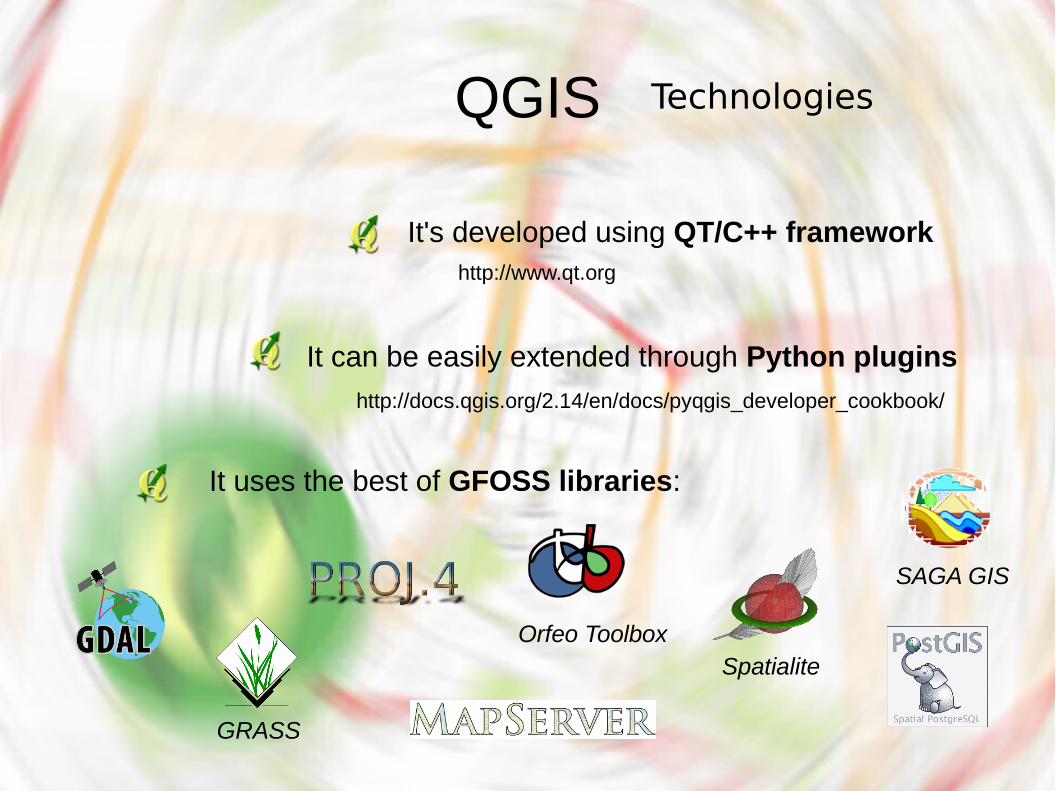
QGIS
It can be easily extended through Python plugins
It uses the best of GFOSS libraries:
GRASS
Spatialite
It's developed using QT/C++ framework
Technologies
http://www.qt.org
http://docs.qgis.org/2.14/en/docs/pyqgis_developer_cookbook/
SAGA GIS
Orfeo Toolbox
QGIS
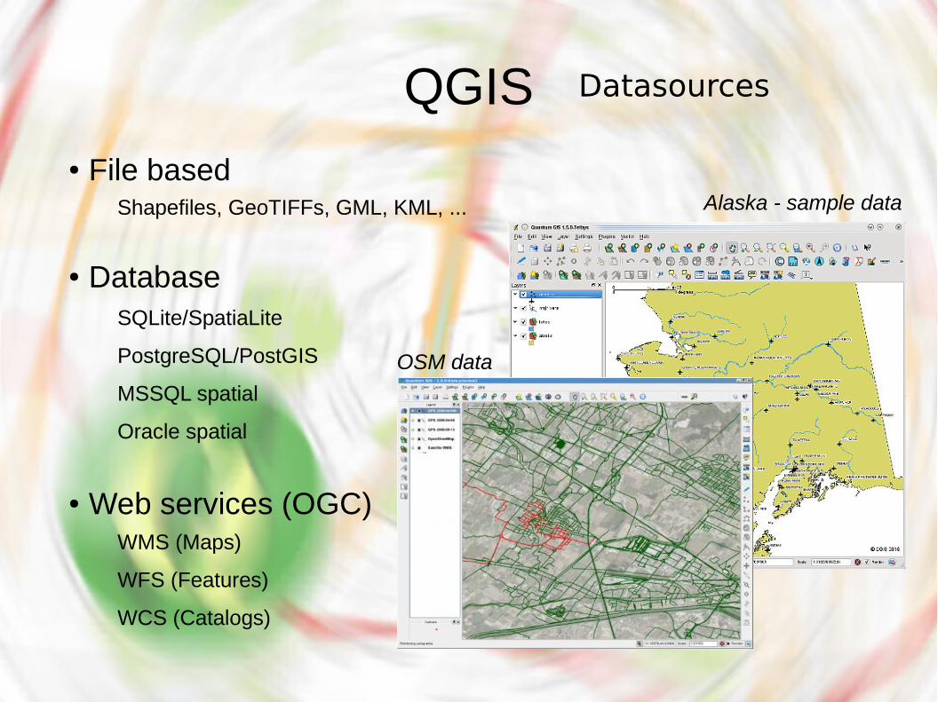
OSM data
Alaska - sample data
Datasources
● File based
● Database
● Web services (OGC)
Shapefiles, GeoTIFFs, GML, KML, ...
SQLite/SpatiaLite
PostgreSQL/PostGIS
MSSQL spatial
Oracle spatial
WMS (Maps)
WFS (Features)
WCS (Catalogs)
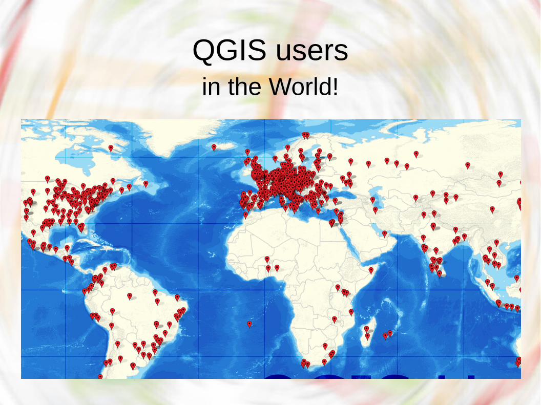
QGIS usersin the World!
QGIS Live session
QGIS
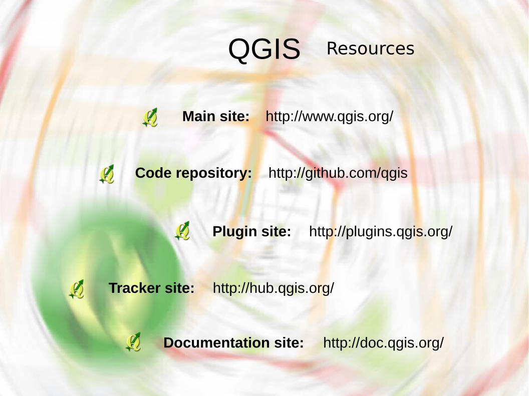
http://www.qgis.org/Main site:
http://plugins.qgis.org/Plugin site:
http://hub.qgis.org/Tracker site:
http://doc.qgis.org/Documentation site:
Resources
http://github.com/qgisCode repository:

Useful links
https://www.gaia-gis.it/spatialite-2.3.1/resources.html
https://freegisdata.rtwilson.com/
http://www.naturalearthdata.com/downloads/
http://earthquake.usgs.gov
https://www1.nyc.gov/site/planning/data-maps/open-data.page
https://open.wien.gv.at/site/datenkatalog/
to get free/open GIS data
Questions?
Licensed under the terms of Creative Commons CC -BY- NC
“May the FOSS be with you!”