Embed Size (px)
Citation preview
Qatar Environment and Energy Research Institute (QEERI)
from Carbon to Creativity
Middle East Geospatial Middle East Geospatial Forum, 3-4 April 2012QNCC www.qeeri.org.qa
QEERI Vision
To ensure sustainable development and management of Qatar’s energy and natural resources, preserving the quality of life of future generations and making Qatar a leader in cutting- edge energy and environment research
QEERI Mission To conduct and coordinate multi-disciplinary research that will address critical national priorities in energy and the environment, by integrating knowledge of the environment, food, energy and water resources in ways appropriate for Qatar and the region.
Introduction• Geospatial data and analysis have become common
place in research centres and natural resources organisations worldwide.
• The continued technological advances in computer hardware and software have provided, at low cost, massive processing power and efficient multi-date data-archiving.
• These developments in the field of Geospatial Analysis are very relevant to renewable energy, monitoring and modelling as well as environmental resources.
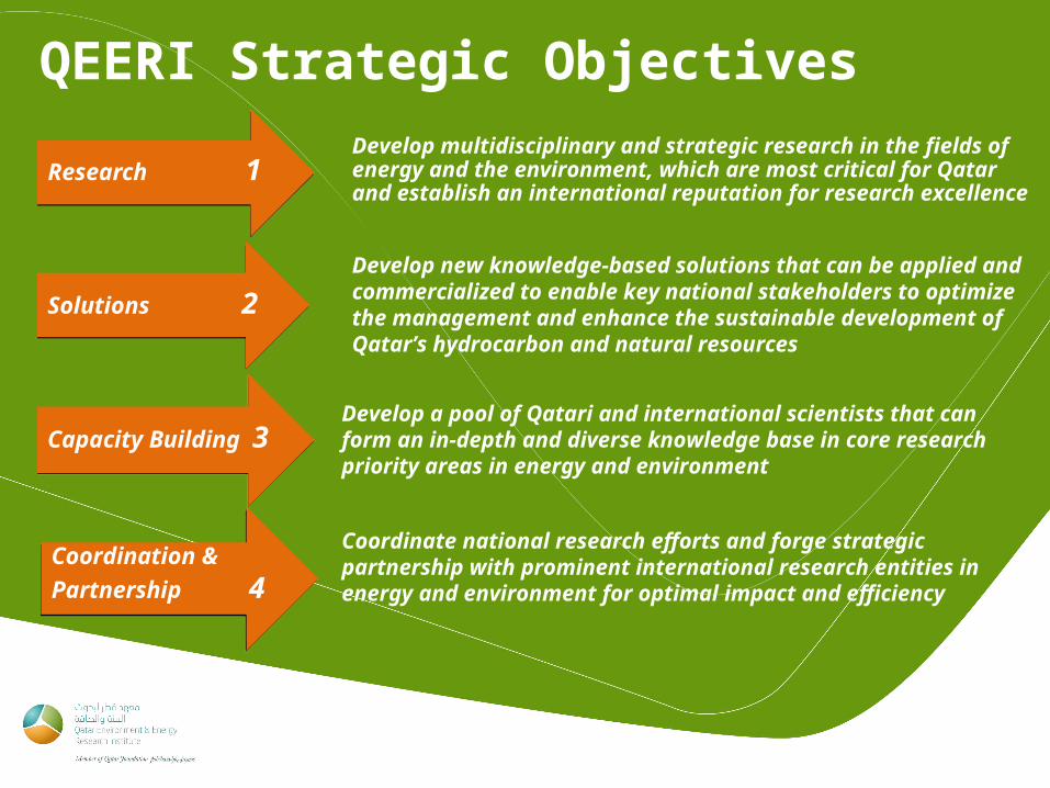
QEERI Strategic Objectives
Research 1Develop multidisciplinary and strategic research in the fields of energy and the environment, which are most critical for Qatar and establish an international reputation for research excellence
Develop new knowledge-based solutions that can be applied and commercialized to enable key national stakeholders to optimize the management and enhance the sustainable development of Qatar’s hydrocarbon and natural resources
Capacity Building 3 Develop a pool of Qatari and international scientists that can form an in-depth and diverse knowledge base in core research priority areas in energy and environment
Coordination &
Partnership 4
Coordinate national research efforts and forge strategic partnership with prominent international research entities in energy and environment for optimal impact and efficiency
Solutions 2
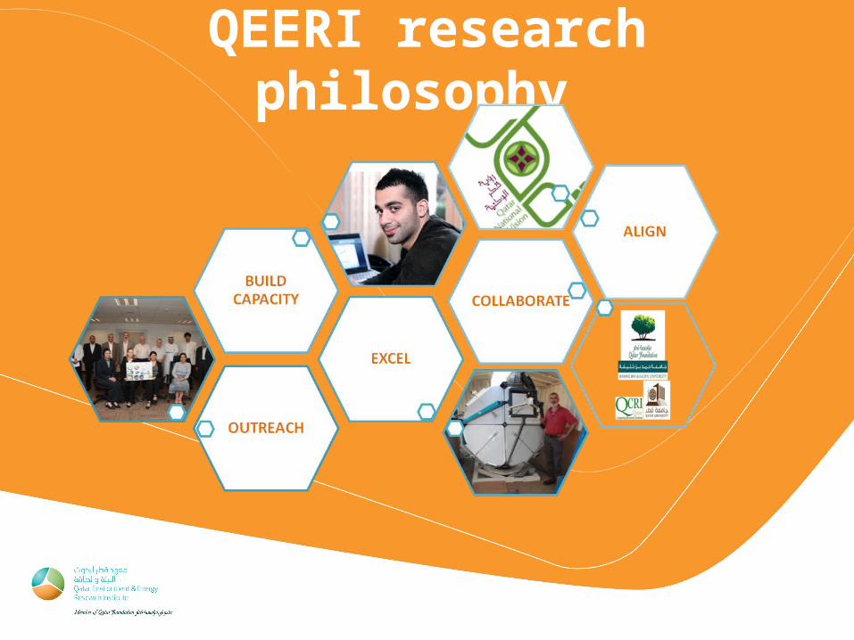
QEERI research philosophy
• QEERI: Geospatial Analysis and Applications
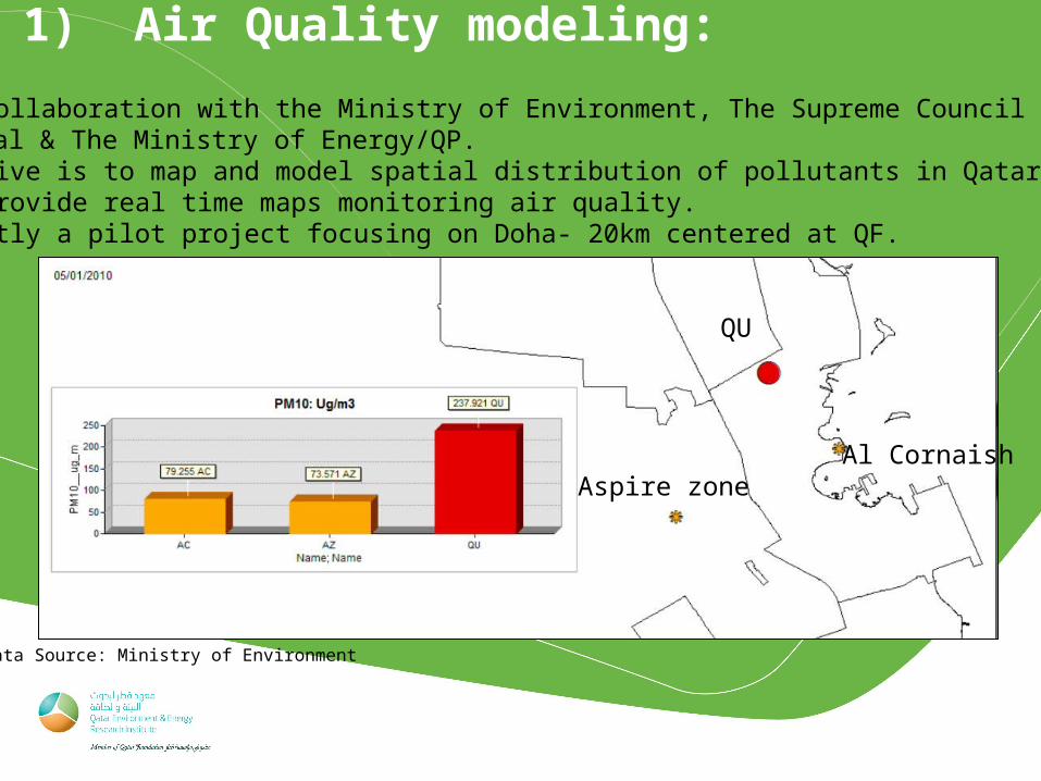
1) Air Quality modeling:
QU
Al CornaishAspire zone
Data Source: Ministry of Environment
- With collaboration with the Ministry of Environment, The Supreme Council of Research, Total & The Ministry of Energy/QP.- Objective is to map and model spatial distribution of pollutants in Qatar.- Will provide real time maps monitoring air quality. - Currently a pilot project focusing on Doha- 20km centered at QF.
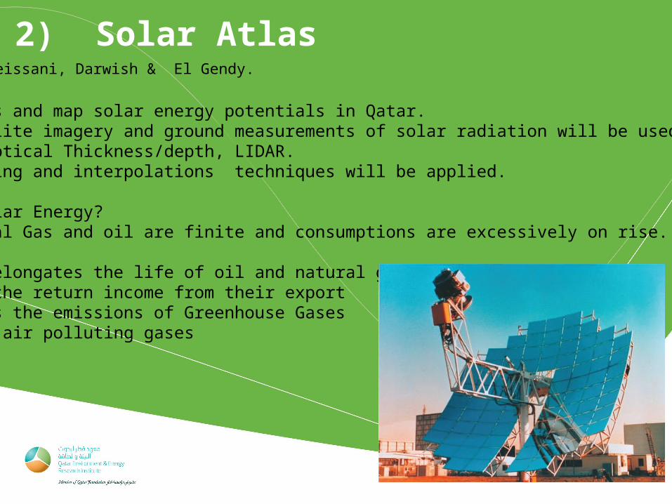
2) Solar AtlasPI: Chmeissani, Darwish & El Gendy.
-Assess and map solar energy potentials in Qatar.-Satellite imagery and ground measurements of solar radiation will be used: Optical Thickness/depth, LIDAR.-Modeling and interpolations techniques will be applied.
Why Solar Energy?-Natural Gas and oil are finite and consumptions are excessively on rise.-Cost-This elongates the life of oil and natural gas resources,-Keep the return income from their export-Limits the emissions of Greenhouse Gases & air polluting gases
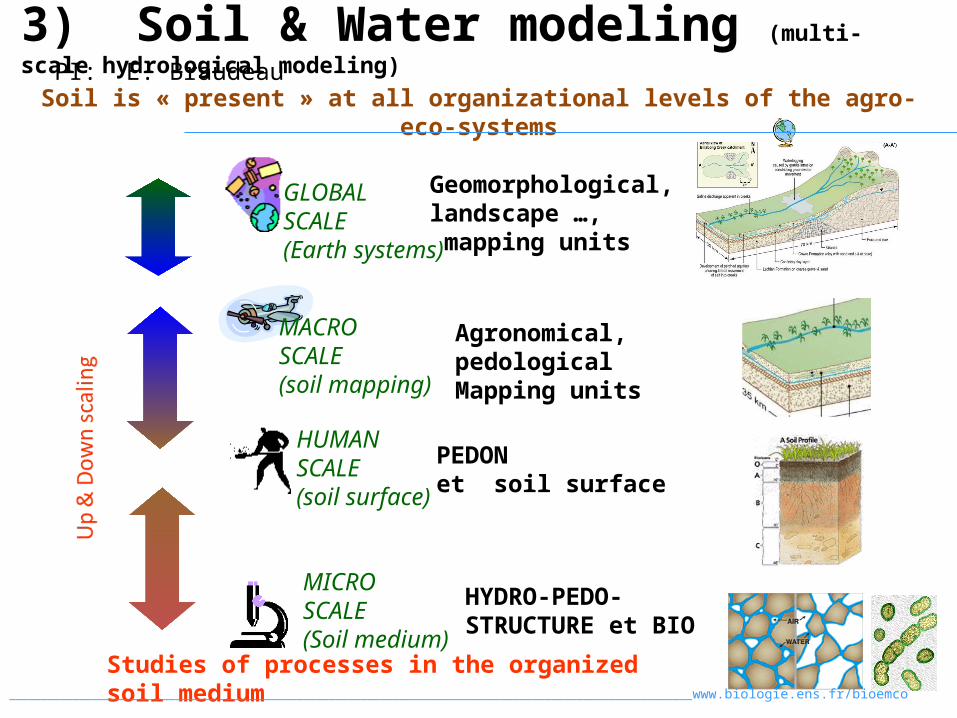
Soil is « present » at all organizational levels of the agro- eco-systems
HYDRO-PEDO-STRUCTURE et BIO
PEDONet soil surface
Agronomical, pedological Mapping units
Geomorphological, landscape …, mapping units
MICROSCALE(Soil medium)
HUMANSCALE(soil surface)
GLOBALSCALE(Earth systems)
Studies of processes in the organized soil medium___________________________________________________________________________________________________________www.biologie.ens.fr/bioemco
MACROSCALE(soil mapping)
3) Soil & Water modeling (multi-scale hydrological modeling)PI: E. Braudeau
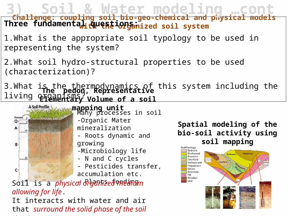
Challenge: coupling soil bio-geo-chemical and physical models with the organized soil system
Many processes in soil -Organic Mater mineralization- Roots dynamic and growing-Microbiology life- N and C cycles- Pesticides transfer, accumulation etc.- Plants feeding
Three fundamental questions:
1.What is the appropriate soil typology to be used in representing the system?
2.What soil hydro-structural properties to be used (characterization)?
3.What is the thermodynamics of this system including the living organisms?
Soil is a physical organized medium allowing for life. It interacts with water and air that surround the solid phase of the soil structure.
Spatial modeling of the bio-soil activity using soil mapping
The pedon, Representative Elementary Volume of a soil mapping
unit
3) Soil & Water modeling …cont
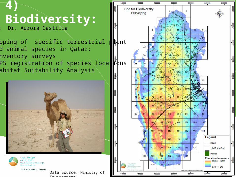
4) Biodiversity:
Data Source: Ministry of Environment
PI: Dr. Aurora Castilla
Mapping of specific terrestrial plant and animal species in Qatar:-Inventory surveys -GPS registration of species locations -Habitat Suitability Analysis
Thank You
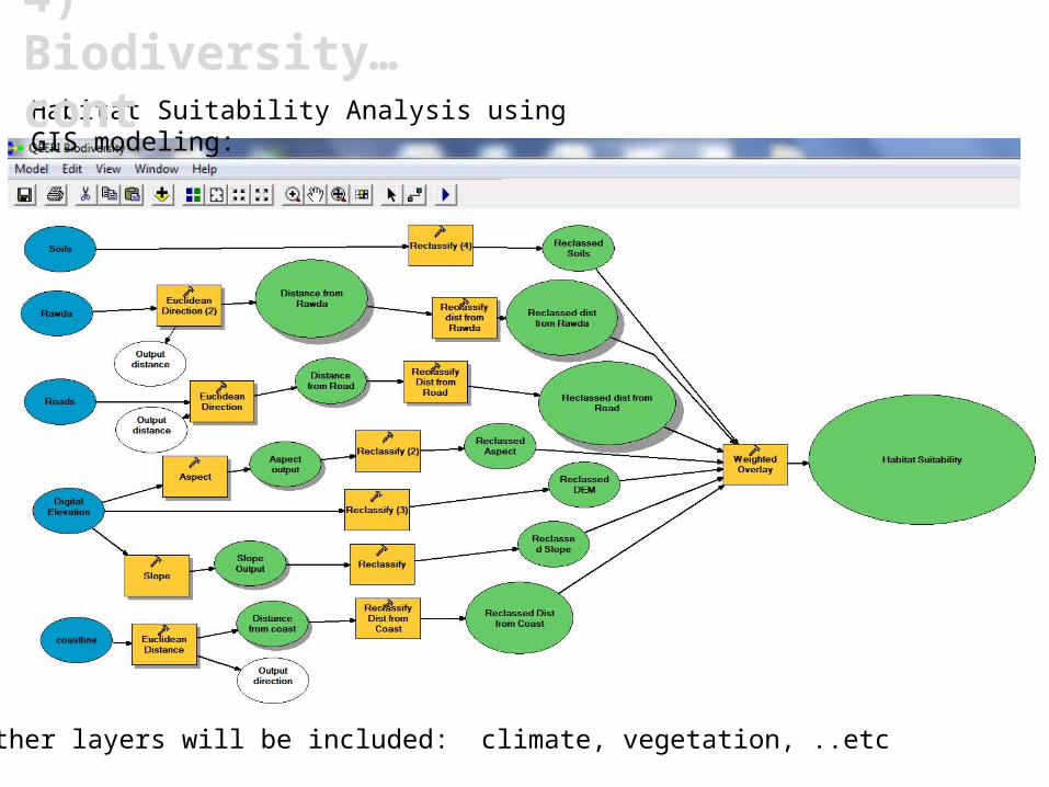
Habitat Suitability Analysis using GIS modeling:
Other layers will be included: climate, vegetation, ..etc
4) Biodiversity… cont
5) Water Quality
PI: Dr. Shomar
• Understanding the groundwater aquifer system in Qatar• Identification the environmentally hotspots affecting
groundwater quality• Establishment of groundwater monitoring strategy,
assessment and interpretation• Mapping of groundwater quality in Qatar using GIS and RS • Assessment of intrinsic vulnerability to contamination for
Qatar aquifer using Integrated GIS and Earth Observation (EO) systems
• Use the results of the study in supporting policy and decision making on water laws, acts, planning and management
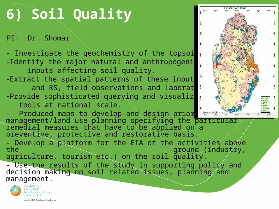
6) Soil Quality
PI: Dr. Shomar
- Investigate the geochemistry of the topsoil in Qatar.-Identify the major natural and anthropogenic inputs affecting soil quality.-Extract the spatial patterns of these inputs using GIS and RS, field observations and laboratory analyses.-Provide sophisticated querying and visualization tools at national scale.- Produced maps to develop and design priority soil management/land use planning specifying the particular remedial measures that have to be applied on a preventive, protective and restorative basis.- Develop a platform for the EIA of the activities above the ground (industry, agriculture, tourism etc.) on the soil quality.- Use the results of the study in supporting policy and decision making on soil related issues, planning and management.
PI: Dr. Basem Shomar
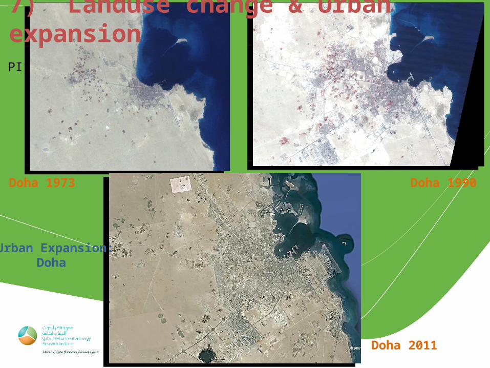
Urban Expansion:Doha
Doha 1973
Doha 2011
Doha 1990
7) Landuse change & Urban expansion

Thank You