Embed Size (px)
DESCRIPTION
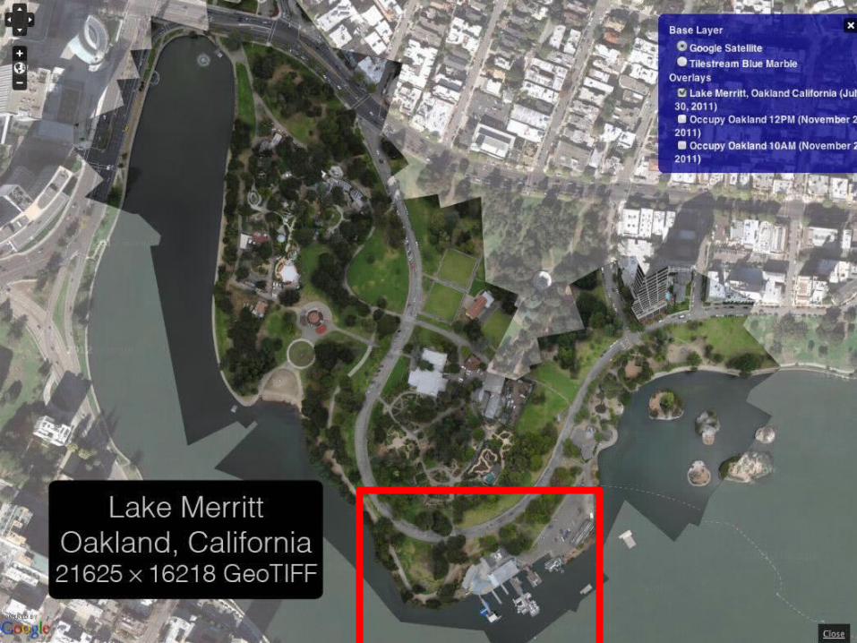
Public Laboratory Map Tools. open source aerial imagery & mapmaking. 350+ of users 340+ published maps. Lake Merritt. 1:1 at the boat house, with their map of the park. map viewer publish to the public domain (or as private) project images nearby and related maps map export - PowerPoint PPT Presentation
Citation preview

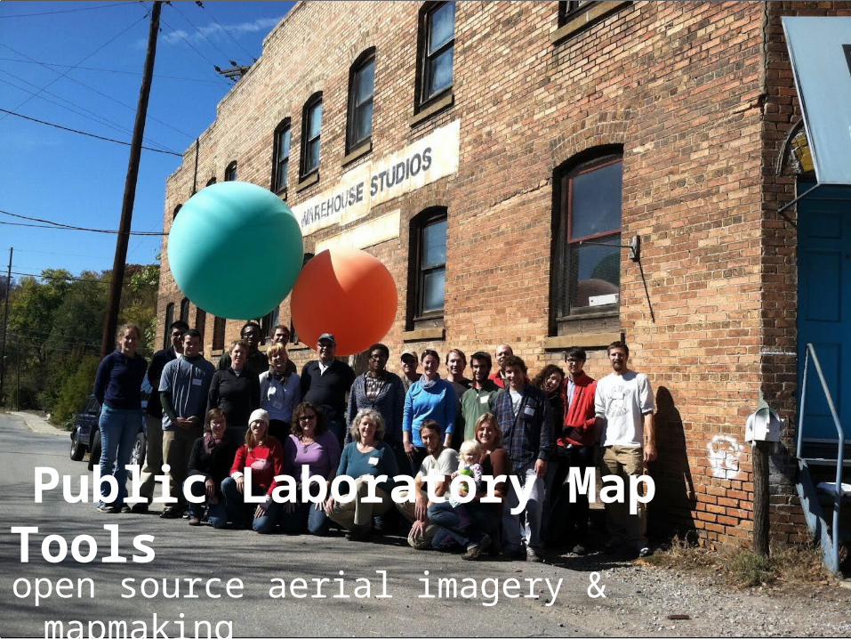
Public Laboratory Map Toolsopen source aerial imagery & mapmaking
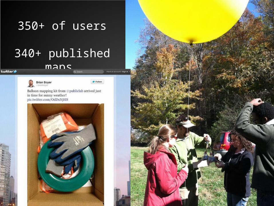
350+ of users
340+ published maps
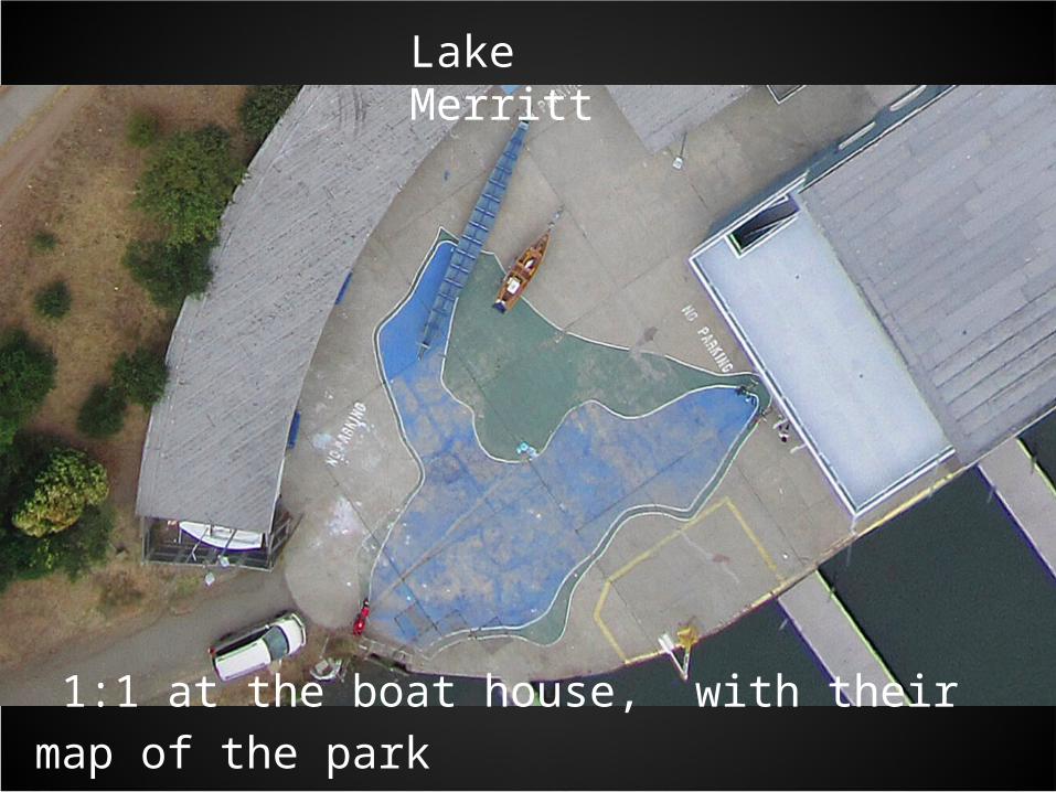
1:1 at the boat house, with their map of the park
Lake Merritt
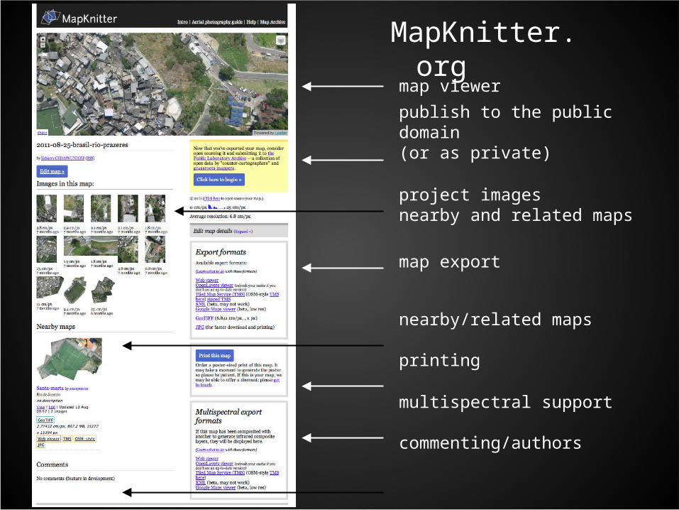
MapKnitter.org
map viewer
publish to the public domain (or as private)
project imagesnearby and related maps
map export
nearby/related maps
printing
multispectral support
commenting/authors
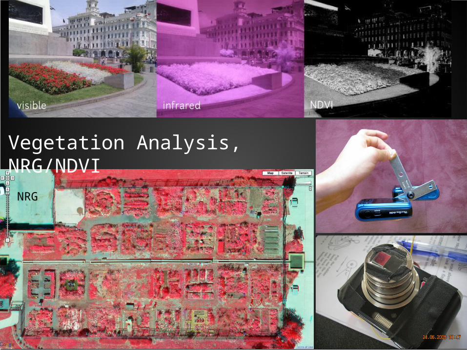
NRG
Vegetation Analysis, NRG/NDVI
zoom-out video of Map>>>End
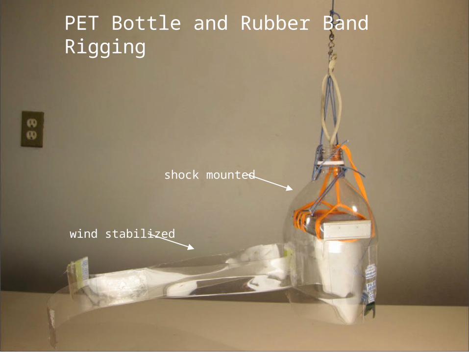
PET Bottle and Rubber Band Rigging
wind stabilized
shock mounted
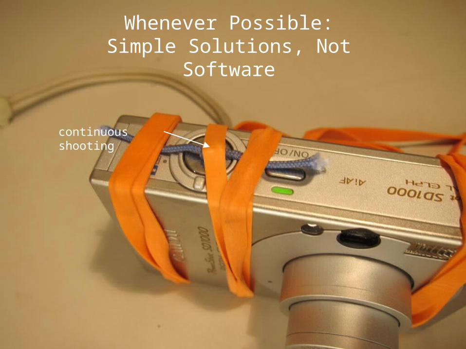
Whenever Possible:Simple Solutions, Not Software
continuous shooting

publiclaboratory.org


![H - Optical equipments B - General use C · 6 FCD - Laboratory jacks. page [73] [FC] assemblies - LABORATORY ASSEMBLIES AND TOOLS laboratory equipment LABORATORY ASSEMBLIES AND TOOLS](https://img.pdfslide.us/doc/110x75/5b9357e909d3f206218d2a5f/h-optical-equipments-b-general-use-c-6-fcd-laboratory-jacks-page-73.jpg)