Embed Size (px)
Citation preview
Protected Area Profile – Peru
Pantanos de Villa Reserved Zone Date of last onsite field visit: December 2004 Date of publication: January 2005 Location: Chorrillos District, Province of Lima, Department of Lima Year created: 1989 Area: 263.27 ha Ecoregion: Pacific subtropical desert Habitats: rushes, water channels and drainages, grasslands, cattail stands, crystal-clear lakes, and lake beds Summary Description The wetlands of the Pantanos de Villa Reserved Zone is a world-important site because of its role as habitat for migratory bird species. It is one of the few natural environments along the desert coast of Peru that harbors the permanent presence of several species. Located in the city of Lima and surrounded by dwellings and factories, Pantanos de Villa represents an ecosystem that offers important environmental services, besides providing recreational and educational facilities for the local population. Biodiversity The protected area provides several habitats, each for specific biodiversity. Flora is represented by 67 species of plants and characteristic associations that feed from nutrients in the substratum of the soil, which is rich in salts and organic material accumulated throughout the years. Fauna is represented mainly by some 14 species of fish and some reptiles and rodents whose distribution is influenced by salinity, and river and spring vegetation. Fish are an important link of the Pantanos de Villa feeding chain because they are the most important food source for the birds. Of the 178 species of birds found in the area, 77 are migratory. Threats The reserve faces several problems, including lack of sustainable water flows, illegal settlements in the surrounding plots, pollution due to vegetation clearing, solid waste, and flooding. The most worrisome problems are the industrial activities and growth of the urban sector. There are also conflicts among the pertinent authorities, impeding them achieving common objectives. A similar setback is the lack of coordination and decision-making among institutions, due primarily to financial and budget shortcomings.
1
View of the southern part of Pantanos de Villa Reserved Zone
Description The Pantanos de Villa natural area is part of the world-important wetlands system that provides feeding, breeding, roosting, and sheltering sites to the resident and migratory birds of America, who travel the many thousands of miles between North and South America, the upper Andes lagoons, and the Amazonia.1 Pantanos de Villa is located in the department of Lima, south of the city of Lima, in the Chorrillos district, approximately between 12°11´42´´ - 12°13´18´´ LS and 76°58´42´´ - 76°59´42´´ LW. Pantanos de Villa is classified as a subtropical arid desert life zone, in the Pacific Desert biogeographic province.2 It is located at an altitude range between 0 to 5 m ASL, the average temperature is 15°C to 26ºC, and the rainy season, although short, occurs between June and September.3 Geography Pantanos de Villa Reserve Zone was established on May 29, 1989 through Ministry Resolution Nº 00144-89-AG/DGFF. The RAMSAR Convention acknowledged the zone as an Internationally Important Wetland for Waterfowl in January 20, 1997. At the time of creation, the extension of the area was estimated at 396 hectares. Later measurements carried out with highly innovative systems (geodetic GPS), however, verified that the area actually covers 263.27 hectares. The actual size was amended and published in Ministry Resolution No. 0909-2000-AG. Pantanos de Villa is the only protected area that exists inside the urban area of the city of Lima; for this reason, it is highly valued by the local population as a scientific, educational, and recreational site. The wetland is part of the migratory corridor traveled by many bird species along the Neotropical coast.
2
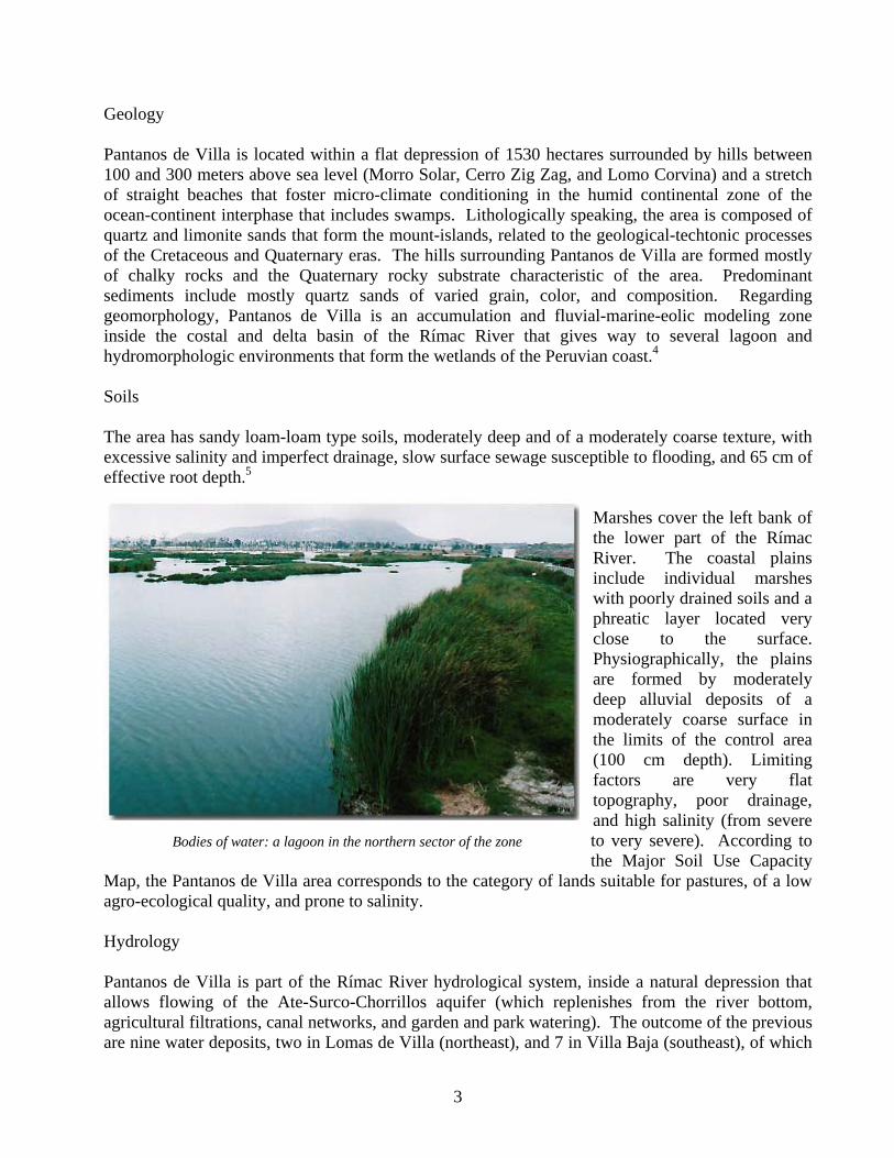
Geology Pantanos de Villa is located within a flat depression of 1530 hectares surrounded by hills between 100 and 300 meters above sea level (Morro Solar, Cerro Zig Zag, and Lomo Corvina) and a stretch of straight beaches that foster micro-climate conditioning in the humid continental zone of the ocean-continent interphase that includes swamps. Lithologically speaking, the area is composed of quartz and limonite sands that form the mount-islands, related to the geological-techtonic processes of the Cretaceous and Quaternary eras. The hills surrounding Pantanos de Villa are formed mostly of chalky rocks and the Quaternary rocky substrate characteristic of the area. Predominant sediments include mostly quartz sands of varied grain, color, and composition. Regarding geomorphology, Pantanos de Villa is an accumulation and fluvial-marine-eolic modeling zone inside the costal and delta basin of the Rímac River that gives way to several lagoon and hydromorphologic environments that form the wetlands of the Peruvian coast.4 Soils The area has sandy loam-loam type soils, moderately deep and of a moderately coarse texture, with excessive salinity and imperfect drainage, slow surface sewage susceptible to flooding, and 65 cm of effective root depth.5
Marshes cover the left bank of the lower part of the Rímac River. The coastal plains include individual marshes with poorly drained soils and a phreatic layer located very close to the surface. Physiographically, the plains are formed by moderately deep alluvial deposits of a moderately coarse surface in the limits of the control area (100 cm depth). Limiting factors are very flat topography, poor drainage, and high salinity (from severe to very severe). According to the Major Soil Use Capacity
Map, the Pantanos de Villa area corresponds to the category of lands suitable for pastures, of a low agro-ecological quality, and prone to salinity.
Bodies of water: a lagoon in the northern sector of the zone
Hydrology Pantanos de Villa is part of the Rímac River hydrological system, inside a natural depression that allows flowing of the Ate-Surco-Chorrillos aquifer (which replenishes from the river bottom, agricultural filtrations, canal networks, and garden and park watering). The outcome of the previous are nine water deposits, two in Lomas de Villa (northeast), and 7 in Villa Baja (southeast), of which
3
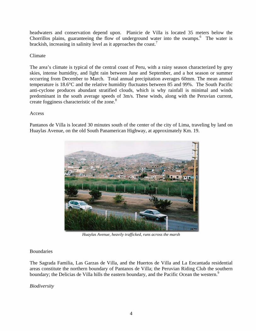
headwaters and conservation depend upon. Planicie de Villa is located 35 meters below the Chorrillos plains, guaranteeing the flow of underground water into the swamps.6 The water is brackish, increasing in salinity level as it approaches the coast.7 Climate The area’s climate is typical of the central coast of Peru, with a rainy season characterized by grey skies, intense humidity, and light rain between June and September, and a hot season or summer occurring from December to March. Total annual precipitation averages 60mm. The mean annual temperature is 18.6°C and the relative humidity fluctuates between 85 and 99%. The South Pacific anti-cyclone produces abundant stratified clouds, which is why rainfall is minimal and winds predominant in the south average speeds of 3m/s. These winds, along with the Peruvian current, create fogginess characteristic of the zone.8 Access Pantanos de Villa is located 30 minutes south of the center of the city of Lima, traveling by land on Huaylas Avenue, on the old South Panamerican Highway, at approximately Km. 19.
Huaylas Avenue, heavily trafficked, runs across the marsh
Boundaries The Sagrada Familia, Las Garzas de Villa, and the Huertos de Villa and La Encantada residential areas constitute the northern boundary of Pantanos de Villa; the Peruvian Riding Club the southern boundary; the Delicias de Villa hills the eastern boundary, and the Pacific Ocean the western.9 Biodiversity
4
The protected area includes several habitats with particular biodiversity: 1) Rush habitat: the most prevalent plants therein are rushes, which are fibrous, sturdy, and adequate for making baskets and mats. There are also fan palms and casuarines (introduced species). 2) Canal and drainage habitat: its most important purpose is to provide water to the lagoons that are suitable habitat for several species. The prevailing aquatic vegetation is the water lentil, an important plant in the diet of several species. 3)Grasses habitat: the largest zone has saline and sandy soils and minimal vegetation including sweet, salty, and rush grasses. 4) Bulrush habitat: the most important vegetation are bulrushes, which provide shelter and nesting space to many species. Dragonflies, mosquitoes, and other insects that are part of the ecosystem’s trophic level live in this area, which covers approximately 50 ha and is 2 m deep, as well as a muddy soil of approximately 50 cm.10
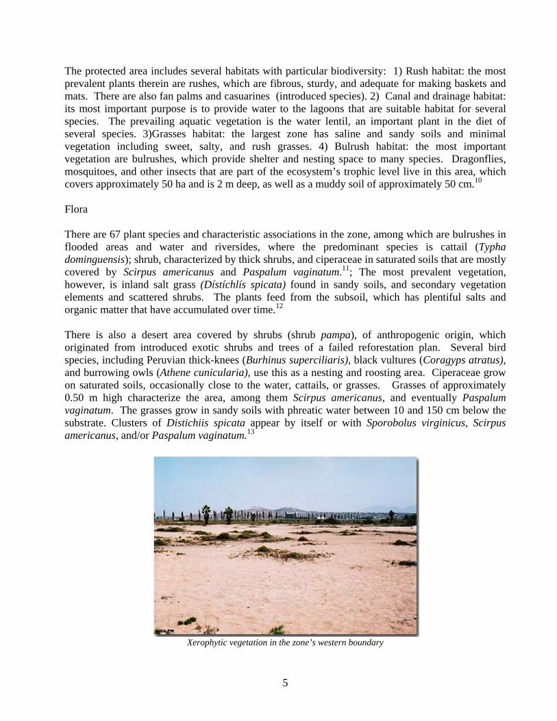
Flora There are 67 plant species and characteristic associations in the zone, among which are bulrushes in flooded areas and water and riversides, where the predominant species is cattail (Typha dominguensis); shrub, characterized by thick shrubs, and ciperaceae in saturated soils that are mostly covered by Scirpus americanus and Paspalum vaginatum.11; The most prevalent vegetation, however, is inland salt grass (Dístíchlís spicata) found in sandy soils, and secondary vegetation elements and scattered shrubs. The plants feed from the subsoil, which has plentiful salts and organic matter that have accumulated over time.12 There is also a desert area covered by shrubs (shrub pampa), of anthropogenic origin, which originated from introduced exotic shrubs and trees of a failed reforestation plan. Several bird species, including Peruvian thick-knees (Burhinus superciliaris), black vultures (Coragyps atratus), and burrowing owls (Athene cunicularia), use this as a nesting and roosting area. Ciperaceae grow on saturated soils, occasionally close to the water, cattails, or grasses. Grasses of approximately 0.50 m high characterize the area, among them Scirpus americanus, and eventually Paspalum vaginatum. The grasses grow in sandy soils with phreatic water between 10 and 150 cm below the substrate. Clusters of Distichiis spicata appear by itself or with Sporobolus virginicus, Scirpus americanus, and/or Paspalum vaginatum.13
Xerophytic vegetation in the zone’s western boundary
5
Some other plant species that thrive in the marshes are Sesuvium portulacastrum, Sagittaria montenidensis, Ciclospermum leptophyllum, Hydrocotyle ranunculoides, Pistia stratiotes, Hendirá sessilifolia, Picrosia longifolia, Salicornia fruticosa, Calystegia sepium, Cladium jamaicense, Cyperus alternifolius, Scirpus americanus, Vigna luteola, Lemna gibba, Lemna minuta, Spirodela intermedia, Wolffia columbiana, Utricularia gibba, Lythrum maritimum, Myrsine manglilla, Najas guadalupensis, Ludwigia octovalis, Ludwigia peploides, Ludwigia peruviana, Brachiaria mutica, Cynodon dactylon, Gynerium sagitatum, Luziola peruviana, Paspalidium germinatum, Phragmites australis, Polypogon semiverticillatus, Polygonum hydropiperoides, Eichhornia azurea, Eichhornia crassipes, Potamogeton pusillus, Potamogeton striatus, Samolus valerandi, Azolla filiculoides, Equisetum giganteum, Galium hypocarpium, Ruppia marítima, Bacopa monnieri, Lycopersicon pimpinellifolium, Solanum americanum, Lippia nodiflora, Zannichellia palustris. The most important introduced species are Washingtonia robusta, Casuarina equisetifolia, and Eucaliptus sp.14 Fauna There are approximately 14 species of fish, as well as some reptiles and rodents in the zone. Two hundred and eight bird species have been reported, of which 70% are migratory. The most prevalent of these are great grebe (Podiceps major), pied-billed grebe (Podilymbus podiceps), great egret (Ardea alba), black-crowned night heron (Nycticorax nycticorax), cinammon teal (Anas cyanoptera), white-cheeked pintail (Anas bahamensis), osprey (Pandion haliaetus), moorhen (Gallinula chloropus), American coot (Fulica Americana), greater yellowlegs (Tringa melanoleuca), and killdeer (Charadrius vociferus), among many others. According to studies carried out by INRENA between 1993 and 2001, these birds can be classified by their places of origin. There are 38 species of migratory birds from the Andes; 49 local migratory species; 53 species migrating from the North; 19 migratory species from the South; and 49 resident species. A full list of the birds that have been sighted in Pantanos de Villa is available at http://www.avesdelima.com/lista_pantanos.htm. Fish are an important link in the Pantanos de Villa’s ecosystem feeding chain because they provide sustenance to the many bird species therein. As stated previously, the Pantanos de Villa wetland includes water environments with running waters (rivers and streams) and still waters (lakes, lagoons, and swamps), for which 14 fish species of 12 genus and 7 families have been reported; they are distributed according to salinity, river vegetation, and springs. Icthiofauna include omnivores, herbivores, and meat-eaters with a preference for insects.15
Carassius auratus, Bryconamericus peruanus, Lebiasina bimaculata, Guavina charcoes, Gambusia sp., Poecilia reticulata, Xiphophorus maculatus, Mugil cephalus, Aequidens rivulatus, Cichlasoma nigrofasciatum, Oerochromis niloticus, and Tilapia rendalli have been reported as the most important and prevalent fish species in the area.16 Management The most important objectives of the Pantanos de Villa Reserve are to protect the migratory and resident aquatic birds, to preserve the important associations of wild flora characteristic of the
6
coastal aquatic ecosystems, to defend and care for the landscape, and to motivate educational and recreational activities.17
Background On March 20, 1964, the Patronato de Parques Nacionales y Zonales (National and Zone Parks Patronage) was created. On May 21, 1969, Decree No 17528 gave way to the Parks Service, which substituted the Patronage. The Metropolitan Municipal Hall of Lima and the Lima Parks Service SERPAR - LIMA, has managed, preserved, and developed the natural area since 1977. That year the area was decreed Metropolitan Zone Park No. 25 Pantanos de Villa (Supreme Decree 009-77-VC of the Ministry of Housing and Construction) and became part of the System of Recreational Areas for Metropolitan Lima. In 1989, the Ministry of Agriculture decreed 396 hectares as a reserve for wild flora and fauna (Ministry Resolution 144-89-DGFF-AG), and designated the “Patronage for the Defense of Pantanos de Villa” as the manager of the Reserve. The Patronage was comprised of public and private entities, as well as Peruvian residents willing to help preserve the area. INRENA, then the General Forest and Fauna Directorate, was named to head the area, with the power to subscribe cooperative agreements with public and private institutions. INRENA becomes, thereby, the second echelon in charge of the direct management of the protected area. It should be noted that in 1989 the concept of a “reserve” was used in the Flora and Fauna Conservation Guidelines but not in the guidelines for conservation units (today called natural protected areas). For this reason, when a preliminary legal figure was needed for Pantanos de Villa, the term “reserve” was used to temporarily protect particular environments.18 INRENA is second in command because 80% of the protected area is property of SERPAR of the Metropolitan Municipality of Lima, who collaborates with the INRENA regional office in matters related to the upkeep of the area. In January 1991, the Metropolitan Council of Lima declared the zone a Metropolitan Ecological Area (Council Agreement N° 026-91), according to the power invested by Ministry Resolution 144-89-DGFF-AG and because 208 hectares of the protected area are property of the municipality. In 1993, the Municipality of Lima established the Villa Great Natural Metropolitan Park special project in order to implement actions to safeguard and protect the environment and to preserve local flora and fauna. The plan was to promote the development of the area with the aim of protecting the environment and to organize recreational and cultural services for the metropolitan area. In 1994, the Office for Coordination of Development and Management of the Pantanos de Villa Reserve was formed with representatives from the Ministry of Agriculture, the Chorrillos Municipality, the Ministry of Defense, and the Municipality of Lima.19
On January 20, 1997, the Pantanos de Villa wetlands became a Ramsar site because of the great biodiversity representative of wetlands therein. The Ramsar Wetlands Convention is an inter-government treaty that was approved on February 2, 1971 in the Iranian city of Ramsar, located in the coasts of the Caspian Sea. The Ramsar Convention’s main purpose is to promote the conservation and rational use of wetlands by implementing national actions and fostering international collaboration to achieve the sustainable development of the wetlands of the world.20
In 1998, the Metropolitan Municipality of Lima released Municipal Ordinance N° 184 which establishes special regulations for the Pantanos de Villa and its buffer zone. It deals with
7
environmental prescriptions, protection of landscapes and aquifers, traffic regulations, zone classification (residential, commercial, recreational), environmental impact studies, management and administration of the area, protection, and sanctions. The ordinance appointed the Pantanos de Villa municipal authority, Prohvilla, where INRENA participates. The objectives of the Prohvilla Board of Directors are to promote management plans and agreements, to establish committees, to carry out administrative actions, to approve the master plan, to request environmental audits of the companies that operate in the buffer zones, to prescribe land users, and to evaluate and authorize any actions to be carried out in Pantanos de Villa. Municipal Ordinance No. 184 – 98 appoints Prohvilla as the office in charge of environmental impact studies for any project to be undertaken in the area. This does not agree with the usual guidelines that say the pertinent offices (Ministry of Energy and Mines, Ministry of Industry, etc.) must approve or research cannot be conducted in the area. Thus, Municipal Ordinance 184 - 98 has generated some problems. In urban areas, it is generally the municipalities that collect the environmental impact studies and forward them to the pertinent authorities for assessment. INRENA, regardless of any other arrangements, must always do an assessment of the studies. The municipalities and the pertinent organizations must forward the documents for INRENA’s technical assessment, which must be honored. Ministry Resolution N° 0909-2000-AG, published in 2000, stated that the Pantanos de Villa Reserve covers 263.27 ha. In 2001, Resolution N° 358-2001-INRENA established the buffer zone of the Pantanos de Villa Reserve.21 Inside the reserve there is a series of signposts, bird-watching overlooks, and an interpretation center, all under the responsibility of SERPAR, Lima’s Park Service. INRENA runs a Voluntary Park Ranger Program (visit Programa de Guardaparques Voluntarios) and a Research Program (to find out about research authorizations, visit Para Investigadores).
8
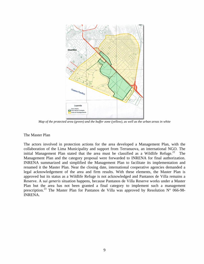
Map of the protected area (green) and the buffer zone (yellow), as well as the urban areas in white
The Master Plan The actors involved in protection actions for the area developed a Management Plan, with the collaboration of the Lima Municipality and support from Terranuova, an international NGO. The initial Management Plan stated that the area must be classified as a Wildlife Refuge.22 The Management Plan and the category proposal were forwarded to INRENA for final authorization. INRENA summarized and simplified the Management Plan to facilitate its implementation and renamed it the Master Plan. Near the closing date, international cooperative agencies demanded a legal acknowledgement of the area and firm results. With these elements, the Master Plan is approved but its status as a Wildlife Refuge is not acknowledged and Pantanos de Villa remains a Reserve. A sui generis situation happens, because Pantanos de Villa Reserve works under a Master Plan but the area has not been granted a final category to implement such a management prescription.23 The Master Plan for Pantanos de Villa was approved by Resolution N° 066-98-INRENA.
9
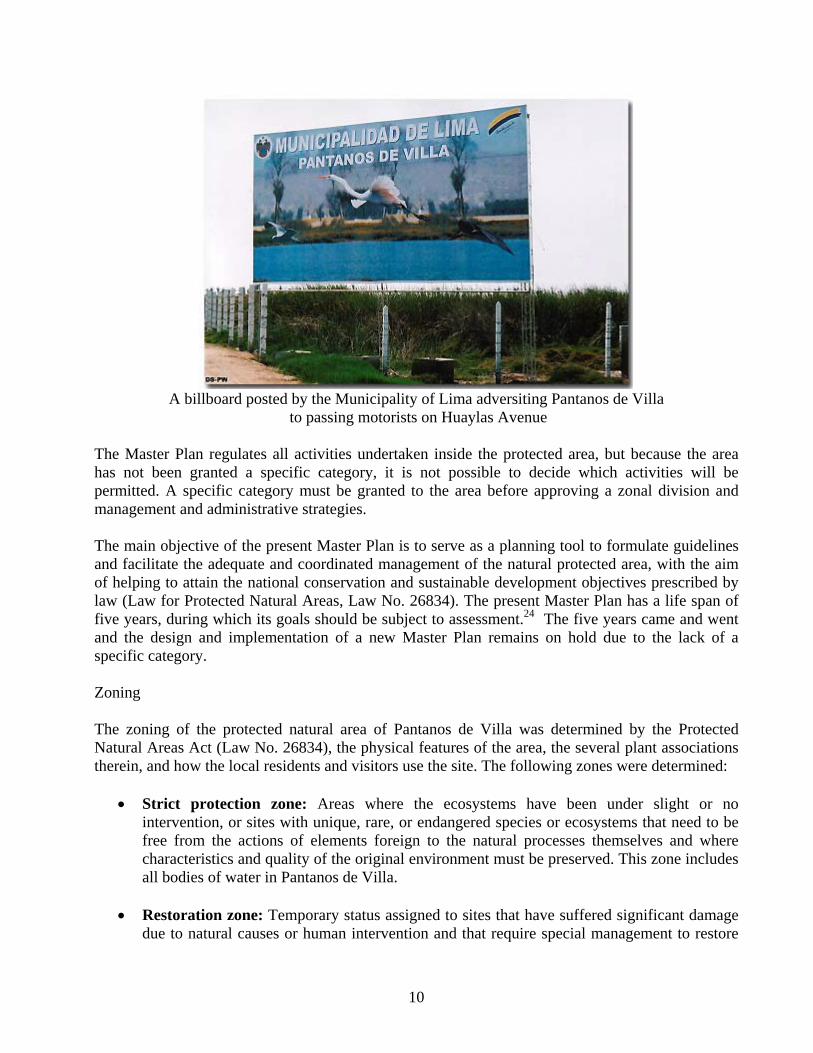
A billboard posted by the Municipality of Lima adversiting Pantanos de Villa
to passing motorists on Huaylas Avenue The Master Plan regulates all activities undertaken inside the protected area, but because the area has not been granted a specific category, it is not possible to decide which activities will be permitted. A specific category must be granted to the area before approving a zonal division and management and administrative strategies. The main objective of the present Master Plan is to serve as a planning tool to formulate guidelines and facilitate the adequate and coordinated management of the natural protected area, with the aim of helping to attain the national conservation and sustainable development objectives prescribed by law (Law for Protected Natural Areas, Law No. 26834). The present Master Plan has a life span of five years, during which its goals should be subject to assessment.24 The five years came and went and the design and implementation of a new Master Plan remains on hold due to the lack of a specific category. Zoning The zoning of the protected natural area of Pantanos de Villa was determined by the Protected Natural Areas Act (Law No. 26834), the physical features of the area, the several plant associations therein, and how the local residents and visitors use the site. The following zones were determined:
• Strict protection zone: Areas where the ecosystems have been under slight or no intervention, or sites with unique, rare, or endangered species or ecosystems that need to be free from the actions of elements foreign to the natural processes themselves and where characteristics and quality of the original environment must be preserved. This zone includes all bodies of water in Pantanos de Villa.
• Restoration zone: Temporary status assigned to sites that have suffered significant damage
due to natural causes or human intervention and that require special management to restore
10
their environmental quality and stability. In the Pantanos de Villa Reserve, the restoration zone includes grasslands and bulrushes between Hernando Lavalle Avenue and the southern boundary, and the areas between blocks U and Y of Huertos de Villa and a small portion between Huaylas and 12 de Octubre Avenues.
• Wilderness zone: Areas that have been under almost no human intervention, if any, and in
which wilderness prevails, but where biodiversity is less vulnerable than in the areas included in the strict protection prescription. This zone is perfect for research and educational and recreational actions because it almost completely lacks permanent infrastructure and motorized vehicles. The wilderness zone includes the area that surrounds the most important lagoon of the protected area.
• Special use zone: Spaces occupied by settlements that existed before the area was declared
protected, or where, in special circumstances, some type of agricultural activities that transform the natural ecosystem are carried out. The special use zone includes the area between Huaylas and 12 de Octubre Avenues, presently used for sports activities.
• Buffer zone: The areas adjacent to the protected natural areas that, due to their features and
location, require special treatment to guarantee the preservation of the protected natural area. The buffer zone has been delimited by the adjacent underground aquifer, the springs of Villa Baja and the bordering coastline. The South Panamerican Highway, the coastline, South Alameda Avenue, and the Zigzag mountain range surround this area.25
Programs included in the Master Plan:
• Protection and Control Program: Its objectives are to guarantee the physical integrity of the protected natural area, to preserve the natural resources and biodiversity by honoring zoning prescriptions and established regulations, to define the physical boundaries of the area, to promote and organize the development of basic research that can support the management of the protected natural area, and to monitor the changes that occur in the natural processes and those that are the result of human actions. This program includes protection, territorial organization, management of natural resources, and territory regulation sub-programs.
• Public Use Program: This program is mainly committed to educating the public about the
zone’s objectives and goals, the definition and importance of a wetlands ecosystem, and the wetlands’ behavior and ecological role, and to promoting initiatives and projects to improve the quality of life of the urban sector; visitor activities, and social and scientific ecotourism. The program includes interpretation, education, tourism, recreation, and community extension sub-programs.
• Operations Program: The principal objectives are to promote the implementation of
activities geared toward the adequate operation and development of the protected natural area, taking into account management, infrastructure, maintenance, security, and visitor services, as well as to implement actions recommended by the other programs in the protected natural area, to prepare and implement the basic infrastructure of the protected
11
area, to develop training courses for the technical staff of the area, and to convene and organize technical training agreements with other institutions. This program includes maintenance and management training.26
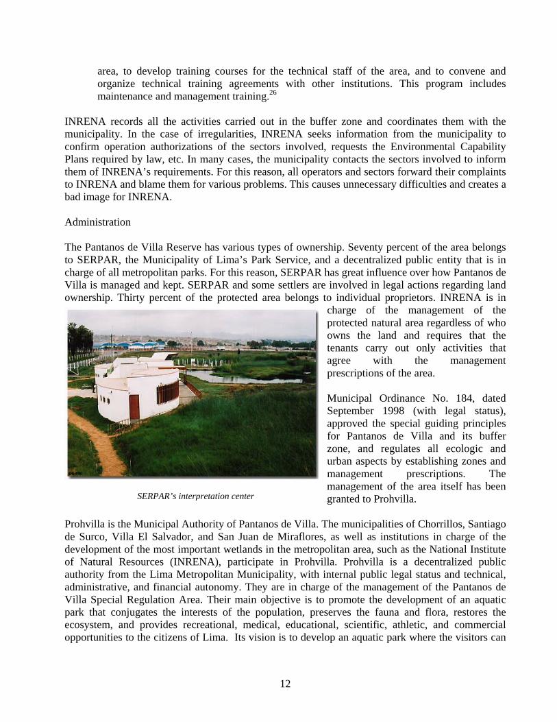
INRENA records all the activities carried out in the buffer zone and coordinates them with the municipality. In the case of irregularities, INRENA seeks information from the municipality to confirm operation authorizations of the sectors involved, requests the Environmental Capability Plans required by law, etc. In many cases, the municipality contacts the sectors involved to inform them of INRENA’s requirements. For this reason, all operators and sectors forward their complaints to INRENA and blame them for various problems. This causes unnecessary difficulties and creates a bad image for INRENA. Administration The Pantanos de Villa Reserve has various types of ownership. Seventy percent of the area belongs to SERPAR, the Municipality of Lima’s Park Service, and a decentralized public entity that is in charge of all metropolitan parks. For this reason, SERPAR has great influence over how Pantanos de Villa is managed and kept. SERPAR and some settlers are involved in legal actions regarding land ownership. Thirty percent of the protected area belongs to individual proprietors. INRENA is in
charge of the management of the protected natural area regardless of who owns the land and requires that the tenants carry out only activities that agree with the management prescriptions of the area. Municipal Ordinance No. 184, dated September 1998 (with legal status), approved the special guiding principles for Pantanos de Villa and its buffer zone, and regulates all ecologic and urban aspects by establishing zones and management prescriptions. The management of the area itself has been granted to Prohvilla. r
Prohvilla is thede Surco, Villadevelopment ofof Natural Reauthority from administrative, Villa Special Rpark that conjuecosystem, andopportunities to
SERPAR’s interpretation cente
Municipal Authority of Pantanos de Villa. The municipalities of Chorrillos, Santiago El Salvador, and San Juan de Miraflores, as well as institutions in charge of the the most important wetlands in the metropolitan area, such as the National Institute sources (INRENA), participate in Prohvilla. Prohvilla is a decentralized public the Lima Metropolitan Municipality, with internal public legal status and technical, and financial autonomy. They are in charge of the management of the Pantanos de egulation Area. Their main objective is to promote the development of an aquatic gates the interests of the population, preserves the fauna and flora, restores the provides recreational, medical, educational, scientific, athletic, and commercial the citizens of Lima. Its vision is to develop an aquatic park where the visitors can
12
learn about the importance of the natural ecosystem inside the great city, and where nature, productive activities, and humans coexist in an organized, healthy, and sustainable fashion. The people in charge of the Prohvilla Board of Directors are the Mayor of Lima, the Mayor of Villa el Salvador, the Mayor of San Juan de Miraflores, the Mayor of Santiago de Surco, the General Manager of the Lima Parks Service (SERPAR-LIMA), the Director of INRENA’s Office of Protected Natural Areas, and the Technical Director of the Metropolitan Institute of Planning , or their respective representatives. INRENA employs four park rangers, one professional, and a chief; it has no administrative staff. INRENA’s annual operation budget for the area amounts to approximately US$8,000. SERPAR employs 28 workers, including professionals, administrative staff, and custodial workers for the swamp area. The financial resources available for management purposes are based on the allocations of the municipalities that participate in the Board of Directors, donations received from national or foreign foundations or other institutions, concessions authorized after review of their feasibility and environmental impact studies, admittance fees, and other funds provided by the public treasury.27 SERPAR charges admittance to the area but the funds are not shared with INRENA. Adults pay S/. 5.00 (US$1.5) and children pay S/. 3.00 (US$0.8). The administrative headquarters are located at Av. 12 de Octubre, manzana D2 Lote 2, Las Delicias de Villa - Chorrillos (telefax : 258-81-07; e-mail: [email protected]). Human Influence During ancient Incan times the area belonged to the Sulco Dominion, whose capital city, Armatampu (“resting area”) was located 7 Km north of the natural area. Pantanos de Villa kept close links with the Pachacamac sanctuary, the most important of the central coast, located 15 Km south. The lagoons were mainly used for feeding purposes. According to the itinerant geographer Bernarcase (1902), swamps covered approximately 500 hectares. The predominant fauna were swamp bird species.28
Demography and Housing The town of Chorrillos has approximately 220,000 inhabitants and 40,300 houses. It has been estimated that the area surrounding the protected area has 116,200 inhabitants who reside in 21,200 houses: approximately 5.5 people per house.29
Even though the site is one of the oldest of the metropolitan area, the largest part of the population resides in human settlements. In the district, 12% of the population is less than 6 years old and 19% are between 6 and 14 years of age, totaling 66,000 persons under 15. Twenty-four percent of the population is between the ages of 15 and 24, meaning over half of the population is under 25.
13
Human settlements in the eastern sector of Pantanos de Villa
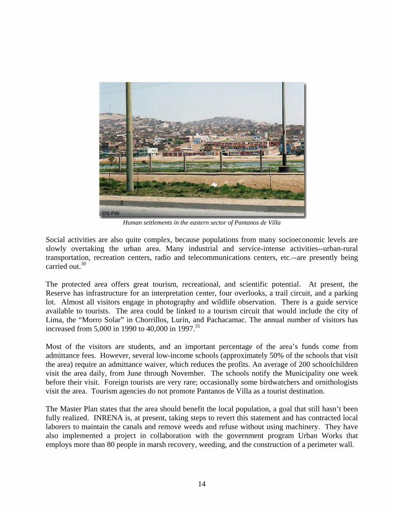
Social activities are also quite complex, because populations from many socioeconomic levels are slowly overtaking the urban area. Many industrial and service-intense activities--urban-rural transportation, recreation centers, radio and telecommunications centers, etc.--are presently being carried out.30 The protected area offers great tourism, recreational, and scientific potential. At present, the Reserve has infrastructure for an interpretation center, four overlooks, a trail circuit, and a parking lot. Almost all visitors engage in photography and wildlife observation. There is a guide service available to tourists. The area could be linked to a tourism circuit that would include the city of Lima, the “Morro Solar” in Chorrillos, Lurín, and Pachacamac. The annual number of visitors has increased from 5,000 in 1990 to 40,000 in 1997.31 Most of the visitors are students, and an important percentage of the area’s funds come from admittance fees. However, several low-income schools (approximately 50% of the schools that visit the area) require an admittance waiver, which reduces the profits. An average of 200 schoolchildren visit the area daily, from June through November. The schools notify the Municipality one week before their visit. Foreign tourists are very rare; occasionally some birdwatchers and ornithologists visit the area. Tourism agencies do not promote Pantanos de Villa as a tourist destination. The Master Plan states that the area should benefit the local population, a goal that still hasn’t been fully realized. INRENA is, at present, taking steps to revert this statement and has contracted local laborers to maintain the canals and remove weeds and refuse without using machinery. They have also implemented a project in collaboration with the government program Urban Works that employs more than 80 people in marsh recovery, weeding, and the construction of a perimeter wall.
14
Because enrolling in the Urban Works program represents too much bureaucracy for INRENA, the institute helps associations and human settlements request individual participation to benefit from this Government program. The Sagrada Familia and Garzas de Villa settlements have implemented some projects, such as the construction of a contention wall and a few wetlands recovery activities. The Delicias de Villa and Sagrada Familia settlements are lobbying for support from the program to build a trail around the contention wall. INRENA wants to promote projects related to the protected area to benefit local people.
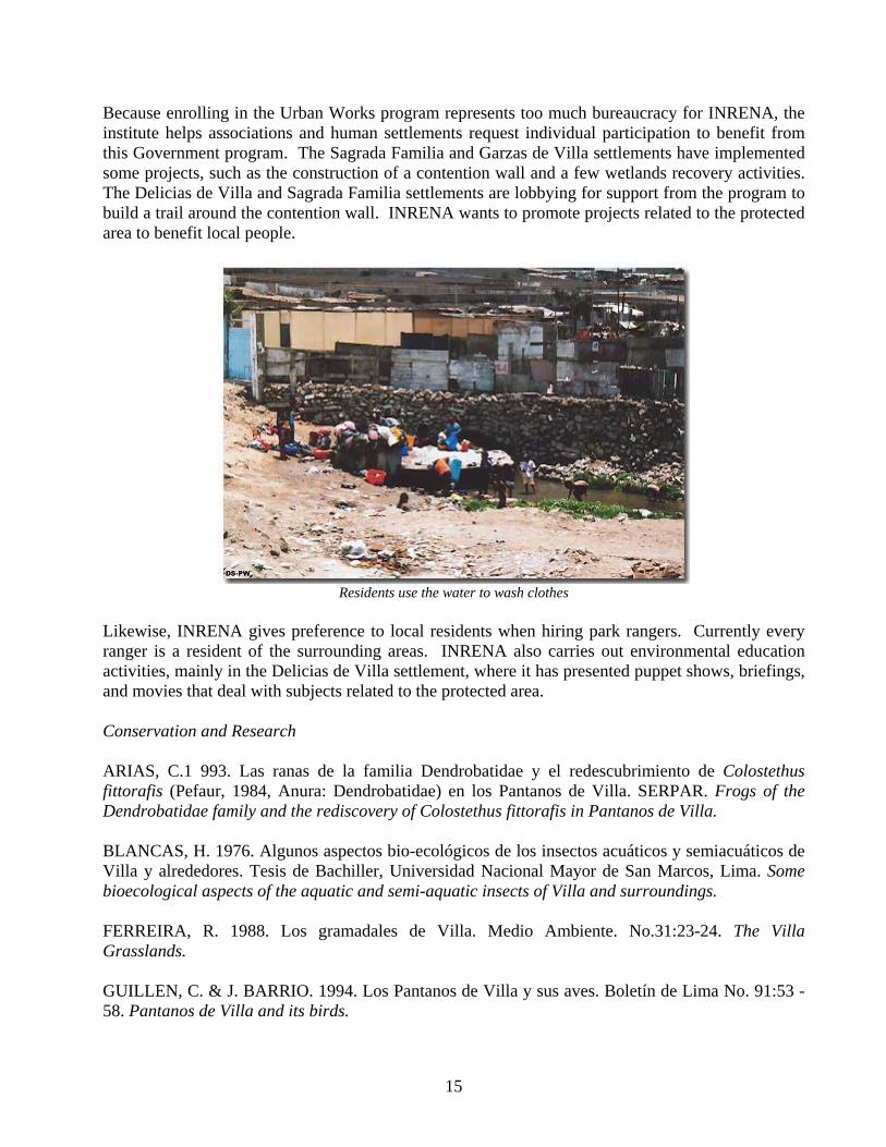
Residents use the water to wash clothes
Likewise, INRENA gives preference to local residents when hiring park rangers. Currently every ranger is a resident of the surrounding areas. INRENA also carries out environmental education activities, mainly in the Delicias de Villa settlement, where it has presented puppet shows, briefings, and movies that deal with subjects related to the protected area. Conservation and Research ARIAS, C.1 993. Las ranas de la familia Dendrobatidae y el redescubrimiento de Colostethus fittorafis (Pefaur, 1984, Anura: Dendrobatidae) en los Pantanos de Villa. SERPAR. Frogs of the Dendrobatidae family and the rediscovery of Colostethus fittorafis in Pantanos de Villa. BLANCAS, H. 1976. Algunos aspectos bio-ecológicos de los insectos acuáticos y semiacuáticos de Villa y alrededores. Tesis de Bachiller, Universidad Nacional Mayor de San Marcos, Lima. Some bioecological aspects of the aquatic and semi-aquatic insects of Villa and surroundings. FERREIRA, R. 1988. Los gramadales de Villa. Medio Ambiente. No.31:23-24. The Villa Grasslands. GUILLEN, C. & J. BARRIO. 1994. Los Pantanos de Villa y sus aves. Boletín de Lima No. 91:53 - 58. Pantanos de Villa and its birds.
15
WUST, W., LUSCOMBE, T. & T. VALQUI. 1994. Las aves de los Pantanos de Villa y alrededores. Asociación de Ecología y Conservación (ECCO). Lima. 37p. Birds of Pantanos de Villa and surroundings. Current Threats Pantanos de Villa Reserved Zone faces many threats, including:
• Land ownership conflicts: urban expansion • Socioeconomic conflicts • Industry • Poor management of swamp waters
The area residents carry out productive and commercial activities that frequently harm the wetland ecosystem. The reserve zone is set inside the urban area, the constant advance of which threatens the preservation of the boundaries. The Pantanos de Villa special use zone is “everybody’s land,” and greatly influences the four districts, with all the complexity involved. This is the same scenario where other factors that affect the quality of life of the families and the ecosystem interact, including: small and large industries, the great demand of state realtors for inexpensive land plots, and the inadequate water and sewage services. The constant filling of the wetlands that surround the protected area, the noise pollution from traffic jams, the presence of flood-prone facilities, the corrupted landscape, and the inefficient use of the land are also worrisome threats.32 The area also faces problems such as the difficulty of keeping the water supply to the area sustainable. Water comes from the San Juan and Óvalo de Villa underground creeks, and from the marginal basin of the Rímac River. The city of Lima has extracted important amounts of water from underground sources, which has depleted several springs and those that remain all originate in the San Juan area. There is a trend to illegally occupy the surrounding plots and to establish homes. Several lawsuits have been issued to recuperate the invaded areas. There is a pollution problem caused by weeding, garbage, and water stagnation. There are also conflicts between the pertinent authorities, such as the Municipalities of Chorrillos, Metropolitan Lima, and the Ministry of Agriculture, who do not seem to agree on a specific future objective.33
Territorial conflicts: Urban expansion Pantanos de Villa, a natural area wealthy in biological, recreational, and educational opportunities, has gradually been affected by accelerated reduction and deterioration due to urban pressure and the building of important infrastructure. As a matter of fact, planned and unplanned residential areas, the Panamerican highway, the industrial areas, the proliferation of sports clubs, and other infrastructure and development have gradually crept upon the ecosystem’s area. Today, although the protected natural area has clear boundaries, property rights overlap. SERPAR owns 208 hectares and Rinconada Villa Essant, a company that owns plots in the area, has 20 hectares, of which approximately 5 have already been invaded (by the Sagrada Familia and Garzas de Villa settlements). The northeast sector overlaps with plots from blocks U and Y of the Huertos
16
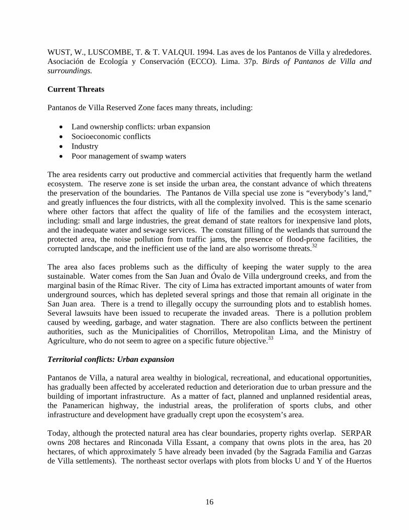
de Villa residential area. In the southeast region, SERPAR has taken legal actions against illegal tenants.34 Agricultural areas have become smaller, creating disorder in the region, and directly leading to a greater number of housing developments inside the wetlands, a collapse of the surrounding desert hills, pressure from urban infrastructure (roads, industrial clubs, radio antennae, etc.), a lack of physical boundaries and sewage in the buffer zone, an untidy landscape, a depletion of green recreational areas, and inadequate urban planning, all of which jeopardize the protected area’s integrity.
Human settlements in the northeastern sector of the protected area
17
Socioeconomic conflicts In the late 20th century, Pantanos de Villa was located in the outskirts of the city of Lima. The activities carried out there where mostly agricultural and, chiefly, herding of cattle, especially fighting bulls. The zone is easily accessible through the South Panamerican Highway and Huaylas Avenue. The presence of roads and empty plots in this fast-growing environment favored the creation of housing developments and mixed settlements. The hillsides surrounding the marshes and the flatlands previously used for cattle herding became settled or fragmented into plots, and later sold for housing, productive purposes, or a combination of both. Human settlements and housing developments reduced the wetland area. The low and very-low income population settled in the northern and eastern zones of the marsh while the high-income residents went to the southeast part. Thus, geographical sections of the zone are used differently depending on the residents. Former wetlands that had dried up were immediately taken over for industrial and commercial purposes which jeopardize the protected area. All of the above causes even more land ownership problems. The social problems are worsened because drinking water is not available in most of the surrounding human settlements, so they obtain it from vendor trucks. Most of the houses have wells, but some do not even have a sewage system. The main socioeconomic conflicts arise from the lack of job opportunities, poverty, marginality, unemployment and underemployment, informal economic activities, underused local resources, a lack of business opportunities, self-made precarious housing, deficient basic services, lacking infrastructure, and scare urban facilities in the surrounding human settlements. The institutional conflicts that arise from the lack of agreement regarding the management of the protected natural area are due to four distinct aspects: 1) Lack of long-term development plans, 2) dispersion and overlap of institutional responsibilities, 3) partial and fragmented vision of the present status, and 4) inefficient coordination mechanisms between institutions. These conflicts evince the lack of organization and control of the urban and industrial activities, transportation and roads, and infrastructure and equipment. Many of these are obviously incompatible with the wetlands’ conservation objectives.35 Industry Several companies operate in the surrounding areas. The companies that operate inside the buffer zone are 3M (office materials), which owns a large store; Mimosa Kimberly (diapers, toilet paper, etc.), and Globe Natural (cosmetics and natural products), as well as several smaller companies that operate in the settlements of the hillsides.
18
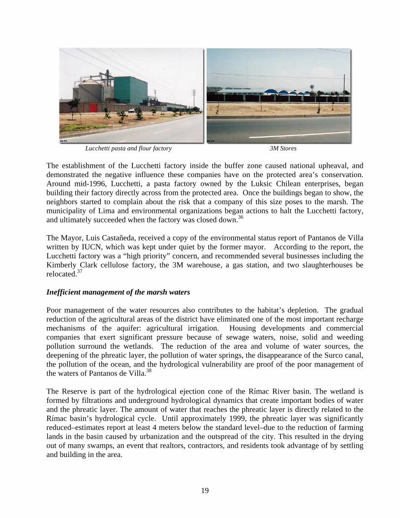
Lucchetti pasta and flour factory 3M Stores The establishment of the Lucchetti factory inside the buffer zone caused national upheaval, and demonstrated the negative influence these companies have on the protected area’s conservation. Around mid-1996, Lucchetti, a pasta factory owned by the Luksic Chilean enterprises, began building their factory directly across from the protected area. Once the buildings began to show, the neighbors started to complain about the risk that a company of this size poses to the marsh. The municipality of Lima and environmental organizations began actions to halt the Lucchetti factory, and ultimately succeeded when the factory was closed down.36 The Mayor, Luis Castañeda, received a copy of the environmental status report of Pantanos de Villa written by IUCN, which was kept under quiet by the former mayor. According to the report, the Lucchetti factory was a “high priority” concern, and recommended several businesses including the Kimberly Clark cellulose factory, the 3M warehouse, a gas station, and two slaughterhouses be relocated.37
Inefficient management of the marsh waters Poor management of the water resources also contributes to the habitat’s depletion. The gradual reduction of the agricultural areas of the district have eliminated one of the most important recharge mechanisms of the aquifer: agricultural irrigation. Housing developments and commercial companies that exert significant pressure because of sewage waters, noise, solid and weeding pollution surround the wetlands. The reduction of the area and volume of water sources, the deepening of the phreatic layer, the pollution of water springs, the disappearance of the Surco canal, the pollution of the ocean, and the hydrological vulnerability are proof of the poor management of the waters of Pantanos de Villa.38 The Reserve is part of the hydrological ejection cone of the Rímac River basin. The wetland is formed by filtrations and underground hydrological dynamics that create important bodies of water and the phreatic layer. The amount of water that reaches the phreatic layer is directly related to the Rímac basin’s hydrological cycle. Until approximately 1999, the phreatic layer was significantly reduced–estimates report at least 4 meters below the standard level–due to the reduction of farming lands in the basin caused by urbanization and the outspread of the city. This resulted in the drying out of many swamps, an event that realtors, contractors, and residents took advantage of by settling and building in the area.
19
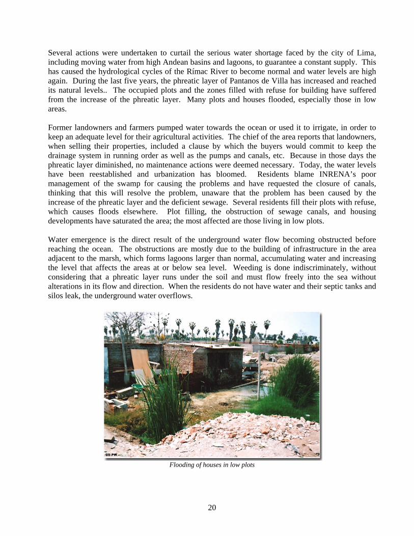
Several actions were undertaken to curtail the serious water shortage faced by the city of Lima, including moving water from high Andean basins and lagoons, to guarantee a constant supply. This has caused the hydrological cycles of the Rímac River to become normal and water levels are high again. During the last five years, the phreatic layer of Pantanos de Villa has increased and reached its natural levels.. The occupied plots and the zones filled with refuse for building have suffered from the increase of the phreatic layer. Many plots and houses flooded, especially those in low areas. Former landowners and farmers pumped water towards the ocean or used it to irrigate, in order to keep an adequate level for their agricultural activities. The chief of the area reports that landowners, when selling their properties, included a clause by which the buyers would commit to keep the drainage system in running order as well as the pumps and canals, etc. Because in those days the phreatic layer diminished, no maintenance actions were deemed necessary. Today, the water levels have been reestablished and urbanization has bloomed. Residents blame INRENA’s poor management of the swamp for causing the problems and have requested the closure of canals, thinking that this will resolve the problem, unaware that the problem has been caused by the increase of the phreatic layer and the deficient sewage. Several residents fill their plots with refuse, which causes floods elsewhere. Plot filling, the obstruction of sewage canals, and housing developments have saturated the area; the most affected are those living in low plots. Water emergence is the direct result of the underground water flow becoming obstructed before reaching the ocean. The obstructions are mostly due to the building of infrastructure in the area adjacent to the marsh, which forms lagoons larger than normal, accumulating water and increasing the level that affects the areas at or below sea level. Weeding is done indiscriminately, without considering that a phreatic layer runs under the soil and must flow freely into the sea without alterations in its flow and direction. When the residents do not have water and their septic tanks and silos leak, the underground water overflows.
Flooding of houses in low plots
20
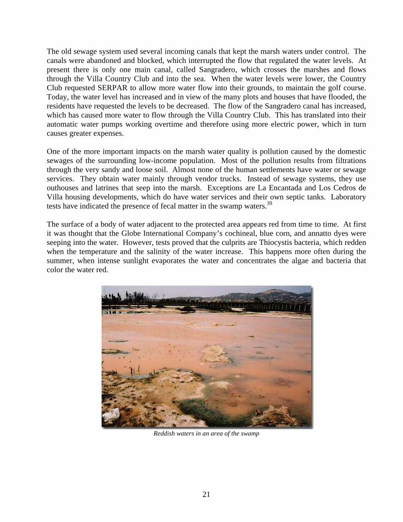
The old sewage system used several incoming canals that kept the marsh waters under control. The canals were abandoned and blocked, which interrupted the flow that regulated the water levels. At present there is only one main canal, called Sangradero, which crosses the marshes and flows through the Villa Country Club and into the sea. When the water levels were lower, the Country Club requested SERPAR to allow more water flow into their grounds, to maintain the golf course. Today, the water level has increased and in view of the many plots and houses that have flooded, the residents have requested the levels to be decreased. The flow of the Sangradero canal has increased, which has caused more water to flow through the Villa Country Club. This has translated into their automatic water pumps working overtime and therefore using more electric power, which in turn causes greater expenses. One of the more important impacts on the marsh water quality is pollution caused by the domestic sewages of the surrounding low-income population. Most of the pollution results from filtrations through the very sandy and loose soil. Almost none of the human settlements have water or sewage services. They obtain water mainly through vendor trucks. Instead of sewage systems, they use outhouses and latrines that seep into the marsh. Exceptions are La Encantada and Los Cedros de Villa housing developments, which do have water services and their own septic tanks. Laboratory tests have indicated the presence of fecal matter in the swamp waters.39 The surface of a body of water adjacent to the protected area appears red from time to time. At first it was thought that the Globe International Company’s cochineal, blue corn, and annatto dyes were seeping into the water. However, tests proved that the culprits are Thiocystis bacteria, which redden when the temperature and the salinity of the water increase. This happens more often during the summer, when intense sunlight evaporates the water and concentrates the algae and bacteria that color the water red.
Reddish waters in an area of the swamp
21
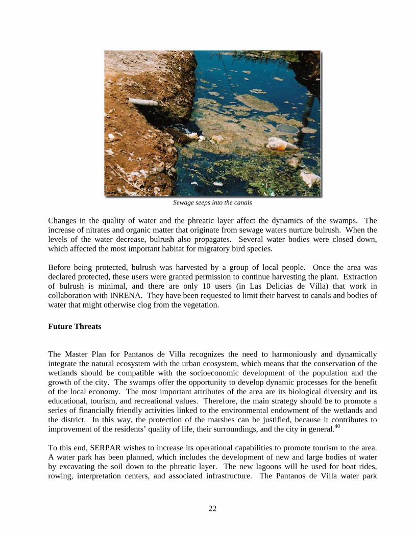
Sewage seeps into the canals
Changes in the quality of water and the phreatic layer affect the dynamics of the swamps. The increase of nitrates and organic matter that originate from sewage waters nurture bulrush. When the levels of the water decrease, bulrush also propagates. Several water bodies were closed down, which affected the most important habitat for migratory bird species. Before being protected, bulrush was harvested by a group of local people. Once the area was declared protected, these users were granted permission to continue harvesting the plant. Extraction of bulrush is minimal, and there are only 10 users (in Las Delicias de Villa) that work in collaboration with INRENA. They have been requested to limit their harvest to canals and bodies of water that might otherwise clog from the vegetation.
Future Threats
The Master Plan for Pantanos de Villa recognizes the need to harmoniously and dynamically integrate the natural ecosystem with the urban ecosystem, which means that the conservation of the wetlands should be compatible with the socioeconomic development of the population and the growth of the city. The swamps offer the opportunity to develop dynamic processes for the benefit of the local economy. The most important attributes of the area are its biological diversity and its educational, tourism, and recreational values. Therefore, the main strategy should be to promote a series of financially friendly activities linked to the environmental endowment of the wetlands and the district. In this way, the protection of the marshes can be justified, because it contributes to improvement of the residents’ quality of life, their surroundings, and the city in general.40
To this end, SERPAR wishes to increase its operational capabilities to promote tourism to the area. A water park has been planned, which includes the development of new and large bodies of water by excavating the soil down to the phreatic layer. The new lagoons will be used for boat rides, rowing, interpretation centers, and associated infrastructure. The Pantanos de Villa water park
22
project requires several facilities for information and interpretation centers, classrooms, and documentation centers, trails and picnic areas, parking lots, overlooks, botanical research stations, eco-museums, and lodges. According to SERPAR, the area is just right for the project because the water surfaces of the south will be made larger, the new lagoons will regulate the surface waters, the surplus aquifers will be managed, eco-tourism circuits and sites will be opened, and some areas will be used for compatible purposes and activities.41
The Fondo de las Américas has issued a complementary proposal suggesting that private companies assume responsibility for their activities or adopt projects. The Fondo de las Américas will contribute 50 % to the companies that adopt a project. The Metropolitan Municipality of Lima has suggested several installation projects for the swamps, including nesting posts, information signposts, elevated trails, log trails, an aerostatic globe overlook, a seven-colors cafeteria, a security plant wall, and bird watching overlooks, as well a project to rehabilitate the community laundry in the Palmeras de Villa human settlements, and donations for conservation (canal cleaning, specialized information, ecological latrines, etc.). The water park project implies the removal of large amounts of soil from the marshes, which will interfere with the present landscape. This will modify important bird and small reptile nesting sites and will jeopardize the animals that depend upon the ecosystem. The park will most likely interfere with the hydrological dynamics and water flows. The construction and constant visitors inside an area where such activities are presently prohibited will most surely affect the migratory and local bird species. This project is quite controversial and, if approved, will cause upheaval and public debates. The media will participate in the process and the issue will most likely raise political awareness, as did the Lucchetti factory case. If the project is given the green light, environmental impact assessments will have to be carried out. The municipality proposing the park should not assess the studies.
Recommended Solutions
Land ownership conflicts: Urban expansion It is necessary to carry out a physical and legal cleanup of the area and resolve all pending judicial matters. Overlapping land ownership problems must be resolved. A municipal ordinance must be implemented to homogenize the zoning of the area concerning land and plot use. All these recommendations need the collaboration of the municipality, INRENA, and other pertinent institutions such as the Ministry of Housing or of Transportation, to resolve road issues. If the reserve is divided into zones, it is recommended to cut down the area that is presently occupied by the Sagrada Familia and Las Garzas de Villa human settlements, up to at least five hectares inside the reserve. Socioeconomic conflicts The socioeconomic problems of the human settlements that surround the protected area should be reduced or resolved to minimize the many threats the population poses upon the area. The resolution of the water supply and sewage problems in the low-income settlements surrounding the
23
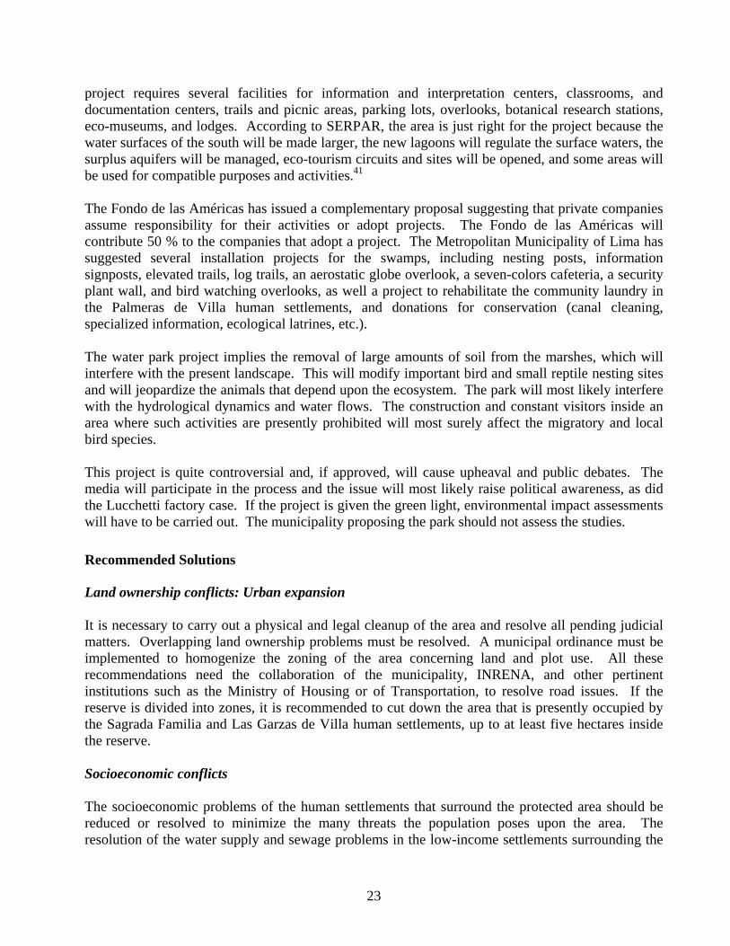
area will translate into improved quality swamp water. If potable water is supplied, the unsustainable use (laundry, car washing, extraction for drinking) of swamp water will decrease. The installation of sewage facilities will help reduce the pollution of underground and surface swamp water. The supply of water and sewage is a public service and the government must take charge if the area is to be preserved. A social problem will be resolved and the swamp will be released from the pressure it is under, if water and sewage services are supplied. Control actions must be enforced by implementing and strengthening patrols and surveillance, to prevent neighboring residents from conducting activities that jeopardize the swamps. Environmental education is fundamental to raise awareness among the neighbors and visitors, by teaching about the ecosystem, the threats it faces, and the rules and bylaws that have been implemented for the sustainable use of the protected area. Industry The dried up wetlands are used not only for housing purposes, but also for industrial and commercial activities that antagonize the protected area. New companies whose operations damage the Pantanos de Villa ecosystem should not be permitted to operate inside the buffer zone. Large companies with large-scale infrastructure should also be banned from the area. Even minimum-impact companies whose operations do not interfere with the ecosystem must fully comply with the existing environmental rules and regulations. Control and surveillance must be strictly enforced and exemplary sanctions be given to individuals and companies who do not observe the rules or jeopardize the ecosystem. In the case of companies that do not comply with the regulations, they should be subject to eviction. The Lucchetti factory case must be used as an example for all companies that do not follow the regulations.
Closing of the Lucchetti factory
24
Closing of the fuel faucet
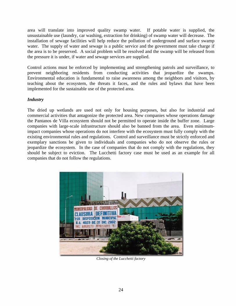
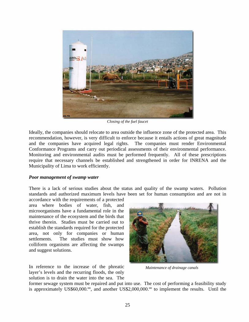
Ideally, the companies should relocate to area outside the influence zone of the protected area. This recommendation, however, is very difficult to enforce because it entails actions of great magnitude and the companies have acquired legal rights. The companies must render Environmental Conformance Programs and carry out periodical assessments of their environmental performance. Monitoring and environmental audits must be performed frequently. All of these prescriptions require that necessary channels be established and strengthened in order for INRENA and the Municipality of Lima to work efficiently. Poor management of swamp water There is a lack of serious studies about the status and quality of the swamp waters. Pollution standards and authorized maximum levels have been set for human consumption and are not in accordance with the requirements of a protected area where bodies of water, fish, and microorganisms have a fundamental role in the maintenance of the ecosystem and the birds that thrive therein. Studies must be carried out to establish the standards required for the protected area, not only for companies or human settlements. The studies must show how colliform organisms are affecting the swamps and suggest solutions.
In reference to the increase of the phreatic layer’s levels and the recurring floods, the only solution is to drain the water into the sea. The former sewage system must be repaired and put into use. The cost of performing a feasibility study is approximately US$60,000.ºº, and another US$2,000,000.ºº to implement the results. Until the
Maintenance of drainage canals
25
funds are available, the existing sewage options should be optimized and the canals (such as the Sangradero) be used more efficiently to allow the drainage of excess water and keep the swamp waters at an adequate level.
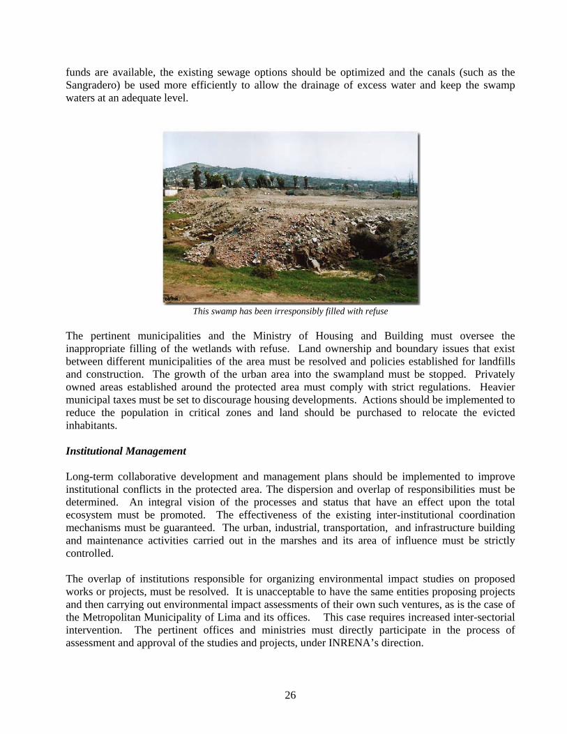
This swamp has been irresponsibly filled with refuse
The pertinent municipalities and the Ministry of Housing and Building must oversee the inappropriate filling of the wetlands with refuse. Land ownership and boundary issues that exist between different municipalities of the area must be resolved and policies established for landfills and construction. The growth of the urban area into the swampland must be stopped. Privately owned areas established around the protected area must comply with strict regulations. Heavier municipal taxes must be set to discourage housing developments. Actions should be implemented to reduce the population in critical zones and land should be purchased to relocate the evicted inhabitants. Institutional Management Long-term collaborative development and management plans should be implemented to improve institutional conflicts in the protected area. The dispersion and overlap of responsibilities must be determined. An integral vision of the processes and status that have an effect upon the total ecosystem must be promoted. The effectiveness of the existing inter-institutional coordination mechanisms must be guaranteed. The urban, industrial, transportation, and infrastructure building and maintenance activities carried out in the marshes and its area of influence must be strictly controlled. The overlap of institutions responsible for organizing environmental impact studies on proposed works or projects, must be resolved. It is unacceptable to have the same entities proposing projects and then carrying out environmental impact assessments of their own such ventures, as is the case of the Metropolitan Municipality of Lima and its offices. This case requires increased inter-sectorial intervention. The pertinent offices and ministries must directly participate in the process of assessment and approval of the studies and projects, under INRENA’s direction.
26
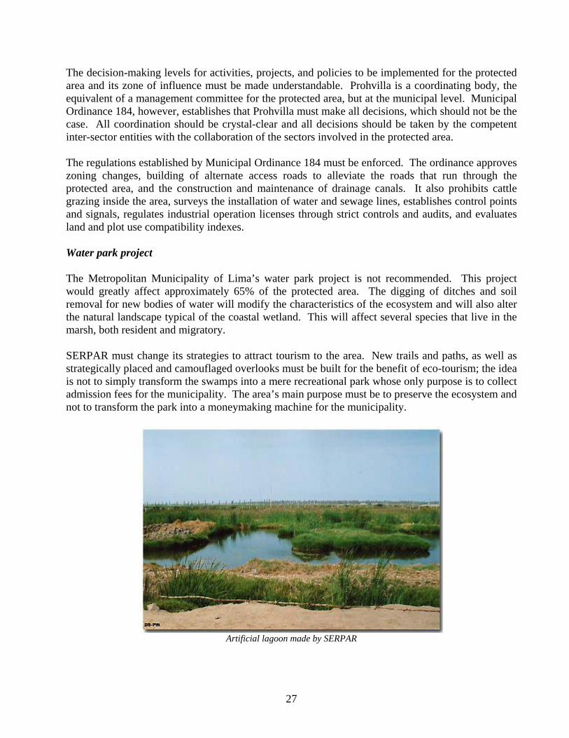
The decision-making levels for activities, projects, and policies to be implemented for the protected area and its zone of influence must be made understandable. Prohvilla is a coordinating body, the equivalent of a management committee for the protected area, but at the municipal level. Municipal Ordinance 184, however, establishes that Prohvilla must make all decisions, which should not be the case. All coordination should be crystal-clear and all decisions should be taken by the competent inter-sector entities with the collaboration of the sectors involved in the protected area. The regulations established by Municipal Ordinance 184 must be enforced. The ordinance approves zoning changes, building of alternate access roads to alleviate the roads that run through the protected area, and the construction and maintenance of drainage canals. It also prohibits cattle grazing inside the area, surveys the installation of water and sewage lines, establishes control points and signals, regulates industrial operation licenses through strict controls and audits, and evaluates land and plot use compatibility indexes. Water park project The Metropolitan Municipality of Lima’s water park project is not recommended. This project would greatly affect approximately 65% of the protected area. The digging of ditches and soil removal for new bodies of water will modify the characteristics of the ecosystem and will also alter the natural landscape typical of the coastal wetland. This will affect several species that live in the marsh, both resident and migratory. SERPAR must change its strategies to attract tourism to the area. New trails and paths, as well as strategically placed and camouflaged overlooks must be built for the benefit of eco-tourism; the idea is not to simply transform the swamps into a mere recreational park whose only purpose is to collect admission fees for the municipality. The area’s main purpose must be to preserve the ecosystem and not to transform the park into a moneymaking machine for the municipality.
Artificial lagoon made by SERPAR
27
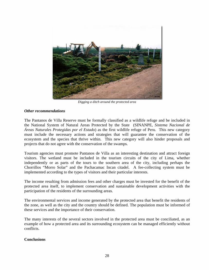
Digging a ditch around the protected area
Other recommendations The Pantanos de Villa Reserve must be formally classified as a wildlife refuge and be included in the National System of Natural Areas Protected by the State (SINANPE, Sistema Nacional de Áreas Naturales Protegidas por el Estado) as the first wildlife refuge of Peru. This new category must include the necessary actions and strategies that will guarantee the conservation of the ecosystem and the species that thrive within. This new category will also hinder proposals and projects that do not agree with the conservation of the swamps. Tourism agencies must promote Pantanos de Villa as an interesting destination and attract foreign visitors. The wetland must be included in the tourism circuits of the city of Lima, whether independently or as parts of the tours to the southern area of the city, including perhaps the Chorrillos “Morro Solar” and the Pachacamac Incan citadel. A fee-collecting system must be implemented according to the types of visitors and their particular interests. The income resulting from admission fees and other charges must be invested for the benefit of the protected area itself, to implement conservation and sustainable development activities with the participation of the residents of the surrounding areas. The environmental services and income generated by the protected area that benefit the residents of the zone, as well as the city and the country should be defined. The population must be informed of these services and the importance of their conservation. The many interests of the several sectors involved in the protected area must be conciliated, as an example of how a protected area and its surrounding ecosystem can be managed efficiently without conflicts.
Conclusions
28
The Pantanos de Villa Reserve wetlands are part of the migratory corridor used by several bird species along the Pacific coast. The reserve includes many habitats, each with its own biodiversity. It is located in the city of Lima, surrounded by a multi-tasking urban zone that includes industrial operations. The main objectives of the Pantanos de Villa Reserve include the protection of migratory and resident aquatic bird species, the preservation of important wild flora associations that are native to the coastal aquatic ecosystems, and the defense and care of the landscape to promote educational and tourism activities. The lands of the Pantanos de Villa Reserve are property of multiple owners, though the majority (70%) belongs to SERPAR, the Municipality of Lima’s Park Service, which is why they have great influence over the reserve’s maintenance and management. The other 30% of the protected area is privately owned. INRENA manages the protected natural area regardless of who owns the land, and requires that they only engage in activities that do not harm the protected area. The residents of the area conduct productive and commercial activities that frequently damage the ecosystem of Pantanos de Villa. The threats faced by the reserve include land ownership conflicts and urban expansion, socioeconomic conflicts, industrial operations, and unproductive water management. Pantanos de Villa is a natural area with enormous biological, recreational, and educational wealth that has become rapidly reduced and deteriorated due to urban pressure and the building of large infrastructure. The low and very-low income populations settled in the northern and eastern zones of the marsh and the high-income residents that live in the southeast are proof of the conflicting and varied land uses. The inadequate use of the water resources also deteriorates the habitat. The old drainage sewage used several incoming canals that kept the marsh waters under control. These canals were abandoned and obstructed, which interrupted the flow that regulated the water levels. SERPAR wishes to increase its operational capabilities to promote tourism to the area. A water park has been planned, which includes the development of new and large bodies of water by excavating the soil down to the phreatic layer. This project requires equipment and infrastructure that will interfere with the integrity of the landscape and with the conservation of the ecosystem. It is necessary to carry out a physical and legal cleanup of the area and to resolve all pending judicial matters. The solution to the water and sewage services for the low-income settlements around the area will translate into improved quality of the swamp waters. It is also necessary to ban new companies whose operations conflict with the ecosystem’s integrity. Control must be strictly enforced and constant. The effectiveness of the existing inter-institutional coordination mechanisms must be guaranteed. In reference to the increase of the phreatic layer’s levels and the recurring floods, the only solution is to drain the water into the sea. The former sewage system must be repaired and put into use. The Metropolitan Municipality of Lima’s water park project is not recommended.
29
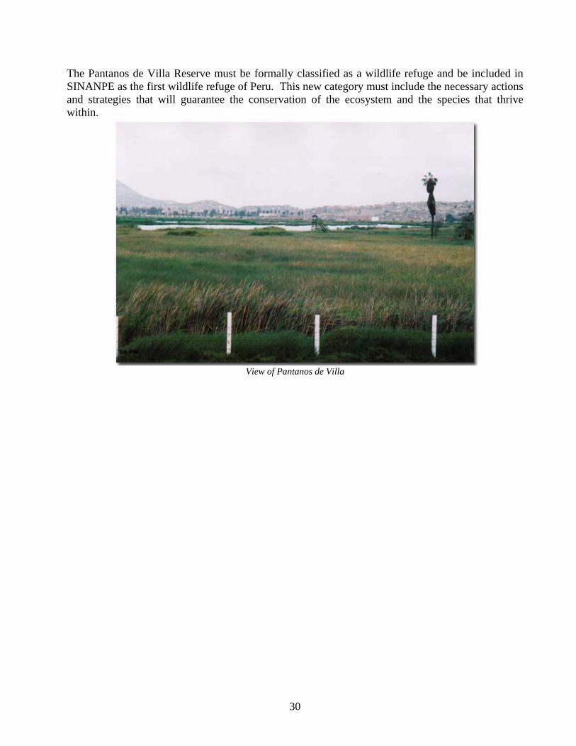
The Pantanos de Villa Reserve must be formally classified as a wildlife refuge and be included in SINANPE as the first wildlife refuge of Peru. This new category must include the necessary actions and strategies that will guarantee the conservation of the ecosystem and the species that thrive within.
View of Pantanos de Villa
30
References
• CANO, A., LEON, B. & K. YOUNG. 1993. Plantas vasculares de los Pantanos de Villa, Lima. p. 177 - 207. En: Kanh, R, León., B. & K. Young (compils). Las plantas vasculares en las aguas continentales del Perú. Instituto Francés de Estudios Andinos, Lima
• DAVIS, T., BLASCO, D. & M. CARBONELL. 1996. Manual de la Convención Ramsar.
Dirección General de Conservación de la Naturaleza, Ministerio de Medio Ambiente, España. 211 pp.
• DIRECCION GENERAL DE ÁREAS NATURALES PROTEGIDAS Y FAUNA
SILVESTRE. 1996. Estrategia Nacional para la Conservación de Humedales en el Perú. Ministerio de Agricultura, Instituto Nacional de Recursos Naturales. Programa de Conservación y Desarrollo Sostenido de Humedales, Perú. Lima, Perú. 278 pp.
• DIRECCION GENERAL DE ÁREAS NATURALES PROTEGIDAS Y FAUNA
SILVESTRE. 1997. Informe Técnico "Categorización de la Zona Reservada de los Pantanos de Villa a Refugio de Vida Silvestre" Ministerio de Agricultura, Instituto Nacional de Recursos Naturales. Lima, Perú.
• KOEPCKE, M. 1964. Las Aves del Departamento de Lima. Lima, Perú. pp 128.
• LAURO, A., CANO, A. & L. CARPO. 1993, Los Pantanos de Villa. Conocer, proteger,
conservar. Terra Nuova. Lima.
• LIZARZABURU, J. 1992. Plano del área ecológica de la Laguna de Villa. Zonas de vida natural. Boletín de Lima. No. 38:65 - 70.
• PROGRAMA DE CONSERVACIÓN Y DESARROLLO SOSTENIDO DE HUMEDALES,
PERÚ. 1998. Reporte de Humedales 1992 - 1997. INRENA, UNALM, PRONATURALEZA, Wl, WWF Lima, Perú. 131 pp.
• SCOTT, D. & M. CARBONELL. 1988. Inventario de Humedales de la Región Neotropical.
Taller de Trabajo para Gestores Ambientales, del 05 al 07 de Octubre de 1988.
• SOLANO, P. & NOEJOVICH, F. 1994. Situación legal del Sistema Nacional de Áreas Naturales Protegidas. Sociedad Peruana de Derecho Ambiental. Lima. 105p.
• VELARDE, D. 1998. Resultados de los Censos Neotropicales de Aves Acuáticas en el Perú,
1992 - 1995. Programa de Conservación y Desarrollo Sostenido de Humedales, Perú. Lima, Perú. 278 pp.
• WUST, W., LUSCOMBE, T. & T. VALQUI. 1997. Humedales de Villa. Refugio de Vida
Silvestre. Documentos Sustentatorios para la Categorización del Área Natural Protegida Pantanos de Villa. Instituto Nacional de Recursos Naturales - INRENA, Oficina de Asesoría a y Consultoría Ambiental - OACA, TERRA NUOVA, Unión Europea.
31
NOTES
1 http://www.prohvilla.munlima.gob.pe/QuienesSomos.htm
2 Master Plan – Pantanos de Villa. Ministerio de Agricultura, Instituto Nacional de Recursos Naturales INRENA, Dirección General de Áreas Naturales Protegidas y Fauna Silvestre. Lima 1998. Page 21. 3 http://www.inrena.gob.pe/dganp_cat_zr_02.html 4 Master Plan – Pantanos de Villa. Ministerio de Agricultura, Instituto Nacional de Recursos Naturales INRENA, Dirección General de Áreas Naturales Protegidas y Fauna Silvestre. Lima 1998. Pages 17-18. 5 http://www.monografias.com/trabajos16/pantanos-de-villa/pantanos-de-villa.shtmlLLAUCE CAJUSOL FRANCISCO D. [email protected] Peruana de las Americas. Curso: Ecología. Lima - Peru 6 6 http://peru.gotolatin.com/spa/Guide/PeruNationalParks/PantanosVilla/Pantanos-Villa-1.aspMaster Plan – Pantanos de Villa. Ministerio de Agricultura, Instituto Nacional de Recursos Naturales INRENA, Dirección General de Áreas Naturales Protegidas y Fauna Silvestre. Lima 1998. Pages 18 - 19. 7 http://www.monografias.com/trabajos16/pantanos-de-villa/pantanos-de-villa.shtmlLLAUCE CAJUSOL FRANCISCO D. [email protected] Peruana de las Americas. Curso: Ecología. Lima - Peru 8 Master Plan – Pantanos de Villa. Ministerio de Agricultura, Instituto Nacional de Recursos Naturales INRENA, Dirección General de Áreas Naturales Protegidas y Fauna Silvestre. Lima 1998. Page 19. 9 Master Plan – Pantanos de Villa. Ministerio de Agricultura, Instituto Nacional de Recursos Naturales INRENA, Dirección General de Áreas Naturales Protegidas y Fauna Silvestre. Lima 1998. Page 17. 10 http://www.monografias.com/trabajos16/pantanos-de-villa/pantanos-de-villa.shtmlLLAUCE CAJUSOL FRANCISCO D. [email protected] Peruana de las Americas. Curso: Ecología. Lima - Peru 11 http://peru.gotolatin.com/spa/Guide/PeruNationalParks/PantanosVilla/Pantanos-Villa-1.asphttp://www.enjoyperu.com/naturaleza/zonas-reserv/reser-pantanos-villa/index2.htm 12 Master Plan – Pantanos de Villa. Ministerio de Agricultura, Instituto Nacional de Recursos Naturales INRENA, Dirección General de Áreas Naturales Protegidas y Fauna Silvestre. Lima 1998. Page 19 13 Master Plan – Pantanos de Villa. Ministerio de Agricultura, Instituto Nacional de Recursos Naturales INRENA, Dirección General de Áreas Naturales Protegidas y Fauna Silvestre. Lima 1998. Page 20. 14 Master Plan – Pantanos de Villa. Ministerio de Agricultura, Instituto Nacional de Recursos Naturales INRENA, Dirección General de Áreas Naturales Protegidas y Fauna Silvestre. Lima 1998. Pages 69 – 70. (Annex 2).
32
15 http://peru.gotolatin.com/spa/Guide/PeruNationalParks/PantanosVilla/Pantanos-Villa-1.asphttp://www.inrena.gob.pe/dganp_cat_zr_02.html 16 Master Plan – Pantanos de Villa. Ministerio de Agricultura, Instituto Nacional de Recursos Naturales INRENA, Dirección General de Áreas Naturales Protegidas y Fauna Silvestre. Lima 1998. Page 70. (Annex 3). * List of birds, Pages 71 – 74. (Annex 4). 17 http://peru.gotolatin.com/spa/Guide/PeruNationalParks/PantanosVilla/Pantanos-Villa-1.asphttp://www.enjoyperu.com/naturaleza/zonas-reserv/reser-pantanos-villa/index2.htm 18 Statement from the ZRPV Area Chief Omar Ubillús, by e-mail 25/01/05. 19 http://www.peruecologico.com.pe/lib_c8_t10.htm 20 http://www.pantanosdevilla.com/principal.htm 21 Article No. 25 of Law 26834, Law of the Protected Natural Areas states that the buffer zones are the areas adjacent to protected natural areas that require special treatment to guarantee the conservation of the protected natural area. The Master Plan for each area defines the size of the respective buffer zone and states that the activities carried out therein should not interfere with the objectives of the protected natural area. 22 Article No. 22 of Law 26834, Law of Protected Natural Areas states that Wildlife Refuges are areas that require active intervention and management to guarantee the preservation of the habitats, as well as to satisfy the particular needs of individual species, as reproduction areas and other critical sites, to recuperate or maintain the populations of said species. Article No. 54 of the Regulations of the Law of the Protected Natural Areas, Supreme Decree No. 038-2001-AG authorizes public use, intervention, and management of the habitat to guarantee the maintenance of the features, promote population increase, or to satisfy the particular needs of the species. The extraction of species is authorized if it is done to regulate populations, per the area’s objectives and under strict regulations and specific authorization. The use and commercial harvest of natural resources that might cause significant modifications to the habitat or interfere with the objectives of the area are not permitted. The extraction of non-renewable resources will only be authorized if the users abide by the relevant regulations. 23 Article No. 13 of Law 26834, Law of Protected Natural Areas states that the Ministry of Agriculture can declare Reserved all areas that embody the characteristics of Protected Natural Areas and that require complementary studies to determine, among others, the breadth and category that they will be classified under. Reserves are part of the SINANPE (Sistema Nacional de Áreas Naturales Protegidas por el Estado – National System of Natural Areas Protected by the State) and are subject to all dispositions corresponding to Protected Natural Areas according to the existing Law and bylaws. Article No. 59 of the Law of Protected Natural Areas, Supreme Decree No. 038-2001-AG, refers to Reserves. 24 Master Plan – Pantanos de Villa. Ministerio de Agricultura, Instituto Nacional de Recursos Naturales INRENA, Dirección General de Áreas Naturales Protegidas y Fauna Silvestre. Lima 1998. Page 13. Briefing. 25 Master Plan – Pantanos de Villa. Ministerio de Agricultura, Instituto Nacional de Recursos Naturales INRENA, Dirección General de Áreas Naturales Protegidas y Fauna Silvestre. Lima 1998. Pages 39 – 40. 26 Master Plan – Pantanos de Villa. Ministerio de Agricultura, Instituto Nacional de Recursos Naturales INRENA, Dirección General de Áreas Naturales Protegidas y Fauna Silvestre. Lima 1998. Pages 41 – 44. 27 http://www.prohvilla.munlima.gob.pe/QuienesSomos.htm 28 http://www.pantanosdevilla.com/principal.htm 29 Estimated by the author using figures from the 1993 census.
33
30 Master Plan – Pantanos de Villa. Ministerio de Agricultura, Instituto Nacional de Recursos Naturales INRENA, Dirección General de Áreas Naturales Protegidas y Fauna Silvestre. Lima 1998. Page 22. 31 Master Plan – Pantanos de Villa. Ministerio de Agricultura, Instituto Nacional de Recursos Naturales INRENA, Dirección General de Áreas Naturales Protegidas y Fauna Silvestre. Lima 1998. Page 27. 32 http://www.prohvilla.munlima.gob.pe/Problematica.htm 33 http://www.peruecologico.com.pe/lib_c8_t10.htm 34 Master Plan – Pantanos de Villa. Ministerio de Agricultura, Instituto Nacional de Recursos Naturales INRENA, Dirección General de Áreas Naturales Protegidas y Fauna Silvestre. Lima 1998. Pages 26 – 27. 35 Master Plan – Pantanos de Villa. Ministerio de Agricultura, Instituto Nacional de Recursos Naturales INRENA, Dirección General de Áreas Naturales Protegidas y Fauna Silvestre. Lima 1998. Page 31. 36 For more information about the conflict, visit: http://www.olca.cl/rl_43_pr.htmhttp://gin.confex.com/gin/2003/11con/papers/viewpdf.cgi/paper9/abstract_9.pdf?extended=extended&displaying.pdfhttp://www.siamazonia.org.pe/DetallesNoticias/2003/Enero/conam_pantanos_villa.htmhttp://www.ecoportal.net/content/view/full/21082http://www.agenciaperu.com/actualidad/2002/dic/lucchettiseva.htmhttp://www.olca.cl/peru/lucchetti.htmhttp://www.caretas.com.pe/1998/1515/luchetti/luchetti.htmhttp://www3.larepublica.com.pe/2002/AGOSTO/pdf7/opinion.htmhttp://www.caretas.com.pe/1998/1498/luchetti/luchetti.htmhttp://www.peru.com/noticias/AutoNoticias/DetalleNoticia3950.asphttp://www.sur.iucn.org/publicaciones/detalles_portema.cfm?passcodpub=149http://www.rumbosdelperu.com/al_dia/conserv/2003/cons_05.htmhttp://www.agenciaperu.com/investigacion/2002/dic/lucchetti.htmhttp://www.quepasa.cl/revista/1396/14.htmlhttp://www.elmostrador.cl/modulos/noticias/constructor/detalle_noticia.asp?id_noticia=25336http://www.ileperu.org/contenido/Articulos/lucchetti_joseluis.htmhttp://www.peru.com/noticias/AutoNoticias/DetalleNoticia3854.asphttp://www.cajpe.org.pe/rij/BASES/NOTICIAS/per/noti10.htmhttp://www.quepasa.cl/revista/2002/12/27/t-27.12.QP.NEG.LUCCHETTI.htmlhttp://www.periodismo.uchile.cl/themoroso/2001/nacional/exportaciones.htmhttp://www.elmostrador.cl/modulos/noticias/constructor/detalle_noticia.asp?id_noticia=62858http://www.ainfos.ca/01/apr/ainfos00169.html 37 http://www.tierramerica.net/2003/0126/ecobreves.shtml 38 Master Plan – Pantanos de Villa. Ministerio de Agricultura, Instituto Nacional de Recursos Naturales INRENA, Dirección General de Áreas Naturales Protegidas y Fauna Silvestre. Lima 1998. Pages 26 – 27. 39 Per references of Omar Ubillúz Tolentino, Area Chief. 40 Master Plan – Pantanos de Villa. Ministerio de Agricultura, Instituto Nacional de Recursos Naturales INRENA, Dirección General de Áreas Naturales Protegidas y Fauna Silvestre. Lima 1998. Page 33. 41 http://www.prohvilla.munlima.gob.pe/Proyecto.htm
34