Embed Size (px)
Citation preview

Prospective Work onRegridding of Remote Sensing Measurements
Y. CalisesiInternational Space Science Institute
V. SoebijantaBelgian Institute of Space Aeronomy
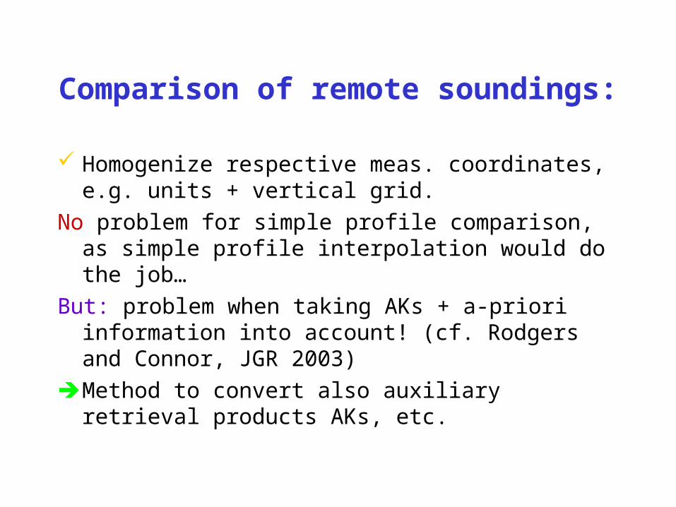
Comparison of remote soundings:
Homogenize respective meas. coordinates, e.g. units + vertical grid.
No problem for simple profile comparison, as simple profile interpolation would do the job…
But: problem when taking AKs + a-priori information into account! (cf. Rodgers and Connor, JGR 2003)
Method to convert also auxiliary retrieval products AKs, etc.

Idea (Trivial!)
: Retrieved profile on a given vertical grid
: Retrieved profile on another vertical grid
It exists W such as
or
And
or
: Pseudo-inverse of W
)x-W(xx-x 00
xy00 ε)xK(xyy
y00 ε)xx(Kyy
xWx *
*W
x
Wxx
)x-x(Wx-x 0*
0
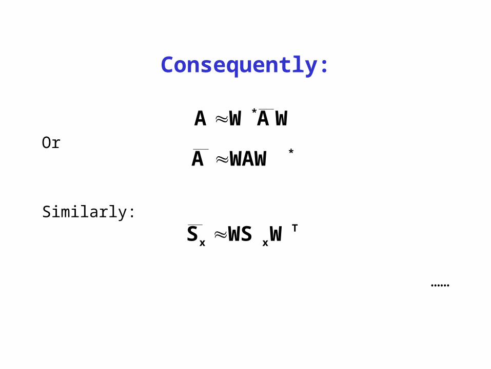
Consequently:
Or
Similarly:
……
WAWA **WAWA
Txx WWSS
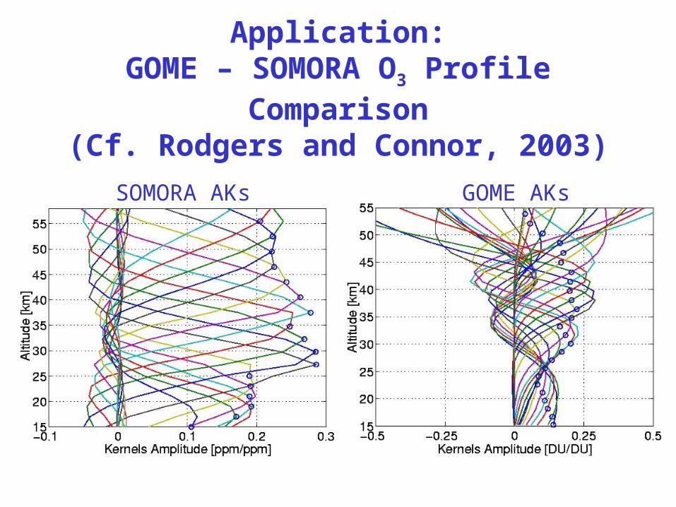
Application:GOME – SOMORA O3 Profile
Comparison(Cf. Rodgers and Connor, 2003)
SOMORA AKs GOME AKs
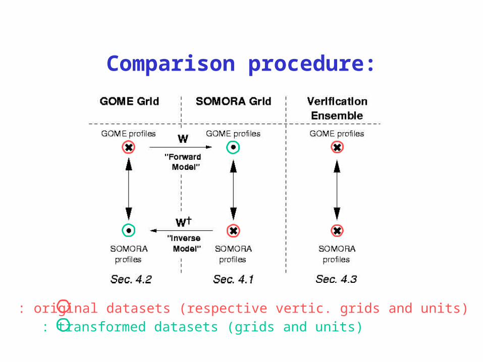
Comparison procedure:
: original datasets (respective vertic. grids and units): transformed datasets (grids and units)
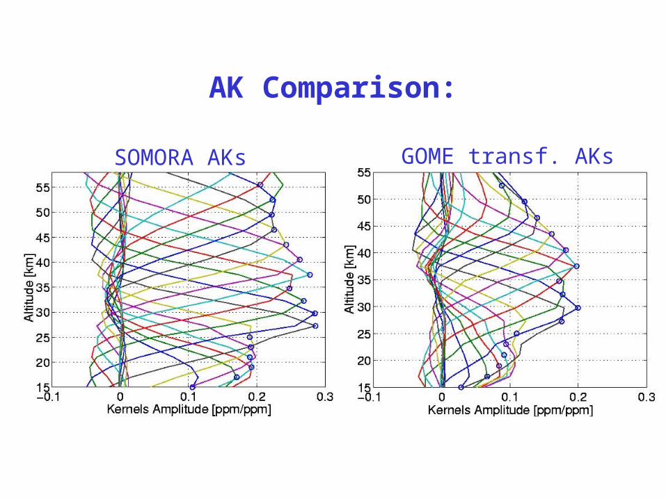
AK Comparison:
SOMORA AKs GOME transf. AKs
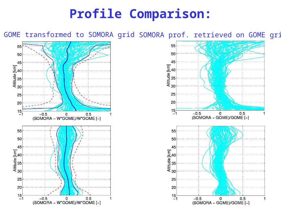
Profile Comparison:
GOME transformed to SOMORA grid SOMORA prof. retrieved on GOME grid
Conclusions and Outlook:
Simple method to homogenize remote sensing measurements for comparison
Does not require data re-processingApplied to intercomparison of SOMORA
vs. GOME O3 profiles
Assess method limits or generalize to more tricky cases
Include random errors in the analysis…