Embed Size (px)
Citation preview
WIRRAL LOCAL PLAN
DEVELOPMENT OPTIONS REVIEW
PROPOSED GREEN BELT BOUNDARY CORRECTIONS
SEPTEMBER 2018

[blank for copying]
Wirral Local Plan September 2018
Proposed Green Belt Boundary Corrections
Page 1 of 1
Parcel Ref Site Name Electoral Ward
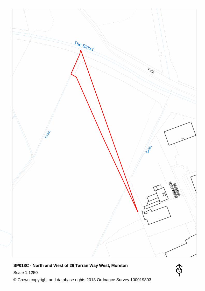
SP018C North and west of 26 Tarran Way West, Moreton
Moreton West and Saughall Massie
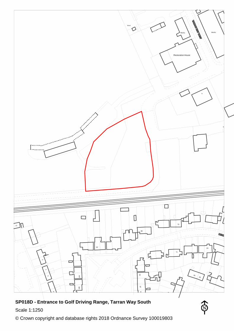
SP018D Entrance to Golf Driving Range, Tarran Way South
Moreton West and Saughall Massie
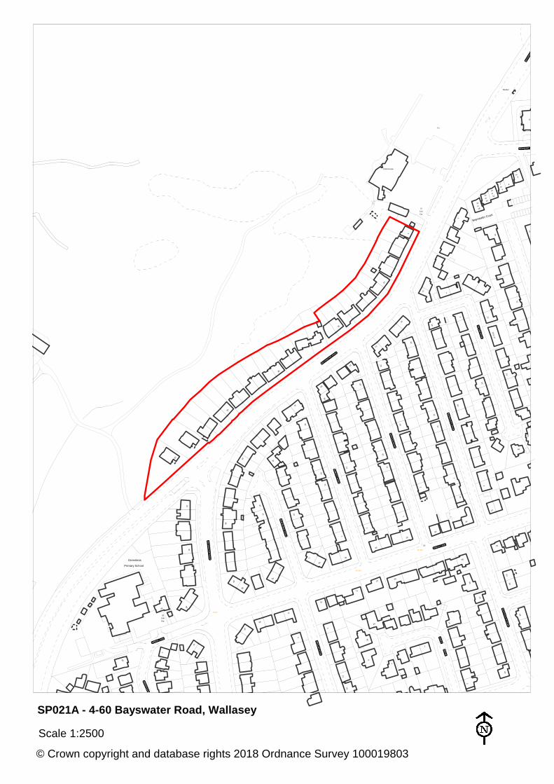
SP021A 4-60 Bayswater Road, Wallasey Wallasey
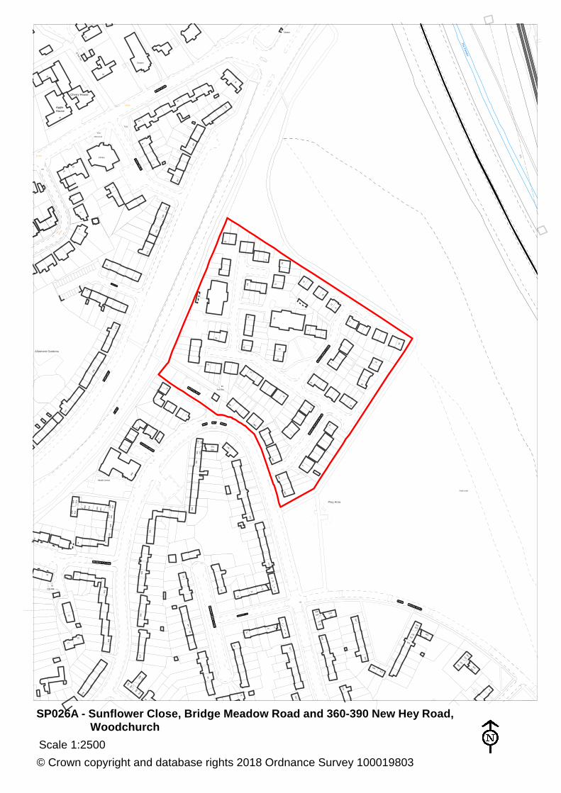
SP026A Sunflower Close, Bridge Meadow Road and 360-390 New Hey Road, Woodchurch (former St Benedict’s)
Upton
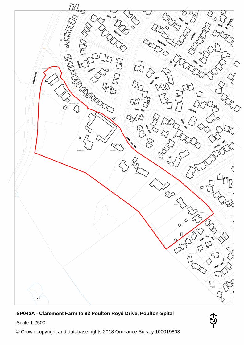
SP042A Claremont Farm to 83 Poulton Royd Drive, Poulton-Spital
Clatterbridge
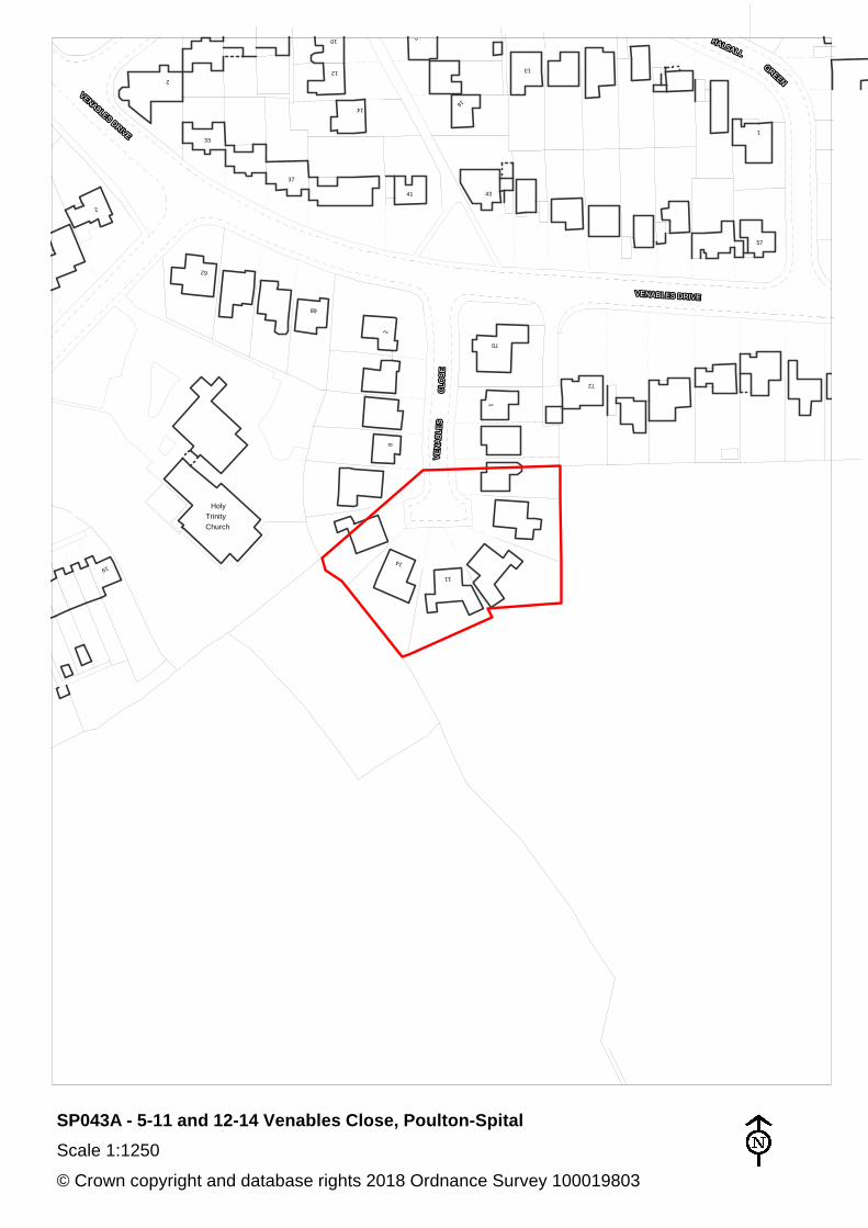
SP043A 5-11 and 12-14 Venables Close, Poulton-Spital Clatterbridge
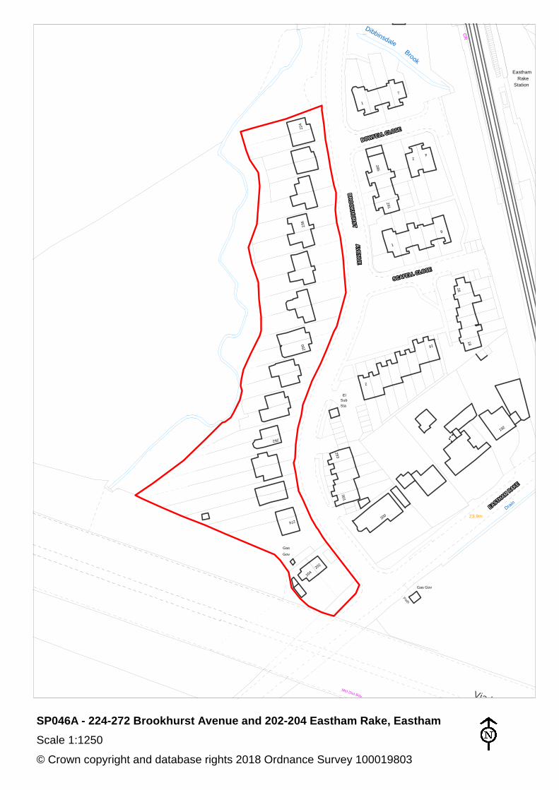
SP046A 224-272 Brookhurst Avenue and 202-204 Eastham Rake, Eastham
Clatterbridge
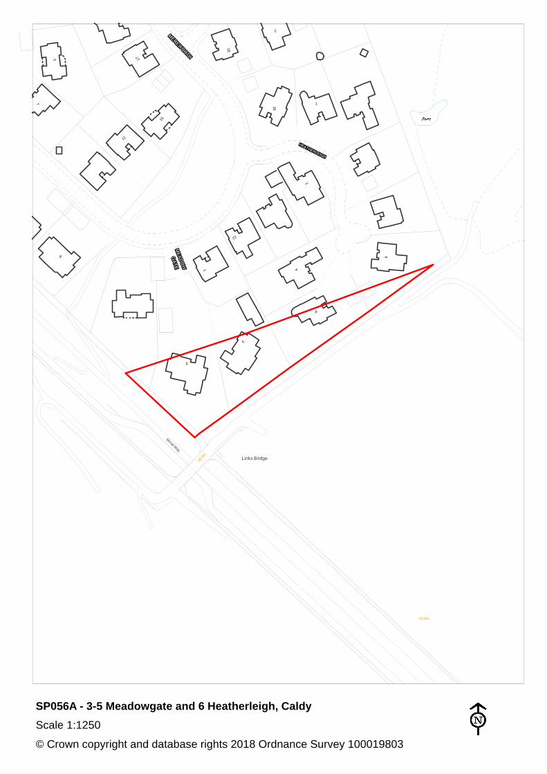
SP056A 3-5 Meadowgate and 6 Heatherleigh, Caldy
West Kirby and Thurstaston
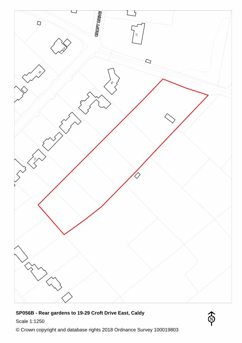
SP056B Rear gardens to 19-29 Croft Drive East, Caldy
West Kirby and Thurstaston
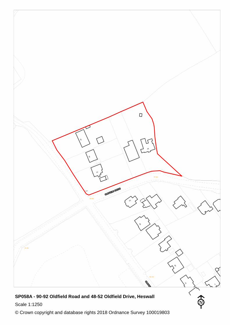
SP058A 90-92 Oldfield Road and 48-52 Oldfield Drive, Heswall
Heswall
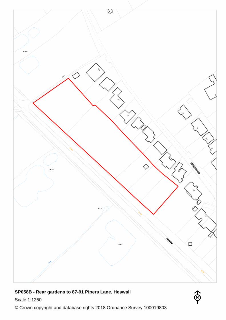
SP058B Rear gardens to 87-91 Pipers Lane, Heswall Heswall
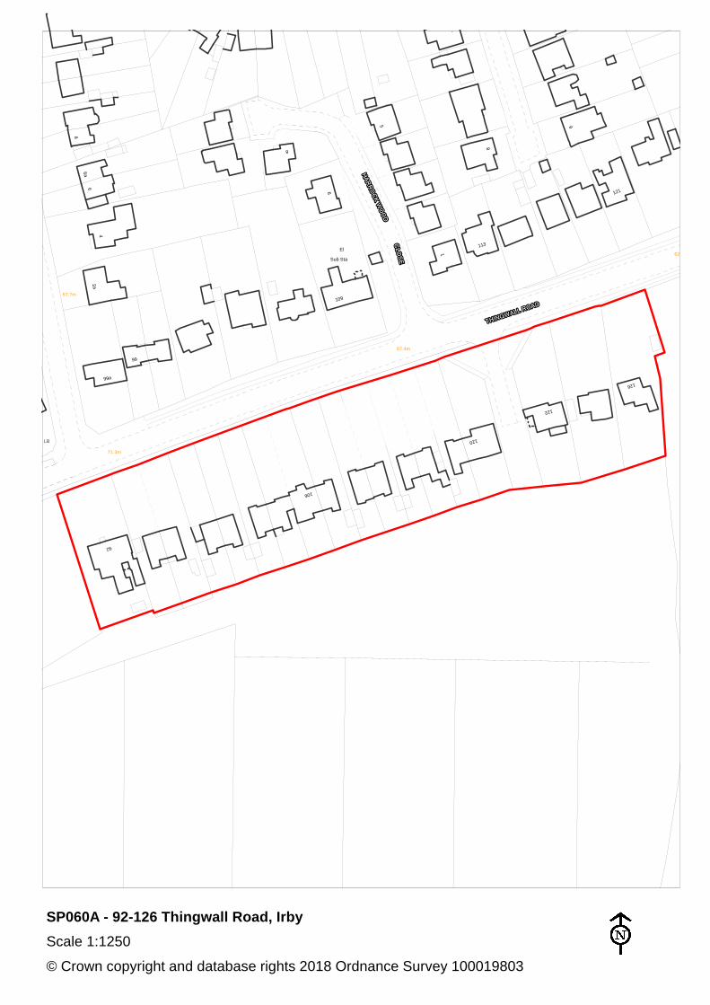
SP060A 92-126 Thingwall Road, Irby
Greasby Frankby and Irby
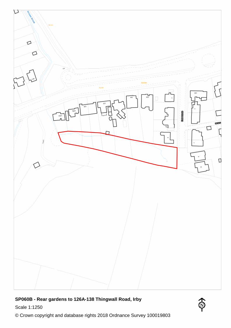
SP060B Rear gardens to 126A-138 Thingwall Road, Irby Pensby and Thingwall
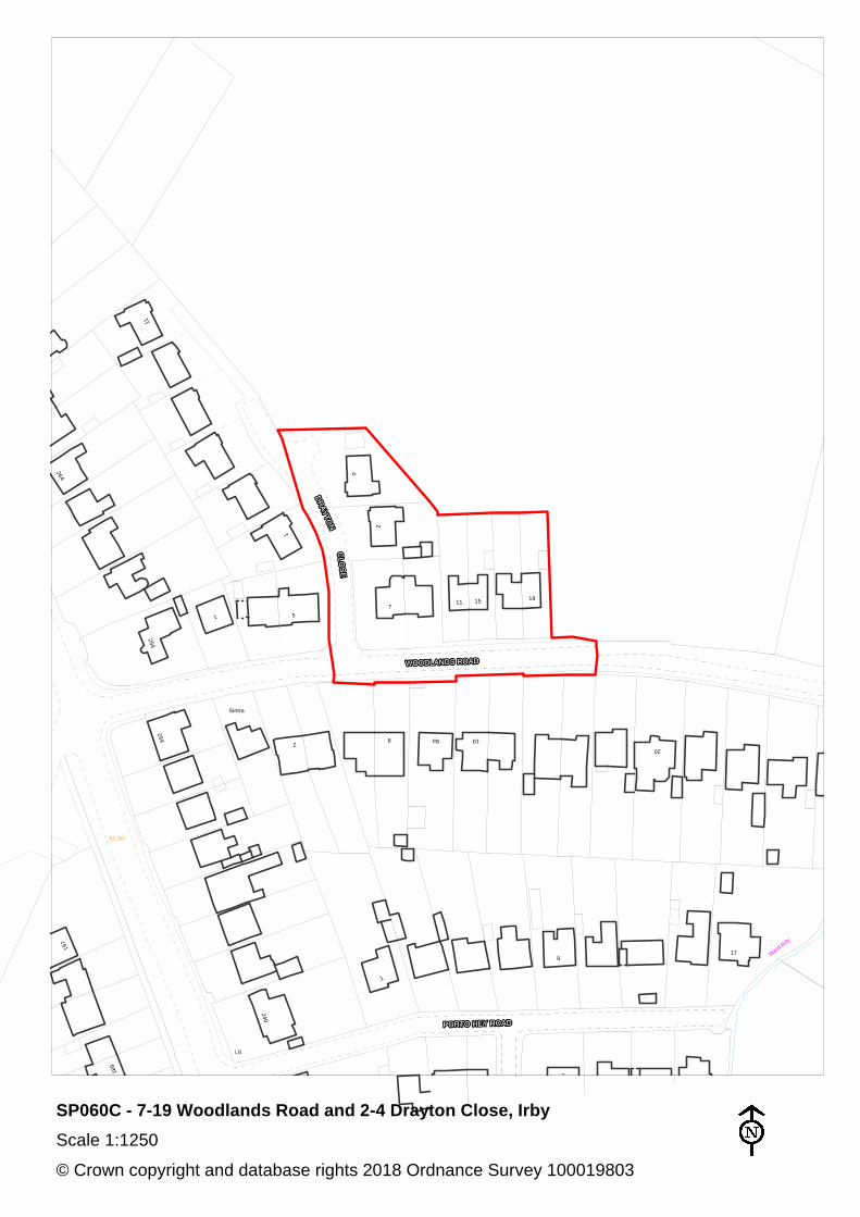
SP060C 7-19 Woodlands Road and 2-4 Drayton Close, Irby
Greasby Frankby and Irby
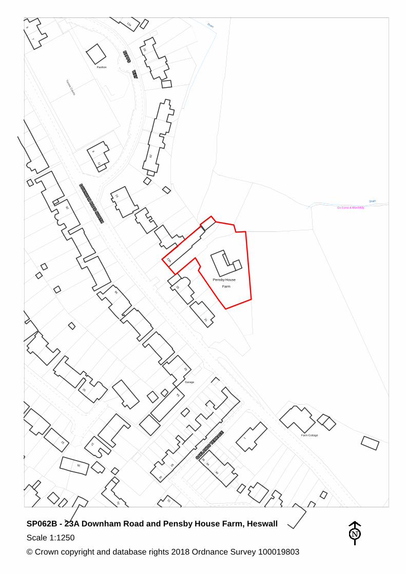
SP062B 23A Downham Road and Pensby House Farm, Heswall
Pensby and Thingwall
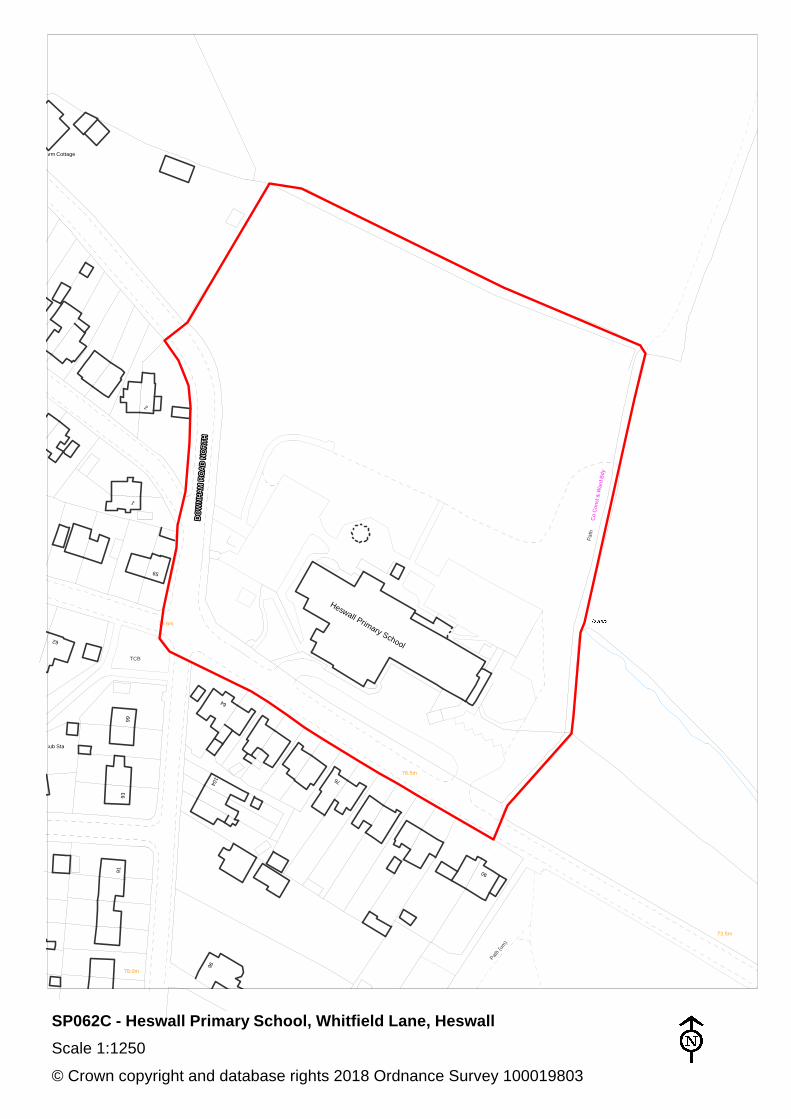
SP062C Heswall Primary School, Whitfield Lane, Heswall Pensby and Thingwall
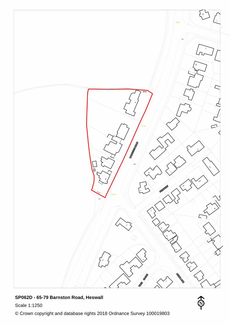
SP062D 65-79 Barnston Road, Heswall
Heswall
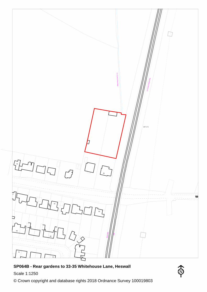
SP064B Rear gardens to 33-35 Whitehouse Lane, Heswall Heswall
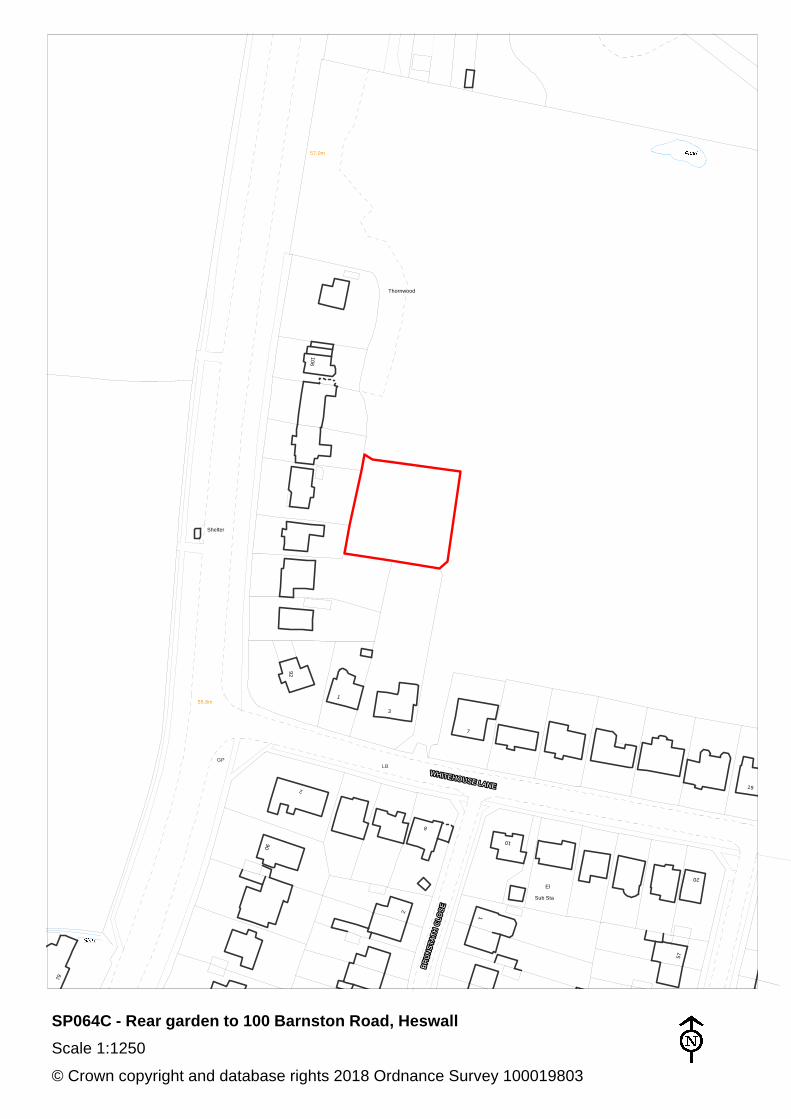
SP064C Rear garden to 100 Barnston Road, Heswall Heswall
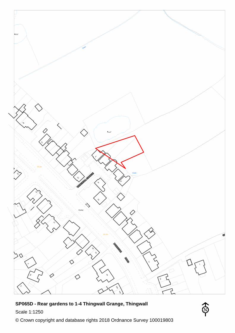
SP065D Rear gardens to 1-4 Thingwall Grange, Thingwall Pensby and Thingwall
Further information on the background to these proposals is contained within the Initial Green Belt Review Background Report (September 2018) and the Summary of Initial Green Belt Assessment (September 2018).

[blank for copying]
Dra
in
Dra
in
31
The Birket
Path
26
SP018C - North and West of 26 Tarran Way West, Moreton
Scale 1:1250
© Crown copyright and database rights 2018 Ordnance Survey 100019803
87
80
63
71
28
26
83
70
89
6
2
92
1
10
4
3
11
10
8
4
Mast
WorksWorks
Restoration House
Mast
SP018D - Entrance to Golf Driving Range, Tarran Way South
Scale 1:1250
© Crown copyright and database rights 2018 Ordnance Survey 100019803
38
Shelter
3
1
15
9
to
7
2
33
26
13
to
16
18to
12to
10
6
to
FS
St
23
15 to
17
1
31
Sta
Sub
El
Bayswater Court
1
112
14
12
41
15
16
15
55
11
14
11
53
52
50
48
43
2
69
1
2
1
20
2
14
18
1a
11
1
14
59
10.4m
LB
57
9
7
77
2
26
10.1m
67
71
65
1
28
32
29 29
28
31
23
15
14
25
11
43
50
38
4
11
29
30
88
40
Greenleas
Primary School
60
10
1
26
24
75
2
34
38
73
78
1
9.4m
1
15
11
55
65
70
Club House
26
15
21
26
14
85
Sta 83
64
Sub
El
20
15
SP021A - 4-60 Bayswater Road, Wallasey
Scale 1:2500
© Crown copyright and database rights 2018 Ordnance Survey 100019803
147
197
Shelter
2172
62
78
The
Fend
er
ET
L
63
TCB
32
1
33
3
32
55
44
277
122
60
63
64
209
45
75
9
11
15
4
8
18
6
10
14
20
3
5
55
14.3m
2
8
War
Memorial
Cherry House
Library
34
23
El S
ub S
ta
Surgery
17.1m
40
Apple
House
LB
65
67
42
2
149
155
153
159
169
161167
157
165
12
Path (um)
Play Area
201
199
205
197
LB
19
3
181
18
3
179
163
26
262
28
18
16
11
1
2
31
263
270
44
15
48
42
7
1
380
1
911
19
7
17
203
282
207
275
366
289
360
368
Sub Sta
39
27
51
50
31
13
13
307
El
309
390
1
315
31
93
17
381
145
151
43
36
5
377
44
3793
75
383385
17 46
4
11
42
8
41
2
40
640
4
40
0
42
441
4
41
0
28
1
35
5
45
2
15
19 7
El
16
430
34
5
147
8
9
41
8
Health Centre
1
396
41
642
2
18.6
m
3
2
183
173
179
185
1
9
187
11
2
10
1
171
5
159
387
478
1
5
Allotment Gardens
42
6
42
0
Sub Sta
SP026A - Sunflower Close, Bridge Meadow Road and 360-390 New Hey Road,Woodchurch
Scale 1:2500
© Crown copyright and database rights 2018 Ordnance Survey 100019803
6
16
11
10
22
24
10
3
5
36
14
8
1
22
26
7
2
29
11a
15
2
1
11
Greenacre
11
25
14
12
7
15
23
17
8
14
12
12a
15
1
1
10
2
18
14
2
16
2
9
14
1
5
8
5
9
1
11a
85
83
Yewtree
19
Lodge
El Sub Sta
3
6
1
9
15
11
55
7
5
20
1
6
101
2
1
5
12
6
23
2
9
1
107
15
11
2
Mast (telecommunication)
Mast (telecommunication)
Claremont Farm
40.1m
37.7m
33
35
8
47
22
36.1m
Poulton Royd
11
15
1
22
11a
5
41
12
8
30
7
11
91
89
Windcote
1
17
5
1
4
1
14
16
6
2
Mill Hill
Windy Harbour
12a
12
Pinewood
38.2m
14
SP042A - Claremont Farm to 83 Poulton Royd Drive, Poulton-Spital
Scale 1:2500
© Crown copyright and database rights 2018 Ordnance Survey 100019803
2
1
72
70
57
1
14
43
20
16
13
2
10
37
12
2
33
41
14
11
8
19
Holy
Church
Trinity
68
2
62
SP043A - 5-11 and 12-14 Venables Close, Poulton-Spital
Scale 1:1250
© Crown copyright and database rights 2018 Ordnance Survey 100019803
29
1
Met Dist Bdy
7
Brook
Viaduct
Gas Gov
Path
23.9m
Drain
192
25
0
28
1
16
18
202
204
Gas
Gov
30
1
274
Sub
Sta
29
3
262
El
23
6
9
2
22
4
Rake
Station
CR
Eastham
28
5
2
1
200
Dibbinsdale
4
SP046A - 224-272 Brookhurst Avenue and 202-204 Eastham Rake, Eastham
Scale 1:1250
© Crown copyright and database rights 2018 Ordnance Survey 100019803
5
Wirral W
ay
Links Bridge
1
12
15
18
2
23.9m
26.9
m
3
17
8
11
9
2
6
4
116
7
5
SP056A - 3-5 Meadowgate and 6 Heatherleigh, Caldy
Scale 1:1250
© Crown copyright and database rights 2018 Ordnance Survey 100019803
14
19
27
16
17
SP056B - Rear gardens to 19-29 Croft Drive East, Caldy
Scale 1:1250
© Crown copyright and database rights 2018 Ordnance Survey 100019803
GP
90
97.8m
86
53
4892
3
52
93.0m
91.4m
80
92.4m
76
SP058A - 90-92 Oldfield Road and 48-52 Oldfield Drive, Heswall
Scale 1:1250
© Crown copyright and database rights 2018 Ordnance Survey 100019803
96
94
85
22.3m
81
22.6m
15
98
Dra
in
Path
105
101
22.3m
97
94a
SP058B - Rear gardens to 87-91 Pipers Lane, Heswall
Scale 1:1250
© Crown copyright and database rights 2018 Ordnance Survey 100019803
62.8m
9
2
8
9
El
Sub Sta
109
67.4m
8
5
1
122
113
126
120
121
99
99a
92
106
71.3m
LB
8
2a
6
67.7m
4
6a
SP060A - 92-126 Thingwall Road, Irby
Scale 1:1250
© Crown copyright and database rights 2018 Ordnance Survey 100019803
61.9m
GP
128
138
64.0m
1
1
Tra
ck
135
2
140
7
8
9
11
132
136
128a
126a
59.1m
Arro
we B
rook
SP060B - Rear gardens to 126A-138 Thingwall Road, Irby
Scale 1:1250
© Crown copyright and database rights 2018 Ordnance Survey 100019803
8
Ward
Bdy
20
179
10
1
8 8a
82.3m
197
18
9
LB
24
0
11 15
4
19
7
2
25
6
5
1
1
2
Sintra
254
11
264
SP060C - 7-19 Woodlands Road and 2-4 Drayton Close, Irby
Scale 1:1250
© Crown copyright and database rights 2018 Ordnance Survey 100019803
36 34
26
36
33
30
30
31
Farm Cottage1
31
Garage
52
29
23A
25
Pensby House
Drain
Co Const & Ward Bdy
Farm
9
11
15
38
25
3732
54
26
Tennis C
ourts
7
5
Pavilion
15
11
Drain
11a
SP062B - 23A Downham Road and Pensby House Farm, Heswall
Scale 1:1250
© Crown copyright and database rights 2018 Ordnance Survey 100019803
Co
Co
nst
& W
ard
Bd
y
Pa
th
Pat
h (u
m)
90
76.5m
73.5m
99
93
Heswall Primary School
104 76
TCB
96
78.0m
91
65
75.6m
1
64
62
2
El Sub Sta
Farm Cottage
SP062C - Heswall Primary School, Whitfield Lane, Heswall
Scale 1:1250
© Crown copyright and database rights 2018 Ordnance Survey 100019803
2
90
79
55.8m
92
57.0m
58.5m
2
GP
10
10a
1a
Track
1
1b
2
5
3
3a1
2
72
35
12
5
76
65
1
MP
1
GP
SP062D - 65-79 Barnston Road, Heswall
Scale 1:1250
© Crown copyright and database rights 2018 Ordnance Survey 100019803
35
Co
Co
nst &
Wa
r d B
dy
Co
Co
nst
& W
ard
Bd
y
40
32
21
38
MP 0.75
31
24
48
CR
Wa
rd B
dy
23
SP064B - Rear gardens to 33-35 Whitehouse Lane, Heswall
Scale 1:1250
© Crown copyright and database rights 2018 Ordnance Survey 100019803
12
Sub Sta
2
90
79
55.8m
92
El
10
10
6
Shelter
Thornwood
57.0m
19
20
57
3
1
8
7
LBGP
SP064C - Rear garden to 100 Barnston Road, Heswall
Scale 1:1250
© Crown copyright and database rights 2018 Ordnance Survey 100019803
1
90
77
92a
92b
79
5
65
6
1
Drain
Shelter
9
11
55.2m
82
80
63
51
62
Drain
72
55.2m
49
1
60
9a
SP065D - Rear gardens to 1-4 Thingwall Grange, Thingwall
Scale 1:1250
© Crown copyright and database rights 2018 Ordnance Survey 100019803