Embed Size (px)
Citation preview
RISE II SUPPLEMENTAL INITIAL ENVIRONMENTAL EXAMINATION
PROJECT/ACTIVITY DATA
Project/Activity Name: Water Security and Resilience
Amendment (Y/N): N
Geographic Location(s) (Country/Region):
Burkina Faso and Niger/ Sahel region
Implementation Start/End: FY19
Solicitation/Contract/Award Number:
TBD
Implementing Partner(s): TBD
Tracking ID/link: TBD
Tracking ID/link of Related RCE/IEE (if any): − AF69 SRO RISE II PIEE 040318
https://ecd.usaid.gov/document.php?doc_id=51010.
− Sustainable Water Partnership PIEE https://ecd.usaid.gov/repository/pdf/47041.pdf
− FFP FY18 RFA IEE https://ecd.usaid.gov/document.php?doc_id=50497
Tracking ID/link of Other, Related Analyses: − 2013 Sahel JPC (23 January 2013)
https://ecd.usaid.gov/repository/pdf/39036.pdf
− 2014 REGIS-ER/RISE – [Amendment to Sahel JPC] (31 March 2015) https://ecd.usaid.gov/repository/pdf/4615
1
6.pdf− 2018 REGIS-ER/RISE Amendment (29
January 2018) https://ecd.usaid.gov/document.php?doc_id=50615
− 2017 Alliance for Year-Round Resilience in Tahoua and Maradi #Niger_GDA_Lutheran World Relief
− 2017 Burkina Faso ASTER https://ecd.usaid.gov/document.php?doc_id=50407
− Power Africa PATRP https://ecd.usaid.gov/document.php?doc_id=48721
− Global Health Supply Chain –Procurement and Supply Management https://ecd.usaid.gov/document.php?doc_id=50325
− 2017 FAA 118/119 Burkina Faso
− 2017 FAA 118/119 Niger
ORGANIZATIONAL/ADMINISTRATIVE DATA
Implementing Operating Unit(s): (e.g. Mission or Bureau or Office)
USAID/Senegal/Sahel Regional Office
Funding Operating Unit(s): (e.g. Mission or Bureau or Office)
USAID/Senegal/Sahel Regional Office
Funding Account(s): TBDFunding Amount: $38.9 MAmendment Funding Date:
N/A Amendment Funding Amount:
N/A
Other Affected Unit(s): E3, BFSLead BEO Bureau: AFRPrepared by: Abdourahmane Ndiaye, D-REO/MEO for Sahel
LPCs/NPCs and Samantha Wapnick, Sahel REO and WSR AOR
2
Date Prepared: 11/1/2018
ENVIRONMENTAL COMPLIANCE REVIEW DATA
Analysis Type: ☐ Request for Categorical Exclusion ☐ Amendment
☒ Initial Environmental Examination ☐ Deferral
Environmental Determination(s):
☒ Negative Determination ☐ Positive Determination
☒ Negative Determination w/ Conditions
☒ ERR/EMMP ☐PERSUAP
Initial Environmental Examination Expiration Date:
11/1/2023
Additional Analyses/Reporting Required:
None
Climate Risks Identified (put # of each):
Low 2 Moderate 3 High 4
Climate Risks Addressed (put # of each):
Low 2 Moderate 3 High 4
3
THRESHOLD DECISION MEMO AND SUMMARY OF FINDINGSPURPOSE AND SCOPE OF THE INITIAL ENVIRONMENTAL EXAMINATION
The purpose of this Supplemental Initial Environmental Examination (SIEE), in accordance with Title 22, Code of Federal Regulations, Part 216 (22CFR216), is to provide a preliminary review of the reasonably foreseeable effects on the environment, as well as recommended Threshold Decisions, for the Water Security and Resilience Activity, part of the RISE II project under an Associate Award with Partnership for Sustainable Water a Leadership with Associate type mechanism. This document provides a brief statement of the factual basis for Threshold Decisions as to whether an Environmental Assessment or an Environmental Impact Statement is required for the activity managed under the scope of this document.
Per the guidance of the Parent IEEs, the Resilience in the Sahel Enhanced II (RISE II) PIEE and the Sustainable Water Partnership (SWP) PIEE, a supplemental IEE (SIEE) needs to be developed. Specifically, the SWP IEE requires a supplemental analysis prior to award of the Associate Award. Therefore, this SIEE is developed for the “Water Security and Resilience Activity”.
This Supplemental IEE will: a) Provide additional specific details regarding activity and its entailed
actions, including location (environmental baseline), and the impacts associated with all actions.
b) Consolidate all required conditions. For actions addressed by the two Programmatic IEEs, the Supplemental IEE must, at a minimum, include the conditions for these actions as established by the Programmatic IEEs and confirm that no additional activities are planned for the activity at the time of completion.
c) Rectify any deferrals from the RISE II Programmatic IEE for the planned award/activity.
d) Define and fully comply with 22 CFR 216 requirements for actions that may not have been addressed in the Programmatic IEEs because they were defined during the activity design process rather than at the PAD level. This includes establishing determinations, and as relevant, conditions for these actions.
e) Provide direction for the development of an Environmental Assessment or Scoping Environmental Assessments for actions identified as a Positive Determination.
4
f) Specifically direct the actions of the implementing partners in the development of necessary subsidiary environmental compliance documentation, including:
i) the Environmental Mitigation and Monitoring Plan (EMMP) for actions assigned a negative determination with conditions in the Supplemental IEE (both new conditions and those reiterated from the Programmatic IEE)
ii) the development and implementation of the ERF/ERR for sub-grants and sub-awards.
PROJECT/ACTIVITY SUMMARY The Water Security and Resilience Activity will contribute directly to the overarching goals of RISE II by ensuring lasting improvements to water and land resources and their related services, and by enhancing capacities to manage the social risks related to climate impacts on those resources. Well-functioning ecological systems provide and regulate the water essential for human health and keep landscapes productive for agricultural and pastoral livelihoods. Social systems are equally important, creating formal and informal safety nets. Risk management approaches complement these supportive systems by providing information to plan, prepare for and manage risk, practices to reduce risks, and modalities to respond quickly to reduce impact and facilitate productive recovery. This Activity is in Associate Award with the Sustainable Water Partnership (SWP), a Lead with Associate type mechanism funded and managed by E3. The goal of the SWP is to increase resilience to water security risk at the basin, sub-basin, or local catchment scale. The SWP is designed to support USAID and host country governments in safeguarding access to adequate quantities of acceptable quality water for sustaining livelihoods, human well-being, socioeconomic development, and the protection of ecosystem services that underpin these development objectives.
This SIEE relates to the following IEEs that cover activities in the same areas inBurkina Faso and Niger: #Niger_GDA_Lutheran World Relief , REGIS #BEO_Sahel JPC REGIS ETD IEE 2012-2018, and the 2017 Burkina Faso ASTER https://ecd.usaid.gov/document.php?doc_id=50407
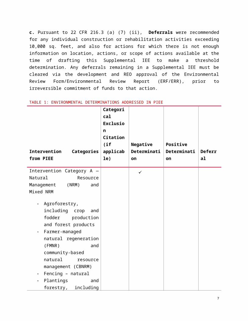
ENVIRONMENTAL DETERMINATIONS a. Pursuant to 22 CFR 216.2(c)(1)(i) and 216.2(c)(2)(i), (iii) and (v), Categorical Exclusions are recommended for program-supported activities involving technical assistance, training and education, institutional strengthening, enhancing governance of institutions and organizations, capacity-building and performance
5
monitoring activities, awareness raising, communications and information, regulatory and policy related activities that have no physical interventions and no direct effects on the environment.
b. As per 22 CFR 216.3 (a) (2) (iii), a Negative Determination with Conditions is recommended for actions which, based on the impacts analysis, are highly unlikely to result in significant adverse impacts. This includes instances in which the impacts of the unmitigated action could be significant, but technically straightforward, easily monitorable, and mitigation as specified by the condition(s) will reliably prevent impacts from becoming significant. Conditions are those requirements, or specific mitigation measures applicable, to the project planning, implementation, and operation. For water points, a Water Quality Assurance Plan (WQAP) must be prepared by the partner and approved by the AOR. Water quality testing will be done to determine the presence of arsenic and fecal coliforms. It is essential for determining that the water from a constructed water source is safe to drink and to determine a baseline so that any future degradation can be detected.
c. Pursuant to 22 CFR 216.3 (a) (7) (ii), Deferrals were recommended for any individual construction or rehabilitation activities exceeding 10,000 sq. feet, and also for actions for which there is not enough information on location, actions, or scope of actions available at the time of drafting this Supplemental IEE to make a threshold determination. Any deferrals remaining in a Supplemental IEE must be cleared via the development and REO approval of the Environmental Review Form/Environmental Review Report (ERF/ERR), prior to irreversible commitment of funds to that action.
TABLE 1: ENVIRONMENTAL DETERMINATIONS ADDRESSED IN PIEE
Intervention Categories from PIEE
Categorical Exclusion Citation (if applicable)
Negative Determination
Positive Determination
Deferral
Intervention Category A — Natural Resource Management (NRM) and Mixed NRM
- Agroforestry, including crop and fodder
✓
6
production and forest products
- Farmer-managed natural regeneration (FMNR) and community-based natural resource management (CBNRM)
- Fencing – natural- Plantings and forestry,
including buffers, wind blocks, and nurseries
- Soil and water conservation, including infiltration structures and erosion control
- NRM infrastructure, including groundwater recharge structures, flood control, and storm water management
- Composting- Watershed protection
and exclusion zones- Land and water
management planning and community engagement
Intervention Category D — WASH
- Construction, rehabilitation, and promotion of latrines
- Construction/rehabilitation of boreholes
- Construction/rehabilitation of hand wash stations and soak pits
- Water distribution systems, including piped systems and
✓
7
communal taps- Construction/
rehabilitation of impoundments for household use
- Distribution infrastructure and distribution systems
- Construction of sand dams or subsurface dams
- Water purification and treatment
- Water protection structures
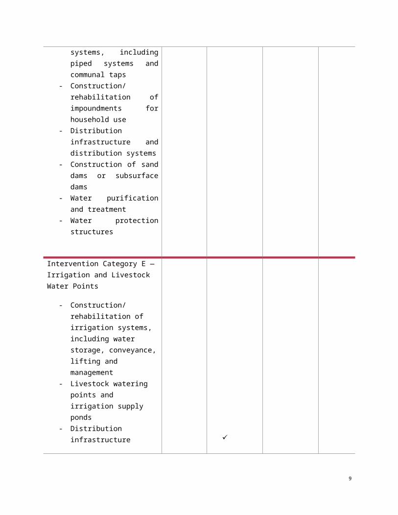
Intervention Category E — Irrigation and Livestock Water Points
- Construction/rehabilitation of irrigation systems, including water storage, conveyance, lifting and management
- Livestock watering points and irrigation supply ponds
- Distribution infrastructure ✓
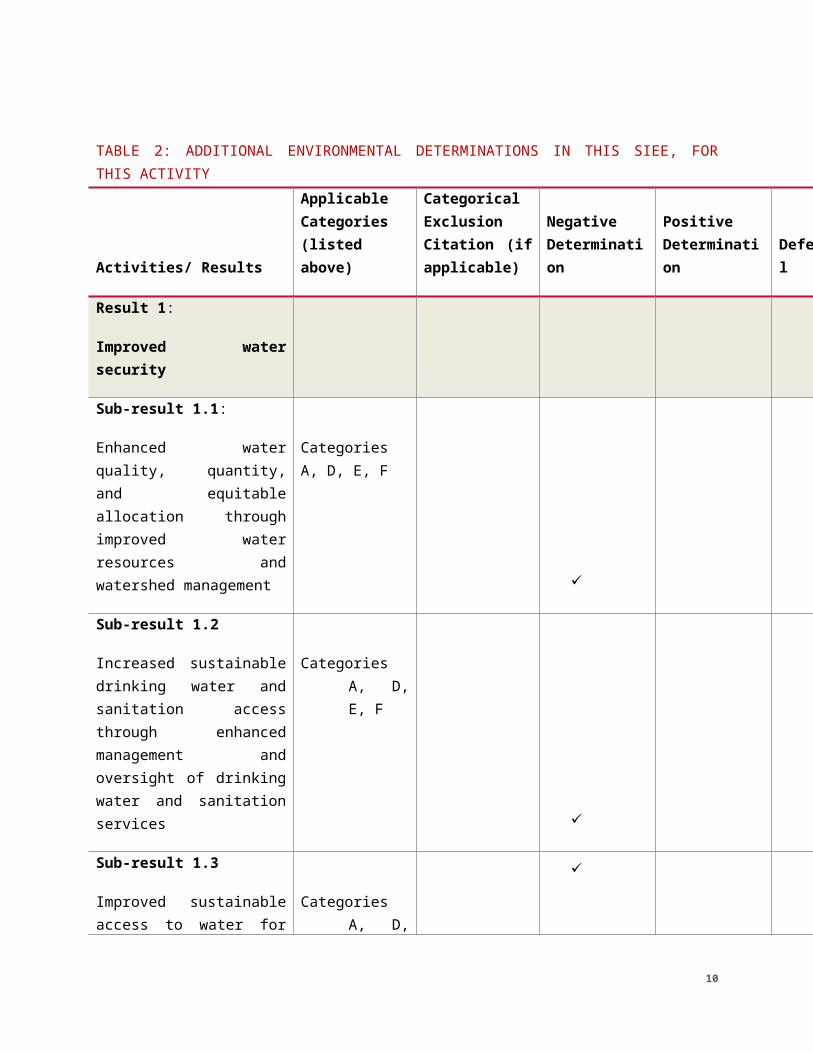
TABLE 2: ADDITIONAL ENVIRONMENTAL DETERMINATIONS IN THIS SIEE, FOR THIS ACTIVITY
Activities/ Results
Applicable Categories (listed above)
Categorical Exclusion Citation (if applicable)
Negative Determination
Positive Determination
Deferral
8
Result 1:
Improved water security
Sub-result 1.1:
Enhanced water quality, quantity, and equitable allocation through improved water resources and watershed management
Categories A, D, E, F
✓
Sub-result 1.2
Increased sustainable drinking water and sanitation access through enhanced management and oversight of drinking water and sanitation services
Categories A, D, E, F
✓
Sub-result 1.3
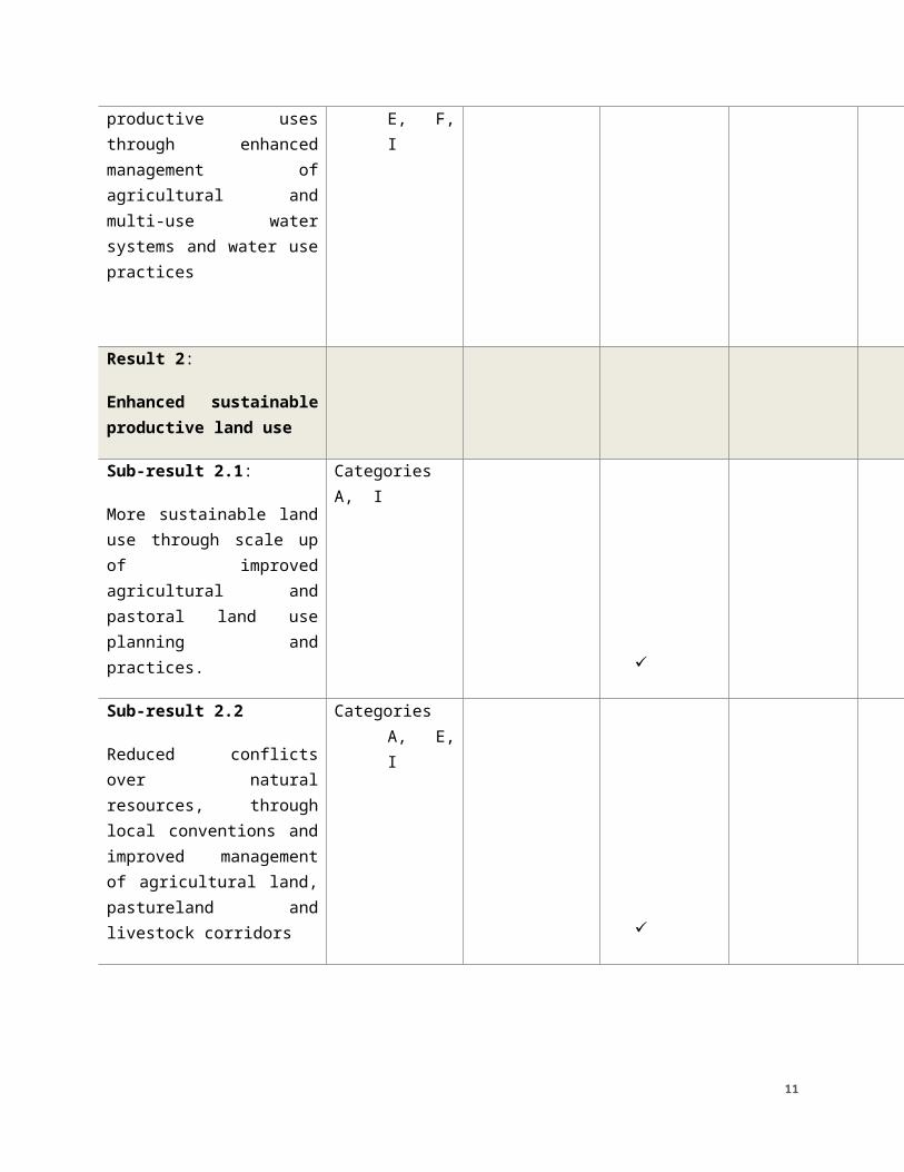
Improved sustainable access to water for productive uses through enhanced management of agricultural and multi-use water systems and water use practices
Categories A, D, E, F, I
✓
Result 2:
Enhanced sustainable productive land use
Sub-result 2.1:
More sustainable land use through scale up of improved agricultural and
Categories A, I ✓
9
pastoral land use planning and practices.
Sub-result 2.2
Reduced conflicts over natural resources, through local conventions and improved management of agricultural land, pastureland and livestock corridors
Categories A, E, I
✓
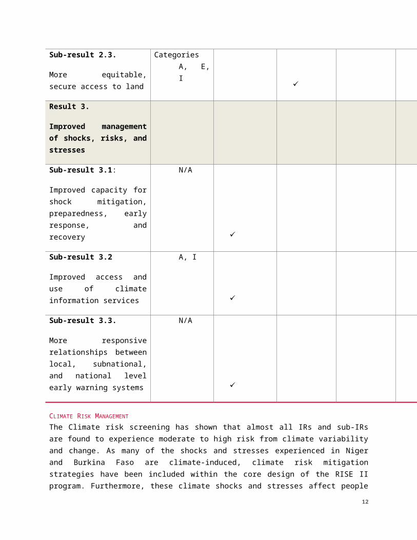
Sub-result 2.3.
More equitable, secure access to land
Categories A, E, I
✓
Result 3.
Improved management of shocks, risks, and stresses
Sub-result 3.1:
Improved capacity for shock mitigation, preparedness, early response, and recovery
N/A
✓
Sub-result 3.2
Improved access and use of climate information services
A, I
✓
Sub-result 3.3.
More responsive relationships between local, subnational, and national level early
N/A ✓
10
warning systems
CLIMATE RISK MANAGEMENT The Climate risk screening has shown that almost all IRs and sub-IRs are found to experience moderate to high risk from climate variability and change. As many of the shocks and stresses experienced in Niger and Burkina Faso are climate-induced, climate risk mitigation strategies have been included within the core design of the RISE II program. Furthermore, these climate shocks and stresses affect people in multifaceted and differentiated ways. Therefore, RISE II was designed such that each DO supports and complements the others to ensure climate risks, including both up- and downstream risks, are addressed through multiple interventions. For example, droughts are not only addressed through increased risk management in DO1 and through more drought resilient livelihoods and increased access to insurance in DO2. These risks are also addressed through downstream interventions in the health sector (e.g., health systems strengthening (DO3)) and improved flexibility in governance (DO4). The resilience approach adopted in RISE II will help ensure that climate risks do not undermine the program’s objective of helping people achieve a sustainable pathway to self-sufficiency
BEO SPECIFIED CONDITIONS OF APPROVAL[BEOs may provide specific conditions tied to their approvals. Please follow Bureau-specific guidance. In cases where no additional conditions of approval are required, this section receives a “N/A”. In the event the BEO wishes to provide further commentary regarding the analysis, they may do so here. This approach is used to provide direct and specific conditions to the IPs and may be presented in three parts: 1) Issue; 2) Discussion; 3) Condition.]
IMPLEMENTATIONIn accordance with 22CFR216 and Agency policy, the conditions and requirements of this document become mandatory upon approval. This includes the relevant limitations, conditions and requirements in this document as stated in Sections 3, 4, and 5 of this SIEE and any BEO Specified Conditions of Approval.
11
USAID APPROVAL OF INITIAL ENVIRONMENTAL EXAMINATION
PROJECT/ACTIVITY NAME: RISE II’s Water Security and Resilience Activity
Approval: ___________________________________________________Lisa Franchett, Mission Director
_______________Date
Clearance: ___________________________________________________Roy Geiser, Acting Director of Sahel Regional Program Office
_______________Date
Clearance: ___________________________________________________Abdourahmane Ndiaye, Mission Environmental Officer
_______________Date
Clearance: ___________________________________________________Samantha Wapnick, Regional Environmental Advisor
_______________Date
Clearance: ___________________________________________________Samantha Wapnick, Mission Climate Integration Lead
_______________Date
Clearance: ___________________________________________________Roopa Karia, Regional Climate Integration Lead
_______________Date
Co- Concurrence:
___________________________________________________Teresa Bernhard E3 Bureau Environmental Officer
_______________Date
Co- Concurrence: ___________________________________________________Brian D. Hirsch Africa Bureau Environmental Officer
_______________Date
DISTRIBUTION:
Jennifer Karsner, Activity Manager, Niger
12
Saadatou Oumarou, Activity Manager, Burkina Faso
Zeric Smith, Director of Sahel Regional Technical Office
Shannon Rogers, Regional Director of Food for Peace West Africa
1.0 PROJECT/ACTIVITY DESCRIPTION1.1 PURPOSE AND SCOPE OF SUPPLEMENTAL IEE
Background:This is a RISE II Supplemental IEE in accordance with the RISE II Programmatic IEE (PIEE) which requires that a Supplemental IEE be developed and approved for each activity under the RISE II PAD. The Sustainable Water Partnership PIEE requires that all Associate Awards develop a supplemental analysis. Toward this end, as a general condition of approval, this Supplemental IEE will: 1) Provide additional specific details regarding activity and its entailed actions,
including location (environmental baseline), and the impacts associated with all actions;
2) Consolidate all required conditions. For actions addressed by the Programmatic IEE, Supplemental IEEs must, at a minimum, include the conditions for these actions as established by the RISE 2 Programmatic IEE and the Sustainable Water Partnership Programmatic IEE and confirm that no additional activities are planned for the activity at the time of completion. Additional or more stringent conditions or determinations must be recommended as indicated and documented within the supplemental IEE;
3) Rectify deferrals from the Programmatic IEE for the planned award/activity; 4) Define and fully comply with 22 CFR 216 requirements for actions that may not
have been addressed in the Programmatic IEE because they were defined during the activity design process rather than at the PAD level. This includes establishing determinations and, as relevant, conditions for these actions;
5) Provide direction for the development of an Environmental Assessment or Scoping Environmental Assessments for actions identified as a Positive Determination;
6) Specifically direct the actions of the implementing partners in the development of necessary subsidiary environmental compliance documentation, including:
13
a) The EMMP for actions assigned a negative determination with conditions in the Supplemental IEE (both new conditions and those reiterated from the Programmatic IEE)
b) Development and implementation of the Environmental Review Form/Environmental Review Report (ERF/ERR) for sub-grants /sub-awards . The ERR can become the facesheet for the EMMP.
Amendments:This Supplemental IEE must be amended when new actions particular to this award/activity are to be implemented, or to increase the ceiling cost or performance period of the activity. Supplemental IEE amendments must proceed through the clearance and approval process by the team, Mission Director, MEO, REO, and the BEO(s).Responsibilities for Supplemental IEE amendment. Responsibility for amending this Supplemental IEE lies with the A/COR/GATR/ award/activity team, with development to be undertaken when the detailed information of the actions are available, and with input from the SRO MEO and Sahel REO. The documentation will be shared, reviewed, and filed with the AOR for the Sustainable Water Partnership (SWP) Leader Award.
Per ADS204.5.1, conditions established by the Supplemental IEE amendments will be incorporated in the activity work plan, and where appropriate, the IPs will be directed to develop their associated trailing documentation, EMMPs or ERF/ERRs, with full clearance, prior to commencing those actions. A notional Environmental Mitigation and Monitoring Plan (EMMP) will be submitted with the workplan, when activities have the potential for adverse environmental or social impacts. Additionally, an EMMR will be submitted with annual performance reporting.
Overview:
The purpose and scope of this document, in accordance with Title 22, Code of Federal Regulations, Part 216 (22CFR216), is to provide a preliminary review of the reasonably foreseeable effects on the environment of the USAID intervention described herein and recommend determinations and, as appropriate, conditions, for these activities. Upon approval, these determinations become affirmed, per 22CFR216 and specified conditions become mandatory obligations of implementation. This IEE also documents the results of the project/activity level Climate Risk Management process in accordance with USAID policy (specifically, ADS 201mal).
14
This SIEE is a critical element of USAID’s mandatory environmental review and compliance process meant to achieve environmentally sound activity design and implementation. Potential environmental impacts should be addressed through formal environmental mitigation and monitoring plans (EMMPs) and/or Environmental Assessments (EAs), if needed.
1.2 PROJECT/ACTIVITY OVERVIEW The Resilience in the Sahel Enhanced II (RISE II) Project builds upon the existing RISE I actions in the Sahel, targeting vulnerable populations in Burkina Faso and Niger to bring them out of poverty along sustainable pathways.
The RISE II goal statement reflects USAID’s key priorities – that vulnerable populations need to be the actors in their own development, that supportive systems (social, ecological, economic, and governmental) are essential to their success, that shocks and stressors are central contextual factors that must be explicitly addressed, and that our success will be measured by the extent to which these communities are able to sustainably progress to a higher level of well-being.The RISE II goal is transformational, seeking to enhance individual, household, community, and institutional capacities that can sustain and continue to grow improvements in well-being in the face of a dynamic context of challenges and opportunities. These transformational aspects are embodied in the following RISE II transformative development outcomes to which all activities will contribute:
● Enhanced community leadership of local development
● Enhanced social capital through strengthened ties of mutual assistance among people
● Enhanced capacity to learn and adapt among beneficiaries, local partners, and partner governments
This Water Security and Resilience Activity will be the RISE II lead on developing and implementing a holistic program for water security improvement, centered on assessment, planning, and capacity-building interventions for water security and sanitation service delivery at commune and possibly higher levels.
1.3 PROJECT/ACTIVITY DESCRIPTIONBuilding on the successes and challenges from RISE I, USAID envisions this Activity to take a more holistic and comprehensive view of increasing water and land security. The Activity will implement an interconnected set of interventions designed to address water insecurity and its underlying drivers, improve land management and tenure, and enhance preparedness and contingency planning for the most vulnerable populations in the RISE II zones.
Result 1: Improved water security
15
This Activity will be the RISE II lead on developing and implementing a holistic program for water security improvement, centered on assessment, planning, and capacity-building interventions to ensure water security and sanitation service delivery at commune and possibly higher levels. This will require coordinating with DFSAs and other RISE II actors (as applicable) for assessment, coordination, piloting and demonstration of models for implementation at local levels. This includes work to strengthen and harmonize commune, regional, and national policies and systems to enhance the sustainability, quality and availability of water for drinking and other productive uses. This includes work to improve watershed management and water resources governance, including budgeting and commune and private sector implementation; increasing sustainable access to water and sanitation services through work to strengthen and/or harmonize commune, regional, and national policies and market systems to enhance the enabling environment for both community and private sector water and sanitation service delivery; and work to develop and implement strategies for reducing vulnerability to and conflict arising from droughts, floods and other water-related shocks. Technical working groups that bring together key actors in water supply and sanitation may be convened or supported by this Activity to increase coordination and collaboration and improved sustainable service delivery. This Activity will coordinate closely with the DFSAs and other RISE partners during the Refine period to analyze the institutional landscape and develop common strategies. In order to be successful, the Activity will need to achieve the following sub-results:
Sub-Result 1.1: Enhanced water quality, quantity, and equitable allocation through improved water resources and watershed management
Sub-Result 1.2. Increased sustainable drinking water and sanitation access through enhanced management and oversight of drinking water and sanitation servicesSub-Result 1.3: Improved sustainable access to water for productive uses through enhanced management of agricultural and multi-use water systems and water use practices
Result 2: Enhanced sustainable productive land useThis Activity will work closely with DFSAs, ONF-BF, MCC, and other RISE II and national partners to increase secure access to land using locally appropriate arrangements. Local conventions—natural resource management techniques that have been successful under RISE for promoting dialogue, establishing community agreements and reducing conflicts that arise over access to and use of natural resources—will remain a central entry point and methodology for RISE II activities to achieve this Result. Landscape maps (that include land use, soil types, and surface water) can help communes and villages to make strategic, well-informed local development and inclusive land tenure decisions, including access to land for women and youth, as well as transhumant herders. Maps can also serve to identify and promote locally appropriate, climate-smart practices that reinforce the principles of Results 1 and 3. These will likely include conservation farming, farmer-managed natural regeneration (FMNR) of trees and shrubs, agroforestry systems, and the selection and installation of appropriate soil and water conservation
16
structures. A systematic approach for strategically planning and properly designing these interventions with local users will ensure maximum benefit based on the soil types, slopes, drainage area, and rainfall variation. Climate Information Services developed through Result 3 and improved technologies will play a key part in increasing effectiveness of preparatory and early response actions to manage risks associated with rainfall and seasonal variability. The following are sub-results that this Activity will focus on:
Sub-Result 2.1: More sustainable land use through scale up of improved agricultural and pastoral land use planning and practices Sub-Result 2.2: Reduced conflicts over natural resources, through local conventions and improved management of agricultural land, pastureland and livestock corridorsSub-Result 2.3: More equitable, secure access to land
Result 3: Improved management of shocks, risks, and stressesIn order to manage the endemic cycles of recurrent and protracted crisis in the Sahel, local communities and actors at all levels need to be capable of managing risks, and to be prepared to respond quickly to shocks and stresses. This Activity will bring innovation and address a critical element of this system, which is to connect early warning to early response programming and actions.
All RISE II activities are required to develop a sector- and location-specific contingency plan for their own activity to harness both development and humanitarian programs in the service of a coherent USG response to situations of protracted and recurrent crisis. Pre-established contingency plans will add flexibility and agility to USG assistance programs. Through an institutionalized process for adaptive management and linking local and sub-national actors to supportive information and response systems, disaster preparedness and timely prevention and mitigation will be enhanced for improved resilience outcomes.
This Activity will also carry out an updated stocktaking of Climate Information Services (CIS) and coordinate as appropriate with relevant USG, local, regional, and other donor actors to ensure access to relevant, actionable weather and climate information to meet the needs of local communes and communities in a manner that can be sustained after the end of the intervention. It will also work closely with other RISE II actors to share data outputs from Results 1 and 2 that would be relevant for contingency planning. Included in this coordination will be technical contributions to collaborating, learning, and adapting (CLA) efforts on contingency planning, such as spearheading early warning data sourcing and leading certain technical discussions at RISE II partner meetings.
Sub-Result 3.1: Improved capacity for shock mitigation, preparedness, early response, and recoverySub-result 3.2: Improved access and use of climate information services Sub-result 3.3: More responsive relationships between local, sub-national, and national level early warning and response systems
17
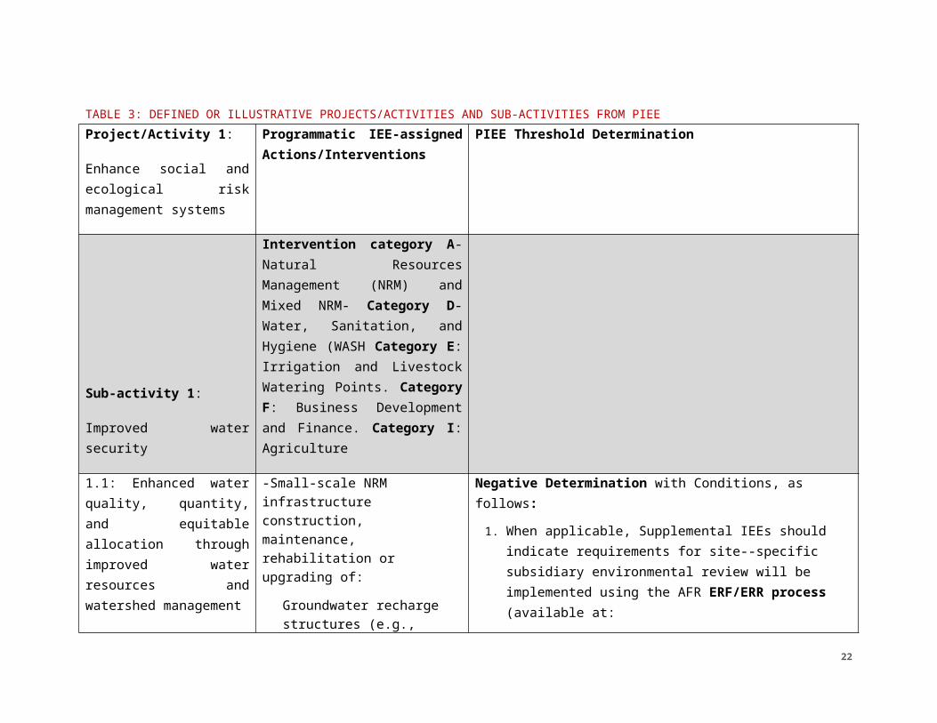
TABLE 3: DEFINED OR ILLUSTRATIVE PROJECTS/ACTIVITIES AND SUB-ACTIVITIES FROM PIEEProject/Activity 1:
Enhance social and ecological risk management systems
Programmatic IEE-assigned Actions/Interventions
PIEE Threshold Determination
Sub-activity 1:
Improved water security
Intervention category A- Natural Resources Management (NRM) and Mixed NRM- Category D- Water, Sanitation, and Hygiene (WASH Category E: Irrigation and Livestock Watering Points. Category F: Business Development and Finance. Category I: Agriculture
1.1: Enhanced water quality, quantity, and equitable allocation through improved water resources and watershed management
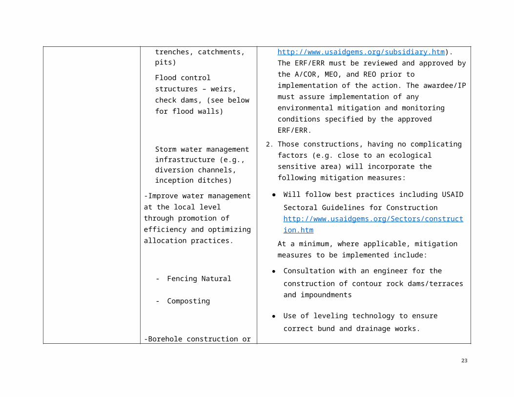
-Small-scale NRM infrastructure construction, maintenance, rehabilitation or upgrading of:
Groundwater recharge structures (e.g., trenches, catchments, pits)Flood control structures – weirs, check dams, (see below for flood walls)
Negative Determination with Conditions, as follows:1. When applicable, Supplemental IEEs should indicate
requirements for site--specific subsidiary environmental review will be implemented using the AFR ERF/ERR process (available at: http://www.usaidgems.org/subsidiary.htm). The ERF/ERR must be reviewed and approved by the A/COR, MEO, and REO prior to implementation of the action. The awardee/IP must assure implementation of any environmental mitigation and monitoring conditions specified by the approved ERF/ERR.
18

Storm water management infrastructure (e.g., diversion channels, inception ditches)
-Improve water management at the local level through promotion of efficiency and optimizing allocation practices.
- Fencing Natural
- Composting
-Borehole construction or rehabilitation for drinking water or household uses only
-Surface water impoundment construction or rehabilitation for household use
2. Those constructions, having no complicating factors (e.g. close to an ecological sensitive area) will incorporate the following mitigation measures:
● Will follow best practices including USAID Sectoral Guidelines for Construction http://www.usaidgems.org/Sectors/construction.htm
At a minimum, where applicable, mitigation measures to be implemented include:
● Consultation with an engineer for the construction of contour rock dams/terraces and impoundments
● Use of leveling technology to ensure correct bund and drainage works.
● Create standardized checklists for construction, monitoring, and maintenance.
● Consult with and engage the village management committee to ensure correct functioning and maintenance of the systems.
● Obtain authorization for the construction from all necessary authorities, including traditional authorities.
● Borrow pits will be rehabilitated (mechanically and biologically) to limit erosion. For backfilling, a
19
borrow pit will be used, and excavations will be superficial and not deep.
● Utilize living structures, (e.g., live fences and cover cropping) to protect structures from erosion, stabilize loose soils, and prevent water logging.
● No materials will be mined from streambeds.
● Work will be limited to the area required (no un-used land will be cleared).
The capacity of a community NRM committee will be strengthened by training the committee in governance and maintenance.
Negative Determination with Conditions, as follows:1. The awardee/IP engaged in construction of
boreholes will ensure environmentally sound design by skilled professionals and actionable mitigation at every phase of construction, as provided in USAID Sectoral Guidelines for Water Supply and Sanitation http://www.usaidgems.org/Documents/SectorGuidelines/Wat%20San%20Guideline%20Final_w_GCC_Addition__May11.pdf
2. Prior to borehole drilling and water extraction, the
20
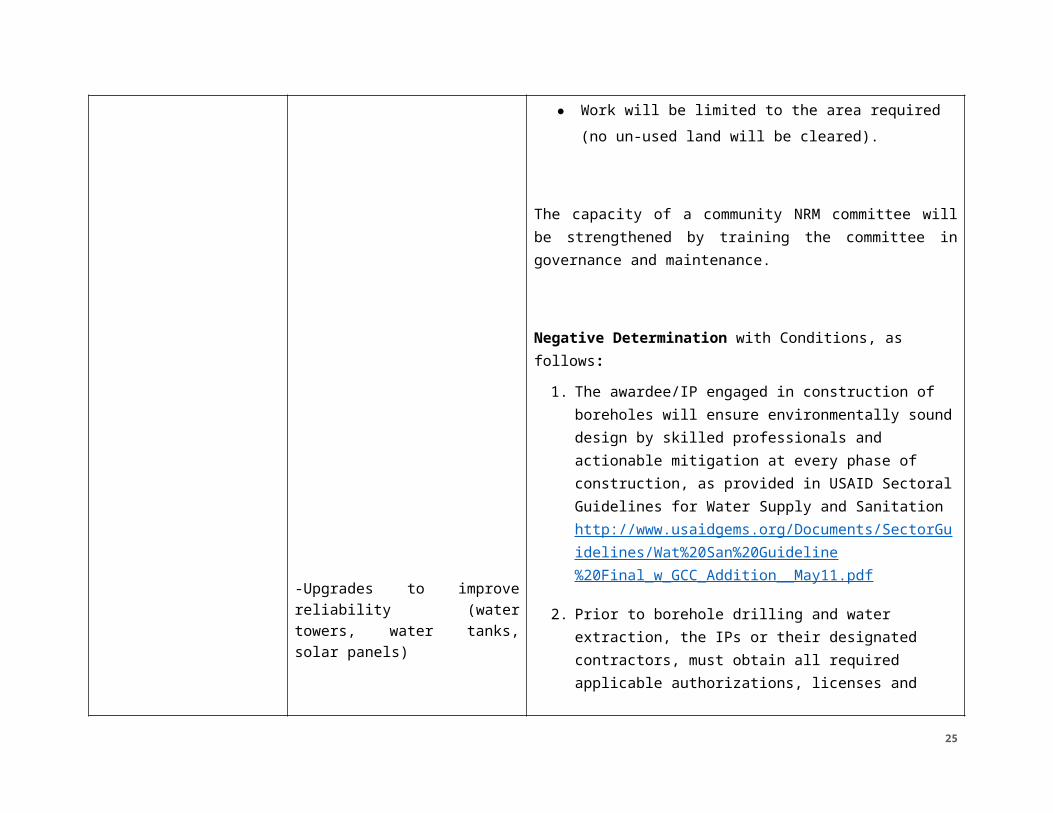
-Upgrades to improve reliability (water towers, water tanks, solar panels)
IPs or their designated contractors, must obtain all required applicable authorizations, licenses and permits from the local authorities.
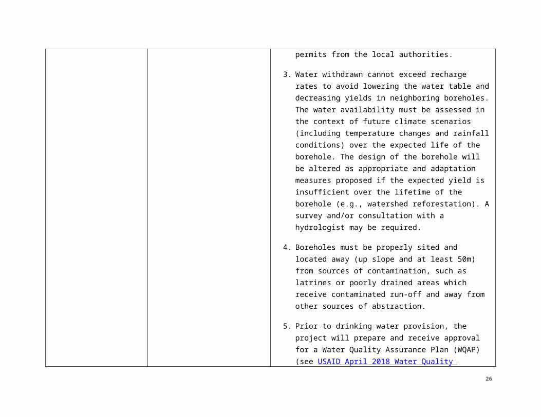
3. Water withdrawn cannot exceed recharge rates to avoid lowering the water table and decreasing yields in neighboring boreholes. The water availability must be assessed in the context of future climate scenarios (including temperature changes and rainfall conditions) over the expected life of the borehole. The design of the borehole will be altered as appropriate and adaptation measures proposed if the expected yield is insufficient over the lifetime of the borehole (e.g., watershed reforestation). A survey and/or consultation with a hydrologist may be required.
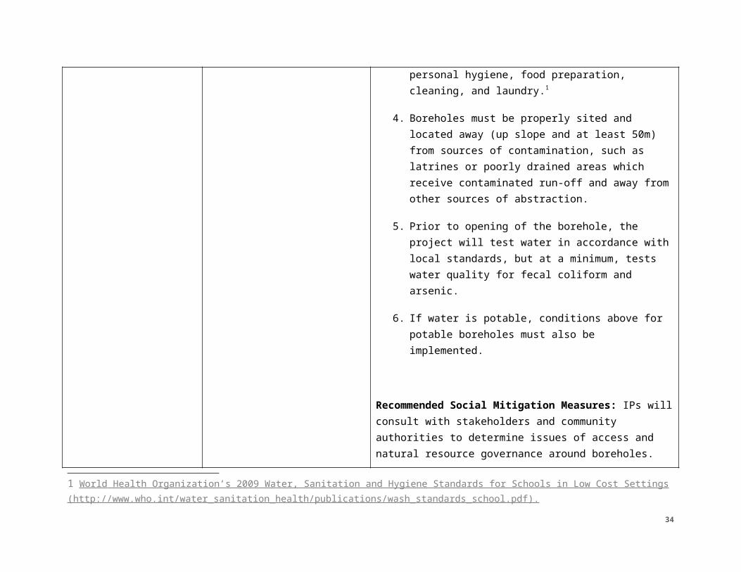
4. Boreholes must be properly sited and located away (up slope and at least 50m) from sources of contamination, such as latrines or poorly drained areas which receive contaminated run-off and away from other sources of abstraction.
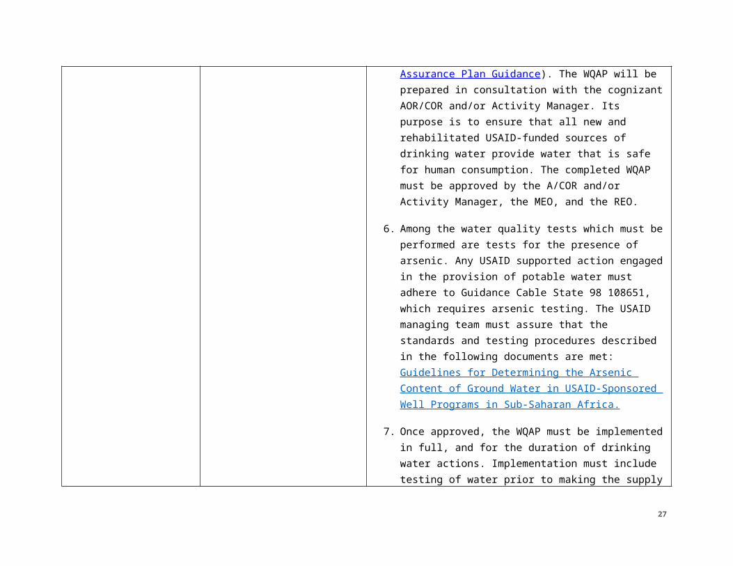
5. Prior to drinking water provision, the project will prepare and receive approval for a Water Quality Assurance Plan (WQAP) (see USAID April 2018 Water Quality Assurance Plan Guidance). The WQAP will be prepared in consultation with the cognizant AOR/COR and/or Activity Manager. Its purpose is to ensure that all new and rehabilitated USAID-funded sources of drinking water provide water that is safe for human consumption. The completed WQAP
21
must be approved by the A/COR and/or Activity Manager, the MEO, and the REO.
6. Among the water quality tests which must be performed are tests for the presence of arsenic. Any USAID supported action engaged in the provision of potable water must adhere to Guidance Cable State 98 108651, which requires arsenic testing. The USAID managing team must assure that the standards and testing procedures described in the following documents are met: Guidelines for Determining the Arsenic Content of Ground Water in USAID-Sponsored Well Programs in Sub-Saharan Africa.
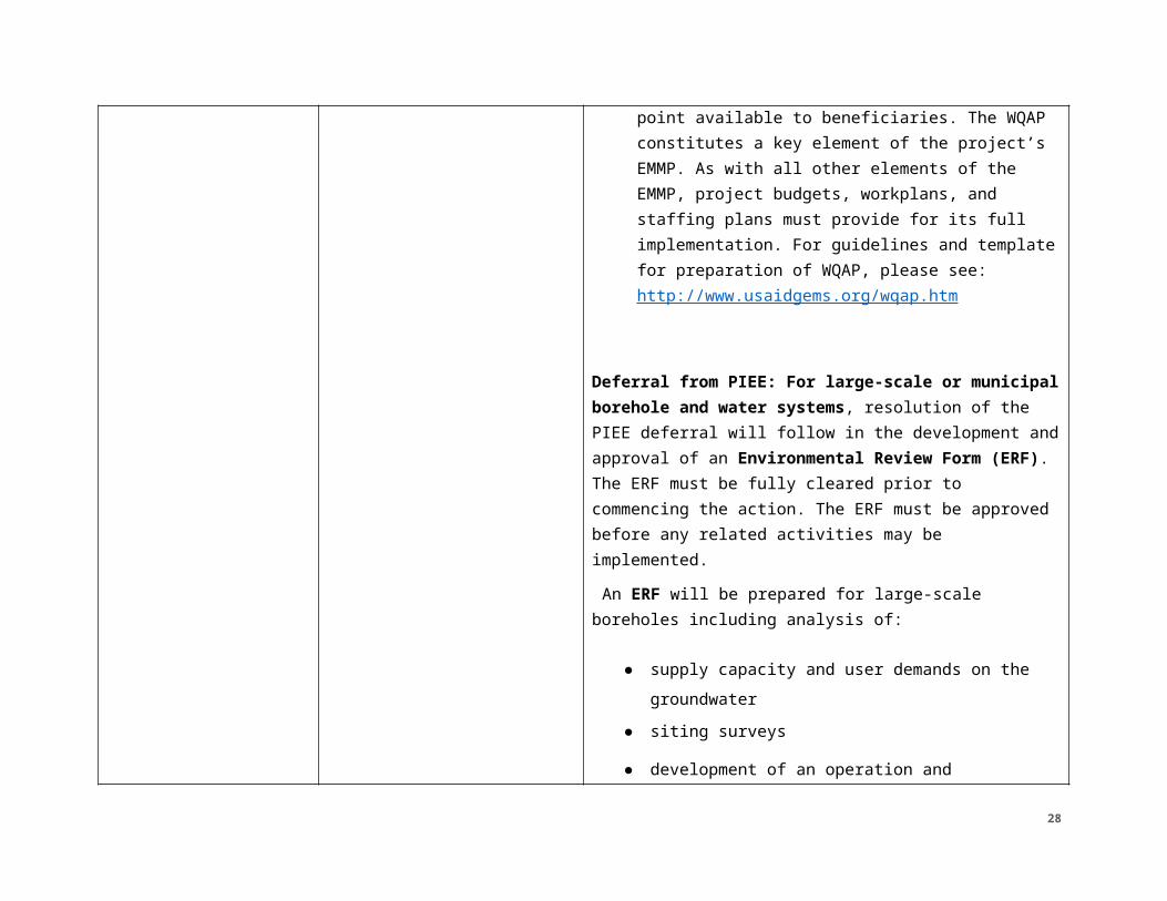
7. Once approved, the WQAP must be implemented in full, and for the duration of drinking water actions. Implementation must include testing of water prior to making the supply point available to beneficiaries. The WQAP constitutes a key element of the project’s EMMP. As with all other elements of the EMMP, project budgets, workplans, and staffing plans must provide for its full implementation. For guidelines and template for preparation of WQAP, please see: http://www.usaidgems.org/wqap.htm
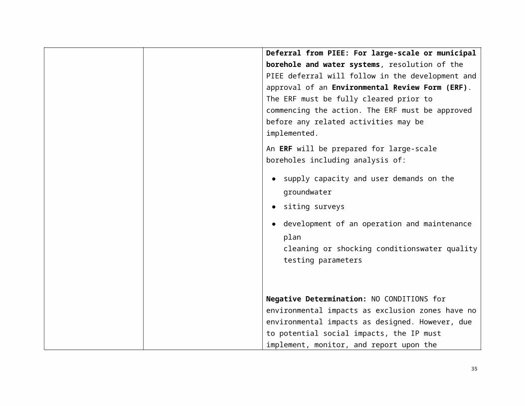
Deferral from PIEE: For large-scale or municipal borehole and water systems, resolution of the PIEE deferral will follow in the development and approval of an Environmental Review Form (ERF). The ERF must
22
be fully cleared prior to commencing the action. The ERF must be approved before any related activities may be implemented. An ERF will be prepared for large-scale boreholes including analysis of:
● supply capacity and user demands on the groundwater
● siting surveys
● development of an operation and maintenance plan
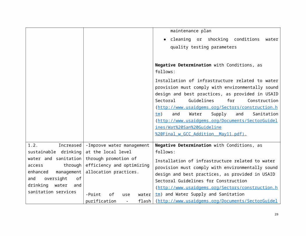
● cleaning or shocking conditions water quality testing parameters
Negative Determination with Conditions, as follows:Installation of infrastructure related to water provision must comply with environmentally sound design and best practices, as provided in USAID Sectoral Guidelines for Construction (http://www.usaidgems.org/Sectors/construction.htm) and Water Supply and Sanitation (http://www.usaidgems.org/Documents/SectorGuidelines/Wat%20San%20Guideline%20Final_w_GCC_Addition__May11.pdf ).
1.2. Increased -Improve water management Negative Determination with Conditions, as follows:
23
sustainable drinking water and sanitation access through enhanced management and oversight of drinking water and sanitation services
at the local level through promotion of efficiency and optimizing allocation practices.
-Point of use water purification - flash chlorination, draining, filtration, etc.
Installation of infrastructure related to water provision must comply with environmentally sound design and best practices, as provided in USAID Sectoral Guidelines for Construction (http://www.usaidgems.org/Sectors/construction.htm) and Water Supply and Sanitation (http://www.usaidgems.org/Documents/SectorGuidelines/Wat%20San%20Guideline%20Final_w_GCC_Addition__May11.pdf ).
1.3. Improved sustainable access to water for productive uses through enhanced management of agricultural and multi-use water systems and water use practices
-Small-scale NRM infrastructure construction, maintenance, rehabilitation or upgrading of:
Groundwater recharge structures (e.g., trenches, catchments, pits)Flood control structures – weirs, check dams, (see below for flood walls)
Negative Determination with Conditions, as follows:1. Site--specific subsidiary environmental review will be
implemented using the AFR ERF/ERR process (available at: http://www.usaidgems.org/subsidiary.htm). The ERF/ERR must be reviewed and approved by the A/COR, MEO, and REO prior to implementation of the action. The awardee/IP must assure implementation of any environmental mitigation and monitoring conditions specified by the approved ERF/ERR.
2. If an action is high risk, the action will continue to the development of a Environmental Review Form (ERF). The ERF must be fully cleared prior to commencing the action. The ERF must be approved before any related activities may be implemented.
24
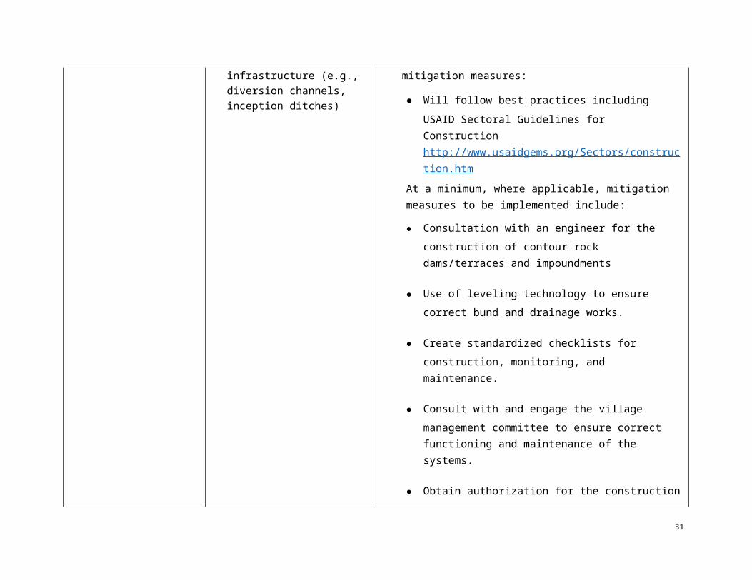
Storm water management infrastructure (e.g., diversion channels, inception ditches)
-Borehole construction or rehabilitation for mixed use
3. Those actions, having no complicating factors (see left) will incorporate the following mitigation measures:
● Will follow best practices including USAID Sectoral Guidelines for Construction http://www.usaidgems.org/Sectors/construction.htm
At a minimum, where applicable, mitigation measures to be implemented include:
● Consultation with an engineer for the construction of contour rock dams/terraces and impoundments
● Use of leveling technology to ensure correct bund and drainage works.
● Create standardized checklists for construction, monitoring, and maintenance.
● Consult with and engage the village management committee to ensure correct functioning and maintenance of the systems.
● Obtain authorization for the construction from all necessary authorities, including traditional authorities.
● Borrow pits will be rehabilitated (mechanically
25
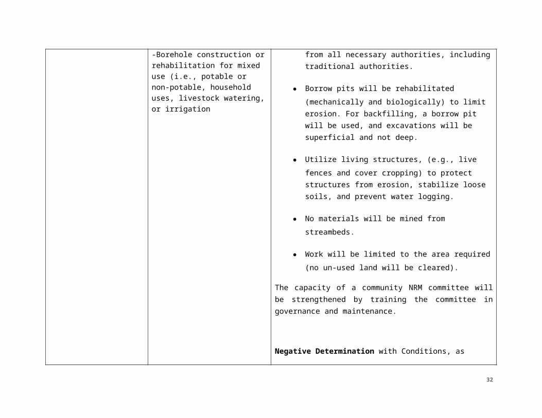
(i.e., potable or non-potable, household uses, livestock watering, or irrigation
and biologically) to limit erosion. For backfilling, a borrow pit will be used, and excavations will be superficial and not deep.
● Utilize living structures, (e.g., live fences and cover cropping) to protect structures from erosion, stabilize loose soils, and prevent water logging.
● No materials will be mined from streambeds.
● Work will be limited to the area required (no un-used land will be cleared).
The capacity of a community NRM committee will be strengthened by training the committee in governance and maintenance.
Negative Determination with Conditions, as follows:1. The awardee/ IP engaged in construction of
boreholes will ensure environmentally sound design by skilled professionals and actionable mitigation at every phase of construction, as provided in USAID Sectoral Guidelines for Water Supply and Sanitation http://www.usaidgems.org/Documents/SectorGuidelines/Wat%20San%20Guideline%20Final_w_GCC_Addition__May11.pdf
26
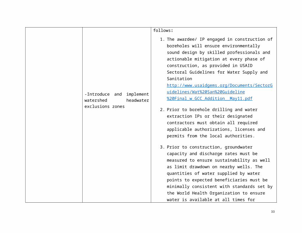
-Introduce and implement watershed headwater exclusions zones
2. Prior to borehole drilling and water extraction IPs or their designated contractors must obtain all required applicable authorizations, licenses and permits from the local authorities.
3. Prior to construction, groundwater capacity and discharge rates must be measured to ensure sustainability as well as limit drawdown on nearby wells. The quantities of water supplied by water points to expected beneficiaries must be minimally consistent with standards set by the World Health Organization to ensure water is available at all times for personal hygiene, food preparation, cleaning, and laundry.1
4. Boreholes must be properly sited and located away (up slope and at least 50m) from sources of contamination, such as latrines or poorly drained areas which receive contaminated run-off and away from other sources of abstraction.
5. Prior to opening of the borehole, the project will test water in accordance with local standards, but at a minimum, tests water quality for fecal coliform and arsenic.
6. If water is potable, conditions above for potable boreholes must also be implemented.
1 World Health Organization’s 2009 Water, Sanitation and Hygiene Standards for Schools in Low Cost Settings (http://www.who.int/water_sanitation_health/publications/wash_standards_school.pdf).
27
Recommended Social Mitigation Measures: IPs will consult with stakeholders and community authorities to determine issues of access and natural resource governance around boreholes.Deferral from PIEE: For large-scale or municipal borehole and water systems, resolution of the PIEE deferral will follow in the development and approval of an Environmental Review Form (ERF). The ERF must be fully cleared prior to commencing the action. The ERF must be approved before any related activities may be implemented.An ERF will be prepared for large-scale boreholes including analysis of:
● supply capacity and user demands on the groundwater
● siting surveys
● development of an operation and maintenance plancleaning or shocking conditionswater quality testing parameters
Negative Determination: NO CONDITIONS for environmental impacts as exclusion zones have no environmental impacts as designed. However, due to potential social impacts, the IP must implement, monitor, and report upon the following mitigation measures in a
28
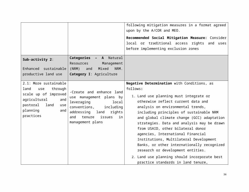
format agreed upon by the A/COR and MEO.Recommended Social Mitigation Measure: Consider local or traditional access rights and uses before implementing exclusion zones
Sub-activity 2:
Enhanced sustainable productive land use
Categories – A Natural Resources Management (NRM) and Mixed NRM. Category I: Agriculture
2.1: More sustainable land use through scale up of improved agricultural and pastoral land use planning and practices
-Create and enhance land use management plans by leveraging local conventions, including addressing land rights and tenure issues in management plans
Negative Determination with Conditions, as follows:1. Land use planning must integrate or otherwise
reflect current data and analysis on environmental trends, including principles of sustainable NRM and global climate change (GCC) adaptation strategies. Data and analysis may be drawn from USAID, other bilateral donor agencies, International Financial Institutions, Multilateral Development Banks, or other internationally recognized research or development entities.
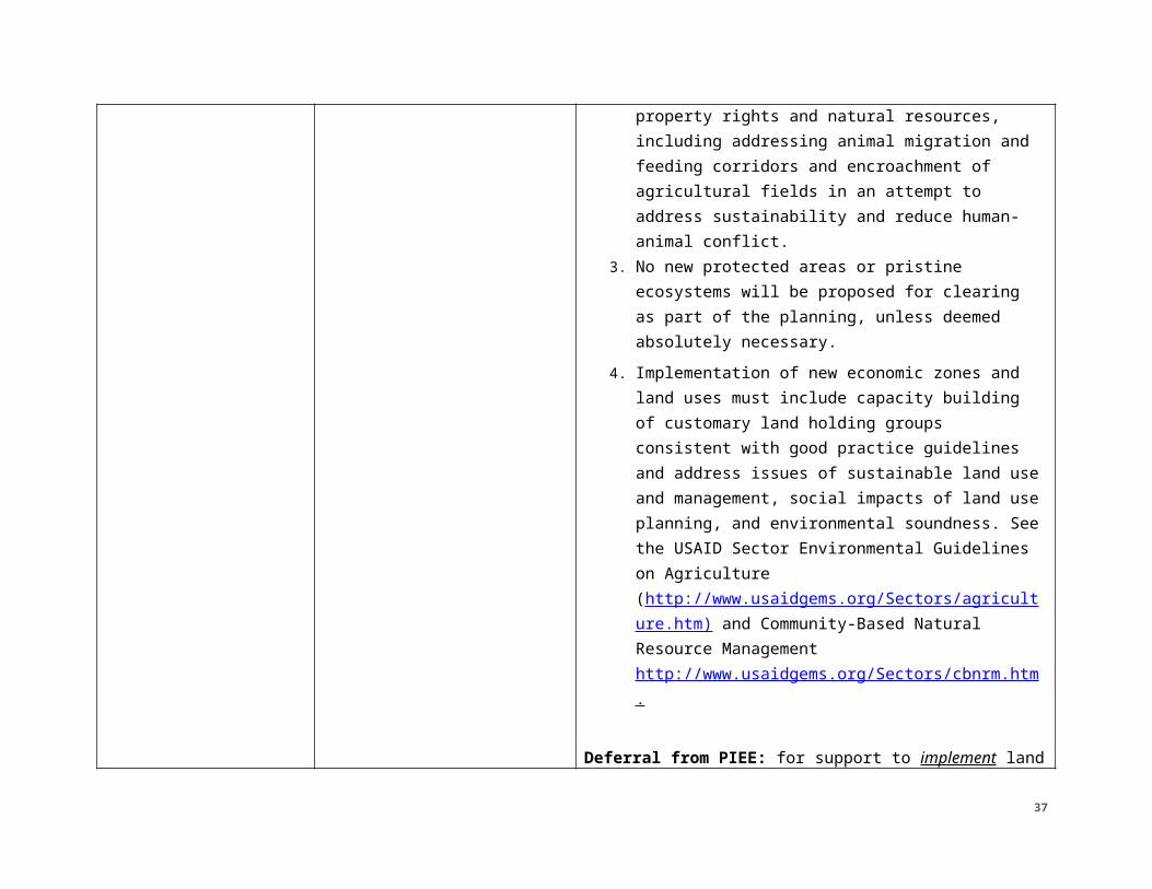
2. Land use planning should incorporate best practice standards in land tenure, property rights and natural resources, including addressing animal migration and feeding corridors and encroachment of agricultural fields in an attempt to address sustainability and reduce human-animal conflict.
3. No new protected areas or pristine ecosystems will be proposed for clearing as part of the planning, unless deemed absolutely necessary.
4. Implementation of new economic zones and land
29
uses must include capacity building of customary land holding groups consistent with good practice guidelines and address issues of sustainable land use and management, social impacts of land use planning, and environmental soundness. See the USAID Sector Environmental Guidelines on Agriculture (http://www.usaidgems.org/Sectors/agriculture.htm) and Community-Based Natural Resource Management http://www.usaidgems.org/Sectors/cbnrm.htm.
Deferral from PIEE: for support to implement land use plans in protected or pristine areas. However, creating or improving such plans falls under the previous negative determination with conditions. Resolution of the deferral will follow in the development and approval of the Environmental Review Form (ERF). The ERF must be fully cleared prior to commencing the action. The ERF must be approved before any related activities may be implemented.Recommended Social Mitigation Measure: Make all reasonable efforts to prevent or mitigate adverse economic consequences on local communities or individuals due to plan recommendations, including from loss of usual and customary use of resources. Conduct inclusive planning actions to address conflicts between groups.Training and sensitization of communities on land rights
30
will integrate cultural realities and take into account proper management of sensitive issues in order to avoid social conflicts.
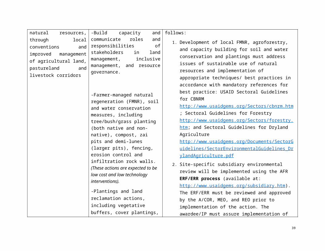
2.2: Reduced conflicts over natural resources, through local conventions and improved management of agricultural land, pastureland and livestock corridors
-Build capacity and communicate roles and responsibilities of stakeholders in land management, inclusive management, and resource governance.
-Farmer-managed natural regeneration (FMNR), soil and water conservation measures, including tree/bush/grass planting (both native and non-native), compost, zai pits and demi-lunes (larger pits), fencing, erosion control and infiltration rock walls. (These actions are expected to be low cost and low technology interventions).
-Plantings and land reclamation actions, including vegetative buffers, cover
Negative Determination with Conditions, as follows:1. Development of local FMNR, agroforestry, and
capacity building for soil and water conservation and plantings must address issues of sustainable use of natural resources and implementation of appropriate techniques/ best practices in accordance with mandatory references for best practice: USAID Sectoral Guidelines for CBNRM http://www.usaidgems.org/Sectors/cbnrm.htm; Sectoral Guidelines for Forestry http://www.usaidgems.org/Sectors/forestry.htm; and Sectoral Guidelines for Dryland Agriculture http://www.usaidgems.org/Documents/SectorGuidelines/SectorEnvironmentalGuidelines_DrylandAgriculture.pdf
2. Site-specific subsidiary environmental review will be implemented using the AFR ERF/ERR process (available at: http://www.usaidgems.org/subsidiary.htm). The ERF/ERR must be reviewed and approved by the A/COR, MEO, and REO prior to implementation of the action. The awardee/IP must assure implementation of any environmental mitigation and monitoring conditions specified by the approved ERF/ERR.
31
plantings, nurseries, and wind blocks.
3. For actions on communal lands, local authorities (including traditional authorities) will be involved, to ensure local authorization and agreement with the action.
4. For actions disseminated to farmers with minimal direct oversight by experts or IPs, a well-developed manual for implementation and maintenance, planned and overseen by a forester or agronomist, will be developed.
5. The capacity of NRM Committee (or similar) and communities to implement NRM practices will be strengthened by training the committee in governance and maintenance.
6. Species selection will include consultation with a qualified forester, agronomist, or biologist, in order to avoid creating problems with invasive species.
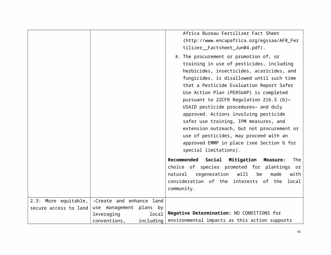
7. The provision/distribution, promotion of, and training in use of fertilizers must conform to best practices outlined in the Africa Bureau Fertilizer Fact Sheet (http://www.encapafrica.org/egssaa/AFR_Fertilizer__Factsheet_Jun04.pdf).
8. The procurement or promotion of, or training in use of pesticides, including herbicides, insecticides, acaricides, and fungicides, is disallowed until such time that a Pesticide Evaluation Report Safer Use Action Plan (PERSUAP) is completed pursuant to 22CFR Regulation 216.3 (b)—USAID pesticide procedures— and duly approved. Actions involving pesticide safer use
32
training, IPM measures, and extension outreach, but not procurement or use of pesticides, may proceed with an approved EMMP in place (see Section 6 for special limitations).
Recommended Social Mitigation Measure: The choice of species promoted for plantings or natural regeneration will be made with consideration of the interests of the local community.
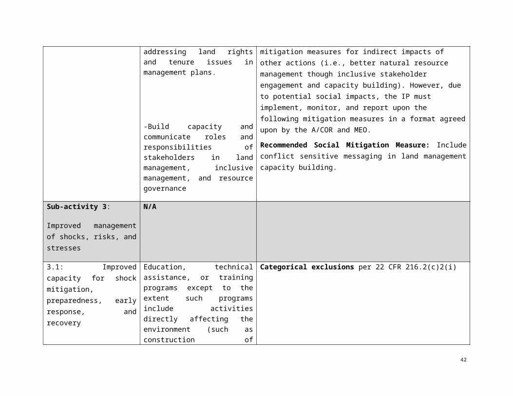
2.3: More equitable, secure access to land
-Create and enhance land use management plans by leveraging local conventions, including addressing land rights and tenure issues in management plans.
-Build capacity and communicate roles and responsibilities of stakeholders in land management, inclusive management, and resource governance
Negative Determination: NO CONDITIONS for environmental impacts as this action supports mitigation measures for indirect impacts of other actions (i.e., better natural resource management though inclusive stakeholder engagement and capacity building). However, due to potential social impacts, the IP must implement, monitor, and report upon the following mitigation measures in a format agreed upon by the A/COR and MEO.Recommended Social Mitigation Measure: Include conflict sensitive messaging in land management capacity building.
Sub-activity 3:
Improved management of shocks, risks, and
N/A
33
stresses
3.1: Improved capacity for shock mitigation, preparedness, early response, and recovery
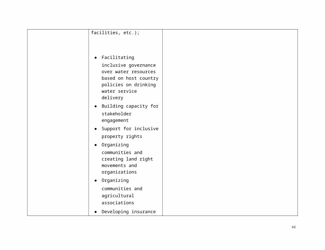
Education, technical assistance, or training programs except to the extent such programs include activities directly affecting the environment (such as construction of facilities, etc.);
● Facilitating inclusive governance over water resources based on host country policies on drinking water service delivery
● Building capacity for stakeholder engagement
● Support for inclusive property rights
● Organizing communities and creating land right movements and organizations
● Organizing communities and agricultural associations
● Developing insurance
Categorical exclusions per 22 CFR 216.2(c)2(i)
34
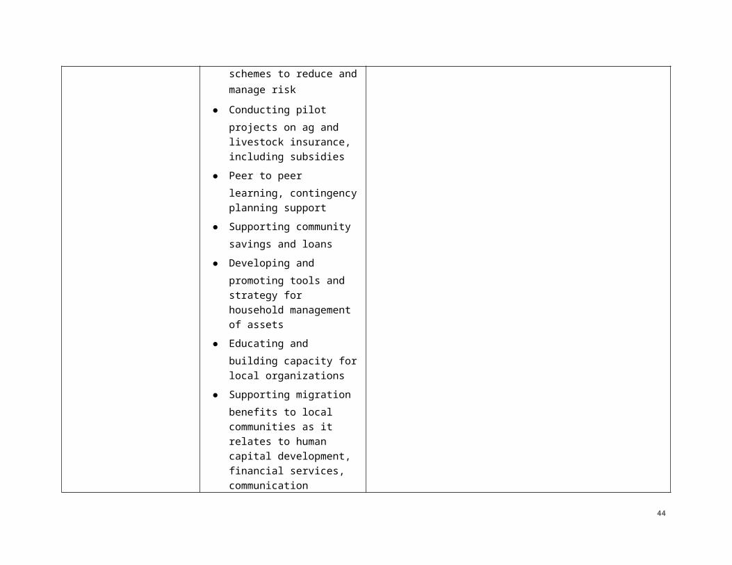
schemes to reduce and manage risk
● Conducting pilot projects on ag and livestock insurance, including subsidies
● Peer to peer learning, contingency planning support
● Supporting community savings and loans
● Developing and promoting tools and strategy for household management of assets
● Educating and building capacity for local organizations
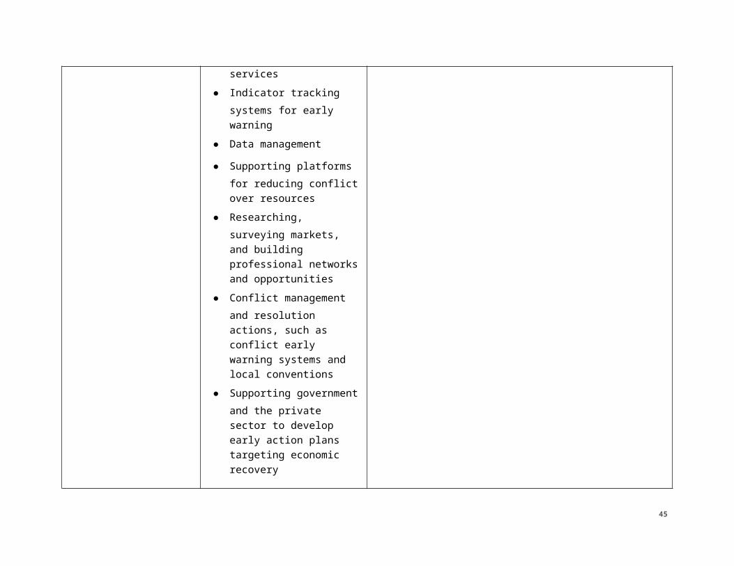
● Supporting migration benefits to local communities as it relates to human capital development, financial services, communication services
● Indicator tracking systems for early warning
35
● Data management
● Supporting platforms for reducing conflict over resources
● Researching, surveying markets, and building professional networks and opportunities
● Conflict management and resolution actions, such as conflict early warning systems and local conventions
● Supporting government and the private sector to develop early action plans targeting economic recovery
● Developing policy to strengthen preparedness, disaster risk reduction (DRR), and early response
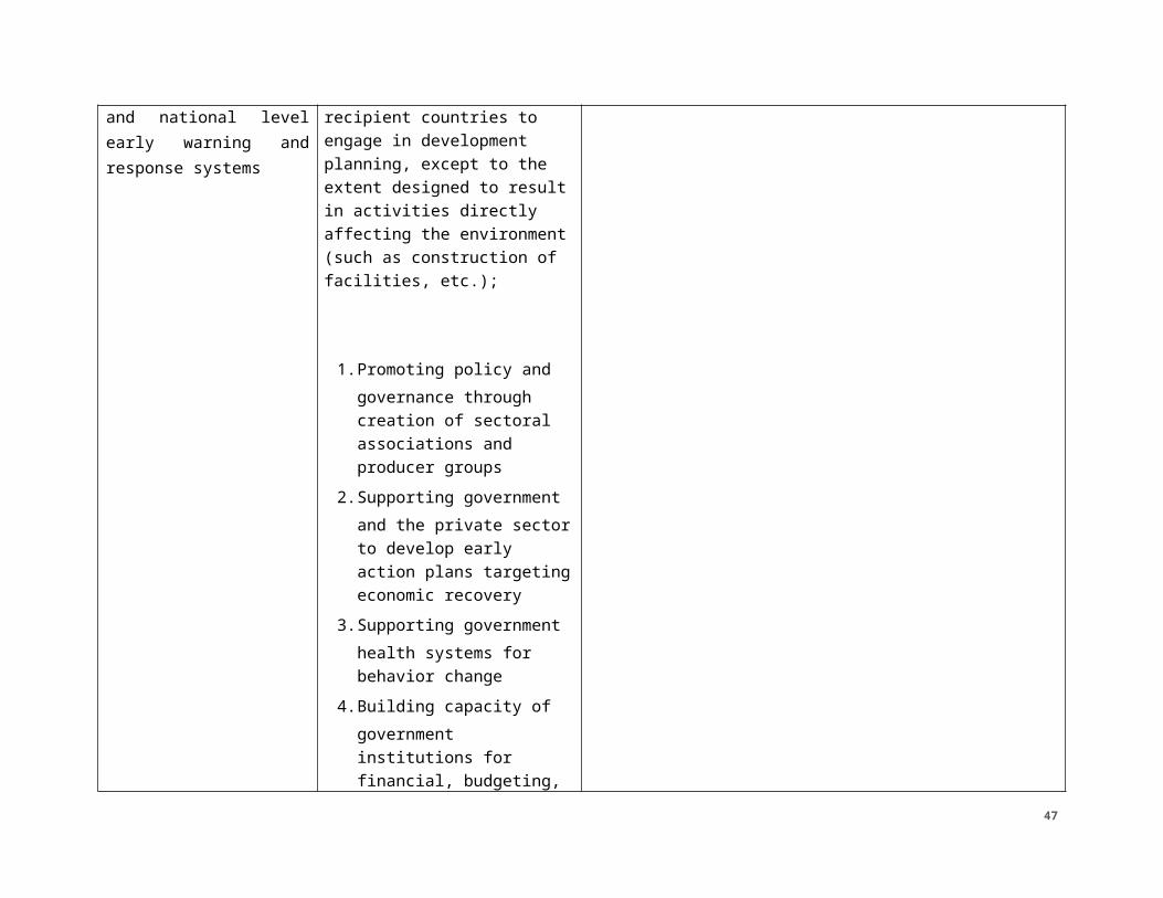
3.2: Improved access and use of climate information services
Document and information transfers
● Distributing and increasing consumption
Categorical exclusion per §216.2(c)(2)(v)
36
of climate and market information to rural poor
● Analyzing community based organizations (CBOs) and enhance their capacity and visibility to engage in dialogue with the government and motivation to do so
3.3. More responsive relationships between local, sub-national, and national level early warning and response systems
Studies, projects or programs intended to develop the capability of recipient countries to engage in development planning, except to the extent designed to result in activities directly affecting the environment (such as construction of facilities, etc.);
1. Promoting policy and governance through creation of sectoral associations and producer groups
2. Supporting government and the private sector to develop early action plans targeting economic
categorical exclusions per 22 CFR 216.2(c)2:
37
recovery3. Supporting government
health systems for behavior change
4. Building capacity of government institutions for financial, budgeting, and resource allocation
5. Analyzing CBOs and enhancing their capacity
6. Developing policy to strengthen preparedness, disaster risk reduction (DRR), and early response
7. Strengthening national government and regional capacity and coordination
8. Facilitating the clarification of roles and responsibilities and enhancing capacities to effectively implement host country policies, operations, and maintenance
9. Demonstrating approaches to strengthen local systems of leadership, management,
38
workforce development, and data collection
10. Analyzing national strategies to align them with interventions of institutions responsible for managing them
39
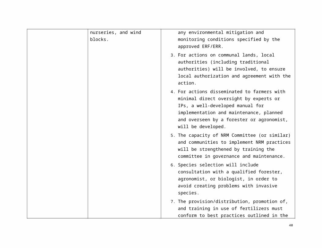
TABLE 4: ADDITIONALLY DEFINED OR ILLUSTRATIVE PROJECTS/ACTIVITIES AND SUB-ACTIVITIES (NOT ADDRESSED IN PROGRAMMATIC IEE) Project/Activity 1 — [Title]
Anticipated Environmental Impact
Recommended Threshold Determination
Sub-activity 1.1 NA NA
1.2 NA NA
1.3 NA NA
2.0 BASELINE ENVIRONMENTAL INFORMATION2.1 LOCATIONS AFFECTED AND ENVIRONMENTAL CONTEXT (ENVIRONMENT, PHYSICAL, CLIMATE, SOCIAL)
2.1.1. LOCATION AFFECTEDBurkina Faso and Niger are the RISE II focus countries. The operational zone for RISE II will be similar to the previous RISE I project; however, the target zone will be contracted to focus on a smaller area to maximize impact. In Niger, the zone of influence encompasses the Maradi region and the entire Zinder region except the northernmost desert communes. In Burkina Faso, the zone of influence is a selected group of communes of the northern Centre Nord region. However, USAID anticipates investing in livelihoods and governance activities in insecure zones such as Tillabéri and Sahel under the umbrella of preventing and countering violent extremism. Further, RISE II activities will be designed to be flexible and allow adjustments to implementation modalities and/or geography in response to changing situations on the ground, U.S. Government priorities, resource availability, and other challenges or opportunities. Activities will be focused on rural areas, but investment in urban and peri-urban areas is also expected since linking them to rural markets is critical to ensuring rural prosperity as well.
2.1.2 CLIMATE2.1.2.1. Burkina
Burkina Faso’s geographical situation makes it particularly vulnerable to climate change. As a Sahelian country, Burkina Faso suffers an extreme, variable climate: the same area can be affected by both flooding and drought within only a few months.
Climate change may affect the Sahelian region of Africa through severe variations in rainfall, water shortage and low agricultural yield. In addition, climate change will probably result in higher temperatures, potentially increasing the risk for forest fires or bushfires. Burkina Faso is a Sahelian country faced with several weather constraints. In Burkina Faso, droughts and floods are the most serious constraints. Between 1991 and 2009, the country experienced eleven (11) major floods which have affected 383,203 people and claimed 93 lives, three (3) major droughts which
40
have affected 96,290 people, an invasion of locusts and many episodes of epidemic diseases.
As noted in the Burkina Faso Climate Risk Profile2, the Centre-Nord area of Burkina Faso is a semi-arid climate with 50-70 rainy days a year, most falling during a two-month rainy season in the north from June/July to August (See Figure 1 for rainfall estimates). Dry season is dominated by the Harmattan trade winds which reduce humidity and contribute to reduced air quality and eroded soils. Temperatures in the north can vary dramatically between 15-45 degrees C.
Crop production, and therefore food security, and water availability are highly vulnerable to climate change in Burkina Faso. Environmental factors such as degraded systems, poor soils, lack of vegetative cover, and high evaporation rates are confounding factors exacerbating climate threats and contributing to vulnerability. While improving natural resources or “regreening” efforts have been implemented to adapt to climate change, these interventions face similar challenges as traditional agriculture because of extreme weather events and trends toward a drier and hotter climate (e.g., limited water availability during seedling establishment, wind erosion, heat waves, etc.).
2.1.2.2. Niger
Niger’s Climate Risk Profile summarizes climate vulnerabilities and risks to USAID food security programs but can be more broadly applied to the RISE II zone of influence.3 Niger is one of the hottest countries in the world and has three basic climatic zones: the Saharan desert in the north, the Sahel to the south of the desert, and the Sudan in the southwest corner (See climate zones in Figure 2). The dry season is November through May with a short rainy season in August. The intense heat of the Saharan zone often causes the scant rainfall to evaporate before it hits the ground.4 The Harmattan winds blow from the northeast and cause dust storms from November to March. Temperatures in the south average 30 degrees C.
Only one-fifth of the total land mass is savanna in Niger and is suitable for livestock or limited agriculture. As a result, the populace is concentrated in the far south along the borders with Nigeria and Benin. Crop production is primarily rainfed so erratic rainfall and decreased rainfall affects production. Additionally, high winds can erode topsoil, reducing overall fertility, and causing damage or stress to vegetation during storm events. These climate threats also affect the livestock/pastoralist sector. Rangeland can be degraded by high winds and low rainfall. Areas that are still producing fodder during dry periods also may be overgrazed and degraded due to overuse. Conflicts may arise over access rights.
The most important climate event of the last century in the Sahel was the “great drought” of the early 1970s, and its successors in the mid-1980s. The great drought was transformative, drying up water bodies and drastically reducing vegetative 2https://www.climatelinks.org/sites/default/files/asset/document/20170807_USAID %20ATLAS_FFP_BurkinaFaso.pdf3https://www.climatelinks.org/sites/default/files/asset/document/2017_USAID %20ATLAS_Climate%20Risks%20in%20Food%20for%20Peace%20Geographies%20Niger.pdf4 http://www.nationsencyclopedia.com/Africa/Niger-CLIMATE.html
41
cover over vast areas. While the area has received an increase in total rainfall since the 1990s, the 21st century has seen the return of a series of droughts and severe food insecurity in 2005, 2010, and 2012. Researchers also have noted what they characterize as changes in seasonal patterns (late arrival and early cessation of rains) and intense rain events. There is not a strong consensus about future rainfall in the Sahel, but scientists have recently suggested the likelihood of a somewhat wetter Sahel, with more variable precipitation on all time scales, from intra-seasonal to multi-decadal, and projected increases in daily rainfall intensity rather than frequency. There is a strong consensus that increases in Sahelian temperatures will continue.5
2.1.3 STATUS OF NATURAL RESOURCES
In 2017, USAID conducted Conservation of Tropical Forests and Biodiversity assessments for Burkina Faso and Niger in accordance with Sections 118 and 119 of the Federal Assistance Act (FAA) of 1961 as amended. Burkina Faso and Niger have diverse forest and wildlife resources, although environmental pressure and human activity (e.g., poaching and habitat destruction) have put some of these critical natural resources in jeopardy.6,7, 8,9 Habitat loss due to the growth of agriculture is the primary driver of biodiversity loss. Although it should be noted that one implication is that agricultural intensification, implemented in an environmentally sensitive manner, has the potential to reduce threats to wild species by diversifying and increasing income.
Burkina Faso had 5.35 million hectares of forests and 4.80 million ha of other wooded lands in 2015, which represented 19.6 percent and 17.5 percent of the country’s area respectively.10 The vast majority (93.44 percent) of Burkina Faso’s forests are the property of the state and administered by the government; 5.8 percent are public lands reserved for indigenous groups and communities; and the remaining forests are held by private individuals or companies.11 Ninety six percent of all forests are naturally regenerated and 4 percent are planted. There are no primary forests left in the country12 and planted forests have expanded at a rate of 7.9 percent per year from 2010 to 2015, when they reached 239,000 ha.13 However, while planted forests have expanded, forest loss in natural and protected areas has continued, with 59.8 thousand ha per year, or a 1.1 percent yearly reduction.14
5 http://www.fess-global.org/Publications/Other/FESS%20Sahel_Case_Study.pdf6 https://www.cia.gov/library/publications/the-world-factbook/geos/uv.html7 https://www.cia.gov/library/publications/the-world-factbook/geos/ng.html8 https://www.cia.gov/library/publications/the-world-factbook/geos/ng.html9 https://www.cia.gov/library/publications/the-world-factbook/geos/uv.html10 Food and Agricultural Organization (FAO), 2015. Global Forest Resources Assessment 2015: Desk Reference, Rome. Available at: http://www.fao.org/3/a-i4808e.pdf11 Global Forest Watch (GFW), 2013. Global Forest Watch System Status. Hansen/UMD/Google/USGS/NASA Tree Cover and Tree cover Loss and Gain, Country Profile. Available at: http://www.globalforestwatch.org/countries12 GFW, 201313 FAO, 201514 Niger Tropical Forest and Biodiversity (FAA 118/119) Assessment (2017)
42
In 2015, Niger had 1.14 million ha of forests and 3.14 million ha of other wooded lands, which represent 0.9 percent and 2.5 percent of the country area, respectively.15 The state owns and administers 82.44 percent of all national forests, while 17.37 percent are public lands reserved for the use of indigenous groups and communities, and the remaining forests are held by private individuals or companies.16 Naturally regenerated forests account for 68 percent of country’s forests, whereas 19 percent are primary forests, and 13 percent are planted forests. There has been no reduction of forest cover within protected areas, but the country has lost on average 12,400 ha of forests per year between 2010 and 2015, a 1.1 percent yearly reduction. In 2011, deforestation was responsible for 3.4 percent of the nation’s greenhouse gas (GHG) emissions.17
Re-greening has been a major focus of donors, government, and non-governmental organizations (NGOs). Hundreds of thousands of farmers in Burkina Faso and Niger have utilized agroforestry, water, and soil-management practices to rehabilitate arid lands into agricultural areas and increase tree cover. Farmers have used zai pits, demi-lunes, and contour planting along natural contours to capture rainwater, recharge aquifers and improve overall soil moisture. Tree plantings and multiplication have also been used by farmers in their fields, also resulting in some success. The efforts in Burkina Faso have rehabilitated 200,000 to 300,000 ha of land, resulting in 80,000 tons of food annually. Farmers in Niger have improved about 5 million ha of land and resulted in 500,000 additional tons of food annually.18
The landscape of southern Niger has transformed considerably over the past 30 years and is an unprecedented success story. Local farmers’ practices and expert knowledge of the landscape were copied and enhanced in low-cost ways to replicate their success throughout the country and the entire Sahel region.
2.1.4 STATUS OF WATER INFRASTRUCTURE
Burkina Faso and Niger both have limited water resources with barriers both to access and availability of water. Rapid urbanization has placed pressure on water resources and climate change may pose additional challenges as variable rainfall is expected to contribute to intensified droughts and floods.
The longest river in Burkina Faso is the Black Volta (1,352 km/840 miles), located in the southwestern bulge of the country. The two other principal rivers, the White Volta and Red Volta, run north to south in the central plateau region. Burkina Faso has very few permanent natural lakes.19 Although water access has improved significantly over the past decade, improvements are still needed in many areas. An estimated 72 to 82 percent of the population has access to adequate water resources, though rural areas lag far behind urban areas in terms of access. Despite dramatic improvements in water access, adequate access to sanitation is still very
15 FAO, 201516 GFW, 201317 FAO, 201518 https://pubs.er.usgs.gov/publication/7015735919 http://www.nationsencyclopedia.com/geography/Afghanistan-to-Comoros/Burkina-Faso.html
43
low. As of 2016, only an estimated 20 percent of the population has adequate sanitation facilities.20, 21. 22
Farmers in Burkina Faso are moving away from collective irrigation schemes towards individually-managed irrigation installations. Gravity-fed community schemes focus on the production of staple crops and tend to be inefficient and management-demanding. Conversely, small private irrigation saves water and is on-demand, so can be applied to high-value crops (vegetables mostly). These systems coexist and complement one another.23 Most systems in Burkina Faso are surface irrigation systems, though sprinkler irrigation is favored for cultivation of certain crops, such as sugarcane. Other irrigated crops with recommended rotations on irrigated areas include rice, maize, and cowpeas. Irrigated crops contribute significantly to food security in Burkina Faso. Cultivation of irrigated crops also offers economic opportunities to vulnerable populations including women, though women represented only 10 percent of the members of irrigators’ communities in 2011.
The Niger River flows through the south west corner of Niger and there are extensive fossil groundwater resources. But the river can dry up completely at Niamey, and most aquifers are deeply buried and non-renewable. In the northeast, Niger shares Lake Chad with Nigeria, Chad and Cameroon. The size of Lake Chad greatly varies seasonally with the flooding of the wetlands areas.
The most recent data suggests that in Niger, 58 to 62 percent of the population has access to water sources.24 Around 41 percent of the population has access to sanitation facilities and about 11 percent has access to improved facilities. An estimated 63 million people do not have access to improved drinking water sources and 100 million people lack access to basic sanitation facilities. While people in urban areas have access to water, people often purchase water from vendors and carry it long distances in containers. In rural areas, only about 42 percent of households have access to improved water sources.25 Some World Bank sources suggest that private water companies lack incentives to modernize rural water systems.26 Other sources have found that even when new water systems are installed, as many as 30 percent fail within the first year. In rural areas 61 percent
20 http://www.worldbank.org/en/results/2017/07/28/burkina-faso-developing-infrastructure-and-an-enabling-environment-for-sustained-access-to-water-and-sanitation-services-for-the-urban-poor (Reported rate of total improved water source use: 72 percent in 2016)21 https://www.unicef.org/infobycountry/burkinafaso_statistics.html (Reported rate of total improved water source use: 80 percent in 2011)22 https://www.cia.gov/library/publications/the-world-factbook/geos/ng.html (Reported rate of total improved water source use: 82 percent in 2015)23 http://awm-solutions.iwmi.org/burkina-faso-solutions.aspx24 https://www.cia.gov/library/publications/the-world-factbook/geos/ng.html25 http://www.who.int/water_sanitation_health/monitoring/investments/nigeria-10-nov.pdf (67 percent access to water supply, estimated 62 percent access to improved, 41 percent access to sanitation facilities as of 2013)26 http://blogs.worldbank.org/water/delivering-water-and-sanitation-services-niger-challenges-and-results
44
of the population lives more than 30 minutes away from a functioning water source and 34 percent live more than 2 hours away.27
Currently, irrigation in Niger is practicable only along the water courses,28 so affordable and efficient irrigation systems is an area of interest for investment. The renewable water resources that may be available for improved irrigation systems include 31 billion m3 of surface water and 2.5 billion m3 of groundwater.29 The Millennium Challenge Corporation, Niger Compact will invest a portion of $254 million into access to water for agriculture and livestock.30 In 2013, the estimated cost of developing new lands with total water control was $30,000/ha and the cost of physical rehabilitation was estimated at $8,000/ha.31 The estimated cost for smaller scale irrigation projects is much lower, at $8,000/ha for new systems. Operating costs for these lands may vary based on the type of irrigation system. Estimates ranged from $30/ha in gravity systems in the Tahoua region to $120-240/ha for surface irrigation systems that require pumping water near the Niger River. The totally controlled water areas monitored by the National des Amenagements Hydro-Agricoles have demonstrated positive results including increased cultivation of rice, a major agricultural staple.
2.1.5 NATURAL DISASTERS AND RESPONSE SYSTEMSBoth Burkina Faso and Niger are part of the Climate Risk and Early Warning Systems (CREWS). CREWS is an initiative by the Global Facility for Disaster Reduction and Recovery (GFDRR) to finance weather stations, radar facilities, and early warning systems in poor and vulnerable countries where weather data is unreliable or lacking. GFDRR is a global partnership that helps developing countries better understand and reduce their vulnerability to natural hazards and climate change. In Burkina Faso, CREWS supports capacity-building for hydro-meteorological services that serve as early warning systems and contribute to risk-reduction with a focus on flood-risks and agricultural and food security. This capacity-building is directed towards the National Meteorological Service and creating strong partnerships between ministries and stakeholders.32 In Niger, CREWS is working to strengthen early warning systems for floods along the Niger and Komadougou Rivers and improve early warning systems for famine.33
The most common natural disasters in Burkina Faso are drought and concurrent famine. In the 1970s, droughts caused famines and resulted in high mortality and depleted livestock. Since then, droughts have been less severe and responses from the government and international aid organizations have prevented high fatality rates but drought and famine are a persistent threat. Desertification and climate change also present challenges to water resources. The expanding desert degrades
27 http://blogs.worldbank.org/water/water-key-poverty-reduction-and-health28 http://documents.worldbank.org/curated/en/821031468758341721/pdf/multi-page.pdf29https://www.climateinvestmentfunds.org/sites/default/files/IFC%20PPCR_Niger %20Program%20Proposal_PUBLIC_May%202014.pdf30 https://www.mcc.gov/where-we-work/program/niger-compact31 http://www.fao.org/nr/water/aquastat/countries_regions/NER/index.stm32 https://www.crews-initiative.org/en/projects/burkina-faso-strengthening-national-capacities-early-warning-system-service-delivery33 http://www.crews-initiative.org/fr/projects/niger-strengthening-early-warning-services
45
the quality of soil and water resources, while higher temperatures evaporate more water from reservoirs and dams, all affecting agricultural production. Human activities such as overgrazing and intensive farming may also exacerbate the threat of drought and famine. Sandstorms and flooding also occur in certain parts of the country. In August 2006 for example, the Oudalan province experienced unusually heavy rains and flooding which resulted in widespread property damage.34
Niger experiences a very similar set of natural disasters. Drought and famine occur persistently. In 2017, an estimated 1.5 million people were affected by food insecurity and an additional 1.5 million were estimated to be chronically food insecure. Inadequate food production and rapid population growth have led to 20 percent of the population being unable to meet their food needs and 30 percent being unable to meet their needs when rainfall is poor.35 In addition to natural disasters, violence by Boko Haram in Nigeria has spread into Niger and resulted in displaced populations and additional food security.36 Flooding is also common in Niger. More than 50 people died in floods in 2017. Improvements in early warning systems for floods include partnerships between the Ministry for Humanitarian Action and Disaster Management, the National Meteorological Service, the National Mechanism for Food Crisis Management, the Civil Protection Directorate, the National Hydrology Service, and the World Meteorological Organization-World Bank mission. Strategies include identifying flood-prone areas along the rivers, improving risk-mitigation infrastructure, and identifying vulnerable populations.37
2.2 APPLICABLE AND APPROPRIATE PARTNER COUNTRY AND OTHER INTERNATIONAL STANDARDS (E.G. WHO), ENVIRONMENTAL AND SOCIAL LAWS, POLICIES, AND REGULATIONS
2.2.2 BURKINA FASO REGULATORY STRUCTUREConstitution and Regulations.38 Burkina Faso’s constitutional, legislative and regulatory frameworks address environmental protection and natural resources management. The constitution approved on June 2, 1991, accords a special importance to and includes a number of provisions for the protection and management of the environment:
Article 14 of the constitution asserts that the natural wealth and resources belong to the people. Article 29 recognizes the right to a healthy environment and states that the protection, defense and promotion of the environment are a shared duty.
Article 101 defines legal authority and responsibility of the state towards protection of the environment. The Environmental Code (Act No. 05/97/ADP of 30 January 1997) sets out basic principles to preserve the environment and improve
34 http://www.un.org/africarenewal/magazine/july-2007/coping-less-rain-burkina-faso35 http://www1.wfp.org/countries/niger36 https://docs.wfp.org/api/documents/WFP-0000016302/download/?_ga=2.211866644.1459596640.1518199153-304593260.151819915337 https://public.wmo.int/en/media/news/niger-making-progress-towards-flood-early-warning-system38 2017 USAID ASTER IEE on Burkina Faso. http://gemini.info.usaid.gov/repository/pdf/50407.pdf
46
the quality of life in Burkina Faso. It defines what are considered to be pollution-causing actions, pollution control and provides penalties for violators.
Burkina Faso’s 2007 national environmental policy, Politique Nationale en Matière d’environnement, is the main strategic policy framework. It sets out the national framework and plans for the sustainable management of natural resources and the environment. It has not yet been operationalized, but the government plans to do so in conjunction with several other recently developed key programs and policies.
In 2008, the government signed a decree (No. 2008-125/PRES/PM/MECV) specifying the creation and organization of environmental units that would be placed within the various ministerial departments and government enterprises as a way to ensure that environmental concerns are integrated into plans, policies and actions at different levels of government.
Oversight Bodies. The Ministry of Environment is the principal government department in charge of the design, coordination and implementation of national environmental policy. The ministry is responsible for promotion and coordination of actions to combat desertification; protection of forests and wildlife; promotion of environmental assessments and environmental education, compliance with environmental conventions, and pollution prevention and control. The Ministry of Environment, the Ministry of Agriculture, and the Ministry of Water & Water Resources are responsible for the implementation and enforcement of legal provisions that apply to land, forestry, wildlife, fishery, water, agricultural and livestock systems. Measures, in addition to the Environment Code, that directly apply to environmental conservation include Agrarian and Land Reform, Forestry Code, Mining Code, Water Code, and traditional and customary regulations (traditional hunting and fishing, sacred woods, taboos). Burkina Faso is party to international agreements on Biodiversity, Climate Change (Kyoto Protocol), Desertification, Endangered Species, Hazardous Wastes, Law of the Sea, Marine Life Conservation, Ozone Layer Protection, and Wetlands.
The Environmental Code provides (in Article 17) that activities likely to have significant effects on the environment are subject to prior review by the Minister of Environment based on an EIA study or other evaluation document. The EIA implementation procedure is burdened by weak capacities of national actors and a low level of enforcement. Sector guides are currently under development to help facilitate the understanding and approval of the procedure. Local human resources for assisting with the EIA process are available via the Burkina Faso National Association of EIA professionals.
Conservation and Forestry.39 Burkina Faso has several laws, policies and strategies around the Legal Framework affecting conservation and forestry. The most relevant laws and policies are described in an International Union for Conservation of Nature (IUCN) report called “An IUCN situation analysis of terrestrial and freshwater fauna in West and Central Africa”. The report identifies and
39 Excerpts from DCHA BEO FY18 RFA Burkina Faso, Niger IEE. 2018. https://ecd.usaid.gov/document.php?doc_id=50497
47
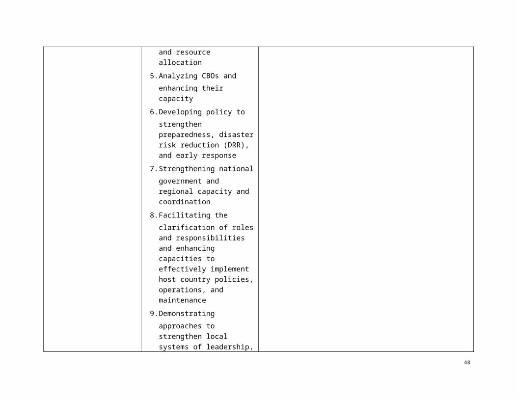
describes the main institutional laws, policies, and strategies regulating the country’s aim to conserve and search for sustainability. The country is also a member on several international agreements, treaties and conventions such as: Convention on International Trade in Endangered Species of Wild Fauna and Flora, United Nations Framework Convention on Climate Change, and United Nations Convention to Combat Desertification just to name a few. More detailed information can be found in the Tropical Forests and Biodiversity Analysis for Burkina Faso.40
Law No. 006-2013/AN (Loi n°006-2013/AN portant code de l’environnement du Burkina Faso) of 2 April 2013 provided the Environmental Code of Burkina Faso and repealed Law No. 005/97/ADP (Loi nº 005/97/ADP portant Code de l’environnement au Burkina Faso) of 30 January 1997. The new Environmental Code aims to protect people against the threats caused by the degradation of their environment and to improve living conditions. It states that promoting a healthy environment is of general interest and the responsibilities of all individuals. It further states that maintaining environmental quality and the restoration and enhancement of natural resources must be based on the principles of participation and public information, prevention, precaution, polluter pays, sustainable development, and subsidiarity. It recognizes the rights of local populations, civil society, and the private sector to participate in the management of their environment and it enshrines a right to use natural and genetic resources for local people and the sharing of benefits arising from their exploitation.
Climate Adaptation Planning. Burkina Faso’s resilience to climate change is guided by the country's 2015 National Adaptation Plan (NAP), which aims to “(i) reduce vulnerability to the impact of climate change by developing adaptation and resilience capabilities; (ii) facilitate the integration of climate change adaptation into new or existing policies, programs or activities and in specific development planning processes and strategies in pertinent sectors and at various levels in a coherent manner.”41 In addition, the Second National Communication of Burkina Faso on Climate Change to the United Nations Framework Convention on Climate Change highlights climate mitigation commitments of the country and sector specific climate risks and adaptation measures.42
Water Resources. In Burkina Faso, the National Office of Water and Sanitation (ONEA) serves most urban areas and some rural areas. As of 2008, urban areas were reasonably well serviced by ONEA whereas rural areas were underserved. In 2003 the country adopted an action plan for integrated water resources management. This plan indicated a shift towards a decentralized water system. Following up on that plan, in 2004 Burkina Faso adopted the General Charter of Territorial Collectives (CGCT). The CGCT gave responsibility for rural water supplies to local communities. While there is legal infrastructure in place to address the lack of water resources in rural areas, some challenges to implementation over the past two decades have included a lack of technical assistance to implement the plans. In
40 http://www.usaidgems.org/118119/faa118119Africa.htm41http://www4.unfccc.int/nap/Documents/Parties/PNA_Version_version%20finale%5bTransmission %5d.pdf42http://www4.unfccc.int/nap/Documents/Parties/PNA_Version_version%20finale%5bTransmission %5d.pdf
48
addition, there have been conflicting interests between the different parties responsible for increased rural water access.43
Land tenure policy.44 After independence in 1960, land management in Burkina Faso was primarily left to customary institutions and governed according to customary law. The government’s role was restricted to management of classified or protected land. The basis for the country’s modern statutory system is the Réorganisation Agraire et Foncière, introduced in 1984 and amended in 1991 and 1996, which helped to develop a private property rights regime for land. The legislation vested all land in the state, regardless of customary tenure status, and outlawed all land sales in an attempt to make a clean break with customary rights. Citizens would henceforth be able to gain access to land through government rules of access, thus ending the power of traditional chiefs. Its interpretation in rural areas was that land belonged to whoever was cultivating it, regardless of customary rules. Amendments allowed them privatization of land, recognized use-rights and long-term leases, and enabled the state to cede land to private operators.
The legislation also created a national village land-use management program that operates Commission Villageoise de Gestion des Terroirs (CVGTs), village-level representative committees responsible for land management. These bodies were intended to represent the village by bringing together customary leaders and members of underrepresented groups in committees. In practice, however, CVGTs have not realized their purpose, as the Réorganisation Agraire et Foncière is commonly superseded by customary systems at the village level. The commissions are more often associated with donors or viewed as State projects, rather than as belonging to the community. Another local body that plays a role in land management is the Conseil Villageois de Développement (CVD), which is tasked with managing and resolving conflicts and ‘finding solutions to land tenure problems’ according to the 2004 Code Général des Collectivités Territoriales (2004 Decentralization Code). Both CVGTs and CVDs are evidence of Burkina Faso’s push for decentralization, which has sought to transfer management responsibilities over land to local bodies.
Rural Land Tenure Law. The latest development in this process was the adoption of the new Rural Land Tenure Law (Act. No 034) in June 2009 following a long, transparent, and inclusive process. The goals of the new law include:
1) ensuring equitable access to rural land; 2) promoting investments in agriculture, forestry and pastoralism in Burkina Faso; 3) reducing poverty in rural areas; and 4) promoting sustainable management of natural resources.
In addition, the new law is meant to protect property rights, prevent and manage land conflicts, and build a framework for ensuring rural land tenure security. The law furthers decentralization in Burkina Faso and codifies principles of customary rights by enabling communities to draft Chartes Foncière Rurale (Rural Land
43 http://pdf.usaid.gov/pdf_docs/PNADO927.pdf44 2017 USAID ASTER IEE on Burkina Faso. http://gemini.info.usaid.gov/repository/pdf/50407.pdf
49
Charters), which are local conventions based on customary land uses. These land charters contain rules relating to conservation or shared natural resources, the process of giving and receiving land loans, and land dispute management. The new law provides the governing framework for the land charters, which vary according to local needs and customs to reflect the diversity of Burkina Faso’s people and ecosystems.
Local land charters are created at the village level in a participatory manner that includes a representative group of stakeholders (including women, forest users, pastoralists, and youth), and is aided by the state. They are adopted at the village level, validated at the municipal court, and recorded in the register of local land charters.
The 2009 law also enables legal recognition of individual and collective land rights, the transfer of certificates of rural land possession through inheritance, oral and written rural land leases, and the creation of local land management institutions. These bodies include:
• Service Foncier Rural (Rural Land Service), a national institution represented in each community; • Commissions Villageoises Foncière (Village Land Commissions); • and ‘local consultative bodies for land-related matters’ in rural municipalities.
The Rural Land Service and Village Land Commissions are designed to work together to maintain public spaces and common areas, secure individual land tenure rights, and prevent disputes. The 2009 law created the Attestation de Possession Foncière Rurale (AFPR) (or Rural Land Possession Certificate), which can be granted to individuals and associations. This replaces the previous practice of issuing ‘minutes of palaver’ that affirmed rights to land usage. In the new system, certificates can be obtained within 75 days if no objections are raised. Any property owner may request an individual certificate or recognition of possession by submitting an application to the Village Land Commission (these may be made orally). The commission forwards it to the Rural Land Service, which checks that no possession or property title has been previously established on the parcel in consultation with local customary and traditional authorities.
The rural land possession certificate is then prepared for the Mayor’s signature on behalf of the applicant. In the case that there are competing claims to the land, the case is referred to the Commission de Conciliation Foncière Villageoise, which reviews it for up to 45 days through local-level consultations. Only if this is unsuccessful is the case referred to the local court, or tribunal de grande instance. AFPRs differ from full land ownership titles in that they confer the right to use undeveloped land; they entail rights of usufruct (use and profit), but not abusus (alienation1). AFPRs may be used to obtain bank loans, depending on individual bank requirements and can be loaned, donated, rented, or passed on to the next generation.
Local consultative bodies must include members of development committees, traditional land chiefs, representatives of state and local government, representatives from women’s groups, and technical experts. Mayors and prefects
50

also take part in conflict resolution relating to land disputes. However, these groups can only examine and issue reports and suggestions. Most groups with customary claims over land also have a land chief, or chef de terre, who has a connection with the ancestors who initially approached the local spirits of the land. The chef de terre stands as a symbol of the inalienability of that group’s right to land. The 2009 law sets forth the framework for addressing land disputes, stating that parties should first attempt to resolve the situation with local authorities, per procedures in the local land charter. The law gives local authorities a 45-day period, which may be extended once, in which to reach conciliation between the parties. Addressing the courts and initiating litigation should only be used as a last resort.
2.2.3 NIGER REGULATORY STRUCTURE
Constitution and Regulations. In light of the climate and ecological characteristics and the overall reliance on agricultural and pastoral livelihoods by 80 percent of the country’s population, natural resources management and environmental protection is one of the top priorities of the Nigerien government. The local governance of natural resources is well-defined in the Government of Niger “Strategy for the Accelerated Reduction of Poverty (2008) and the Rural Development Strategy”. The Government of Niger has enacted the following laws governing the natural resources management and environmental protection:
● “Executive Order no 98-56” related to environmental management and bio-diversity conservation;
● The executive convention to fight against desertification;● The law for the protection of fauna and the management of wetlands;● The Environmental Code;● Law 1971 017 governing fishing;● Law 2004-040 governing forestry; and● “Executive Order no 93-014 governing water systems.
51
Oversight Bodies. The National Council for Sustainable Environmental Development, a Ministry-level agency in charge of environment, a permanent secretariat for the rural code and its decentralized services, has oversight of natural resources management and environmental regulation. The rural code on environmental issues has two components: one is juridical and the other is institutional. The juridical one is defined by “Executive Order 93-015” and its legislative and statutory texts. The institutional component includes the National Committee of the Rural Code-15 and its Permanent Secretariat, the departmental land tenure commissions, the communal land tenure commissions and community-based land tenure commissions.
Niger is also member of and implementing the United Nations Framework Convention on Climate Change, the protection and conservation of water and water resources and maintaining environmental health, as well as the prevention of natural disasters. Niger is also member of other regional and sub- regional agreements on environmental protection and the fight against desertification.
Conservation and Forestry. Although Niger is a signatory of many international treaties, including Convention on International Trade in Endangered Species of Wild Fauna and Flora and Convention on Biological Diversity, the country’s capacity to implement treaty or convention agreements is weak due to a lack of information given to key government stakeholders and a lack of resources. Commonly, government agencies look to NGOs or cooperation agencies to collaborate and/or coordinate activities and actions related to treaties/conventions. More detailed information can be found in the Tropical Forests and Biodiversity assessment for Niger.45
Land tenure. The Rural Code is a key element of the Nigerien national policy on rural land tenure and the management of natural resources. It hinges on a legal system (composed of all the rules and regulations concerning land tenure and natural resources management) and an institutional system (a group of institutions that implement and monitor those rules). The two systems apply at different levels, from the local level to the national one. The Rural Code consists of a series of legal texts; the 1993 ordinance (ordonnance cadre) containing its guiding principles and sector-specific legislation. At the national level, the National Committee of the Rural Code defines global policy guidelines for the State. It is chaired by the Ministry of Agriculture and includes other ministries involved in the management of land and natural resources.
The rural agricultural zone is the part of the national territory located south of the limit for cultivation as defined by the 1961 Law. The private property system applies to this area. Land property can be acquired through custom or positive law. When no ownership rights can be established, the land is considered vacant and belongs to the State or to decentralized local institutions. The Ministry of Agriculture (Ministère de l´Agriculture) is responsible for the preparation, implementation, and monitoring of the national policy on agricultural development.
The rural pastoral zone is the part of the national territory located north of the limit for cultivation defined also by the 1961 Law. It belongs to the State. The rights of 45 http://www.usaidgems.org/118119/faa118119Africa.htm
52
pastoralists (who own or keep cattle) include free access to natural resources in the pastoral zone, they hold a common use right for this zone. Ministry of Livestock (Ministère de l´Elevage du Niger) ensures the development and promotion of livestock through the design, development, and implementation of the national policy for productions development, the animal industries, and the national animal health policy.
Climate Adaptation Planning. To limit the impacts of climate change to Niger, the country’s NAP is being developed, as highlighted by the ‘stocktaking activity and recommendations’ conducted in 2014 to prepare for the NAP.46 Niger released their Second National Communication on Climate Change to the United Nations Framework Convention on Climate Change in 2009 and their Third National Communication on Climate Change in 2016.47, 48 These documents guide climate change mitigation commitments from the country and highlight climate change adaptation needs.
Water regulation and management. Water is a strategic resource and constitutes state property. rivers, lakes, ponds, sources, and groundwater are therefore considered state property. The ministries of environment and water (Ministère de l´hydraulique et de l´enviornnement) are responsible for the design, development, implementation, and monitoring and evaluation of national environment and water policies and combating desertification. they are specifically responsible for defining and implementing policies and strategies relating to water, forest, wildlife, fisheries, and apiculture resources.
2.3 COUNTRY/MINISTRY/MUNICIPALITY ENVIRONMENTAL CAPACITY ANALYSIS (AS APPROPRIATE) N/A. It is not anticipated to have G2G awards.
3.0 ANALYSIS OF POTENTIAL ENVIRONMENTAL RISK49
[In this section, analyze and document all potential adverse environmental and social impacts of activity elements, such as water quality impairment, habitat alteration, resource depletion, health, safety, contributions to climate change, increased vulnerability to climate change impacts, etc. With regards to climate change, consider how your Activity might contribute to greenhouse gas emissions (e.g., through diesel generators) and how climate impacts may exacerbate the environmental impacts of your activity (e.g., by reducing water flows). How climate risks may impact the success of your activity is considered separately in section 4.2. The information from this section will support analysis sufficient to identify the
46 http://www.adaptation-undp.org/sites/default/files/downloads/draft_niger_stocktaking_report.pdf47 http://adaptation-undp.org/sites/default/files/downloads/niger_snc_english.pdf48 https://unfccc.int/files/national_reports/non-annex_i_natcom/submitted_natcom/application/pdf/nernc3.pdf49 Includes analysis of environmental and social
53
appropriate mitigation measures and monitoring indicators necessary to avoid or sufficiently reduce impacts of the activities.]
ACTIVITY 1: WATER SECURITY AND RESILIENCE
TABLE 3A. POTENTIAL IMPACTS –ACTIVITY 1Activity: Water Security and Resilience Potential environmental and social impacts
Activity 1:
Improved water security
Sub-activity 1.1:
Enhanced water quality, quantity, and equitable allocation through improved water resources and watershed management
a) Health risks related to excessive dilution/dosage of water with chemical products (aquatabs, chlorine).
b) Possible contamination by animal feces if there’s no separation,
c) Allocation of water could have social impacts (conflicts) If this is not done in a concerted manner that does not respect the rights of all populations without distinction of social category.
d) Poor design, operation and/or maintenance of water supply improvements can lead to pools of stagnant water near water taps, water pipes and storage tanks.
Sub-activity 1.2:
Increased sustainable drinking water and sanitation access through enhanced management and oversight of drinking water and sanitation services
a) Poor design, operation and/or maintenance of water supply improvements can lead to pools of stagnant water near water taps, water pipes and storage tanks. Improper or ineffective practices for disposing of excreta and solid waste can exacerbate this problem. Stagnant water pools form an excellent breeding place for disease vectors (mosquitoes that carry malaria, etc.), and surface water impoundments for household non-potable uses may be especially challenging to manage. They can also increase transmission of water-related diseases, especially when exchange of water is low or in other cases, during high rainfall, they may capture solid waste or excreta as runoff.
b) Water transport containers can also be sources of contamination if they are not properly maintained.
c) Adverse impacts to ecosystems can arise from water
54
diversion, construction, or decommissioning actions in or near a watercourse, or from fecal contamination of water. Numerous impacts on ecosystems are possible including the following: i) construction of facilities in sensitive areas; ii) improperly designed water-supply projects that deplete fresh water, erode soil from pipe leakage, or create poor drainage at taps; and iii) contamination of receiving waters with human excreta or animal manure.
d) Depletion of freshwater sources can occur when projects do not adequately assess the quantity of available surface and groundwater (including typical seasonal and annual variations.) These assessments need to take into account future changes in temperature and rainfall due to climate change. Other causes include poor mechanisms for regulating withdrawals and use of water, and insufficient monitoring and maintenance of leaks.
e) Construction and operation of wells, boreholes and small water systems can cause the following adverse impacts:
● Groundwater depletion. Deplete groundwater when abstraction exceeds replenishment of groundwater resource. This can lead to conflict amongst users over water quantity or access to water. Drawdown is also a concern if other boreholes are located nearby, thereby reducing water access at adjacent locations.
● Disease transmission. Create stagnant (standing) water near the water supply point and creation of diseases vectors breeding sites (mosquitoes, risks of contamination of fetched water, foot infection of water point users, seepage in and contamination of the wells, etc.). Multiple use sites may pass zoonotic diseases to humans. Providing water that does not meet water quality standards can contribute to disease in both humans and animals.
● Contamination. Create human health risks from provision of biologically or chemically
55
contaminated water. Even if water is not contaminated initially, it can become so through flooding, failure to exclude livestock from the water point, use of contaminated containers to draw water from hand-dug wells, and other factors.
● Material sourcing and construction. Even small-scale uses of burnt brick for water supply (e.g. well enclosures, water towers, etc.) can locally contribute to deforestation.
Sub-activity 1.3:
Improved sustainable access to water for productive uses through enhanced management of agricultural and multi-use water systems and water use practices
An array of adverse environmental impacts may be associated with newly irrigated areas and modifications to existing irrigation projects. They generally include the following:
a) Construction. Construction of intake/diversion/impoundment structures presents high risks of damaging stream/river banks and introducing heavy sediment loads and potentially fuel, oil and other contaminants to downstream waters during the active construction period.
b) Soil salinity. Intensified agricultural production on irrigated lands can reduce soil fertility over time by making it saltier (saline). A high level of salt in the soil limits the types of crops that can be grown, reduces crop germination and yields, and may make soils more difficult to work.
c) Waterlogging. Excessive irrigation on poorly drained soils will create waterlogging. This occurs (as is common for salinization) in poorly drained soils where water cannot penetrate deeply. For example, there may be an impermeable clay layer below the soil. It also occurs on areas that are poorly drained topographically. What happens is that the irrigation water (and/or seepage from canals) eventually raises the water table in the ground. The groundwater table rises and causes a reduction of oxygen available to plant root systems. It also results in increased salinity as it brings the dissolved salts and minerals of the soil to the surface.
d) Hydrology. Diverting water for irrigation affects
56
watersheds by altering rivers’ flow regimes (patterns of flow volume) and affecting the depth of the water table, including low flow regimes, flood regimes, water table levels and dams.
e) Erosion and sedimentation. Because irrigated land is already wet, it may be less able to absorb rainfall. Runoff from irrigated croplands during a storm can thus be heavier than runoff from unirrigated areas, carrying sediment and any farm chemicals into water bodies.
f) Destruction of the soil structure. Possible structural collapse during irrigation of soils with low structural stability. Soil structure can be dramatically and rapidly degraded by irrigation. Soil strength decreases rapidly with increasing water content so that wet soil is generally more vulnerable to structural damage from mechanical stresses or disturbance.
g) Human health. On one hand, irrigated agriculture can improve human health through greater food security, better nutrition, improved local infrastructure and higher incomes that allow access to medicines and health services. On the other hand, irrigation also supports many waterborne diseases in both humans and animals, including malaria, schistosomiasis, dengue, bancroftian and lymphatic filariasis, river blindness, roundworm, tapeworm, guinea worm, yellow fever, sleeping sickness, cholera, typhoid, hepatitis and leishmaniasis.
h) Water quality. As mentioned earlier, irrigation can affect downstream water quality by reducing the amount of water available to dilute contaminants and by potentially increasing agrochemical pollution.
i) Impacts on ecosystems. Diverting water for irrigation leaves less for downstream ecosystems, including wetlands, mangroves, and coastal estuaries. Discharge water from irrigated fields may contain more salt, less dissolved oxygen, more pollutants, and a heavier silt load than the incoming flow.
j) Socioeconomic impacts. Although irrigation is usually introduced to improve economic conditions and
57
support development, it may wreak social and economic havoc. New irrigation schemes can disrupt communal land-use rights and highlight discontinuities between traditional and legal land rights. Individual water rights may need to be negotiated, particularly for small plots. As land becomes more productive it may be taken away from women by men for their own use, exacerbating gender inequalities.
k) Cumulative and area wide impacts. Before creating a new irrigation project, it is crucial to consider the cumulative impacts of other water needs in the watershed.
Livestock access to watercourses. Livestock that have free access to watercourses may impact both the water quality and the land bordering the watercourse (the riparian area). Impacts can include: direct deposit of urine and manure into the water; deposit of manure onto low land that is seasonally flooded or where it can be washed into a watercourse; spawning bed trampling; streambank trampling and siltation of the water; and removal of riparian vegetation. Livestock impacts are usually related to the duration and timing of use, the livestock density, and the nature of the watercourse.
Water reservoirs. Reservoirs are often used for multiple purposes including supplying irrigation water during dry seasons, providing power, and preventing flooding. In the Sahel, mixed use systems where household water is reused or captured for livestock purposes or irrigation is also common. Like other water diversions, reservoirs and their associated dams worsen low-flow states and add to the potential adverse impacts of reduced flooding. Creation of new reservoirs, although anticipated to be small in this case, may deprive villages of farmlands or forests. Shallow reservoirs can become clogged with weeds, impeding water flow and preventing livestock from reaching drinking water. Reservoirs may also be breeding grounds for vectors carrying diseases like malaria, schistosomiasis (bilharzia) and river
58
blindness.
ACTIVITY 2: ENHANCED SUSTAINABLE PRODUCTIVE LAND USE
TABLE 3B. POTENTIAL IMPACTS – PROJECT/ACTIVITY 2Activity Potential environmental and social impacts
Activity 2:
Enhanced sustainable productive land use
Sub-activity 2.1:
More sustainable land use through scale up of improved agricultural and pastoral land use planning and practices
In the Sahel, land has traditional and formal rights or uses that are sometimes in conflict because the capacity of the resources to meet the needs of stakeholders is limited, the access to the area is in dispute, or because traditional and new economic growth plans for the area have different objectives.
Land use management plans are intended to conserve soils, the economic productivity of land, including forests, and the ecosystem services that forest and other land cover types provide. The principle risk is that they fail to be fully based on principles of sustainable use, or do not address the adverse social impacts on communities that can result when strengthened management of forests reduces community access to forest resources.
Sub-activity 2.2:
Reduced conflicts over natural resources, through local conventions and improved management of agricultural land, pastureland and livestock corridors
Allocation or identification of governance over any resources, particularly natural resources, is a sensitive subject as many resources are communal, have local rights that must be considered, or are contested among the target beneficiaries.
As with land rights, the participation in groups or consultation meetings when developing management or governance schemes, may be favorably or unfavorably viewed by community members. Therefore, protections for participants and an atmosphere where participants can honestly communicate their opinions is important.
59
On the other hand, in favorable conditions, the composition of the consultation groups should also be representative of the target beneficiaries.
Even with stakeholders’ suggestions, the outputs should carefully consider in light of impacts to the physical environment or potential to enhance social marginalization through overexploitation contamination, and discrimination.
Sub-activity 2.3:
More equitable, secure access to land
Access to land by youth and for households headed by women is also frequently an issue contributing to unrest and marginalization of those groups. If land planning or designation of rights, are not developed in an inclusive manner, the action can contribute to conflict and undermine success of the activity. Additionally, the selection of and participation in consultations or community planning groups may be favorably or unfavorably viewed by community members. Influential people may try to exclude or include those that will contribute to the organization in their favor. Therefore, careful selection and protections for participants and an atmosphere where participants can honestly communicate their opinions is important. On the other hand, in favorable conditions, the composition of the consultation groups should also be representative of the target beneficiaries.
ACTIVITY 3: IMPROVED MANAGEMENT OF SHOCKS, RISKS, AND STRESSES
Activity Potential environmental and social impacts
Activity 3:
Improved management of shocks, risks, and stresses
Sub-activity 3.1: These activities are not anticipated to have any negative impacts in the physical or biological environment no also
60
Improved capacity for shock mitigation, preparedness, early response, and recovery negative social impacts.
Sub-activity 3.2:
Improved access to and use of climate information services
These activities are not anticipated to have any negative impacts in the physical or biological environment no also negative social impacts.
Sub-activity 3.3:
More responsive relationships between local, sub-national, and national level early warning and response systems
These activities are not anticipated to have any negative impacts in the physical or biological environment no also negative social impacts.
4.0 ENVIRONMENTAL DETERMINATIONS 4.1 RECOMMENDED ENVIRONMENTAL DETERMINATIONSThe following table summarizes the complete list of recommended determinations based on the environmental analysis conducted for both the Programmatic IEE and the Supplemental IEE. Upon approval of this Supplemental IEE, these determinations become affirmed, per 22CFR216. Specified conditions, detailed in Section 5, become mandatory obligations of implementation, per ADS 204.
TABLE 4: ENVIRONMENTAL DETERMINATIONS
Activities:
Categorical Exclusion Citation (if applicable)
Negative Determination
Positive Determination
Deferral
Activity 1: Improved water
61
security
Sub-activity 1.1:
Enhanced water quality, quantity, and equitable allocation through improved water resources and watershed management ✓
Sub-activity 1.2. Increased sustainable drinking water and sanitation access through enhanced management and oversight of drinking water and sanitation services ✓
Sub-activity 1.3. Improved sustainable access to water for productive uses through enhanced management of agricultural and multi-use water systems and water use practices ✓
Activity 2: Enhanced sustainable productive land use
Sub-activity 2.1:
More sustainable land use through scale up of improved
✓
62
agricultural and pastoral land use planning and practices
Sub-activity 2.2: Reduced conflicts over natural resources, through local conventions and improved management of agricultural land, pastureland and livestock corridors ✓
Sub-activity 2.3: More equitable, secure access to land ✓
Activity 3:
Improved management of shocks, risks, and stresses
Sub-activity 3.1: Improved capacity for shock mitigation, preparedness, early response, and recovery
§216.2(c)(2)(iii) Analyses, studies, academic or research workshops and meetings
Sub-activity 3.2: Improved access to and use of climate information services
§216.2(c)(2)(iii) Analyses, studies, academic or research workshops and meetings
63
§216.2(c)(2)(i) Education, technical assistance, or training programs except to the extent such programs include activities directly affecting the environment (such as construction of facilities, etc.)
Sub-activity 3.3: More responsive relationships between local, sub-national, and national level early warning systems
§216.2(c)(2)(i) Education, technical assistance, or training programs except to the extent such programs include activities directly affecting the environment (such as construction of facilities, etc.)
4.2 CLIMATE RISK MANAGEMENTThe CRM screening focused on primarily on two climate stressors (i.e., increasing temperatures and increasingly variable and unpredictable seasonal rainfall) and two primary shocks (i.e., increased flooding and the increased frequency and magnitude of drought). It is important to note that three of these shocks and stresses (i.e., seasonal rainfall, flooding, and drought) are related to both climate variability and change. These shocks and stresses have the potential not only to negatively affect most RISE II interventions, but to result in differentiated and multifaceted impacts across the target zones and populations. The main climate risks for the Water Security and Resilience Activity will be associated with direct threats (e.g., floods can wash away irrigation infrastructure, reduced rainfall can limit soil productivity and soil water retention capacity, increasing temperatures can limit crop productivity and
64
surface water retention, etc.). WSR was designed to address climate risks in a holistic manner across all sub-results. Direct threats from each shock and stress are addressed below, followed by a brief discussion of upstream drivers. Specifically, the Water Security and Resilience activity is very sensitive to climatic stresses such as drought, high temperatures that can reduce water availability and floods that can cause water contamination and even destroy facilities.
65
TABLE 5. ACTIVITY CLIMATE RISK MANAGEMENT SUMMARY TABLETasks / Defined or Illustrative Interventions
Climate Risks
List key risks related to the project elements identified through either the strategy- or project-level climate risk assessment.
Risk Rating
Low/ Moderate/ High
How Risks are Addressed at Activity Level
Describe how risks have been addressed in activity design and/or additional steps that will be taken in implementation. If you chose to accept the risk, briefly explain why.
Opportunities to Strengthen Climate Resilience
Describe opportunities to achieve development objectives by integrating climate resilience or mitigation measures.
1.1. Enhanced water quality, quantity, and equitable allocation through improved water resources and watershed management
Increasingly erratic and excessive rainfall can lead to flooding, which can destroy infrastructure (e.g., green infrastructure), and cause increased runoff, erosion, river flows, sedimentation, eutrophication.
Increased temperatures (which drives higher evaporation and evapotranspiration), decreased rainfall and drought reduce water availability
Actual risk depends on location, especially proximity to water bodies and topography.
Increased variability of inter- and intra-annual precipitation can
High Water is explicitly acknowledged as one of the main limiting factors to productivity and thus improved management has the potential to better use available supplies under a range of seasonal rainfall scenarios.
It will be particularly important to ensure use in one area does not negatively affect other areas (e.g., dam building upstream for gardening does not reduce water flow downstream). It will also be important to consider land use changes, which can exacerbate floods during intense rainfall
Creative solutions to maximize water drainage and enhance long term water availability and inter-seasonal access will be pursued (eg deblocking drainage barriers, introducing water recycling, etc)
Use of climate information to forecast water availability based on seasonal forecast, and flexible
Result 1 is explicitly linked with Result 3 in the activity design, to ensure the use of climate information and early warning and response services. The activity will also work to improve local capacity to access and use these resources in all water resources planning.
66
significantly affect water availability from year to year.
More intense dry spells can result in land degradation, which can enhance flash floods and land erosion during intense rainfall
management mechanisms that can function across a range of water availability scenarios. A contingency plan will likely be established for large scale drought drastically reducing water availability.
Further analysis will be carried out during the startup and early months of the activity implementation and specific climate risk management options will be defined based on the watershed of interest.
This will include strategic selection and alignment of climate services based on available reliable data, end user needs, and assessing/differentiating what is feasible and appropriate at different levels (i.e. for a village, a producer organization or a commune)
1.2. Increased sustainable drinking water and sanitation access through enhanced management and oversight of drinking water and sanitation services
Increased temperatures may cause more favorable vector habitats in drinking water supplies (increased disease burden.
Increased rainfall and extreme weather events impact availability of clean drinking water (drought or contamination)
Open defecation,
High This element is interwoven with the agriculture elements associated with productivity and certain health activities, all of which will be coordinated with other RISE II mechanisms, as well as nested within the wider water management promoted by WSR across all of RISE II. The exact interventions undertaken will depend on the local context and will be defined by detailed local water and natural resources analyses.
Water resources management activities will include improved water
Result 1 is explicitly linked with Result 3 in the activity design, to ensure the use of climate information and early warning and response services. The activity will also work to improve local capacity to access and use these resources in all water and sanitation services planning.
67
location dependent, system dependent
storage, management, and supply tracking for sustainable access. Contingency plans will include purification methodologies for crisis situations, and may involve deployment of purification materials. Preparedness approaches will also include water storage and purification.
Contingency plans will account for climate shocks where drinking water supply is overwhelmed/contaminated.
Drinking water infrastructure will be situated in areas to avoid contamination by flood waters.
Given the location and context specific nuances, further analysis and consideration will be conducted at the activity implementation stage to identify the most appropriate practices to promote, and the necessity of engaging in flood mitigation measures.
1.3. Improved sustainable access to water for productive uses through enhanced management of agricultural and multi-use water systems and water use practices
1. Increasing variability in rainfall and increased temperature can result in decreased water availability and increased demand for and competition over the same limited resources and potentially cause conflict.This may become particularly acute during droughts. Decreased water availability can significantly constrain productivity in rainfed agriculture, irrigated agriculture (if the water source dries up) and pastoralism if there is not enough water for the animals
2. Extreme weather events (e.g., flooding) can destroy or damage infrastructure necessary for productive water uses (i.e., irrigation) and agricultural lands. Flash floods can trap and drown livestock
Actual climate risk depends on location and topography3. Droughts (or
High
Moderate
Result 1 is explicitly linked with Result 3 in the activity design, to ensure the use of climate information and early warning and response services. The activity will also work to improve local capacity to access and use these resources in all water resources and MUS planning.
68
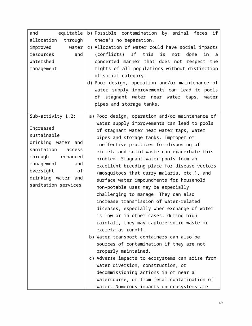
contamination from flooding) decrease water availability increasing challenges for livestock production
Related to production issues in DO2
Tasks/Defined or Illustrative Interventions
Climate Risks
List key risks related to the defined/illustrative interventions identified in the screening and additional assessment.
Risk Rating
Low/Moderate/ High
How Risks are Addressed
Describe how risks have been addressed in activity design and/or additional steps that will be taken in implementation. If you chose to accept the risk, briefly explain why.
Opportunities to Strengthen Climate Resilience
Describe opportunities to achieve multiple development objectives by integrating climate resilience or mitigation measures
2.1. More sustainable land use through scale up of improved agricultural and pastoral land use planning and practices
Extreme events (flooding) can reduce the availability of arable land and also results in shifting agro-ecological zones, that bring competing land uses into closer proximity, or cause them to overlap. This could affect municipalities' decisions in allocating land despite the existence of maps.
Frequency of these extreme events causing a shifting in agro ecological zones and
LowThe activity will promote flexible and adaptive land management structures that can adjust to the quality of the agricultural and pastoralist season as well as to shifting land uses related to longer term changes. These systems may also be supplemented with climate information to allow them to be more proactive to seasons when conflicts are more likely to occur.
Result 2 is explicitly linked with Result 3 in the activity design, to ensure the use of climate information and early warning and response services. The activity will also work to improve local capacity to access and use these resources in all land use planning.
69
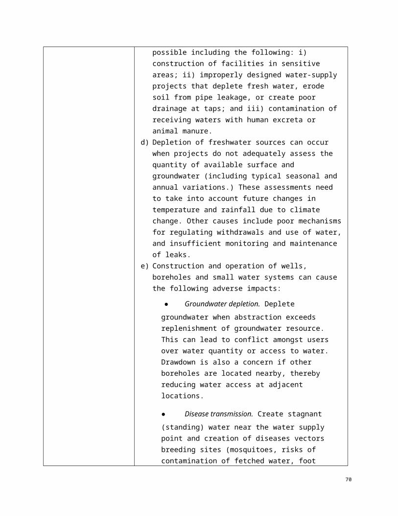
changes in land occupation may require periodic updating of the maps; which could be costly for municipalities if they should support the costs.
2.2. Reduced conflicts over natural resources, through local conventions and improved management of agricultural land, pastureland and livestock corridors
Increased variability and droughts can reduce the availability of natural resources and decrease livelihoods, causing competition over resources. These conflicts are most likely to occur between pastoralists and farmers
Long term changes can result in shifting agro-ecological zones, that bring competing land uses into closer proximity, or cause them to overlap
Moderate The activity will ensure that improved pasture management and restored land are done in a climate appropriate manner. This will depend on the local context, including topography, soil type, land use, etc.
As this activity is also a risk mitigation measure it will be interwoven with other activities, especially IR 1.1 where it will help ensure the watershed is managed in a holistic manner.
The activity will promote flexible and adaptive land management structures that can adjust to the quality of the agricultural and pastoralist season as well as to shifting land uses related to longer term changes. These systems may also be supplemented with climate information to allow them to be more proactive to seasons when conflicts are more likely to occur.
Result 2 is explicitly linked with Result 3 in the activity design, to ensure the use of climate information and early warning and response services. The activity will also work to improve local capacity to access and use these data and resources in all land use planning, including transhumance and local conventions.
2.3. More equitable, secure access to land
Increased flooding owing to more extreme rainfall events can destroy fields and erode arable land. This can in turn decrease access,
Moderate This activity element will be interwoven with the early warning system element to provide timelier, more accurate and accessible flood warnings. Additional efforts will be included on appropriate land use,
Result 2 is explicitly linked with Result 3 in the activity design, to ensure the use of climate information
70
especially for women
Land tenure concerns will likely be exacerbated by reduced productive land availability. This would manifest via typical farmer vs. pastoralist conflicts, but also around artisanal mining or land for exploitation of other resources.
Seasonal risk, higher during rainy season, location dependent, topography dependent.
Increasing temperatures and changes in rainfall patterns can result in shifting agroecological zones thus changing land use distribution and access over time
especially in flood vulnerable areas. This activity will also ensure that women are not more negatively affected by this.
The project will consider land use planning that takes into account future shifts in agroecological zones. In the near term this will also address growing land issues between farmers and pastoralists by working on natural resource management and tenure. Here it will be important to ensure that as land uses shift that all stakeholders, especially women and youth benefit equally.
and early warning and response services. The activity will also focus on the differentiated impacts of climate change on women and youth, which will have implications for land tenure and the risks that women, youth, and other marginalized populations might be further at risk as a result of their compounded vulnerabilities.
3.1. Improved capacity for shock mitigation, preparedness, early response, and recovery
Enhanced preparedness is a climate risk management approach, but it needs to be right-sized for the context (e.g., climate variations and local capacities/needs)
Improved early response is a climate risk management
High Effectiveness for different shocks (and concurrent, consecutive) depends on all components within this activity’s sub-results.The activity will interweave this element with other elements related to improved livelihoods and improved health. This will ensure that people are supported in their recovery without having to resort to negative coping mechanisms.
The activity also includes efforts to more proactively react to shocks and
Result 2 is explicitly linked with Result 3 in the activity design, to ensure the use of climate information and early warning and response services. The activity will also focus on the differentiated impacts of climate change on women and youth, which will have implications for land
71
approach, but it needs to be right-sized for the context (e.g., climate variations and local capacities
Increasing frequency or magnitude of climate shocks (especially droughts) could overwhelm the capacity of resilience systems to provide recovery support or reduce the capacity of government officials to focus on recovery especially in the long term (addressing concurrent and consecutive shocks)
stresses, which will enhance recovery by limiting the initial impact.
The activity will ensure that governance systems enable and enhance early warning, response, and recovery efforts.
The use of climate and weather information combined with a more robust monitoring and reporting system will allow earlier response to shocks and stresses. This will need to be combined with more efficient decision-making systems that can incorporate this information and make decisions quickly. The shock response mechanism in the contingency plans will establish what level of threshold has been exceeded and thus the level of response needed.
The activity also includes efforts to have preliminary discussions with other actors in the Sahel to devise appropriate response actions before they are needed, enabling more efficient implementation
Investigate additional options to partner with existing actors on EWS and climate information services. Refine the approach to fill gaps in existing decision-making systems.
tenure and the risks that women, youth, and other marginalized populations might be further at risk as a result of their compounded vulnerabilities.
3.2. Improved access and use of climate information
Enhanced preparedness is a climate risk management approach, but it needs to be right-
Low This activity element underlies the broader strategy of the activity. Through the use of climate information, improved governance
72
services
sized for the context (e.g., climate variations and local capacities/needs)
Effectiveness for different shocks (and concurrent, consecutive) depends on all components within this IR and in other DOs.
and early warning and response systems, the targeted zones will be better prepared for shocks and stresses. Similarly, improved agricultural practices will make people less vulnerable, and thus more prepared to weather a shock or stress
Investigate additional options to partner with existing actors on EWS and climate information services. Refine the approach to fill gaps in existing decision-making systems
3.3. More responsive relationships between local, sub-national, and national level early warning and response systems
Increased demand for decentralized funding, centralized support for resilience and shock response could strain relationships.
Large or recurrent local shocks or multiple shocks in different locations could overwhelm national systems capacity to engage and respond in all places in a timely manner.
Moderate The activity will increase the use of climate and weather information at all governance scales. This will include acting as information disseminators to rural communities, as well as helping roll up monitoring data back up to national institutions
Further consideration is necessary to both understand the climate information landscape in both countries. It will also be important to consider the most effective way for information to be communicated between governance levels.
73
5.0 CONDITIONS AND MITIGATION MEASURES5.1 CONDITIONS The environmental determinations in this Supplemental IEE are contingent upon full implementation of the following general implementation and monitoring requirements.
5.1.1. The A/COR will ensure appropriate environmental compliance language, including standard limitations defined in the IEEs be incorporated into solicitations and awards for these activities. These requirements will ensure:
a) The A/COR must provide this Supplemental IEE to the IP upon award and prior to project start-up. IPs must develop, obtain approval for, and fully implement an Environmental Mitigation and Monitoring Plan (EMMP). The EMMPs include the actions assigned a negative determination with conditions in the Supplemental IEE (both new conditions and those reiterated from the Programmatic IEE); and guide the development and implementation of the ERF/ERR for sub-grants and sub-awards.
b) IPs must integrate EMMPs in work plans and ensure adequate budget to fully comply with requirements including EMMP implementation and monitoring. IPs report on monitoring actions and take corrective measures when issues are identified.
c) An Environmental Mitigation and Monitoring Report (EMMR) will be submitted with annual performance reporting.
a. The EMMR should be submitted to the Leader Award AOR with the annual program performance report each year.
b. The EMMR will record the environmental mitigation and monitoring measures outlined in the EMMP and will indicate the activities used to ensure that those measures were implemented.
c. Based on the process outlined in the annual workplan, the implementing pa1tners' annual reports to USAID will include brief updates on mitigation and monitoring measures being implemented, results of environmental monitoring, and any other major modifications/ revisions to the development activities or mitigation and monitoring procedures. The EMMR will also identify issues and challenges associated with the implementation of the EMMP.
d. The EMMR must be stored in project files.
d) Solicitations include Statements of Work with task(s) for meeting environmental compliance requirements and appropriate evaluation criteria.
e) Ensure integration of compliance responsibilities in prime and sub-grants agreements and contracts.
f) IP use the Environmental Review Form to screen sub-grant applications and to aid in development of EMMPs as well as document baseline conditions and
74
screen for activity specific impacts to ensure environmental, health, and safety safeguards are adequately programmed.
g) Ensure sub-grantees and sub-contractors have capacity to fully carry out environmental compliance requirements
h) Any sub-agreements or funds transfers from the implementing partners to other organizations must incorporate provisions stipulating:
a. Requirements to implement conditions outlined in this document or any supplemental 22 CFR 216 documents;
b. Completion of an annual EMMP and EMMR and submission to the implementing partner;
i) Activities to be under taken will be within the scope of the environmental determinations and recommendations of this document, including assurance that any mitigating measures required for those activities be followed.
j) IPs will ensure Compliance with partner country regulations. Implementation will adhere to applicable partner country environmental laws.
5.1.2 The A/COR will review the Supplemental IEEs against annual work plans to ensure all planned actions remain covered by the IEE and if new actions are identified which fall outside the scope of this IEE, an Amendment will be provided to the BEO for concurrence.
5.1.3. The A/COR, with the support of the MEO upon request, is responsible for monitoring compliance of actions by means of desktop reviews and site visits.
5.1.4. The A/COR is responsible for preparing appropriate environmental compliance documentation for new or modified project/activity components (such as amendments to the Supplemental IEE).
5.1.5. The A/COR and/or MEO will provide briefings for the IP on environmental compliance responsibilities.
5.1.6. The A/COR will obtain BEO clearance for any deferrals prior to implementation of deferred actions.
5.1.7. If at any time the project is found to be out of compliance with the Programmatic IEE or this associated Supplemental IEE, the A/COR, MEO, and/or REO shall immediately notify the BEO.
5.1.8. The BEO or designated representative may conduct site visits or request additional information for compliance monitoring purposes to ensure compliance with the IEEs, as necessary.
5.1.9 All EMMPs shall be reviewed and approved by A/COR, MEO, and REO..
75
5.1.10The A/COR shall keep and maintain environmental compliance documents in the official project file and submit to the MEO or REO upon request for internal quality reviews or AFR best practice reviews (BPRs).
5.1.11. Nothing in this document substitutes for or supersedes IP’s or sub-awardee’s/-grantee’s/-contractor's responsibility for compliance with all applicable partner country laws and regulations. They must comply with local environmental regulations unless otherwise directed in writing by USAID. However, in the case of a conflict between partner country and USAID regulations, the latter shall govern.
5.1.12The IP will prepare a closeout plan consistent with contract documentation for A/COR review and approval that outlines responsibilities for end-of-project operation, for example, clean-up and disposal of veterinary supplies, construction, surplus pesticide and other wastes, and/or transition of other operational responsibilities. Where identified as needed, the closeout/transition operation will provide training to support continuity of environmental responsibilities. The A/COR will ensure the IP sign and submits a Record of Compliance with the EMMP certifying that the organization met all applicable EMMP conditions.
5.2 MITIGATION MEASURESACTIVITY 1: WATER SECURITY AND RESILIENCETABLE 7A. SUMMARY OF MITIGATION MEASURES FOR ACTIVITY 1Project/Activity 1: Improved water security Mitigation Measures
Sub-activity 1.1:
Enhanced water quality, quantity, and equitable allocation through improved water resources and watershed management
At a minimum, where applicable, mitigation measures to be implemented include:
● Consultation with an engineer for the construction of contour rock dams/terraces and impoundments
● Use of leveling technology to ensure correct bund and drainage works.
● Create standardized checklists for construction, monitoring, and maintenance.
● Consult with and engage the village management committee to ensure correct functioning and maintenance of the
76
systems.
● Obtain authorization for the construction from all necessary authorities, including traditional authorities.
● Borrow pits will be rehabilitated (mechanically and biologically) to limit erosion. For backfilling, a borrow pit will be used, and excavations will be superficial and not deep.
● Living structures, (e.g., live fences and cover cropping) to protect structures from erosion, stabilize loose soils, and prevent water logging will be utilized.
● No materials will be mined from streambeds.
● Work will be limited to the area required (no unused land will be cleared).
● The capacity of water committees will be strengthened by training the committees in governance and maintenance.
● The awardee/IP engaged in construction of boreholes will ensure environmentally sound design by skilled professionals and actionable mitigation at every phase of construction, as provided in USAID Sectoral Guidelines for Water Supply and Sanitation http://www.usaidgems.org/Documents/SectorGuidelines/Wat%20San%20Guideline%20Final_w_GCC_Addition__May11.pdf
● Prior to borehole drilling and water extraction, all required applicable authorizations, licenses and permits from the local authorities will be obtained.
● Water withdrawn will not exceed recharge rates to avoid lowering the water table and decreasing yields in neighboring boreholes. The water availability will be assessed in the context of future climate scenarios (including temperature changes and rainfall conditions) over the expected life of the borehole. The design of the borehole will
77
be altered as appropriate and adaptation measures proposed if the expected yield is insufficient over the lifetime of the borehole (e.g., watershed reforestation). A survey and/or consultation with a hydrologist may be required.
● Boreholes will be properly sited and located away (up slope and at least 50m) from sources of contamination, such as latrines or poorly drained areas which receive contaminated run-off and away from other sources of abstraction.
● Prior to drinking water provision, the project will prepare and receive approval for a Water Quality Assurance Plan (WQAP) (see USAID April 2018 Water Quality Assurance Plan Guidance).
● Among the water quality tests which must be performed are tests for the presence of arsenic.
● The standards and testing procedures described in the following documents will be followed : Guidelines for Determining the Arsenic Content of Ground Water in USAID-Sponsored Well Programs in Sub-Saharan Africa.
● Once approved, the WQAP will be implemented in full, and for the duration of drinking water actions. Implementation will include testing of water prior to making the supply point available to beneficiaries.
Sub-activity 1.2. Increased sustainable drinking water and sanitation access through enhanced management and oversight of drinking water and sanitation
Installation of infrastructure related to water provision will comply with environmentally sound design and best practices, as provided in USAID Sectoral Guidelines for Construction (http://www.usaidgems.org/Sectors/construction.htm) and Water Supply and Sanitation (http://www.usaidgems.org/Documents/SectorGuidelines/Wat%20San%20Guideline%20Final_w_GCC_Addition__May11.pdf
● Prior to borehole drilling and water extraction, all required applicable authorizations, licenses and permits from the local
78
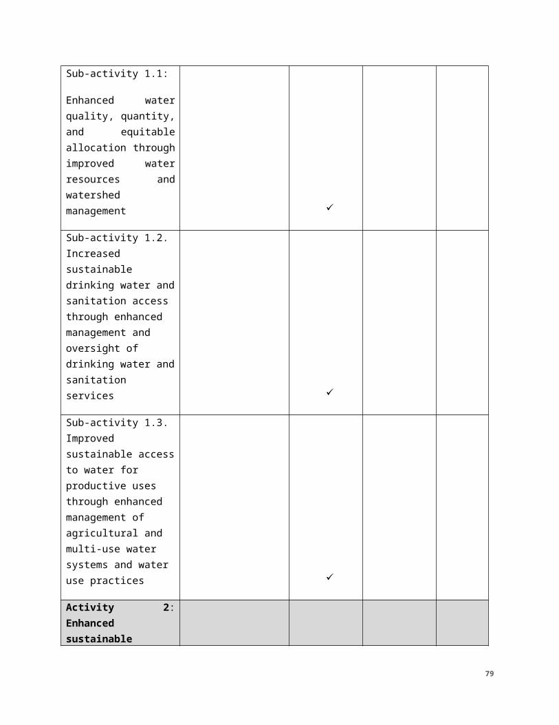
services authorities will be obtain.
● Water withdrawn will not exceed recharge rates to avoid lowering the water table and decreasing yields in neighboring boreholes. The water availability will be assessed in the context of future climate scenarios (including temperature changes and rainfall conditions) over the expected life of the borehole. The design of the borehole will be altered as appropriate and adaptation measures proposed if the expected yield is insufficient over the lifetime of the borehole (e.g., watershed reforestation). A survey and/or consultation with a hydrologist may be required.
● Boreholes will be properly sited and located away (up slope and at least 50m) from sources of contamination, such as latrines or poorly drained areas which receive contaminated run-off and away from other sources of abstraction.
● Prior to drinking water provision, the project will prepare and receive approval for a Water Quality Assurance Plan (WQAP) (see USAID April 2018 Water Quality Assurance Plan Guidance).
● Standards and testing procedures described in the following documents will be followed: Guidelines for Determining the Arsenic Content of Ground Water in USAID-Sponsored Well Programs in Sub-Saharan Africa.
Once approved, the WQAP will be implemented in full, and for the duration of drinking water actions. Implementation will include testing of water prior to making the supply point available to beneficiaries.
Sub-activity 1.3: Improved sustainable access to water for productive uses through enhanced management
Installation of infrastructure related to water provision will comply with environmentally sound design and best practices, as provided in USAID Sectoral Guidelines for Construction (http://www.usaidgems.org/Sectors/construction.htm) and Water Supply and Sanitation (http://www.usaidgems.org/Documents/SectorGuidelines/Wat%20San%20Guideline%20Final_w_GCC_Addition__May11.pdf
79
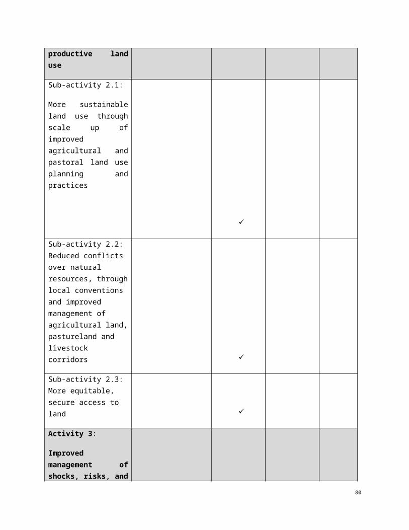
of agricultural and multi-use water systems and water use practices
● Prior to borehole drilling and water extraction, all required applicable authorizations, licenses and permits from the local authorities will be obtain.
● Water withdrawn will not exceed recharge rates to avoid lowering the water table and decreasing yields in neighboring boreholes. The water availability will be assessed in the context of future climate scenarios (including temperature changes and rainfall conditions) over the expected life of the borehole. The design of the borehole will be altered as appropriate and adaptation measures proposed if the expected yield is insufficient over the lifetime of the borehole (e.g., watershed reforestation). A survey and/or consultation with a hydrologist may be required.
● Boreholes will be properly sited and located away (up slope and at least 50m) from sources of contamination, such as latrines or poorly drained areas which receive contaminated run-off and away from other sources of abstraction.
● Prior to drinking water provision, the project will prepare and receive approval for a Water Quality Assurance Plan (WQAP) (see USAID April 2018 Water Quality Assurance Plan Guidance).
● Standards and testing procedures described in the following documents will be followed: Guidelines for Determining the Arsenic Content of Ground Water in USAID-Sponsored Well Programs in Sub-Saharan Africa.
Once approved, the WQAP will be implemented in full, and for the duration of drinking water actions. Implementation will include testing of water prior to making the supply point available to beneficiaries.
ACTIVITY 2: TABLE 7B. SUMMARY OF MITIGATION MEASURES FOR ACTIVITY 2Project/ Mitigation Measures
80
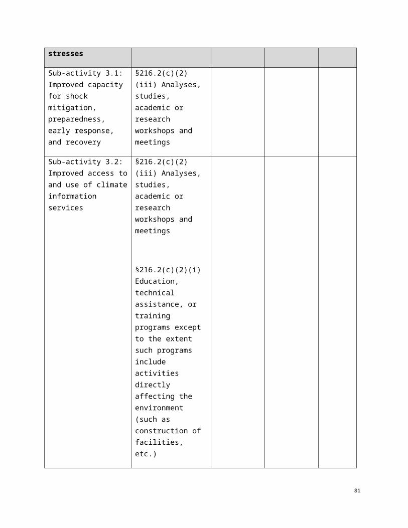
Activity: Enhanced sustainable productive land use
Sub-activity 2.1:
More sustainable land use through scale up of improved agricultural and pastoral land use planning and practices
1. Land use planning will be integrated or otherwise reflected in data and analyses on environmental trends, including principles of sustainable NRM and global climate change (GCC) adaptation strategies. Data and analysis will be drawn from USAID, other bilateral donor agencies, International Financial Institutions, Multilateral Development Banks, or other internationally recognized research or development entities.
2. Land use planning will incorporate best practice standards in land tenure, property rights and natural resources, including addressing animal migration and feeding corridors and encroachment of agricultural fields in an attempt to address sustainability and reduce human-animal conflict.
3. No new protected areas or pristine ecosystems will be proposed for clearing as part of the planning, unless deemed absolutely necessary.
4. Implementation of new economic zones and land uses will include capacity building of customary land holding groups consistent with good practice guidelines and address issues of sustainable land use and management, social impacts of land use planning, and environmental soundness. See the USAID Sector Environmental Guidelines on Agriculture (http://www.usaidgems.org/Sectors/agriculture.htm) and Community-Based Natural Resource Management http://www.usaidgems.org/Sectors/cbnrm.htm.
Recommended Social Mitigation Measure:1. All reasonable efforts to prevent or mitigate adverse
economic consequences on local communities or individuals due to plan recommendations, including from loss of usual and customary use of resources will be made.
2. Inclusive planning actions to address conflicts between groups will be conducted.
81
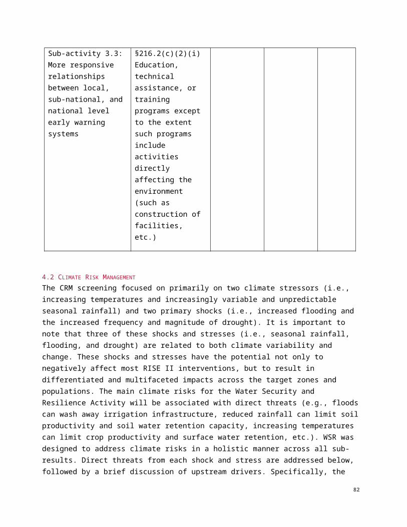
3. Training and sensitization of communities on land rights will integrate cultural realities and take into account proper management of sensitive issues in order to avoid social conflicts.
Sub-activity 2.2: Reduced conflicts over natural resources, through local conventions and improved management of agricultural land, pastureland and livestock corridors
1. Development of local FMNR, agroforestry, and capacity building for soil and water conservation and plantings will take into consideration the need to address issues of sustainable use of natural resources and implementation of appropriate techniques/ best practices in accordance with mandatory references for best practice: USAID Sectoral Guidelines for CBNRM http://www.usaidgems.org/Sectors/cbnrm.htm; Sectoral Guidelines for Forestry http://www.usaidgems.org/Sectors/forestry.htm; and Sectoral Guidelines for Dryland Agriculture http://www.usaidgems.org/Documents/SectorGuidelines/SectorEnvironmentalGuidelines_DrylandAgriculture.pdf
2. When necessary, for specific sites, subsidiary environmental review will be implemented using the AFR ERF/ERR process (available at: http://www.usaidgems.org/subsidiary.htm).
3. For actions on communal lands, local authorities (including traditional authorities) will be involved, to ensure local authorization and agreement with the action.
4. For actions disseminated to farmers with minimal direct oversight by experts or IPs, a well-developed manual for implementation and maintenance, planned and overseen by a forester or agronomist, will be developed.
5. The capacity of NRM Committee (or similar) and communities to implement NRM practices will be strengthened by training the committee in governance and maintenance.
6. Species selection will include consultation with a qualified forester, agronomist, or biologist, in order to avoid creating problems with invasive species.
7. The provision/distribution, promotion of, and training in use of fertilizers will conform to best practices outlined in the Africa Bureau Fertilizer Fact Sheet (http://www.encapafrica.org/egssaa/AFR_Fertilizer__Factsheet_Jun04.pdf).
82
8. The procurement or promotion of, or training in use of pesticides, including herbicides, insecticides, acaricides, and fungicides, will not be done until a Pesticide Evaluation Report Safer Use Action Plan (PERSUAP) is completed pursuant to 22CFR Regulation 216.3 (b)—USAID pesticide procedures— and duly approved.
Recommended Social Mitigation Measure: The choice of species promoted for plantings or natural regeneration will be made with consideration of the interests of the local community and cultural beliefs.
Sub-activity 2.3: More equitable, secure access to land
1. Conflict sensitive messaging will be included in land management capacity building.
2. Cultural sensitivities will be taken into account in policies for equitable access to land to avoid conflict
3. Inclusive discussions will be conducted between the different stakeholder (farmers, herders, foresters) for any decision on equitable access to land. Gender considerations will also be taken into account in equitable access to land.
ACTIVITY 3: Improved management of shocks, risks, and stressesTABLE 7B. SUMMARY OF MITIGATION MEASURES FOR ACTIVITY 3Activity 3: Improved management of shocks, risks, and stresses Mitigation Measures
Sub-activity 3.1: Improved capacity for shock mitigation, preparedness, early response, and recovery N/A for categorical exclusion
Sub-activity 3.2: Improved access to and use of climate
N/A for categorical exclusion
83
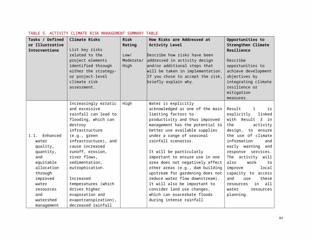
information services at commune and village levels
Sub-activity 3.3: More responsive relationships between local, sub-national, and national level early warning and response systems N/A for categorical exclusion
84
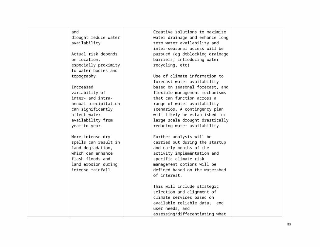
6.0 LIMITATIONS OF THIS INITIAL ENVIRONMENTAL EXAMINATION The determinations recommended in this document apply only to projects/activities and sub-activities described herein. Other projects/activities that may arise must be documented in either a separate IEE, an IEE amendment if the activities are within the same project/activity, or other type of environmental compliance document and shall be subject to an environmental analysis within the appropriate documents listed above.
Any of the following actions would require additional environmental analyses and environmental determinations:
● Support project preparation, project feasibility studies, or engineering design for activities listed in §216.2(d)(1);
● Affect endangered and threatened species or their critical habitats per §216.5, FAA 118, FAA 119;
● Provide support to extractive industries (e.g. mining and quarrying) per FAA 117;
● Promote timber harvesting per FAA 117 and 118;
● Lead to new construction, reconstruction, rehabilitation, or renovation work per §216.2(b)(1);
● Support agro-processing or industrial enterprises per §216.1(b)(4);
● Provide support for regulatory permitting per §216.1(b)(2);
● Lead to privatization of industrial facilities or infrastructure with heavily polluted property per §216.1(b)(4);
● Procure or use genetically engineered organisms per §216.1(b)(1); and/or
● Assist the procurement (including payment in kind, donations, guarantees of credit) or use (including handling, transport, fuel for transport, storage, mixing, loading, application, clean-up of spray equipment, and disposal) of pesticides or activities involving procurement, transport, use, storage, or disposal of toxic materials. Pesticides cover all insecticides, fungicides, rodenticides, etc. covered under the Federal Insecticide, Fungicide, and Rodenticide Act per §216.2(e) and §216.3(b).
7.0 REVISIONS
85
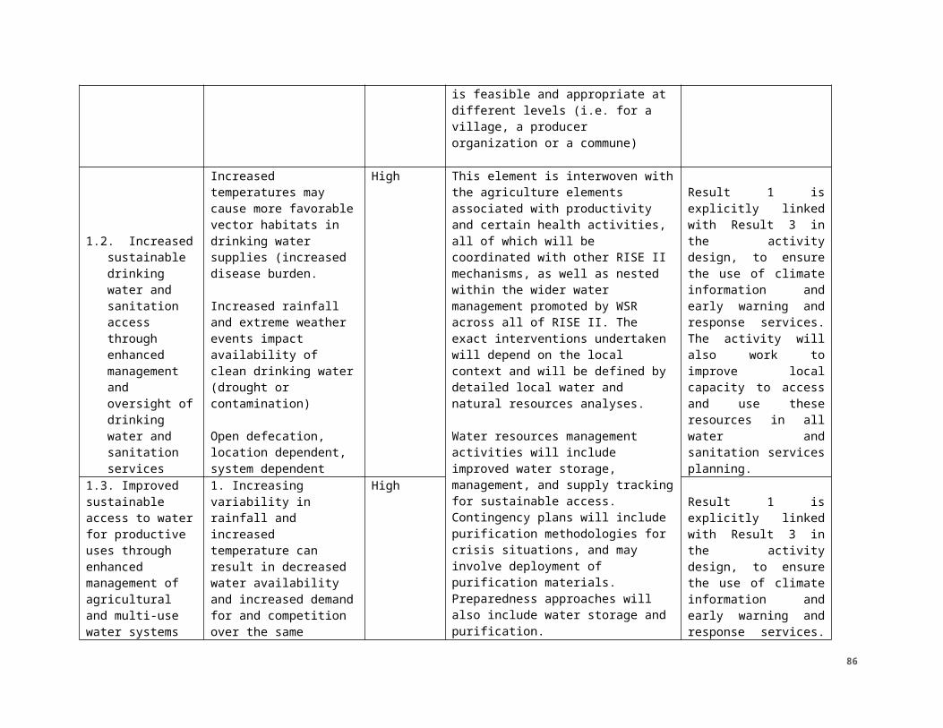
Per 22CFR216.3(a)(9), when ongoing programs are revised to incorporate a change in scope or nature, a determination will be made as to whether such change may have an environmental impact not previously assessed. If so, this IEE will be amended to cover the changes. Per ADS 204, it is the responsibility of the USAID A/COR to keep the MEO/REA and BEO informed of any new information or changes in the activity that might require revision of this environmental analysis and environmental determination.
ATTACHMENTS: 1. REFERENCE DOCUMENTS
a. RISE II PAD PIEE: Sahel_SRO_RISE_II_PAD_PIEE_07122018 https://ecd.usaid.gov/document.php?doc_id=51010
b. Sustainable Water Partnership PIEE https://ecd.usaid.gov/repository/pdf/47041.pdf
c. Annex A: Environmental Mitigation and Monitoring Plan (EMMP) Template
Annex A: Environmental Mitigation and Monitoring Plan (EMMP)
Project Name
Descriptionof Activity
Describe specificpotential environmental impacts
Description of Specific Mitigation Measures
Identify the party responsible for monitoring
Identify the Monitoring Indicator
Identify the Monitoring Method
Identify the Frequency of Monitoring
86