Embed Size (px)
Citation preview

Presenter’s Name June 17, 2003
Project Title: Arctic Information Fusion Capability (AIFC)
Project Objectives:
Integrate and fuse information from an array of authoritative
data sources in support of USCG operators in the Arctic.
Enhance domain awareness by communicating both from
and to community-based observers in the field achieving
“Fusion Central and Fusion Forward.”
Provide decision support through data visualization,
connecting to and from the field despite austere comms;
and in later stage, apply artificial/machine intelligence.
Through NOAA partnering, utilize and advance Arctic
ERMA, as the base platform, a tool already used by USCG.
Potential Impact: Next generation agile decision support.
Key Milestones/Deliverable Schedule:
Project restart…………………………………………… Mar 16
Identify elements of domain awareness……………… Oct 16
Integrate community based observer through Field
Information Support Tool (FIST) demonstration..........Aug 16
2D map of geospatial data, feeds………….………..…Mar 17
Completion of demonstration scenario……………..…May 17
Near-real-time and intelligent support…………………May 17
Project End…………………………….……...….………Jun 19
Performance Metrics:
AIFC products in Arctic ERMA. Some products ingested
Model data available via Arctic ERMA. Status: completed
for some products, others in testbed stage.
AIFC fusion demo. Status: in development.
Program Champions:
Mr. H. Blaney, HQ USCG CG-255.
CAPT D. Evans, USCG RDC.
Stakeholders:
DHS S&T.
HQ USCG, USCG RDC, USCG Pac Area & USCG D-17.
NOAA / NWS.
NASA-ACE.
Points of Contact:
Federal Agency POC: Amy Merten, NOAA/ORR.
Kenrick Mock, UAA, Principal Investigator.
John DeLaurentis, ASRC Federal Mission Solutions,
Project Manager.
*See PowerPoint Notes for Project Abstract 1
FOA/NOFO Research Question(s): Topic 1a, Maritime Risk & Threat Analysis; Topic 2b, Coastal and
Marine Modeling and Analysis; Topic 2d, Arctic Analysis; Topic 3f, Maritime IoNS; Topic 5c, Arctic E2E.
Specific research questions: 2d. 3. i & iii.
Key Accomplishments:
Use case scenarios developed with USCG D17 with
agreement on initial focus on marine environmental
response.
Catalog of over 1800 data feeds in support of use cases
established.
Coordination with NOAA on delivery of fusion products
through ERMA.
Field Information Support Tool portal established as
conduit between CBONS and AIFC.
Data fusion testbed / prototype established with oil spill
simulation and high-resolution storm surge model.
Funding:
Expended to Date by End of Year 2 ……..$229,312.72
Presenter’s Name June 17, 2003
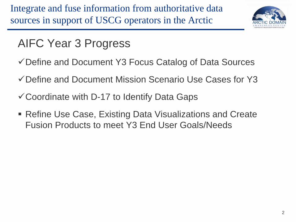
AIFC Year 3 Progress
Define and Document Y3 Focus Catalog of Data Sources
Define and Document Mission Scenario Use Cases for Y3
Coordinate with D-17 to Identify Data Gaps
Refine Use Case, Existing Data Visualizations and Create
Fusion Products to meet Y3 End User Goals/Needs
Integrate and fuse information from authoritative data
sources in support of USCG operators in the Arctic
2

Presenter’s Name June 17, 2003
Define and Document Y3 Focus Catalog of Data Sources
Narrowed down the 250,000 data feeds available through Data One and
Axiom Data Science to the feeds important to the arctic and D-17
Created a list of over 1,800 feeds available and shared data sources with
NOAA that were not currently accessed by ERMA
Integrate and fuse information from authoritative data
sources in support of USCG operators in the Arctic
3

Presenter’s Name June 17, 2003
Define and Document Y3 Mission Scenario Use Cases
Integrate and fuse information from authoritative data
sources in support of USCG operators in the Arctic
4
Use Case 4: Marine Environmental Protection Response
Marine Environmental Response – Oil spill from a grounded vessel, North Slope
Domain awareness info environment Response information environment
Traffic monitoring data shows a near-real-time plot of positions for vessels transiting Alaskan Arctic waters1
Command center data shows real-time & forecast air temperature, visibility, precipitation, wave height/direction, water temperature, sea ice coverage, currents
Command center data base permits rapid access to information about any registered vessel
Command center data shows detailed coastal bathymetry
Response case opened
Oil spill confirmed
Incident command system activated, begins spill response mobilization
Command center monitors all response assets, coordinates with incident commander, provides direction and appropriate data (including spill trajectory) to all involved parties
Command center documents case, provides input for lessons learned & final report
A transiting vessel reports loss of power; direction of drift in 5/10s ice coverage indicates imminent grounding
Command center obtains detailed info (# persons, nature of propulsion casualty, amount of fuel or other hazardous material onboard, last known position, etc.)
Comms schedule with distressed vessel instituted
Safety broadcasts made for any other vessel able to assist
Diversion of vessel traffic (if any) considered, based on proximity & capability
Area oil spill response organization mobilized
Fixed-wing (C-130) launched with droppable repair parts, pumps or other emergency equipment
USCG cutter diverted to area to act as forward command post (C2), staging platform, assist with vessel refloating & repair, etc.
Helos dispatched to FOL or cutter for spill monitoring, movement of personnel & equipment, etc.
Spill response teams, equipment & support moved to area; deployed for spill containment & clean-up
1 1. Ideally this would include routine flow of vessel traffic information from Canadian Coast Guard and Russian Arctic navigation systems.
Variables
Domain awareness info environment Response information environment
Locations of vessels (i.e. NAIS) supplemented by Canadian Arctic Reporting System. Validated by cutter and aircraft sensor reports (i.e. COP)
Locations of commercial activity (i.e. oil and gas, construction)
Environmental conditions (sea ice, tide, current, temp & wx changes)
Ice and WX forecast data
Environmental conditions (sea ice, tide, current, temp & wx changes)
Targeted forecast information for the area of response
Desired process and outcome
Command center has adequate information to evaluate urgency of situation and alert/allocate response resources as quickly as possible
If possible, vessel can be assisted early enough to prevent grounding (repair parts provided, towing, ice management to allow anchoring, etc.)
Once a spill is imminent, rapid movement of response personnel and equipment is crucial to minimize the spill and prevent environmental impact
Use Cases not selected:
1. Mass Marine Rescue Operation (MMRO)
2. Ship in Distress; Ship Lost at Sea (SLAS)
3. Search and Rescue (SAR)
4. Ice Operations – Multi-ship research
expedition in the high Arctic
Presenter’s Name June 17, 2003
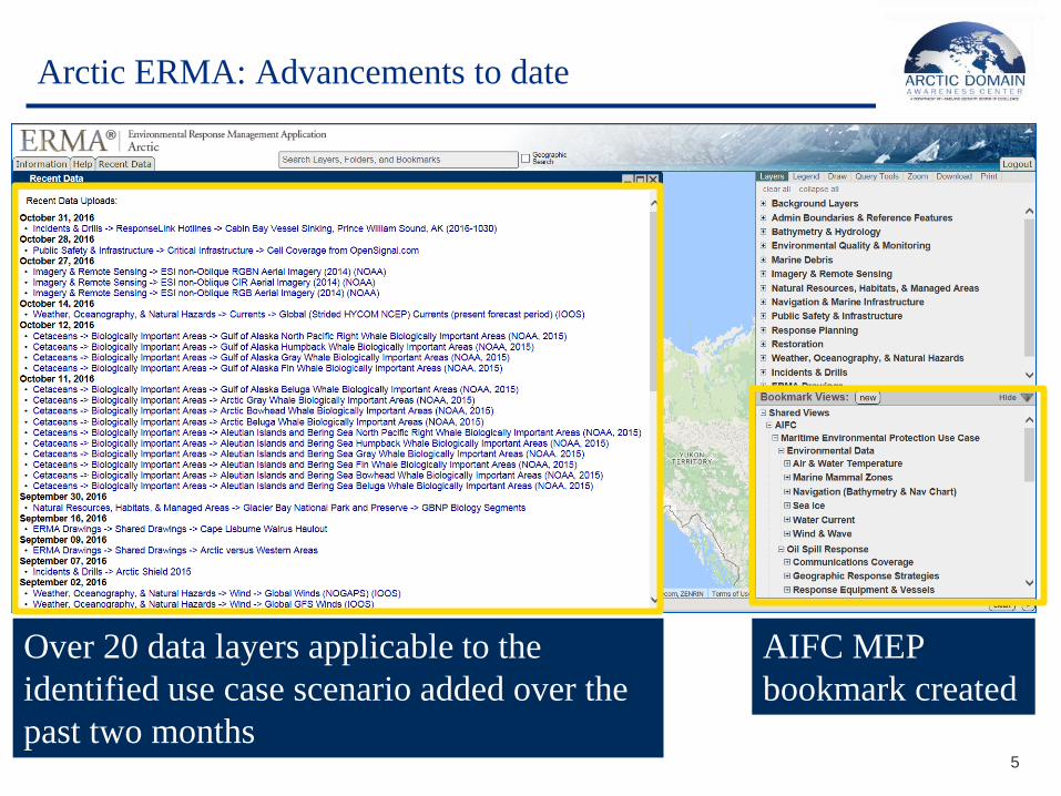
Arctic ERMA: Advancements to date
5
Over 20 data layers applicable to the
identified use case scenario added over the
past two months
AIFC MEP
bookmark created

Presenter’s Name June 17, 2003
Bathymetry &
Electronic
Navigation
Charts
Provide decision support through data visualization
6

Presenter’s Name June 17, 2003
Wind speed, direction and wave height
Provide decision support through data visualization
7

Presenter’s Name June 17, 2003
Sea Ice Extent
Provide decision support through data visualization
8

Presenter’s Name June 17, 2003
Marine Mammal Zones
Provide decision support through data visualization
9

Presenter’s Name June 17, 2003
Marine Mammal Zones (.pdf)
Provide decision support through data visualization
10