Embed Size (px)
Citation preview
Honolulu Rail Transit Project
Programmatic Agreement
Historic Properties Web Map and Documentation
Management Application
November 1, 2011
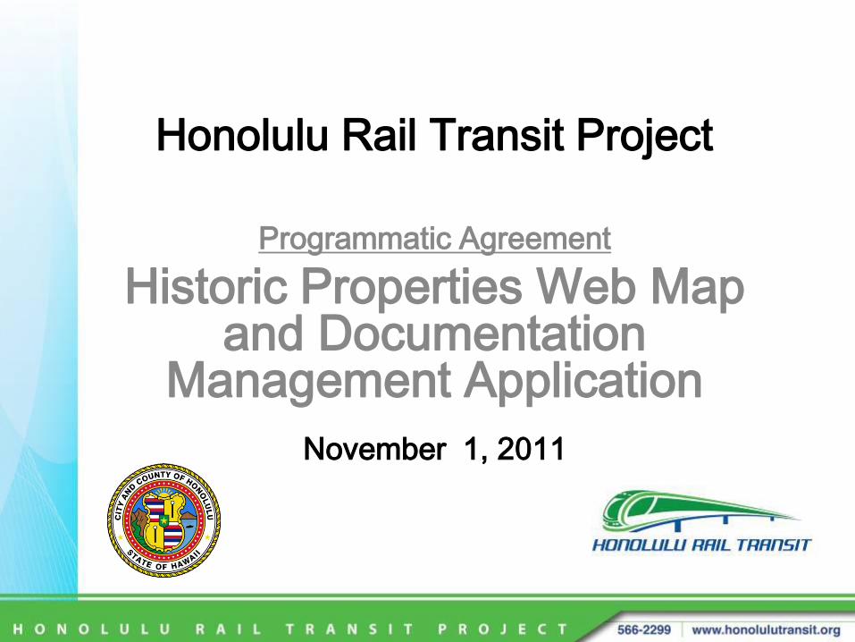
Overview• A web-based mapping and documentation
management system for historic properties.
• Two components:
1. Publicly-accessible interactive web map application for visualizing historic properties and accessing related content.
2. Secure Content Management interface used by administrators to manage content.
Purpose• Enables the Public to:
• access historic property data and documentation.
• develop an understanding of historic properties in the context of the Honolulu Rail Transit Project.
• visually experience and interact with historic properties through an interactive map, photos, videos, panoramas, and 3D models.
• access documents and reports.
Purpose (continued)• Enables Internal Stakeholders to:
• store, organize, manage, and maintain historic property data and documentation.
• maintain a repository of information about historic properties in the context of the Honolulu Rail Transit Project.
• present to the Public a visual and interactiveexperience by exploring historic properties through an interactive map, photos, videos, panoramas, and 3D models.
• provide access to documents and reports.
Web Map• Easy online access – using a web browser; Enables visualization,
discovery, and dissemination of historic property information.
• Historic property locations featured on an interactive map.
• Functions:
• Browse/Filter/Search historic properties.
• Access and view information and documentation associated with each Historic Property:
• Name, Address, TMK, Property type, NRHP Status, Project effect, etc.
• Photos, videos, panoramas, 3D models.
• Searchable documents. For example: NRHP Nomination Form; Determination of Eligibility form; Effects Report.
Content Management• A secure web-based interface is used to manage the content which
is presented in the Web Map Application.
(The content is actually stored in a database/server. The database/server is from where the Web Map App gets its content.)
• Functions:
• Browse/Filter/Search historic properties.
• Add, delete, edit historic property.
• Add, delete, edit a property’s general info; e.g. Name, Address, TMK, Property type, NRHP Status, Project effect, etc.
• Use a map to set geographic location of the historic property.
• Upload and manage a property’s specialty media and documents; e.g. photos, videos, panoramas, 3D models, documents (searchable PDFs).
Web Map walk-through
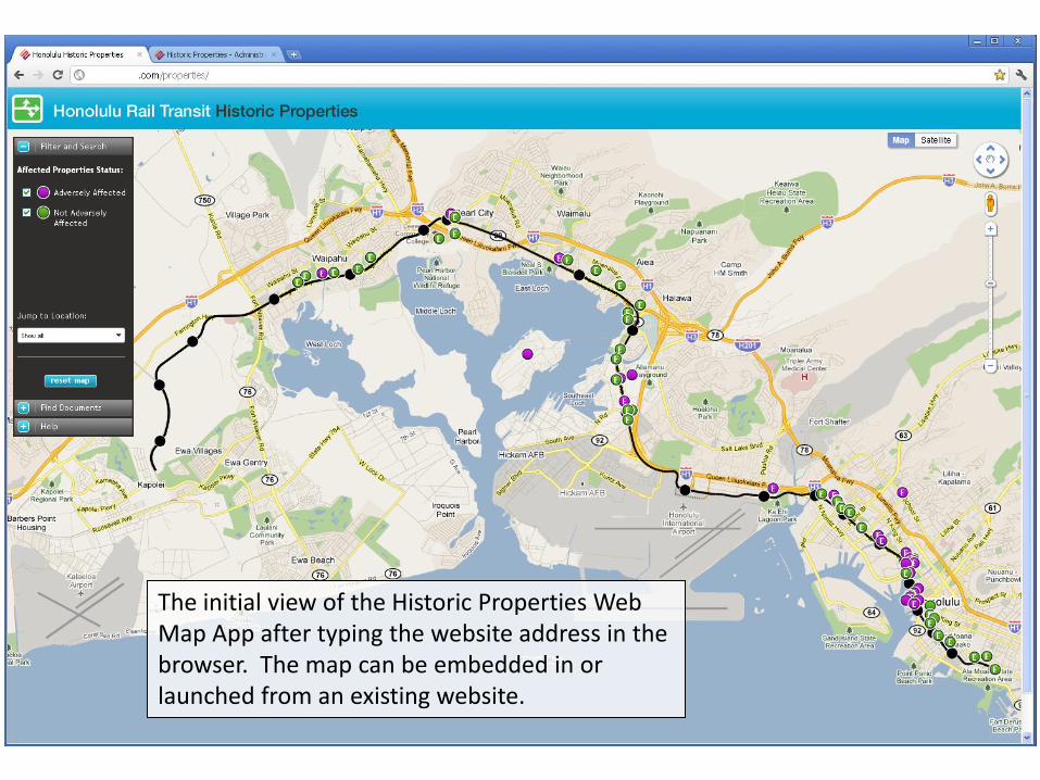
The initial view of the Historic Properties Web Map App after typing the website address in the browser. The map can be embedded in or launched from an existing website.
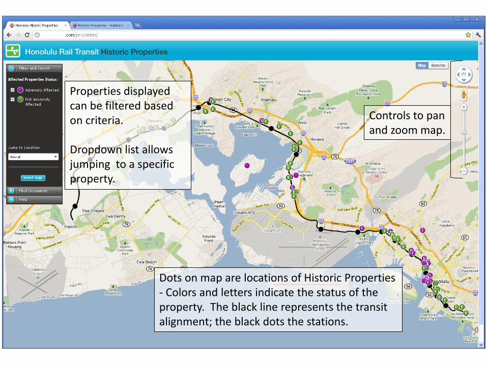
Controls to panand zoom map.
Dots on map are locations of Historic Properties - Colors and letters indicate the status of the property. The black line represents the transitalignment; the black dots the stations.
Properties displayed can be filtered based on criteria.
Dropdown list allows jumping to a specific property.
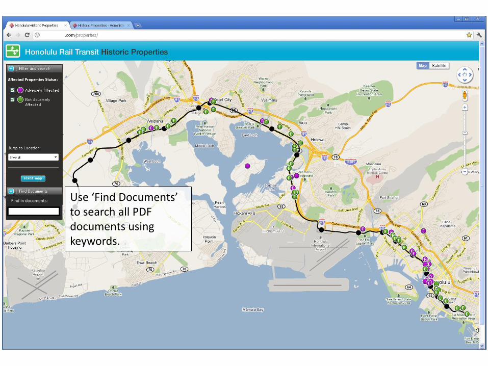
Use ‘Find Documents’ to search all PDF documents using keywords.
Find in documents:

Click for info on:
Map NavigationSearchContent
‘Help’ contains instructions on how to use this application.
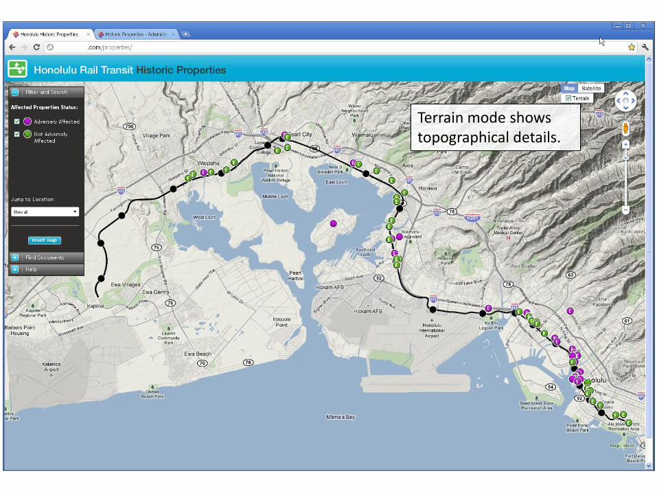
Terrain mode showstopographical details.
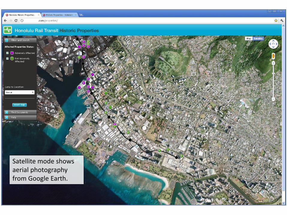
Satellite mode showsaerial photography from Google Earth.

Google Earth map labels can be toggled on and off.
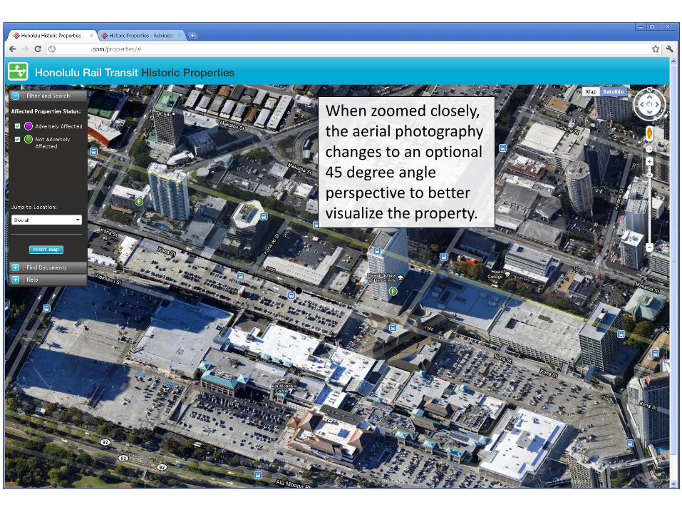
When zoomed closely, the aerial photography changes to an optional 45 degree angle perspective to better visualize the property.
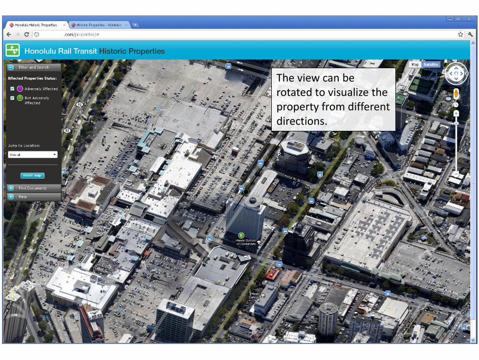
The view can be rotated to visualize the property from different directions.
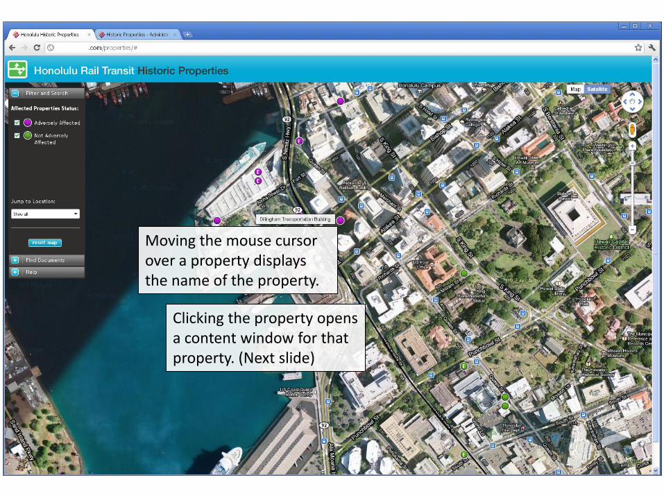
Clicking the property opens a content window for that property. (Next slide)
Moving the mouse cursor over a property displays the name of the property.

The content window provides an overview of the historic property and access to related media and documents.
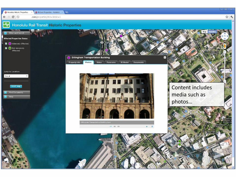
Content includes media such as photos…
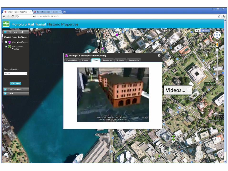
Videos…
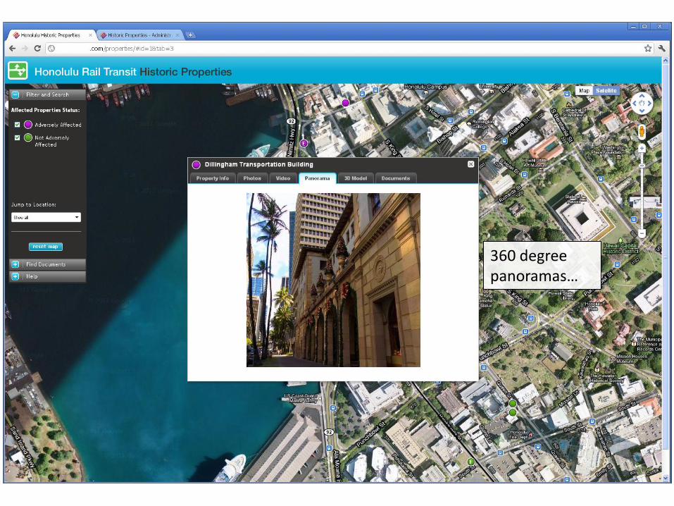
360 degree panoramas…
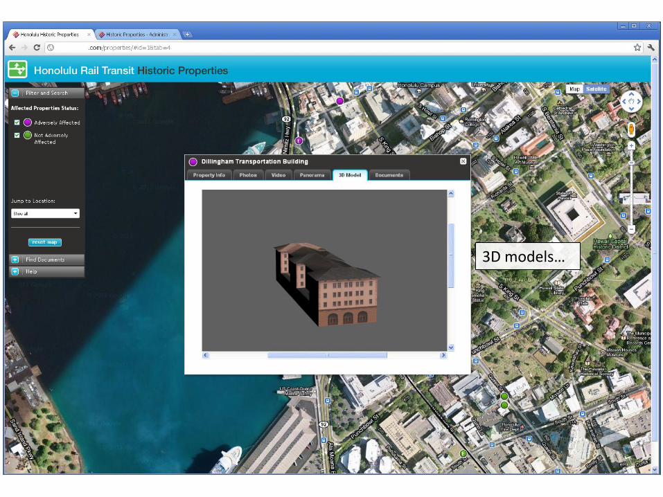
3D models…

and searchable PDF documents.
Content Management walk-through
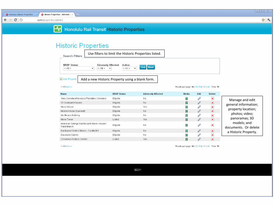
Manage and edit general information;
property location; photos; video; panoramas; 3D
models; and documents. Or delete
a Historic Property.
Use filters to limit the Historic Properties listed.
Add a new Historic Property using a blank form.
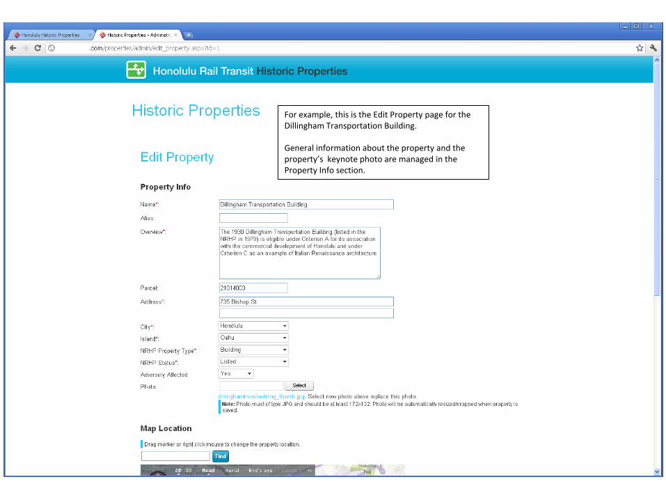
For example, this is the Edit Property page for the Dillingham Transportation Building.
General information about the property and the property’s keynote photo are managed in the Property Info section.
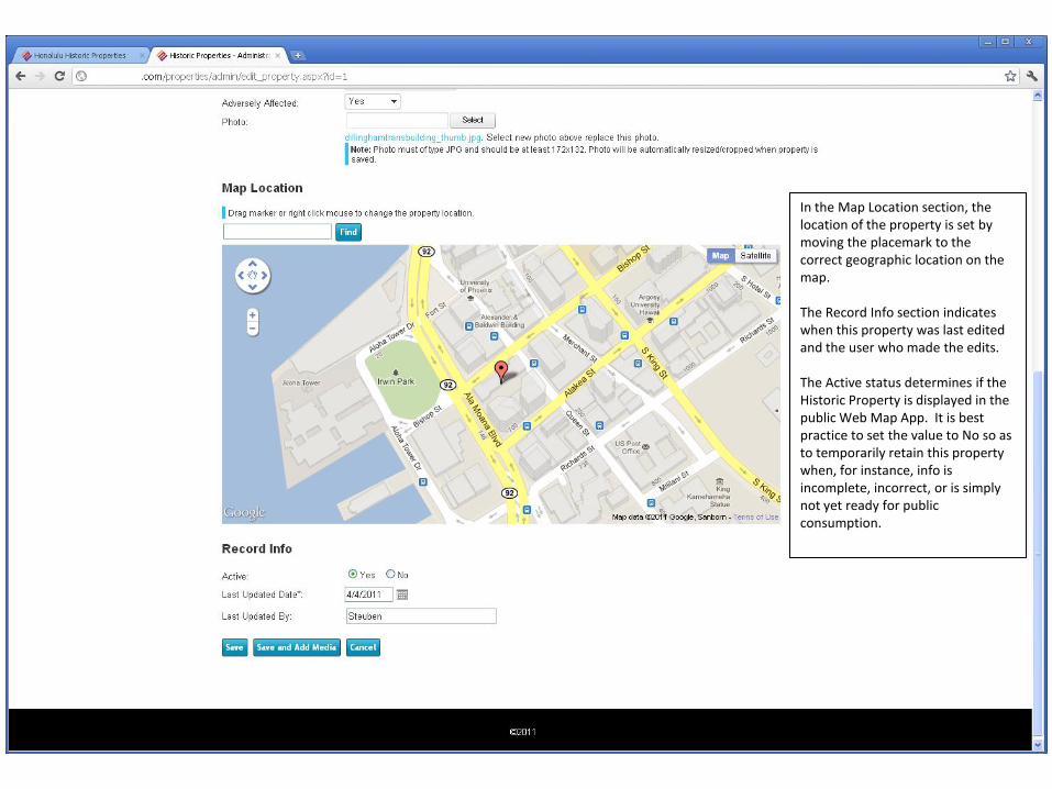
In the Map Location section, the location of the property is set by moving the placemark to the correct geographic location on the map.
The Record Info section indicates when this property was last edited and the user who made the edits.
The Active status determines if the Historic Property is displayed in the public Web Map App. It is best practice to set the value to No so as to temporarily retain this property when, for instance, info is incomplete, incorrect, or is simply not yet ready for public consumption.
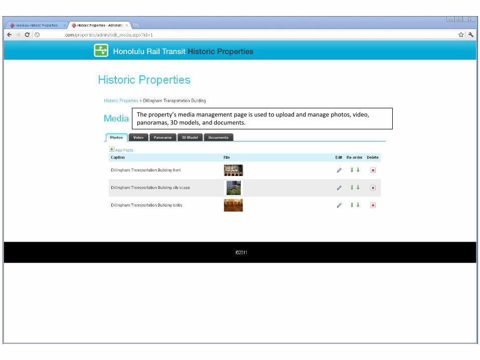
The property’s media management page is used to upload and manage photos, video, panoramas, 3D models, and documents.

From the Documents tab in the Content Management or Web Map App interfaces, clicking a PDF document opens the document in a new window.
Shown here is the NRHPNomination Form for the Dillingham Transportation Building.
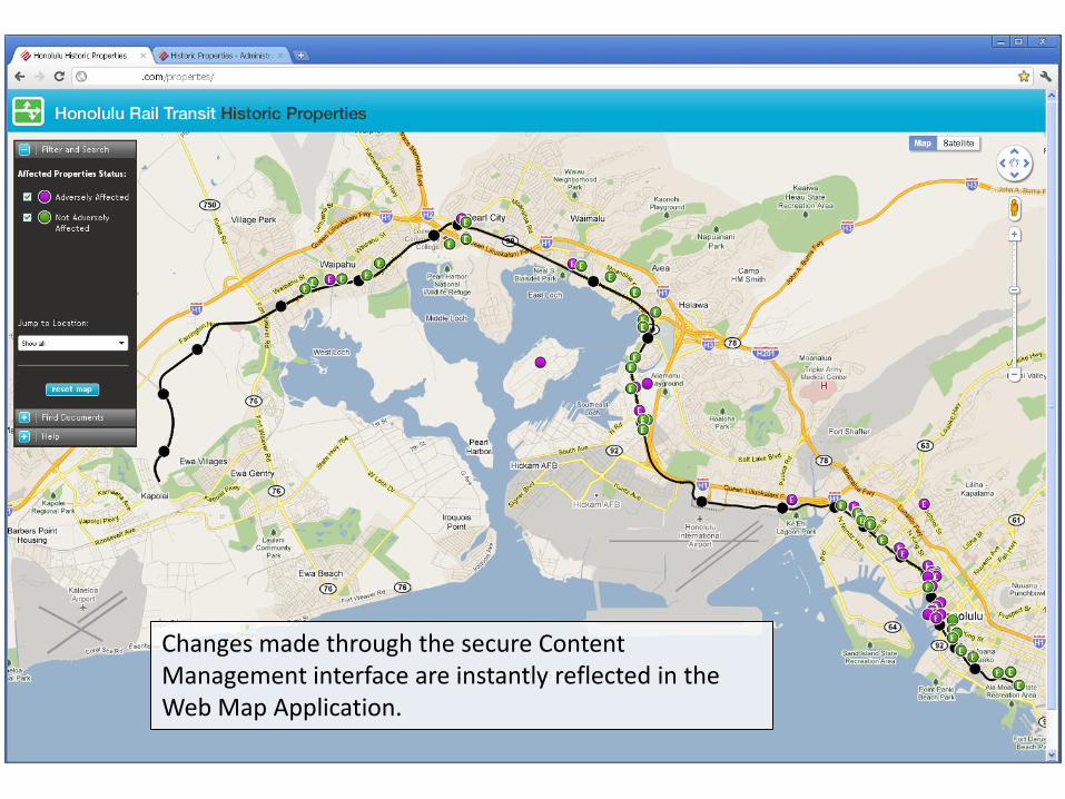
Changes made through the secure Content Management interface are instantly reflected in the Web Map Application.
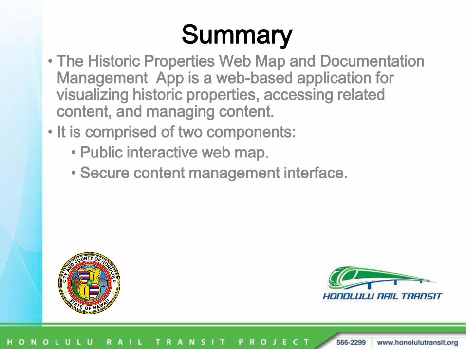
Summary• The Historic Properties Web Map and Documentation
Management App is a web-based application for visualizing historic properties, accessing related content, and managing content.
• It is comprised of two components:
• Public interactive web map.
• Secure content management interface.
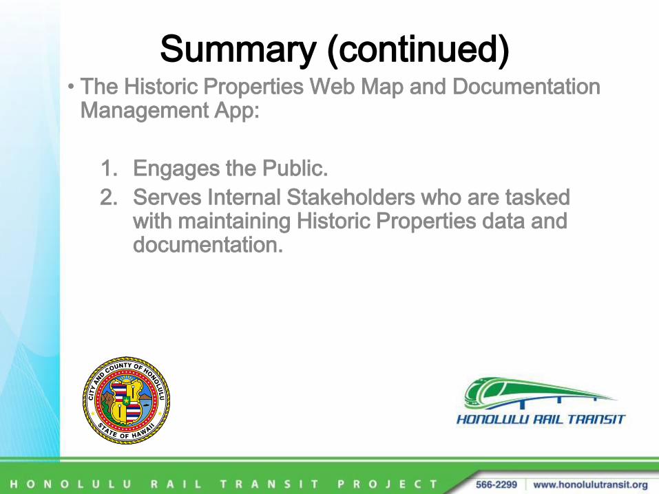
Summary (continued)• The Historic Properties Web Map and Documentation
Management App:
1. Engages the Public.
2. Serves Internal Stakeholders who are tasked with maintaining Historic Properties data and documentation.
Summary (continued)• Enables the Public to:
• access Historic Property data and documentation.
• develop an understanding of Historic Properties in the context of the Honolulu Rail Transit Project.
• visually experience and interact with Historic Properties through an interactive map, photos, videos, panoramas, and 3D models.
• access documents and reports.

Summary (continued)• Enables Internal Stakeholders to:
• store, organize, manage, and maintain historic property data and documentation.
• maintain a repository of information about historic properties in the context of the Honolulu Rail Transit Project.
• present to the public a visual and interactiveexperience by exploring historic properties through an interactive map, photos, videos, panoramas, and 3D models.
• provide access to documents and reports.