Embed Size (px)
Citation preview
ModulhandbuchStudiengang Master of Science Geomatics Engineering
Prüfungsordnung: 936-2013
Wintersemester 2017/18Stand: 19. Oktober 2017
Universität StuttgartKeplerstr. 7
70174 Stuttgart
Modulhandbuch: Master of Science Geomatics Engineering
Stand: 19. Oktober 2017 Seite 2 von 31
Kontaktpersonen:
Studiendekan/in:Univ.-Prof. Wolfgang KellerGeodätisches InstitutE-Mail: [email protected]
Studiengangsmanager/in: Friedrich Wilhelm KrummGeodätisches InstitutTel.: 0711 685 83388E-Mail: [email protected]
Prüfungsausschussvorsitzende/r: Apl. Prof. Norbert HaalaInstitut für PhotogrammetrieE-Mail: [email protected]
Stundenplanverantwortliche/r: Ron SchlesingerGeodätisches InstitutTel.: 685-83473E-Mail: [email protected]
Modulhandbuch: Master of Science Geomatics Engineering
Stand: 19. Oktober 2017 Seite 3 von 31
Inhaltsverzeichnis
Qualifikationsziele .............................................................................................................. 4
19 Auflagenmodule des Masters ...................................................................................... 5
100 Pflichtmodule ............................................................................................................... 641210 Advanced Mathematics .................................................................................................................... 741220 Geomatics Methodology ................................................................................................................... 841230 Geodesy ........................................................................................................................................... 1041240 Remote Data Acquisition .................................................................................................................. 1241250 Representation of Geodata .............................................................................................................. 1441280 Integrated Project ............................................................................................................................. 1648400 Engineering Geodesy ....................................................................................................................... 1748440 Information and Contract Law .......................................................................................................... 19
200 Wahlpflichtmodule ...................................................................................................... 2148420 Satellite Geodesy ............................................................................................................................. 2248430 Navigation ......................................................................................................................................... 2377790 Computer Vision and Pattern Recognition ....................................................................................... 2577800 Multisensor Integration in Geodesy and Transport .......................................................................... 27
400 Deutschkurse ............................................................................................................... 2948450 German as a Foreign Language ...................................................................................................... 30
80920 Masterthesis GEOENGINE ...................................................................................... 3180920 Masterthesis GEOENGINE ..............................................................................................................

Modulhandbuch: Master of Science Geomatics Engineering
Stand: 19. Oktober 2017 Seite 4 von 31
QualifikationszieleAdvanced Mathematics, Geomatics Methodology and Geodesy (Advanced Mathematics, Signal Processing,Statistical Inference, Dynamic System Estimation, Map Projections and Geodetic Coordinate Systems, PhysicalGeodesy), Engineering Geodesy, Remote Data Acquisition and Representation of Geodata (Monitoring, KinematicMeasurement Systems, Remote Sensing, Airborne Data Acquisition, Geoinformatics, Thematic Cartography),Elective specialization (Multisensor Integration, Satellite Geodesy, Navigation, Geo-Telematics), two-weekIntegrated Fieldwork, Non-technical courses (Language and Culture, Information and Contract Law), Research-oriented thesis (6 months).

Modulhandbuch: Master of Science Geomatics Engineering
Stand: 19. Oktober 2017 Seite 5 von 31
19 Auflagenmodule des Masters
Modulhandbuch: Master of Science Geomatics Engineering
Stand: 19. Oktober 2017 Seite 6 von 31
100 Pflichtmodule
Zugeordnete Module: 41210 Advanced Mathematics41220 Geomatics Methodology41230 Geodesy41240 Remote Data Acquisition41250 Representation of Geodata41280 Integrated Project48400 Engineering Geodesy48440 Information and Contract Law
Modulhandbuch: Master of Science Geomatics Engineering
Stand: 19. Oktober 2017 Seite 7 von 31
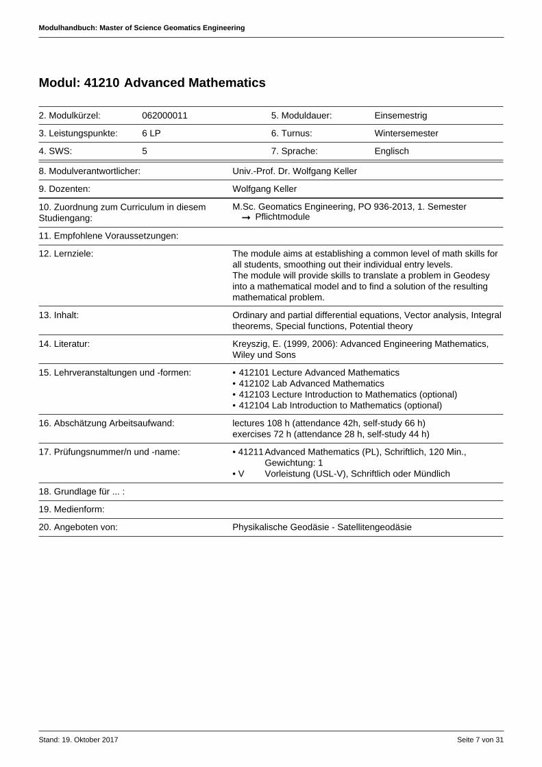
Modul: 41210 Advanced Mathematics
2. Modulkürzel: 062000011 5. Moduldauer: Einsemestrig
3. Leistungspunkte: 6 LP 6. Turnus: Wintersemester
4. SWS: 5 7. Sprache: Englisch
8. Modulverantwortlicher: Univ.-Prof. Dr. Wolfgang Keller
9. Dozenten: Wolfgang Keller
10. Zuordnung zum Curriculum in diesemStudiengang:
M.Sc. Geomatics Engineering, PO 936-2013, 1. Semester➞ Pflichtmodule
11. Empfohlene Voraussetzungen:
12. Lernziele: The module aims at establishing a common level of math skills forall students, smoothing out their individual entry levels.The module will provide skills to translate a problem in Geodesyinto a mathematical model and to find a solution of the resultingmathematical problem.
13. Inhalt: Ordinary and partial differential equations, Vector analysis, Integraltheorems, Special functions, Potential theory
14. Literatur: Kreyszig, E. (1999, 2006): Advanced Engineering Mathematics,Wiley und Sons
15. Lehrveranstaltungen und -formen: • 412101 Lecture Advanced Mathematics• 412102 Lab Advanced Mathematics• 412103 Lecture Introduction to Mathematics (optional)• 412104 Lab Introduction to Mathematics (optional)
16. Abschätzung Arbeitsaufwand: lectures 108 h (attendance 42h, self-study 66 h)exercises 72 h (attendance 28 h, self-study 44 h)
17. Prüfungsnummer/n und -name: • 41211Advanced Mathematics (PL), Schriftlich, 120 Min.,Gewichtung: 1
• V Vorleistung (USL-V), Schriftlich oder Mündlich
18. Grundlage für ... :
19. Medienform:
20. Angeboten von: Physikalische Geodäsie - Satellitengeodäsie
Modulhandbuch: Master of Science Geomatics Engineering
Stand: 19. Oktober 2017 Seite 8 von 31
Modul: 41220 Geomatics Methodology
2. Modulkürzel: 062200301 5. Moduldauer: Zweisemestrig
3. Leistungspunkte: 15 LP 6. Turnus: Wintersemester
4. SWS: 9 7. Sprache: Englisch
8. Modulverantwortlicher: Dr.-Ing. Friedrich Wilhelm Krumm
9. Dozenten: Friedrich Wilhelm KrummAlfred KleusbergUwe Sörgel
10. Zuordnung zum Curriculum in diesemStudiengang:
M.Sc. Geomatics Engineering, PO 936-2013, 1. Semester➞ Pflichtmodule
11. Empfohlene Voraussetzungen:
12. Lernziele: Statistical InferenceThe goal of this course is to impart knowledge on the mostfrequently applied adjustment models (model with observationequations, model with condition equations, mixed models) usedin engineering disciplines and Geosciences, and their geometricinterpretation. A minor part will treat hypothesis testing in linearmodels, internal and external reliability.Signal ProcessingThe students will learn the methodologies of signal processing.Differentiation is made between deterministic signals and randomsignals. FIR and IIR filters are described by difference equations,filter design is solved in time and frequency domain. Markovprocesses are used to simulate random signals. The filter output isapplied for many examples in signal and image processing.Dynamic System EstimationThe students are familiar with the methodology for parameterestimation in systems, which can be described by solutions toordinary differential equation systems. The concept of selectedrandom processes for the error description is understood. Thestudents are familiar with the Kalman filter estimation procedure
13. Inhalt: Statistical InferenceBasics on linear algebra, parameter adjustment, conditionadjustment and mixed model adjustment, random variables,probability density functions, error propagation, hypothesis testingSignal ProcessingDefinition of one- and two-dimensional signals. Fourier Seriesand Fourier Transforms, Cosine transforms, theory of Wavelets.Linear systems, FIR and IIR filters. Linear phase and zero-phasedsystems. Filter design for deterministic and random signals.Matched and Wiener filters, convolutions in 1D and 2D, Fastconvolutions. Explanations of ad hoc operators in signal and imageprocessing and its comparison of designed systems.Dynamic System EstimationReview of Least Squares Estimation, Sequential Least SquaresEstimation, Ordinary Differential Equations, numerical integrationmethods, linear dynamic systems, state space descriptions,random processes, state augmentation, derivation of KalmanFilter equations, Kalman smoother, comparison of Kalman filter tosequential Least Squares Estimation
Modulhandbuch: Master of Science Geomatics Engineering
Stand: 19. Oktober 2017 Seite 9 von 31
14. Literatur: Statistical InferenceGhilani Ch. D. (2010): Adjustment Computations. SpatialData Analysis. 5th edition. John Wiley und Sons, Inc., ISBN978-0-470-46491-5Krumm F (2017): Statistical Inference, Powerpoint viewgraphs,University of StuttgartSneeuw N and F Krumm (20xx): lecture Notes Adjustment Theory,University of StuttgartTeunissen P J G (2003): Adjustment theory - an introduction. DelftUniversity Press, ISBN 13 978-90-407-1974-5Teunissen P G J (2006): Network Quality Control. Delft UniversityPress, ISBN 13 978-90-71301-98-8Signal ProcessingFritsch, Signal Processing, lecture Materials, University of StuttgartRabiner, L.R., Gold, P. (1975): Theory and Applications of DigitalSignal Processing. Prentice-Hall, Englewood Cliffs.Oppenheim, A.V., Schafer, R.W. (2007): Discrete-Time SignalProcessing (3rd Edition), Prentice Hall(2007), 1132 Seiten,ISBN-13: 978-0132067096.Berber, S. (2009): Continuous and Discrete Time Signals, VDMVerlag Dr. Müller (2009), 632 Seiten, ISBN-13: 978-3639111880.Dynamic System EstimationKleusberg, Dynamic System Estimation, lecture materials, Univ. ofStuttgartGelb (1974) Applied Optimal Estimation, MIT PressJekeli (2001) Inertial Navigation Systems with GeodeticApplications, deGruyter
15. Lehrveranstaltungen und -formen: • 412201 Lecture Statistical Inference• 412205 Lecture Signal Processing• 412204 Lab Dynamic System Estimation• 412202 Lab Statistical Inference• 412206 Lab Signal Processing• 412203 Lecture Dynamic System Estimation
16. Abschätzung Arbeitsaufwand: Statistical Inference 150 h (contact hours lectures and labs 42 h,self study 108 h)Signal Processing 150 h (contact hours lectures and labs 42 h, selfstudy 108 h)Dynamic System Estimation 150 h (contact hours lectures and labs42 h, self study 108 h)Total 450 h
17. Prüfungsnummer/n und -name: • 41221Statistical Inference and Signal Processing (PL), Schriftlich,120 Min., Gewichtung: 1
• V Vorleistung (USL-V), Schriftlich oder Mündlich• 41222Dynamic System Estimation (PL), Schriftlich, 60 Min.,
Gewichtung: 1
18. Grundlage für ... :
19. Medienform: Videocasts, Beamer, Board, Overhead projection, Matlab
20. Angeboten von: Höhere Geodäsie
Modulhandbuch: Master of Science Geomatics Engineering
Stand: 19. Oktober 2017 Seite 10 von 31
Modul: 41230 Geodesy
2. Modulkürzel: 062000401 5. Moduldauer: Zweisemestrig
3. Leistungspunkte: 9 LP 6. Turnus: Wintersemester
4. SWS: 6 7. Sprache: Englisch
8. Modulverantwortlicher: Univ.-Prof. Dr.-Ing. Nicolaas Sneeuw
9. Dozenten: Nicolaas SneeuwFriedrich Wilhelm Krumm
10. Zuordnung zum Curriculum in diesemStudiengang:
M.Sc. Geomatics Engineering, PO 936-2013, 1. Semester➞ Pflichtmodule
11. Empfohlene Voraussetzungen: Advanced Mathematics
12. Lernziele: Map Projections and Geodetic Coordinate Systems Students are enabled to interpret maps and to represent the Earthusing different kinds of map projections. They are capable toinvestigate, to evaluate and to visualize occurring distortions. Theyknow how to deal with different kinds of reference and coordinatesystems, and to perform transformations between them.
Physical Geodesy Students are able to judge the fundamental role of the gravityfield and the geoid in all disciplines of geomatics engineering.They have the skills to select the appropriate methodological toolsfrom physical geodesy for actual problems and projects. Theyunderstand the pros and cons of different height systems.
13. Inhalt: Map Projections and Geodetic Coordinate Systems Basics on differential geometry of surfaces, geometry of sphereand ellipsoid-of-revolution, spherical map projections, optimalmap projections, legal map projections (Gauß-Krüger/UTM),deformations and deformation measures, 2D and 3D coordinatesystems and datum transformation modelsPhysical Geodesy Elements of potential theory, gravitation and gravity, measurementprinciples of gravimetry, gravity networks, approaches to solvingthe Laplace equation, special functions of physical geodesy, geoiddetermination, height systems
14. Literatur: Physical Geodesy • Sneeuw, Physical Geodesy, lecture notes, University of Stuttgart• Torge, W. (2001) Geodesy. De Gruyter, Berlin (3rd ed.)• Matlab
Map Projections and Geodetic Coordinate Systems • Krumm F (2016): Map Projections and Geodetic Coordinate
Systems. Powerpoint viewgraphs, University of Stuttgart• Bugayevskiy L M and J P Snyder (1995): Map Projections - A
Reference Manual. Taylor und Francis• Canters F and H Decleir (1989): The world in perspective: A
directory of world map projections. Wiley• Grafarend E W and F W Krumm (2007): Map Projections,
Cartographic Information Systems. Springer• Hofmann-Wellenhof B, H Lichtenegger and J Collins (1997):
GPS - Theory and Practice. Springer
Modulhandbuch: Master of Science Geomatics Engineering
Stand: 19. Oktober 2017 Seite 11 von 31
• Hooijberg M (2008): Geometrical Geodesy Using Informationand Computer Technology, Springer
• Iliffe J (2000): Datums and Map Projections for Remote Sensing,GIS, and Surveying. Boca Raton
• Kühnel W (2002): Differential Geometry. Curves - Surfaces -Manifolds. Student Mathematical Library, Vol. 16, AmericanMathematical Society
• Lauf GB (1983): Geodesy and Map Projections. TAFEPublications Unit, Collingwood, Vic.
• Maling D H (1992): Coordinate Systems and Map Projections.2nd Edition, Oxfor
• McDonnel PW (1991): Introduction to Map Projections. 2ndEdition. Permission department, Landmark Enterprises, RanchoCordova, Ca, USA
• Pearson F (1990): Map Projection: Theory and Applications.Boca Raton
• Snyder J.P. (1987): Map Projections - A Working Manual. USGSProfessional Paper 1395, United States Government PrintingOffice, Washington
15. Lehrveranstaltungen und -formen: • 412301 Lecture Map Projections and Geodetic Coordinate Systems• 412303 Lecture Physical Geodesy• 412302 Lab Excercises Map Projections and Geodetic Coordinate
Systems• 412304 Lab Excercises Physical Geodesy
16. Abschätzung Arbeitsaufwand: Map Projections and Geodetic Coordinate Systems 135 h (contacthours lectures and labs 42 h, self study 93 h)Physical Geodesy 135 h (contact hours lectures and labs 42 h, selfstudy 93 h)Total 270 h
17. Prüfungsnummer/n und -name: • 41231Geodesy (PL), Schriftlich, 120 Min., Gewichtung: 1• V Vorleistung (USL-V), Schriftlich
18. Grundlage für ... :
19. Medienform: blackboard, projector, Matlab
20. Angeboten von: Höhere Geodäsie
Modulhandbuch: Master of Science Geomatics Engineering
Stand: 19. Oktober 2017 Seite 12 von 31
Modul: 41240 Remote Data Acquisition
2. Modulkürzel: 062100310 5. Moduldauer: Zweisemestrig
3. Leistungspunkte: 9 LP 6. Turnus: Sommersemester
4. SWS: 6 7. Sprache: Englisch
8. Modulverantwortlicher: Univ.-Prof. Dr.-Ing. Uwe Sörgel
9. Dozenten: Uwe Sörgel
10. Zuordnung zum Curriculum in diesemStudiengang:
M.Sc. Geomatics Engineering, PO 936-2013, 2. Semester➞ Pflichtmodule
11. Empfohlene Voraussetzungen:
12. Lernziele: Remote Sensing Students understand the principles of Remote Sensing of thesurface of the earth from satellites in the visible light spectrum,the infrared spectrum and the spectrum of Radar signals. Thisincludes the understanding of the complete radiation path from thesource of radiation to the radiation detecting sensors, and the datacommunication to earth receiving stations.Airborne Data Acquisition Students understand the principles of direct georeferencing byGPS/IMU integration and in-situ camera calibration using extendedbundle block adjustments. The photogrammetric processingpipeline consisting of image orientation, image matching and trueorthophoto generation is a major subject. Airborne full waveformLiDAR and airborne RADAR complete the student's knowledge.Follow-up products such as 3D city and landscape models are alsopresented.
13. Inhalt: Remote Sensing (RS) Introduction including the history of RS and an overview of modernRS systems, orbits of RS satellites, sources of electromagnetic(EM) radiation, propagation of EM radiation, interaction of EMradiation with matter, detection and measurement of EM radiation,analog to digital conversion, data transmission and storageAirborne Data Acquisition Principles of airborne kinematic GPS, PPP solutions, basics ofIMU, GPS/IMU integration, bundle block adjustment, cameracalibration using additional parameters, Image matching: from 2Dcorrelation, least-squares and feature-based matching to semi-global matching. Automatic aerial triangulation and generation ofdense surface models, orthophoto generation, airborne LiDAR andits processing (full wave form analysis), RADAR data collection,integration of RADAR and optical imagery.
14. Literatur: Remote Sensing Kleusberg, Remote Sensing, lecture materials, University ofStuttgartElachi, C. (2006) Introduction to the Physics and Techniques ofRemote Sensing, John WileyESA internet:http://www.esa.int/esaMI/Eduspace_EN/SEMF9R3Z2OF_0.htmlNASA internethttp://landsat.gsfc.nasa.gov/education/tutorials.htmlAirborne Data Acquisition
Modulhandbuch: Master of Science Geomatics Engineering
Stand: 19. Oktober 2017 Seite 13 von 31
Fritsch, D (2012): Airborne Data Acquisition, Lecture Notes, Univ.StuttgartMikhail, E.M., Bethel, J.S, McGlone, J.C. (2001): Introduction toModern Photogrammetry.Jon Wiley und Sons, New York, 479p.Schenk, T. (2000): Digital Photogrammetry. Terra Science, 428p.Fritsch, D. (Ed)(2011): Photogrammetric Week'11. Wichmann,Offenbach/Berlin, 330p.
15. Lehrveranstaltungen und -formen: • 412403 Lecture Airborne Data Acquisition• 412401 Lecture Remote Sensing• 412404 Lab Airborne Data Acquisition• 412402 Lab Remote Sensing
16. Abschätzung Arbeitsaufwand: Remote Sensing 135 h(contact hours lectures and labs 42 h, self study 93 h)Airborne Data Acquisition 135 h(contact hours lectures and labs 42 h, self study 93 h)Total 270 h
17. Prüfungsnummer/n und -name: • 41241Remote Data Acquisition (PL), Schriftlich, 120 Min.,Gewichtung: 1
• V Vorleistung (USL-V), Schriftlich oder Mündlich
18. Grundlage für ... :
19. Medienform: Videocasts, Beamer, White Board, MatLab, IGI FlightSimulator
20. Angeboten von: Photogrammetrie und Vermessungswesen
Modulhandbuch: Master of Science Geomatics Engineering
Stand: 19. Oktober 2017 Seite 14 von 31
Modul: 41250 Representation of Geodata
2. Modulkürzel: 062200302 5. Moduldauer: Einsemestrig
3. Leistungspunkte: 9 LP 6. Turnus: Wintersemester
4. SWS: 6 7. Sprache: Englisch
8. Modulverantwortlicher: Bernhard Minke
9. Dozenten: Volker WalterMartin Metzner
10. Zuordnung zum Curriculum in diesemStudiengang:
M.Sc. Geomatics Engineering, PO 936-2013, 3. Semester➞ Pflichtmodule
11. Empfohlene Voraussetzungen:
12. Lernziele: GeoinformaticsThe students know the technologies for the input, management,analysis andpresentationof spatial data. They are able to usedifferent standard software tools. They are able to collect, modeland exchange spatial data on web-platforms. They know thenecessity and the advantages of storing spatial data with databasemanagement systems.
Thematic CartographyThe students have competence in the basics of cartography andthe creation and optimal presentation of thematic data. They willbe enabled to perform the appropriate geometric, topologic andthematic modeling and presentation.
13. Inhalt: GeoinformaticsData Sources, Data Collection, Geometrical/Topological/Thematic Data Modelling, Data Structures,Virtual Globes, Web2.0 Technologies, Spatial Data Infrastructures, Web-APIs, Web-Services,GeoDBMS,Thematic CartographyAnalysis for information systems requirements (focus on thematicmaps), Scientific cartography, cognitive maps, structure of the geo-data market, Techniques of homogenizing data sets (matchingand merging), Map design, animated maps, thematic maps forindividual and public transport
14. Literatur: GeoinformaticsFritsch, D., Geoinformatics, Lecture Notes, Univ. StuttgartDuVander, A. (2010): Map Scripting 101: An Example-DrivenGuide to Building Interactive Maps with Bing, Yahoo!, and GoogleMaps, No Starch Press, Inc.Halpin, T., Morgan, T. (2008): Information Modeling and RelationalDatabases, Second Edition (The Morgan Kaufmann Series in DataManagement Systems) Morgan Kaufmann PublishersThematic CartographyKraak, M.-J. and Ormeling, F. J. (2003), Cartography, Visualizationof Spatial Data, Harlow, PearsonTaylor, D.R.F (Ed.) (1998), Policy Issues in Modern Cartography,Volume 3 in Modern Cartography Series (ed. and contributor),Oxford, Pergamon
Modulhandbuch: Master of Science Geomatics Engineering
Stand: 19. Oktober 2017 Seite 15 von 31
Slocum et. al. (2005): Thematic Cartography and GeographicVisualization, 2nd ed., Upper Saddle River, Pearson Prentice Hall
15. Lehrveranstaltungen und -formen: • 412501 Lecture Geoinformatics• 412503 Lecture Thematic Cartography• 412502 Lab Geoinformatics• 412504 Lab Thematic Cartography
16. Abschätzung Arbeitsaufwand: Geoinformatics 180 h (contact hours lectures and labs 56 h, selfstudy 124 h)Thematic Cartography, lecture: 45 h (attendance 14 h, self study31 h)Thematic Cartography, laboratory: 45 h (attendance 14 h, selfstudy 31 h)Total: 270 h (attendance 78 h, self study 192 h)
17. Prüfungsnummer/n und -name: • 41251Representation of Geodata (PL), Schriftlich, 120 Min.,Gewichtung: 1
• V Vorleistung (USL-V), Schriftlich
18. Grundlage für ... :
19. Medienform: Videocast, Blackboard, laptop + LCD projector, White Board,laboratory and calculation exercises
20. Angeboten von: Photogrammetrie und Vermessungswesen
Modulhandbuch: Master of Science Geomatics Engineering
Stand: 19. Oktober 2017 Seite 16 von 31
Modul: 41280 Integrated Project
2. Modulkürzel: 062300032 5. Moduldauer: Einsemestrig
3. Leistungspunkte: 6 LP 6. Turnus: Sommersemester
4. SWS: 0 7. Sprache: Englisch
8. Modulverantwortlicher: Univ.-Prof. Dr.-Ing. Volker Schwieger
9. Dozenten: Wolfgang KellerNicolaas SneeuwVolker SchwiegerUwe SörgelAlfred KleusbergNorbert Haala
10. Zuordnung zum Curriculum in diesemStudiengang:
M.Sc. Geomatics Engineering, PO 936-2013, 2. Semester➞ Pflichtmodule
11. Empfohlene Voraussetzungen:
12. Lernziele: The students are able to apply the knowledge of the modules ofsemester 1 and 2 project-related on variable topics. Additionallythey know about project management, team work, scientificreporting and presentation techniques.
13. Inhalt: Variable topics are treated in projects, e.g. "geoid determinationand "stake out of a tunnel . The student work for ten days onthe project that is structured by several working packages.The planning, measurement, evaluation and analysis arerealized in small teams. The students take care about the projectmanagement in different organisational levels. The academicstaff act as mentors and not as teachers. For the preparation ofthe measurement campaign each student has to prepare oneworking package including a presentation. After the measurementcampaign a joint scientific report has to be realised and eachstudent has to present his working package.
14. Literatur: Documents/teaching materials from the modules of the 1st and 2ndsemester
15. Lehrveranstaltungen und -formen: • 412801 Integrated Project
16. Abschätzung Arbeitsaufwand: Integrated Project, 10 days project: 90 h (attendance time 90 h,self study 0 h)Integrated Project, presentation and final report: 90 h (attendance10 h, self study 80 h)Total: 180 h (attendance 100 h, self study 80 h)
17. Prüfungsnummer/n und -name: 41281 Integrated Project (USL), Sonstige, Gewichtung: 1
18. Grundlage für ... :
19. Medienform: laptop + LCD projector, field project
20. Angeboten von: Ingenieurgeodäsie und Geodätische Messtechnik
Modulhandbuch: Master of Science Geomatics Engineering
Stand: 19. Oktober 2017 Seite 17 von 31
Modul: 48400 Engineering Geodesy
2. Modulkürzel: 062300031 5. Moduldauer: Zweisemestrig
3. Leistungspunkte: 9 LP 6. Turnus: Wintersemester
4. SWS: 6 7. Sprache: Englisch
8. Modulverantwortlicher: Univ.-Prof. Dr.-Ing. Volker Schwieger
9. Dozenten: Otto LerkeVolker SchwiegerJinyue Wang
10. Zuordnung zum Curriculum in diesemStudiengang:
M.Sc. Geomatics Engineering, PO 936-2013, 1. Semester➞ Pflichtmodule
11. Empfohlene Voraussetzungen:
12. Lernziele: The students are able to understand the principle of monitoringsensors, apply them for monitoring tasks and realize deformationanalysis in the congruency model. Additionally they know all thedetails about positioning, filtering and controlling within kinematicmeasurement systems with a special focus on total stations.Knowledge about the graphical programming software Labview isavailable.
13. Inhalt: Monitoring networks and point determination, Inclinationmeasurements, Hydrostatical leveling, Alignment, plumbingmethods, additional sensors, Monitoring analysis using thecongruency model: two- and multi-epoch , comparison, globaltest, sensitivity test for localization of deformations, Graphicalprogramming: introduction and data acquisition, Recapitulation oftachymeter techniques and measurements, Robot total stations,GNSS, other Kinematic measurement systems, Positioning formoving objects , Vehicle models, Prediction and filtering, e.g.Kalman filter, Basics of control theory, Integration of kinematicmeasurements into control circles, Construction machine guidance,Project at construction machine simulator of IIGS
14. Literatur: Schofield/Breach (2007): Engineering Surveying Sixth Edition,Oxford, ElsevierGelb, G. (Ed.) (1974), Applied optimal estimation, M.I.T. Press,Cambridge, Mass.Chui, C.K., Chen, G.(1999), Kalman filtering with real timeapplications, Springer, Heidelberg - BerlinAnand, D.K.(1974), Introduction to control systems, Pergamon,New York Braunschweig
15. Lehrveranstaltungen und -formen: • 484004 Laboratory Kinematic Measurement Systems• 484003 Lecture Kinematic Measurement Systems• 484002 Laboratory Monitoring• 484001 Lecture Monitoring
16. Abschätzung Arbeitsaufwand: Monitoring, lecture, 45 h (attendance 14h, self study 31h)Monitoring, exercise, 45 h (attendance 14h, self study 31h)Kinematic Measurement Systems, lecture: 90 h (attendance 28 h,self study 62 h)Kinematic Measurement Systems, exercise: 90 h (attendance 28 h,self study 62 h)Total: 270 h (attendance 84 h, self study: 186 h)

Modulhandbuch: Master of Science Geomatics Engineering
Stand: 19. Oktober 2017 Seite 18 von 31
17. Prüfungsnummer/n und -name: • 48401Engineering Geodesy (PL), Schriftlich, 120 Min., Gewichtung:1
• V Vorleistung (USL-V), Schriftlich
18. Grundlage für ... :
19. Medienform:
20. Angeboten von: Ingenieurgeodäsie und Geodätische Messtechnik
Modulhandbuch: Master of Science Geomatics Engineering
Stand: 19. Oktober 2017 Seite 19 von 31
Modul: 48440 Information and Contract Law
2. Modulkürzel: 62000099 5. Moduldauer: Einsemestrig
3. Leistungspunkte: 3 LP 6. Turnus: Wintersemester
4. SWS: 2 7. Sprache: Englisch
8. Modulverantwortlicher: Horst Speichert
9. Dozenten: Horst Speichert
10. Zuordnung zum Curriculum in diesemStudiengang:
M.Sc. Geomatics Engineering, PO 936-2013, 3. Semester➞ Pflichtmodule
11. Empfohlene Voraussetzungen:
12. Lernziele: Introduction to basics of contract law, international contract andinformation law as well as Internet and data protection law.Students are made familiar with methods for lawful contracts andcontracts checking, especially with regard to future managementpositions
13. Inhalt: Introduction: Objectives and mechanism of law, The legal system(overview), The system of national law, The European system oflaw, International lawContract law: General remarks, Requirements for a contract ingeneral, Terms of contract, Irregularities in the performance of thecontract, Disputes, arbitration, law-suitsTypes of contract: act of sale, UN Convention on Contracts for theInternational Sale of Goods (CISG), contract for services, contractof work and laborThe law on torts (liability): General remarks, Tort liability based onfault, Product liability, Warranty, CompensationSelected fields of law (overview): Labor law, The law of businessassociations, Company law, Commercial law, Competition law,advertising, Copyright, patent, brands and related rightsE-commerce and Internet: Web publishing, Liability, Multimedia,European legislation, IT-Security law (overview),Data protection,Privacy policy, European legislation
14. Literatur: James, P.S., Glover, G.N.: Introduction to English Law, 9. Edition1976, ButterworthsMcCormick-Watson, J., Watson, B., Bourne, N.: Essential EnglishLegal System (Essential Law), 2006, Routledge CavendishJewell, M.: An Introduction to English Contract Law, 2. Edition2002, NomosTaylor, R.D.: Law of Contract, 5. Edition 1995, BlackstoneWard, R., Walker und Walker 's English Legal System, 8. Edition1998, ButterworthsFarnsworth, E.A.: An Introduction to the Legal System of theUnited States, 3. Edition 1996, Oceana Publ.Smith, P.F., Bailey, S.H.: The Modern English Legal System, 1984,Sweet und MaxwellHay, P.: An Introduction to the U.S. Law, 2. Edition 1991,ButterworthsClark, D.S., Tugrul, A.: Introduction to the Law of the United States,2. Auflage 2001, Kluwer Law InternationalEddey, K.J., Darbyshire, P.: Eddey and Darbyshire on the EnglishLegal System, 7. Edition 2001, Sweet und Maxwell
Modulhandbuch: Master of Science Geomatics Engineering
Stand: 19. Oktober 2017 Seite 20 von 31
Rutherford, L., Bone, S.: Osborn's Concise Law Dictionary, 8.Edition 1993, Sweet und MaxwellSchlechtriem, P., Butler, P.: UN Law on International Sales. TheUN Convention on the International Sale of Goods, 1. Edition 2007,SpringerMartin, E.A.: A dictionary of law, 6. Edition 2006, Oxford UniversityPressSchlechtriem, P., Schwenzer, I.: Commentary on the UNConvention on the International Sale of Goods (CISG), 2. Edition2005, Oxford University PressSpeichert, H.: Praxis des IT-Rechts, 2. Edition 2007, Vieweg
15. Lehrveranstaltungen und -formen: • 484401 Lecture Information and Contract Law
16. Abschätzung Arbeitsaufwand: attendance 28 hself study 62 hTotal: 90 h
17. Prüfungsnummer/n und -name: 48441 Information and Contract Law (BSL), Schriftlich, Gewichtung:1
18. Grundlage für ... :
19. Medienform:
20. Angeboten von: Geodätisches Institut
Modulhandbuch: Master of Science Geomatics Engineering
Stand: 19. Oktober 2017 Seite 21 von 31
200 Wahlpflichtmodule
Zugeordnete Module: 48420 Satellite Geodesy48430 Navigation77790 Computer Vision and Pattern Recognition77800 Multisensor Integration in Geodesy and Transport
Modulhandbuch: Master of Science Geomatics Engineering
Stand: 19. Oktober 2017 Seite 22 von 31
Modul: 48420 Satellite Geodesy
2. Modulkürzel: 62000092 5. Moduldauer: Einsemestrig
3. Leistungspunkte: 9 LP 6. Turnus: Wintersemester
4. SWS: 6 7. Sprache: Englisch
8. Modulverantwortlicher: Univ.-Prof. Dr. Wolfgang Keller
9. Dozenten: Wolfgang Keller
10. Zuordnung zum Curriculum in diesemStudiengang:
M.Sc. Geomatics Engineering, PO 936-2013, 3. Semester➞ Wahlpflichtmodule
11. Empfohlene Voraussetzungen: Advanced Mathematics
12. Lernziele: The module aims at an understanding of the interplay betweenspace-observation techniques, the related reference systems andthe error sources degrading the observations. The students willlearn to apply and assess space techniques for position acquisitionwith a sound knowledge of the available techniques of errormitigation.
13. Inhalt: Reference systems and transformation rules between them, Signalpropagation, Orbital mechanics, Satellite Laser ranging, VLBI,Satellite altimetry, GNSS positioning
14. Literatur: Seeber, G. (2004) Satellite Geodesy, de GruyterLeick, A.(2004) Satellite Surveying, Wiley und Sons
15. Lehrveranstaltungen und -formen: • 484201 Lecture Foundations of Satellite Geodesy• 484202 Laboratory Foundations of Satellite Geodesy• 484203 Lecture Satellite Geodesy Observation Techniques• 484204 Laboratory Satellite Geodesy Observation Techniques
16. Abschätzung Arbeitsaufwand: lectures 140 h (attendance 56h, self-study 84 h)exercises 130 h (attendance 42 h, self-study 88 h)
17. Prüfungsnummer/n und -name: • 48421Satellite Geodesy (PL), Schriftlich, 120 Min., Gewichtung: 1• V Vorleistung (USL-V), Schriftlich
18. Grundlage für ... :
19. Medienform:
20. Angeboten von: Physikalische Geodäsie - Satellitengeodäsie
Modulhandbuch: Master of Science Geomatics Engineering
Stand: 19. Oktober 2017 Seite 23 von 31
Modul: 48430 Navigation
2. Modulkürzel: 62100320 5. Moduldauer: Einsemestrig
3. Leistungspunkte: 9 LP 6. Turnus: Wintersemester
4. SWS: 6 7. Sprache: Englisch
8. Modulverantwortlicher: Univ.-Prof. Dr.-Ing. Alfred Kleusberg
9. Dozenten: Alfred Kleusberg
10. Zuordnung zum Curriculum in diesemStudiengang:
M.Sc. Geomatics Engineering, PO 936-2013,➞ Zusatzmodule
M.Sc. Geomatics Engineering, PO 936-2013, 3. Semester➞ Wahlpflichtmodule
11. Empfohlene Voraussetzungen: Advanced Mathematics, Dynamic System Estimation
12. Lernziele: Satellite Navigation Students have a complete understanding of all aspects of satellitenavigation with modern Global Navigation Satellite Systems(GNSS) like GPS or Glonass. This understanding includes thedesign of orbital constellation and the description of orbits. Theprocess from signal generation, modulation and transmission oversignal propagation in the atmosphere including refraction effectsup to the signal demodulation and measurement in the receiver isunderstood. Based on this the students know the GNSS positionaccuracy limitations and the potential for error corrections byDGNSS.Integrated Positioning and Navigation Students have a basic understanding of the mathematical andphysical background of Strap-Down Inertial Navigation Systems.Based on this they understand the error behavior of INS withdifferent types of inertial sensors, and the need to integrate suchsystems with external measurements, such as GNSS or DGNSSpositions.
13. Inhalt: Satellite Navigation Definition and realization of global coordinate systems for GNSS,satellite orbits and orbit parameters, GNSS signal generation andmodulation, signal propagation, ionospheric and troposphericrefraction, signal reception and pseudorange measurements,modeling of pseudorange measurements, position determination,position error assessment, DGNSSIntegrated Positioning and Navigation Coordinate systems (inertial, ECEF, local level, body, platform),parameterisation of transformations and rotations, rotationalvelocity, Strap-Down-Navigator differential equations, inertialsensors, integration of differential equations, error control,integration with externally provided positions.
14. Literatur: Kleusberg, Satellite Navigation, lecture materials, University ofStuttgartKleusberg, Integrated Positioning and Navigation, lecturematerials, University of StuttgartIS-GPS-200E Interface Control DocumentJekeli (2001) Inertial Navigation Systems with GeodeticApplications, deGruyterU.S. Coast Guard Navigation Center - GPS
Modulhandbuch: Master of Science Geomatics Engineering
Stand: 19. Oktober 2017 Seite 24 von 31
http://www.navcen.uscg.gov/ESA - Galileohttp://www.esa.int/esaNA/galileo.htmlRussian Federal Space Agency - Glonasshttp://www.glonass-center.ru/en/
15. Lehrveranstaltungen und -formen: • 484304 Laboratory Integrated Positioning and Navigation• 484301 Lecture Satellite Navigation• 484302 Laboratory Satellite Navigation• 484303 Lecture Integrated Positioning and Navigation
16. Abschätzung Arbeitsaufwand: Satellite Navigation 135 h (contact hours lectures and labs 42 h,self study 93 h)Integrated Positioning and Navigation 135 h (contact hourslectures and labs 42 h, self study 93 h)Total 270 h
17. Prüfungsnummer/n und -name: • 48431Navigation (PL), Schriftlich, 120 Min., Gewichtung: 1• V Vorleistung (USL-V), Schriftlich
18. Grundlage für ... :
19. Medienform:
20. Angeboten von: Navigation
Modulhandbuch: Master of Science Geomatics Engineering
Stand: 19. Oktober 2017 Seite 25 von 31
Modul: 77790 Computer Vision and Pattern Recognition
2. Modulkürzel: - 5. Moduldauer: Einsemestrig
3. Leistungspunkte: 9 LP 6. Turnus: Wintersemester
4. SWS: 4 7. Sprache: Englisch
8. Modulverantwortlicher: Univ.-Prof. Dr.-Ing. Uwe Sörgel
9. Dozenten: Uwe Sörgel
10. Zuordnung zum Curriculum in diesemStudiengang:
M.Sc. Geomatics Engineering, PO 936-2013, 3. Semester➞ Wahlpflichtmodule
11. Empfohlene Voraussetzungen:
12. Lernziele: Within this module, the students will understand the automatedmethods and technologies of computer vision and patternrecognition. This comprises on the one hand image matching andorientation by means of approaches like structure from motion and3D reconstruction by dense image matching. On the other hand,students will be able to scan large data amounts to identify certainclasses of interest by means of feature selection and clustering.
13. Inhalt: Lecture Computer VisionAutomatic image matching by intensity and feature basedmethods, automatic image orientation by Structure.from-Motion,image based 3D surface reconstruction using dense multi-viewstereo, image segmentationLecture Pattern RecognitionFeature space, different types of features, curse of dimensionality,Model based and statistical methods, supervised and unsupervisedclassification, Classification methods: Minimum distance, maximumlikelihood, Bayes, decision tree, random forest, support vectormachine, neural networks, and random fields, confusion matrix,overall accuracy, producer's and user's accuracy
14. Literatur: Haala, N. (2016): Computer Vision, Lecture Notes, Univ. Stuttgart.Hartley, R., Zissermann (2000): Multiple View in Computer Vision,Cambridge University Press.C. Bishop: Pattern Recognition and Machine LearningSörgel, U. (2016): Pattern Recognition, Lecture Notes, Univ.Stuttgart
15. Lehrveranstaltungen und -formen: • 777901 VL Computer Vision• 777902 Übung Computer Vision• 777903 Vorlesung Pattern Recognition• 777904 Übung Pattern Recognition
16. Abschätzung Arbeitsaufwand: Computer Vision, Lecture 135 h (contact hours lecture and labs 42h, self study 93 h)Pattern Recognition Lecture 135 h (contact hours lecture and labs42 h, self study 93 h)Total: 270 h (attendance 84 h, self study: 186 h)
17. Prüfungsnummer/n und -name: 77791 Computer Vision and Pattern Recognition (PL), , Gewichtung:1
18. Grundlage für ... :

Modulhandbuch: Master of Science Geomatics Engineering
Stand: 19. Oktober 2017 Seite 26 von 31
19. Medienform: Tafel, Laptop + Beamer, Labor-, Programmier- undRechenübungen
20. Angeboten von: Photogrammetrie
Modulhandbuch: Master of Science Geomatics Engineering
Stand: 19. Oktober 2017 Seite 27 von 31
Modul: 77800 Multisensor Integration in Geodesy and Transport
2. Modulkürzel: - 5. Moduldauer: Einsemestrig
3. Leistungspunkte: 9 LP 6. Turnus: Wintersemester
4. SWS: 6 7. Sprache: Englisch
8. Modulverantwortlicher: Dr.-Ing. Li Zhang
9. Dozenten: Martin MetznerLi Zhang
10. Zuordnung zum Curriculum in diesemStudiengang:
M.Sc. Geomatics Engineering, PO 936-2013, 3. Semester➞ Wahlpflichtmodule
11. Empfohlene Voraussetzungen:
12. Lernziele:
13. Inhalt:
14. Literatur: Terrestrial Multisensor Systems:Padmanabhan, R.T. (2000), Industrial Instrumentation - Principlesand Design, SpringerWebster, G.J. (1999), Measurement, Instrumentation and Sensors- The Handbook, SpringerWeichert, N. and Wülker, M. (2000), Messtechnik undMessdatenerfassung, OldenbourgTransport TelematicsMike de Smith, Mike Goodchild, Paul Longley: Geospatial Analysis:A Comprehensive Guide to Principles, Techniques and SoftwareTools Home page: www.spatialanalysisonline.com. Third Edition.Issue version: 3.15 (2011)McQueen, B. und McQueen, J.(1999), Intelligent transportationsystems architectures, Boston: Artech HouseDrane, C. and Rizos, C. (1998), Positioning systems in intelligenttransportation systems, Boston, Artech House
15. Lehrveranstaltungen und -formen: • 778001 Vorlesung Terrestrial Multisensor Systems• 778002 Übung Terrestrial Multisensor Systems• 778003 Vorlesung Transport Telematics• 778004 Übung Transport Telematics
16. Abschätzung Arbeitsaufwand: Terrestrial Multisensor Systems, Lecture: 90 h (attendance 28 h,self study 62 h)Terrestrial Multisensor Systems, exercise: 45 h (attendance 14 h,self study 31 h)Transport Telematics, lecture: 90 h (attendance 28 h, self study 62h)Transport Telematics, exercise: 45 h (attendance 14 h, self study31 h)Total: 270 h (attendance 84 h, self study 186 h)
17. Prüfungsnummer/n und -name: 77801 Multisensorintegration in Geodesy and Transport (PL),Schriftlich, 120 Min., Gewichtung: 1
Vorleistung (USL-V )
18. Grundlage für ... :
19. Medienform:

Modulhandbuch: Master of Science Geomatics Engineering
Stand: 19. Oktober 2017 Seite 28 von 31
20. Angeboten von: Ingenieurgeodäsie und Geodätische Messtechnik

Modulhandbuch: Master of Science Geomatics Engineering
Stand: 19. Oktober 2017 Seite 29 von 31
400 Deutschkurse
Zugeordnete Module: 48450 German as a Foreign Language
Modulhandbuch: Master of Science Geomatics Engineering
Stand: 19. Oktober 2017 Seite 30 von 31
Modul: 48450 German as a Foreign Language
2. Modulkürzel: - 5. Moduldauer: Einsemestrig
3. Leistungspunkte: 6 LP 6. Turnus: Wintersemester
4. SWS: 2 7. Sprache: Deutsch
8. Modulverantwortlicher: Dr. Karin Herrmann
9. Dozenten:
10. Zuordnung zum Curriculum in diesemStudiengang:
M.Sc. Geomatics Engineering, PO 936-2013, 1. Semester➞ Deutschkurse
11. Empfohlene Voraussetzungen:
12. Lernziele: Students are able to converse about everyday situations in theirstudies and home, read and understand simple texts, have acommand of basic grammar structures, and write about life andculture in the German speaking countries.
13. Inhalt: The course aims to develop the four communication skills listening,speaking, reading, and writing, with an increased emphasis onconversational German. Students are exposed to everyday andprofessional situations. Students learn frequently used expressionsrelated to areas of most immediate relevance (e.-g. very basicpersonal and family information, shopping, local geography,employment)
14. Literatur: text book according to german level
15. Lehrveranstaltungen und -formen: • 484501 Intensive German Course
16. Abschätzung Arbeitsaufwand: attendance 130 h (attendance is mandatory)self study 60 h (since most exercises and labs take place duringclass, self study requires less time)
17. Prüfungsnummer/n und -name: 48451 German as a Foreign Language (USL), Schriftlich,Gewichtung: 1
18. Grundlage für ... :
19. Medienform:
20. Angeboten von: II Internationales
Modulhandbuch: Master of Science Geomatics Engineering
Stand: 19. Oktober 2017 Seite 31 von 31
Modul: 80920 Masterthesis GEOENGINE
2. Modulkürzel: - 5. Moduldauer: -
3. Leistungspunkte: - 6. Turnus: -
4. SWS: - 7. Sprache: -
8. Modulverantwortlicher:
9. Dozenten:
10. Zuordnung zum Curriculum in diesemStudiengang:
11. Empfohlene Voraussetzungen:
12. Lernziele:
13. Inhalt:
14. Literatur:
15. Lehrveranstaltungen und -formen:
16. Abschätzung Arbeitsaufwand:
17. Prüfungsnummer/n und -name:
18. Grundlage für ... :
19. Medienform:
20. Angeboten von: