Embed Size (px)
Citation preview

BY
SURV. ISAAC OLORUNFEMI ADEDURIN
08023139029
MAY 2017
Presented at th
e FIG W
orking Week 2017,
May 29 - June 2, 2
017 in Helsinki, F
inland
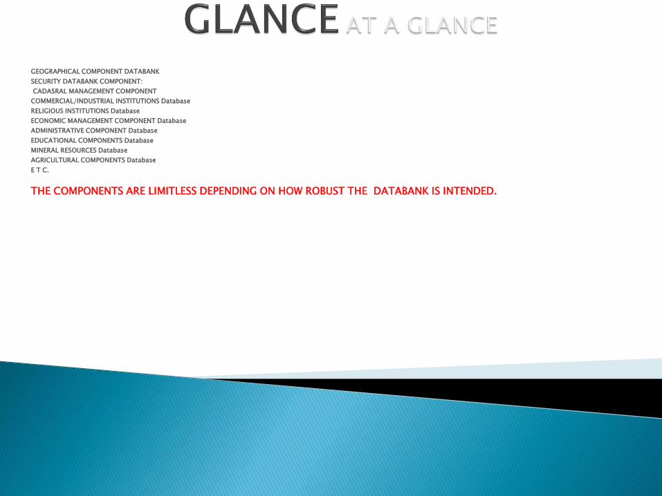
GEOGRAPHICAL COMPONENT DATABANK
SECURITY DATABANK COMPONENT:
CADASRAL MANAGEMENT COMPONENT
COMMERCIAL/INDUSTRIAL INSTITUTIONS Database
RELIGIOUS INSTITUTIONS Database
ECONOMIC MANAGEMENT COMPONENT Database
ADMINISTRATIVE COMPONENT Database
EDUCATIONAL COMPONENTS Database
MINERAL RESOURCES Database
AGRICULTURAL COMPONENTS Database
E T C.
THE COMPONENTS ARE LIMITLESS DEPENDING ON HOW ROBUST THE DATABANK IS INTENDED.
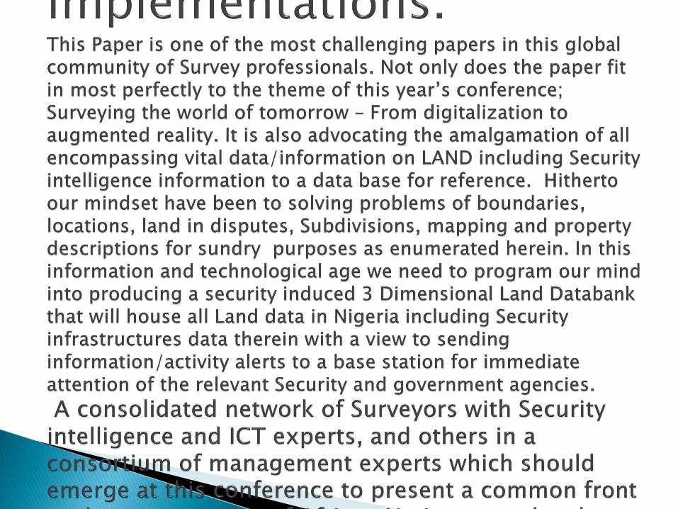
PREAMBLES As at the moments up to date and adequate data regarding land in Nigeria is virtually nonexistent. Each state of the federation has its own splinted spatial data in pieces. This is because there are no secured land depository systems in Nigeria. Most times communities’ clashes with government agents. Also States clashes with the Federal government on matters of land acquisition. Not only that illegal occupation by bandits is on the increase, Terrorists, Kidnappers, Ethnic and Religious sects are ravaging the land without any current and up to date means of monitoring the environment. The absence of digital intelligence gathering facilities as recommended herein makes detection and eradication of vices becomes an uphill task. This system will technologically equip our government and security agencies to track down offenders and pre-empt the criminals in their hideouts in their bid to perpetrate nefarious tendencies. This is most desirable as the new government settles down to work. With this system in place you can tame the tide of Security menace: Terrorists, kidnappers and abductors in our Nation Nigeria. This will serve as a blueprint to land management, security watch, monitoring of land facilities, integration of securities infrastructures and Demarcations, Delimitations and Delineations, Subdivisions and acquisitions etc.

I am hereby introducing National Security Intelligence Land Databank [NASILADAB], a multifaceted and multi-disciplinary digital intelligence gathering blueprint for consideration and adoption
A Comprehensive National Depository System as a BACKUP for all land transactions
A mechanism for land valuation and updating of same A MULTILEVEL DATABAS, a strong room and a warehouse where all
matters that have weight and occupy space on the geographical space called Nigeria is deposited for keeps.
Finally, this system has built in location codes and alerts system in the Security and Safety components to help in monitoring what happens anywhere in Nigeria.
Close circuit TV cameras induced with Explosive detection, detonation and crime detective electromagnetic radiation devices
A system with remote sensors laden with powerful and current detectors are also a significant feature of the National Security Integrated Land Databank [NASILADAB].


TO AMALGAMATE ALL EXISTING GIS INSTITUTIONS IN NIGERIA TO A DATABASE.
AND ESTABLISH A COMPREHENSIVE GIS INSTITUTION FOR THE NATION
INTEGRATING ALL THE GIS DATABASE FROM DIFFERENT COMPONENTS
AMALGAMATION OF SECURITY GADGETS INTO A DATABASE FOR MONITORING AND SURVEILLANCE OF THE NTIRE NATION
ENRISHING LAND RECORDS SERVICES FOR ENDURING CADASTRE DATABASE
TO PROVIDE BASIS FOR SPARTIAL ANALYSIS

ADVANTAGES OF NASILADAB ECONOMIC ADVANTAGE TECHNICAL ADVANTAGE RESOURCE WASTAGE/FRAUD CONTROL PLANNING AND MANAGEMENT BUDGETING ENHANCEMENT MONITORING ENHANCEMENT COST REDUCTION IN CENSUS/ELECTION EXERCISES CRIME DETECTION AND CONTROL VALUE ADDITION JOB CREATION LAND ARBITRATION REVENUE GENERATION STATE SECURITY ADVANTAGE:

PHASE I: BASIC GIS
PHASE II:ADMINISTRATIVE GIS
PHASE III: CORMERCIAL/ENTERPRISE GIS
PHASE IV: SOCIO/ECONOMIC GIS
PHASE V : ENVIRONMENTAL SECURITY PROOF GIS

Gripen Aircraft system
Digital Mapping equipments
High resolution computer hardware
Relevant and latest software for acquisition of data, storing, processing and integration of data are required for the exercise. Like GEO-ROVER-SOFTWARE. GEO ANALYSER a high performance browser-based application REGIONAL SHORE INSTALLATION MANAGEMENT SYSTEM (RSIMS), ARCGIS, ARC READER, ASIMMETRICAL SOFTWARE KIT (ASK) DISTRIBUTED GEOSPARTIAL INTELLIGENCE NETWORK (DGI-net)
MOBILE DETECTION SYSTEMS (MDS) and Arc-lMS software is the foundation for distribution of GIS DATA and application in the internet. Commercial/Joint Mapping Toolkit C/JMTK
State of the art global positioning system
Laser and other high sensitive security devises
Other high resolution CCTV cameras with detective devices
Latest digital electromagnetic radiation remote sensors.
Latest digital high resolution imageries of various brands will be explored for clarity of data acquired.

As it is in financial institutions all over the world that though the bankers and the economics are the major players at the CENTRAL BANK. The volume and enormity of the information involved in this exercise made it inevitable for experts from major fields to combine their expertise in the evolution, maintenance and administration of an endurable, dependable, Secured and Central Security LDB.
Though the spatial engineers or GIS experts or the Surveyors are to produce the basic and primary database framework which other professionals built upon, they are also very vital to the maintenance and hence must team up with others as permanent custodian of this treasury of information.

◦ NATIONAL SPACE RESEARCH AND DEVELOPMENT AGENCY [NASRDA]: The custodian of National Geo-information NGI policy. They are to provide Satellite data/information at stipulated cost per use.
◦ GEODESTS, LAND SURVEYORS/SPATIAL ENGINEERS: To provide spatial data like controls, cadastral framework, topographical information, As-built Surveys.
◦ REMOTE SENSING EXPERTS: They interface with the Security infrastructural facilities.
◦ ESTATE SURVEYORS: They provide ownership and valuation reports for integration.
◦ GEOLOGIST/ ENVIRONMENTAL SCIENTISTS: They supplies mineral deposit data for integration.
◦ URBAN AND REGIONAL PLANNERS: They design of modern City Architecture, Urban renewal etc.
◦ ICT EXPERTS: To interface the digital map with the security infrastructure.
◦ IT SECURITY EXPERTS: To provide digital security infrastructures nationwide
◦ Community Relation experts and marketers: They interface between the government and the people.
◦ QUANTITY SURVEYORS: To provide estimated cost of infrastructures like bridges, roads Dams.
◦ GEOGRAPHERS/GIS/LIS EXPERTS: To integrate the economic/social statistical data like Population distributions, Vegetations etc,

NASILADAB ICT TEAM NASILADAB MARKETING/MEDIA TEAM NASILADAB TRAINING TEAM COMMUNITY RELATIONS REVENUE CONSULTANCY TEAM MANAGEMENT TEAM OF NASILADAB SUGESTIONS ON THE MANAGEMENT TEAM TECHNICAL TEAM BOARD OF DIRECTORS

THIS SYSTEM IF WELL ARTICULATED BY FIG CAN BE FUNDED BY IMF, WORLD BANK ETC
IT MAY ALSO ATTRACT THE ATTENTION OF THE UNITED NATION OR ITS SUBGROUP ON ENVIRONMENT AND SECURITY.
COST/BENEFIT CONSIDERATIONS: This concept is money spinning machine for the governments and array of individuals and corporate bodies involved in all ramifications.

ITS UNIQUENESS LIES IN ITS ABILITY TO REDUCE OVERHEAD COST TO THE BEAREST MINIMUM
IT COMBINE MANY AGENCIES TO ONE FORMIDABLE BODY TO CUT COST OF GOVERNANCE
THE ORGANOGRAM IS ALL EMBRASING AND WILL PUT ALL THE DIRECTORS TO WORK AT THEIR AGENCIES/PARASTATALS
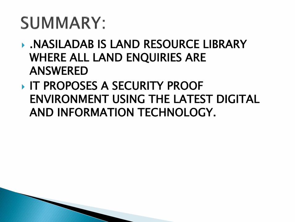
.NASILADAB IS LAND RESOURCE LIBRARY WHERE ALL LAND ENQUIRIES ARE ANSWERED
IT PROPOSES A SECURITY PROOF ENVIRONMENT USING THE LATEST DIGITAL AND INFORMATION TECHNOLOGY.


![Cornus Florida Presented by Torie Ramlose Fig [1]](https://img.pdfslide.us/doc/110x75/56649f1e5503460f94c35437/cornus-florida-presented-by-torie-ramlose-fig-1.jpg)

