Embed Size (px)
Citation preview
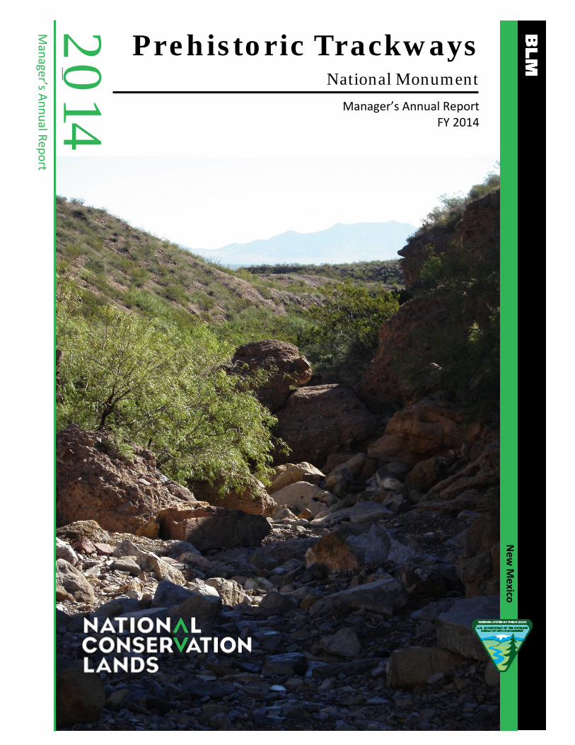
Prehistoric Trackways National Monument
Manager’s Annual Report FY 2014
2014 M
anager’s Annual Report
New
Mexico

1
Table of Contents
1 Prehistoric Trackways Profile 2
2 Planning and NEPA 5
3 Year’s Projects and Accomplishments 7
4 Science 10
5 Resources, Objects, Values, and Stressors 11
6 Summary of Performance Measures 16
7 Manager’s Letter 17

2
Prehistoric Trackways Profile Designating Authority
Designating Authority: Omnibus Public Lands Management Act of 2009
Date of Designation: March 30, 2009 Acreage
Total Acres in Unit BLM Acres Other Fed. Acres State Acres Other Acres
5,280 5,280 0 0 0
Contact Information Unit Manager Phone E-mail Mailing Address
Bill Childress 575-525-4499 [email protected] 1800 Marquess Street, Las Cruces, NM 88005
Field Office District Office State Office
N/A Las Cruces District Office
New Mexico State Office
Budget Total FY14 Budget Subactivity 1711 Other Subactivities’
Contributions Other Funding
$265,306 $265,306 $265,306 $265,306
1

3
Map of Prehistoric Trackways National Monument

4
Managing Partners N/A Staffing
In FY 2014, there was one full time permanent park ranger dedicated solely to the Monument. In addition, Las Cruces District staff who work part time within the Monument include: the Las Cruces District Manager (who performs the Monument Manager functions); supervisory recreation/cultural resources specialist; wildlife biologist, rangeland management specialist; and two law enforcement rangers. The Las Cruces District Office National Environmental Policy Act (NEPA) planner was the lead for the interdisciplinary team (ID Team) completing the resource management plan (RMP) for the Monument, and worked for approximately 2-months on the project.

5
Planning and NEPA Status of RMP In December 2014, the ID Team completed the Proposed Final RMP. After careful and thorough consideration of target shooting issues in the Monument, including consulting with local and regional shooting sports enthusiasts in accordance with the terms of the BLM-Shooting Sports Roundtable Memorandum of Understanding, the Proposed RMP was approved. Following protest resolution (four protests were received), the record of decision could be finalized by summer 2015. Status of Activity Plans During development of the RMP, the BLM developed no activity level actions. Status of RMP Implementation Strategy The BLM will develop an implementation strategy. Key NEPA Actions and/or Project Authorizations The only NEPA analysis the BLM carried out in FY 2104 was an environmental assessment for a paleontological excavation permit to the New Mexico Museum of Natural History and Science, Smithsonian Institution, National Museum of Natural History, and University of California, Berkeley. The proposed excavation is of “Site Flood,” through shovels, hammers, and chisels. The expectation is the recovery of hundreds of hand size or smaller fossil plant specimens. “Site Flood” is a very unusual, unique, and scientifically-important fossil plant locality that preserves foliage (primarily cones), some of it exceptionally well (cuticle is present), of land plants that floated into a shallow sea during the Early Permian (about 280 million years ago). No other such fossil plant resource is known in the Monument or any other New Mexico Permian local. Reconnaissance collecting at the site suggests both the presence of new morphology and new taxa of great scientific importance to paleobotany (Coniferopsid tree trunks preserved in sabkha facies in the Permian [Sakmarian] Community Pit Formation in south-central New Mexico,U.S.A, Falcon-Lang, H., e.t al.).
2

6
A piece of petrified wood found in the Monument.

7
Year’s Projects and Accomplishments General Accomplishments To provide for the safety of Monument visitors, the BLM closed a parking area used for recreational shooting (known as the air-down area because 4WD vehicles decrease their air pressure here before driving into the Monument). Recreationists use this area to set off to hike, bike, and drive off-highway vehicles. The closure was via a temporary closure Federal Register notice published on September 24, 2014. This closure has allowed Monument staff to reinstate BLM-led guided hikes and school field trips in the fall and winter of 2014. Dona Ana Groundworks led and funded three National Public Lands Day events. One day was dedicated to trash pick-up, one day to sign installation, and one day to trail work. Youth helped promote and organize the event and were bussed in from surrounding communities.
3
A group doing trail work for a National Public Lands Day event at the Monument.

8
Current Areas of Focus In late 2013, the BLM began assessing the hazards of shooting in the Monument, and developing strategies to mitigate those hazards. BLM law enforcement rangers have documented stray bullets in this area. The BLM received numerous contacts from the public requesting that target shooting cease in the area. These visitors stated that they use the area less than they would like to because of concern for their safety. Monument visitors usually leave the area when target shooters are present. However, sometimes they would park while no shooting was taking place, and then have to return to their cars after target shooters arrived in their absence. These visitors returned uncomfortable and fearful they would have to pass through a shooting zone. The BLM ceased sponsoring organized events at the Monument due to safety considerations. The loss of the organized events was disappointing to the public and schools. In FY 2014, the BLM determined the best management practice was to close the area to shooting. The BLM was able to reinstate BLM-led guided hikes and school field trips. Education, Outreach, and Interpretation
Interpretation:
There are few formal on-site interpretive facilities in or adjacent to the Monument. The BLM installed an informational wayside exhibit at the beginning of a visitor created ridgeline trail leading into the Monument. There are no designated trails leading to localities interpreting the resources of the Monument. There is a visitor-created trail to the site known as the “Discovery Site” that is marked by an outdated informational sign. There are plans to update the signs with more up-to-date informative exhibits.
In previous years park rangers led guided hikes for the public approximately twice a month on Saturdays (weather permitting). The park rangers also regularly gave programs for local community groups and partnering agencies, and hosted field trips. Because of safety hazards in the area due to target shooting, the BLM ceased hosting guided hikes during FY 2014, and limited public outreach to offsite presentations and in-classroom visits by park rangers. With the initiation of the shooting closure, the BLM has begun to resume guided hikes.
Education Initiatives:
The Monument is a Hands on the Land site. During the year, the Monument hosted 25 formal education events, reaching thousands of students and teachers (pre-K thru college level). These events were comprised of outdoor classroom activities, public land service learning projects, professional development for educators (non-credit), after-school programs, in classroom visits and programs, and day camps. The participating schools for these included Desert Hills Elementary, Mesa Middle Schools, White Sands Elementary, Picacho Elementary, Los Montaños High School, Lynn Middle School, Hillrise Elementary, Fairacres Elementary, Hermosa Heights Elementary, Tombaugh Elementary, and Loma Heights Elementary.

9
Partnerships
Monument partner organizations include: Las Cruces Public School District; Gadsden School District; New Mexico State University (NMSU) STEM Program; Take It Outside New Mexico (U.S. Forest Service, National Park Service, Asombro, New Mexico State Parks, et. al.); Paleozoic Trackways Foundation; Las Cruces Museum of Nature and Science (LCMNS); and New Mexico Museum of Natural History and Science.
In Take it Outside, NM, the BLM partnered to create a program called “Passport to Outdoor Fun,” in which families visit four out of eight dedicated sites, answer questions, and get stamps. They then send the completed passports to get a patch and are entered to win a prize. Schools also were awarded transportation funds to go to the different sites. If classes entered a sharing project, their teachers were entered to win environmental educational supply prizes. It was a great initiative to get families outdoors learning and having fun.
The BLM continues to work closely with LCMNS to display and interpret the fossil resources in the City of Las Cruces. In 2012, a keystone display was opened in the LCMNS, which showcases one of the significant trace fossils collected from the Monument. The LCMNS functions as a primary visitor stop for the Monument, and LCMNS staff further provide guidance to those wishing to visit the Monument. The BLM also continues to work with the Paleozoic Trackways Foundation on opportunities to highlight the resources, objects, and values of the Monument.
Volunteers There is not a formal volunteer program for the Monument. In the next few years, the BLM plans on developing a docent program as well as a site steward program to help interpret and protect the resources of the Monument. Dona Ana Groundworks held three National Public Lands Day events at the Monument. One day was dedicated to trash pick-up, one day to sign installation, and one day to trail work. Youth volunteers organized and promoted all of these events. Land (or Interests in Land) Acquisitions
The Monument does not have legal public access; however, the primary access route that is utilized by the public has not been restricted by the private landowner. The BLM is working with the private landowner to establish a permanent legal access.

10
Science Science Science Plan: The New Mexico Museum of Natural History and Science completed recommendations for a scientific research and outreach plan for the trackways. The BLM staff will use those recommendations to develop a science plan within 3-years. NMSU CESU Geological Studies: Through a National Landscape Conservation System research grant, the BLM partnered with New Mexico State University’s Geology Department to do geological research at the Monument. The objective of this project was to conduct three studies of geological attributes within the Monument. The studies will result in greater scientific understanding of the geology of the Monument, but will also result in interpretation of that geology in the form of a wayside exhibit and a public guide. The scientific objectives are: (1) to study the Permian algal “reefs” with the strata of the Monument; (2) to conduct field and laboratory research on the basalt lava flows and vents within the Monument; and (3) to analyze the uplift history of the Robledo Mountains using apatite fission-track dating of rhyolite sills. The research is ongoing, and the exhibit is in its planning stages. Excavation: The New Mexico Museum of Natural History and Science, Smithsonian Institution’s National Museum of Natural History, and the University of California, Berkeley have requested a permit to excavate a paleontological site within the Monument. It is believed that the proposed excavation site will yield hundreds of fossil plant specimens of scientifically-important fossil plant foliage (primarily cones), some of it exceptionally well (cuticle is present), of land plants that floated into a shallow seaway during the Early Permian. Reconnaissance collection at the site suggests both the presence of new morphology and new taxa of great scientific importance to paleobotany.
4

11
Resources, Objects, Values, and Stressors Paleontological Resources
The fossil resources in the Monument are predominantly Permian Age fossil material, but may be expanded to encompass subsequent discoveries.
The New Mexico Museum of Natural History and Science is continuing to do inventory work within the Monument. The Monument is 5,280 acres, and about half (2640 acres) has been inventoried, possessed, and monitored.
Status and Trend Table Status of Resource, Object, or Value Trend
Good Stable
Inventory, Assessment, Monitoring Table Acres in Unit Acres Inventoried Acres Possessing Object Acres Monitored in FY14
5,280 acres 2,640 acres 2,640 acres 2,640 acres
Stressors Affecting Paleontological Resources
The primary stressors to paleontological resources are environmental (runoff in arroyos from rainstorm events can erode otherwise stable sites), and human disturbances (inadvertent impacts from vehicles unknowingly damaging exposed sites), and intentional theft (BLM presence has greatly reduced this occurrence; however, it is possible that occasional specimens are removed from sites).
5

12
Scientific Resources
The BLM is conducting science-based research paleontological and geologic resources, especially Permian Age fossils and their geologic context.
Status and Trend Table Status of Resource, Object, or Value Trend
Fair Improving
Inventory, Assessment, Monitoring Table Acres in Unit Acres Inventoried Acres Possessing Object Acres Monitored in FY14 5,280 N/A 5,280 N/A Stressors Affecting Scientific Resources
The entire 5,280 acres in the unit can be utilized by a variety of scientific endeavors; however, much of the current interest is associated with the paleontological and geologic resources.
The primary stressor to the scientific resource is associated with lack of regular monitoring and patrolling of sites that are of particular interest to scientists.
A scientist collecting data.
13
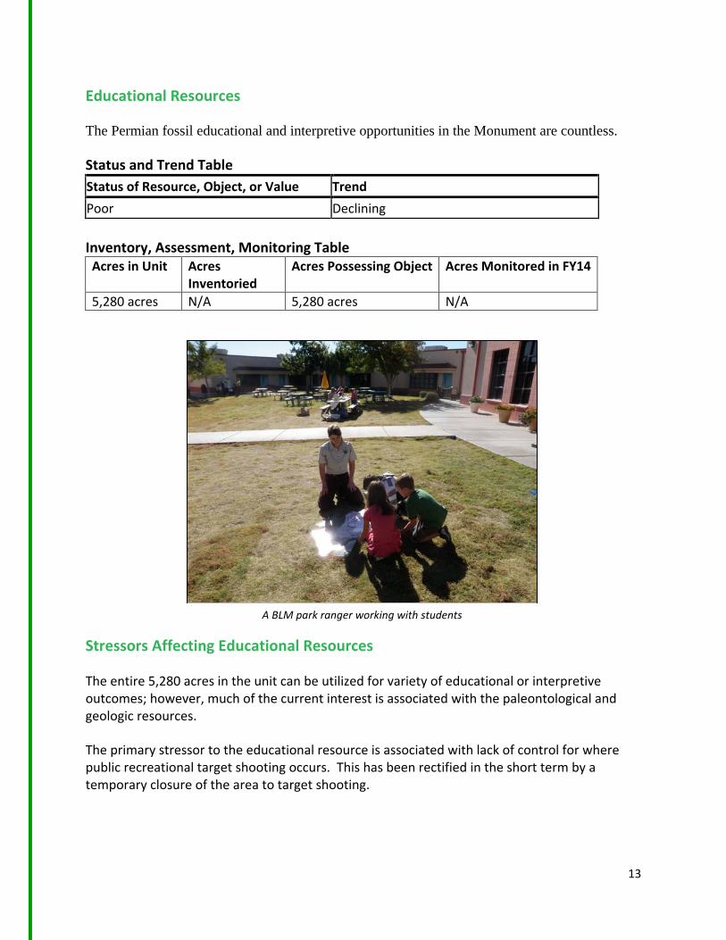
Educational Resources
The Permian fossil educational and interpretive opportunities in the Monument are countless.
Status and Trend Table Status of Resource, Object, or Value Trend Poor Declining Inventory, Assessment, Monitoring Table Acres in Unit Acres
Inventoried Acres Possessing Object Acres Monitored in FY14
5,280 acres N/A 5,280 acres N/A Stressors Affecting Educational Resources
The entire 5,280 acres in the unit can be utilized for variety of educational or interpretive outcomes; however, much of the current interest is associated with the paleontological and geologic resources.
The primary stressor to the educational resource is associated with lack of control for where public recreational target shooting occurs. This has been rectified in the short term by a temporary closure of the area to target shooting.
A BLM park ranger working with students

14
Recreational Resources
The Monument is managed to enhance the recreational uses related to the enjoyment, appreciation, and protection of the fossil resources and their geologic context.
Status and Trend Table Status of Resource, Object, or Value Trend
Static Stable
Inventory, Assessment, Monitoring Table Acres in Unit Acres
Inventoried Acres Possessing Object Acres Monitored in FY14
5,280 acres N/A 5,280 acres N/A Stressors Affecting Recreational Resources
The primary stressor associated with the dispersed recreation use by hikers is uncontrolled public recreational target shooting. This has created uncertainty and trepidation by local hikers and users of the unit. This has been mitigated by a temporary closure of the area to target shooting.
Hikers enjoying the Monument.

15
Scenic Resources
The Monument contains the distinct geologic exposures of the Robledo Mountains in the context of the Permian fossils.
Status and Trend Table
Inventory, Assessment, Monitoring Table Acres in Unit Acres
Inventoried Acres Possessing Object Acres Monitored in FY14
5,280 5,280 5,280 5,280 Stressors Affecting this Resource, Object, or Value
In 2009, the BLM inventoried the entire 5,280 acre unit for its visual and scenic qualities. Currently, no stressor to scenic values exists. Any future surface disturbing activities will be evaluated against the visual resource management class management prescriptions, and the BLM will apply appropriate mitigation when necessary to maintain the scenic values.
Status of Resource, Object, or Value Trend
Good. Stable
Visitors enjoying the scenic qualities of the Monument.

16
Summary of Performance Measure
Summary Table*
Resource, Object, or Value Status Trend
Paleontological Good Static
Scientific. Fair Improving
Educational. Poor. Declining
Recreation Fair Stable
Scenic Good Stable
*This table is a synthesis of the individual object/value status tables in the “Objects, Values, and Stressors” section.
6

17
Manager’s Letter Dear Friends of Prehistoric Trackways National Monument, The Prehistoric Trackways National Monument is a unique resource with one of the most important Permian fossil trackways localities in the world. The Monument has the potential to serve the local and national communities as an educational and scientific research resource that will help future generations to better understand our world’s history. On March 30th, we were excited to celebrate the 5th anniversary of the Monument’s designation. The Paleozoic Trackways Foundation hosted a celebration at the Las Cruces Museum of Nature and Science. Many members of the community attended, and it was great to see how valued the Monument is to the local community. This next year holds a lot of promise to get much done at the Monument. We hope to finish the resource management plan, and start developing the activity level plan, and look forward to continuing educational field trips and guided hikes. Scientific research continues in the Monument, with more research happening for “Site Flood” by scientists from the New Mexico Museum of Natural History, the Smithsonian, and the University of California, Berkley. New Mexico State University will continue in its research for dating the geological layers. Altogether, we are looking forward to the next few years as we implement projects to better protect, understand, and interpret the 280 million year old fossils of the Monument. Thank you, Bill Childress BLM, Las Cruces District Manager
7
18
Prehistoric Trackways National Monument Bureau of Land Management Las Cruces District Office 1800 Marquess Street Las Cruces, NM 88005 Phone: 575-525-4300 March 9, 2015
The mention of company names, trade names, or commercial products does not constitute endorsement or recommendation for use by the federal government.