Embed Size (px)
Citation preview

Pre - Feasibility Report of Chintalapudi Lift Irrigation Scheme, A.P.
Water ResourcesDepartment of Andhra Pradesh 1
GOVERNMENT OF ANDHRA PRADESH WATER RESOURES DEPARTMENT
CHINTHALAPUDI LIFT IRRIGATION SCHEME
PRE FESIBILITY REPORT
Project Proponent
P.G.V. Vijay Kumar, Chief Engineer
Godavari Delta System Dowlaiswaram
Andhra Pradesh – 533125

Pre - Feasibility Report of Chintalapudi Lift Irrigation Scheme, A.P.
Water ResourcesDepartment of Andhra Pradesh 2
Chinthalapudi Lift Irrigation scheme on River Godavari
Near Tadipudi (V) in West Godavari district
1.0 INTRODUCTION
The Chinthalapudi Lift Irrigation Scheme proposed by the Water Resources Department of
Andhra Pradesh has given thrust to provide drinking water facilities to about 25.94 lakhs
population in 410 habitations. Besides the scheme provides assured irrigation facilities to
480000 acres in upland area of West Godavari and Krishna districts of Andhra Pradesh.
The area covered by the ayacut of Chinthalapudi L.I. Scheme constitutes the part of upland
area in the West Godavari and Krishna Districts covering an extent of 835 Sq. Kms. The area
is plain with occasionally High grounds and comparatively scarcely populated with a total
population not exceeding 25.94 Lakhs. The Agriculturist is the child of the area. His entire
life style veers round the bounties that nature offers in the vicinity. The passage of the time
has put tremendous pressure on the farmer and the environment around him. Levelling of the
areas, cultivating whatever land is available and satisfying with what the land gives are all but
a few indications of the hazards the man of the soil is put to. Unemployment looms large on
the agriculture laborer in West Godavari and Krishna Districts with de-escalation of working
opportunities. There are around 15 lakh agricultural laborers in the districts who are directly
or indirectly dependent on farm labour wages.
The ayacut proposed under this L.I. Scheme is a drought stricken area, almost all the people
are backward and below poverty Line. There is no other skill on which the people of this
region can depend upon for economic development except irrigation, which is at very poor
level. There are tanks in the area fed by small catchments of their own. The vagaries of the
rainfall and frequent failure of monsoon make the tanks dry. Though every land under the
tanks is cultivated ayacut in these areas already brought under irrigation entirely depends
upon rains and therefore the crop production is not assured in most cases. In spite of this, the
struggle for cultivation did not die. The farmers are attempting paddy during the kharif
season and other dry crops during the Rabi season. Even though, there are frequent failures,
facing more struggles in cultivation never made them obviate from it and they are continuing
the cultivation by changing the cropping pattern to stake their fortunes year after year.

Pre - Feasibility Report of Chintalapudi Lift Irrigation Scheme, A.P.
Water ResourcesDepartment of Andhra Pradesh 3
The proposed ayacut of the Chinthalapudi Lift irrigation scheme covers in upland areas of
following 15 mandals in West Godavari district and 18 mandals in Krishna district
respectively.
S No. Name of the
District
Details of mandals proposed to get benefitted
1 West Godavari 1. Gopalapuram
2. Koyyalagudem
3. Buttaigudem
4. Jangareddigudem
5.Jeelugumilli
6. Chinthalapudi
7. T. Narasapuram
8. Lingampalem
9. Kamavarapukota
10. Denduluru
11. Pedavegi
12. Devarapalli
13. Dwaraka Tirumala
14. Nallajerlla
15.pedapadu
2 Krishna 1. Vissannapeta
2. A. Konduru
3. Tiruvuru
4. Gampalagudem
5. Reddygudem
6. Mylavaram
7. G.Konduru
8. Vijayawada
9. Ibrahimpatnam
10. Kanchikacherla
11. Veerulapadu
12. Bapulapadu

Pre - Feasibility Report of Chintalapudi Lift Irrigation Scheme, A.P.
Water ResourcesDepartment of Andhra Pradesh 4
13. Gannavaram
14. Nuziveed
15. Agiripalli
16. Chatrai
17. Musunuru
18. Unguturu
The ayacutdars of these regions are agitating for early benefits and requesting for an alternate
pumping scheme. The Torrigedda pumping scheme, Venkatanagaram pumping Scheme,
Tarakarama Ramavarapu Ava L.I. Scheme, Tadipudi and Pushkara LI Schemes and the
Chagalnadu L.I. Scheme were constructed on Godavari River and successfully functioning
and elevating the Economical standards of the local people. Perhaps getting inspiration from
their adjacent brothers, the ayacutdars of the Chinthalapudi L.I. Scheme are also agitating for
supplementing water to the Reservoir in the Area and for irrigation facilities to other areas by
lifting water from Godavari river which is flowing adjacent the proposed ayacut of the
scheme.
The scheme provides early benefits and avoids uncertain conditions and backwardness of
these areas.

Pre - Feasibility Report of Chintalapudi Lift Irrigation Scheme, A.P.
Water ResourcesDepartment of Andhra Pradesh 5
2.1 Identification of the Project Proponent
The Water Resource Department under Government of Andhra Pradesh is responsible for the
development of irrigation schemes. The project details and various components are being
carried out under the Chief Engineer, Godavari Delta System, Water Resources Department,
Dowalaiswaram, Andhra Pradesh – 533125.
2.2 Brief Information about the Project
SALIENT FEATURES AT A GLANCE
1. Name of the project : Chinthalapudi Lift Irrigation Scheme
2. Location : On River Godavari at Km.27.20 of A.G.R.B
Latitude : 170 09’ 2” N
Longitude : 810 39’ 49” E
3. Project Cost : Rs. 4909.80 Crores
4. Ayacut : 194253 Ha. (480000 Acres)
5. Demand : 53.50 TMC
6. Discharge : 194.52 Cumecs (6870 Cusecs)
7. Minimum draw down level : +14.00 M
8. Pump and Pressure Main Details
i. Pressure Main from Head Work pump : 18 Nos of Pumps & 11 No. of
House to Delivery cistern : 3200 mm dia MS for a Length of 3 km
ii. Pressure Main from 2nd stage pump : 14 Nos of 3000 mm dia MS for a
House to delivery cistern : Length of 3.30 km.
iii. Static from 3rd stage : 6 No’s of Pumps and 4 No. of rows of 3000mm
Pump house to Reservoir : diameter M.S Pipe for a length of 1.400 km
9. Mandals Benefited : 33 Mandals.
10. Villages Benefited : 410 villages.
11. Power required : 396 MW :
12. Jalleru Reservoir
a) Gross storage : 20.50 TMC
b) Dead storage : 0.940 TMC
c) Live storage : 19.56 TMC
d) Full Reservoir Level : +144.000 m.
f) TBL : +149.000 m.

Pre - Feasibility Report of Chintalapudi Lift Irrigation Scheme, A.P.
Water ResourcesDepartment of Andhra Pradesh 6
2.3 Need for the Project and its importance to the country and or region
The quality of ground water in West Godavari district areas like Jangareddygudem,
Denduluru, Eluru, Peddapadu and Buttaigudem has shown high nitrates and brackish nature.
SAR is low and salinity hazard is high. Corrosion problem exists in Buttaigudem,
Koyyalagudem, Devarapalli, Nallajerla and Dwaraka Tirumala.
The quality of ground water in Krishna district areas like Kanchikacherla, Vissannapeta,
Gampalagudem is found to have high EC values more than permissible limits. In A.Konduru,
Tiruvuru, Gampalagudem, Kanchikacherla, Nuziveed, Gannavaram and Bapula padu
mandals fluoride problem is persistent not suitable for domestic purposes.
In order to meet the drinking water needs of 25.94 lakh people in 410 habitations and to meet
irrigation water demand for 1,94,253 ha the Chinthalapudi Lift Irrigation Scheme is proposed
by the Government of Andhra Pradesh.
2.4 Demand and Justification
Provide drinking water to the about 25.94 lacks population and Irrigation is proposed over an
extent of 1,94,253 Ha. (4,80,000 Ac) and the requirement of waters is arrived by the modified
Penman Method. The rainfall data for this purpose is taken from the four rain gauge stations
at Polavaram, Kovvuru, Jangareddigudem and Chinthalapudi which are influencing the
command area. The Evapotranspiration rates are taken from the Meteorological data obtained
at Central Tobacco Research Institute, Katheru village, Rajahmundry.
2.5 Employment Generation (Direct and Indirect) due to the project
The project will benefit the socio- economic development of the West Godavari and Krishna
districts, since agriculture is the only sector giving employment and there are presently no
other major employment opportunities like industries, construction etc. in the project area.
The proposed project will involve labour for construction of reservoir, excavation of canal
water distribution systems and other infrastructure etc. This is likely to be an important sector
of employment for the poor, especially the landless rural poor.

Pre - Feasibility Report of Chintalapudi Lift Irrigation Scheme, A.P.
Water ResourcesDepartment of Andhra Pradesh 7
Increased employment in agriculture due to increased cropping intensity, increased crop area
and output from irrigation. Rural poverty levels may therefore be reduced by increased
employment opportunities.
Employees required for the proposed project during construction phase indirectly about 1500
and directly about 2000 in those skilled persons nearly 185 and unskilled persons nearly
about 1815.
From the proposed project 15 lakh agricultural laborers in the districts who are directly or
indirectly dependent on farm labour wages are benefited and besides this employees required
during operation phase directly about 350 and indirectly nearly 100.

Pre - Feasibility Report of Chintalapudi Lift Irrigation Scheme, A.P.
Water ResourcesDepartment of Andhra Pradesh 8
3 PROJECT DESCRIPTION
3.1 Location (map showing general location, specific location, and project boundary &
project site layout) with coordinates.
The site of the off-take point from where the Godavari waters are proposed to be drawn is
situated at Tadipudi village, Tallapudi Mandal located on the right side of river Godavari on
the road connecting Vijjeswaram to Polavaram (at km 27.20) in West Godavari District,
Andhra Pradesh. Kovvur is the nearest Railway Station on Chennai – Kolkata railway line at
a distance of 20 km. Another nearest big railway station, Rajahmundry is situated on the
other side of river Godavari in East Godavari district. The longitude and latitude of the
proposed scheme are as follows:
Longitude: 810 - 39’ – 49” E
Latitude: 170 - 09’ -02” N
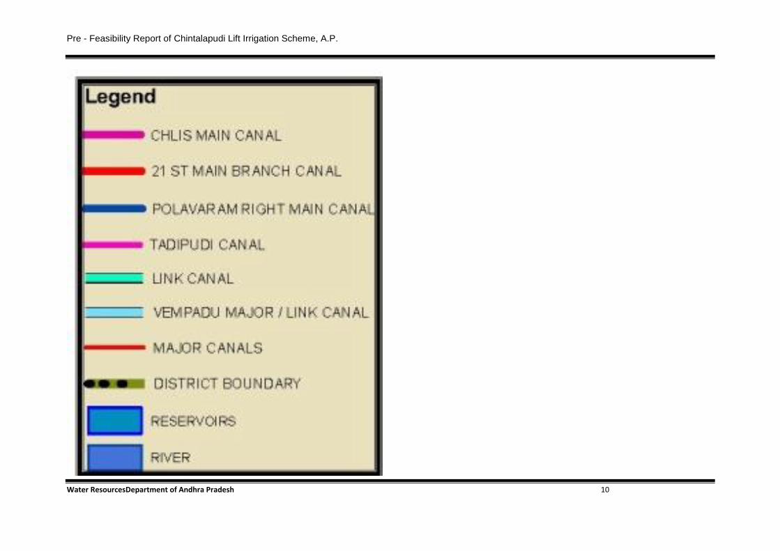
Location Map – CLIS

Pre - Feasibility Report of Chintalapudi Lift Irrigation Scheme, A.P.
Water ResourcesDepartment of Andhra Pradesh 9
Pre - Feasibility Report of Chintalapudi Lift Irrigation Scheme, A.P.
Water ResourcesDepartment of Andhra Pradesh 10

Pre - Feasibility Report of Chintalapudi Lift Irrigation Scheme, A.P.
Water ResourcesDepartment of Andhra Pradesh 11

Pre - Feasibility Report of Chintalapudi Lift Irrigation Scheme, A.P.
Water ResourcesDepartment of Andhra Pradesh 12

Pre - Feasibility Report of Chintalapudi Lift Irrigation Scheme, A.P.
Water ResourcesDepartment of Andhra Pradesh
13
3.2 Details of alternate sites considered and the basis of selecting the proposed site,
particularly the Environmental considerations gone should be highlighted.
3.2.1Choice of the Project Site
The Chinthalapudi L.I. Scheme is meant to provide irrigation facilities for the following areas
S No. Name of the district Details of proposed mandals to get benefitted
1 West Godavari 1).Buttayagudem
2). Jeelugumilli
3). Koyyalagudem
4).T. Narsapuram
5). Denduluru
6). Pedavegi
7). Devurapalle
8). DwarakaTirumala
9). Gopalapuram
10). Nallajerla
11).Jangareddigudem
12). Chinthalapudi
13)Kamavarapukota
14.Lingapalem
15) Pedapadu
1. Vissannapeta
2. A.Konduru
3. Tiruvuru
4. Gampalagudem
5. Reddygudem
6. Mylavaram
7. G.Konduru
8. Vijayawada
9. Ibrahimpatnam

Pre - Feasibility Report of Chintalapudi Lift Irrigation Scheme, A.P.
Water ResourcesDepartment of Andhra Pradesh
14
10. Kanchikacherla
11. Veerulapadu
12. Bapulapadu
13. Gannavaram
14. Unguturu
15. Nuziveed
16. Agiripalli
17. Chatrai
18. Musunuru
Mandals of West Godavari and Mandals of Krishna districts, where there is an immediate need.
Various alternatives are examined for location of pump houses, pressure mains and Canals to
convey waters from river Godavari to upland areas of the above mandals.
3.2.2 Alternatives of the Project
By conducting preliminary and reconnaissance surveys, a suitable location has been finalized at
27.20 km on AGRB near Tadipudi village, Tallapudi mandal, West Godavaridistrict against
which the first site is proposed now at Tadipudi (V) at 28.50 km of Akhanda Godavari right
Bank to reduce the length of costly pressure main by 0.20 km and also avoids village habitations
of Pochavaram and Tupakulagudem Village.
3.2.3 Reasons for the choice of the layout of the project
In this vicinity, a number of sites have been investigated. The present site is selected because of
the following advantages.
i) The pump house and the feeding units can be located without hindrance to the busy
localities such as Kovvur and other valuable lands.
ii) Taking of waters through pressure main and through open channels is more feasible.
iii) The length of pressure main (which is the costliest item) is to minimum possible extent.
iv) Good foundation soils required for structures are available.

Pre - Feasibility Report of Chintalapudi Lift Irrigation Scheme, A.P.
Water ResourcesDepartment of Andhra Pradesh
15
3.3 Size or magnitude of operation
The proposed project provides drinking water to the about 25.94 lacks population and One of the
special features of the scheme is that the entire ayacut of 1,94,253 Ha (4,80,000 Ac) is already
under cultivation either from the insufficient waters from tanks and canals under NSP left canal
or entirely depending upon the rain fall. Out of the proposed 1,94,253 Ha (4,80,000 ac), an extent
of 8200 Ha (20262 ac) is already under paddy cultivation under tanks and 41375 Ha (102237 ac)
is in dry crops purely depending upon rain fall. The ayacut under tanks required fifty percent
supplementation. The remaining ayacut is situated beyond the periphery of tanks ayacut and as
such irrigation for dry crops like chilies, Groundnut and Maize is proposed.
3.4 Project description with process details (a schematic diagram/flow chart showing the
project layout, components of the project etc. should be given)
The daily requirements for the command area with pumping are calculated for the crop period
from July to October. The daily surplus waters spilling over the existing Sir Arthur Cotton
Barrage were also computed. The working tables for utilization of the surplus waters are
prepared for a period of 54 years i.e. from 1962 to 2015. The overall dependability of the scheme
works out to be 76.32%. However it is observed that the scheme achieves 97% to 100% during
the months of August, September and October where the pumping of water is 90 days only. This
small percentage of failure in non-surplus days can be taken care by utilizing the stores water
from the Balancing Reservoir (Jalleru Reservoir)
Since it is a pumping scheme, the terminology has been suitably changed relevant to the
pumping schemes.
a) Pump House: One pump house proposed at 27.20 km of Akhanda Godavari Right Bank on
U/s of S.A.C Barrage, the pump house is located very near to the water course of River Godavari
to draw the water directly into the sump by providing a suitable groine.
The sill level of both of the Pump houses is +10.00 m. The size of the pump house is 130m x25
m. Each pump draws 14 cumecs (494.41 cusecs) through open channel from the river Godavari.
The bottom levels of sump of Pump House are to be +7.50 m to have a clear depth of 2.50 m for
better performance of the vertical turbine pumps. The bottom level of foundation of sump will be

Pre - Feasibility Report of Chintalapudi Lift Irrigation Scheme, A.P.
Water ResourcesDepartment of Andhra Pradesh
16
proposed at (-) 3.50 m, where the hard strata met. It is not possible to lay raft for construction of
pump house at that level. Hence pump house is proposed to construct by diaphragm wall. The
foundation pump house accommodates 18 Nos. vertical turbine pumps with each pump of
capacity 6390 HP. The floor level for both of the pump houses is +22 m.
b) Leading channel: The water drawn from the pump house will be lifted from +12 m to +40 m
into the delivery cistern and runs for a length of 13.22 km in new alignment and then across the
alignment of Polavaram Irrigation Project right main canal at 14.56 km.
c) Main Canal: The water drawn from the 2nd
stage pump house will be lifted from +40 m to
+123.25 m into the delivery cistern and runs for a length of 106.300 km .The bed level, F.S.L.
and T. B.L. of main canal at delivery cistern are +116.800,+123.50,+124.25 m respectively.
d) Storage Reservoir: Two lifts in STAGE-III are proposed at 30 & at 33 km on main canal to
deliver the water into the Jalleru reservoir for storage and Irrigation.
e) Pumps, Motors and other accessories: All the pumps and motors in the pump house of
Stage-I, Stage-II, Stage-III are proposed to be erected for the design floor levels.
f) Pumps for Main canal and pressure main: A pump house and 18 Nos of vertical turbine
pumps each of capacity 6390 HP are proposed of diameter 3.2m to deliver a discharge of
194.52 cumecs (6862 Cusecs) by lifting water from +14 m to +40 m with a total static head of
26.00 m into Leading channel. The length of the pressure main is 3.0 km. Since the pressure
main is subjected to a pressure ranging from 2 to 6 kg/cm2, M.S concrete pipes are proposed. As
per the practice, these pipes are manufactured in lengths of 4 to 6 m. They are coupled by socket
and spigot joint. High stiffened flexible rubber ring is provided between male and female ends to
arrest the leakage. Every row of the pressure main is provided with the required zero velocity
valves and Air cushion valves at suitable locations to safeguard the pipes from water hammering.
The entire pressure main will be resting on a 450 mm thick sand cushion and all the pipes will be
buried with a minimum soil cover of 1000 mm
g) Sub-Stations: The Peak demand of electrical power for is 396 MW. It is proposed to provide
a separate 132/33KV lines from Sub Stationn which is to be constructed at Guddigudem Village
and from Exisiting Kamavarapukota Sub-station.

Pre - Feasibility Report of Chintalapudi Lift Irrigation Scheme, A.P.
Water ResourcesDepartment of Andhra Pradesh
17
h) Tanks and Balancing Reservoirs: Jalleru Balancing reservoir was proposed with storage
capacity of 20.5 TMC which is 60% of total demand in a year that can be safely be stored in
reservoir.
i) Canal: The main canal of length 106.30 km discharging 194.52 cumecs (6869.50 C/S) is
proposed. The ayacut proposed under the main canal is 1,94,253 ha (4, 80,000 Acres). Drinking
water facility is provided to a population of 25.94 Lakhs in 410 village’s enroute at the rate of
140 liters per capita per day.
j) Formation of Jelleru Reservoir
The scheme also envisages formation of balancing reservoir to store 20.50 TMC of water by 3rd
stage lift near Rowthugudem village West Godavari district.
3.5 Raw material required along with estimated quantity, likely source, marketing area of
final product/s, mode of transport of raw material.
Field investigations for construction materials prior to construction of the scheme are chiefly
confined to sand, stone for masonry. Rough stone for dry packed revetments and for aprons,
coarse aggregate for plain and reinforced cement concrete and gravel for protection works. From
the available deposits in the proximity of the proposed scheme, the sources are selected keeping
in view the physical characteristics and composition etc. required as per Andhra Pradesh
standards specifications. The other materials such as cement, steel, wood, A.C. sheets, shell lime,
bricks, gravel and reinforced cement concrete Hume pipes etc. are proposed to be procured from
the reputed companies, confirming to Andhra Pradesh detailed standard specifications.
3.5.1 Soil and Rockfill
Soils for Jalleru reservoir will be collected from the submergence area for forming the earth
bund.
3.5.2 Sand
Clean, sharp, angular type fine aggregate (resulting from natural disintegration of rock which has
been deposited by river Godavari on its right bank composed of hard silicon material and free
from deleterious materials satisfying Andhra Pradesh standard specification No.110) is available

Pre - Feasibility Report of Chintalapudi Lift Irrigation Scheme, A.P.
Water ResourcesDepartment of Andhra Pradesh
18
in large quantities near Prakkilanka village which is about 3 km from the head works of the
scheme.
3.5.3 Rock and Aggregates
Good variety of “H.G. Metal” which forms good stone confirming to Andhra Pradesh standard
specifications No.107 is available at Duddukuru Village, 21 km from Head Works. Bulk quantity
of the stone in these quarries is already utilized for the construction of irrigation works.
Sufficient quantity is available for actual utilization on R.C.C. & C.C works of the present
scheme. Alternative source that is found to be suitable for revetment and apron is selected from
Tupakulagudem village, which is about 5 Km from the Head Works. This stone falls under the
category other than granite variety and the quarry is an approved one by R&B department and
Irrigation. Depending upon the necessity, this stone will be utilized for dry packed revetment
works of the canal of the scheme.
Stone for concrete and for reinforced cement concrete works
Coarse aggregate of hard broken granite of different sizes, for CR Masonry and R.R. Masonry is
available at Katheru at 36 km from Head Works in plenty and the same is selected for
construction of C.R. Masonry and R.R. Masonry.
3.5.4 Common burnt clay bricks
The bricks shall be hand or machine molded confirming to specification No. 102 of Andhra
Pradesh standard specifications. Best quality of bricks are available at Bobbarlanka(v). The same
is proposed to be used for the project works.
3.5.5 Puzzalona
Puzzalona are not proposed for the works of the scheme, if any other material such as G.I. Pipes,
pipe specials etc. are required in small quantities, they shall be purchased from the local
marketing agents of approved manufacturers.
3.5.6 Cement
Port land cement confirming to I.S269-1967 is proposed to be procured from the reputed
manufacturing companies in A.P.

Pre - Feasibility Report of Chintalapudi Lift Irrigation Scheme, A.P.
Water ResourcesDepartment of Andhra Pradesh
19
3.5.7 Steel for reinforcement
Various types of steel confirming to relevant I.S. specifications as per table 126-A of Andhra
Pradesh standard specifications are proposed to be procured from stock-yard of Vijayawada of
steel Authority of India limited.
3.5.8 Scarce Material
Wood, Asbestos Cement Sheets, Shell lime etc.
Best variety of wood (Teak or country), Asbestos Cement sheet and shell lime will be selected
and purchased from local market for utilizing the same for project as the quantity required is
small.
Gravel
Best quality of gravel is available at Gajjaram, at a distance of 2 km from Head Works. This is
an approved quarry and being used for all works of Construction Circle and Irrigation Circle,
Eluru and for all other Engineering Departments. Hence, the Gravel from this quarry is proposed
for the works of the scheme.
Mild steel pipes
MS pipes with required size and strength to withstand the designed pressure are proposed to be
procured from nearest reputed manufactures at Hyderabad at a distance of 422 km from Head
Works.
Reinforced cement concrete Hume pipes
Reinforced cement concrete Hume pipes of required size and strength to withstand the designed
pressure are proposed to be procured from reputed manufacturers at Kovvuru, Nidadavolu etc.,
Mechanical and Electrical Equipment
The mechanical and electrical equipment such as pumps, motors, switch gear arrangements,
cables and equipment required for electrical sub stations etc. required for the scheme will be
procured duly calling tenders from technically qualified reputed firms.
3.6 Hydrology
Godavari is the second largest river draining in India. It originates near Triambakeswar in
Maharashtra and flows for a length of 1465 km before joining the sea in between East & West

Pre - Feasibility Report of Chintalapudi Lift Irrigation Scheme, A.P.
Water ResourcesDepartment of Andhra Pradesh
20
Godavari districts of Andhra Pradesh. Every year on average about 3000 to 4000 TMC of
Godavari flood water goes in to sea as waste. The River Godavari is the main source of the
present proposed Lift Irrigation Scheme.
Table 1 Water Requirement for CHLIS
No. Name of the Project
Discharge
Required
in Cumecs
Utilization
in TMC
1 Kovvada Project (0.40 TMC) 1.45 0.40
2
Ayacut considered in Upland areas of west
Godavari District including feeding of Jalleru
Reservoir
83.35 23.50
3 Yerrakalva Project (1.25 TMC) 4.56 1.25
4 Tammileru Project (1.25 TMC) 4.56 1.25
5 Ayacut of 21st Branch Canal of NSLBC and
Upland areas in Krishna Districts 100.6 27.10
Total Requirement 194.52 53.50
As per the Bachawat award on distribution of water among the states on River Godavari, the
balance water up to Sri Rama Sagar (Pochampadu) Project belongs to that project and the
balance water below that project can be used by the combined Andhra Pradesh. The requirement
of the existing, ongoing and future projects in the combined Andhra Pradesh is shown below.
Table 2 Water requirement of Existing, Ongoing & Future Projects
No. Name of the project Discharge Required
in Cusecs
1 Pranahita-Chevella Lift Irrigation Scheme at
Tummidihetti 20,765
2 Godavari Lift Irrigation Scheme(Devadula) 5000
3 Yellampalli 5000
4 Rajiv Sagar and Indira Sagar Lift Irrigation Scheme 1,600
5 Polavaram Irrigation Project 35,000
6 Torrigedda Lift Irrigation Scheme 180
7 Chagalnadu Lift Irrigation Scheme 232
8 Sir Arthur Cotton Barrage 10,000
9 Other Lift Irrigation Schemes 353
10 Chinthalapudi Lift Irrigation Scheme 6,870
Total Requirement 85,000

Pre - Feasibility Report of Chintalapudi Lift Irrigation Scheme, A.P.
Water ResourcesDepartment of Andhra Pradesh
21
The water flow recorded in the Godavari River Since 1978 at Dowlaiswaram indicates that more
than 85,000 cusecs of water flow was recorded for 90 days, more than 50,000 cusecs was
recorded for 108 days and more than 25,000 cusecs was recorded for 144 days in a year.
As seen from the above, there will be sufficient flood water in Godavari River for Chinthalapudi
lift irrigation scheme to Lift 6,870 cusecs (194.52 cumecs).
The scheme is a major irrigation one benefiting an ayacut of 1, 94,253 Ha (4,80,000 Acres). The
type of project is Lift irrigation scheme. The ayacut of the entire scheme will be covered in
upland area (+40 to +120 m) and present proposal is to derive early benefits. The source of
pumping to feed the ayacut is from the river Godavari and as an alternative surplus waters
spilling over the Sir Aurthur Cotton Barrage are proposed to be utilized. Thus the Hydrological
studies are confined to assess the availability of surplus waters and elevation from which these
waters can be tapped. The pond levels on the river Godavari over years and the surplus waters
passing across the barrage over the years are also maintained by the irrigation circle,
Dowlaiswaram. This data is processed to establish the feasibility and success of the scheme.
The demand of Chinthalapudi LI scheme is 1515 M Cum (53.50 TMC) only, while the surplus
waters of the river are plenty.
No Pumping will be permitted upstream of Sir Arthur Cotton Barrage from December till the
month of May to protect the interests of the ayacut of Godavari Delta. Therefore, lifting the
water is proposed in between June to November (in 90 Flood Days)
3.7 Cost and Benefits of the Scheme
The estimated cost of the project works out to Rs.4909.80 crores. The scheme provides Irrigation
facilities to an extent of 1,94,253 Ha (4,80,000 Ac) by main canal. This includes the stabilization
to an extent of 8,200 Ha (20,262 Ac) now under paddy cultivation entirely depending upon rain
fall and rest of the 72,739 Ha (1,79,738 Ac) under irrigation for dry crops in West Godavari
District. Stabilization of 70,000 acres in medium irrigation projects ayacut and 2.10 Lakh acres
under 21st branch canal of NSLBC in Krishna district.
Pre - Feasibility Report of Chintalapudi Lift Irrigation Scheme, A.P.
Water ResourcesDepartment of Andhra Pradesh
22
3.8 Environmental and Ecological Aspects of the Project
This is a pumping scheme and therefore there is no submersion of land and no rehabilitation of
persons. No forest land is involved. The ground water tables will marginally be increased in the
command area and there will not be any water logging effects in the command area since the
entire command area is generally sloppy. The construction of the project will not have any
adverse effect on the health of the people of the Villages in the area.
The project is proposed to be completed in three years. During all these three years, it will
provide continuous employment for skilled, unskilled workmen of the locality. If the required
workmen are not available, they will be imported from other places.
With the assured water supplies, the marginal farmer will be able to obtain financial assistance
from Government Agencies like D.R.D.A, I.T.D.A, NABARD and other commercial banks to
improve the methods of agriculture and the yields. With the improved financial conditions,
young and enthusiastic farmers will establish industries based on agricultural requirements. Thus
the completion of the project will help an all-round development of the area and prosperity of the
people.

Pre - Feasibility Report of Chintalapudi Lift Irrigation Scheme, A.P.
Water ResourcesDepartment of Andhra Pradesh
23
4. SITE ANALYSIS
4.1 Connectivity
The head works located near Tadipudi village of Tallapudi mandal of West Godavari district.
Andhra Pradesh. The site is situated at a distance of 20 km from Kovvuru and 30 km from
Rajahmundry town. The nearest town is Kovvuru which is well connected with neighboring
district capital and towns by road and railway line.
4.2 Topography
The site now suggested for locating the pump houses has excellent facilities to locate a pumping
scheme of present magnitude at a relatively cheaper cost. The site is situated at 27.20 km on
Akhanda Godavari right bank near Tadipudi village of Tallapudi Mandal. The soil of the
command area consists of mainly red soils and black cotton soils. Jalleru Reservoir was proposed
in command area so that they can be used as Balancing Reservoir to feed the command area in
case of Power failure or trouble in the performance of Motors.
The command area is gradually, sloping with vegetation and cultivable patches of sand, Sandy
loamy, red soils with patches of Black cotton are the main soils met within the command area.
The command area is tolerably plain with few mounds of high grounds.
The command area covering in 33 Mandals is in the Central western side of the West Godavari
and Krishna Districts. Topography of the area is gradually modulating with an elevation
difference of 20 to 30 m. Four major streams namely Jalleru, Bineru, Yerra Kalva and
Thammileru flow through the command area.
4.3 Existing Infrastructure
4.3.1 Railways and Roads
The nearest Railway Station is Kovvuru Railway Station on Chennai Howrah Railway line
which is at a distance of 20 km. The command area is also served by a number of roads out of
which Eluru to Rajahmundry being Major District Route is an important one. Every village is
connected either by metal road or by B.T. Road.
Pre - Feasibility Report of Chintalapudi Lift Irrigation Scheme, A.P.
Water ResourcesDepartment of Andhra Pradesh
24
4.3.2 Marketing Facilities
There are marketing centers at all Mandal Head Quarters and they are connected to the major
marketing centers like Rajahmundry, Jangareddigudem, Tadepalligudem, Nuziveed, Tiruvuru,
Vijayawada etc. There is one sugar factory at Taduvai at present in the command area. Improved
economic condition will give rise to new entrepreneurship to establish agricultural industries.
There are a number of commercial and Co-Operative Banks in the command area, besides the
availability of series of public agencies like D.R.D.A, ITDA, and NABARD for credit facilities
besides private financial agencies to extend credit facilities.
4.4 Soil Classification
The Canal under the Chinthalapudi L.I Scheme from 0.00 km to 106.30 km for which soil
sample tests have already been done and as per soil survey report from 0.00 km to 106.30 km
most of the soils are Red soils, murrum with clay and Hard disintegrated Rock. Soil survey for
earthen bund of Jelleru reservoir is conducted and tested in the laboratory and the soils are All
Soils up to certain depth after that Murrum and Sand Stone exist. The Sub soil strata encountered
along the alignment is varying from Mandal to Mandal.
The soils met with along alignment of main canal are generally red earth and red stiff clay. In
some places, hard gravel, S.D.R., H.D.R, F&F and H.R are met with. The reach wise
classification is as follows.
Table 3 Reach wise Soil Classification
Reach From Km To Km Soils met with
Reach I 0 30 All Soils, HDR, F&F, HR
Reach II 30 32.975 All Soils HDR,F&F
Reach III 32.975 82.15 All Soils HDR,F&F
Reach IV 82.15 95.00 All Soils HDR,F&F
Reach V 95.000 106.300 All Soils HDR,F&F

Pre - Feasibility Report of Chintalapudi Lift Irrigation Scheme, A.P.
Water ResourcesDepartment of Andhra Pradesh
25
4.5 Climatic data from secondary sources
The Chinthalapudi L.I. Scheme project command areas are lying in 15 mandals in West
Godavari District and 18 mandals of Krishna Districts which are coastal districts of Andhra
Pradesh. The general climate in this Region is characterized by the hot summer and general
dryness except during the south-west Monsoon.
4.5.1 Temperature
The mean annual temperature ranges from 12.6O
C to 38.44O
C. During January, this may be
taken as representative of the winter months, the mean daily Temperature ranges from 12.6O C
to 29O C. During April, which may be taken as representative of the summer months, the mean
daily temperature ranges from 27.8O C to 38.44
O C. During August, which may be taken as
representative of monsoon months, the mean daily temperature ranges from 28.3OC to 29.6
O C.
4.5.2 Evaporation
Observed data for evaporation is not necessary for the purpose of Hydrological studies, since this
is a pumping scheme and no storage work is formulated. However, the evaporation losses
considered similar to that of neighboring catchment of Chagalnadu L.I .Scheme at Rajahmundry
(Institute of Meteorological Dept.), Katheru which is nearer to the Head works are taken as
detailed below.
July : 205mm (0.67 ft)
August : 173mm (0.57 ft)
September : 159mm (0.52 ft)
October : 171mm (0.56 ft)
November : 168mm (0.55 ft)
December : 164mm (0.54 ft)
January : 153mm (0.50 ft)
February : 170mm (0.56 ft)
March : 222mm (0.73 ft)

Pre - Feasibility Report of Chintalapudi Lift Irrigation Scheme, A.P.
Water ResourcesDepartment of Andhra Pradesh
26
April : 256mm (0.84 ft)
May : 328mm (1.88 ft)
June : 265mm (0.87 ft)
These values are adopted in the calculation of Net water demand.
4.5.3 Rainfall
The command area is under the influence of rain gauges at Polavaram, Kovvur and
Tadepalligudem. Rain fall is mainly from South-West monsoon. Out of a total Rainfall of 1959
mm, 1515 mm, is from South-West monsoon, and 312 mm from North- West monsoon and the
rest 132 mm is during hot weather & winter periods. Monthly Rainfall particulars of above rain
gauge stations from January to December are available from 1993 to 1999.
4.5.4 Humidity
The mean relative humidity varies from 91% to 46%.
4.5.5 Cloudiness
The sky will be cloudy during the monsoon period and rapidly decreases in post monsoon
season. During the rest of season, the sky will be generally clear except very rarely now and then
lightly clouded.
4.5.6 Winds
The winds are generally light to moderate with some strengthening force during the latter part of
summer and during the monsoon seasons and ranging from 8.46 to 3.35 kmph.
4.5.7 Special Weather Phenomena
Storms and depressions originate in the Bay of Bengal in the post south-west monsoon season,
which cross the coast and affect the weather over the command area causing wide spread heavy
rains. Storms during North-West monsoon season normally from October to December cause
wide spread Rains in the command areas.

Pre - Feasibility Report of Chintalapudi Lift Irrigation Scheme, A.P.
Water ResourcesDepartment of Andhra Pradesh
27
5. PLANNING BRIEF
5.1 Population Projection
The proposed scheme is to be completed in a period of 18 months from after Environmental
Clearance granted. The work is proposed to be carried out through contractors under
departmental supervision i.e under a Chief Engineer, Godavari Delta System at Dowalaiswaram
and an Executive Engineer, Jangareddigudem. It is estimated that the project requires 394520
number of man-days including both skilled and non-skilled category.
5.2 Amenities/Facilities
Proper site services such as Canteen / Rest Shelter, First Aid, Drinking Water, etc. will be
provided to the construction workers. Various facilities to be provided during construction and
operation of the project are as follows:
1. Electricity will be provided by transmission lines and DG sets.
2. Drinking water will be provided to the workers by Tankers during construction.
3. To provide the first aid for any sort of injuries encountered during the construction, one small
first aid room will be provided. First aid kit and sufficient stock of material / medicines needed
for first aid shall be provided as per requirement.
4. In future if women workers are employed, arrangement for a small crèche willbe made as per
the requirement.
5. Necessary arrangement will be made for conducting refresher course as laid down in
vocational training rules to upgrade skills of the persons involved in the project.

Pre - Feasibility Report of Chintalapudi Lift Irrigation Scheme, A.P.
Water ResourcesDepartment of Andhra Pradesh
28
6. INFRASTRUCTURAL FACILITIES
6.1 Green Belt
For the proposed project 9560 acres forest land is required for that Compensatory Afforestation
will be done over equal non-forest land (NFL) identified for compensatory afforestation. At least
1000 saplings per hector will be planted. If it is not possible to plant these many seedlings in the
identified non-forest land, the balance seedlings will be planted in degraded forest land.
6.2 Drinking water management (source & supply of water)
Safe drinking water will be provided at site during contraction phase from Godavari River.
6.3 Sewerage System
The sewage generated from the labour camps shall be treated in the Septic Tankand Soak Pits
designed and constructed as per IS 2470 Part-I and Site selected for habitation of workers will be
so selected that pollution can be kept minimum. The debris/waste during construction phase will
be disposed as per standard procedure.
6.4 Solid Waste Management
Waste materials i.e. scraps, inert concrete waste and plastic waste generation is envisaged. These
waste materials will be separated at source and then collected in suitable bins. Covered trucks
shall be put in place forcollection of these waste from different locations and transfer it to
disposal site. Various disposal options i.e. landfill waste to energy or incineration etc. are
available. This will be studied in detail during preparation of EIA/EMP report.
6.5 Power Requirement & Supply/Source
During the execution of the proposed project, the power required can be met from JENCO,
which is having a well-connected network with Nidadavolusubstation. By optimal planning and
utilization of power resources, the adverse impacts on the environment can be minimized during
construction and operational phase.

Pre - Feasibility Report of Chintalapudi Lift Irrigation Scheme, A.P.
Water ResourcesDepartment of Andhra Pradesh
29
7. REHABILITATION AND RESETTLEMENT (R & R) PLAN
7.1 Policy to be adopted (Central/State) in respect of the project affected persons including
home oustees, land oustees and landless laborers (a brief outline to be given)
Total required land is 22683 acres in that forest land is 9560 acres and non-forest land is 13123
acres. Land required for the project has acquired as per the “ The Right to Fair Compensation
and Transparency in Land Acquisition, Rehabilitation and Resettlement Act, 2013”.
7.2 Affected Population
The scheme is mainly a lift irrigation scheme, where water is pumped from River Godavari and
as such there is no submersion except in storage reservoir (Jelleru Reservoir) which is formed
across the Jelleru stream. Eight number villages are submerged and a population of 4366 tribals
is affected by the Scheme. Submergence area of land is 12336 acres. In addition the above,
acquiring of land to an extent of 3237.56 Ha (8000 Ac) for the purpose of construction of pump
house, feeding units, main canal and Branch canals is envisaged. The details of affected
population are appended in the Annexure-7.

Pre - Feasibility Report of Chintalapudi Lift Irrigation Scheme, A.P.
Water ResourcesDepartment of Andhra Pradesh
30
8. PROJECT SHEDULE & COST ESTIMATES
8.1 Likely Date of Start of Construction and Likely Date of Completion
As soon as the EC granted, immediately work will be started and it will be completed in 18
months.
8.2 Cost and Benefits of the Scheme
The estimated cost of the project works out to Rs.4909.80 crores. The scheme provides Irrigation
facilities to an extent of 1,94,253 Ha (4,80,000 Ac) by main canal. This includes the stabilization
to an extent of 8,200 Ha (20,262 Ac) now under paddy cultivation entirely depending upon rain
fall and rest of the 72,739 Ha (1,79,738 Ac) under irrigation for dry crops in West Godavari
District. Stabilization of 70,000 acres in medium irrigation projects ayacut and 2.10 Lakh acres
under 21st branch canal of NSLBC in Krishna district.

Pre - Feasibility Report of Chintalapudi Lift Irrigation Scheme, A.P.
Water ResourcesDepartment of Andhra Pradesh
31
9. ANALYSIS OF PROPOSAL (FINAL RECOMMENDATIONS)
9.1 Financial and Social Benefits with Special Emphasis on the Benefit to the Local People
Including Tribal Population, If Any, In the Area.
The inhabitants of the command area consist both tribal and non tribals. Non tribals are
predominant. The main occupation of the people in this command area is agriculture and
subsidiary occupation like collection of minor forest produce. Most of the agriculturists are non-
tribals in the command area of the Polavaram Irrigation Project Right main canal. Fifty percent
of agriculturists are small farmers and the rest are marginal farmers. Their annual income ranges
from Rs. 10,000/- to Rs. 15,000/-per annum. The present scheme helps in promoting the
economic and social wellbeing of the people of the area by affording assured water supply for
irrigation and provides the drinking water nearly about 25.94 lacks population in the West
Godavari and Krishna districts.
9.2 Conclusion.
The lift Irrigation scheme is proposed for the benefit of the small land holders living in 585
villages of upland and backward area of West Godavari and Krishna districts. The proposed
project helps in providing assured water supply to the crops in 4,80,000 acres and the agricultural
productivity will improve for up lift of the people who are below poverty line which will
increase per capita income and thereby social situations in this area will be improved. The
scheme also provides drinking water supply to a population of 25.94 lakhs people and their cattle
living in 410 villages those are now in search of water during summer season to quench their
thirst.