Embed Size (px)
Citation preview
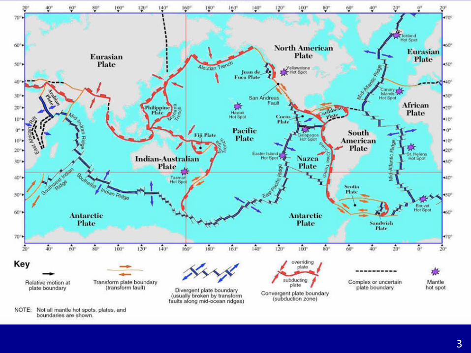
11
2
3
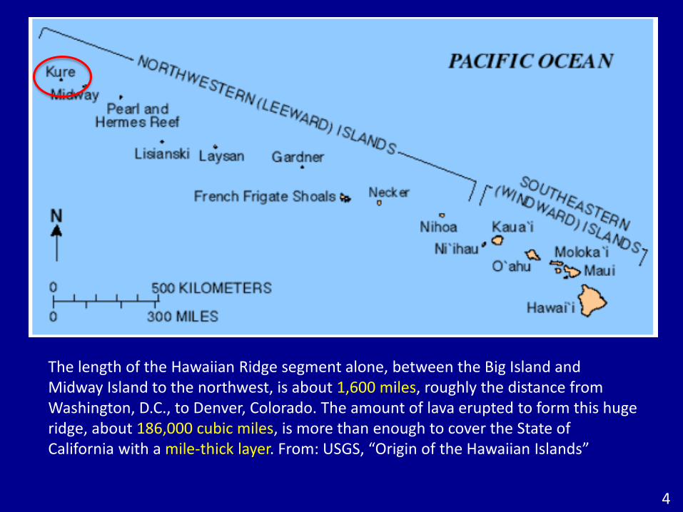
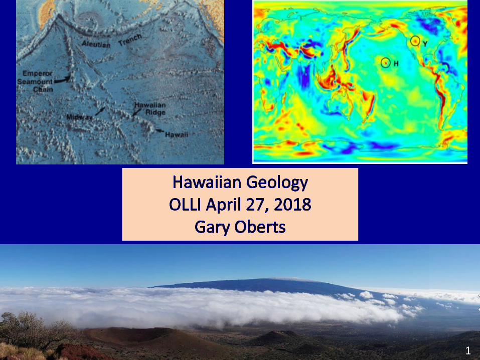
The length of the Hawaiian Ridge segment alone, between the Big Island and Midway Island to the northwest, is about 1,600 miles, roughly the distance from Washington, D.C., to Denver, Colorado. The amount of lava erupted to form this huge ridge, about 186,000 cubic miles, is more than enough to cover the State of California with a mile-thick layer. From: USGS, “Origin of the Hawaiian Islands”
4
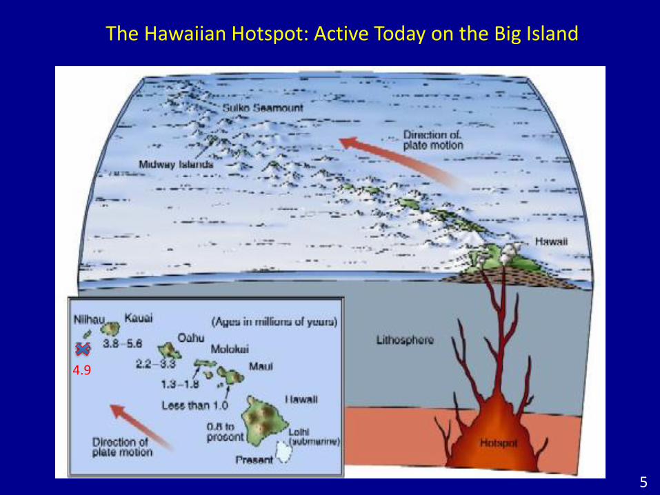
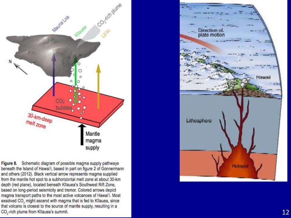
The Hawaiian Hotspot: Active Today on the Big Island
5
4.9
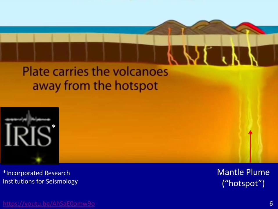
https://youtu.be/AhSaE0omw9o
Mantle Plume (“hotspot”)
*
*Incorporated Research Institutions for Seismology
6
7
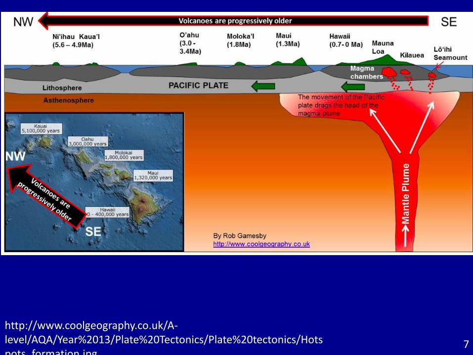
http://www.coolgeography.co.uk/A-level/AQA/Year%2013/Plate%20Tectonics/Plate%20tectonics/Hotspots_formation.jpg
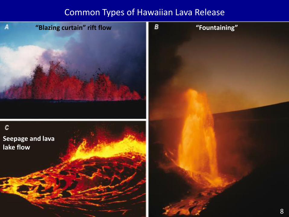
Common Types of Hawaiian Lava Release
“Blazing curtain” rift flow “Fountaining”
Seepage and lava lake flow
8
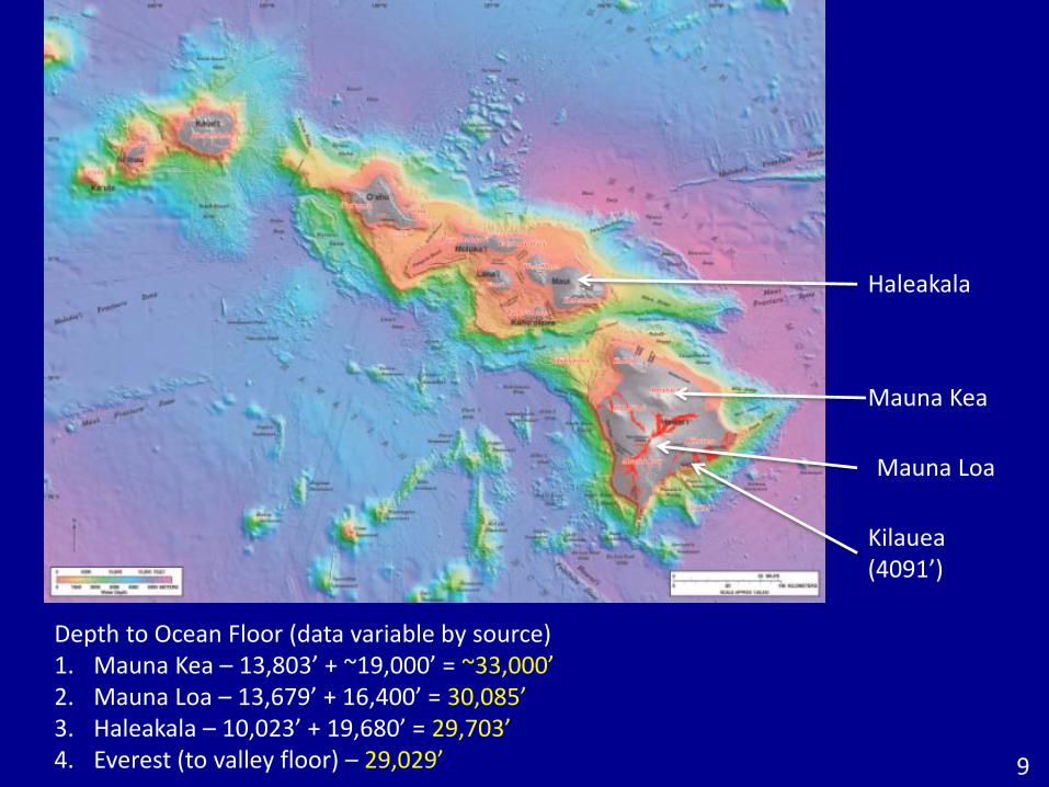
Depth to Ocean Floor (data variable by source)1. Mauna Kea – 13,803’ + ~19,000’ = ~33,000’2. Mauna Loa – 13,679’ + 16,400’ = 30,085’3. Haleakala – 10,023’ + 19,680’ = 29,703’4. Everest (to valley floor) – 29,029’
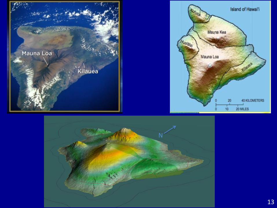
Mauna Kea
Mauna Loa
Haleakala
9
Kilauea (4091’)
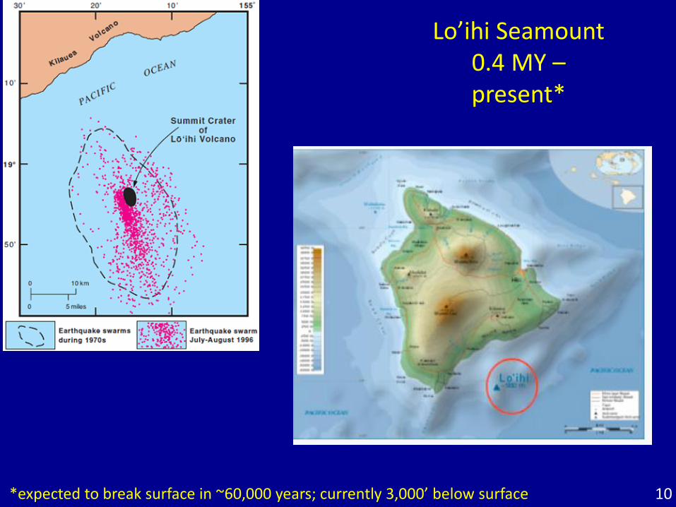
Lo’ihi Seamount 0.4 MY –present*
*expected to break surface in ~60,000 years; currently 3,000’ below surface 10
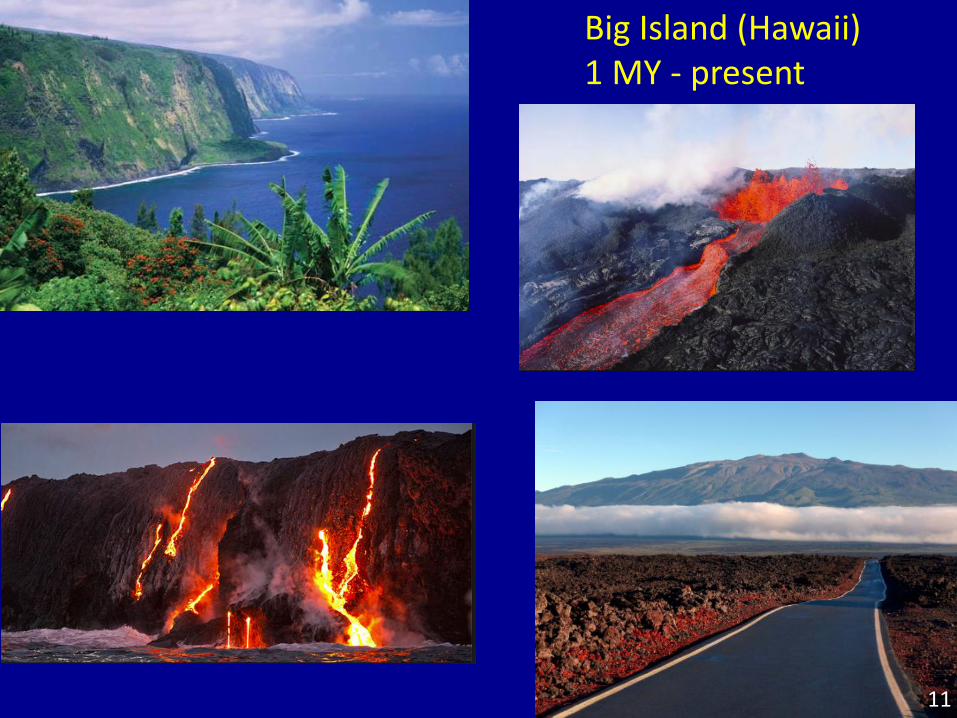
Big Island (Hawaii)1 MY - present
11
12
13
N
14
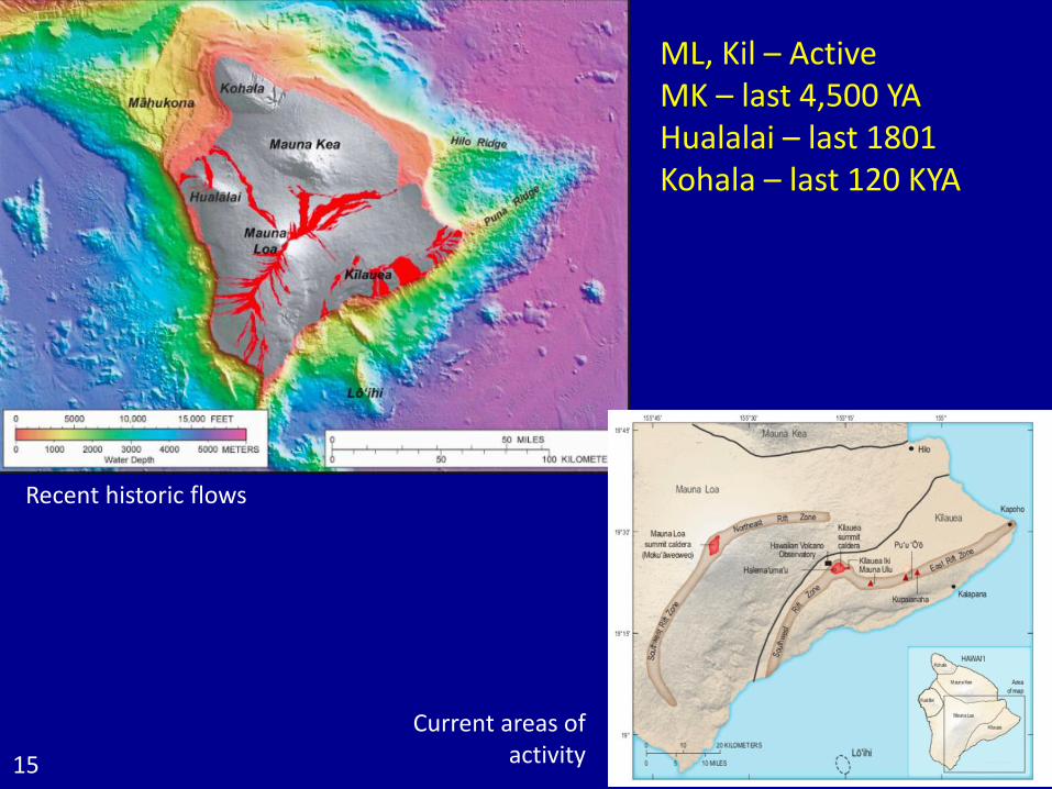
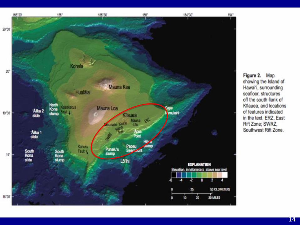
Current areas of activity
Recent historic flows
15
ML, Kil – ActiveMK – last 4,500 YAHualalai – last 1801Kohala – last 120 KYA
16
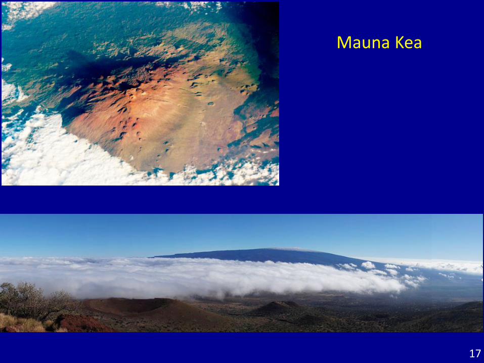
Mauna Kea
17
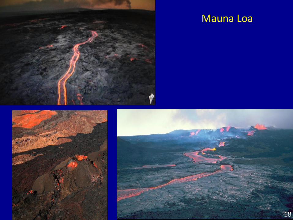
Mauna Loa
18
19
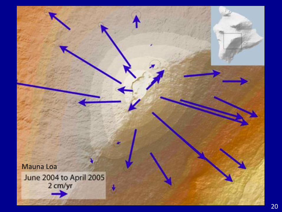
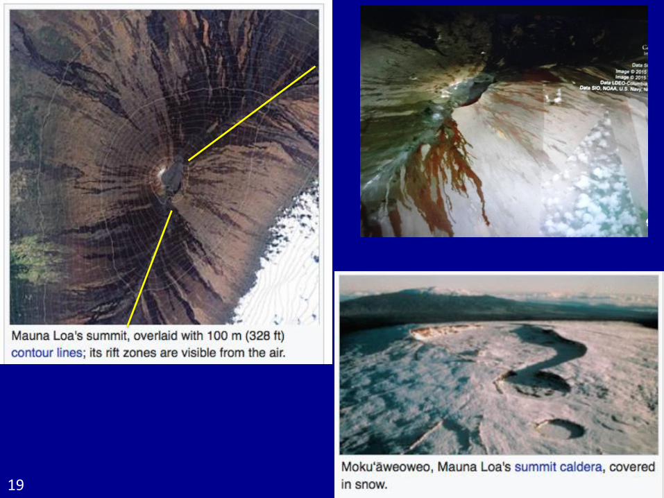
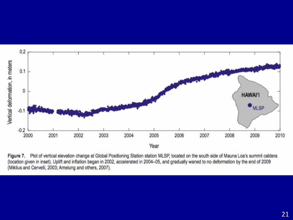
Mauna Loa
20
21
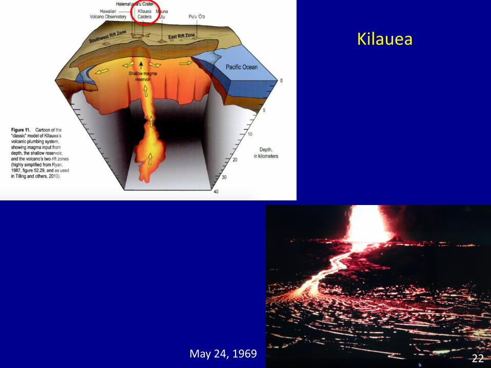
Kilauea
May 24, 1969 22
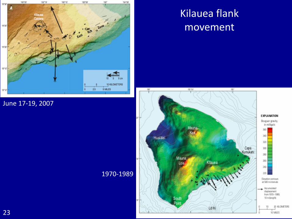
June 17-19, 2007
Kilauea flank movement
1970-1989
23
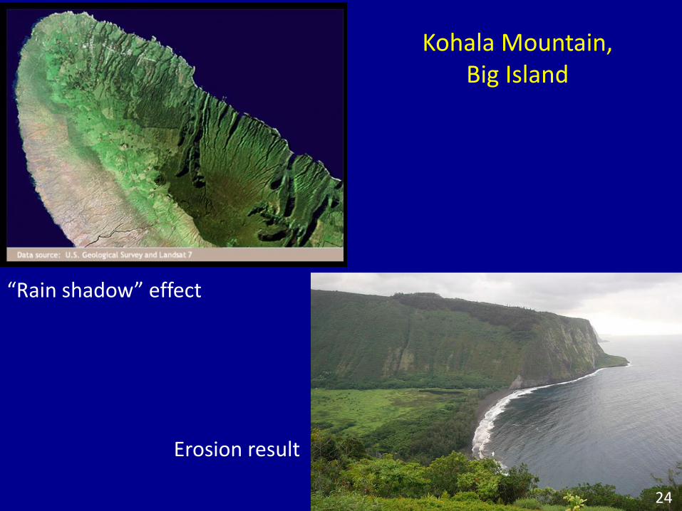
“Rain shadow” effect
Erosion result
Kohala Mountain, Big Island
24
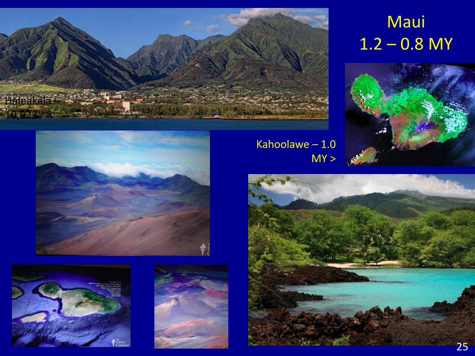
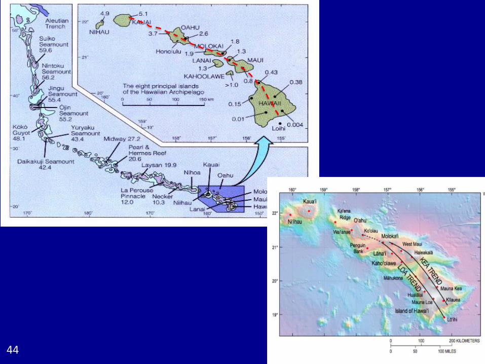
Maui1.2 – 0.8 MY
Kahoolawe – 1.0 MY >
Haleakala –10,023’
25
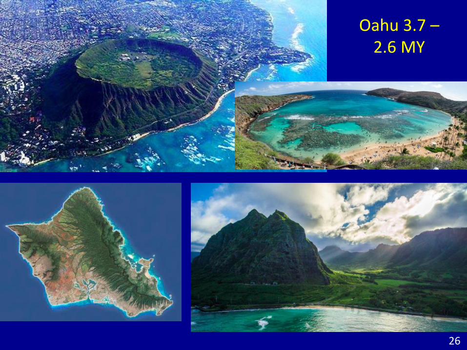
Oahu 3.7 –2.6 MY
26
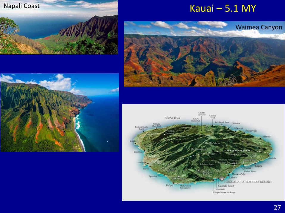
Kauai – 5.1 MY
27
Waimea Canyon
Napali Coast
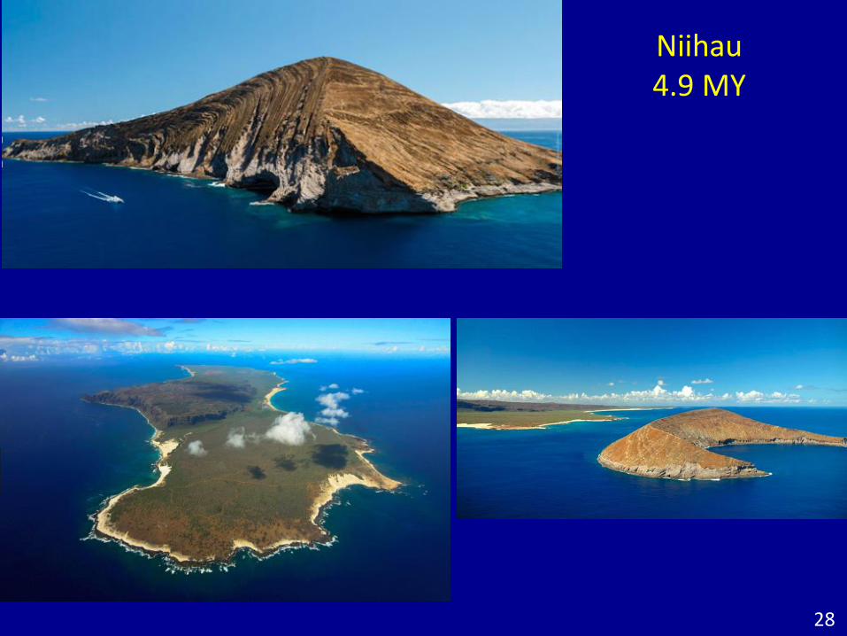
Niihau4.9 MY
28
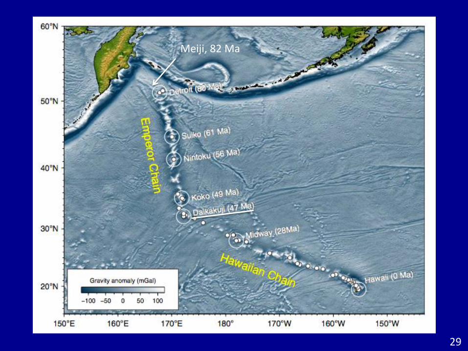
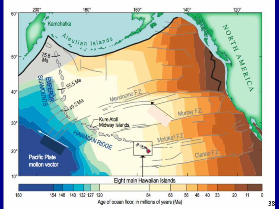
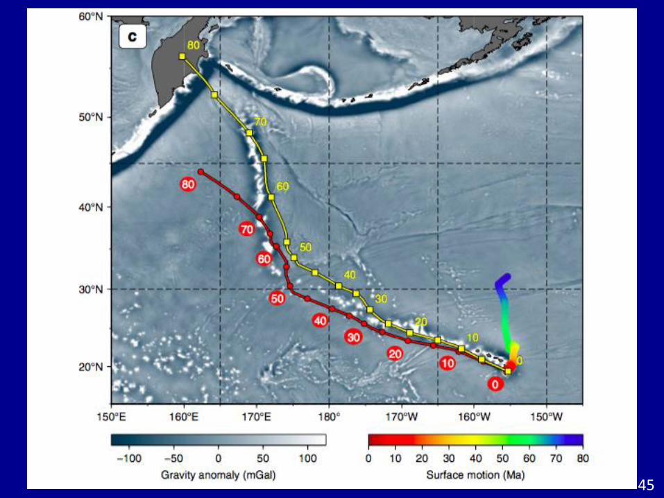
Meiji, 82 Ma
29
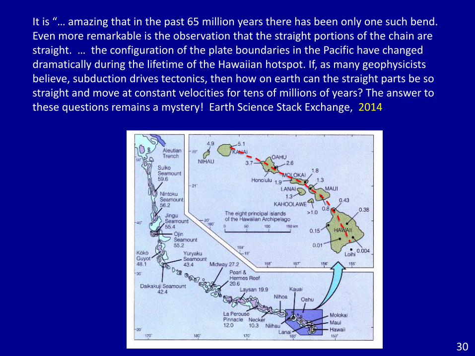
It is “… amazing that in the past 65 million years there has been only one such bend. Even more remarkable is the observation that the straight portions of the chain are straight. … the configuration of the plate boundaries in the Pacific have changed dramatically during the lifetime of the Hawaiian hotspot. If, as many geophysicists believe, subduction drives tectonics, then how on earth can the straight parts be so straight and move at constant velocities for tens of millions of years? The answer to these questions remains a mystery! Earth Science Stack Exchange, 2014
30
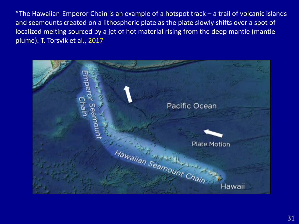
“The Hawaiian-Emperor Chain is an example of a hotspot track – a trail of volcanic islands and seamounts created on a lithospheric plate as the plate slowly shifts over a spot of localized melting sourced by a jet of hot material rising from the deep mantle (mantle plume). T. Torsvik et al., 2017
31
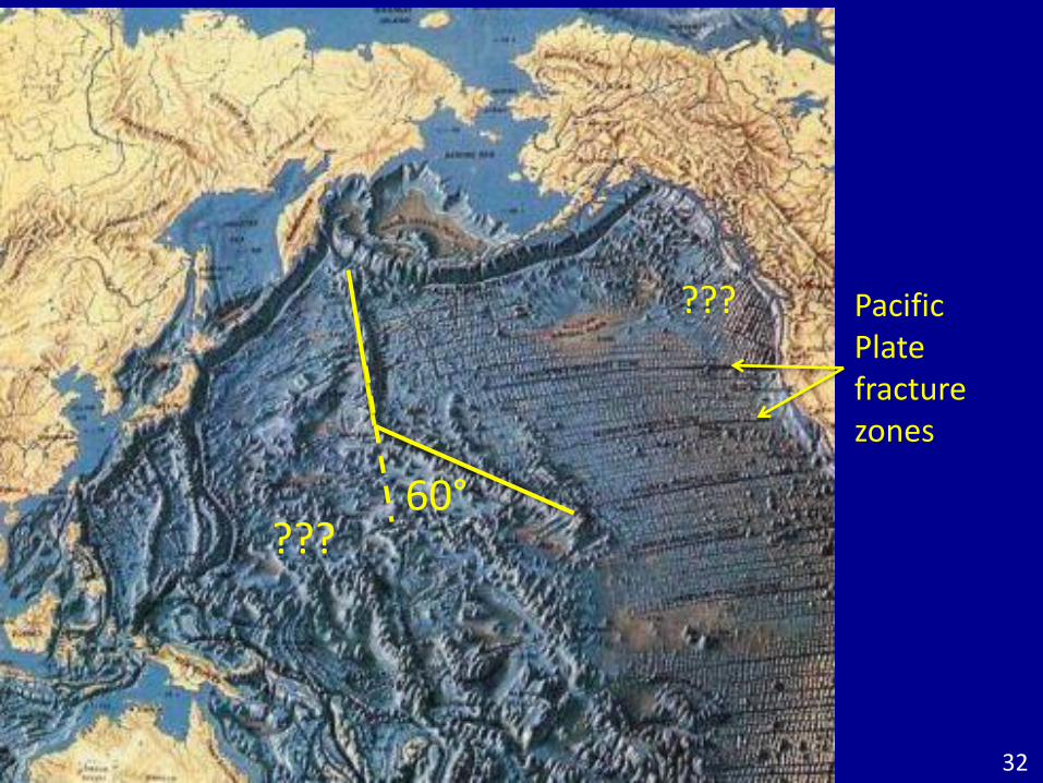
60°
Pacific Plate fracture zones
???
???
32
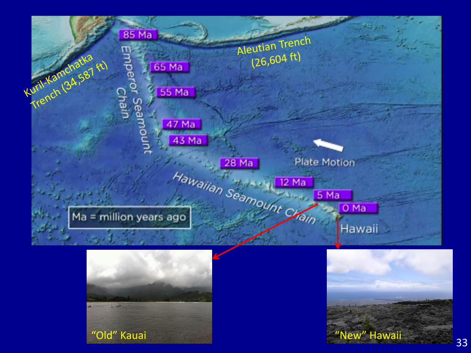
33“Old” Kauai “New” Hawaii
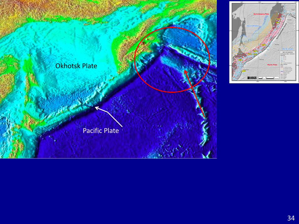
Okhotsk Plate
Pacific Plate
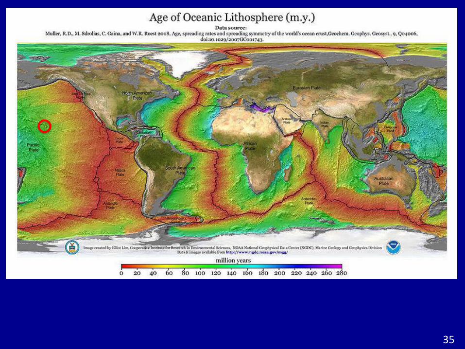
34
35
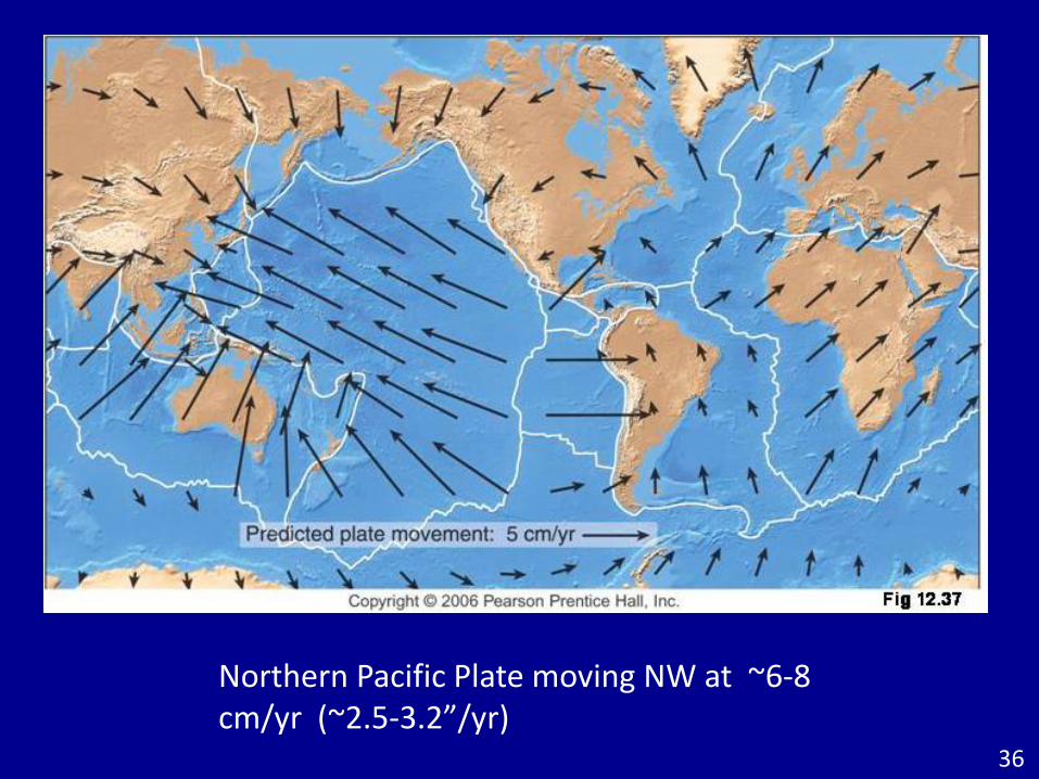
Northern Pacific Plate moving NW at ~6-8 cm/yr (~2.5-3.2”/yr)
36
37
38
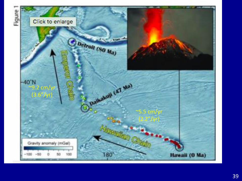
~9.2 cm/yr(3.6”/yr)
~5.5 cm/yr(2.2”/yr)
39
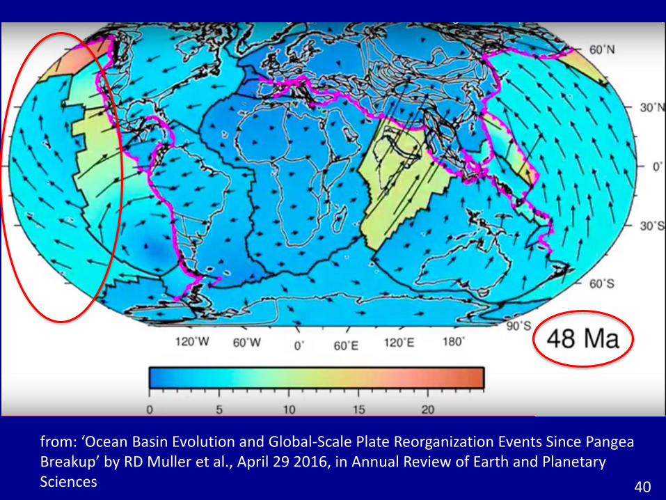
from: ‘Ocean Basin Evolution and Global-Scale Plate Reorganization Events Since PangeaBreakup’ by RD Muller et al., April 29 2016, in Annual Review of Earth and Planetary Sciences 40
from: ‘Ocean Basin Evolution and Global-Scale Plate Reorganization Events Since PangeaBreakup’ by RD Muller et al., April 29 2016, in Annual Review of Earth and Planetary Sciences
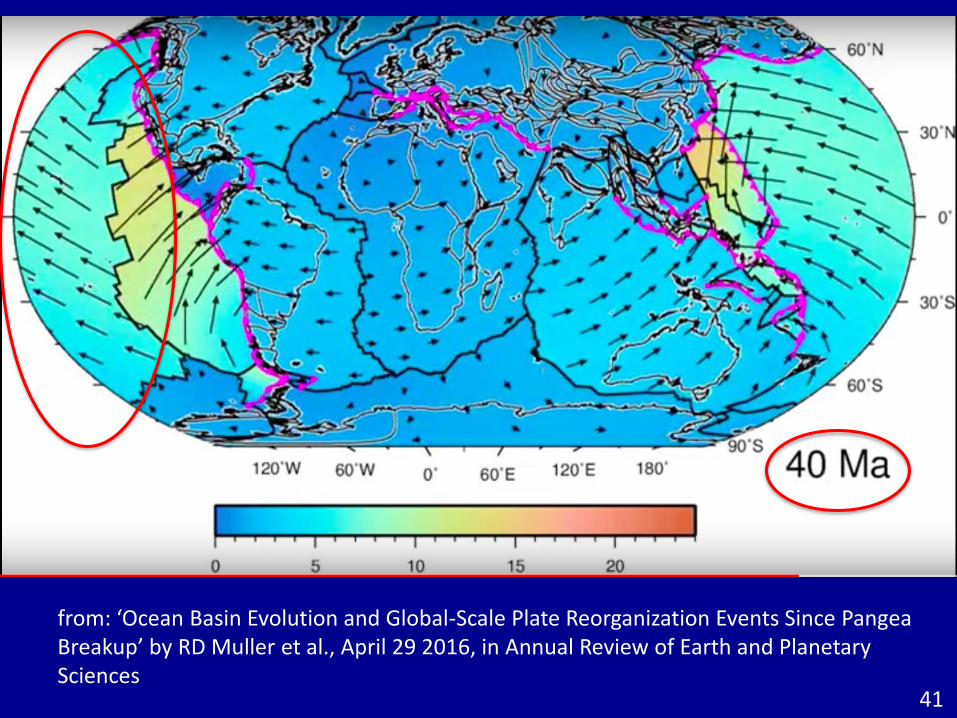
41
42
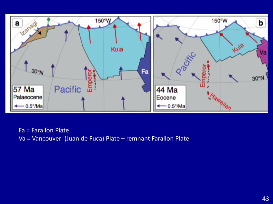
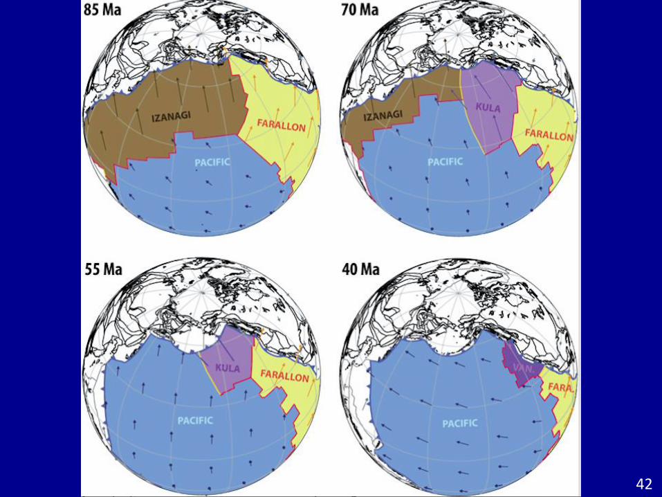
Fa = Farallon PlateVa = Vancouver (Juan de Fuca) Plate – remnant Farallon Plate
43
44
45
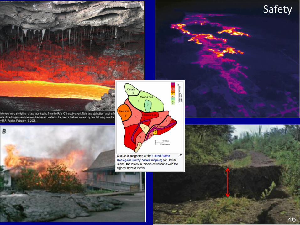
Safety
46
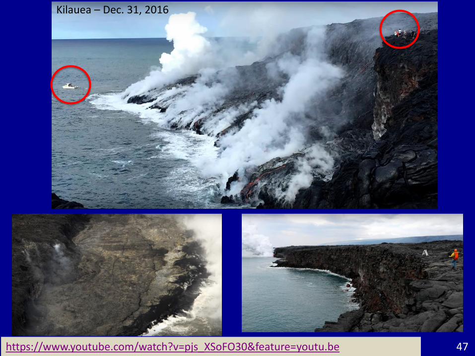
https://www.youtube.com/watch?v=pjs_XSoFO30&feature=youtu.be 47
Kilauea – Dec. 31, 2016
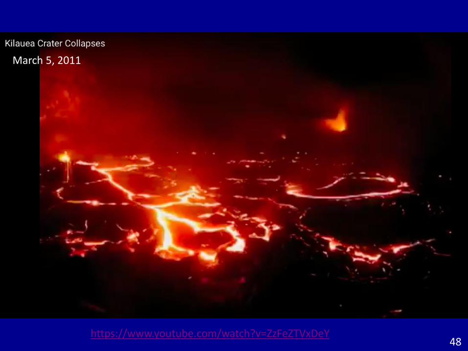
https://www.youtube.com/watch?v=ZzFeZTVxDeY
March 5, 2011
48
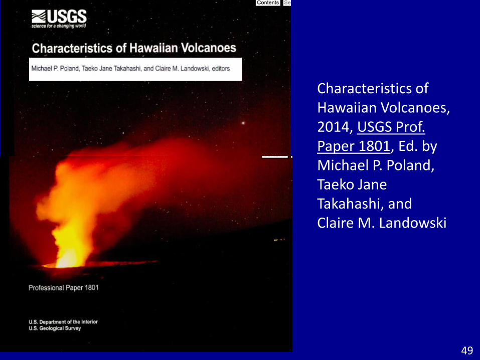
Characteristics of Hawaiian Volcanoes, 2014, USGS Prof. Paper 1801, Ed. by Michael P. Poland, Taeko Jane Takahashi, and Claire M. Landowski
49