Embed Size (px)
Citation preview

AUU-TSX-V
1
March 2015

AUU-TSX-V
2
500 km
Location Map Oaxaca Mexico

AUU-TSX-V
3
Regional Trends of Epithermal Gold & Silver Deposits

AUU-TSX-V
4
Prospect Map East Taviche
AUU-TSX-V
5
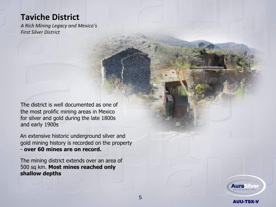
Taviche District A Rich Mining Legacy and Mexico’s First Silver District
An extensive historic underground silver and
gold mining history is recorded on the property - over 60 mines are on record.
The mining district extends over an area of 500 sq km. Most mines reached only shallow depths
The district is well documented as one of
the most prolific mining areas in Mexico for silver and gold during the late 1800s and early 1900s

AUU-TSX-V
6
Table of Contents History of Work Programs
• Location Map slide 2
• Regional Target Map slide 3
• Prospect Map slide 4
• Taviche District slide 5
• Table of Contents slide 6-7
• Exploration Programs slide 8-10
• Higo Blanco Exploration Model slide 11
• Geology Map slide 12
• Early Reconnaissance Map slide 13
• 2008 Reporting NI 43-101 slide 14
• Drilling – Rosario Prospect slide 15
• Prospecting - San Carlos Area slide 16
• Higo Blanco Jasperiod Trend slide 17 • Grid slide 18 • Magnetics slide 19 • Chargeability/ Resistivity Maps slide 20 • Tilt Derivative Map slide 21

AUU-TSX-V
7
Table of Contents (continued)
• Mezcal Vein Structure slide 22
• Mezcal Vein Structure slide 23
• Resource Estimate NI 43-101 slide 24
• Area for Resource Estimate slide 25
• Higo Blanco Resource slide 26
• Significant Drill Assays slide 27
• Jasperoid Trend Soil Grid slide 28
• East Taviche Silver/Gold SGH Targets slide 29
• Drill Rationale slide 30
• 2015 Drill Targets Slide 31
• AUU Social License slide 32
APPENDIX • Actlabs SGH slide 33
• Notes slide 34
• Model for SGH slide 35
• Past Performance slide 36

AUU-TSX-V
8
Very Early Prospecting Exploration Programs
HISTORICAL
• 1580; The Dominican Order of the Roman Catholic Church colonized the valleys of Central Oaxaca and found Zapotec Indians producing gold and silver with Spanish expeditions officially “discovering” the Taviche district in this year. In the absence of iron, the Indians were produceing horseshoes made of silver
• 1836; The first registered mining activity was from the veins of “San Pedro Taviche” which produced “kilos: of silver and 40% copper from shallow workings
• 1890 - 1913; Increase to more than 64 mines being operated by Mexican, North American and British companies
• 1913 - 1970; Mining activity was suspended to 1936 due to social problems resuming as small operations
• 1976; Mine dumps were processed by Canadian miners (containing 4 g/t Au and 450 g/t Ag)
• 1980 - 2001; MIOXSA had small and intermittent production from mines of the San Jeronimo Taviche area
• 1980 - 1993; The district was evaluated by the Consejo de Recursos Naturales and a significant number of reports on mines and prospects were prepared.
• 1999; Plata Panamericana, S.A. de C.V. (“Plata”: a wholly owned subsidiary of Pan American Silver) initiated reconnaissance activities in the district
• 2001 - 2002; Plata acquired the East and West Taviche concessions and conducted preliminary exploration activities including drilling on the West Taviche concession

AUU-TSX-V
9
2006 – 2008 (JV by Intrepid Mines & Aura Silver)
• 2006; Intrepid Mines Limited entered into an agreement with Plata to earn up to a 70% interest in Plata’s Taviche West and East Concessions. Aura Silver signed a MOU with Intrepid to jointly finance and earn 70% in the Taviche concessions
Acquisition, Initial reconnaissance
Exploration Programs
• 2007; Regional reconnaissance mapping and sampling of the East and West Taviche concessions
• 2008; Follow-up, detailed mapping and sampling of several prospects in the central part of East Taviche Discovery of the Higo Blanco jasperoid prospect. Obtain social license from San Pedro Taviche
• 2008; Detailed mapping, rock sampling and trenching on the Higo Blanco Prospect.
• 2008; Dr. A Miller, petrologist; Mineralogy of Precious Metal-Bearing Veins; West and East Taviche NI 43-101 Geological Report for Intrepid Mines
• 2008; IP and Mag survey conducted over the 7.5 km long Higo Blanco jasperoid prospect
2009-14 (focus on Higo Blanco) • 2009 -2011; Diamond Drill tests of geochemical rock and geophysical (“I.P.”) targets
NI 43-101 Report on Higo Blanco Project Area
AUU-TSX-V
10
Exploration Programs
2009-14 (continued)
• 2013; NI 43-101 Reporting on silver resource delineated at Higo Blanco;
• 2014; Actlabs Organic SGH - Confirms resource area and identifies additional targets, soil sampling over 7.5 jasperoid trend. Renew social license
• 2012 Aura Silver – Intrepid JV acquire 100% of East Taviche and sell ownership of West Taviche to Pan American Silver Inc.
• 2014 Aura Silver holds 72.8% of East Taviche while Intrepid Mines holds 17.2% • 2015 Further refining of Actlabs Organic SGH Targets

AUU-TSX-V
11
Higo Blanco Exploration Model
Target Area
AUU-TSX-V
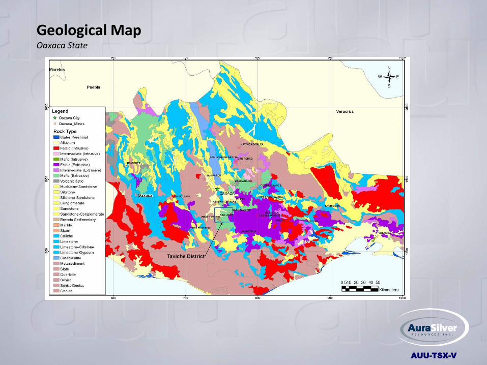
Geological Map Oaxaca State

AUU-TSX-V
13
Early Reconnaissance Prospect Map East Taviche – North Half

AUU-TSX-V
14
Geological NI 43-101 Report Intrepid 2008

AUU-TSX-V
15
Drilling – Rosario Prospect 2010 – Requires Additional Drilling
• Green = Andesite • Orange = Tuffs • Pink = Rhyolite
Legend
Underground Workings
1st Level: 2.78g/t Au, 756 g/t Ag
3rd Level: 2.24g/t Au, 564 g/t Ag
4th Level: 1.71g/t Au, 340 g/t Ag
5th Level: 2.88g/t Au, 769 g/t Ag
1st Level
2nd Level
4th Level
3rd Level
5th Level
2.4 Gold (g/t)
607 Silver (g/t)
Ore Average

AUU-TSX-V
16
San Carlos Area Undrilled, 2014
• Green = Cretaceous Andesite • Beige = Tertiary Andesite • Pink = Rhyolite
Legend
Drill Ready Epithermal Gold Prospect

AUU-TSX-V
17
7.5 km by up to 1 km in Width
Higo Blanco Jasperoid Trend
• dark red = jasperoid • dark blue = limestone • light blue = volcanic sediments • dark pink = overburden • light pink = diorite • green = andesites • circles = drill holes
Legend

AUU-TSX-V
18
Higo Blanco Jasperoid Trend Grid

AUU-TSX-V
19
Higo Blanco Jasperoid Trend Magnetics
Breaks in the magnetic map coincide with the postulated structures outlined by the tilt derivative map.
Magnetics

AUU-TSX-V
20
Higo Blanco Jasperoid Trend Resistivity
Resistivity
Chargeability
The resistivity map delineates the main Jasperoid bodies as mapped, as well as possible buried limestone bodies
The chargeability anomalies coincide very well with the Mezcal Structure and shows possible presence of at least two offsetting structures. The Mezcal Zone appears to be controlled by a major NW-SE fault with several smaller faults in the hanging wall side that hosts most of the mineralization

AUU-TSX-V
21
Higo Blanco Jasperoid Trend Tilt Derivative*
• *Def’n: A simple depth-estimate using first order magnetic derivatives. This enhancement can help define/estimate the physical properties of the source structure causing the anomaly.
• The tilt derivative map at Higo Blanco verifies several mapped and intersected structures in the area of the resource and indicates the presence of additional cross-cutting structures that require further investigation.

AUU-TSX-V
22
Higo Blanco – Mezcal Vein Prime Target Area

AUU-TSX-V
23
Higo Blanco
Mescal Vein Structure Veins and Targets

AUU-TSX-V
24
Resource Estimate NI 43-101 Report Intrepid/Aura Silver 2013

AUU-TSX-V
25
Mezcal Drilling Area for Resource Definition NI 43-101 Compliant

AUU-TSX-V
26
INFERRED SILVER/GOLD RESOURCE
• 865,000 tonnes at a grade of 119 g/t (3.3 million ounces of contained silver) and an inferred gold resource
of 3.3 million tonnes at a grade of 0.51 g/t (54,000 ounces of contained gold). The resource is based on intercepts from 14 drill holes. The cut-off grades utilized in this estimate are 30.77 g/t Ag and 0.331 g/t Au
MINERAL RESOURCE POTENTIAL • Additionally, the "Mineral Potential" located near or within its seven kilometre-long by 300 metre-wide
Higo Blanco jasperoid-altered area on the East Taviche and Alma Delia concessions was estimated to be between 6.0 million and up to 29.0 million ounces of silver (2 to 6 million tonnes at a grade of 100 to 150 g/t) and between 108,000 and up to 450,000 ounces of gold (10 to 20 million tonnes at a grade of 0.4 to 0.7 g/t. The potential quantity and grade is conceptual in nature, there has been insufficient exploration to date to define this as a mineral resource and it is uncertain if further exploration will result in the target being delineated as a mineral resource
**"Taviche Project, Resource Estimate and Preliminary Economic Assessment for the Higo Blanco Project" by Geoffrey S. Carter, P. Eng. of Broad Oak Associates (dated September 28, 2011)
Higo Blanco Resource** NI 43-101

AUU-TSX-V
27
Significant Drill Assays (silver equivalents)*
12.1 Meters – 533 g/t Silver Equivalent (HBET 03)
11.6 Meters – 166.3 g/t Silver Equivalent (HBET 02)
36.6 Meters – 303.9 g/t Silver Equivalent (HBET 16)
* Defined as silver grade plus 60x gold grade
29.55 Meters - 0.50 g/t Gold (HBET - 01)
9.80 Meters - 0.87 g/t Gold (HBET - 02)
14.10 Meters - 0.54 g/t Gold (HBET - 03)
8.95 Meters - 0.50 g/t Gold (HBET - 11)
10.55 Meters - 0.51 g/t Gold (HBET - 15)
15.50 Meters - 0.69 g/t Gold (HBET - 22)
8.35 Meters - 2.05 g/t Gold (HBET - 24)
22.00 Meters - 0.54 g/t Gold (HBET - 26)
23.15 Meters - 0.85 g/t Gold (HBET - 27)
AUU-TSX-V
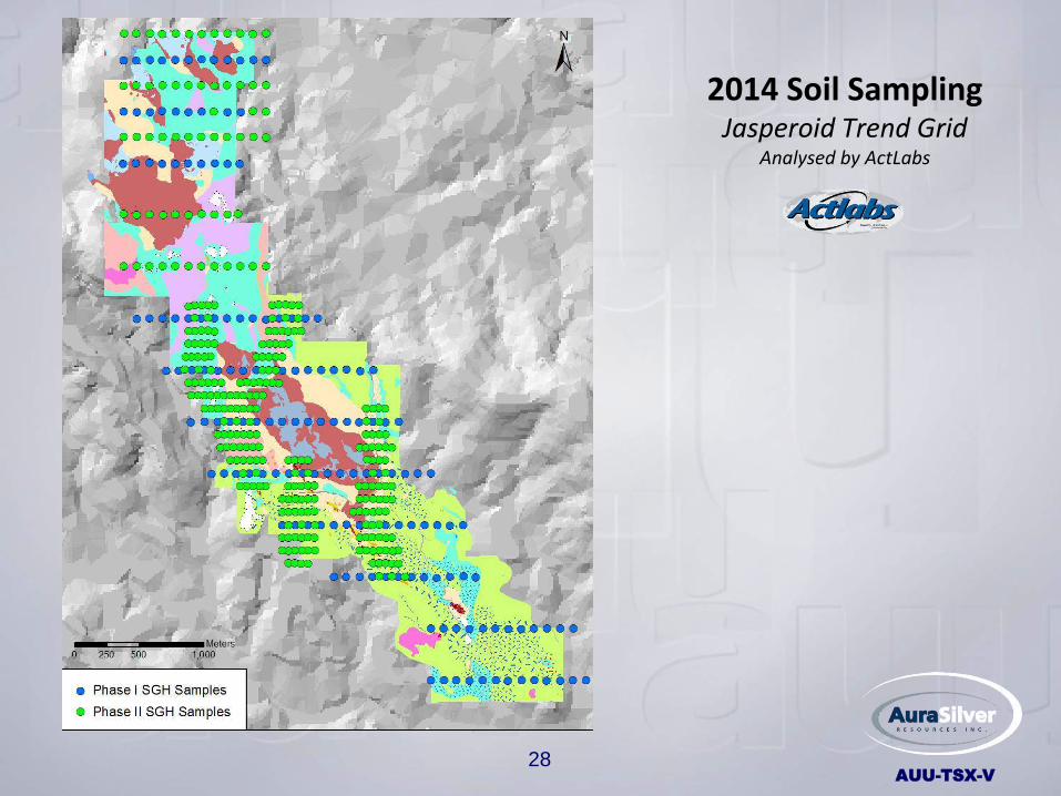
28
2014 Soil Sampling Jasperoid Trend Grid
Analysed by ActLabs

AUU-TSX-V
29
Gold/Silver Spatio-Temporal Geochemical Hydrocarbon (SGH) Anomalies Analysed by ActLabs
Gold and Silver Redox Zone
Gold & Silver anomalies Rated 6.0 of 6.0
NI 43-101 Defined Resource Area
Silver Anomalies Rating 6.0 of 6.0
0m 500m 1,000m

AUU-TSX-V
30
• Confirmed silver deposit to be drilled deeper to test for gold zones (refer to exploration model)
• Explore along well-defined target zone(s) outlined by Actlabs SGH Nano-technology results
• Test structural zones/historical pits previously identified by prospecting
• None of these targets have been drilled
Drill Rationale
Patrick Toth, P.Geo., Q.P. Senior Geologist, (Mexico)

AUU-TSX-V
31
Current 2015 Targets – Drill Deeper Epithermal Exploration Model
San Jose Mine
Current Level Higo Blanco
Target Area (Higo Blanco)
surface
Silver Zone

AUU-TSX-V
32
Friendly population, most of whom survive through subsistence agriculture
Aura Silver’s Social License to Work

AUU-TSX-V
33
ORGANIC PREDICTIVE GEOCHEMISTRY*
APPENDIX
REDOX -Cell Model by Dr. Stewart Hamilton
____________________
* Spatiotemporal Geochemical Hydrocarbons (SGH);
Organo Sulphur Geochemistry (OSG)

AUU-TSX-V
Notes on Spatiotemporal Geochemical Hydrocarbons
Measures 162 or more organic NON GASEOUS hydrocarbon compounds that have been synthesized by bacteria feeding on mineral targets (such as gold and silver) In the death phase of these bacteria, cell membranes break down and release hydrocarbons. The hydrocarbons are then diffused through the overburden to the surface where they are deposited in surface soils vertically above the mineral resource. Au and Ag (as well as other minerals) have their own pathfinder templates of bacterial hydrocarbons. Each group/class moves at different rates and distances from the mineral source and multiple classes are used to vector in on the centre of a Redox Cell
34
Apical Model
Nested Rabbit Ear
SGH Combined
Class Model
Rabbit Ear

AUU-TSX-V
35
A Model for Actlabs SGH and OSG Hydrocarbon Studies
3D-SGH – Multiple Classes
In 3D Space this model of the SGH response is illustrated here as a combination of Hydrocarbon Class flow pathways
Ore Body
Microbe/Bacterial Activity

AUU-TSX-V
Advanced determination of a variety of mineralizations
(1) Canadian Mining Industry Research Organization Studies
• CAMIRO-97- ten blind studies where Organic SGH discovered 9 of 10 while inorganic studies identified only 3 of 10
• CAMIRO-01- identified kimberlites and Olympic Dam deposits
• CAMIRO-08 – Superior technique in identifying uncomformity uranium deposits at Cameco’s Cigar Lake and Maclean Lake properties
• Actlabs has ranked the SGH and OSG Greyhound results with their highest rating
** Study participants:BHP, Cameco, Noranda, Inco, Outokumpu, Rio Algom, Barrick Gold, Newmont, Anglo-American, WMC, Xstrata among others
(2) 2010 Mt. Milligan Study for Geoscience BC – Actlabs SGH was only geochemical method out of over 20 tests that correctly identified the location of the deposit
(3) From 1997 to the present, Actlabs has tested more than a thousand sample data bases for properties using their organic geochemistry with a high success rate
Past Performance of Actlabs Technology
36