Embed Size (px)
Citation preview
Potential Historic Winter StormFebruary 8-9, 2013
Briefing Summary:830 AM Thursday, February 7th, 2013
National Weather ServiceBoston, MA
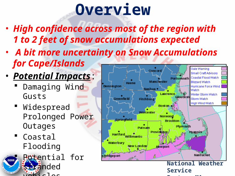
Overview
National Weather ServiceBoston, MA
• High confidence across most of the region with 1 to 2 feet of snow accumulations expected
• A bit more uncertainty on Snow Accumulations for Cape/Islands
• Potential Impacts: Damaging Wind Gusts Widespread Prolonged
Power Outages Coastal Flooding Potential for stranded
vehicles
Timing
National Weather ServiceBoston, MA
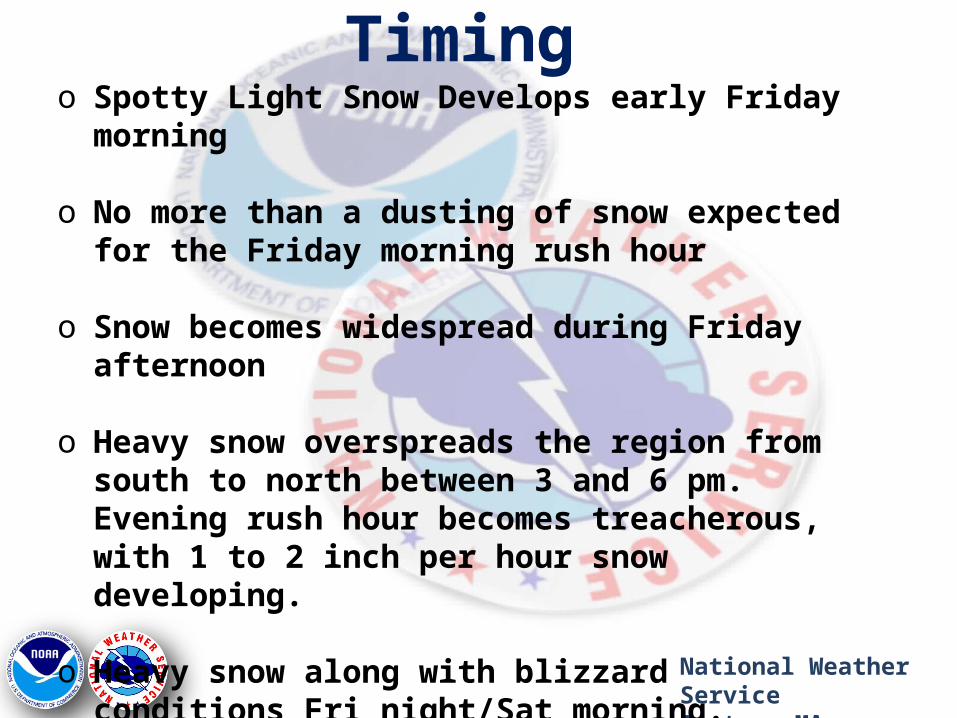
o Spotty Light Snow Develops early Friday morning
o No more than a dusting of snow expected for the Friday morning rush hour
o Snow becomes widespread during Friday afternoon
o Heavy snow overspreads the region from south to north between 3 and 6 pm. Evening rush hour becomes treacherous, with 1 to 2 inch per hour snow developing.
o Heavy snow along with blizzard conditions Fri night/Sat morning. Travel not recommended with whiteout conditions possible. 2 to 3 inch per hour snowfall rates.
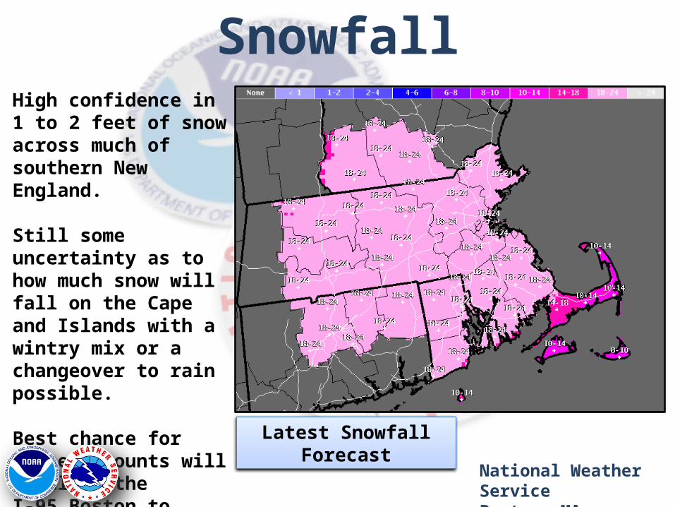
SnowfallHigh confidence in 1 to 2 feet of snow across much of southern New England.
Still some uncertainty as to how much snow will fall on the Cape and Islands with a wintry mix or a changeover to rain possible.
Best chance for higher amounts will be along the I-95 Boston to Providence corridor.
National Weather ServiceBoston, MA
Latest Snowfall Forecast
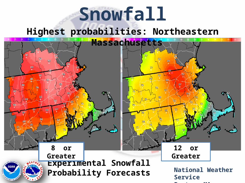
SnowfallHighest probabilities: Northeastern Massachusetts
National Weather ServiceBoston, MA
Experimental Snowfall Probability Forecasts
8” or Greater 12” or Greater
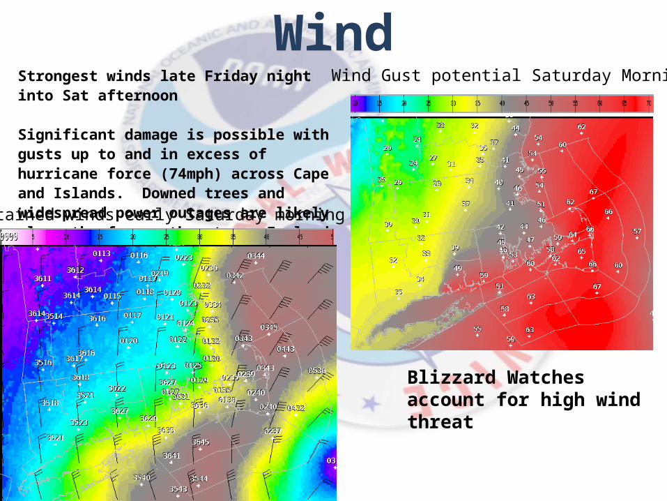
WindStrongest winds late Friday night into Sat afternoon
Significant damage is possible with gusts up to and in excess of hurricane force (74mph) across Cape and Islands. Downed trees and widespread power outages are likely along the far southeast new England Coast.
Blizzard Watches account for high wind threat
Sustained winds early Saturday morning
Wind Gust potential Saturday Morning
Marine ImpactDangerous and Life Threatening storm for mariners!
Storm Force and Hurricane Wind Watches continue for all waters. Strongest winds from Cape Cod Bay and Nantucket and points east.
Wind gusts of 55 to 65 kts. Up to Hurricane Force!
Seas between 25 and 30 feet.
Timing: The worst conditions with highest seas and strongest winds occur late Friday night into Saturday afternoon.
Conditions will gradually improve Saturday night and Sunday, but galeForce wind gusts still expected.
National Weather ServiceBoston, MA
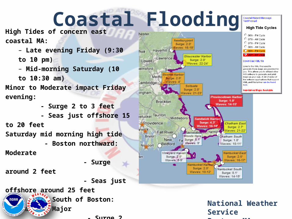
Coastal FloodingHigh Tides of concern east coastal MA:
– Late evening Friday (9:30 to 10 pm)– Mid-morning Saturday (10 to 10:30 am)
Minor to Moderate impact Friday evening: - Surge 2 to 3 feet - Seas just offshore 15 to 20 feetSaturday mid morning high tide - Boston northward: Moderate - Surge around 2 feet - Seas just offshore around 25 feet - South of Boston: Moderate to Major - Surge 2 to 3 feet (possibly 4 feet north side of Cape) - Seas just offshore around 30 feetPockets of minor flooding possible along the south coast (confidence not as high)
National Weather ServiceBoston, MA
SummaryPotential for a Historic Winter Storm and Blizzard
Summary:
– Heavy Snow and blizzard conditions late Friday into Saturday morning
– Travel may become nearly impossible with blowing/drifting snow and near 0 Visibilities.
– Moderate to perhaps a few pockets of major coastal flooding Friday night/Sat AM High Tide Cycle
– Winds to Hurricane Force across far Southeast New England coast resulting in structural damage
– Concern for Stranded VehiclesNational Weather ServiceBoston, MA
Questions?• Get the latest information at: – www.weather.gov/boston• Area Forecast Discussion• Hazardous Weather Outlook
• Call us: 508-823-2228• NWSChat Online– https://nwschat.weather.gov
• E-mail:
National Weather ServiceBoston, MA