Embed Size (px)
Citation preview
PORTLAND‐MILWAUKIE LIGHT RAIL PROJECTPORTLAND MILWAUKIE LIGHT RAIL PROJECT
Final Environmental Impact Statement SnapshotStatement SnapshotBridget Wieghart
Citizens Advisory Committee
April 15, 2010

The Final EIS will
• Refine the analysis based on further d i f h LPAdesign of the LPA
• Respond to all comments received during the SDEIS comment period
• Establish mitigation commitments for gsignificant impacts
This information is draft and subject to change, pending publication of the Final EIS, May 2010.

Final EIS topics
Displacements and Acquisitions ‐ April
Parks and Recreational Resources
Land Use and Economy ‐ April
Community Impacts
Historic and Archaeological Resources
Visual Resources
Noise and Vibration ‐May
Geology and Soils
Air QualityAir Quality
Energy Consumption
Hazardous Materials
Ecosystems
Water Quality
Safety and security
Transit benefits
Transportation
This information is draft and subject to change, pending publication of the Final EIS, May 2010.
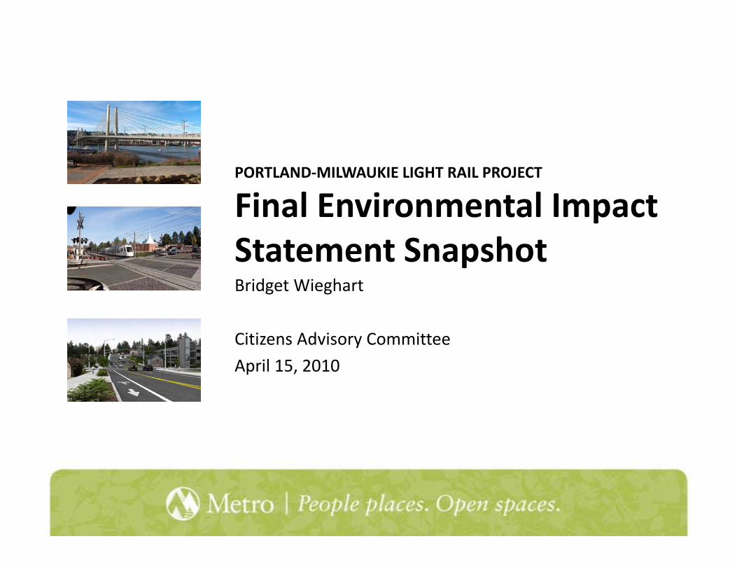
Acquisitions
• Project approach to property:
More detail today
– Avoid– MinimizeMitigate– Mitigate
• Utilize public right‐of‐way where iblpossible
• Utilize railroad corridor where possible
• Design to minimize impact where possiblep
This information is draft and subject to change, pending publication of the Final EIS, May 2010.

Acquisitions
• Permanent property impacts77 94 f ll i i i
More detail today
– 77‐94 full acquisitions
– 108‐121 partial acquisitions
– Approximately 1/3 of above are public/utility– Approximately 1/3 of above are public/utility property
– Ruby Junction: 14 full taxlots /1 partial taxlot
• Displacements– Businesses ‐ Approximately 60 businesses
– Residences – Approximately 11 residences
– Ruby Junction: 8 businesses/9 residences
• Relocation assistanceThis information is draft and subject to change, pending publication of the Final EIS, May 2010.

Land use and economy
• Project is consistent with existing zoning d l
More detail today
and plans
• Support achievement of 2040 goals
• Coordination with ongoing planning efforts
Portland ‐ Innovation Quadrant, station area planning and employment TODMilwaukie ‐ South Downtown PlanClackamas County ‐McLoughlin Area Plan
• Creation of temporary and permanent jobs
This information is draft and subject to change, pending publication of the Final EIS, May 2010.

Community impacts
• Evaluates effects to communities, with a f l i d i ifocus on low‐income and minority groups
• Analyzes neighborhood impacts and benefits given project affects, such as traffic, visual resources
• After mitigation for other areas, like noise and vibration, no additional mitigation needed
This information is draft and subject to change, pending publication of the Final EIS, May 2010.

Visual resources ‐ design
• Be consistent with neighborhood pattern d l h ibl
More detail at a future CAC meeting
and scale, where possible
• Buffer or reduce the loss of visual resources
• Reduce obstructions or limitations to designated views, view corridors, viewpoints, and important neighborhood features
This information is draft and subject to change, pending publication of the Final EIS, May 2010.

Minimize visual impacts
• Impacts range from low to high
More detail at a future CAC meeting
• Refine design of bridges, ramps and structures, where possible
• Use elements such as landscaping or fencing where impacts are highg p g
• Replace or restore removed vegetation and landscaping where possibleand landscaping where possible
• Consider neighborhood plan recommendationsrecommendations
This information is draft and subject to change, pending publication of the Final EIS, May 2010.
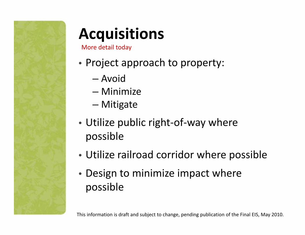
Historic resources
Royal Foods
R. Derwey House
This information is draft and subject to change, pending publication of the Final EIS, May 2010.

Historic resources
Westmoreland Duck Pond Mitigation for Duck PondWestmoreland Duck Pond Mitigation for Duck Pond
• Historic documentation including photos
• Station Design including history of park and photos
This information is draft and subject to change, pending publication of the Final EIS, May 2010.

Park resources
• 18 resources18 resources surveyed
• Effects to 4• Effects to 4 parks; temporary effecttemporary effect to one park
This information is draft and subject to change, pending publication of the Final EIS, May 2010.

Park resources affected
• Eastside Willamette River Greenway– Change in location under new Willamette River Bridge
• Springwater CorridorC i d “3 b id j ”– Connection under “3 bridges project”
• Westmoreland ParkWetland mitigation at Duck Pond– Wetland mitigation at Duck Pond
• Trolley Trail– Co locate alignment adjacent to trail connections to Park– Co‐locate alignment adjacent to trail, connections to Park
Avenue station
• Robert Kronberg Park– Temporary use of small portion during construction
This information is draft and subject to change, pending publication of the Final EIS, May 2010.

Ecosystems
LPA MOSLPA MOSWetlands 1.04 acres 1.04 acres
Waterways 7 crossings 6 crossings
Vegetation 16.2 acres 14.7 acres
Listed Threatened Fall and Spring Chinook, Listed Threatenedand Endangered Species*
p g ,Coho, Winter and Summer Steelhead,
*Listed as threatened Green Sturgeon
This information is draft and subject to change, pending publication of the Final EIS, May 2010.

Efforts to avoid and minimizepotential impacts
Willamette River bridge designed with two piers that largely avoid shallow water habitat
potential impacts
Crystal Springs Creek currently in
shallow water habitat
h k ll b d
Crystal Springs Creek, currently in a culvert, will be spanned
Johnson Creek will be spanned
Crystal Creek and Spring CreekCrystal Creek and Spring Creek remain in culverts
Kellogg Lake will have one “H” pier in the lakepier in the lake
Courtney Springs is currently piped 30’ underground This information is draft and subject to change, pending publication of the Final EIS, May 2010.

Mitigating for impacts that cannot be avoided
Remove derelict piles and restore native vegetation
cannot be avoided
Restore concrete Westmoreland
Create storage for Johnson Creek
Restore concrete Westmoreland duck pond to a natural state
Create storage for Johnson Creek flood waters
Remove derelict piles and restore native vegetation at Kellogg Lake
Grant* for green, habitat‐friendly Park Avenue Park and Ride*not technically “mitigation”This information is draft and subject to change, pending publication of the Final EIS, May 2010.

Water quality
Water quality and hydrology==
Impervious surfaces + stormwater management
New Impervious SurfaceLPA 18 5 acresLPA 18.5 acres
MOS 15.7 acres
B id A St t dBridge Area Streetcar and Roadway Improvements
4.7 acres
Ruby Junction 0.7This information is draft and subject to change, pending publication of the Final EIS, May 2010.

Stormwater and flood managementg
• Tie and ballast track is an impervious surface
Piers and rock for scour protection create a net rise of 0.6” that cannot be mitigated.
• Track on impervious surface reconstructed to
t t t d dmeet current standards
• Stormwater facilities all along alignment meet city
Tacoma Stationalong alignment meet city of Portland standards
Fill in floodplain will be balanced with equal creation of floodplain
Water quality features
This information is draft and subject to change, pending publication of the Final EIS, May 2010.

Noise and vibration
FTA noise impact criteria
More detail at May CAC meeting
This information is draft and subject to change, pending publication of the Final EIS, May 2010.

Noise and vibration impacts without/with mitigationMore detail at May CAC meeting
Alternative Light Rail & Shared Transitway Noise
Impacts
Traffic Noise Impacts
VibrationImpacts
M d t SModerate Severe
LPA to Park Ave 29 3 19 42
LPA to Park Ave. ith Miti ti N i ll I l ti
9 (E t i )
0 0 9with Mitigation: Noise walls, Insulation, and adjustable bells w/shrouds
(Exterior)
MOS to Lake Rd 18 3 19 34
MOS to Lake Rd. 9 0 0 9MOS to Lake Rd. with Mitigation: Noise walls, Insulation, and adjustable bells w/shrouds
9 (Exterior)
0 0 9
This information is draft and subject to change, pending publication of the Final EIS, May 2010.

Hazardous materials• Environmental, health and
cost risk if handled improperly
• Project will identify and remediate affected haz matremediate affected haz mat areas
• Project will adhere to all japplicable protocols
This information is draft and subject to change, pending publication of the Final EIS, May 2010.

Safety and security
• Design of alignment ‐ Crime Prevention h h E i l D ithrough Environmental Design
• Enforcement
• School education program
This information is draft and subject to change, pending publication of the Final EIS, May 2010.

Transportation
Analysis includes:
• Pedestrian system
• Bicycle network
• Off‐street parking
• Traffic network• Traffic network
• Freight operations
• Transit ridership/operations
This information is draft and subject to change, pending publication of the Final EIS, May 2010.

Transportation
Ped/bike improvement examples:
• Two 14‐foot paths on Willamette River bridge
• Improved Powell undercrossing
• Improved pedestrian structures in Southeast Portland
• Accommodation of future pedestrian path over Kellogg Creekgg
This information is draft and subject to change, pending publication of the Final EIS, May 2010.

Transit
• 2030 Ridership– 25,500 average weekday boardings
– 13,300 new daily transit trips
• Vehicle miles traveled reduction: 61,300
• Vehicle hours traveled reduction: 5 700Vehicle hours traveled reduction: 5,700
• Vehicle hours delay reduction: approx. 400
This information is draft and subject to change, pending publication of the Final EIS, May 2010.

Transit
2030 Transit Time
• 24 minutes by rail from Pioneer Square to Lake Rdsame as auto, 4 minutes faster than bus
• 19 minutes by rail from PSU to Lake Rd4 minutes less than auto, 8 minutes faster than bus
• 15 minutes by rail from S. Waterfront to L k RdLake Rd7 miles less than auto, 20 minutes faster than bus
This information is draft and subject to change, pending publication of the Final EIS, May 2010.

TransitUser Benefits
• User benefits determined by new transit users and travel time savings to existing transit usersexisting transit users
• Benefits extend outside of corridor to riders of 9, 17,corridor to riders of 9, 17, and 19 buses that will use the new bridge
This information is draft and subject to change, pending publication of the Final EIS, May 2010.

Local Transportation Impacts
• Mitigation strategies allow for traffic ti i il t th N B ild
At March CAC meeting
operations similar to the No‐Build
• For the LPA, mitigation measures identified t b t 20 i t tiat about 20 intersections
This information is draft and subject to change, pending publication of the Final EIS, May 2010.

Other areas
• Geology and soils ‐ no impacts
• Air quality ‐ improved conditions
• Energy consumption ‐ improvedEnergy consumption improved conditions
This information is draft and subject to change, pending publication of the Final EIS, May 2010.

Willamette River bridge and the Zid ll tZidell property
R kRock armor scour protection around piers
Work bridge constructed over Zidell sediment capZidell sediment cap
This information is draft and subject to change, pending publication of the Final EIS, May 2010.