Embed Size (px)
Citation preview
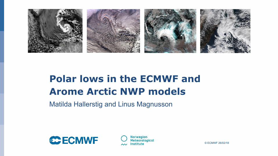
© ECMWF 26/02/18
Polar lows in the ECMWF and Arome Arctic NWP modelsMatilda Hallerstig and Linus Magnusson
October 29, 2014
Who am I?
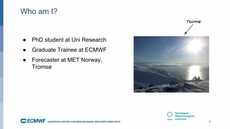
● PhD student at Uni Research●
● Graduate Trainee at ECMWF
● Forecaster at MET Norway, Tromsø
2EUROPEAN CENTRE FOR MEDIUM-RANGE WEATHER FORECASTS
Tromsø
October 29, 2014
What is a polar low?
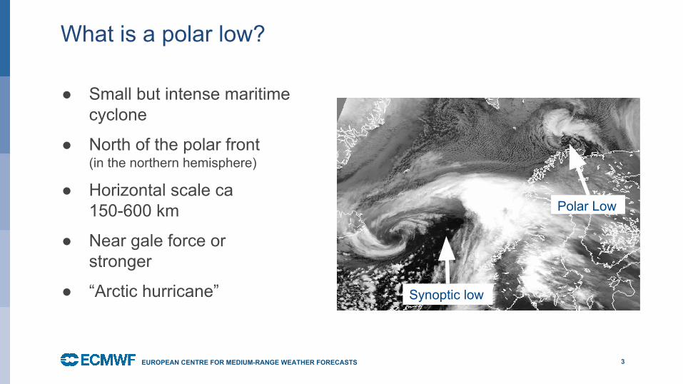
● Small but intense maritime cyclone
● North of the polar front (in the northern hemisphere)
● Horizontal scale ca 150-600 km
● Near gale force or stronger
● “Arctic hurricane”
3EUROPEAN CENTRE FOR MEDIUM-RANGE WEATHER FORECASTS
EUROPEAN CENTRE FOR MEDIUM-RANGE WEATHER FORECASTS
Polar Low
Synoptic low
October 29, 2014
Weather in a polar low
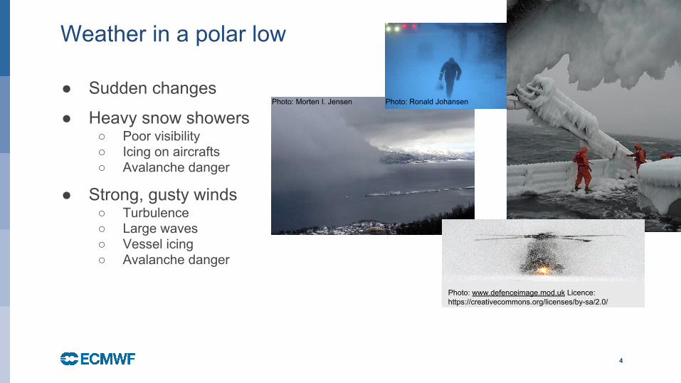
● Sudden changes
● Heavy snow showers○ Poor visibility○ Icing on aircrafts○ Avalanche danger
● Strong, gusty winds○ Turbulence○ Large waves○ Vessel icing○ Avalanche danger
4
Photo: Ronald JohansenPhoto: Morten I. Jensen
Photo: www.defenceimage.mod.uk Licence: https://creativecommons.org/licenses/by-sa/2.0/
October 29, 2014
Forecasting challenges
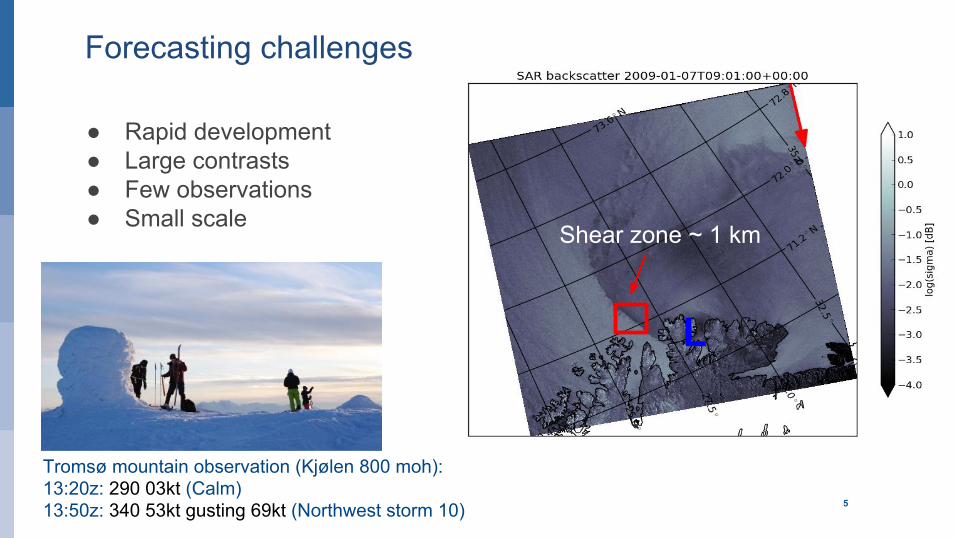
● Rapid development● Large contrasts● Few observations● Small scale
5
EUROPEAN CENTRE FOR MEDIUM-RANGE WEATHER FORECASTS
Shear zone ~ 1 km
Tromsø mountain observation (Kjølen 800 moh):13:20z: 290 03kt (Calm)13:50z: 340 53kt gusting 69kt (Northwest storm 10)
L
October 29, 2014
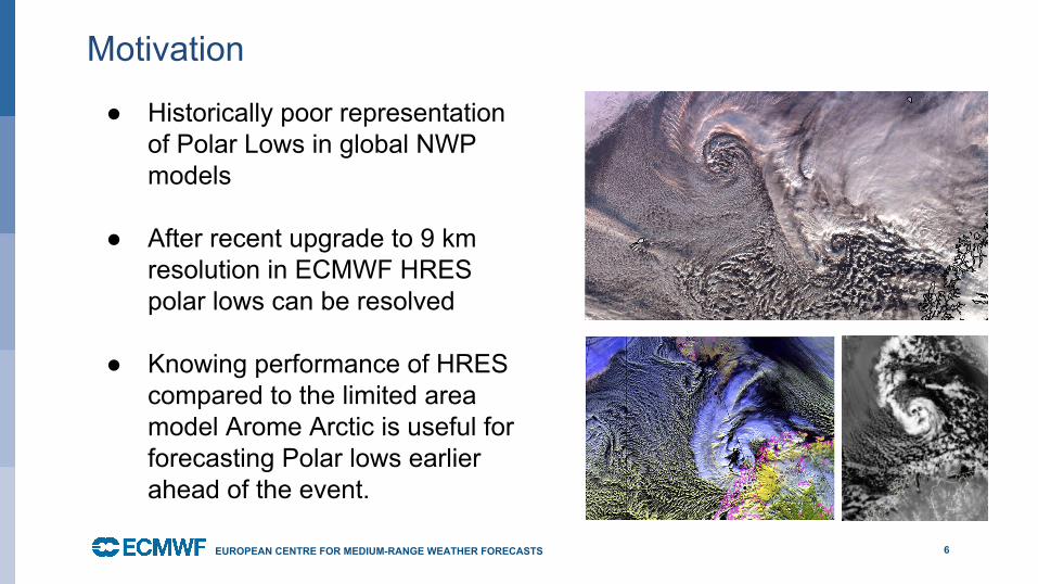
Motivation
● Historically poor representation of Polar Lows in global NWP models
● After recent upgrade to 9 km resolution in ECMWF HRES polar lows can be resolved
● Knowing performance of HRES compared to the limited area model Arome Arctic is useful for forecasting Polar lows earlier ahead of the event.
6EUROPEAN CENTRE FOR MEDIUM-RANGE WEATHER FORECASTS
October 29, 2014
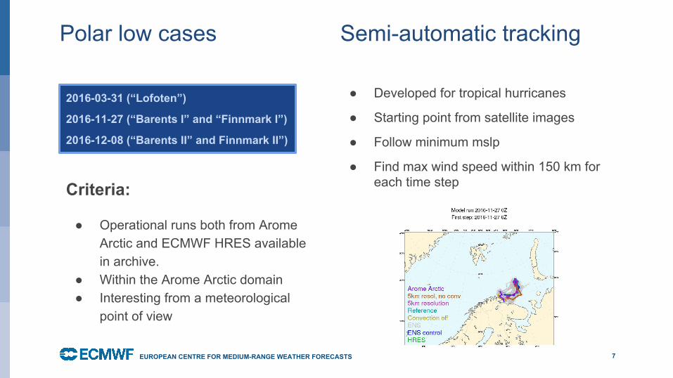
Polar low cases
7EUROPEAN CENTRE FOR MEDIUM-RANGE WEATHER FORECASTS
2016-03-31 (“Lofoten”)
2016-11-27 (“Barents I” and “Finnmark I”)
2016-12-08 (“Barents II” and Finnmark II”)
Semi-automatic tracking
● Developed for tropical hurricanes
● Starting point from satellite images
● Follow minimum mslp
● Find max wind speed within 150 km for each time stepCriteria:
● Operational runs both from Arome Arctic and ECMWF HRES available in archive.
● Within the Arome Arctic domain● Interesting from a meteorological
point of view
October 29, 2014 8EUROPEAN CENTRE FOR MEDIUM-RANGE WEATHER FORECASTS
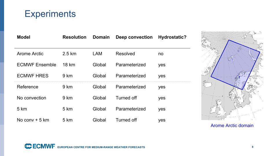
Experiments
Model Resolution Domain Deep convection Hydrostatic?
Arome Arctic 2.5 km LAM Resolved no
ECMWF Ensemble 18 km Global Parameterized yes
ECMWF HRES 9 km Global Parameterized yes
Reference 9 km Global Parameterized yes
No convection 9 km Global Turned off yes
5 km 5 km Global Parameterized yes
No conv + 5 km 5 km Global Turned off yesArome Arctic domain
October 29, 2014
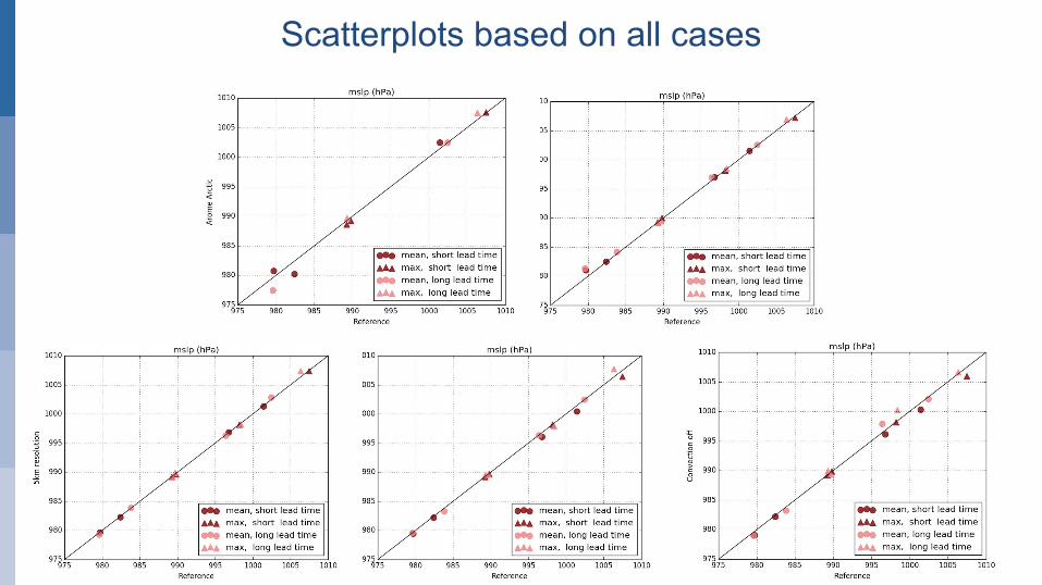
ReferenceReference
Con
vect
ion
off
5 km
reso
lutio
n
5 km
reso
l, no
con
v
Reference Reference
Aro
me
Arc
tic
EN
S c
ontro
l
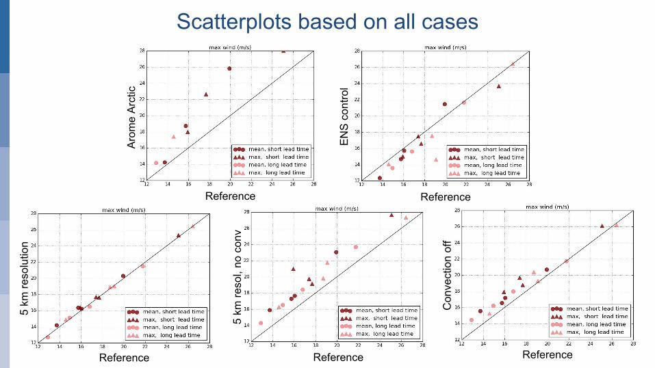
Scatterplots based on all cases
Reference
October 29, 2014
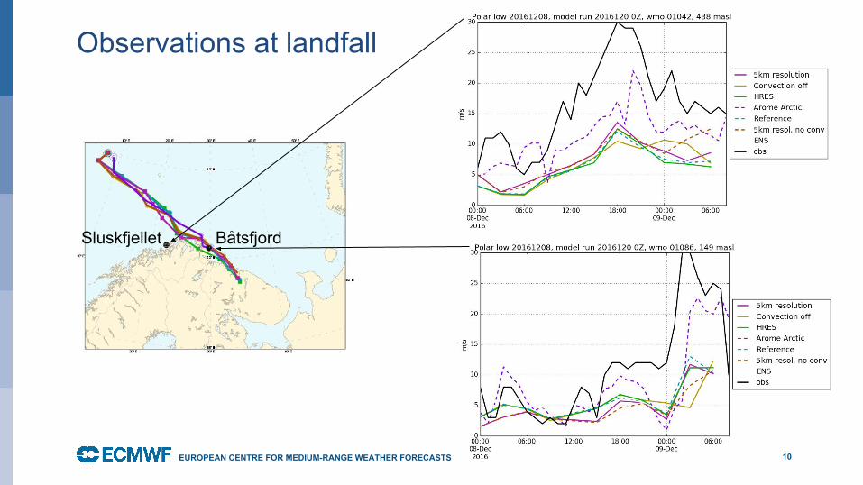
Observations at landfall
●
10EUROPEAN CENTRE FOR MEDIUM-RANGE WEATHER FORECASTS
BåtsfjordSluskfjellet
October 29, 2014
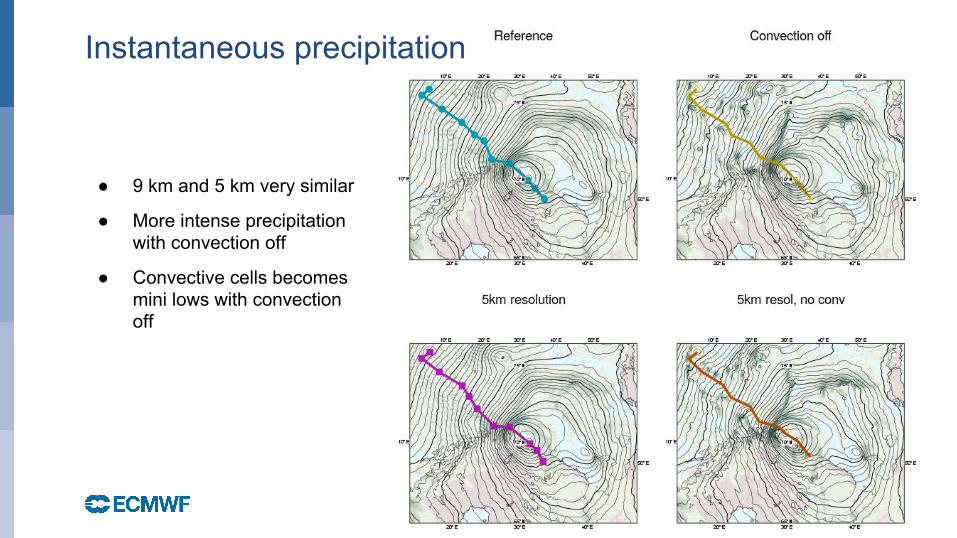
● 9 km and 5 km very similar
● More intense precipitation with convection off
● Convective cells becomes mini lows with convection off
Instantaneous precipitation
October 29, 2014
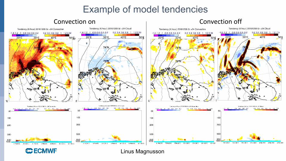
Convection on
Linus Magnusson
Convection off
Example of model tendencies
October 29, 2014
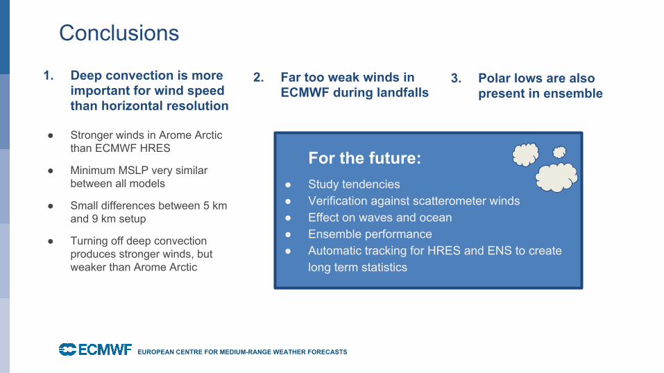
Conclusions
1. Deep convection is more important for wind speed than horizontal resolution
● Stronger winds in Arome Arctic than ECMWF HRES
● Minimum MSLP very similar between all models
● Small differences between 5 km and 9 km setup
● Turning off deep convection produces stronger winds, but weaker than Arome Arctic
EUROPEAN CENTRE FOR MEDIUM-RANGE WEATHER FORECASTS
1.2. Far too weak winds in
ECMWF during landfalls
For the future:● Study tendencies● Verification against scatterometer winds● Effect on waves and ocean● Ensemble performance● Automatic tracking for HRES and ENS to create
long term statistics
1.2.
3. Polar lows are also present in ensemble
© ECMWF 26/02/18
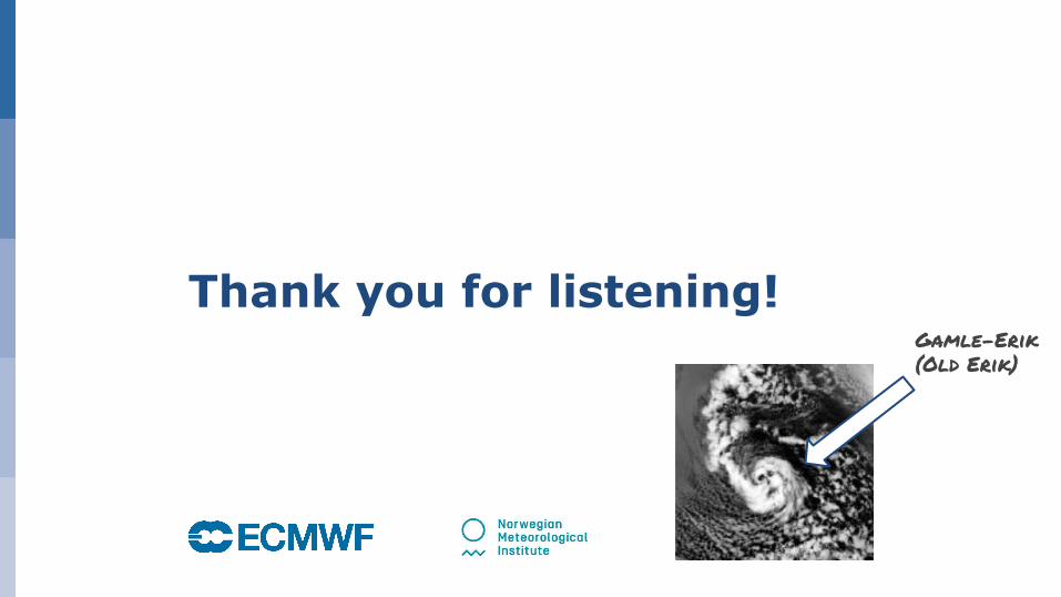
Thank you for listening!Gamle-Erik
(Old Erik)
October 29, 2014
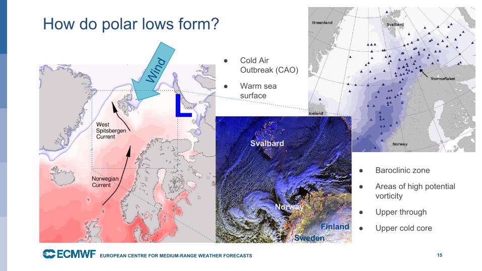
How do polar lows form?
15EUROPEAN CENTRE FOR MEDIUM-RANGE WEATHER FORECASTS
LW
ind
Svalbard
Norway
SwedenFinland
● Cold Air Outbreak (CAO)
● Warm sea surface
● Baroclinic zone
● Areas of high potential vorticity
● Upper through
● Upper cold core
October 29, 201416
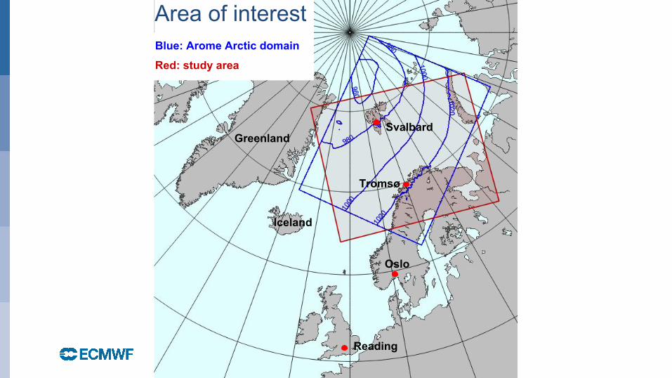
Blue: Arome Arctic domain
Red: study area
Svalbard
Tromsø
Oslo
Reading
Area of interest
Greenland
Iceland
October 29, 2014
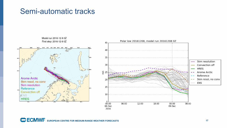
Semi-automatic tracks
●
17EUROPEAN CENTRE FOR MEDIUM-RANGE WEATHER FORECASTS
October 29, 2014
Scatterplots based on all cases