Embed Size (px)
Citation preview
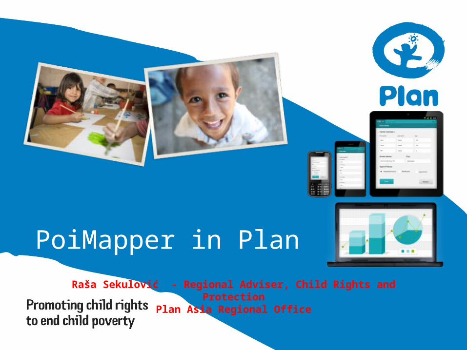
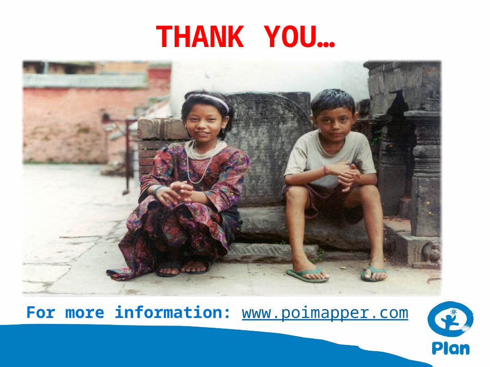
PoiMapper in Plan
Raša Sekulović - Regional Adviser, Child Rights and ProtectionPlan Asia Regional Office
Founded over 75 years ago, Plan International is one of the oldest and largest children’s development organisations in the world. We work in 50 developing countries across Africa, Asia and the Americas to promote child rights and lift millions of children out of poverty.
no religious affiliations no political affiliations no governmental affiliations
What is Plan?
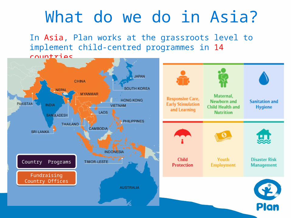
In Asia, Plan works at the grassroots level to implement child-centred programmes in 14 countries.
What do we do in Asia?
Country ProgramsCountry Programs
Fundraising Country Offices
Fundraising Country Offices
• PoiMapper is a solution to replace pen&paper
based monitoring for more reliable, accurate and
up-to-date programme field data collection.
• PoiMapper allows field workers to collect data
with mobile phones or tablets and share the
information near real time for organisations use
for decision making and monitoring.
• Data can be displayed in a visual form on a map,
tables, charts and exported to e.g. excel, word
and pdf formats.
What is PoiMapper?
• Field staff
– Collect data and upload to online server near real time
• Country/Programme Admin
– Manages the users and permissions to access the system
– Manages user groups and forms for programmes/activities
• Reviewers
– Reporting, analyses
– M&E staff & programme managers in Program Units (PUs), Country Offices (COs) and National Offices (NOs), donors, partners
User groups for PoiMapper
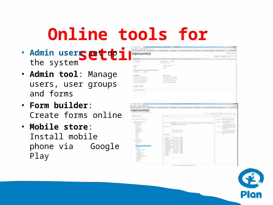
Online tools for setting up• Admin users set up the
system
• Admin tool: Manage users, user groups and forms
• Form builder: Create forms online
• Mobile store: Install mobile phone via Google Play
Data Collection
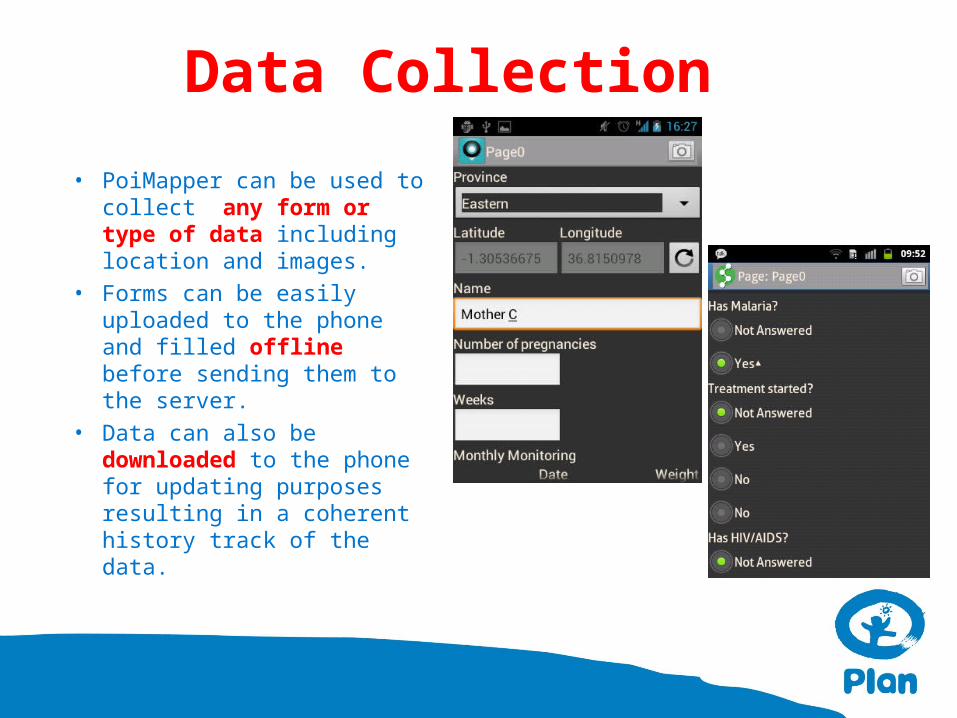
• PoiMapper can be used to collect any form or type of data including location and images.
• Forms can be easily uploaded to the phone and filled offline before sending them to the server.
• Data can also be downloaded to the phone for updating purposes resulting in a coherent history track of the data.
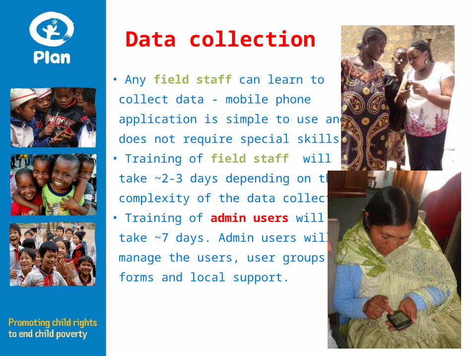
• Any field staff can learn to
collect data - mobile phone
application is simple to use and
does not require special skills.
• Training of field staff will
take ~2-3 days depending on the
complexity of the data collection activities.
• Training of admin users will
take ~7 days. Admin users will
manage the users, user groups,
forms and local support.
Data collection
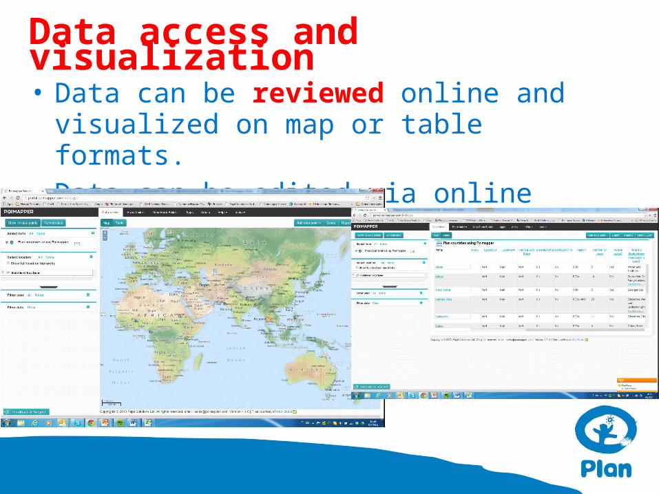
• Data can be reviewed online and visualized on map or table formats.
• Data can be edited via online platform, if needed.
Data access and visualization
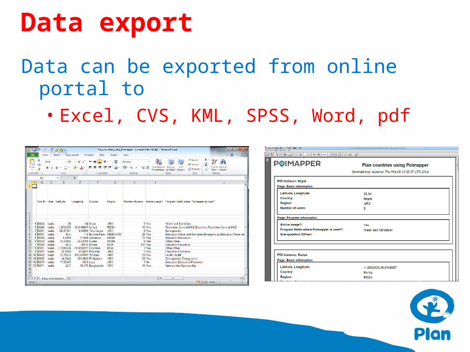
Data can be exported from online portal to• Excel, CVS, KML, SPSS, Word, pdf
Data export
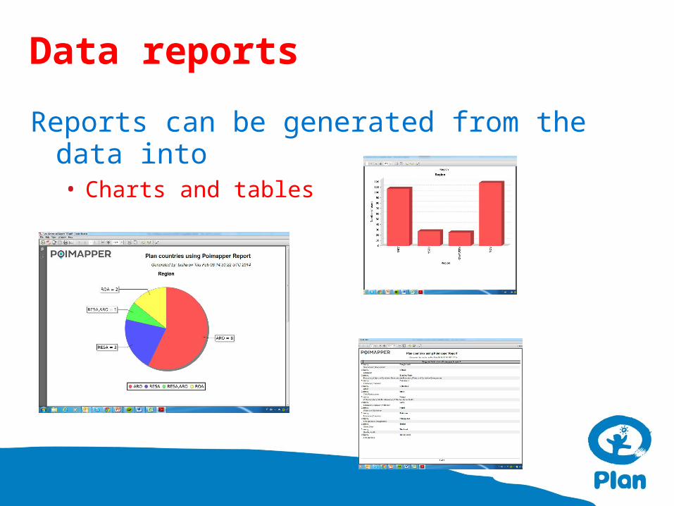
Reports can be generated from the data into • Charts and tables
Data reports
Support structure includes• Plan NO: Coordination of support
functions and partnership management with the solution provider
• Plan CO/RO ”Champion” staff: support in the field
• Pajat solution: Technical implementation, improvements and further development of the solution
Plan support structure
Support functions include:
• License management and partnership with the solution provider
• Technical support and troubleshooting (online, onsite)
• Online trainings
• Onsite trainings
• Linkage to core PoiMapper staff in the organisation
• Coordinating further development of the solution based on the feedback from different countries/programs
• Support in grants/proposals to integrate PoiMapper in M&E or program work
Plan support functions

PoiMapper in Plan – How did we get here?
Development started in 2009 in collaboration w Plan Finland, Plan Kenya and company Pajat.
First Pilot in Kenya 2010. Plan Kenya mapped water points, households, hospitals and schools. Evaluation of PoiMapper was encouraging.
In 2011 Plan Thailand started using PoiMapper in Tuberculosis monitoring winning also the Global Award in 2012.
By 2013 several countries were using PoiMapper in a variety of fields including health, ECCD, WASH, disasters etc. Users now: Kenya, Thailand, Bolivia, Burkina Faso, Nepal, Philippines, Timor Leste, Colombia, Cameroon among others.
In June 2013 Plan Finland signed the PoiMapper globally usable license agreement to cut the costs, simplify the uptake & license agreements and systematise the data structures. More than 25 COs have shown interest in using PoiMapper, and more are coming!
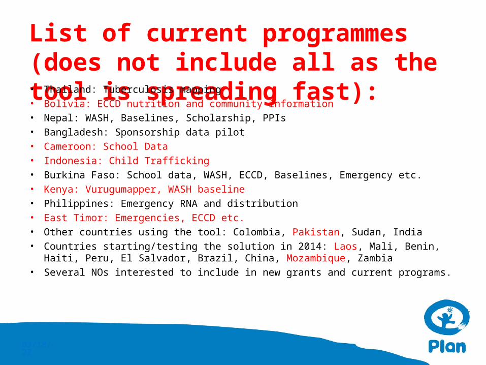
List of current programmes (does not include all as the tool is spreading fast):• Thailand: Tuberculosis mapping
• Bolivia: ECCD nutrition and community information
• Nepal: WASH, Baselines, Scholarship, PPIs
• Bangladesh: Sponsorship data pilot
• Cameroon: School Data
• Indonesia: Child Trafficking
• Burkina Faso: School data, WASH, ECCD, Baselines, Emergency etc.
• Kenya: Vurugumapper, WASH baseline
• Philippines: Emergency RNA and distribution
• East Timor: Emergencies, ECCD etc.
• Other countries using the tool: Colombia, Pakistan, Sudan, India
• Countries starting/testing the solution in 2014: Laos, Mali, Benin, Haiti, Peru, El Salvador, Brazil, China, Mozambique, Zambia
• Several NOs interested to include in new grants and current programs.
04/19/23
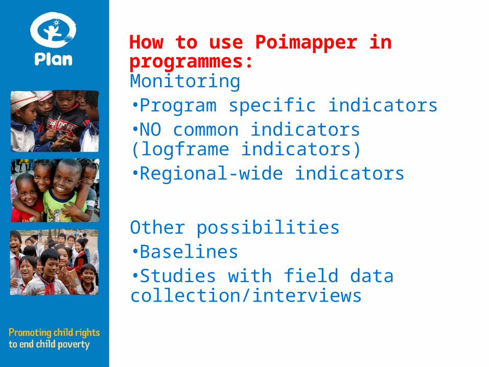
Monitoring•Program specific indicators•NO common indicators (logframe indicators)•Regional-wide indicators
Other possibilities•Baselines•Studies with field data collection/interviews
How to use Poimapper in programmes:
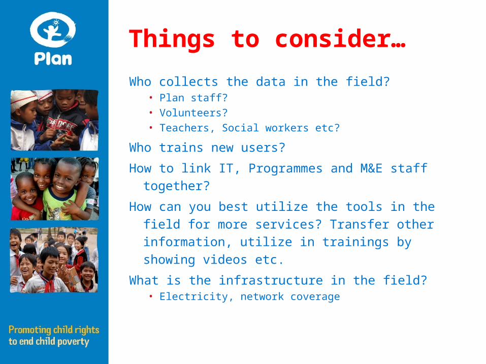
Things to consider…
Who collects the data in the field?• Plan staff?
• Volunteers?
• Teachers, Social workers etc?
Who trains new users?
How to link IT, Programmes and M&E staff together?
How can you best utilize the tools in the field for more
services? Transfer other information, utilize in
trainings by showing videos etc.
What is the infrastructure in the field?• Electricity, network coverage