Embed Size (px)
Citation preview
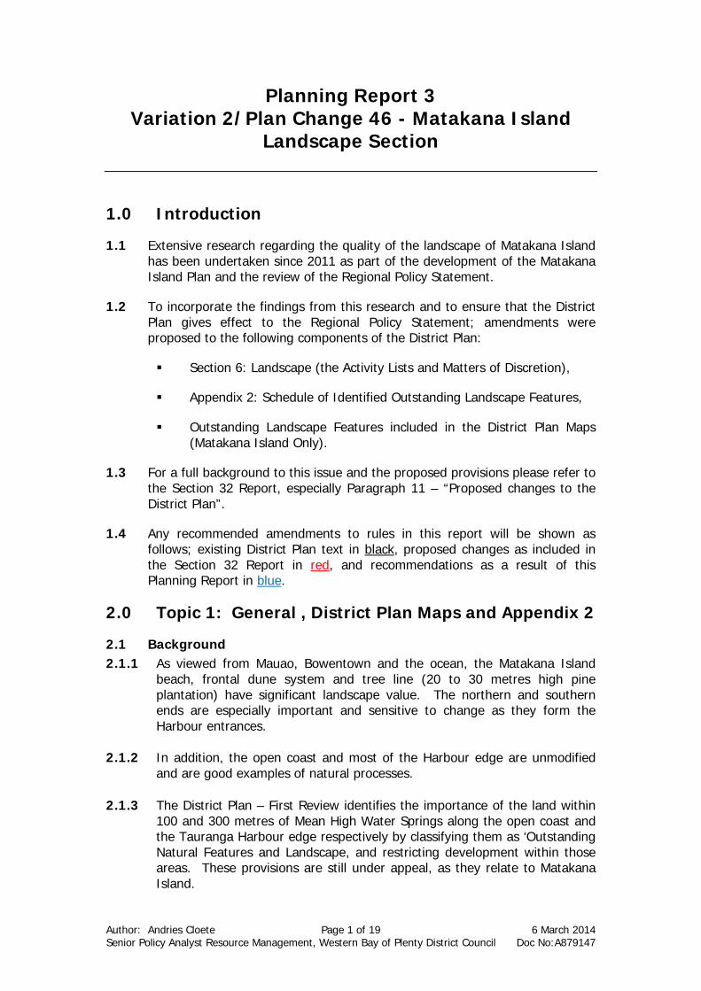
Author: Andries Cloete Page 1 of 19 6 March 2014 Senior Policy Analyst Resource Management, Western Bay of Plenty District Council Doc No:A879147
Planning Report 3 Variation 2/Plan Change 46 - Matakana Island
Landscape Section
1.0 Introduction
1.1 Extensive research regarding the quality of the landscape of Matakana Island has been undertaken since 2011 as part of the development of the Matakana Island Plan and the review of the Regional Policy Statement.
1.2 To incorporate the findings from this research and to ensure that the District Plan gives effect to the Regional Policy Statement; amendments were proposed to the following components of the District Plan:
Section 6: Landscape (the Activity Lists and Matters of Discretion),
Appendix 2: Schedule of Identified Outstanding Landscape Features,
Outstanding Landscape Features included in the District Plan Maps (Matakana Island Only).
1.3 For a full background to this issue and the proposed provisions please refer to the Section 32 Report, especially Paragraph 11 – “Proposed changes to the District Plan”.
1.4 Any recommended amendments to rules in this report will be shown as follows; existing District Plan text in black, proposed changes as included in the Section 32 Report in red, and recommendations as a result of this Planning Report in blue.
2.0 Topic 1: General , District Plan Maps and Appendix 2
2.1 Background 2.1.1 As viewed from Mauao, Bowentown and the ocean, the Matakana Island
beach, frontal dune system and tree line (20 to 30 metres high pine plantation) have significant landscape value. The northern and southern ends are especially important and sensitive to change as they form the Harbour entrances.
2.1.2 In addition, the open coast and most of the Harbour edge are unmodified
and are good examples of natural processes. 2.1.3 The District Plan – First Review identifies the importance of the land within
100 and 300 metres of Mean High Water Springs along the open coast and the Tauranga Harbour edge respectively by classifying them as ‘Outstanding Natural Features and Landscape, and restricting development within those areas. These provisions are still under appeal, as they relate to Matakana Island.
Author: Andries Cloete Page 2 of 19 6 March 2014 Senior Policy Analyst Resource Management, Western Bay of Plenty District Council Doc No:A879147
2.2 Submission Points
2.2.1 Eight submissions and seven further submissions were received.
2.2.2 Submitters 7 and 10 argue that Matakana Island is not an outstanding landscape feature and therefore all provisions that related to Matakana Island in Section 6 and the Planning Maps (S9, S9a and S25) should be deleted. These submission points are supported by FS27 and FS29, and opposed by FS28.
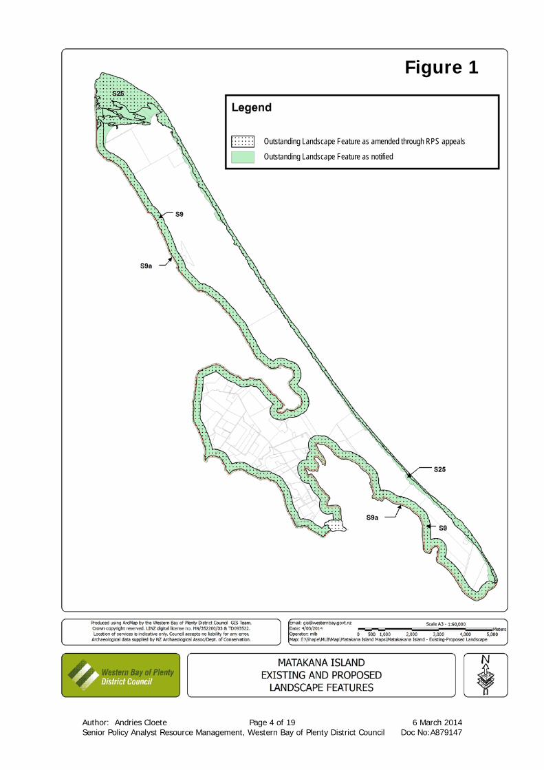
2.2.3 Bay Of Plenty Regional Council supports the proposed changes, but advocate that they be amended to incorporate that latest changes to the Proposed Regional Policy Statement (RPS) (amendments have been made through Environment Court Mediation on the Proposed RPS since the notification of this Plan Change/Variation) (see figure 1). FS27, FS29 and FS30 opposed the initial amendments sought by the Regional Council.
2.2.4 The Regional Council also requested that S24 be removed from Appendix 2 if it is replaced by S25. However, S25 only applies to Matakana Island. S24 still applies to the rest of the open coast and therefore has to be retained in the District Plan.
2.2.5 The proposed changes are supported by Submitters 14, 15 and 16.
2.2.6 Submitter 2 requested that the proposed Outstanding Landscape Features be amended to include sites of cultural significance.
2.3 Option 1 – Retain the Outstanding Landscape Features in Appendix 2 and on the District Plan Maps as Notified.
Advantages
The current amenity and landscape values can be recognised and retained.
The Plan will give effect to the RPS and New Zealand Coastal Policy Statement (NZCPS).
Council will be able to mitigate the effects from development.
The overlay distance of 50m from MHWS along the Harbour will be the same as for the rest of the District.
Will support the objectives (especially those in Section 6) of the Plan.
Disadvantages
It will put some restrictions on landowners. The latest changes to the RPS, as per the signed
consent order (which was finalised after the notification), will not be incorporated.
Effectiveness/ Efficiency
Council will be able to avoid, remedy or mitigate the effects from development effectively.
The Plan will be more effective by giving effect to the RPS and the NZCPS.
Will take the Hapu Management Plan into account.
Author: Andries Cloete Page 3 of 19 6 March 2014 Senior Policy Analyst Resource Management, Western Bay of Plenty District Council Doc No:A879147
2.4 Option 2 – Delete the Outstanding Landscape Features of Matakana Island from the District Plan Maps and Appendix 2
Advantages
Will make it less restrictive for developers.
Disadvantages
Will not recognise and retain the current amenity and landscape values.
The Plan will fail to give effect to the RPS and NZCPS. Council will not be able to mitigate the effects from
development. Plan will not take the Hapu Management Plan into
account. Effectiveness/ Efficiency
The District Plan will not be effective and efficient in protecting outstanding landscape features on Matakana Island that are valued by the community and people from surrounding areas, such as Tauranga inner Harbour or visitors walking up or around Mauao and Bowentown.
2.5 Option 3 – Amend the Outstanding Landscape Features as per the
latest amendment to the RPS (as agreed during Environment Court Mediation on the RPS)
Advantages
The current amenity and landscape values can be recognised and retained.
The Plan will give effect to the Regional Policy Statement and NZCPS
Council will be able to mitigate the effects from development.
The overlay distance of 50m from MHWS along the Harbour will be the same as for the rest of the District.
Will support the objectives (especially those in Section 6) of the Plan.
Will incorporate the agreed changes as per the Environment Court Mediation on the Proposed RPS.
Disadvantages
It will put some restrictions on landowners.
Effectiveness/ Efficiency
Council will be able to avoid, remedy or mitigate the effects from development effectively.
The District Plan will be more effective by giving effect to the RPS and the NZCPS.
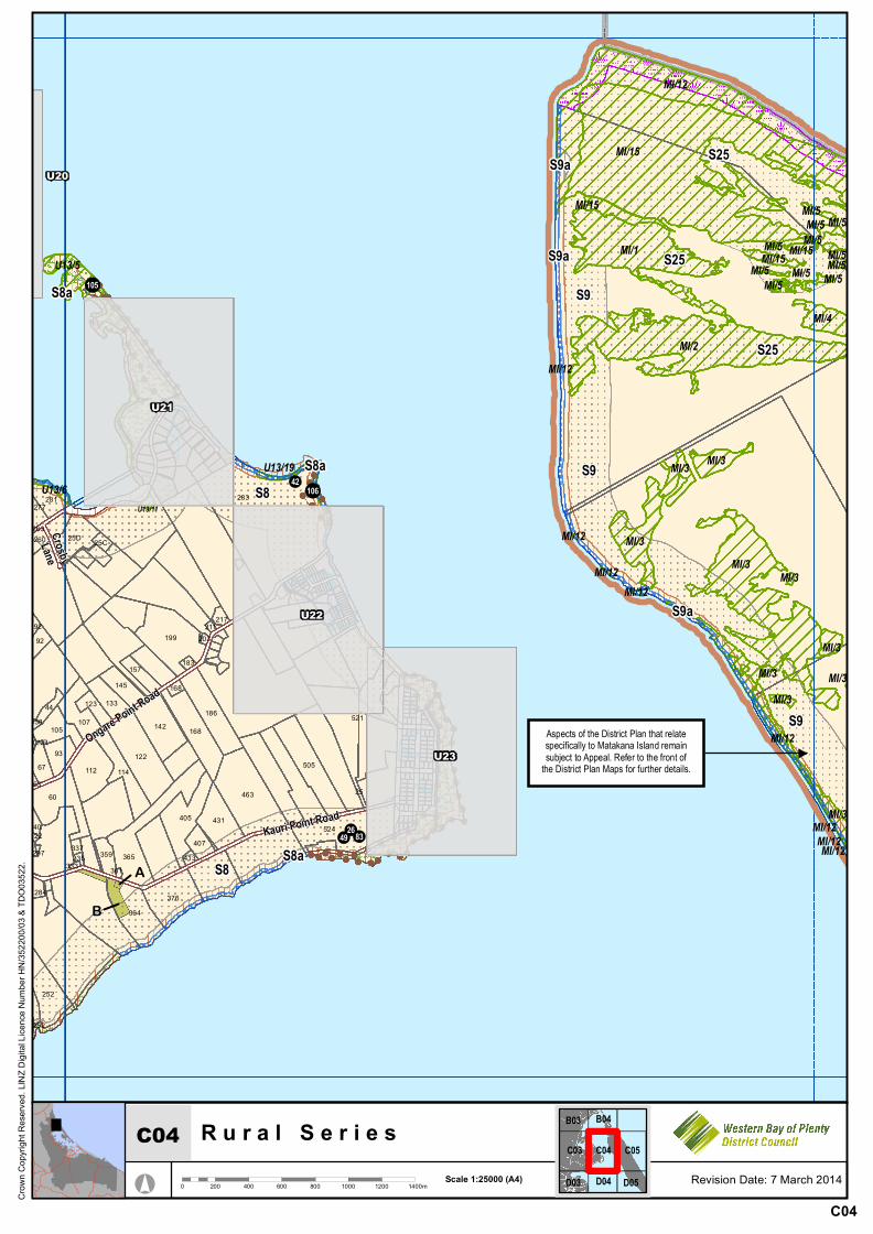
Will take the Hapu Management Plan into account. 2.6 Discussion 2.6.1 It is proposed through Plan Change 46/Variation 2 that three outstanding
landscape features apply to Matakana Island (see map on next page):
Author: Andries Cloete Page 4 of 19 6 March 2014 Senior Policy Analyst Resource Management, Western Bay of Plenty District Council Doc No:A879147
Outstanding Landscape Feature as amended through RPS appeals
Outstanding Landscape Feature as notified
Figure 1
Author: Andries Cloete Page 5 of 19 6 March 2014 Senior Policy Analyst Resource Management, Western Bay of Plenty District Council Doc No:A879147
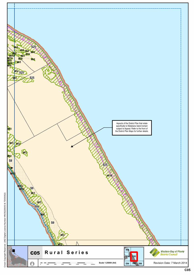
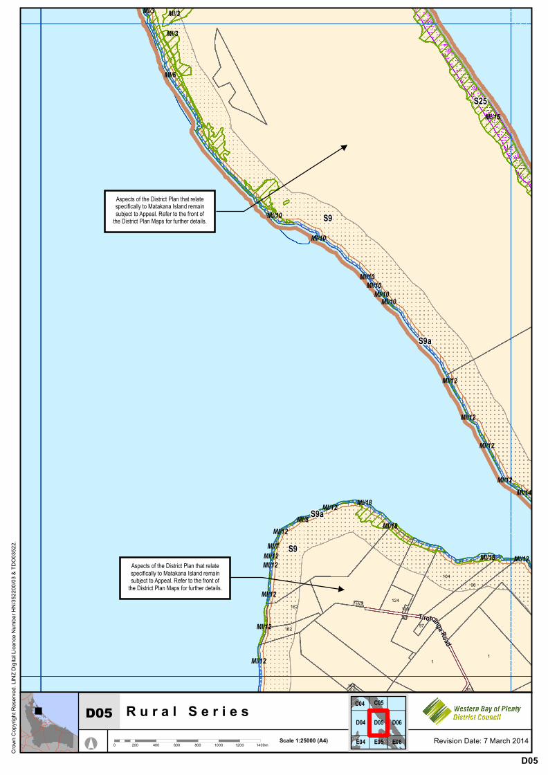
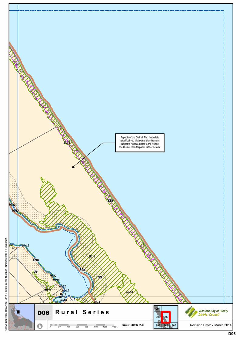
(a) S25 – Matakana Open Coast, which replaces S24 (a generic district
wide landscape feature along the open coast). (b) S9 – Matakana Island Management Area, which includes the land
between 50m above MHWS and 300m above MHWS adjoining the Tauranga Harbour.
(c) S9a - Matakana Island Management Area, which include the land between MHWS and 50m.
2.6.2 S9 and S9a were included in the District Plan – First Review, but this Plan
Change/Variation proposes that the distance of S9a be increased from 40m above MHWS to 50m above MHWS, to align the with existing outstanding landscape features along the harbour edge. As a result, this change will also impact on S9.
2.6.3 Although S24, S9 and S9a were included in the District Plan – First Review,
they are still under an Environment Court appeal. 2.6.4 The Hapu Management Plan, Cultural Values Assessment report and
Matakana Island landscape assessment all conclude that the current landscape along the Harbour is of high value, especially the forested sand barrier, and should not be affected by future development. The proposed landscape features are outstanding and valued by not only the community, but also by:
the general public along the Tauranga Harbour, visitors coming through the harbour entrance, and people visiting Mauao or Bowentown.
2.6.5 Since 2012, the Regional Council also reviewed the natural character areas
as part of the RPS review. During the review process, the two Councils agreed that an attempt should be made to align the outstanding areas to be included in the RPS and the District Plan. As a result the amendments to Outstanding Landscape Features S25, S9 and S9a included in Proposed Plan Change 46/Variation 2 (as notified) were as per the Proposed RPS. However, since the notification of this Plan Change/Variation, the Regional Council has, through the Environment Court appeal process, amended the outstanding features in the RPS. As a result, proposed Outstanding Landscape Features S25, S9 and S9a (as notified) are no longer aligned with the RPS. Both the Regional Council and Submitter 8 requested that S25, S9 and S9a be amended as per the latest features included in the RPS (which will become operative in due course).
2.6.6 It is important to note that the changes to the natural character areas on
Matakana Island, as a result of the Environment Court appeals process on the Proposed RPS, were supported by TKC Holdings, Carrus Corporation, Blakeley Pacific and Western Bay of Plenty District Council.
2.6.7 Due to this agreement on the “boundaries” of the Natural Character areas to
be included in the RPS, the proposed Outstanding Landscape Features to be included in the District Plan has to be amended to realign it with the RPS. The submission point from the Regional Council is therefore supported.
Author: Andries Cloete Page 6 of 19 6 March 2014 Senior Policy Analyst Resource Management, Western Bay of Plenty District Council Doc No:A879147
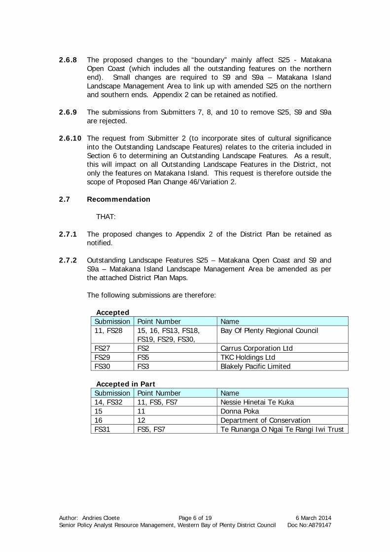
2.6.8 The proposed changes to the “boundary” mainly affect S25 - Matakana
Open Coast (which includes all the outstanding features on the northern end). Small changes are required to S9 and S9a – Matakana Island Landscape Management Area to link up with amended S25 on the northern and southern ends. Appendix 2 can be retained as notified.
2.6.9 The submissions from Submitters 7, 8, and 10 to remove S25, S9 and S9a
are rejected. 2.6.10 The request from Submitter 2 (to incorporate sites of cultural significance
into the Outstanding Landscape Features) relates to the criteria included in Section 6 to determining an Outstanding Landscape Features. As a result, this will impact on all Outstanding Landscape Features in the District, not only the features on Matakana Island. This request is therefore outside the scope of Proposed Plan Change 46/Variation 2.
2.7 Recommendation
THAT:
2.7.1 The proposed changes to Appendix 2 of the District Plan be retained as notified.
2.7.2 Outstanding Landscape Features S25 – Matakana Open Coast and S9 and
S9a – Matakana Island Landscape Management Area be amended as per the attached District Plan Maps.
The following submissions are therefore:
Accepted Submission Point Number Name 11, FS28 15, 16, FS13, FS18,
FS19, FS29, FS30, Bay Of Plenty Regional Council
FS27 FS2 Carrus Corporation Ltd FS29 FS5 TKC Holdings Ltd FS30 FS3 Blakely Pacific Limited
Accepted in Part Submission Point Number Name 14, FS32 11, FS5, FS7 Nessie Hinetai Te Kuka 15 11 Donna Poka 16 12 Department of Conservation FS31 FS5, FS7 Te Runanga O Ngai Te Rangi Iwi Trust
Author: Andries Cloete Page 7 of 19 6 March 2014 Senior Policy Analyst Resource Management, Western Bay of Plenty District Council Doc No:A879147
Rejected Submission Point Number Name 2 4 Easton Taikato 7, FS29 11, FS22, FS24, FS44,
FS45, FS69, FS70, FS96, FS125, FS155,
TKC Holdings Ltd
8, FS27 9, 11, FS 19, FS20, FS45, FS48, FS72, FS73,
Carrus Corporation Ltd
10 15, 16 Blakely Pacific Limited FS26 FS3 Cathryn Faulkner
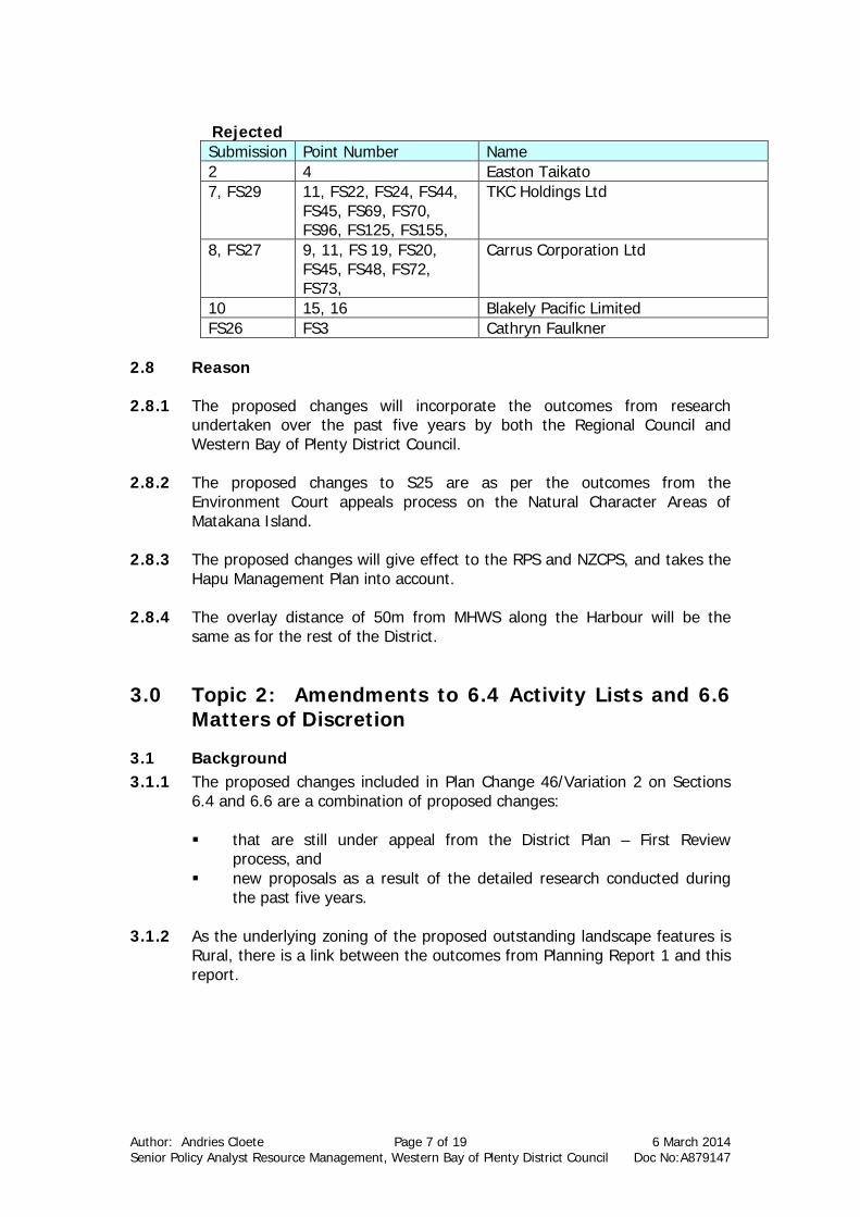
2.8 Reason 2.8.1 The proposed changes will incorporate the outcomes from research
undertaken over the past five years by both the Regional Council and Western Bay of Plenty District Council.
2.8.2 The proposed changes to S25 are as per the outcomes from the
Environment Court appeals process on the Natural Character Areas of Matakana Island.
2.8.3 The proposed changes will give effect to the RPS and NZCPS, and takes the
Hapu Management Plan into account. 2.8.4 The overlay distance of 50m from MHWS along the Harbour will be the
same as for the rest of the District.
3.0 Topic 2: Amendments to 6.4 Activity Lists and 6.6 Matters of Discretion
3.1 Background 3.1.1 The proposed changes included in Plan Change 46/Variation 2 on Sections
6.4 and 6.6 are a combination of proposed changes:
that are still under appeal from the District Plan – First Review process, and
new proposals as a result of the detailed research conducted during the past five years.
3.1.2 As the underlying zoning of the proposed outstanding landscape features is
Rural, there is a link between the outcomes from Planning Report 1 and this report.
Author: Andries Cloete Page 8 of 19 6 March 2014 Senior Policy Analyst Resource Management, Western Bay of Plenty District Council Doc No:A879147
3.2 Submission Points
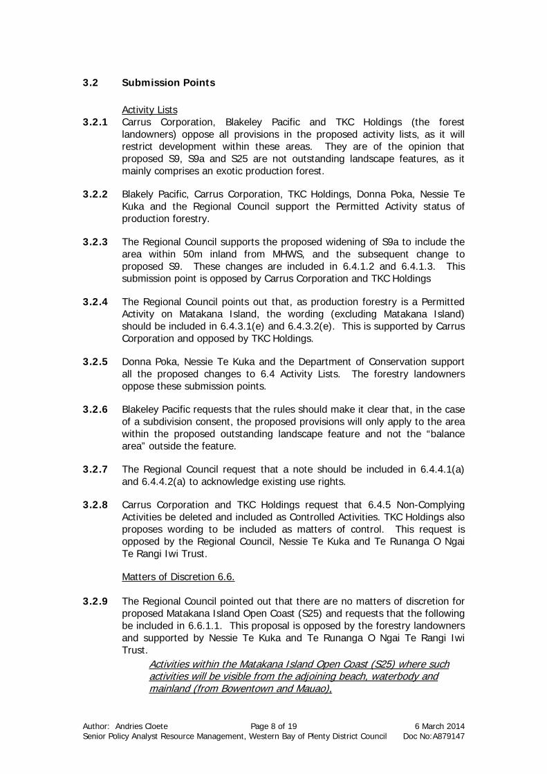
Activity Lists 3.2.1 Carrus Corporation, Blakeley Pacific and TKC Holdings (the forest
landowners) oppose all provisions in the proposed activity lists, as it will restrict development within these areas. They are of the opinion that proposed S9, S9a and S25 are not outstanding landscape features, as it mainly comprises an exotic production forest.
3.2.2 Blakely Pacific, Carrus Corporation, TKC Holdings, Donna Poka, Nessie Te Kuka and the Regional Council support the Permitted Activity status of production forestry.
3.2.3 The Regional Council supports the proposed widening of S9a to include the area within 50m inland from MHWS, and the subsequent change to proposed S9. These changes are included in 6.4.1.2 and 6.4.1.3. This submission point is opposed by Carrus Corporation and TKC Holdings
3.2.4 The Regional Council points out that, as production forestry is a Permitted Activity on Matakana Island, the wording (excluding Matakana Island) should be included in 6.4.3.1(e) and 6.4.3.2(e). This is supported by Carrus Corporation and opposed by TKC Holdings.
3.2.5 Donna Poka, Nessie Te Kuka and the Department of Conservation support all the proposed changes to 6.4 Activity Lists. The forestry landowners oppose these submission points.
3.2.6 Blakeley Pacific requests that the rules should make it clear that, in the case of a subdivision consent, the proposed provisions will only apply to the area within the proposed outstanding landscape feature and not the “balance area” outside the feature.
3.2.7 The Regional Council request that a note should be included in 6.4.4.1(a) and 6.4.4.2(a) to acknowledge existing use rights.
3.2.8 Carrus Corporation and TKC Holdings request that 6.4.5 Non-Complying Activities be deleted and included as Controlled Activities. TKC Holdings also proposes wording to be included as matters of control. This request is opposed by the Regional Council, Nessie Te Kuka and Te Runanga O Ngai Te Rangi Iwi Trust.
Matters of Discretion 6.6.
3.2.9 The Regional Council pointed out that there are no matters of discretion for proposed Matakana Island Open Coast (S25) and requests that the following be included in 6.6.1.1. This proposal is opposed by the forestry landowners and supported by Nessie Te Kuka and Te Runanga O Ngai Te Rangi Iwi Trust.
Activities within the Matakana Island Open Coast (S25) where such activities will be visible from the adjoining beach, waterbody and mainland (from Bowentown and Mauao),
Author: Andries Cloete Page 9 of 19 6 March 2014 Senior Policy Analyst Resource Management, Western Bay of Plenty District Council Doc No:A879147
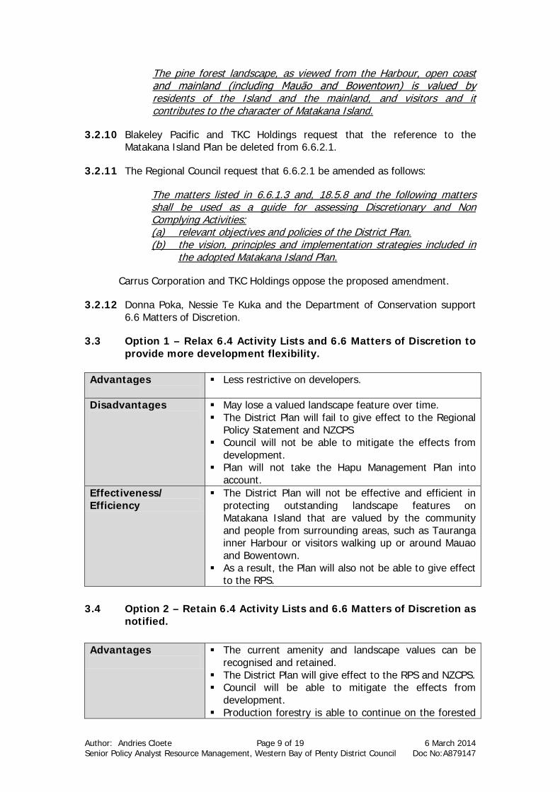
The pine forest landscape, as viewed from the Harbour, open coast and mainland (including Mauāo and Bowentown) is valued by residents of the Island and the mainland, and visitors and it contributes to the character of Matakana Island.
3.2.10 Blakeley Pacific and TKC Holdings request that the reference to the Matakana Island Plan be deleted from 6.6.2.1.
3.2.11 The Regional Council request that 6.6.2.1 be amended as follows:
The matters listed in 6.6.1.3 and, 18.5.8 and the following matters shall be used as a guide for assessing Discretionary and Non Complying Activities: (a) relevant objectives and policies of the District Plan. (b) the vision, principles and implementation strategies included in
the adopted Matakana Island Plan.
Carrus Corporation and TKC Holdings oppose the proposed amendment.
3.2.12 Donna Poka, Nessie Te Kuka and the Department of Conservation support 6.6 Matters of Discretion.
3.3 Option 1 – Relax 6.4 Activity Lists and 6.6 Matters of Discretion to provide more development flexibility.
Advantages
Less restrictive on developers.
Disadvantages
May lose a valued landscape feature over time. The District Plan will fail to give effect to the Regional
Policy Statement and NZCPS Council will not be able to mitigate the effects from
development. Plan will not take the Hapu Management Plan into
account. Effectiveness/ Efficiency
The District Plan will not be effective and efficient in protecting outstanding landscape features on Matakana Island that are valued by the community and people from surrounding areas, such as Tauranga inner Harbour or visitors walking up or around Mauao and Bowentown.
As a result, the Plan will also not be able to give effect to the RPS.
3.4 Option 2 – Retain 6.4 Activity Lists and 6.6 Matters of Discretion as
notified. Advantages
The current amenity and landscape values can be recognised and retained.
The District Plan will give effect to the RPS and NZCPS. Council will be able to mitigate the effects from
development. Production forestry is able to continue on the forested
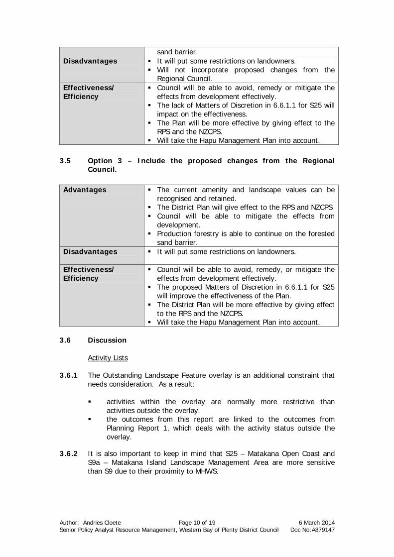
Author: Andries Cloete Page 10 of 19 6 March 2014 Senior Policy Analyst Resource Management, Western Bay of Plenty District Council Doc No:A879147
sand barrier. Disadvantages
It will put some restrictions on landowners. Will not incorporate proposed changes from the
Regional Council. Effectiveness/ Efficiency
Council will be able to avoid, remedy or mitigate the effects from development effectively.
The lack of Matters of Discretion in 6.6.1.1 for S25 will impact on the effectiveness.
The Plan will be more effective by giving effect to the RPS and the NZCPS.
Will take the Hapu Management Plan into account. 3.5 Option 3 – Include the proposed changes from the Regional
Council. Advantages
The current amenity and landscape values can be recognised and retained.
The District Plan will give effect to the RPS and NZCPS Council will be able to mitigate the effects from
development. Production forestry is able to continue on the forested
sand barrier. Disadvantages
It will put some restrictions on landowners.
Effectiveness/ Efficiency
Council will be able to avoid, remedy, or mitigate the effects from development effectively.
The proposed Matters of Discretion in 6.6.1.1 for S25 will improve the effectiveness of the Plan.
The District Plan will be more effective by giving effect to the RPS and the NZCPS.
Will take the Hapu Management Plan into account. 3.6 Discussion
Activity Lists
3.6.1 The Outstanding Landscape Feature overlay is an additional constraint that needs consideration. As a result:
activities within the overlay are normally more restrictive than
activities outside the overlay. the outcomes from this report are linked to the outcomes from
Planning Report 1, which deals with the activity status outside the overlay.
3.6.2 It is also important to keep in mind that S25 – Matakana Open Coast and S9a – Matakana Island Landscape Management Area are more sensitive than S9 due to their proximity to MHWS.
Author: Andries Cloete Page 11 of 19 6 March 2014 Senior Policy Analyst Resource Management, Western Bay of Plenty District Council Doc No:A879147
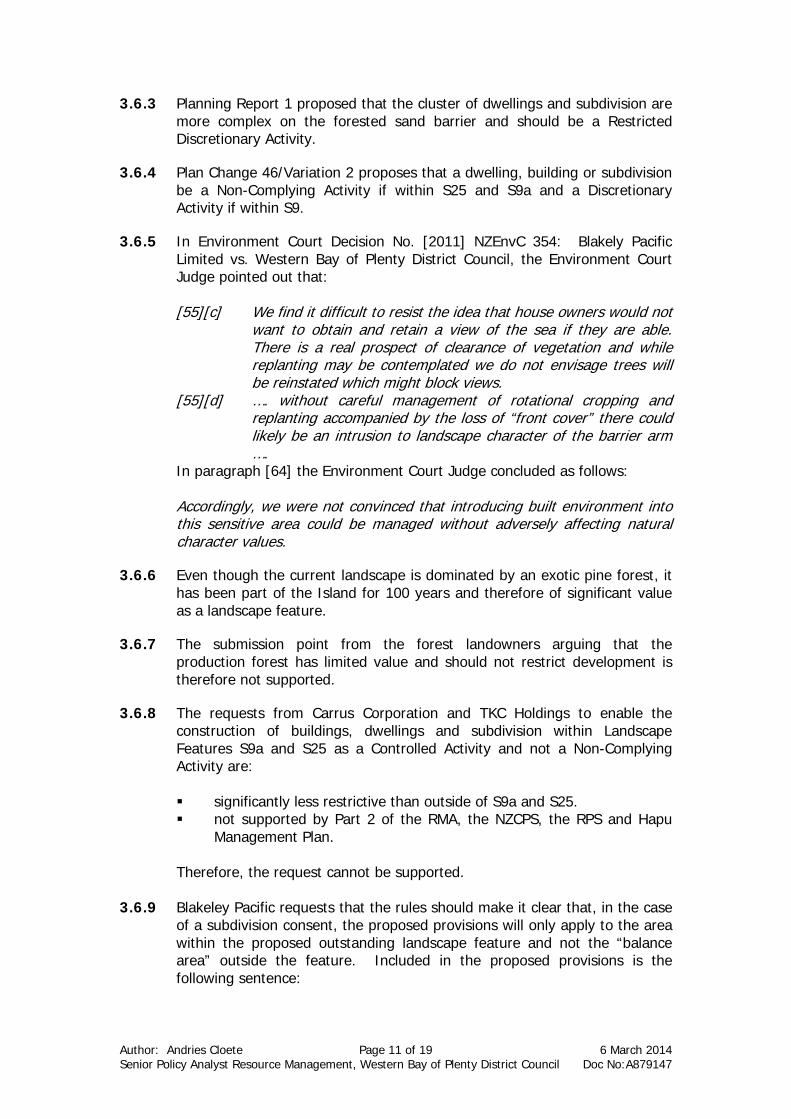
3.6.3 Planning Report 1 proposed that the cluster of dwellings and subdivision are more complex on the forested sand barrier and should be a Restricted Discretionary Activity.
3.6.4 Plan Change 46/Variation 2 proposes that a dwelling, building or subdivision be a Non-Complying Activity if within S25 and S9a and a Discretionary Activity if within S9.
3.6.5 In Environment Court Decision No. [2011] NZEnvC 354: Blakely Pacific Limited vs. Western Bay of Plenty District Council, the Environment Court Judge pointed out that:
[55][c] We find it difficult to resist the idea that house owners would not
want to obtain and retain a view of the sea if they are able. There is a real prospect of clearance of vegetation and while replanting may be contemplated we do not envisage trees will be reinstated which might block views.
[55][d] …. without careful management of rotational cropping and replanting accompanied by the loss of “front cover” there could likely be an intrusion to landscape character of the barrier arm ….
In paragraph [64] the Environment Court Judge concluded as follows: Accordingly, we were not convinced that introducing built environment into this sensitive area could be managed without adversely affecting natural character values.
3.6.6 Even though the current landscape is dominated by an exotic pine forest, it has been part of the Island for 100 years and therefore of significant value as a landscape feature.
3.6.7 The submission point from the forest landowners arguing that the production forest has limited value and should not restrict development is therefore not supported.
3.6.8 The requests from Carrus Corporation and TKC Holdings to enable the construction of buildings, dwellings and subdivision within Landscape Features S9a and S25 as a Controlled Activity and not a Non-Complying Activity are:
significantly less restrictive than outside of S9a and S25. not supported by Part 2 of the RMA, the NZCPS, the RPS and Hapu
Management Plan. Therefore, the request cannot be supported.
3.6.9 Blakeley Pacific requests that the rules should make it clear that, in the case
of a subdivision consent, the proposed provisions will only apply to the area within the proposed outstanding landscape feature and not the “balance area” outside the feature. Included in the proposed provisions is the following sentence:
Author: Andries Cloete Page 12 of 19 6 March 2014 Senior Policy Analyst Resource Management, Western Bay of Plenty District Council Doc No:A879147
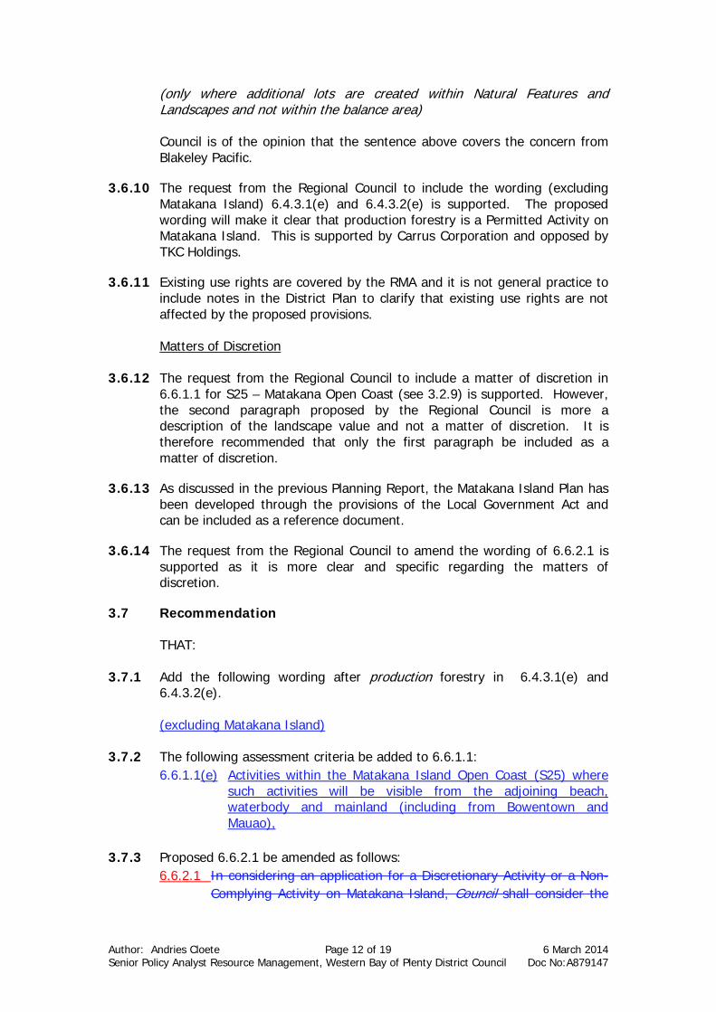
(only where additional lots are created within Natural Features and Landscapes and not within the balance area)
Council is of the opinion that the sentence above covers the concern from Blakeley Pacific.
3.6.10 The request from the Regional Council to include the wording (excluding Matakana Island) 6.4.3.1(e) and 6.4.3.2(e) is supported. The proposed wording will make it clear that production forestry is a Permitted Activity on Matakana Island. This is supported by Carrus Corporation and opposed by TKC Holdings.
3.6.11 Existing use rights are covered by the RMA and it is not general practice to include notes in the District Plan to clarify that existing use rights are not affected by the proposed provisions.
Matters of Discretion
3.6.12 The request from the Regional Council to include a matter of discretion in 6.6.1.1 for S25 – Matakana Open Coast (see 3.2.9) is supported. However, the second paragraph proposed by the Regional Council is more a description of the landscape value and not a matter of discretion. It is therefore recommended that only the first paragraph be included as a matter of discretion.
3.6.13 As discussed in the previous Planning Report, the Matakana Island Plan has been developed through the provisions of the Local Government Act and can be included as a reference document.
3.6.14 The request from the Regional Council to amend the wording of 6.6.2.1 is supported as it is more clear and specific regarding the matters of discretion.
3.7 Recommendation
THAT:
3.7.1 Add the following wording after production forestry in 6.4.3.1(e) and 6.4.3.2(e). (excluding Matakana Island)
3.7.2 The following assessment criteria be added to 6.6.1.1:
6.6.1.1(e) Activities within the Matakana Island Open Coast (S25) where such activities will be visible from the adjoining beach, waterbody and mainland (including from Bowentown and Mauao),
3.7.3 Proposed 6.6.2.1 be amended as follows:
6.6.2.1 In considering an application for a Discretionary Activity or a Non-Complying Activity on Matakana Island, Council shall consider the
Author: Andries Cloete Page 13 of 19 6 March 2014 Senior Policy Analyst Resource Management, Western Bay of Plenty District Council Doc No:A879147
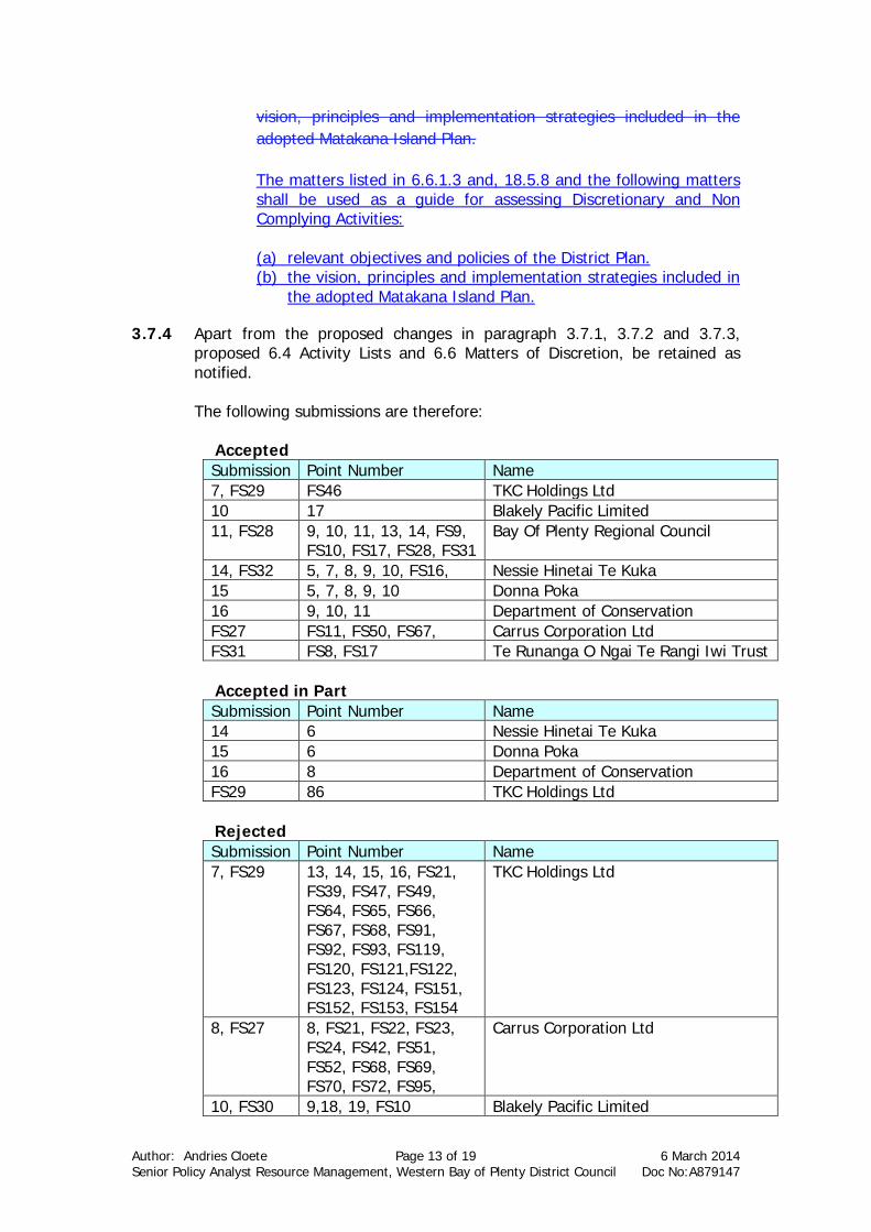
vision, principles and implementation strategies included in the adopted Matakana Island Plan. The matters listed in 6.6.1.3 and, 18.5.8 and the following matters shall be used as a guide for assessing Discretionary and Non Complying Activities: (a) relevant objectives and policies of the District Plan. (b) the vision, principles and implementation strategies included in
the adopted Matakana Island Plan.
3.7.4 Apart from the proposed changes in paragraph 3.7.1, 3.7.2 and 3.7.3, proposed 6.4 Activity Lists and 6.6 Matters of Discretion, be retained as notified.
The following submissions are therefore:
Accepted Submission Point Number Name 7, FS29 FS46 TKC Holdings Ltd 10 17 Blakely Pacific Limited 11, FS28 9, 10, 11, 13, 14, FS9,
FS10, FS17, FS28, FS31 Bay Of Plenty Regional Council
14, FS32 5, 7, 8, 9, 10, FS16, Nessie Hinetai Te Kuka 15 5, 7, 8, 9, 10 Donna Poka 16 9, 10, 11 Department of Conservation FS27 FS11, FS50, FS67, Carrus Corporation Ltd FS31 FS8, FS17 Te Runanga O Ngai Te Rangi Iwi Trust
Accepted in Part Submission Point Number Name 14 6 Nessie Hinetai Te Kuka 15 6 Donna Poka 16 8 Department of Conservation FS29 86 TKC Holdings Ltd
Rejected Submission Point Number Name 7, FS29 13, 14, 15, 16, FS21,
FS39, FS47, FS49, FS64, FS65, FS66, FS67, FS68, FS91, FS92, FS93, FS119, FS120, FS121,FS122, FS123, FS124, FS151, FS152, FS153, FS154
TKC Holdings Ltd
8, FS27 8, FS21, FS22, FS23, FS24, FS42, FS51, FS52, FS68, FS69, FS70, FS72, FS95,
Carrus Corporation Ltd
10, FS30 9,18, 19, FS10 Blakely Pacific Limited
Author: Andries Cloete Page 14 of 19 6 March 2014 Senior Policy Analyst Resource Management, Western Bay of Plenty District Council Doc No:A879147
11 12 Bay Of Plenty Regional Council FS26 FS16 Cathryn Faulkner
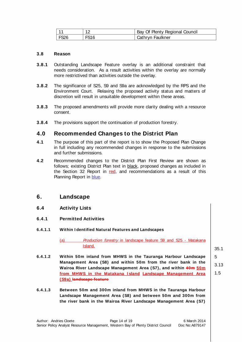
3.8 Reason 3.8.1 Outstanding Landscape Feature overlay is an additional constraint that
needs consideration. As a result activities within the overlay are normally more restrictived than activities outside the overlay.
3.8.2 The significance of S25, S9 and S9a are acknowledged by the RPS and the Environment Court. Relaxing the proposed activity status and matters of discretion will result in unsuitable development within these areas.
3.8.3 The proposed amendments will provide more clarity dealing with a resource consent.
3.8.4 The provisions support the continuation of production forestry.
4.0 Recommended Changes to the District Plan 4.1 The purpose of this part of the report is to show the Proposed Plan Change
in full including any recommended changes in response to the submissions and further submissions.
4.2 Recommended changes to the District Plan First Review are shown as follows; existing District Plan text in black, proposed changes as included in the Section 32 Report in red, and recommendations as a result of this Planning Report in blue.
6. Landscape 6.4 Activity Lists 6.4.1 Permitted Activities 6.4.1.1 Within Identified Natural Features and Landscapes
(a) Production forestry in landscape feature S9 and S25 - Matakana
Island.
6.4.1.2 Within 50m inland from MHWS in the Tauranga Harbour Landscape Management Area (S8) and within 50m from the river bank in the Wairoa River Landscape Management Area (S7), and within 40m 50m from MHWS in the Matakana Island Landscape Management Area (S9a) landscape feature
6.4.1.3 Between 50m and 300m inland from MHWS in the Tauranga Harbour
Landscape Management Area (S8) and between 50m and 300m from the river bank in the Wairoa River Landscape Management Area (S7)
35.1
5
3.13
1.5
Author: Andries Cloete Page 15 of 19 6 March 2014 Senior Policy Analyst Resource Management, Western Bay of Plenty District Council Doc No:A879147
and between 40m 50m and 300m inland from MHWS in the Matakana Island Landscape Management Area (S9) landscape feature
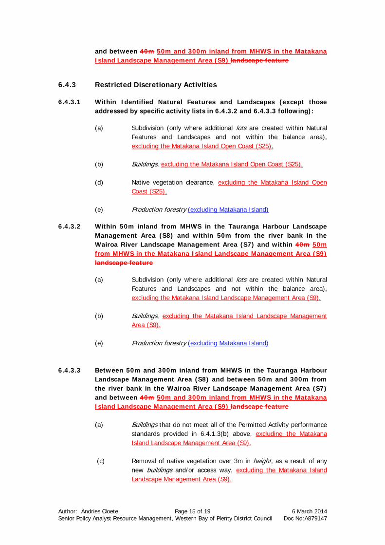
6.4.3 Restricted Discretionary Activities 6.4.3.1 Within Identified Natural Features and Landscapes (except those
addressed by specific activity lists in 6.4.3.2 and 6.4.3.3 following):
(a) Subdivision (only where additional lots are created within Natural Features and Landscapes and not within the balance area), excluding the Matakana Island Open Coast (S25).
(b) Buildings, excluding the Matakana Island Open Coast (S25). (d) Native vegetation clearance, excluding the Matakana Island Open
Coast (S25). (e) Production forestry (excluding Matakana Island)
6.4.3.2 Within 50m inland from MHWS in the Tauranga Harbour Landscape
Management Area (S8) and within 50m from the river bank in the Wairoa River Landscape Management Area (S7) and within 40m 50m from MHWS in the Matakana Island Landscape Management Area (S9) landscape feature
(a) Subdivision (only where additional lots are created within Natural
Features and Landscapes and not within the balance area), excluding the Matakana Island Landscape Management Area (S9).
(b) Buildings, excluding the Matakana Island Landscape Management
Area (S9). (e) Production forestry (excluding Matakana Island)
6.4.3.3 Between 50m and 300m inland from MHWS in the Tauranga Harbour Landscape Management Area (S8) and between 50m and 300m from the river bank in the Wairoa River Landscape Management Area (S7) and between 40m 50m and 300m inland from MHWS in the Matakana Island Landscape Management Area (S9) landscape feature (a) Buildings that do not meet all of the Permitted Activity performance
standards provided in 6.4.1.3(b) above, excluding the Matakana Island Landscape Management Area (S9).
(c) Removal of native vegetation over 3m in height, as a result of any
new buildings and/or access way, excluding the Matakana Island Landscape Management Area (S9).
Author: Andries Cloete Page 16 of 19 6 March 2014 Senior Policy Analyst Resource Management, Western Bay of Plenty District Council Doc No:A879147
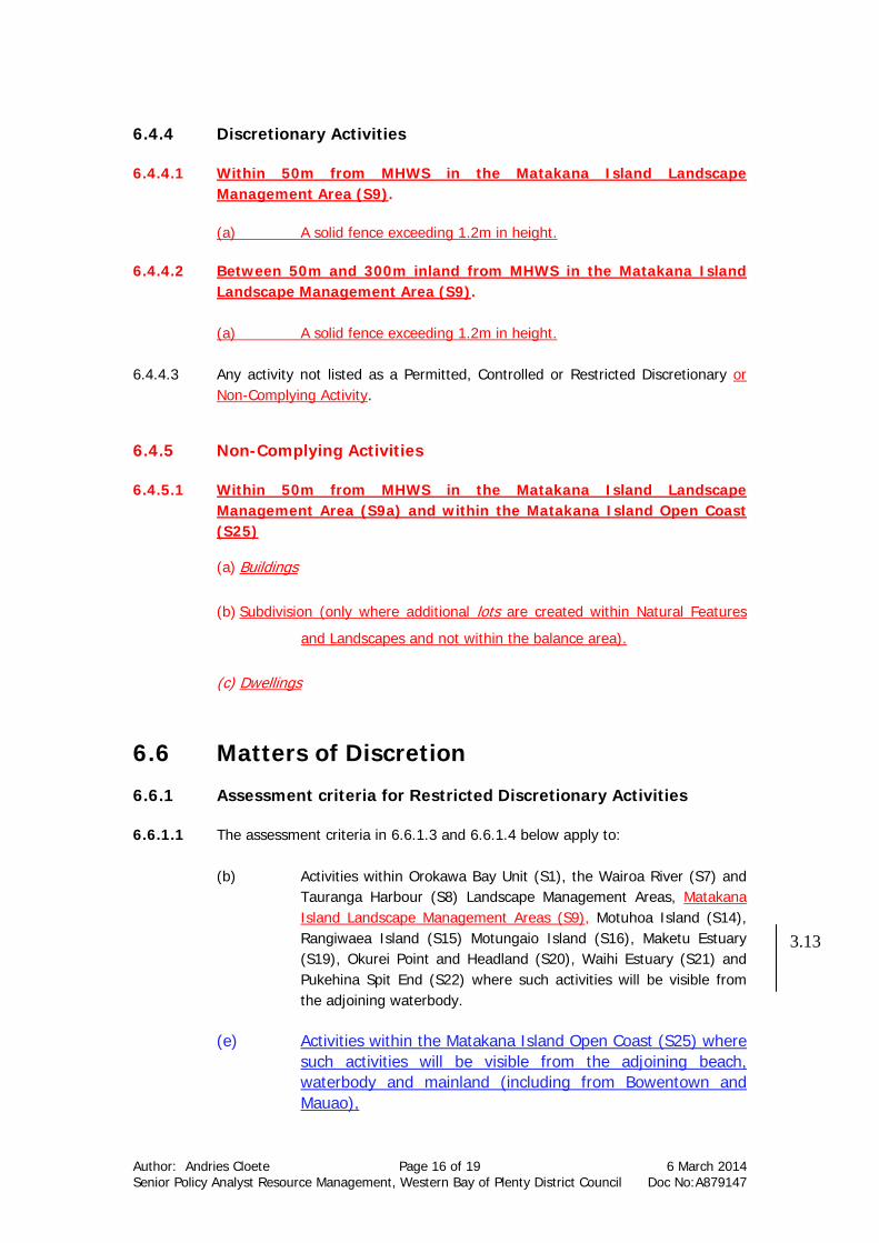
6.4.4 Discretionary Activities 6.4.4.1 Within 50m from MHWS in the Matakana Island Landscape
Management Area (S9).
(a) A solid fence exceeding 1.2m in height. 6.4.4.2 Between 50m and 300m inland from MHWS in the Matakana Island
Landscape Management Area (S9). (a) A solid fence exceeding 1.2m in height.
6.4.4.3 Any activity not listed as a Permitted, Controlled or Restricted Discretionary or
Non-Complying Activity. 6.4.5 Non-Complying Activities 6.4.5.1 Within 50m from MHWS in the Matakana Island Landscape
Management Area (S9a) and within the Matakana Island Open Coast (S25)
(a) Buildings
(b) Subdivision (only where additional lots are created within Natural Features
and Landscapes and not within the balance area).
(c) Dwellings
6.6 Matters of Discretion 6.6.1 Assessment criteria for Restricted Discretionary Activities 6.6.1.1 The assessment criteria in 6.6.1.3 and 6.6.1.4 below apply to:
(b) Activities within Orokawa Bay Unit (S1), the Wairoa River (S7) and Tauranga Harbour (S8) Landscape Management Areas, Matakana Island Landscape Management Areas (S9), Motuhoa Island (S14), Rangiwaea Island (S15) Motungaio Island (S16), Maketu Estuary (S19), Okurei Point and Headland (S20), Waihi Estuary (S21) and Pukehina Spit End (S22) where such activities will be visible from the adjoining waterbody.
(e) Activities within the Matakana Island Open Coast (S25) where
such activities will be visible from the adjoining beach, waterbody and mainland (including from Bowentown and Mauao),
3.13
Author: Andries Cloete Page 17 of 19 6 March 2014 Senior Policy Analyst Resource Management, Western Bay of Plenty District Council Doc No:A879147
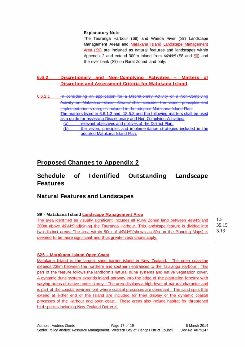
Explanatory Note The Tauranga Harbour (S8) and Wairoa River (S7) Landscape
Management Areas and Matakana Island Landscape Management Area (S9) are included as natural features and landscapes within Appendix 2 and extend 300m inland from MHWS (S8 and S9) and the river bank (S7) on Rural Zoned land only.
6.6.2 Discretionary and Non-Complying Activities – Matters of
Discretion and Assessment Criteria for Matakana Island 6.6.2.1 In considering an application for a Discretionary Activity or a Non-Complying
Activity on Matakana Island, Council shall consider the vision, principles and implementation strategies included in the adopted Matakana Island Plan. The matters listed in 6.6.1.3 and, 18.5.8 and the following matters shall be used as a guide for assessing Discretionary and Non Complying Activities:
(a) relevant objectives and policies of the District Plan. (b) the vision, principles and implementation strategies included in the
adopted Matakana Island Plan.
Proposed Changes to Appendix 2
Schedule of Identified Outstanding Landscape Features
Natural Features and Landscapes S9 - Matakana Island Landscape Management Area The area identified as visually significant includes all Rural Zoned land between MHWS and 300m above MHWS adjoining the Tauranga Harbour. This landscape feature is divided into two distinct areas. The area within 50m of MHWS (shown as S9a on the Planning Maps) is deemed to be more significant and thus greater restrictions apply. S25 – Matakana Island Open Coast Matakana Island is the largest sand barrier island in New Zealand. The open coastline extends 23km between the northern and southern entrances to the Tauranga Harbour. This part of the feature follows the landform’s natural dune systems and native vegetation cover. A dynamic dune system extends inland partway into the edge of the plantation forestry with varying areas of native under storey. The area displays a high level of natural character and is part of the coastal environment where coastal processes are dominant. The sand spits that extend at either end of the Island are included for their display of the dynamic coastal processes of the Harbour and open coast. These areas also include habitat for threatened bird species including New Zealand Dotterel.
1.5 35.15 3.13

Author: Andries Cloete Page 18 of 19 6 March 2014 Senior Policy Analyst Resource Management, Western Bay of Plenty District Council Doc No:A879147

Author: Andries Cloete Page 19 of 19 6 March 2014 Senior Policy Analyst Resource Management, Western Bay of Plenty District Council Doc No:A879147
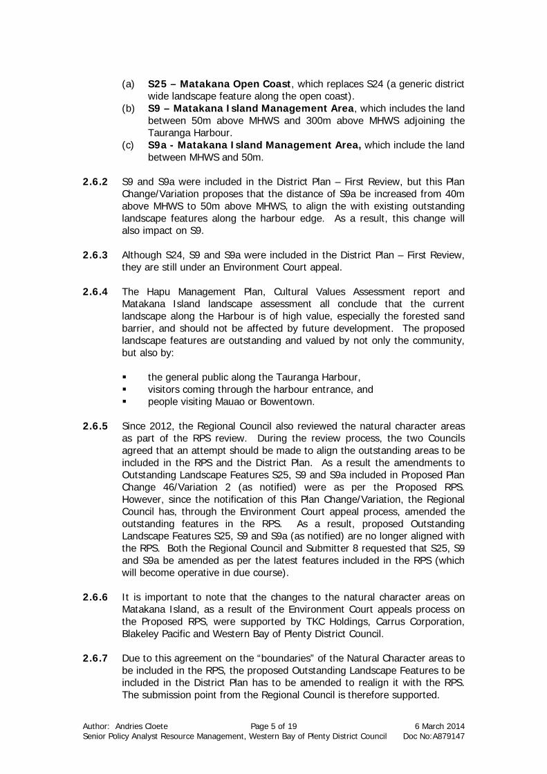
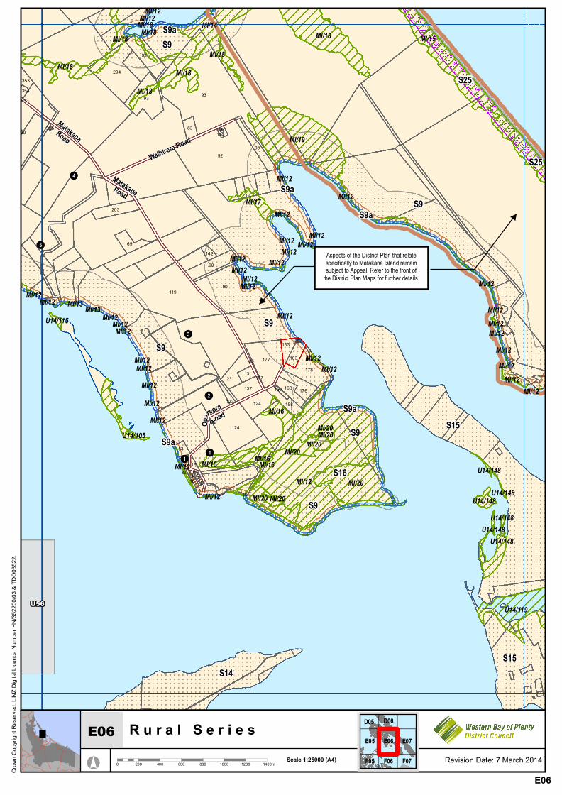
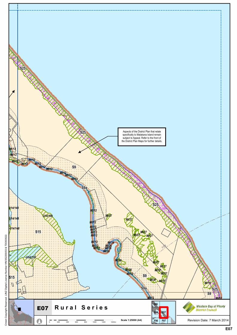
New District Plan Maps C04, C05, D05, D06, E06, E07, F07
R u r a l S e r i e s
° 0 200 400 600 800 1000 1200 1400mScale 1:25000 (A4)
Crow
n Cop
yrigh
t Res
erved
. LIN
Z Digi
tal Li
cenc
e Num
ber H
N/35
2200
/03 &
TDO0
3522
.
Revision Date: 7 March 2014
A
B
U13/5
U13/19
Aspects of the District Plan that relatespecifically to Matakana Island remainsubject to Appeal. Refer to the front of
the District Plan Maps for further details.
V1
U13/6U13/11
MI/1
MI/2MI/4
MI/12
MI/12
MI/12
MI/12MI/12
MI/12
MI/12MI/12MI/12
MI/5 MI/5MI/5MI/5 MI/5MI/5MI/5 MI/5MI/5MI/5
MI/5
MI/15 MI/15
MI/15
MI/15
MI/3MI/3
MI/3
MI/3MI/3
MI/3MI/3
MI/3
MI/3 MI/3
U23
U22
U21
U20
!26
!42
!83!49
!105
!106
CrosbyLane
Ongare Point Road
Kauri Point Road
S8
S8S8a S9
S8a
S9a
S8a
S25
S9
S9
S9a
S9a
S25
S25
283
260
277
25D
281
25C263
217
19921192
92 203
186107
133
145157
142 168
168
183
44521
505
25463
431405
112 114
365
122
105
93
123
38
CNR
6367
60
524
413
376
40740
359337335
22
297333 361
364
284
252
252
D03 D04 D05
C03 C04 C05
B03 B04C04
C04
R u r a l S e r i e s
° 0 200 400 600 800 1000 1200 1400mScale 1:25000 (A4)
Crow
n Cop
yrigh
t Res
erved
. LIN
Z Digi
tal Li
cenc
e Num
ber H
N/35
2200
/03 &
TDO0
3522
.
Revision Date: 7 March 2014
Aspects of the District Plan that relatespecifically to Matakana Island remainsubject to Appeal. Refer to the front of
the District Plan Maps for further details.
Aspects of the District Plan that relatespecifically to Matakana Island remainsubject to Appeal. Refer to the front of
the District Plan Maps for further details.
MI/2
MI/4
MI/6
MI/12
MI/12MI/12
MI/5MI/5 MI/5MI/5 MI/5MI/5MI/5MI/5 MI/5MI/5MI/5
MI/5
MI/5
MI/15MI/15
MI/15
MI/3
MI/3
MI/3
MI/3MI/3
MI/3
MI/3
MI/3 MI/3
S9a
S25
S9
S9
S9
S25S25
S25
D04 D05 D06
C04 C05
B04C05
C05
R u r a l S e r i e s
° 0 200 400 600 800 1000 1200 1400mScale 1:25000 (A4)
Crow
n Cop
yrigh
t Res
erved
. LIN
Z Digi
tal Li
cenc
e Num
ber H
N/35
2200
/03 &
TDO0
3522
.
Revision Date: 7 March 2014
Aspects of the District Plan that relatespecifically to Matakana Island remainsubject to Appeal. Refer to the front of
the District Plan Maps for further details.
Aspects of the District Plan that relatespecifically to Matakana Island remainsubject to Appeal. Refer to the front of
the District Plan Maps for further details.
MI/7
MI/8
MI/14
MI/6
MI/10
MI/10
MI/10MI/10
MI/10
MI/10
MI/18
MI/18
MI/12
MI/12
MI/12
MI/12
MI/12 MI/18
MI/12
MI/12 MI/12MI/12
MI/12
MI/12
MI/12
MI/15
MI/3
MI/3MI/3
Tirohanga Road
S9
S9a
S25
S9a
S9
11
90104
353100100
121120
124
97162
162 162
E04 E05 E06
D04 D05 D06
C04 C05D05
D05
R u r a l S e r i e s
° 0 200 400 600 800 1000 1200 1400mScale 1:25000 (A4)
Crow
n Cop
yrigh
t Res
erved
. LIN
Z Digi
tal Li
cenc
e Num
ber H
N/35
2200
/03 &
TDO0
3522
.
Revision Date: 7 March 2014
Aspects of the District Plan that relatespecifically to Matakana Island remainsubject to Appeal. Refer to the front of
the District Plan Maps for further details.
MI/14
MI/18
MI/12MI/12
MI/12
MI/12
MI/12MI/12
MI/12 MI/18
MI/18MI/18MI/18
MI/18
MI/15
S25
S9aS9
S9
S9a
S9a9393
1
90104
E05 E06 E07
D05 D06
C05D06
D06
R u r a l S e r i e s
° 0 200 400 600 800 1000 1200 1400mScale 1:25000 (A4)
Crow
n Cop
yrigh
t Res
erved
. LIN
Z Digi
tal Li
cenc
e Num
ber H
N/35
2200
/03 &
TDO0
3522
.
Revision Date: 7 March 2014
Aspects of the District Plan that relatespecifically to Matakana Island remainsubject to Appeal. Refer to the front of
the District Plan Maps for further details.
U14/148U14/148
U14/148U14/148
U14/148
U14/105
U14/115
U14/119
U14/148
MI/14
MI/17
MI/19
MI/13 MI/13
MI/20MI/20MI/20
MI/20
MI/20 MI/20MI/20
MI/12MI/12
MI/12MI/12
MI/12
MI/12MI/12 MI/12MI/12MI/12
MI/12
MI/12MI/12
MI/12MI/12
MI/12MI/12MI/12MI/12MI/12 MI/12MI/12MI/12 MI/12
MI/12MI/12MI/12
MI/12 MI/12MI/12
MI/12MI/12
MI/12
MI/12MI/12
MI/12
MI/12
MI/12
MI/18
MI/18
MI/18MI/18
MI/18
MI/18MI/18
MI/18 MI/15
MI/16
MI/16 MI/16MI/16
U56
!3
!2
!1!1
!5
!4 MatakanaRoadOp
ureora
Road
MatakanaRoad
Waihirere Road
S25
S16
S9
S9
S9
S15
S15
S9a
S9a
S9
S9a
S14
S25
S9
S9a
S9S9a
178137
158
16223
137
123
177
168 176
13
23
181521
124
124
53
1539 10 214 418 3
9293
93
183
183
183
90
90
203
83114116
93
294
93
169
119
142
1
305
353354353
60
F05 F06 F07
E05 E06 E07
D05 D06E06
E06
R u r a l S e r i e s
° 0 200 400 600 800 1000 1200 1400mScale 1:25000 (A4)
Crow
n Cop
yrigh
t Res
erved
. LIN
Z Digi
tal Li
cenc
e Num
ber H
N/35
2200
/03 &
TDO0
3522
.
Revision Date: 7 March 2014
Aspects of the District Plan that relatespecifically to Matakana Island remainsubject to Appeal. Refer to the front of
the District Plan Maps for further details.
Aspects of the District Plan that relatespecifically to Matakana Island remainsubject to Appeal. Refer to the front of
the District Plan Maps for further details.
Aspects of the District Plan that relatespecifically to Matakana Island remainsubject to Appeal. Refer to the front of
the District Plan Maps for further details.
U14/100
U14/148
U14/148
U14/119
U14/148
MI/26MI/26
MI/12MI/12
MI/12 MI/12MI/12MI/12 MI/12 MI/12
MI/12MI/12MI/12
MI/12
MI/12MI/12MI/12MI/12MI/12MI/12MI/12MI/12
MI/12
MI/12 MI/12
MI/15MI/27 MI/27
MI/27MI/27
MI/27MI/27
MI/27MI/27MI/27
MI/27MI/27
MI/26
MI/26MI/26
MI/26
154
S25
S9a
S15
S15
S9
S9
S9
S25
S25
S9a S25
F06 F07
E06 E07
D06E07
E07

R u r a l S e r i e s
° 0 200 400 600 800 1000 1200 1400mScale 1:25000 (A4)
Crow
n Cop
yrigh
t Res
erved
. LIN
Z Digi
tal Li
cenc
e Num
ber H
N/35
2200
/03 &
TDO0
3522
.
Revision Date: 7 March 2014
Aspects of the District Plan that relatespecifically to Matakana Island remainsubject to Appeal. Refer to the front of
the District Plan Maps for further details.
MI/12
MI/12
MI/12MI/12
MI/12
MI/15
TAURANGACITY 4049
49
607680
154
9010011
0
154
S15S9
S9
S9a
S9a S25
G06 G08
F06 F07
E06 E07F07
F07