Embed Size (px)
Citation preview
© Hatch 2012/10
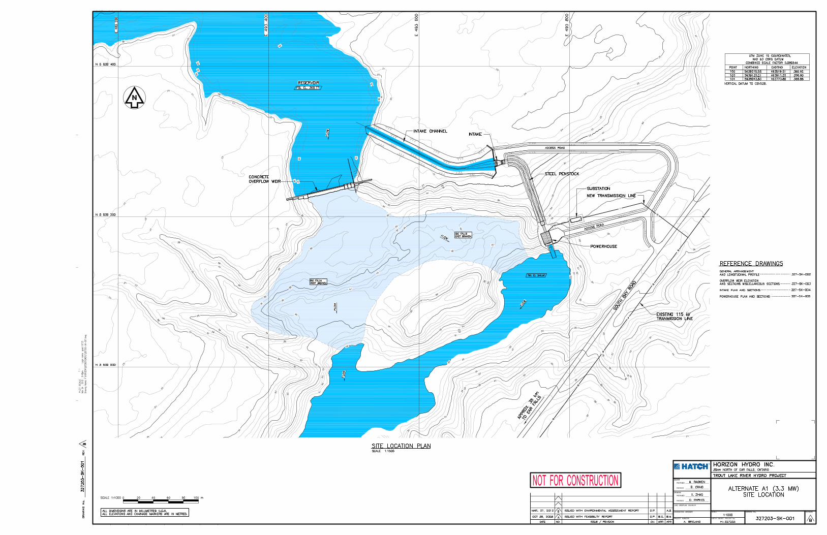
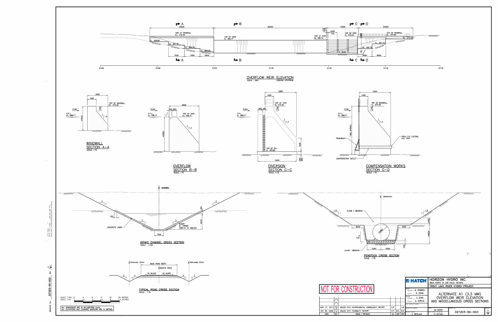
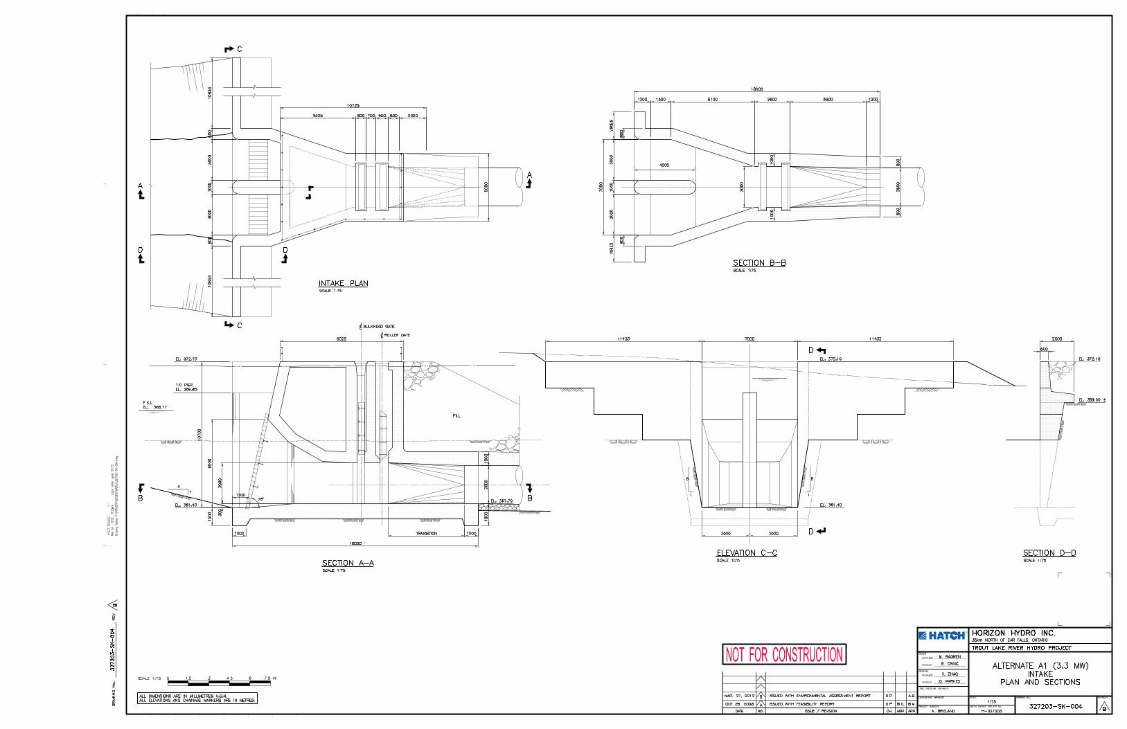
Appendix A
Engineering Drawings
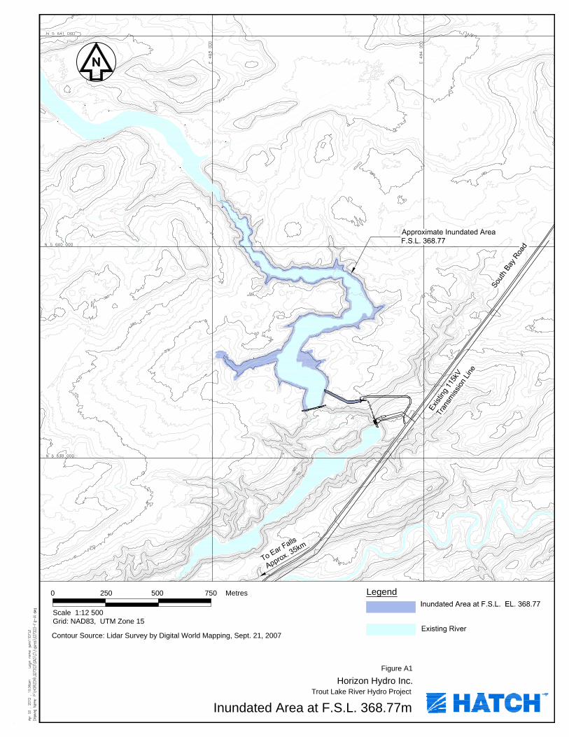
Contour Source: Lidar Survey by Digital World Mapping, Sept. 21, 2007
Horizon Hydro Inc.
Inundated Area at F.S.L. 368.77m
Scale 1:12 500
2500 Metres500 750
Figure A1
Grid: NAD83, UTM Zone 15
Legend
Trout Lake River Hydro Project

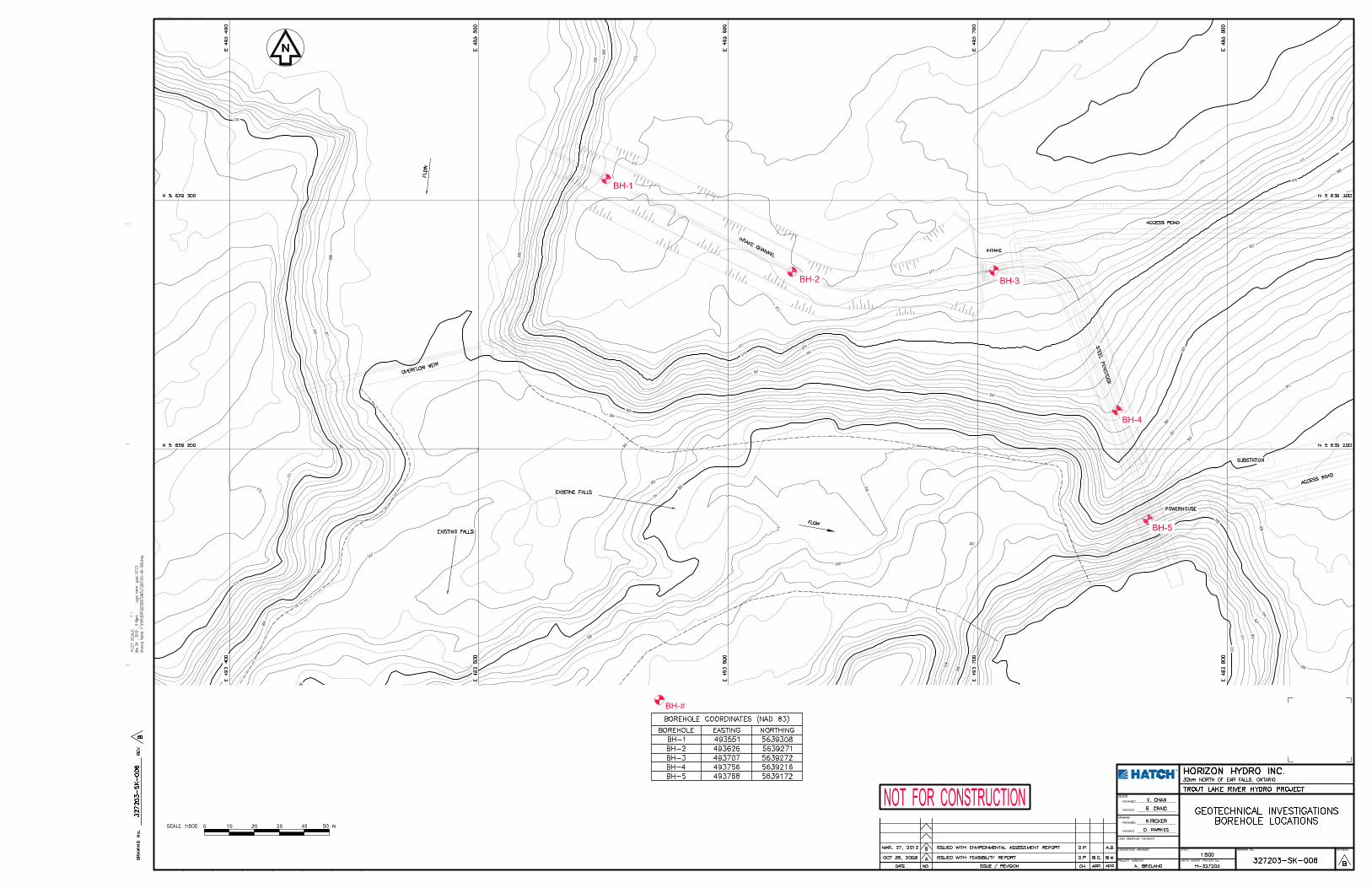
BH-#


![VALUE€¦ · Contour Drawing [Project One] Contour Drawing. Contour Line: In drawing, is an outline sketch of an object. [Project One]: Layered Contour Drawing The purpose of contour](https://img.pdfslide.us/doc/110x75/60363a1e4c7d150c4824002e/value-contour-drawing-project-one-contour-drawing-contour-line-in-drawing-is.jpg)