Embed Size (px)
Citation preview

The Southern Kaurna Place Names Project
PNS 7.02/04 by Chester Schultz © 2017 22.9.2017 | 1 of 35
The writing of this essay was funded as part of The Kaurna Project 2015-7 (coordinator Rob Amery) by the Commonwealth of Australia Ministry for the Arts through its Indigenous Languages and Arts (Languages)
program.
This and other essays may be downloaded free of charge from https://www.adelaide.edu.au/kwp/placenames/research-publ/
Place Name SUMMARY (PNS) 7.02/04
MURTAPARRINGGA (last edited: 22.9.2017)
NOTEANDDISCLAIMER:
Thisessayhasnotbeenpeer-reviewedorculturallyendorsedindetail.
Thespellingsandinterpretationscontainedinit(linguistic,historicalandgeographical)aremyown,anddonotnecessarilyrepresenttheviewsofKWP/KWKoritsmembersoranyothergroup.
Ihavestudiedhistoryattertiarylevel.Thoughnotalinguist,for30yearsIhavelearnedmuchabouttheKaurna,Ramindjeri-NgarrindjeriandNarunggalanguageswhileworkingwithKWP,RobAmery,andotherlocalculture-reclamationgroups;andfromprimarydocumentsIhavelearnedmuchabouttheAboriginalhistoryoftheAdelaide-Fleurieuregion.
Myexplorationsof'languageontheland'throughtheSouthernKaurnaPlaceNamesProjectarepartofanongoingefforttocorrecttherecordaboutAboriginalplace-namesinthisregion(whichhasaboundedinconfusionsanderrors),andtoaddreliablenewmaterialintothepublicdomain.
Ihopeupcominggenerationswillcontinuethisworkandimproveit.Myinterpretationsshouldbeamplified,re-consideredandifnecessarymodifiedbyKWPorotherlinguists,andbyothersengagedinculturalmapping:Aboriginalpeople,archaeologists,geographers,ecologistsandhistorians.
ChesterSchultz,21/7/2017.

The Southern Kaurna Place Names Project
PNS 7.02/04 by Chester Schultz © 2017 22.9.2017 | 2 of 35
Place Name SUMMARY (PNS) 7.02/04
MURTAPARRINGGA (last edited: 22.9.2017)
Abstract
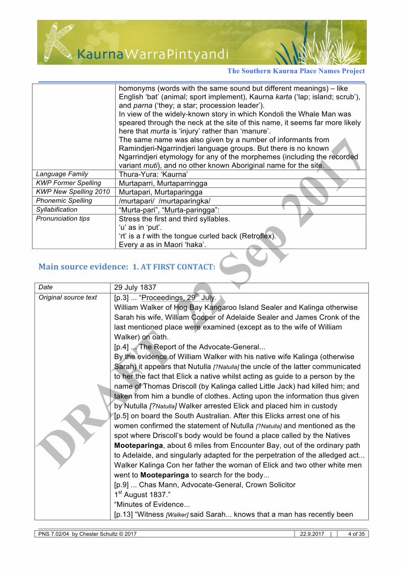
Murtaparri or Murtaparringga (Murtapari or Murtaparingga in KWP’s New Spelling 2010) is the Kaurna name for all or part of an area around the high plateau southeast of Spring Mount. This area, loosely defined by data from the primary sources, includes the southern side of the summit on Section B; the southeastern plateau and scarps on Sections A2, A1 and 125; the major tributary creek gully on A2 and A1 which crosses the plateau from near the summit to the Hindmarsh River a little below the Falls; and the ford or floodway on the river at Sawpit Rd on Section 59. (See the ‘Note On Location’ below, and the maps at the end of the essay).
The name is easily identified as Kaurna language, as it includes the very common word paringga ‘river place’. The Locative suffix -ngga (‘at, place of’) is optional, as the linguists Teichelmann and Schürmann recorded “Murtaparri” without it.
It was obtained at first contact by the linguist Schürmann from Kaurna-speaking Adelaide people, and by Charles Mann in court evidence from Aboriginal interpreter Kalinga (Sarah Walker, ‘Sally’).
The same name was also well-known to Ngarrindjeri speakers on the opposite side of the ranges, and recorded from them with minor spelling variations: at first contact (by the linguist Meyer from Ramindjeri speakers at Encounter Bay), and in the 1930s (by Tindale and Berndt from Milerum, Karlowan, and Mark Wilson). In the 1830s there may also have been a Ramindjeri variant with a different second vowel, recorded as “Mooteparinga” and “Mootiparinga”. But neither this nor the Kaurna version can be explained linguistically in Ramindjeri-Ngarrindjeri language.
Most of the records refer to this place as an important Dreaming site. Ramindjeri and Ngarrindjeri informants told the story of the Whale Man Kondoli: he alone had the means of making fire, and this is where he was speared in order to take the fire from him and share it with all humankind.1 A Kaurna version of the story was also recorded in 1839 without reference to any place or name.
1 In most versions. In one account (Milerum’s), this is the place where there was a more general ‘big fight’ from which he
ran away, but the fire-flints were taken from him later at another place. See the Discussion below.

The Southern Kaurna Place Names Project
PNS 7.02/04 by Chester Schultz © 2017 22.9.2017 | 3 of 35
Murtaparingga is located on border territory between the Kaurna, Ramindjeri and Peramangk language groups. All versions of the story agree that it was a place for intertribal meetings and ceremonies.
MEANING: Murta can mean either ‘injury’ or ‘animal excrement’. In Kaurna these are two different words which sound identical (i.e. are both pronounced murta) but have different meanings (i.e. they are homonyms like English ‘bat’, which can mean either the animal or the sporting tool; only the context can tell you which). The place-name Murta-pari could therefore mean either ‘injury creek’ or ‘manure creek’; but ‘injury’ is more likely because it probably refers to the wounding of Kondoli at this place.
Some authors have claimed that the name means ‘brackish water’ or ‘murky water’. Neither of these anonymous glosses have any linguistic or ecological credibility. ‘Tindale gave ‘sacred magic doctor place’, but this this is a Ngarrindjeri folk etymology possibly originating with Milerum, and also has no linguistic credibility as a meaning.
NOTE ON LOCATION: Various generalizations or parts of this area were given by various primary informants: ‘upper vale of the Hindmarsh’ (Wyatt); ‘last creek on the old road to Encounter Bay’ (Schürmann); a place at the ‘head of Hindmarsh Valley’ with a ‘steep hill and large ponds’ (Meyer); ‘top hill’ (Blackmore); ‘top of the range at head of Hindmarsh River’ and ‘flat top of the range with a big hole or depression’ (Milerum); ‘at the back of Victor Harbour, on the hill’ (Wilson); ‘in the Hindmarsh Valley’ (?Karlowan or Berndt). On the basis of what his informants told him, Tindale guessed at Section A2, immediately southeast of the Spring Mount Conservation Park. These referents are diverse enough that it is unclear whether Aboriginal people used the name for the whole area or only a part of it; and if a part, then we are not sure which part. Perhaps it was used by different groups in slightly different ways at different times, or for different purposes.
Coordinates Latitude -35.457035°, Longitude:138.566265° [in the northwestern tributary on Section A1: nominal centre of area around it from Spring Mount summit to the floodway on Sawpit Rd]
LanguageInformation
Meaning ‘[place of] murta river’: 1. [probably] ‘river place of injury or mutilation’, OR 2. [possibly] ‘river place of animal faeces’.
Etymology murta [probably ] 1. ‘injury, mutilation’ OR [possibly] 2. ‘animal faeces’: + pari ‘river’ + ngga ‘at, place of’ (optional)
Notes Murta is well attested as meaning ‘animal excrement’. But there is also an adjective murtana ‘hurt, injured, deformed, broken, defective’; and the verbs murtarrinthi ‘to mutilate oneself’ and murta-wardninthi ‘to get hurt, become defective’. The latter expression is composed of wardninthi ‘to fall down, drop, be born’, and an otherwise unrecorded noun-adjective murta, which must mean something like ‘injury, mutilation, defect’ and ‘injured, mutilated, defective’. This word appears to have exactly the same sounds as the word for ‘animal manure’, i.e. the two words are
The Southern Kaurna Place Names Project
PNS 7.02/04 by Chester Schultz © 2017 22.9.2017 | 4 of 35
Mainsourceevidence:1.ATFIRSTCONTACT:
Date 29 July 1837 Original source text [p.3] ... “Proceedings, 29th July.
William Walker of Hog Bay Kangaroo Island Sealer and Kalinga otherwise Sarah his wife, William Cooper of Adelaide Sealer and James Cronk of the last mentioned place were examined (except as to the wife of William Walker) on oath. [p.4] ... The Report of the Advocate-General... By the evidence of William Walker with his native wife Kalinga (otherwise Sarah) it appears that Nutulla [?Natulla] the uncle of the latter communicated to her the fact that Elick a native whilst acting as guide to a person by the name of Thomas Driscoll (by Kalinga called Little Jack) had killed him; and taken from him a bundle of clothes. Acting upon the information thus given by Nutulla [?Natulla] Walker arrested Elick and placed him in custody [p.5] on board the South Australian. After this Elicks arrest one of his women confirmed the statement of Nutulla [?Natulla] and mentioned as the spot where Driscoll’s body would be found a place called by the Natives Mooteparinga, about 6 miles from Encounter Bay, out of the ordinary path to Adelaide, and singularly adapted for the perpetration of the alledged act... Walker Kalinga Con her father the woman of Elick and two other white men went to Mooteparinga to search for the body... [p.9] ... Chas Mann, Advocate-General, Crown Solicitor 1st August 1837.” “Minutes of Evidence... [p.13] “Witness [Walker] said Sarah... knows that a man has recently been
homonyms (words with the same sound but different meanings) – like English ‘bat’ (animal; sport implement), Kaurna karta (‘lap; island; scrub’), and parna (‘they; a star; procession leader’). In view of the widely-known story in which Kondoli the Whale Man was speared through the neck at the site of this name, it seems far more likely here that murta is ‘injury’ rather than ‘manure’. The same name was also given by a number of informants from Ramindjeri-Ngarrindjeri language groups. But there is no known Ngarrindjeri etymology for any of the morphemes (including the recorded variant muti), and no other known Aboriginal name for the site.
Language Family Thura-Yura: ‘Kaurna’ KWP Former Spelling Murtaparri, Murtaparringga KWP New Spelling 2010 Murtapari, Murtaparingga Phonemic Spelling /murtapari/ /murtaparingka/ Syllabification “Murta-pari”, “Murta-paringga”: Pronunciation tips Stress the first and third syllables.
‘u’ as in ‘put’. ‘rt’ is a t with the tongue curled back (Retroflex). Every a as in Maori ‘haka’.
The Southern Kaurna Place Names Project
PNS 7.02/04 by Chester Schultz © 2017 22.9.2017 | 5 of 35
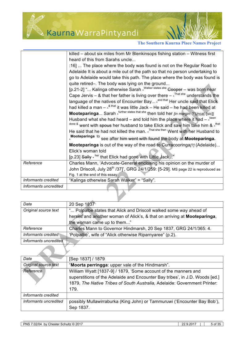
killed – about six miles from Mr Blenkinsops fishing station – Witness first heard of this from Sarahs uncle... :16] ... The place where the body was found is not on the Regular Road to Adelaide It is about a mile out of the path so that no person undertaking to go to Adelaide would take this path. The place where the body was found is quite retired–. The body was lying on the ground... [p.21-2] “... Kalinga otherwise Sarah ^Walker states she
Cooper – was born near Cape Jervis – & that her father is living over there – ^That she understands the language of the natives of Encounter Bay... ^and that Her uncle said that Elick had killed a man – ^& that it was little Jack – He said – he had been killed at Mooteparinga... Sarah ^further states that she then told her [in margin: ?‘Uncal’ [sic]] Husband what she had heard – and told him the place where it had – ^been
done & went with spous her husband to take Elick and saw him take him & ^that He said that he had not killed the man. ^That she then Went with her Husband to
^Mooteparinga to see after him went with found the body at Mooteparinga.
Mooteparinga is out of the way of the road to Curracooringa[?] (Adelaide)... Elick’s woman told [p.23] Sally ^
her that Elick had gone with Little Jack...” Reference Charles Mann, ‘Advocate-General enclosing his opinion on the murder of
John Driscoll, July 28th /37]’, GRG 24/1/259: [5-29]. MS page 22 is reproduced as Fig. 1 at the end of this essay.
Informants credited “Kalinga otherwise Sarah Walker” = “Sally”. Informants uncredited
Date 20 Sep 1837 Original source text “... Polpalbe states that Alick and Driscoll walked some way ahead of
herself and another woman of Alick’s, & that on arriving at Mooteparinga, the woman came up to them...”
Reference Charles Mann to Governor Hindmarsh, 20 Sep 1837, GRG 24/1/365: 4. Informants credited ‘Polpalbe’, wife of “Alick otherwise Riparnyaree” (p.2). Informants uncredited
Date [Sep 1837] / 1879 Original source text “Moorta perringga: upper vale of the Hindmarsh”. Reference William Wyatt [1837-9] / 1879, ‘Some account of the manners and
superstitions of the Adelaide and Encounter Bay tribes’, in J.D. Woods [ed.] 1879, The Native Tribes of South Australia, Adelaide: Government Printer: 179.
Informants credited Informants uncredited possibly Mullawirraburka (King John) or Tammuruwi (‘Encounter Bay Bob’),
Sep 1837.
The Southern Kaurna Place Names Project
PNS 7.02/04 by Chester Schultz © 2017 22.9.2017 | 6 of 35
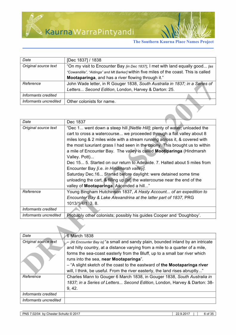
Date [Dec 1837] / 1838 Original source text “On my visit to Encounter Bay [in Dec 1837], I met with land equally good... [as
“Cowandilla”, “Aldinga” and Mt Barker] within five miles of the coast. This is called Mootaparinga, and has a river flowing through it.”
Reference John Wade letter, in R Gouger 1838, South Australia in 1837; in a Series of Letters... Second Edition, London, Harvey & Darton: 25.
Informants credited Informants uncredited Other colonists for name.
Date Dec 1837 Original source text “Dec 1... went down a steep hill [Nettle Hill]; plenty of water; unloaded the
cart to cross a watercourse... we proceeded through a flat valley about 8 miles long & 2 miles wide with a stream running across it, & covered with the most luxuriant grass I had seen in the colony. This brought us to within a mile of Encounter Bay. The valley is called Mootiparinga (Hindmarsh Valley. Pott)... Dec 15... 5. Started on our return to Adelaide. 7. Halted about 5 miles from Encounter Bay [i.e. in Hindmarsh valley]. Saturday Dec.16... Started before daylight: were detained some time unloading the cart, & filling up [at] the watercourse near the end of the valley of Mootaparinga. Ascended a hill...”
Reference Young Bingham Hutchinson 1837, A Hasty Account... of an expedition to Encounter Bay & Lake Alexandrina at the latter part of 1837, PRG 1013/1/4/1: 3, 8.
Informants credited Informants uncredited Probably other colonists; possibly his guides Cooper and ‘Doughboy’.
Date 6 March 1838 Original source text – [At Encounter Bay is] “a small and sandy plain, bounded inland by an intricate
and hilly country, at a distance varying from a mile to a quarter of a mile, forms the sea-coast easterly from the Bluff, up to a small bar river which runs into the sea, near Mootaparinga”. – “A slight sketch of the coast to the eastward of the Mootaparinga river will, I think, be useful. From the river easterly, the land rises abruptly...”
Reference Charles Mann to Gouger 6 March 1838, in Gouger 1838, South Australia in 1837; in a Series of Letters... Second Edition, London, Harvey & Darton: 38-9, 42.
Informants credited Informants uncredited

The Southern Kaurna Place Names Project
PNS 7.02/04 by Chester Schultz © 2017 22.9.2017 | 7 of 35
Date 8 April 1838 Original source text [April 1838, from Adelaide] “Sat. 7. Started on the mare in Co with
Strangways, Nation, Blunden & the Serjeant. 6. Arrived & slept at Sladdens at Unkaparringa. Sunday 8th started. Shot a turkey at 200 yards with rifle. dined at Miponga. 6. Passed 3 armed men. 6.30 halted at Mootiparinga...”
Reference Journal of Young Bingham Hutchinson 8 April 1838, PRG 1013/1/1: 46. Informants credited Informants uncredited
Date July 1839 Original source text “We were determined today to reach Encounter Bay but rain, the nightfall,
exhaustion and above all sore feet compelled us to make a halt 6 miles this side of Encounter Bay at Murta Creek [?] [original “Murta flüss”]. We were quite comfortable enough under a thick tree with a big fire which dried us and warmed us at the same time...”
Reference CW Schürmann diary 25 July 1839 (in German, microfilm MF 3700-3701), translated from the German by Rev. Geoff Noller 2007-8 (Lutheran Archives, Adelaide).
Informants credited Informants uncredited Wauwitpinna (Schürmann’s guide: see 17 and 20 July)
Date Nov 1839 Original source text “When the lark and the whale were men, they fought against each other.
The lark speared the whale twice in the neck. The whale, finding itself sorely wounded, made its escape, jumped from pain into the sea, became a whale and spouted through the two wounds water to heal them; but in vain, till this very day.”
Reference CG Teichelmann to GF Angas 9 Nov 1839, in South Australian Colonist 7/7/1840: 277a; quoted in full in Amery 2016, Warraparna Kaurna!... 2nd ed, University of Adelaide Press: 114, https://www.adelaide.edu.au/press/titles/kaurna/.
Informants credited Informants uncredited Kadlitpinna, Mullawirraburka, Ityamaiitpinna, etc 1838-9.
Date 1840 Original source text “Murtaparri: the last creek on the old road to Encounter Bay”. Reference Teichelmann & Schürmann 1840, Outlines of a Vocabulary..., Adelaide.
2:75. Informants credited Informants uncredited Kadlitpinna, Mullawirraburka, Ityamaiitpinna, etc 1838-40.
The Southern Kaurna Place Names Project
PNS 7.02/04 by Chester Schultz © 2017 22.9.2017 | 8 of 35
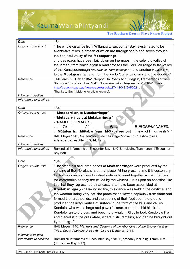
Date 1841 Original source text “The whole distance from Willunga to Encounter Bay is estimated to be
twenty-five miles, eighteen of which are through scrub and seven through the beautiful valley of the Mootaparinga... ... cross roads have been laid down on the maps... the splendid valley of the Inman, from which again a road crosses the Perilillah range to the valley of the Karrapootemagh [sic: error for ‘Karrapootungah’], and another [= Sawpit Rd} to the Mootaparinga, and from thence to Currency Creek and the Goolwa.”
Reference J McLaren & J Calder 1841, ‘Report On Roads And Bridges’, Transactions of the Statistical Society 23 Dec 1841, South Australian Register 25/12/1841: 3a-b, http://trove.nla.gov.au/newspaper/article/27443063/2050221. [Thanks to Gavin Malone for this reference].
Informants credited Informants uncredited
Date 1843 Original source text - “Mutabarri-ar, to Mutabarringar”
- “Mutabarr-ingar, at Mutabarringar” - “NAMES OF PLACES. ... To –– At –– From –– EUROPEAN NAMES. ... Mūtabarriar Mūtabariñgar Mūtabarre-nont Head of Hindmarsh V.”
Reference HAE Meyer 1843, Vocabulary of the Language Spoken by the Aborigines..., Adelaide, James Allen: 13, 14, 49.
Informants credited Informants uncredited Ramindjeri informants at Encounter Bay 1840-3, including Tammuruwi (‘Encounter
Bay Bob’).
Date 1846 Original source text “The steep hill and large ponds at Mootabarringar were produced by the
dancing of their forefathers at that place. At the present time it is customary for two hundred or three hundred natives to meet together at their dances (or corrobories as they are called by the whites)... It is upon an occasion like this that they represent their ancestors to have been assembled at Mootabaringar [sic]. Having no fire, this dance was held in the daytime, and the weather being very hot, the perspiration flowed copiously from them and formed the large ponds; and the beating of their feet upon the ground produced the irregularities of surface in the form of the hills and vallies... Kondole, who was a large and powerful man, came, but hid his fire... Kondole ran to the sea, and became a whale... Rilballe took Kondole’s fire and placed it in the grass-tree, where it still remains, and can be brought out by rubbing...”
Reference HAE Meyer 1846, Manners and Customs of the Aborigines of the Encounter Bay Tribe, South Australia, Adelaide, George Dehane: 13-14.
Informants credited Informants uncredited Ramindjeri informants at Encounter Bay 1840-6, probably including Tammuruwi
(‘Encounter Bay Bob’).

The Southern Kaurna Place Names Project
PNS 7.02/04 by Chester Schultz © 2017 22.9.2017 | 9 of 35
Mainsourceevidence:2.INTHE20thCENTURY:
Date 14-15 Feb 1934 Original source text - “Shark story.... jamakawi.... Big fight at Cub Hill (Jagged Hill) [error for ‘Cut
Hill’] = Mutebaruŋa, away back at VH [Victor Harbor].” - “Story of Yamakawi (shark) [`jamakawi] took grass tree away with him. A Rapid Bay story.” - “Story of whale at Cut Hill. (Kondoli) took flint away into sea. When spouts the smoke of fire comes out. This is the fire in the flint.”
Reference Tindale 'Journey along Coorong with... Milerum’ 8-18 Feb 1934, etc’, SE of SA journal Vol.2, AA 338/1/33/2: 40, 53.
Informants credited Milerum (Clarence Long) Informants uncredited
Date 20 May 1934 Original source text [Jarildi text] “....
[translation of text] From different places they walked the natives
.... Down there sat she, Ramindjerer. They Together.
.... Joined up They then Corroboried did the Ramindjerer
.... Nar `wa:r [nur waar] And they were pleased those who on Top Hill...”
Reference Tindale typescript, ‘Story of Kondoli (the whale man): A Ramindjeri Story told by Frank Blackmore 20-5-1934’, in Murray River Notes Vol.1, AA 338/1/31/1: 343.
Informants credited Frank Blackmore Informants uncredited
Date May 1934 Original source text - “Story of Kondoli (the whale man). A Ramindjeri story told by Frank
Blackmore 20/5/1934 using Jarildekald speech”... [Jarildi text] “.... “`Nar `wa:r leiwimb `Perawar [translation] ... on top hil [sic] sat down on the people way back on the hills,
the timber i.e. scrub people” Reference Tindale, 'Frank Blackmore at Adelaide 12-25/5/1934’, in SE of SA journal
Vol.2, AA 338/1/33/2: 181-2. Informants credited Frank Blackmore for the Yaraldi text Informants uncredited

The Southern Kaurna Place Names Project
PNS 7.02/04 by Chester Schultz © 2017 22.9.2017 | 10 of 35
Date May 1936 Original source text “They met at `Muţ:abari`ŋga on top of the range at head of Hindmarsh
River (over somewhere near Section A2 H of Encounter Bay apparently) there is flat on top of range with a big hole and depression. This was the ceremonial place. `Kondoli who camped at Walsh’s Bend (Browns Hill). He was a big man. He used to carry the flint with which the people make fire. The Jamakawi (was related to him (`tawuli i.e. their hunting territories adjoined) lived at Inman Hill... [after the fight] The Kondoli made for the sea as hard as he could. He ran down the valley of the Hindmarsh... [to] the Gay [?Gap = Watson’s Gap] Bridge, Pt Elliot...”
Reference Tindale, ‘Story of Kondoli from Milerum May 1936’, in SE of SA journal Vol.2, AA 338/1/33/2: 232-3.
Informants credited Milerum Informants uncredited
Date n.d. [Dec 1935?] Original source text - “`Mut:a`bari`ŋga (Karloan)” [arrow (crossed out) to east corner of Section 110, near
ford, at Sawpit Rd just southwest of intersection with Nettle Hill Rd] - [inside a bubble] “Cut Hill” flat place ontop of range. Big ceremony called for
here. There is a big [?hill ?hole] on top of range. = `Mut:abariŋga. see whole legend 13.5.36” [arrow (intact) to middle of Section A2, 1.3 km SSE of Spring Mount]
Reference Tindale annotated maps, Hundred of Encounter Bay, AA 338/24/28 and /29, SA Museum.
Informants credited Albert Karlowan Informants uncredited Milerum
Date 26 May 1937 Original source text “All the birds & animals who at one time were human beings had a corobori
at the back of Victor Harbour, on the hill called [`Mut:a`bariŋ`ga] (Section A2 or thereabouts Hundred of Encounter Bay). The natives did not know how to make fire & only one the [`Kondoli] or whale possessed it.... the whale leaped up, fled into a cave on the hill & disappeared, emerging again in the water on the beach at Encounter Bay...”
Reference Tindale, ‘Story of the Stealing of fire by the Whale’, in ‘[`Jarildə`kald] Notes from Mark Wilson 26.5.37’, in Murray River Notes AA 338/1/31/1: 272-3.
Informants credited Thralrum (Mark Wilson) (see p.263) Informants uncredited

The Southern Kaurna Place Names Project
PNS 7.02/04 by Chester Schultz © 2017 22.9.2017 | 11 of 35
Date c.1940 Original source text - [p.235] “Fire from Whale:
The scene of the third Ramindjeri myth... was located at Kondolinar and at Muthabaringga... In Meyer’s version of this... the steep hill and large ponds at Muthabaringga were formed by the dancing feet of the mythic beings who came to the meeting also referred to in our version. It was an important ceremonial place of the Ramindjeri people. Muthabaringga in the Hindmarsh Valley is not too far distant from Limpiang, the place of Lime, his site being in the Hindmarsh River near the coast... A meeting was arranged at Kondilinar for talking and for dancing. They chose their ground for dancing. The dancing went on and on. At last Whale danced and as he did so sparks issued from his body... Skylark... speared him so that the spear sunk deep into the back of his neck...”
- [p.329 map + legend] “49 Kondilinar” [marked roughly on west side of Brown’s Hill] “50 Muthabaringga” [marked roughly on southeast side of Brown’s Hill]
Reference Berndt & Berndt 1993, A World That Was: the Yaraldi of the Murray River and the Lakes, South Australia, Melbourne University Press: 235, 329.
Informants credited Karlowan c.1940 Informants uncredited
Date 1985-7 Original source text [Tjirbruki, tracking an emu, travelled from] “Witawali where the tracks turned
inland... near Sellicks Hill... Tjirbruki, having lost all traces of the tracks, and judging that the male bird would continue its movements southward along the coast, turned inland on a path which took him through the valley at [`Maitpaŋ`ga] (which still bears the name as Myponga), travelling to [`Muta`pariŋga], a place where there are many blackwood trees, continuing down the Hindmarsh Valley [`Jaladula], and passing [`Jerlto`worti], to Victor Harbor at [`Lat:arŋ]...”
Reference Tindale 1987, ‘The Wanderings of Tjirbruki’, Records of SA Museum 20: 7b. Informants credited Informants uncredited Unknown; possibly Milerum 1930s
Date n.d. [1987 or after] Original source text “Muta`pariŋga Kaurna Tr. Rapid Bay SA.
A place where there are many blackwood trees. This bears the same name as the Kaurna give to a ceremonial place linked with the story of Kondoli, the Whale man, at Section A2, Hundred of Encounter Bay. It is one of the few duplicated names found and may be a sign of some boundary changes which has not been noted by us. The place is mentioned as one visited by Tjirbruki, the wandering Kaurna hunter of emus. Tindale 1987 Rec.SA.Mus 20:7.”
Reference Tindale Kaurna place-name card [571] in AA 338/7/1/12, SA Museum. Informants credited Informants uncredited Unknown; possibly Milerum

The Southern Kaurna Place Names Project
PNS 7.02/04 by Chester Schultz © 2017 22.9.2017 | 12 of 35
APLACEOFINJURY:Discussion:
Murtaparingga has an unusually rich record, containing a plentiful share of paradoxes and mysteries.
The name is clearly in Kaurna language, even when given by speakers of Ramindjeri-Ngarrindjeri (a quite different language). Yet its general location is known to be on land which no known records indicate as the home of Kaurna-speaking peoples. It was an important place for meeting, ceremony and dancing. It was the site of the central event in an important Dreaming story told by at least six different informants from the 1830s to about 1940: the story of Kondoli the Whale Man,2 and how fire was seized from him with violence in order to share it with humankind. It is the site of a Whale Dreaming which is still important to the Walker family today.3
Yet it is quite hard to find out exactly where it is.
I offer here a history (roughly chronological) of records of the place-name, and of the associated story of fire; followed by an analysis:
1. AT FIRST CONTACT:
1.1 – KALINGA, MANN AND WYATT:
Ironically, when the place and the name were first brought to European attention it was through violence, a whale killer, and the agency of the Walker family and their senior men on the Aboriginal side, ‘Condoy’ (probably Kondoli) and Natalla.
In July 1837 a whaler, John Driscoll (known to the Encounter Bay locals as ‘Little Jack’), was murdered by a Ramindjeri man called Reppindjeri (‘Elick’ or ‘Alick’ to the whalers). A number of locals began their own investigation, especially whaleman William Walker (of Hog Bay, Kangaroo Island), and his wife Kalinga (the well-known Sarah Walker or ‘Sally’, who spoke Ramindjeri, Kaurna and English). They went to the spot with her father Condoy and three others to find the body.4 Later this couple went to Adelaide to give evidence, accompanied by another of Walker’s fellow whalers, Thomas Stacks. Advocate-General Charles Mann summarized:5
2 Kondoli is the word for ‘whale’ in both the Kaurna and Ramindjeri-Ngarrindjeri languages, one of the few words they
share. 3 For many years the late Karno Walker was the public representative of the Kondoli Dreaming for the Walker family and
the Ramindjeri Heritage Association. This essay has made no attempt to research the oral history of the Walkers, but relies entirely on documentary records. Of course there is more work to be done by and with living Aboriginal people who may wish to give their inherited accounts of what is known about this site and its significance. 4 The story of the murder of Driscoll by Reppindjeri, and the involvement of Kalinga, her relatives, and Walker in the
aftermath, has been told (Gene Ballantyne [Paisley ed] 2002, As For Encounter Bay, Barwon Heads, the author: 69ff; Chris Durrant 2014, Encounter Bay 1836-1837: 28-30, via http://www.durrant.id.au/encounter_bay.html [4/4/17]), and will be told again in my history of first contact, Feet On the Fleurieu (in progress 2017). The full text of Mann’s examination in

The Southern Kaurna Place Names Project
PNS 7.02/04 by Chester Schultz © 2017 22.9.2017 | 13 of 35
The spot where Driscoll’s body would be found a place called by the Natives Mooteparinga, about 6 miles from Encounter Bay, out of the ordinary path to Adelaide, and singularly adapted for the perpetration of the alledged act.
The evidence from Walker also asserted that
The place where the body was found is not on the Regular Road to Adelaide It is about a mile out of the path so that no person undertaking to go to Adelaide would take this path. The place where the body was found is quite retired.
In Kalinga’s evidence (probably spoken in English) she said that she
Went with her Husband to Mooteparinga to see after the body. Mooteparinga is out of the way of the road to Curracooringa[?] (Adelaide).6
Stacks gave evidence. He was one of those who had been with them to the place, and confirmed that it was
about 5 or 6 miles from Captain Blenkinsop. Was about a mile out of the Road from Adelaide and Witness wod not go that Road way to Adelaide.
In order to get first-hand evidence from Reppindjeri’s wife Popalbe, Mann then travelled overland to Encounter Bay with the new Protector William Wyatt. Although Wyatt did not mention the name of the murder site in his letters and reports in 1837, he did publish it later in his vocabulary as “Moorta perringga: upper vale of the Hindmarsh”.7 In the light of the next few years of settler history, he was referring here to the vicinity of a ford over the river at the northern end of the valley July 1837 is transcribed (with a few minor errors) in Hallet Shueard 2013, The Forgotten Men: The Pioneer Settlers of Southern Australia, Adelaide, Peacock Publications: 302-8. See also Wyatt to Hindmarsh 22 Sep 1837, GRG 24/1/1837/372. Reppindjeri was guiding Driscoll from Encounter Bay to Adelaide via the Hindmarsh River. They were accompanied by Reppindjeri’s two wives, who had been the object of previous ‘arrangements’ between the men. When the drunken whaler now tried to accost the women uninvited, he came off second best in the subsequent fight. Report of this drama was passed on by Popalbe (one of the wives) to an elderly man Natalla (brother of Condoy); Natalla told his niece Kalinga, and she told Walker. He, in collaboration with the SA Company’s whale fishery at the Bluff, lured Reppindjeri onto the Company’s ship, the South Australian and imprisoned him there. 5 Charles Mann, ‘Advocate-General enclosing his opinion on the murder of John Driscoll, July 28th /37]’, GRG 24/1/259:
[5-29]. 6 Mann’s spelling ”Mooteparinga” is repeated several times, once in his own summary and again in Kalinga’s evidence
(pp.[5, 22]); and again in a letter to Governor Hindmarsh (Charles Mann to Governor Hindmarsh, 20 Sep 1837, GRG 24/1/365: 4). 7 William Wyatt [1837-9] / 1879, ‘Some account of the manners and superstitions of the Adelaide and Encounter Bay
tribes’, in J.D. Woods [ed.] 1879, The Native Tribes of South Australia, Adelaide: Government Printer: 179.
The Southern Kaurna Place Names Project
PNS 7.02/04 by Chester Schultz © 2017 22.9.2017 | 14 of 35
below today’s Nettle Hill Road.8 In the first several years of the colony, most of the recorded journeys overland from Adelaide to Encounter Bay passed over Sellicks Hill, across the Myponga valley, across Hindmarsh Tiers, down Nettle Hill, across the Hindmarsh River at this ford (which is still marked as a ‘floodway’ on Sawpit Rd), and along a ridge route which brought them to the coast via today’s Greenhills Rd and Seaview Rd.9
1.2 – COLONISTS AFTER SEPTEMBER 1837:
Both Mann and Wyatt eulogized the valley of the Hindmarsh in their reports.10 As a result the name passed quickly into common use among colonists looking out for good land to buy. In December 1837 the Tasmanian visitor John Wade was the first on record to use the spelling “Mootaparinga”, which he doubtless obtained from other colonists.11 This spelling soon became the standard ‘native name’ for the whole river and its valley, even after it had been officially named the ‘Hindmarsh’, and was even used in this extended way by Mann, who had recorded a different spelling and been told a different location.12
In those months the journals of ‘gentleman surveyor’ Hutchinson – travelling through this region with TB Strangways, also accompanied on the first occasion by William Cooper and his Aboriginal wife ‘Doughboy’ – seem unsure how to spell it: “Mootiparingara Plain”, “the valley... Mootiparinga”,
8 For Nettle Hill Rd and the ford or floodway, see the four maps at the end of this essay.
9 See Maps 1 and 2. Cp. e.g. Hutchinson’s account of his first crossing of it on 1 Dec 1837 (YB Hutchinson, ‘A Hasty
Account... of an expedition to Encounter Bay’, PRG 1013/1/4/1: 3), and other journals of the route such as BT Finniss 1838 (BRG 42/53: 3). When a new route was surveyed this one became known as ‘the old road’, as we shall see below. See also Light’s map, in which the end of the “Old Road” is explicitly marked at the Seaview Rd location (‘Plan of sections at Encounter Bay’ [n.d.], insert in Arrowsmith 1841, ‘Plan of New Port, Adelaide’); and Plans 4/24 (1839) and 6/27 (1839), GNU. Strangely, Mann and Wyatt’s journey to Encounter Bay in September 1837 was unusual in using a radically different route, from the west (see my Feet On the Fleurieu). However, there may have been others, because if all we know about their route is that they passed ‘Mypunga’, we cannot be sure whether they went southeast across the valley to Hindmarsh Tiers, or southwest along it and thence to Wattle Flat (e.g. Sturt and Inspector Inman to the Murray Mouth in Sep 1838). 10
“A most beautiful pasture land, a Savannah... length about 7 miles... the scenery romantic & beautiful” (Mann 1837, ‘General Description of The Country from Adelaide to Encounter Bay South Australia: Memoranda extracted from a Journal by Hon. C. Mann, Sept.’, BRG 42/52: 3); “a lovely vale eight miles long by from one to four broad... altogether one of the finest views I have ever beheld of the kind” (Wyatt to JC Mathews 2 Aug 1838, published in South Australian Record 1(8): 83c). 11
“I met with land equally good... within five miles of the coast. This is called Mootaparinga, and has a river flowing through it” (John Wade letter, in R Gouger 1838, South Australia in 1837; in a Series of Letters... Second Edition, London, Harvey & Darton: 25). 12
Charles Mann to Gouger 6 March 1838, in Gouger 1838, South Australia in 1837; in a Series of Letters... Second Edition, London, Harvey & Darton: 38-9, 42. Cp. TB Strangways & S Blunden, ‘Progress Of Discovery – Another Fresh Water River’, SA Gazette & Colonial Register 1/12/1838: 3c, http://trove.nla.gov.au/ndp/del/article/31750268; J McLaren & J Calder 1841, ‘Report On Roads And Bridges’, Transactions of the Statistical Society 23 Dec 1841, South Australian Register 25/12/1841: 3a-b, http://trove.nla.gov.au/newspaper/article/27443063/2050221. Early almanacs also cite “Mootaparinga” as the locality of early land-holdings in Hindmarsh Valley (Cotter SA Almanac 1844: 165, 172; Allen SA Almanac 1844: 235).

The Southern Kaurna Place Names Project
PNS 7.02/04 by Chester Schultz © 2017 22.9.2017 | 15 of 35
and only once “Mootaparinga”.13 Had Hutchinson been talking to Mann? Or did Doughboy give the same pronunciation as Mann recorded from Kalinga?
But Strangways and Hutchinson were ever keen to flatter their patron the Governor. On the first of these expeditions, in December 1837, they gave the name ‘Hindmarsh’ to both this river and the large island in the estuary of the Murray.14 Accordingly the title ‘Mootaparinga’ was destined for a very short period of colonial fame; yet long enough that in those early years the governor John Hindmarsh bought property near the river mouth, built a cottage on Section 19, and called it
“Mootaparinga Farm”. Today this property is the Uniting Church’s ‘Adare’ centre.15
1.3 – THE ADELAIDE MISSIONARY LINGUISTS:
In 1838 two missionaries from the Dresden Missionary Society, trained linguists CG Teichelmann and CW Schürmann, arrived in Adelaide and set up at the Native Location. Schürmann journeyed on foot to Encounter Bay in July 1839, guided by a young man of the Adelaide tribe named Wauwitpinna.16 On 25 July (wrote Schürmann) the little party halted for the night “6 miles this side of Encounter Bay at Murta Creek” (“Murta flüss” in the original German).17
A year later, Teichelmann and Schürmann published a vocabulary of the Adelaide tribe which included this place-name: “Murtaparri: the last creek on the old road to Encounter Bay”.18 This full Kaurna name was no doubt contributed by Schürmann, together with his limited knowledge about the location as he remembered it from that first journey. They never translated the first morpheme (nor almost any other place-name), no doubt realizing that such terms need not have a dictionary meaning.
13
Journal of Young Bingham Hutchinson 1 Dec 1837, 8 April 1838, PRG 1013/1/1: 45, 46; Hutchinson 1837, A Hasty Account... of an expedition to Encounter Bay & Lake Alexandrina at the latter part of 1837, PRG 1013/1/4/1: 3, 8. 14
Within a few days of Strangways’ entering this nomination for the hall of geographical fame, another expedition of Cock, Finlayson and Barton was giving the name ‘Hindmarsh’ to what we now know as the Bremer River. The Strangways party won the subsequent bunfight, possibly because of their closer ties with the governor. See GH Manning 2011: 380-1, or on his website with the State Library of SA. 15
Anthony Laube 1985, Settlers Around the Bay: the Pioneering Families of Encounter Bay and Victor Harbor, Victor Harbor, The Author: 126, 131. 16
My transcription of his name, with the aid of Lois Zweck. In the published version of Schürmann’s diary the name is given as “Wattewattipinna”, but this is a mis-transcription by the translator Spoeri from the original German MS (EA Schurmann 1987, I’d Rather Dig Potatoes, Adelaide, Lutheran Publishing House: 53ff). Wattewattitpinna was a different individual who also features in the Diary. I have examined the MS for its Aboriginal words and transcribed all of them. 17
Schürmann diary 25 July 1839 (original MS microfilm MF 3700-3701, Barr Smith Library. “Flüss” is German for ‘river, creek’. Here I use the translation by Rev. Geoff Noller 2007-8 (Lutheran Archives, Adelaide). No doubt Wauwitpinna said ‘Murtapari’, and Schürmann merely translated its second morpheme into German. 18
Teichelmann & Schürmann 1840, Outlines of a Vocabulary..., Adelaide. 2:75. To a modern reader ‘last creek’ might seem to imply the Inman rather than the Hindmarsh. I explain the matter later in this essay.

The Southern Kaurna Place Names Project
PNS 7.02/04 by Chester Schultz © 2017 22.9.2017 | 16 of 35
1.4 – LINGUIST MEYER AND THE RAMINDJERI OF ENCOUNTER BAY:
Not until another German missionary linguist HAE Meyer was living at Encounter Bay in the 1840s did Europeans learn that the place of Reppindjeri’s revenge was also the site of violence in an important Dreaming story. In Meyer’s Ramindjeri vocabulary of 1843 “Mūtabariñgar” was merely a place at the “Head of Hindmarsh V[alley]”. But three years later he published a pamphlet which contained a story about how fire came to humankind. Immediately following a different story about the creation of the Hindmarsh River, he begins:
The steep hill and large ponds at Mootabarringar were produced by the dancing of their forefathers at that place. At the present time it is customary for two hundred or three hundred natives to meet together at their dances (or corrobories as they are called by the whites)... It is upon an occasion like this that they represent their ancestors to have been assembled at Mootabaringar [sic]. Having no fire, this dance was held in the daytime, and the weather being very hot, the perspiration flowed copiously from them and formed the large ponds; and the beating of their feet upon the ground produced the irregularities of surface in the form of the hills and vallies. They sent messengers, Kuratje and Kanmari, towards the east, to Kondole, to invite him to the feast, as they knew that he possessed fire. Kondole, who was a large and powerful man, came, but hid his fire, on account of which alone he had been invited. The men, displeased at this, determined to obtain the fire by force; but no one ventured to approach him. At length one named Rilballe determined to wound him with a spear, and then take the fire from him. He threw the spear and wounded him in the neck. This caused a great laughing and shouting, and nearly all were transformed into different animals. Kondole ran to the sea, and became a whale, and ever after blew the water out of the wound which he had received in his neck. Kuratje and Kanmari became small fish... Rilballe took Kondole’s fire and placed it in the grass-tree, where it still remains, and can be brought out by rubbing...19
A very short summary of the same myth had already been recorded by Teichelmann from the Kaurna-speaking people of Adelaide, but without identifying any place or name.20
19
‘Kuratje’ (kuratji) is possibly the Tommy Rough or the Australian Salmon; Kanmari or kanmeri is the Coorong mullet; ’Rilballe’ (in the light of 20th-century accounts) is certainly Krilbali, the skylark (see Gale 2009, Ngarrindjeri Dictionary: 31, 11, 25). 20
CG Teichelmann to GF Angas 9 Nov 1839, in South Australian Colonist 7/7/1840: 277a. See the full text above in the table of Evidence. As Amery says, this and other stories were almost certainly given in Kaurna, and it is to our loss that Teichelmann (as far as we know) did not write them down in full (Amery 2000/2016, Warraparna Kaurna!... 2nd ed, Uni of Adelaide Press, https://www.adelaide.edu.au/press/titles/kaurna/ p.114).

The Southern Kaurna Place Names Project
PNS 7.02/04 by Chester Schultz © 2017 22.9.2017 | 17 of 35
1.5 – LINGUISTICS (1): THE NAME AT FIRST CONTACT:
1.5.1 – A KAURNA WORD:
We may pause here in the history of the name and place, to note that in all its spellings this is certainly a word in the Kaurna language.
Murta-paringga is a compound, i.e. made up of two words.
Most clearly, its second part consists of the very common Kaurna word pari ‘river’, plus the standard Kaurna Locative suffix -ngga. In many Kaurna place-names (perhaps all, the Locative is optional; and we know that this is one of them, for Teichelmann and Schürmann published it as “Murtaparri”. Their publications did not give an etymology; but the transition from “Murta flüss” in Schürmann’s diary to the published “Murtaparri” emphasizes that here is the word for ‘creek’.21
There are no independent Ngarrindjeri morphemes pari, bari, paringga or baringga; Meyer has merely transcribed this word into his own spelling system.22
In the standard English spelling of ‘Moota’, the ‘t’ might represent a familiar English ‘t’ in muta, or it might be a mis-hearing of a sound which does not occur in English (an interdental or a retroflex) in mutha or murta. On the reliable evidence of the linguists who spoke and studied Kaurna language – Schürmann in 1839, both of them in 1840 – the word was murta. But they gave no etymology for it, probably because they knew that place-names need not have a dictionary meaning.
Meyer’s ‘Mūta’ and ‘Moota’ do not differ from Murta except in the second consonant, where he gives an English t. He too was a linguist; but he was listening to Ramindjeri informants, not Kaurna.23 There is no known Ramindjeri word muta, murta or mutha to suggest a Ramindjeri etymology. This alone is not conclusive about a Kaurna origin for the name; but we may also suspect that ‘Mutabarringar’ is an imported word when we note the other forms which Meyer gives (“Mūtabarriar: to Mutabarringa” and “Mūtabarre-nont: from Mutabarringar”): their suffixes often do not match his other Ramindjeri place-names.24
21
It may also signify that in July 1839 Schürmann was not yet sure whether parri was part of the name. 22
In Aboriginal languages p and b are not distinguished in significance, but are merely variant pronunciations of the same thing. Meyer’s final ‘ar’ means the same as a final ‘a’. Place-name Locatives in Ngarrindjeri are various, but the standard ones are angk ‘at’ and war ‘upon’, but never ar alone except in ‘Mutabarringar’ (see Gale & French 2007, Ngarrindjeri Learners’ Guide: 28, 165). No linguist has made anything of Meyer’s diacritic on the ñ. 23
One of Meyer’s main informants from 1840 onward was Tammuruwi (‘Encounter Bay Bob’), who in September 1837 had interpreted for Mann and Wyatt. See Meyer’s diary and letters (translations in Lutheran Archives, Adelaide). 24
Among the place-names given by Meyer’s Ramindjeri informants, this was a special case. The Locative form of ‘Mutabarringa’ for common use (‘at the named place’) ends in ‘ngar’: the only such example in all of Meyer’s writings. “Mūtabarriar”, his Allative case for the same word (‘to the named place’) ends in ‘ar’: also the only such in his output. His Ablative “Mūtabarre-nont” (“from Mutabarringar”) seems conventional. For an outline of these suffixes see Gale & French 2007: 25-8, 163-5.

The Southern Kaurna Place Names Project
PNS 7.02/04 by Chester Schultz © 2017 22.9.2017 | 18 of 35
But in Kaurna there are two words pronounced murta: they are homonyms or homophones (same sound, different meaning, regardless of spelling, like the two meanings of English ‘bat [cricket] / bat [animal]’, or ‘new / knew’). One murta is directly attested and means ‘animal excrement, manure’. The other is easily deduced from known vocabulary, and means ‘injury’ or ‘injured’.25
Kondoli was mutilated by a spear at this site, and (as we shall see) at least four independent Aboriginal sources over a period of a century explicitly named the injury site with a variant of Murta-.26 In view of this story associated with both the site and the name, we may consider ‘injury’ the more likely of the two meanings.27
1.5.2 – RAMINDJERI-NGARRINDJERI PRONUNCIATIONS OF A KAURNA WORD (1):
We have noted that some of the earliest records of the name spell the first morpheme as ‘Moote’ and ‘Mooti’ (= muti, muthi or murti).28 But no such word is known in either language; and all the most reliable linguistic records show a as the second vowel. We might ignore Hutchinson, whose spelling of Aboriginal place-names was often erratic; but Kalinga’s testimony to a second-syllable sound i (assuming that Mann heard correctly) is potentially important.
This anomaly is best explained by considering Kalinga’s language affilations. We know that she was tri-lingual in English, Kaurna and Ramindjeri-Ngarrindjeri, and it makes sense that this would be so. The local marriage requirements were exogamous. She was born “near Cape Jervis” (an ambiguous statement in the 19th century when the term was usually used to mean the whole peninsula). Her father Condoy was identified mostly as an Encounter Bay man; but we may fairly deduce that he had married a woman from the Gulf (Yankalilla or Rapid Bay). If so, then Kalinga inevitably grew up speaking one language with her father and his clan at Encounter Bay, and the other with her mother and mother’s clan on frequent family visits to the Gulf.29 It seems that
25
We have a Kaurna adjective murtana (‘hurt, injured, deformed, broken, defective’); and the verbs murtarrinthi (‘to mutilate oneself’) and murta-wardninthi (‘to get hurt, become defective’). This last expression is composed of wardninthi (‘to fall down, drop, be born’) and an otherwise unrecorded noun-adjective murta, which must therefore mean something like ‘injury, mutilation, defect’ or ‘injured, mutilated, defective’. 26
Meyer’s informants; Milerum; Mark Wilson; Karlowan (see below). 27
My linguistic colleague Rob Amery thinks the probabilities of ‘manure’ and ‘injury’ are about equal. 28
“Moote” (Mann from Kalinga in July 1837); “Mooti” (Hutchinson in December 1837, either from his guides Cooper and ‘Doughboy’, or perhaps from Mann). There is also another record of second-vowel i in the 20th century: Milerum’s “Mutebaruŋga” as recorded by Tindale in 1934 (but Tindale later recorded “`Muţ:abari`ŋga” from the same man): see below. 29
KALINGA’S LANGUAGE AFFILIATIONS AND IDENTITIES: Such bi-cultural circumstances were normal on the southern Fleurieu, making it pointless to ask whether she ‘was’ Ramindjeri or Kaurna. In my analysis she was a child of both language groups; for like everyone else then and since, she had more than one ancestry and identity. The question of languages around the Fleurieu, and the story of these events in 1837 with Condoy and Kalinga, are pursued in some

The Southern Kaurna Place Names Project
PNS 7.02/04 by Chester Schultz © 2017 22.9.2017 | 19 of 35
Condoy knew very little English in the pre-colonial years; but it is very likely that he too was bi-lingual in Ramindjeri and Kaurna.
Yet even if this was so, the name she gave was still Kaurna in origin – whether the strictly correct Murta-paringga (if Mann’s ears were inaccurate), or perhaps a slightly Ramindjerified Murti-paringga (a pronunciation which she might have heard from her Ramindjeri relatives). Probably even in 1837 a form of the name closely resembling this was already the universally agreed name of this border place. Perhaps she represents a time of transition when the importation into Ramindjeri language was still taking various forms: her ‘Mooteparinga’ and perhaps Hutchinson’s or Doughboy’s ‘Mootiparinga’. If ever Kaurna-speaking people stopped being present to correct it, the pronunciation would be in the hands of Ngarrindjeri speakers alone; etymology and origins would become irrelevant; it would be ‘just a name’. Yet we shall see that as it turned out, something like Meyer’s version, with the correct second vowel, would be the one remembered in the 20th century.
1.6 – THE PLACE: CONTRADICTIONS AT FIRST CONTACT?
So far we have what seem to be contradictory indicators of place: on one hand a low-lying river, valley and ford; on the other a high place with a steep hill and ‘ponds’ (whatever they were in more precise geographical terms).
Can these two sides be reconciled? Does the name really refer to one place only?
We shall consider this in more detail after obtaining more light from informants a hundred years later.
................................................... detail in my history of first contact, Feet On the Fleurieu (in progress 2017). But, since it impacts on our understanding of Kalinga’s ‘Mooteparinga’, I add here a brief summary of the core data for the cultural identities of her and Condoy. Condoy was described both as a ‘Cape Jervis’ man (by George Bates, Advertiser 27/12/1886: 6d) and as an ‘Encounter Bay’ man (by Davis 1831, in J. Proc. Royal Geographical Society (SA) Vol. 6 (1903): 25; and by Wyatt in JD Woods 1879, Native Tribes of SA: 180). He undoubtedly spoke Ramindjeri-Ngarrindjeri language, for he not only frequented Encounter Bay but in 1831 supervised the communications in which the Barker search party interrogated an Aboriginal girl from the Murray Mouth. However, the time or times which Bates spent living with him and his group in about 1829 seems to have happened largely on Gulf country. Condoy’s brother Natalla was also recorded as an ‘Encounter Bay’ man (Mann 1837: 13). Kalinga said she was born “near Cape Jervis” (Mann 1837a: 21), which is ambiguous: did she (or Mann who reoprted her) mean ‘Fleurieu Peninsula’ or the cape itself? – probably the latter. We know that she spoke English quite well (for a summary of the evidence see R Amery 1998, ‘Sally and Harry’, History In Portraits, Aboriginal History Monograph 6: 58, 61, 65), and it seems that her father and uncle knew very little English (e.g. Mann 1837a: 13). Under forensic examination her husband Walker claimed that she “speaks the language of the Encounter Bay people fluently”, and “could tell the natives what was wanted of them” (Mann 1837a: 12, 22), though no Ramindjeri words are recorded from her to prove this. It is easily deduced that she must also have known Kaurna language, because almost every surviving Aboriginal word which was (or may have been) recorded from her and/or from her long-term husband Walker, was Kaurna: e.g. a place-name “Curra__inga” (Karra__ingga, using the Kaurna locative suffix) and the “Conyou” spirits (kuinyo ‘death’, a term in Kaurna but not Ramindjeri) (Mann 1837a: 12); three Kaurna place-names on Sturt’s map (Sturt 1833 Vol.2, map p.228; see PNS 4.04.01/03 Wakondilla, 4.04.03/03 Kurtandilla, 4.02/05 ‘Ponkepurringa’); “Pat Bungar” (patpangga ‘south place’, in a letter by Morphett 1836 (see PNS 1/3); and of course “Mooteparinga”. The sole exceptions in her recorded repertoire are the Ngarrindjeri personal names of the three murderers of Captain Barker, which she and/or Condoy obtained from a girl captured from the eastern side of the Murray Mouth in 1831 (Davis 1831: 25).

The Southern Kaurna Place Names Project
PNS 7.02/04 by Chester Schultz © 2017 22.9.2017 | 20 of 35
2. IN THE 20th CENTURY:
Senior Aboriginal men in the 1930s and 40s gave several new accounts of the Fire and Whale story. But it is not my purpose to analyse the story or the differences between the various versions of it,30 except in passing. Here I shall concentrate on the name (about which there will be little that we have not already covered) and especially on the location (for which we will find several important new leads). I present here the core details as they concern us, classified by informant and in an order as near to chronological as I can discover or deduce.
Most of them were recorded by Tindale:
2.1 – MILERUM (CLARENCE LONG) 1934-?1941:
In mid-February 1934 Tindale was camping at Salt Creek on the Coorong with Milerum (Clarence Long), an old Tangani31 man from that country who would become Tindale’s chief informant. Among the many things Milerum told him on that memorable trip were some brief references to “New songs & legend”. It was a myth of the Shark Yamakawi, and Tindale’s first introduction to our present place-name: “Legend of how shark man ran away with grass tree into sea & became Jamakawi”;32 there was a “Big fight at Cub Hill (Jagged Hill)33 = Mutebaruŋa, away back at VH, then he ran away”.34 This was “A Rapid Bay story”. Probably on the evening of the same day, Milerum told another long and important tale which also came from many miles west of his country: “Tjelbruke”, incorporating some “Rapid Bay talk” from the 1880s. (This was the well-known
30
Philip Clarke identifies about eight 20th-century versions of the story (PA Clarke 2001, ‘The significance of whales to the Aboriginal people of southern South Australia’, Records of the SA Museum 34(1): 22-6). But by focussing on the question ‘What did each original informant actually say?’, we can reduce these to about four or five, classified mainly by informant: Frank Blackmore-Tindale 1934; Milerum 1936 (probably with extras in the Milerum MSS which I have not seen); Mark Wilson-Tindale 1937; Karlowan-Berndt c.1940/1993 (with an item from Karlowan-Tindale ?1935-6); and perhaps an unnamed fifth whose original record (if it exists) I have not found and which was probably Milerum-Tindale. Clarke’s essay contains much helpful detail, but is unnecessarily complicated by his acceptance of Tindale’s index cards and unpublished write-ups as primary sources, when they are usually secondary sources: working notes containing interpretations which were many, often sourced poorly or from other secondary documents, and sometimes inconsistent or misleading. At the top right of most of his place-name cards Tindale writes a standardized classification of ‘tribe’. These entries tell us nothing about language and are not evidence for anything, but merely signal his decision that the location lay within the boundaries he had concluded for this ‘tribe’. Thus an obviously Ngarrindjeri name can be classified “Kaurna Tr, South Aust” merely because of its location. Variants of the name Mutabaringga occur on his index cards attributed to three different ‘tribes’, Kaurna, Ramindjeri and Warki – which shows how his ideas could sometimes be fluid and fixed at the same time. 31
Tindale did not use Taplin’s classification ‘Ngarrindjeri’, but distinguished his informants as ‘Tangani’ (Milerum), ‘Yaralde’ (Karlowan, Frank Blackmore, Mark Wilson) or ‘Ramindjeri’ (Reuben Walker). All these men spoke dialects of the single language now called ‘Ngarrindjeri’ or (since Taplin based his linguistics on Meyer’s earlier work at Encounter Bay) ‘Ramindjeri-Ngarrindjeri’. 32
Tindale uses the letter ‘j’ for the consonant y. 33
i.e. Mt Jagged. As we will see, ‘Cub Hill’ was an error for ‘Cut Hill’. 34
Victor Harbor.
The Southern Kaurna Place Names Project
PNS 7.02/04 by Chester Schultz © 2017 22.9.2017 | 21 of 35
ancestral hero ‘Tjilbruki’ or ‘Tjirbuki’, who travelled down the Gulf coast and around the borders of the South Mt Lofty Ranges). On the same journey shortly after this, Milerum outlined a “Story of whale at Cut Hill. (Kondoli) took flint away into sea. When spouts the smoke of fire comes out. This is the fire in the flint.” To this was appended a list of “Meanings of Place names” which began with “Nantanbatj” or “`Natano `batj”, “Lookout hill”.35
Two years later Tindale heard from Milerum how these two tales of ‘Cut Hill’ were related. It turned out to be another version of the Fire myth, filling in many details omitted by Meyer.36 A big intertribal meeting for shared ceremony was planned:
They met at `Muţ:abari`ŋga37 on top of the range at head of Hindmarsh River (over somewhere near Section A2 H of Encounter Bay apparently) there is flat on top of range with a big hole and depression. This was the ceremonial place. `Kondoli who camped at Walsh’s Bend (Browns Hill). He was a big man. He used to carry the flint with which the people make fire. The Jamakawi (was related to him...
Section A2 is a large rectangle WNW of the ford, covering a considerable part of the high area immediately southeast of Spring Mount Conservation Park, and containing the property ‘Kanangra’. Its nearest corner is 1.6 miles from the ford as the crow flies, its furthest corner 2.8 miles.38 Presumably it was Tindale who identified the Section.39
In this version a general fight arose at the ceremony place from causes unrelated to fire, and the Whale Man fled to escape it:
The Kondoli made for the sea as hard as he could. He ran down the valley of the Hindmarsh... [to] the [?Gay ?Gap] Bridge, Pt Elliot,40
on the way dropping pieces of granite which became boulders along the creek.41
35
Tindale 'Journey along Coorong with... Milerum’ 8-18 Feb 1934, etc’, SE of SA journal Vol.2, AA 338/1/33/2: 40, 53. 36
Tindale, ‘Story of Kondoli from Milerum May 1936’, in SE of SA journal Vol.2, AA 338/1/33/2: 232-3; Clarke 2001: 24a. 37
Note the dot under-dotted ‘t’ (“ţ”) which Tindale used for t when he considered it to be an Interdental; e.g. the place-name “Tulukudaŋk” in which the t is published with a caret above (Tindale 1987: 7a, 13 note 3), but written with an under-dot or underline on his unpublished maps (AA 338/16/7). Cp. “`Pot`artaŋ” on AA 338/16/8 and AA 338/24/97. 38
2.5 and 4.5 km respectively. 39 For the ‘flat top’ and Section A2, see Maps 1, 2 and 3 at the end of this essay. 40
Probably the railway bridge at Watson’s Gap, visible from the road between Victor Harbor and Port Elliot. For my estimation of Kondoli’s approximate escape route, see Map 1 at the end of this essay. 41
Other records (some from Wilson, some possibly from Milerum) say or imply that Kondoli did not run down the river valley but somewhere near the fight scene ‘dived into the ground’ (Blackmore 1934 paraphrased in Clarke 2001: 23b) or

The Southern Kaurna Place Names Project
PNS 7.02/04 by Chester Schultz © 2017 22.9.2017 | 22 of 35
From there he travelled west; but when he reached the Inman River he saw Yamakawi, firestick in hand, running away from ‘wild men’ who wanted it. Both Whale and Shark entered the sea to escape, and humankind remained without fire until both of them were eventually ‘sung’ ashore and their flint and firestick were seized.
At some later date Milerum is said to have told Tindale that “the hill represents Kondoli, who later became a whale. A big hole at the summit was described as “the 'blow hole' of the whale”.42
2.2 – FRANK BLACKMORE:
On 20 May 1934 the Aboriginal man Frank Blackmore told Tindale his version of the Ramindjeri “story of Kondoli”, in Yaraldi dialect. Tindale wrote it down with a rough literal translation: “From different places” the people “joined up” with the Ramindjeri, “corroboried” and “were pleased... on Top Hill (Nar`wa:r [or] nurwaar)”.43 Elsewhere Tindale gave another literal translation for the same item: “on top hil [sic] sat down on the people way back on the hills, the timber i.e. scrub people (`Perawar)”.44
Blackmore’s ‘Top Hill (Nar`war)’ presumably refers to the same thing as Milerum’s ‘top of the range’.45 The ‘scrub people’ are those we now call the Peramangk.
2.3 – THRALRUM (MARK WILSON) 1937:
Three years after Blackmore told the story, another Yaraldi man Thralrum (Mark Wilson) – who had written down Blackmore’s account – told it again in his own version:46
“into a cave on the hill” (Wilson), and emerged again at Brown’s Hill (on the east side about 5 km from the mouth of the river), before running to the Gap and entering the sea there (Milerum notes appended to two of the Wilson accounts, AA 338/1/31/1: 161; AA 338/1/33/2: 181). However, the geographical route is the same, i.e. down the river. This detail becomes important later when we consider the location of Murtaparingga. 42
Clarke 2001: 24a. I have not seen the references cited here: unspecified “Place Names Cards” and “'Milerum' Manuscript, stage A. no.3”. In this source Kondoli is said to have “chased the Shark man” down the river, which contradicts Milerum’s 1936 record above in which Kondoli fled rather than chased, 43
Tindale typescript, ‘Story of Kondoli (the whale man): A Ramindjeri Story told by Frank Blackmore 20-5-1934’, in Murray River Notes Vol.1, AA 338/1/31/1: 343. 44
Tindale, 'Frank Blackmore at Adelaide 12-25/5/1934’, in SE of SA journal Vol.2, AA 338/1/33/2: 181-2. Tindale’s journals also contain an undated Yaraldi text of the Kondoli story “written down in by Mark Wilson and gone over with Frank by me. It is F.B.'s story” (Tindale Murray River Notes, AA 338/1/31/1: 161-165). 45
“Nar`war / nurwaar” appears to be a Ngarrindjeri place-name with the suffix war ‘upon’. I have no etymology for the first syllable, unless perhaps it was a mispronounced or mis-heard ngurliwar ‘upon the hill’ – in which case it is not a place-name but an ordinary descriptor. Ngarrwar, ‘upon the distinct or intelligible thing’, seems unlikely. 46
Tindale, ‘Story of the Stealing of fire by the Whale’, in ‘[`Jarildə`kald] Notes from Mark Wilson 26.5.37’, in Murray River Notes AA 338/1/31/1: 263, 272-3.

The Southern Kaurna Place Names Project
PNS 7.02/04 by Chester Schultz © 2017 22.9.2017 | 23 of 35
All the birds & animals who at one time were human beings had a corobori at the back of Victor Harbour, on the hill called [`Mut:a`bariŋ`ga] (Section A2 or thereabouts Hundred of Encounter Bay). The natives did not know how to make fire & only one the [`Kondoli] or whale possessed it... the whale leaped up, fled into a cave on the hill & disappeared, emerging again in the water on the beach at Encounter Bay...
In Wilson’s version, Kondoli did not lose the fire at the fight scene but later in the sea, where it was the Shark who stole it from him and gave it the birds.47
It is possible that Tindale deduced ‘A2’ from an unrecorded comment by Thralrum which was much more precise than ‘at the back of Victor Harbour on the hill’; but – knowing Tindale’s ingrained habit of referring back to his own previous records without saying so, and setting down his own ideas or deductions on an equal level with those of his informants – it is much more likely that he was remembering it from Milerum 1936.
2.4 – ALBERT KARLOWAN ?1935-c.1940:
Anthropologist Ronald Berndt recorded an account of the Fire myth from a third Yaraldi man, Karlowan, around 1940.48 Berndt’s introduction cites Meyer’s version, using not Meyer’s spelling but a new one “Muthabaringga”. This place, he says, is “in the Hindmarsh Valley... not too far distant from Limpiang, the place of Lime, his site being in the Hindmarsh River near the coast”; i.e. Muthabaringga is vaguely in the lower part of the valley.49
It seems likely that Karlowan did also speak to Tindale about the story and the place; but many of the Tindale records about it which I have either seen or read about are extraordinarily confusing and (probably) confused. On one map he has an undated annotation “`Mut:a`bari`ŋga (Karloan)” at Sawpit Rd near the ford, in Section 110; but this location arrow has been crossed out in favour of another linked to the Milerum bubble and pointing to Section A2.50
47
See Clarke 2001: 25a. 48
RM Berndt & CH Berndt 1993, A World That Was: the Yaraldi of the Murray River and the Lakes, South Australia, Melbourne University Press: 235, 450. 49
It is impossible to be more precise about this geography from Berndt’s book. His map contradicts his text about these locations, marking Limpiang a short way inland but not in the valley, and Muthabaringga apparently not even next to the river valley but on the opposite side of Brown’s Hill facing Port Elliot (Berndt & Berndt 1993: 329-330). But with topographical information absent, the scale very small, and the information very crowded, not much can be made of it all. Limi was a Being involved in the creation of the river. Berndt also marks a place ‘Limi’ at the mouth. Meyer said that Limi’s rock was on the beach (Meyer 1846: 12-13); and recorded “Limbuanuwar” at “Section 17, Enc. Bay” (Meyer 1843: 50), half a km southwest of the river mouth: but Wyatt recorded “Limboanora, limboanungga” as “Lower part of the Hindmarsh valley” (Wyatt in Woods 1879: 179). Perhaps there were several places with names relating to Limi; but even if so, they are all near the mouth. 50
Tindale annotated maps, Hundred of Encounter Bay, AA 338/24/28, and 24/29 (based on a photocopy of 24/28), SA Museum. Here the ‘bubble’ information clearly comes from Milerum’s 1936 ‘Story of Kondoli’ (AA 338/1/33/2: 232).

The Southern Kaurna Place Names Project
PNS 7.02/04 by Chester Schultz © 2017 22.9.2017 | 24 of 35
I have not seen any other records by Tindale to convince me beyond doubt that he ever spoke with Karlowan about the Kondoli story.51 It is more likely that he gave this pronunciation (and perhaps the place) as an independent item during sessions in December 1935 when he “put numbers of new place names on the map”.52
Thus it seems fairly certain that Karlowan knew the name ‘Mut:a`bari`ŋga’ or ‘Muthabaringga’, pronouncing it (perhaps) with an interdental t.53 But it is not clear where he believed it was, or even whether he himself had any clear idea about this.54
2.5 – ANONYMOUS (?MILERUM 1936-41):
Finally there is a quite different item – uncredited and so far untraced – which appeared only in 1987 in Tindale’s big published essay on ‘Tjirbruki’.55 The place-name returns here to the old ‘Mootaparinga’ form, though re-spelled in Tindale’s orthography. In this part of the story – paraphrasing from Milerum’s 1934 ‘Story of Tjelbruke’ – Tjirbruki was “travelling to” this place on his way between Myponga and Hindmarsh Valley. He had tracked an emu along the coast to somewhere near Sellicks Hill, where “the tracks turned inland”; now he decided to ‘head it off’:
Tjirbruki, having lost all traces of the tracks, and judging that the male bird would continue its movements southward along the coast, turned inland on a path which took him through the valley at [`Maitpaŋ`ga] (which still bears the name as Myponga), travelling to [`Muta`pariŋga], a
51
Tindale did obtain the place-name Kondolinggara (Mount Jagged) from Karlowan indirectly, via an essay by other authors (Mountford and Berndt 1941, ‘Making fire by percussion’, Oceania 11(4); cited as his source in Tindale Ramindjeri card ‘`Kondoliŋ`gara’). However, information on the Warki cards cited by Clarke in connection with this name appears very unreliable. Along with what must be his own folk etymologies for this name and another, these cards assert that Kondoli fought with the Skylark at Kondolinggara. But Mt Jagged is 7 km north of the ‘head of Hindmarsh Valley’, and no other source supports this location for the fight (Clarke 2001: 24b). 52
Tindale, Murray River notes Vol.1, AA 338/1/31/1: 195-20. The rejected location near the ford suggests perhaps that Tindale was asking Karlowan about T&S’s ‘Murtaparringga’ or Wyatt’s ‘Moorta perringga’, which locate it respectively at a river crossing and in a river valley. 53
Berndt’s ‘th’ from Karlowan, and Tindale’s under-dotted ‘ţ’ from Milerum (cp. many other place-names on his maps) mean the same thing: an interdental t, pronounced with the tongue between the teeth. But in his own write-up Berndt uses ‘Muthabaringga’ only while outlining Meyer’s 1846 account (in which originally it is spelled “Mootabarringar” and “Mootabaringar”, without the interdental). Karlowan’s Yaraldi text never mentions it, and appears to say that the dancing happened not there but at another place called “Kondilinar”: “Wonya-i-in tampung itjau ruwi lamba tolkuramb Kondilinar tolu tolkung Then they chose that ground for dancing at Kondilinar ceremony dancing” (Berndt & Berndt 1993: 235, 450). Yet Berndt’s ‘th’ does appear to be new information, presumably from Karlowan. But the interdental may be doubtful; neither Tindale’s ear nor Berndt’s was always reliable. Perhaps Karlowan was actually using a Retroflex rt as in the original Kaurna. 54
Not only does Berndt show “Kondilinar” on the western or river side of Brown’s Hill, nearer to the gully area known locally as ‘Cut Hill’, but “Muthabaringga” is marked further away, on the eastern side of the same hill facing away from Hindmarsh Valley. Neither of these markings can be regarded as reliable; the maps in this book include some doubtful information unsupported by the main text. 55
Tindale spelled this name in several different ways, including ‘Tjelbruke’ (unpublished, from Milerum in 1934), ‘Tjirbuki’ (from Karlowan, published in 1936), and finally in 1985-7 decided that his own hybrid “[`Tji:rbruki]... in view of the semantics involved”, was “the best available conventional spelling” (Tindale 1987: 12 note 2).

The Southern Kaurna Place Names Project
PNS 7.02/04 by Chester Schultz © 2017 22.9.2017 | 25 of 35
place where there are many blackwood trees, continuing down the Hindmarsh Valley [`Jaladula], and passing [`Jerlto`worti], to Victor Harbor at [`Lat:arŋ]...56
After publishing this essay, Tindale also made an index card which confirms that “the place is mentioned as one visited by Tjirbruki”.57 He gives no source here other than his own 1987 essay; but presumably he had rediscovered or remembered something from one of his two informants for the Tjelbruke/Tjirbuki story, i.e. Milerum or Karlowan: probably Milerum in one of his “supplementary discussions thereafter on more than one occasion”.58
...................................................
3. THE NAME: LINGUISTICS (2):
3.1 – SECOND and THIRD MORPHEMES:
The second morpheme pari (whether or not combined with the third, the suffix ngga) remains without serious question the common Kaurna word for ‘river’. Tindale’s “-baruŋa” (= ‘barunga’) in his note from Milerum in 1934 need not detain us long. Apart from being obviously a hasty note, the spelling is reminiscent of Milerum’s “beringgi” in the place-name “Wataraberiŋgi”.59 Milerum explicitly said (without using the technical terms) that he believed that among the Kaurna speakers ‘beringgi’ was a Locative suffix meaning ‘at’, like his own Ngarrindjeri angk.60 In both cases the place is on border territory and in both the only credible origin for these morphemes is Kaurna paringga.
3.2 – NGARRINDJERI PRONUNCIATIONS OF A KAURNA WORD (2):
(1) FIRST MORPHEME:
The same note from Milerum in 1934 adds “Mute-” (muti) to Kalinga’s and Hutchinson’s records of a second syllable i. But all of Tindale’s later records from Milerum use an a; and as we noted earlier, there is no Kaurna or Ngarrindjeri word muti/murti/muthi.
We also now have an Interdental t: consistently from Karlowan, and Milerum is recorded both with and without it.61 But there is no mutha in either language. It remains true that all the most reliable
56
Tindale 1987, ‘The Wanderings of Tjirbruki’, Records of SA Museum 20: 7b. The geography of this incident might seem unlikely in view of the long distances and very rugged terrain around the coast of southern Fleurieu Peninsula. However, Tindale’s original notes from Milerum’s telling do confirm it: “Sellicks Hill. Track across to Victor Harbour as thought emu was going right round coast” (Tindale SE of SA journal 2: 45). At this point the story seems to describe gigantic beings with gigantic travels. 57
Tindale Kaurna place-name card [571] ‘Muta`pariŋga’. 58
Tindale 1987: 5b. 59
See PNS 5.03/04 Wataraparingga. 60
Tindale Kaurna vocabulary card ‘beringgi’, AA 338/7/1/12; cp. Tindale unpublished MS, ‘Place Names: Drafts For Text’, AA 338/10/2: 29. 61
Karlowan’s version is written as “Mutha” in Berndt & Berndt 1993, “Mut:a” in the ‘Karloan’ entry on Tindale’s map. Milerum’s is recorded as “Mut:a” in Tindale-Milerum 1936, “Mute” in Tindale-Milerum 1934, “Muta” in the ‘Milerum’ entry on Tindale’s map. In fact, we may wonder whether the spelling in Tindale-Milerum 1936 was a transcription of Milerum’s

The Southern Kaurna Place Names Project
PNS 7.02/04 by Chester Schultz © 2017 22.9.2017 | 26 of 35
linguistic records show a as the second vowel, and that Kaurna murta is only credible etymology. Mutha is merely a Ramindjeri-Ngarrindjeri adaptation; and not a universal one, if we believe Tindale’s record of an English t in Wilson 1937.62
(2) STRESS PATTERNS:
Of more interest are the stress patterns recorded in Tindale’s spellings.63 All three of his informants – Milerum, Karlowan and Wilson – appear to have pronounced the word with three equal stresses: “Muta-baring-ga” (a rhythm rather like ‘motor bearing car’ in English).64 A Kaurna pronunciation would be Murta-paringga, with two stresses (like ‘motor paragon’). The Ngarrindjeri speakers were pronouncing this Kaurna word with a Ngarrindjeri accent, probably after the model of their own Locative angk which inherently gives greater weight to the final syllable.65
3.3 – OTHER ETYMOLOGIES RECORDED:
Unsurprisingly, Tindale recorded at least one folk etymology for the name, probably because he asked for one. Though I have not found the original record, Milerum apparently said that ‘muta’ was derived from muturi: “sacred magic doctor”, as he put it.66 But this fails to explain the difference in the second vowel between the u here and Milerum’s own ‘muta’ (which he could have explained more convincingly as mutha ‘grandmother’); and also the omission of the syllable ri.67
There have of course been folk etymologies from European sources too. “Mootaparinga reputedly means 'brackish water'”, says one;68 “murky water”, says another.69 These glosses probably originated as guesses based on putting together the two easily accessible meanings ‘animal excrement’ and ‘river’.
pronunciation, or whether perhaps it was lifted as a whole from the identical spelling “`Mut:a`bari`ŋga” in the “Karloan” note on Tindale’s map; or vice versa. We may also wonder whether both Tindale and Berndt may have confused a pronounced Retroflex rt (matching the Kaurna original) with an Interdental. 62
In these cases we may also ignore Tindale’s colon after the t (“t:”). There is no conceivable linguistic meaning for this. Perhaps it was his eccentric way of emphasizing the interdental which he has already marked by an under-dot; perhaps he misplaced it from the preceding u (in which case it would signify a long uu). But elsewhere he often used it in transcribing a written double ‘tt’ from other writings: a usage which makes no sense and is probably unique to him. 63 Tindale marked stresses with a superscripted forward slash, which for convenience I render as the sign “ ` ”. 64
Milerum 1936 “`Muţ:abari`ŋga”; Tindale map “`Mut:a`bari`ŋga (Karloan)”; Wilson 1937 “`Mut:a`bariŋ`ga”. 65
Cp. Tindale’s records of the Ngarrindjeri place-name “`Parewar`a:ŋk” (Tindale maps Hd of Yankalilla AA 338/24/101 and Hd of Waitpinga 338/24/93; Tindale 1936: 501). 66
Tindale Warki language card, cited in Clarke 2001: 24b). However, this card also contains Kaurna etymology which must be Tindale’s own (“bari (river) and ingga (at)”). Clarke’s other reference to this (p.24a) cites “Milerum' Manuscript, stage A. no.3”. In more formal terms, muturi is an adjective meaning ”separated, holy” (Gale 2009, Ngarrindjeri Dictionary). In a note on one of the Blackmore journal pages there is a cryptic reference to “notes re sacred place, from Milerum & account of whale on it for camp”, but it may refer to the preceding note on another place-name “Kondolanaŋ” (Tindale Murray River Notes, AA 338/1/31/1: 161). 67
Of course, Ngarrindjeri mutha cannot be combined with the Kaurna word parringga except as a borrowing of one or the other, which would negate the etymology. 68
M Robinson 1975. Historical Highlights: Encounter Bay and Goolwa, Lynton, Adelaide: 44. 69
Quoted in the context of John Hindmarsh’s ‘Mootaparinga Farm’, in Laube 1985: 126; original source unknown.
The Southern Kaurna Place Names Project
PNS 7.02/04 by Chester Schultz © 2017 22.9.2017 | 27 of 35
3.4 – STILL A KAURNA NAME:
Even after considering the Ngarrindjeri spellings and folk etymology, there is no serious challenge to this name or to its Kaurna origin as Murtaparingga, the ‘river place’ of either ‘animal excrement’ or (more likely) ‘injury’. And taking into account the other known place-names in the area, we can already assert that there is no other known Aboriginal name in any language for a site in the general vicinity indicated by all the evidence, somewhere around the head of the valley or on the nearby upland.70
...................................................
4. THE PLACE: GEOGRAPHY AND STORY:
4.1 – LANDSCAPE:
Before we analyse the indications of place in the evidence, we must outline the complex landscape of the area in question.
The top of the range in the whole southern Fleurieu is at Spring Mount (412m above sea level). East and west of it are two areas of high plateau, part of a very ancient ‘peneplain’ (now elevated); there is a much larger section of it around Parawa further southwest.71 The eastern plateau extends from near Spring Mount to steep scarps within 1 and 2 km of the Hindmarsh ford.72
70
All the other known place-names in the Hindmarsh Valley belong further downstream: Wyatt’s “Peeralilla, a beautiful hill” (Wyatt in Woods 1879: 179) is gazetted, having been mapped from 1840 on the eastern side of the valley 2.5 km downstream from the ford (e.g. Plan 6/29 “17th Feb 1840”, SA Geographical Names Unit). Teichelmann and Schürmann’s Yerltoworti (1840, 2:76) belongs vaguely to “the valley of the Hindmarsh River”, and was probably obtained by Schürmann during his trip in July 1839, though his diary does not mention it. It must be below the ford. Two more are explicitly at or near the mouth: - Wyatt’s “Yalla doola”, a Kaurna version of Ramindjeri Lartangk (Meyer 1843: 49; on Section 19 “at the bridge”: see Tindale, ‘Story of Ŋurunderi – brief note from Reuben Walker’, SE of SA journal 2, AA 338/1/33/2: 103); Tindale 1941, ‘Native Songs of the SE of SA, Part 2’, Transactions of the Royal Society of SA 65: 242-3; Berndt & Berndt 1993: 225, 235-6); - Wyatt’s Kaurna “Limboanungga”, from Ramindjeri Limbuanuwar or Limpiang (see previous footnote on Limpiang). 71
“Forming the central east-west spine in the southern section of Fleurieu Peninsula... the Spring Mount Plateau, which is coincident with the Parawa High Plain... constitutes the highest and most extensive of the erosional surfaces in the region. The most prominent hills on this dissected high plain are, Spring Mount (412m)... and Parawa (375m). The Spring Mount-Parawa High Plain cuts across steeply dipping Cambrian and Precambrian metasedimentary rock. The remnants of this once continuous ‘peneplain’ are of low relief” (i.e. they are fairly flat); they are a “remnant of a once continuous ‘erosional plain’” (SE Lamprey & LH Mitchell (ed) 1979, Biogeographical and Landform Survey of Fleurieu Peninsula South Australia, Adelaide, Core Group, Evaluation Panel for Natural Areas in SA, Australian Heritage Commission: 46-7, 155). For a geological map and some explanation of these ‘Tertiary Laterite’ plateaus, see JW Talbot & RW Nesbitt 1968, Geological Excursions in the Mount lofty Ranges and the Fleurieu Peninsula, Sydney, Angus & Robertson: 30. 72 The plateau or ‘flat top’ in this area is shown by the countour lines in Maps 1 and 3 at the end of this essay.

The Southern Kaurna Place Names Project
PNS 7.02/04 by Chester Schultz © 2017 22.9.2017 | 28 of 35
Common still on these high plains are the little wetlands called ‘perched swamps’, especially in the surviving areas of ancient plateau around Spring Mount and Parawa, though less so in the area which concerns us between Spring Mount and the ford on Hindmarsh River.73 Because their vegetation is distinctive, they often harbour remnant groups of endangered species. According to one study, “Prior to European occupation they would have been exploited by Aboriginal people for water and food: after European settlement, and up to the present day, many have been accessed as water supplies for farm water but some are becoming progressively more saline”. Moreover, those on the lower flanks of the plateaus where gradients are gentler – i.e. areas like ours, a flat top close to the scarp – have a higher turnover of fresh water (input from groundwater and extra discharge), which means better water for camping.74 There can be little doubt that these are what Meyer’s informants meant by ‘large ponds’, and none of them are very far from a ‘steep hill’.
Of the tributary creeks flowing into the Hindmarsh River below the Falls directly from the southern side of the plateau, the largest by far – a substantial pari – arises near the intersection of Mt Alma and Springmount Rds, only half a km from the summit of Spring Mount. From there it flows ESE across the plateau, skirts the northeastern corner of Section A2, and finally cuts down through a deep gorge in the scarp and into the main river gorge, about 1.5 km below the Falls and about the same distance above the ford. Along its course the pre-European vegetation was Swamp or Black Gum (Eucalyptus ovata) woodland with dense understorey. On the plateau area south and north of it was once an area of open forest dominated by Messmate Stringybark (Eucalyptus obliqua).75
We are now ready to put together the whole body of evidence about the location of Murtaparingga – a subject which has been tantalizing me for decades.
4.2 – MURDER SITE (1): ROUTES:
Stacks “wod not go that Road way”, wrote lawyer Mann in his Minutes of Evidence. The self-correction implies that he was meticulously removing the unwanted implication that the murder site was on any road or path at all. Reppindjeri probably led Driscoll off into the scrub intentionally, already premeditating the murder. This pathless place was ‘about a mile out of the ordinary road’; no person” going to Adelaide would come there. In order to locate it we must first know where the ‘ordinary road’ went.
73
However, the whole hydrology of the plateaus has been drastically altered since settlement and farming. Perhaps there may have been more and larger perched swamps in this eastern plateau before then. 74
See RP Bourman & AR Milnes, The Geology & Landforms of the Inman River Catchment: report to Inman River Catchment Landcare Group, December 2016: 128-130, https://www.victor.sa.gov.au/webdata/resources/files/Geology%20&%20Geomorphology%20of%20the%20Inman%20River%20Catchment%202016_FINAL_Web.pdf (12/5/17). 75
Enviro Data SA at NatureMaps, http://spatialwebapps.environment.sa.gov.au/naturemaps/?locale=en-us&viewer=naturemaps; select ‘Pre-European vegetation’, click on a place on the map, and in the new box click on ‘View Additional Details’, which will appear in the sidebar. Most of the old forest has been cleared for farming long ago, as a casual glance at a GoogleEarth map will show. For the northwestern major tributary creek, see Maps 1, 3 and 4 at the end of this essay.

The Southern Kaurna Place Names Project
PNS 7.02/04 by Chester Schultz © 2017 22.9.2017 | 29 of 35
It was of course the ‘old road’. By 1840 Sturt and the surveyors had mapped out a better route for vehicles, using Willunga Hill in order to avoid the “formidable obstacle” of Sellicks Hill,76 and Schürmann used this ‘new road’ in October 1839. But he recorded the place-name only on his first journey south in July of that year, when he had used the ‘old road’ and camped at “Murta flüss”. Thus the ‘old road’ included the ‘head’ of the valley’ (the site of our place-name according to Meyer), the ‘upper valley’ (Wyatt), and (by deduction) the ford on Schürmann’s ‘last creek’.77
4.3 – MURDER SITE (2): DISTANCE FROM KNOWN AND NAMED LANDMARKS:78
We are looking for a place which is also “five or six miles” from Blenkinsop’s whale fishery (located almost opposite Grantley Av at Victor Harbor), and also “about eight or ten miles” from the Bluff.79 In both cases this matches the distance to the immediate vicinity of the ford.80
4.4 – TOPOGRAPHY:
If we draw a circle of ‘about a mile’ around the ford,81 we may safely ignore the southern semicircle in the valley; for (in spite of Berndt placing the site ‘in’ the valley) there is too much evidence pointing upstream rather than down. The place we want was ‘quite retired’, almost certainly somewhere in the upper semicircle which covers a large area of the southeastern scarps as well as part of Mt Billy on the opposite side of the river. Mt Billy is probably eliminated because it is further away from the ‘flat top’. Also within the northern semicircle is the lower half of the major northwestern creek which I described above, including its deep entrance gully. South of this creek, an old settler track up to the plateau which begins at McEwin Rd; but this could not lead to Adelaide except via the summit of the range at Spring Mount.
Milerum made it clear that the ceremony site Mutabaringga was at the ‘flat top of range’; a place which had a ‘lookout hill’. Blackmore called it the ‘Top Hill’.
76
Sturt 1849, Narrative of an Expedition into Central Australia, Vol.2: 224. 77 For the approximate route of the ‘old road’ in this area, see the four Maps at the end of this essay. 78
See Maps 1 and 2. 79
In his log of the ship South Australian, anchored at the Bluff to manage the SA Company’s fishery, John Anthony wrote that Driscoll was murdered “about eight or ten miles from this place” (Log Book of the ‘South Australian’ 21 July 1837, BRG 42/78). 80
With the help of the NatureMaps website (see Maps 1 and 2), I estimate the distance to the ford from Blenkinsop’s – on foot via the ridges – to be about 6½ miles. From the Bluff direct via Swain’s Crossing is about 9½ miles. Schürmann 1839 made the distance to Encounter Bay 6 miles; Hutchinson’s account of Dec 1837 makes the valley 8 miles long, and Finniss 1838 makes the same distance from Nettle Hill to the Bay. The various differences would come both from approximation and from the point defined as the destination, which for most travellers then would have been one or the other of the two fisheries. 81 See Maps 3 and 4.

The Southern Kaurna Place Names Project
PNS 7.02/04 by Chester Schultz © 2017 22.9.2017 | 30 of 35
Tindale approximated all this by guessing ‘somewhere over near Section A2’, but we should not regard A2 itself as definitive.
We may also regard Milerum’s English-language landmarks for ‘Mutabaringga’ as approximations. His view of them was a geographically distant one from his home country on the Coorong; they were “away back at VH”. Cut Hill and Mt Jagged were the English names he knew and could be used to stand for places several km away from them. When he noted that ‘Cut Hill = Jagged Hill’, Tindale (and perhaps Milerum too) did not know the local geography and local names well enough to realize that Cut Hill is 7 km away from any kind of ‘top of the range’; nor that Mt Jagged is also the same distance away in a different direction, and 8.5 km away from Cut Hill.82
I do not know the area well enough83 to have any explanation for the ‘big hole and depression’, nor for the whale’s ‘blow-hole’ at the summit – unless perhaps these refer to the creek gully, maybe near Spring Mount where it is shallower.
4.5 – WATER:
We have already seen how Meyer’s ‘large ponds’ are almost certainly the perched swamps on the plateau. But we might still ask why a site high up on the plateau should be named as paringga, a ‘river place’. If the site of the dancing, the fight and the injury was up on the plateau, why did Aboriginal informants also identify the ford or part of the Hindmarsh valley as the ‘injury river’?
The story may contain an answer. The plateau where he was speared includes a creek gully which is already substantial enough to be called a parri. But also the upper half of the main valley was Kondoli’s route as he fled; this stretch of Hindmarsh Valley could (by extension and narrative association) be identified with his murta, his injury or mutilation.
Halfway down the main valley, another steep gully enters it on the western side; this is the real ‘Cut Hill’ (actually the name of a settler road up a steep-sided gully, rather than a hill in its own right).84 Brown’s Hill is only 3 km from this gully, and it was to this hill that Kondoli fled down the river.85
82
Milerum’s “Jagged Hill” (Mt Jagged) was the view of an outsider sitting 170 km away in the Coorong sandhills. It was misleadingly approximate even for Tindale at first, let alone for any precise account – rather like saying ‘Glenelg is at Adelaide’. For the locations of Cut Hill and Mt Jagged in relation to the ‘flat top hill’, see Maps 1 and 2. 83
Most of this plateau is on private property, too hidden by the terrain to see small features from the public roads. 84 ‘Cut Hill’ is the local name for the road in the gully between Peeralilla Hill and Kerby Hill. The latter is continuous with what used to be separately called ‘Brown’s Hill’ to the south. See http://maps.sa.gov.au/plb/ and NatureMaps. This stretch of the Victor Harbor Road – from the top of the ridge where the older Crows Nest Road branches off to Port Elliot, to the bottom near the Hindmarsh Tiers Rd turnoff – was nicknamed ‘Cut Hill’ because of the many excavations which were needed in order to make a level road passable for vehicles, including the landmark dry-stone retaining wall built in 1868. See http://www.weekendnotes.com/cut-hill-victor-harbor-road/ [10/3/17]; also Victor Harbor Heritage Survey 1997, Vol.2: 117 (Google search to find the link and download the pdf). 85
– or (in other versions) he dived into the ground on the plateau and emerged again at Brown’s Hill (AA 338/1/31/1: 161; AA 338/1/33/2: 181); but the underlying geography is the same. For the location of Brown’s Hill see Maps 1 and 2.
The Southern Kaurna Place Names Project
PNS 7.02/04 by Chester Schultz © 2017 22.9.2017 | 31 of 35
Thus even ‘Cut Hill’ itself might be considered an English-language landmark to locate the wider ‘place of murta’, and Milerum’s use of it might perhaps be justified after all.86
4.6 – VEGETATION:
(1) BLACKWOODS:
As we saw earlier, Tindale wrote that one of his informants had said “`Muta`pariŋga” was “a place where there are many blackwood trees”, somewhere between the valleys of Myponga and Hindmarsh.
On one of his working cards he speculated that this name belonged not to the place of Kondoli but to a second place: “one of the few duplicated names found and may be a sign of some boundary changes which has not been noted by us”.87 Why did he think this, even momentarily? – perhaps because it was spelled and perhaps pronounced with a p instead of a b?88 Did his informant actually say that it was another place? If so, the evidence for it is not available. The data on blackwoods (below) is perfectly consistent with ‘top of the range’, a referent which Tindale had also obtained from Milerum. We may retain his blackwoods while discarding his guess or recollection about a duplicated name.89
So we must ask where the blackwoods were ‘many’ in the vicinity of Kondoli’s crisis, whose location is loosely defined so far as ‘the southeastern scarps of the plateau’.
Blackwood is a wattle tree (Acacia melanoxylon) which thrives in a wide range of habitats, soils and altitudes, especially those of this cool high rainfall area.90 No doubt Tindale’s informant
86
But Tindale’s mistaken use of the name ‘Cut Hill’ remains erroneous. 87
Tindale Kaurna place-name card [571] ‘Muta`pariŋga’. 88
This reference to ‘place of blackwoods’ is the only primary context in which Tindale spelt the name with a ‘p’. (On a late map he did mark “`Mutaparingga” at Section A2 [Tindale annotated map County Hindmarsh, AA 338/24/121]. We may take this as a merging of two separate sources, though both may have originated with Milerum). Tindale should not have thought that this spelling made a difference to the name, for he was well aware that in Aboriginal languages ‘p’ and ‘b’ are variant pronunciations with the same significance. 89
How fictitious are the blackwoods? Both the published and unpublished references to them occur very late in Tindale’s output, fifty years after Milerum told him the ‘Tjelbruke’ story. Were these trees one of the ‘personal recollections’ from which (by his own admission) some of the links were constructed in his 1987 essay? “The account is based, not on direct text material, but has been brought together from conversations with men of four of the tribes over a long period between 1928 and 1964. At first the full import of the Tjirbruki story was not evident to this writer; thus the notes are widely scattered in his journals and in part therefore have been linked together from personal recollection” (Tindale 1987, ‘The Wanderings of Tjirbruki’: 5). While we have seen other examples of a fallible memory in Tindale, we may grant validity to the blackwoods in this case. But the ‘duplicated name’ was probably a false problem which arose because Tindale by the 1980s had allowed his ‘Section A2’ – originally an approximate guess meaning something like ‘that plateau’ – to harden into an absolute, separating in his mind the plateau from the valley. The drift of this essay is to show that they are intimately connected by topography, water and story. 90
See http://www.florabank.org.au/lucid/key/species%20navigator/media/html/Acacia_melanoxylon.htm [30/10/14] and http://www.environment.gov.au/cgi-bin/species-bank/sbank-treatment2.pl?id=10902 [30/10/14].

The Southern Kaurna Place Names Project
PNS 7.02/04 by Chester Schultz © 2017 22.9.2017 | 32 of 35
(probably Milerum) remembered a place of blackwoods because they had important uses: the hard wood for weapons, the bark for string and soaked to treat inflamed joints.91
There is one small hint for our search. Today remnants of original vegetation in this area are minimal, but doubtless indicate that the main species were much more widely distributed here before farm development. The mapped survivors92 include one isolated patch of blackwoods at the bottom of the southern scarp, half a km west of McEwin Rd and about 2 km west of the ford. Does McEwin Rd mark the route of an Aboriginal track up the scarp here, perhaps in times gone by a southern way to the ceremony ground, with ‘many blackwoods’ nearby?
(2) – STRINGYBARKS:
Trees may also add a touch of colour to both the mythological and the historical stories; for the plateau and its scarps are “the gloomy region of the Stringy Bark (Eucalypti) forest” – as early survey worker Louis Piesse put it, referring to similar but lower country behind Willunga Hill.93 Spring Mount Conservation Park is a rare and precious remainder of these dark, mysterious, seemingly pathless and endless halls of tall pillars – many of them far bigger than the regrowth we see today – inhabited by creatures which live scarcely anywhere else, such as the endangered Glossy Black Cockatoo. The greater part of the plateau, along our northwestern creek, north and south of it, and right up to the summit, was once covered with Open Forest dominated by Messmate Stringybark (Eucalyptus obliqua). Remnant stands of both Messmate and Brown Stringybark are marked (among other places) in the same gully as the blackwoods. All the gullies, including the entire length of our creek and the whole Hindmarsh gorge, had and still have Swamp Gum Woodland whose understorey of shrubs is often dense.94
With panoramic lookout spots on the scarps, this makes a spectacular environment for meetings and ceremonies – and for murders. We don’t know exactly where Reppindjeri led Driscoll that day, whether into the deep Hindmarsh gorge or up a lesser-known route near McEwin Rd and into the ‘gloomy’ stringybark forest at the top; but either way, Walker telling the tale, or perhaps Mann hearing it, thought the surroundings at ‘Mooteparinga’ were “singularly adapted for the perpetration of the alledged act”.
................................................... 91
Daphne Nash 2004, Aboriginal Plant Use in south-eastern Australia, Australian National Botanic Gardens: 3, http://docplayer.net/24794348-Information-resources-aboriginal-plant-use-in-south-eastern-australia.html [4/5/17]. 92
NatureMaps website shows a few blackwoods remaining around Spring Mount Conservation Park, on parts of the southern scarps, and at Mt Billy to the east. See https://data.environment.sa.gov.au/NatureMaps/Pages/default.aspx, and view them by using the menu ‘Flora Tools’ and selecting the species. 93
’L.P’ [Louis Piesse] 1844, ‘Descriptive Tours In South Australia’, Adelaide Observer 16/3/1844: 7a, http://trove.nla.gov.au/newspaper/article/158918330/18834055. Sturt observed that “Opposite to Encounter Bay... there [is] a considerable breadth of barren stringy-bark forest between the heads of the opposite valleys”, i.e. the Inman and the Hindmarsh (Sturt 1849, Narrative of an Expedition into Central Australia, Vol.2: 228). 94
Nature Maps: Enviro Data SA at https://data.environment.sa.gov.au/NatureMaps/Pages/default.aspx (access) or (direct to app) http://spatialwebapps.environment.sa.gov.au/naturemaps/?locale=en-us&viewer=naturemaps, For a description of a Pre-European Plant Community go to: Vegetation / Pre-European Vegetation / click on place > new box ‘Selected Feature Attributes’ / ‘View Additional Details’ > sidebar shows it.
The Southern Kaurna Place Names Project
PNS 7.02/04 by Chester Schultz © 2017 22.9.2017 | 33 of 35
5. CONCLUSIONS: PLACE OF INJURY AND OF COOPERATION:
At the end of this detective hunt we are not much closer to an exact location for Murtaparingga, but perhaps we understand it a little better.
The referents are diverse enough that it is unclear whether Aboriginal people used the name for the whole area or only a part of it; if the latter, then we are not sure which part. Perhaps it was used by different groups in slightly different ways at different times, or for different purposes.
It is somewhere in the large area which includes the ford, the Hindmarsh gorge, the northwestern creek and the plateau around it, right up to its headwater at Spring Mount. Or perhaps it is this whole area or a large part of it, in recognition the wounding of Kondoli and his flight down this parri (for us today, the tributary creek plus the upper part of the Hindmarsh River), so that for once an Aboriginal place-name may have applied here to several km of a watercourse rather than to one small site on it. Perhaps there was a large ‘outside’ Murtaparingga for general use and a small ‘inside’ one whose location was not publicized; for it included a major Dreaming site whose story was told from Adelaide to the Coorong.
By contrast with the steep, tortuous and thickly-forested stringybark hills east of Adelaide, a region of mystery and dread to strangers, here the Murtaparingga highland became a place of for tribes to meet and hold ceremony, There must have been a Murtaparingga campsite: an ancestral place used by Kondoli and perhaps sacred in some way (as Milerum may have said), and also used by the people of historical times.95 Most of the area is a plateau rather than a maze of gullies; the ‘ponds’ would make particular sites attractive for meeting and camping; a good ‘lookout hill’ nearby would clinch it. Archaeologists may one day be able to find signs of high campsites. The story of Kondoli tells us explicitly that this was a meeting place for several tribes. As Blackmore said, “From different places they walked the natives; Down there sat she, Ramindjerer. They Together. Joined up They then Corroboried did the Ramindjerer”. and they included not only the Ramindjeri whose story it was, but the “Perawar: the people way back in the timber”, whom we now call the Peramangk.96 To these participants in celebration on this high country we must add – by deduction if not direct historical evidence – the Kaurna-speaking people on the western side of the range, who gave this place its name and also had their own version of the story. The location – recorded approximately but consistently in both the 1830s and the 1930s – is clearly a borderland. The
95
About Murtaparingga as a campsite and a sacred place, Tindale’s primary records seem very ambiguous and to me doubtful. He noted (from Milerum) that Whale camped at a “sacred place”, though it is not clear whether this was Murtaparingga or Kondolonangg (AA 338/1/31: 161). The folk etymology ‘sacred magic doctor place’ may also hint at some such knowledge. Tindale also asserted in one his cards that Murtaparingga was “one of the homes of Kondoli” (Tindale Warki card, cited by Clarke 2001: 24b); but this working card is his only known mention of it and it may be an error. Elsewhere Kondoli’s ‘homes’ or camps or living places are only at Kondalinggara (Mt Jagged: Ramindjeri cards ‘`Kondoliŋ`gara’) and Kondolanangg (Brown’s Hill: Milerum 1936, AA 338/1/33/2: 232; cp. AA 338/1/31: 161). 96
Tindale AA 338/1/31/1: 343. Milerum seems to have called these people the “Mereldi”, and regarded this vicinity as part of their southern boundary. Tindale annotated map AA 338/24/28.

The Southern Kaurna Place Names Project
PNS 7.02/04 by Chester Schultz © 2017 22.9.2017 | 34 of 35
entire package of evidence points to something like the ‘shared boundary land’ of which many local Aboriginal leaders speak.
Inevitably from the nature of the surrounding terrain, the ford was a focal point for travel over the range. Southward from here, the beautiful valley of the Hindmarsh in its 10 km southward course led to core Ramindjeri lands not far away at Victor Harbor, Port Elliott and Middleton.97 If the traveller climbed the pass at Nettle Hill to the high valley of what is now the Hindmarsh Tiers Road, he might head northeast into Peramangk country towards Mt Barker, or southeast (via Pambula and Crows Nest Roads) into the country of the Estuary people at Currency Creek and Goolwa. To the northwest, the Tiers Rd today follows the old ‘native pad’ to Maitpangga (Myponga valley) and Mt Terrible (Sellicks Hill), with Kurtandilla on the other side of it:98 the southern gateway to the Gulf plains of the ‘Adelaide tribe’.
The only known name remains a Kaurna word, even when adopted by speakers of Ramindjeri-Ngarrindjeri99 and given by them long after Kaurna speakers had disappeared from the scene. It seems to have been well-known among the Ramindjeri from earliest times, and so inevitably modified by them. As we saw earlier, the first record – Kalinga’s ‘Mooteparinga’ with its adapted second vowel – highlights the question of her language affiliation. It is an enigma for us looking back, but was not for her then, living a life in two politically allied and intermarrying cultures.100 But the version of this name which she knew was not the one which lasted longest among speakers of Ramindjeri-Ngarrindjeri. A century later they were pronouncing the correct second vowel a, though probably not the correct second consonant rt. If the original etymology had ever been known, it had been forgotten. Senior Ngarrindjeri speakers like Milerum and Karlowan might propose a Ngarrinjderi etymology such as muturi (if asked by somebody like Tindale), but this would be just as speculative as many of Tindale’s. But the story remained.
I leave it to others (especially Aboriginal people) to reflect wisely how we should understand these ancient intertribal relationships and their aftermath down to the present day. Despite the violence in the stories of Murtaparingga both mythical and historical, behind these is another story of long-term cooperation. The land can still bring everyone together to celebrate.
.............................................................
97
– such as the place in the lee of the Bluff: Ramong, after which the Ramindjeri group was named (see PNS 7.02/01 ‘Ramong & Wirramulla’). 98
At the site of the Victory Hotel (see PNS 4.04.03/03). 99
I do not know any Peramangk records which name sites in this area. 100
See my Feet on the Fleurieu.

The Southern Kaurna Place Names Project
PNS 7.02/04 by Chester Schultz © 2017 22.9.2017 | 35 of 35
APPENDICES on pp.36-40:
FIG. 1: MS page from Charles Mann’s Minutes of Evidence, 29 July 1837 (GRG 24/1/1837/259 p.22).
MAP 1: Travel route from Adelaide, and Kondoli’s escape route: Murtaparingga country 1. = original annotated document ‘-MurtaparinggaCountry2.pdf’
MAP 2: Landmarks and travel route from Adelaide: Murtaparingga country 2. = original annotated document ‘-MurtaparinggaCountry3.pdf’
MAP 3: MURTAPARINGGA LOCATION INDICATORS: ‘flat-top hill’, pre-European forest, etc: NW creek + ford.
Contour lines show distribution of high range, plateau and lowland. Before setllement, the areas shaded dark green were Open Forest, and those shaded light green were Woodland. = original annotated document ‘NWck2 contours+preEurForest annot.pdf’
MAP 4: MURTAPARINGGA LOCATION INDICATORS: Blackwoods + Stringybarks. Areas shaded green are forested now. = original annotated document ‘NWck1 annot.pdf’
All base maps from Department of Environment, Water and Natural Resources (Enviro Data SA on NatureMaps http://spatialwebapps.environment.sa.gov.au/naturemaps/?locale=en-us&viewer=naturemaps).
....................................................................................................................................
EndofSummary