Embed Size (px)
Citation preview
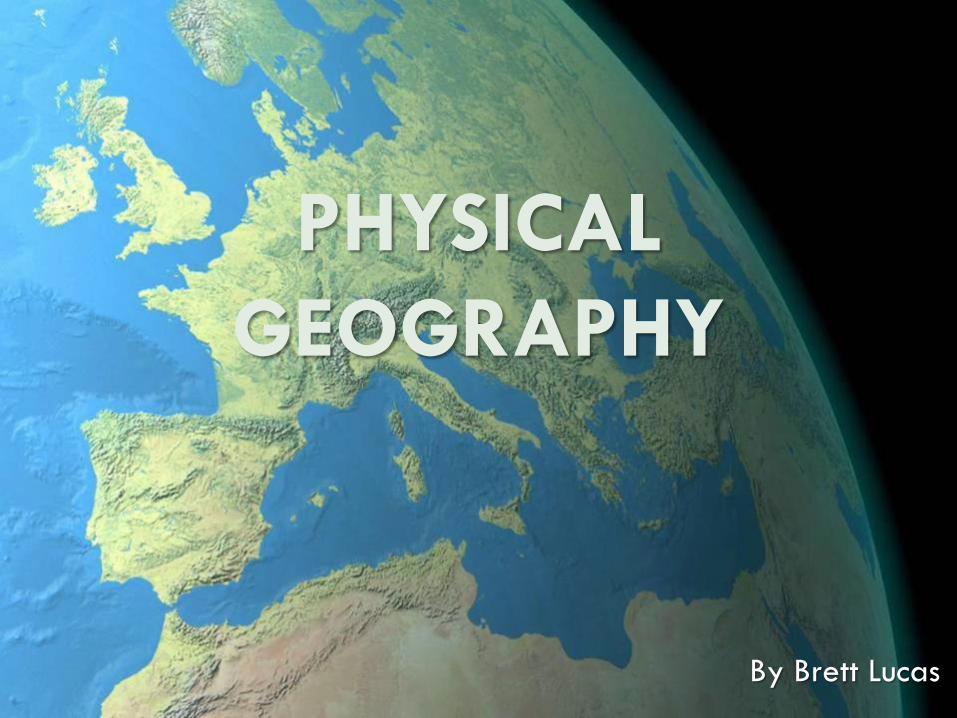
PHYSICAL
GEOGRAPHY
By Brett Lucas
FLUVIAL PROCESSES
Fluvial Processes
The Impact of Fluvial Processes on the Landscape
Streams and Stream Systems
Stream Channels
Structural Relationships
The Shaping and Reshaping of Valleys
Floodplains
Stream Rejuvenation
Theories of Landform Development
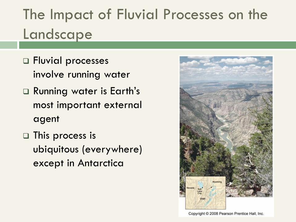
The Impact of Fluvial Processes on the
Landscape
Fluvial processes
involve running water
Running water is Earth’s
most important external
agent
This process is
ubiquitous (everywhere)
except in Antarctica
Streams and Stream Systems
Streamflow and Overland Flow Streamflow – channeled movement of water along a
valley bottom
Overland flow – unchanneled downslope movement of surface water
Valleys and Interfluves Valley – drainage system of channeled (stream) flow
Valley bottom and valley walls
Interfluve – No clearly established channeled flow High area between valleys (“top of the ridge”)
Leads to overland flow, see next slide.
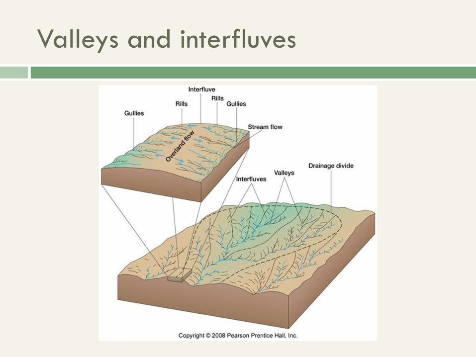
Valleys and interfluves
Drainage Basins (Watersheds)
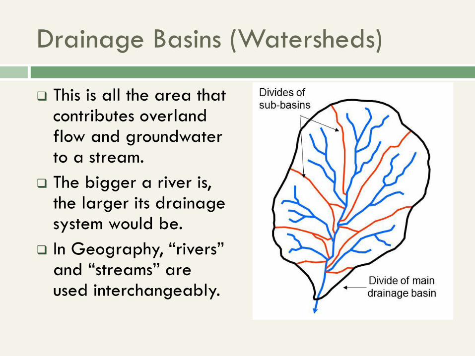
This is all the area that contributes overland flow and groundwater to a stream.
The bigger a river is, the larger its drainage system would be.
In Geography, “rivers” and “streams” are used interchangeably.
Drainage Basins (Watersheds)
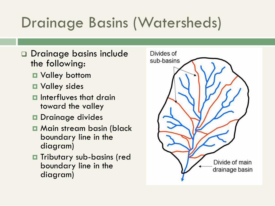
Drainage basins include the following:
Valley bottom
Valley sides
Interfluves that drain toward the valley
Drainage divides
Main stream basin (black boundary line in the diagram)
Tributary sub-basins (red boundary line in the diagram)
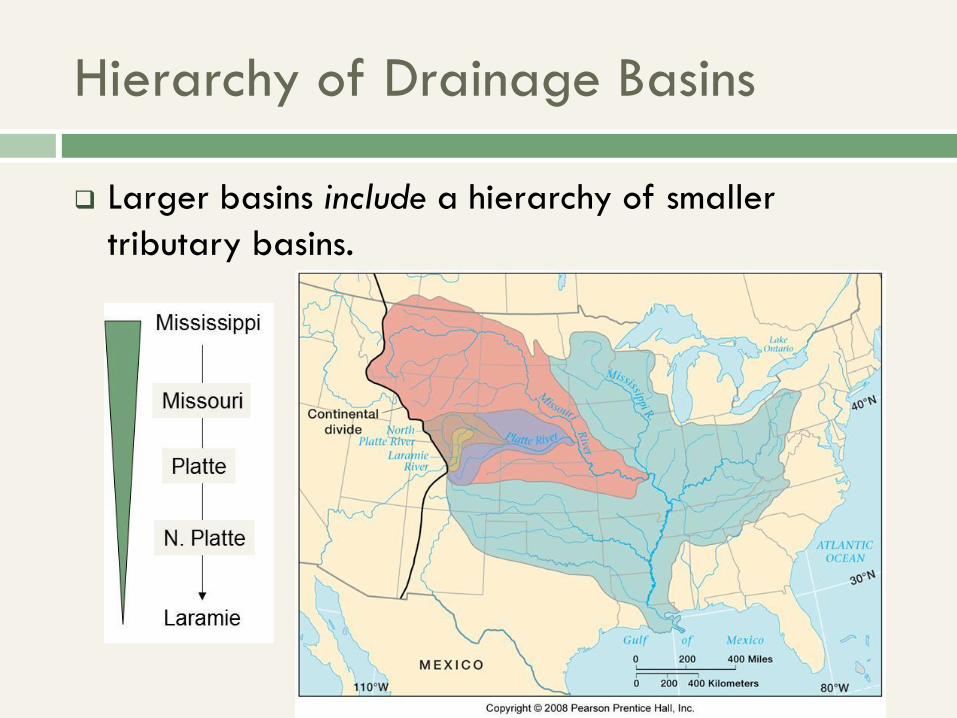
Hierarchy of Drainage Basins
Larger basins include a hierarchy of smaller
tributary basins.
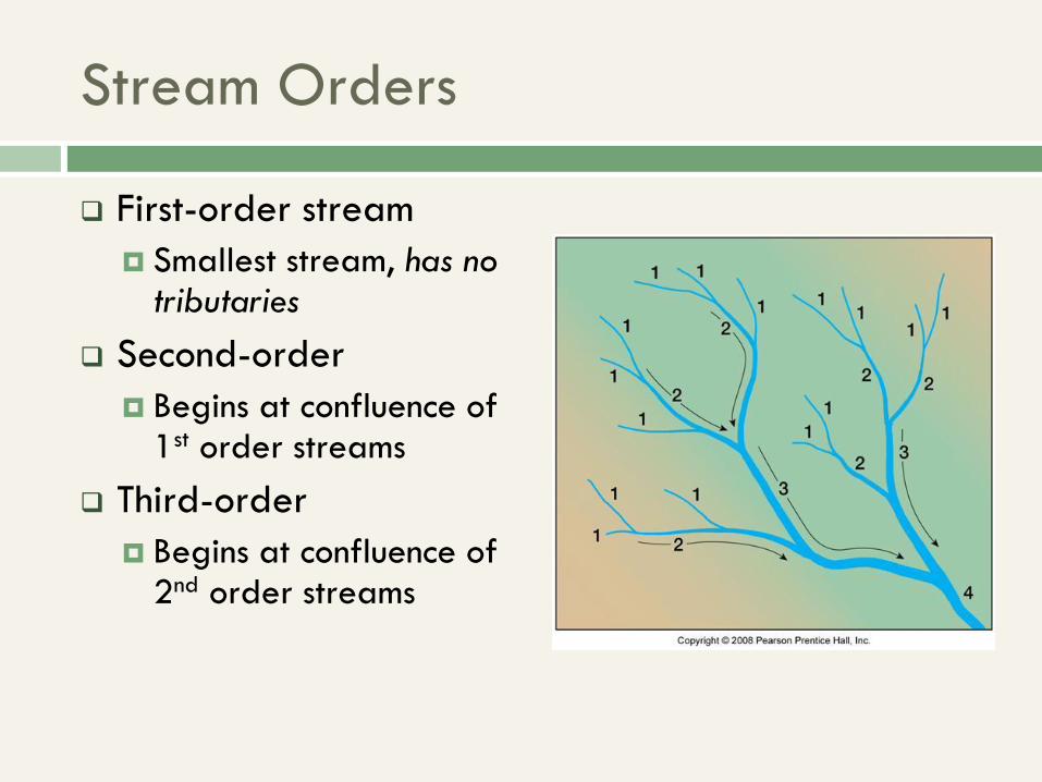
Stream Orders
First-order stream
Smallest stream, has no tributaries
Second-order
Begins at confluence of 1st order streams
Third-order
Begins at confluence of 2nd order streams
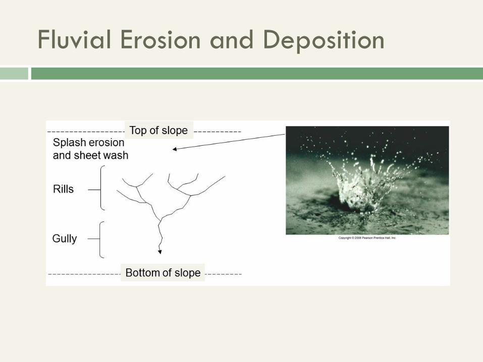
Fluvial Erosion and Deposition
Erosion by Overland Flow
It happens in 3 stages:
Splash erosion and sheet wash
Rill erosion and
Gully erosion. Once the gullies are deep enough,
they eventually become streamflow
Fluvial Erosion and Deposition
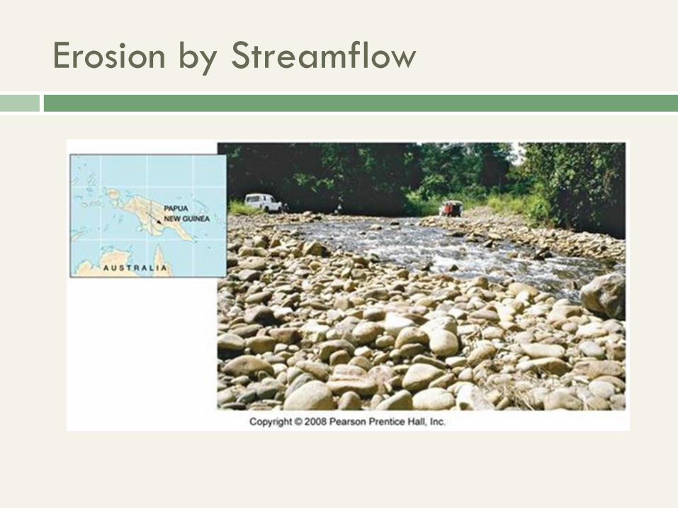
Erosion by Streamflow
Causes abrasion of streambed and rounded rock fragments, seen at right Some chemical weathering of channel
Amount of erosion depends on: Volume of flow
Flow speed
Turbulence of flow
Erosion by Streamflow
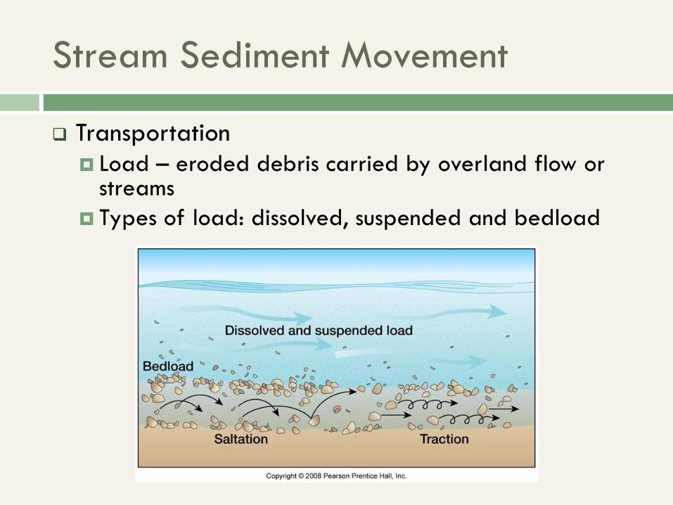
Stream Sediment Movement
Transportation
Load – eroded debris carried by overland flow or streams
Types of load: dissolved, suspended and bedload
Stream Sediment Movement
Deposition
Alluvium
The general term for stream deposited debris
They occur on sorted/stratified deposits, esp. if
flooding/deposition happens over a different periods time
Usually smooth, rounded particles (discussed before)
Cause of alluvium: Decrease in flow speed
The Role of Floods
Floods – periods of peak stream flow
They erode upper portions of valleys and form vast floodplains in lower parts of valleys
Sometimes leads to certain types of streams:
Perennial stream (permanent)
Intermittent stream (temporary) or Ephemeral (very temporary
Streams are intermittent if they flow only for part of the year (e.g. rainy season). Usually shown on topographic maps with dotted blue lines, instead of complete blue lines.
Streams are ephemeral if they flow only during or immediately after heavy rains. E.g. in a desert, where certain flowers can complete their whole life cycle in one day! (ephemeral plants).
Stream Channels
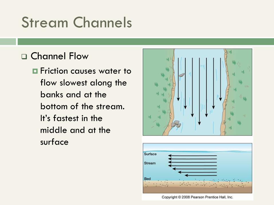
Channel Flow
Friction causes water to
flow slowest along the
banks and at the
bottom of the stream.
It’s fastest in the
middle and at the
surface
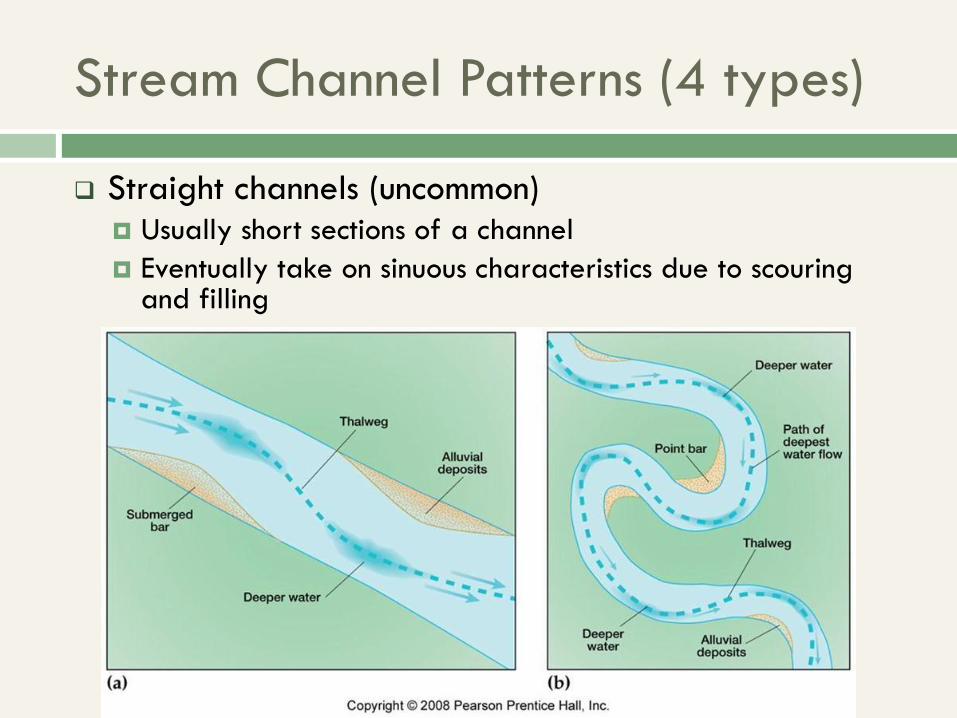
Stream Channel Patterns (4 types)
Straight channels (uncommon) Usually short sections of a channel
Eventually take on sinuous characteristics due to scouring and filling
Stream Channel Patterns (4 types)
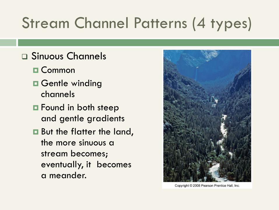
Sinuous Channels
Common
Gentle winding channels
Found in both steep and gentle gradients
But the flatter the land, the more sinuous a stream becomes; eventually, it becomes a meander.
Stream Channel Patterns (4 types)
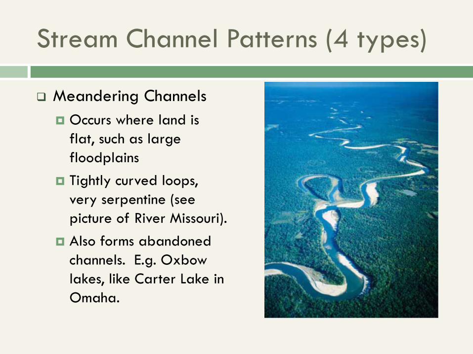
Meandering Channels
Occurs where land is
flat, such as large
floodplains
Tightly curved loops,
very serpentine (see
picture of River Missouri).
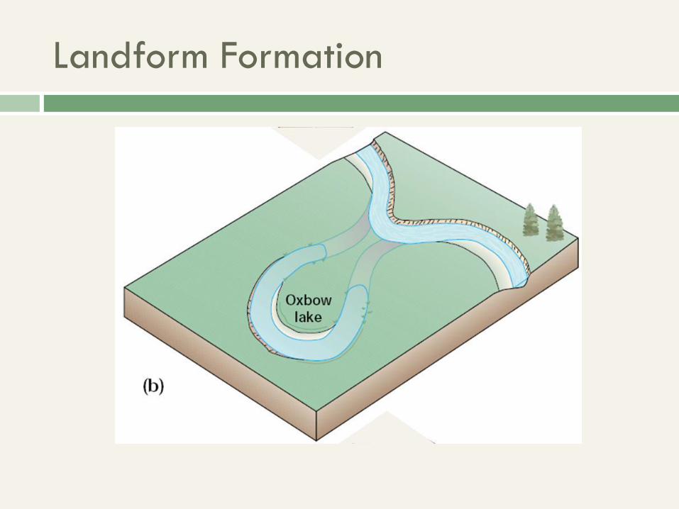
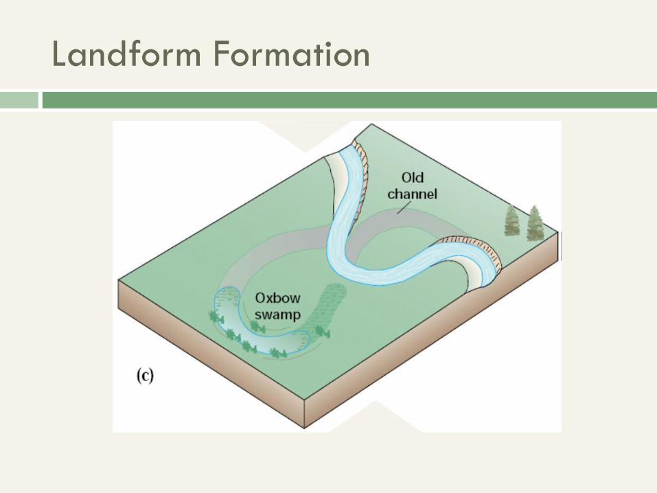
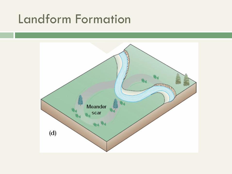
Also forms abandoned
channels. E.g. Oxbow
lakes, like Carter Lake in
Omaha.
Stream Channel Patterns (4 types)
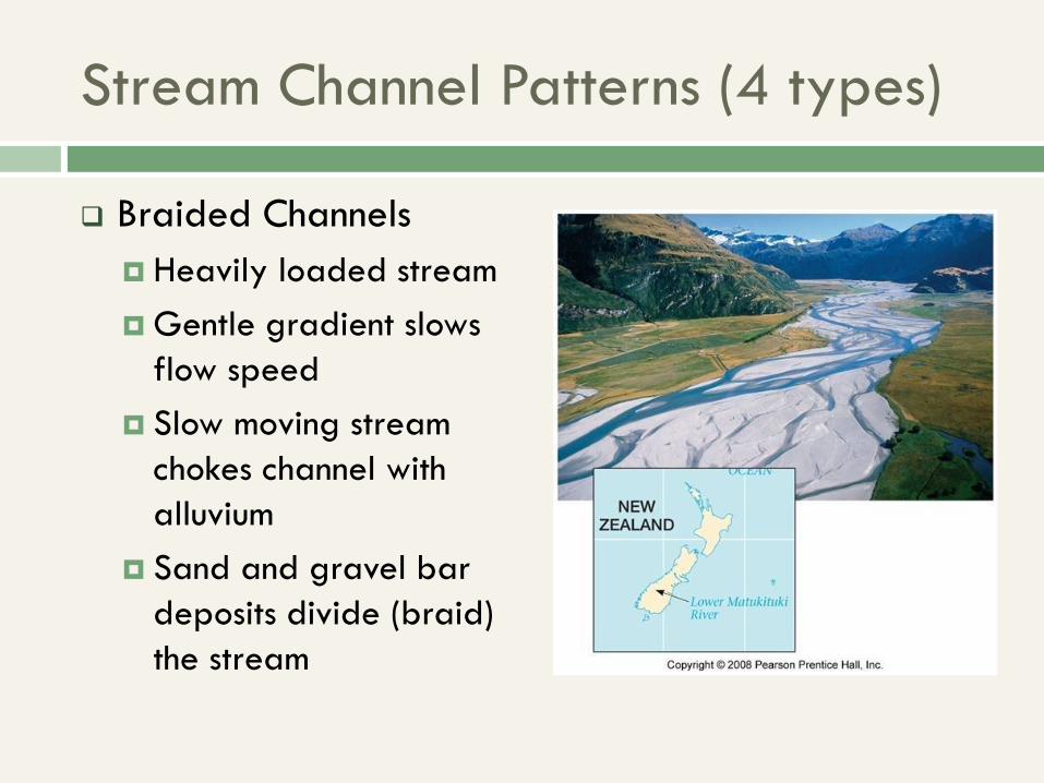
Braided Channels
Heavily loaded stream
Gentle gradient slows
flow speed
Slow moving stream
chokes channel with
alluvium
Sand and gravel bar
deposits divide (braid)
the stream
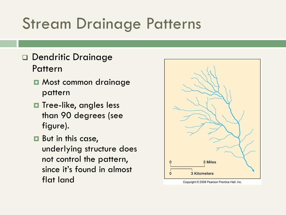
Stream Drainage Patterns
Dendritic Drainage Pattern
Most common drainage pattern
Tree-like, angles less than 90 degrees (see figure).
But in this case, underlying structure does not control the pattern, since it’s found in almost flat land
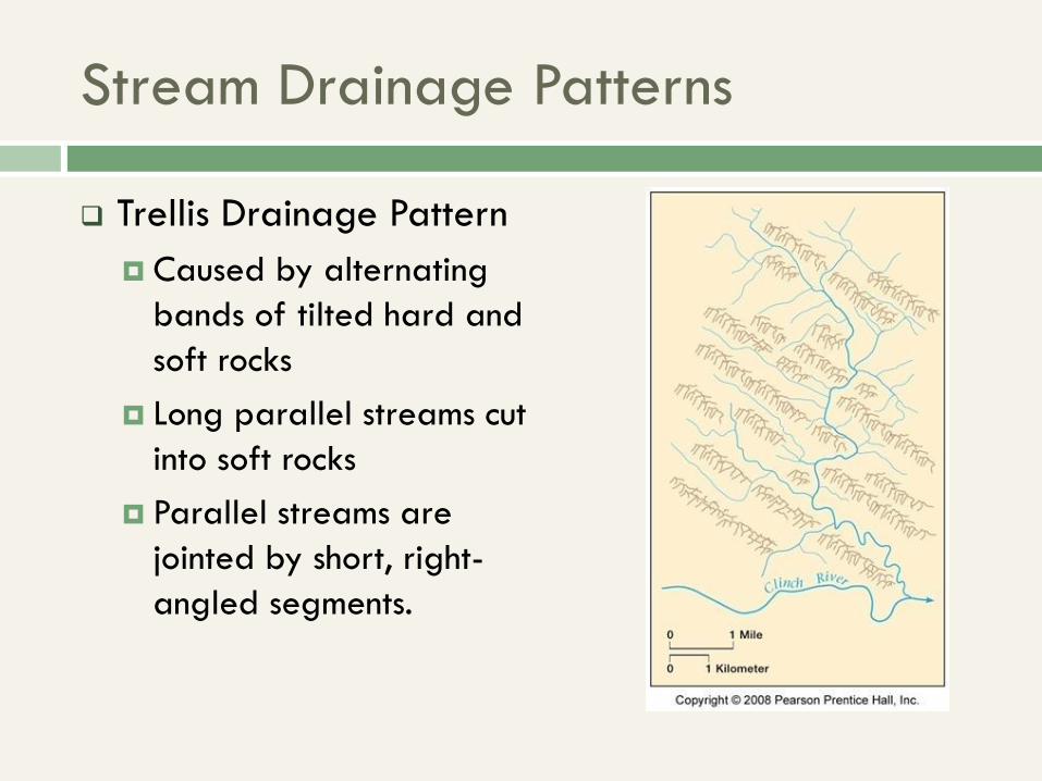
Stream Drainage Patterns
Trellis Drainage Pattern
Caused by alternating
bands of tilted hard and
soft rocks
Long parallel streams cut
into soft rocks
Parallel streams are
jointed by short, right-
angled segments.
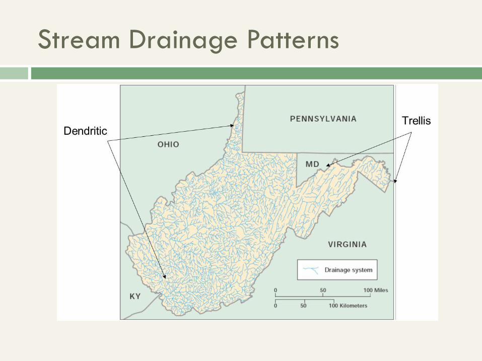
Stream Drainage Patterns
Stream Drainage Patterns
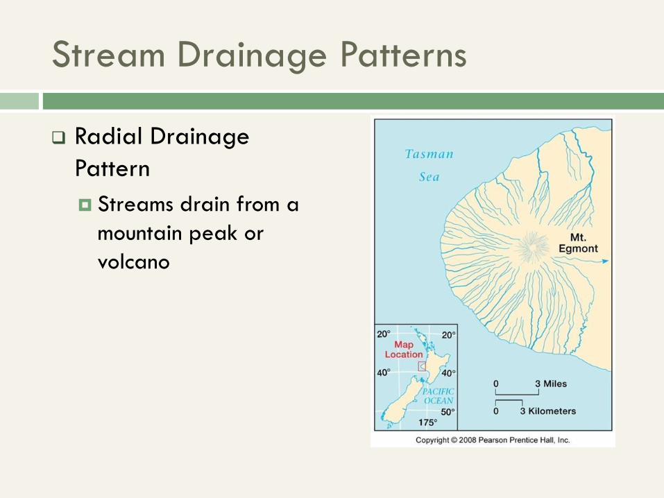
Radial Drainage
Pattern
Streams drain from a
mountain peak or
volcano
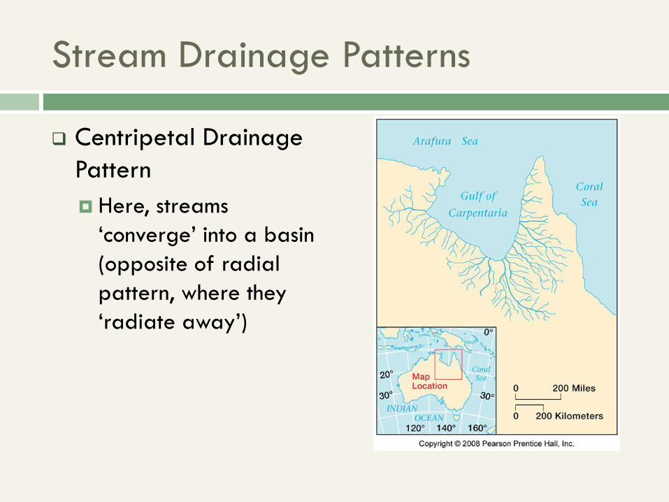
Stream Drainage Patterns
Centripetal Drainage
Pattern
Here, streams
‘converge’ into a basin
(opposite of radial
pattern, where they
‘radiate away’)

Stream Drainage Patterns
Annular Drainage
Pattern
Streams converge into
a basin, in right angles
between hard and soft
rock (almost sounds like
the trellis pattern at
first, but these
branches here all
converge at once).
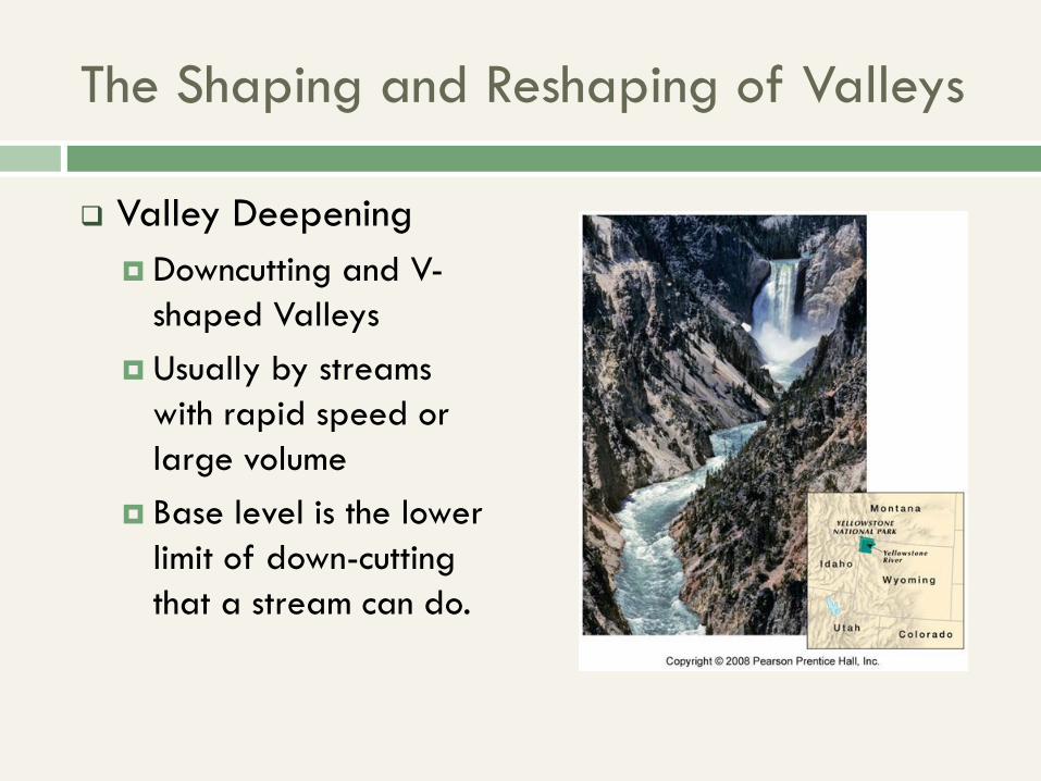
The Shaping and Reshaping of Valleys
Valley Deepening
Downcutting and V-
shaped Valleys
Usually by streams
with rapid speed or
large volume
Base level is the lower
limit of down-cutting
that a stream can do.
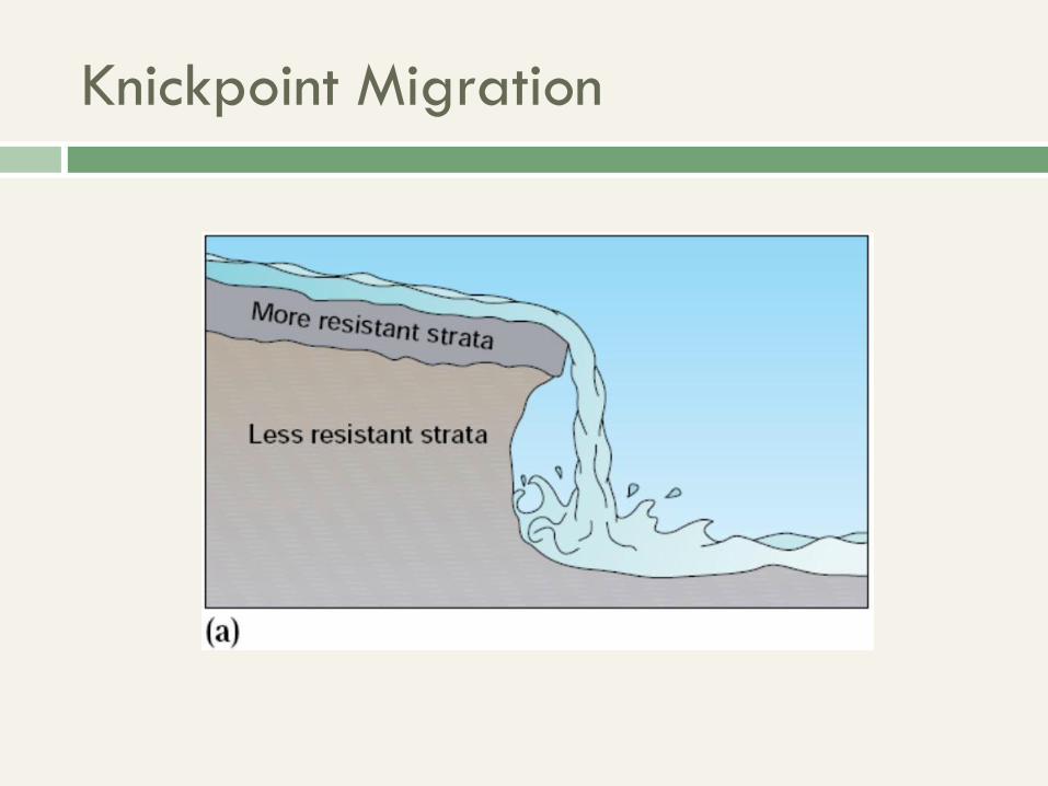
Knickpoint Migration
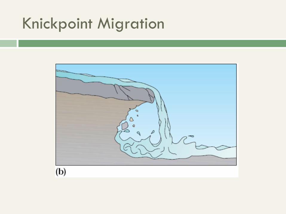
Knickpoint Migration
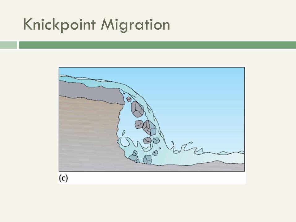
Knickpoint Migration
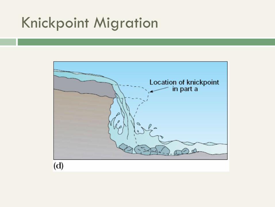
Knickpoint Migration
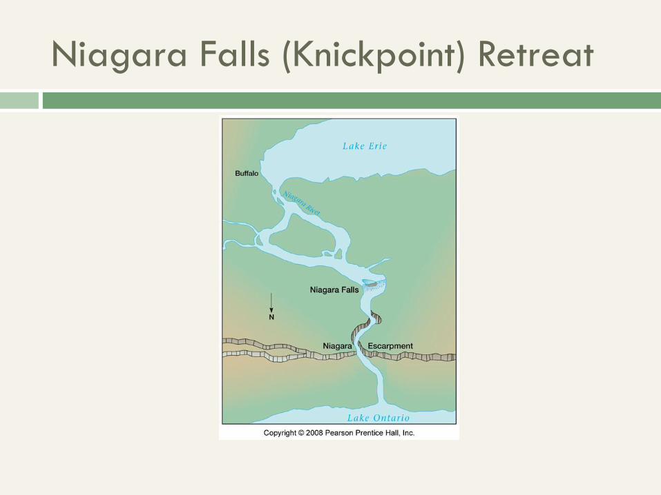
Niagara Falls (Knickpoint) Retreat
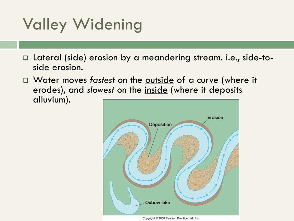
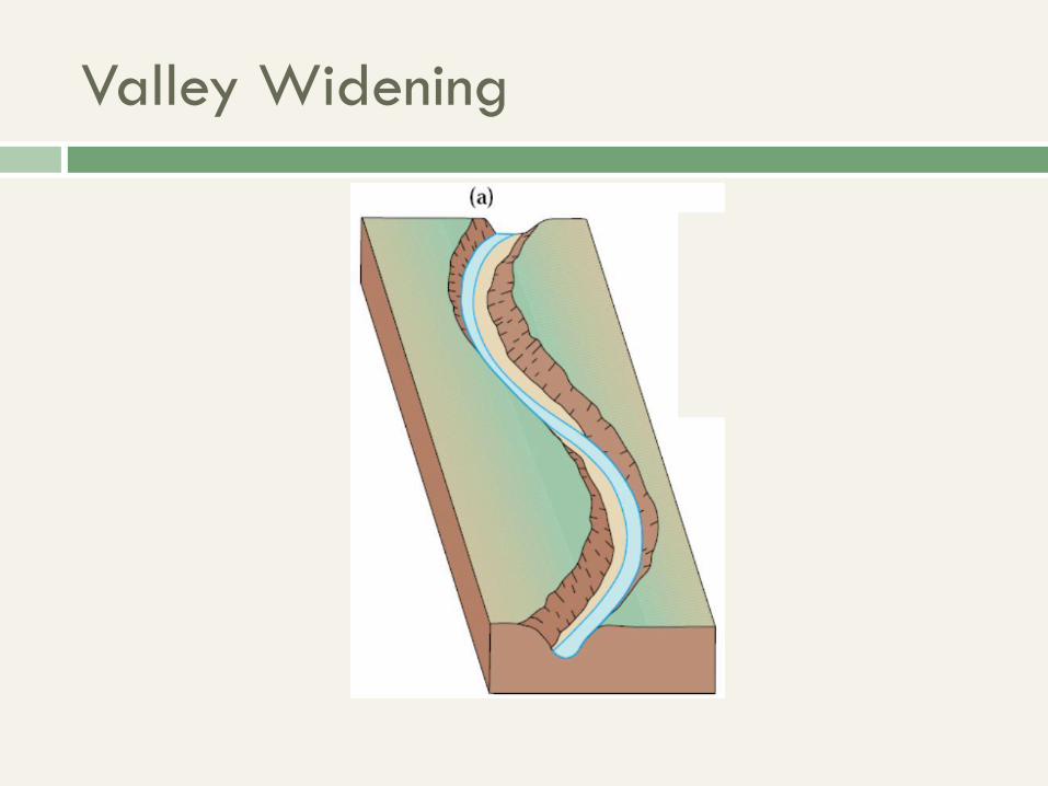
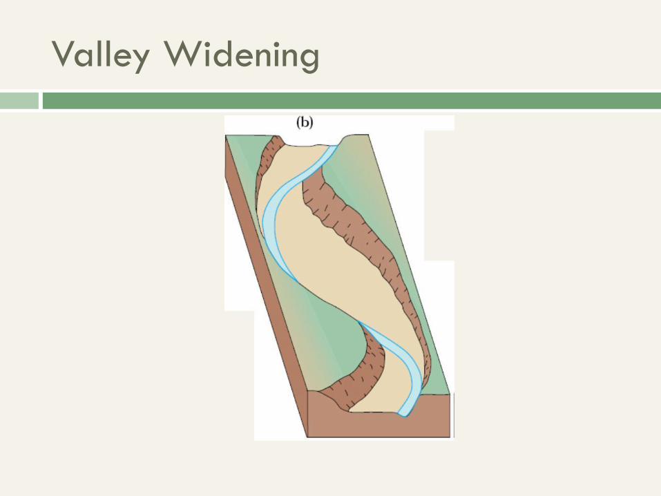
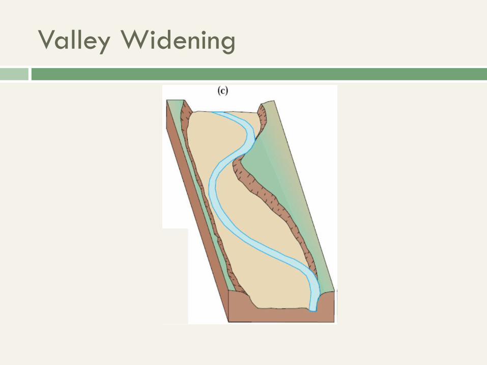
Valley Widening
Lateral (side) erosion by a meandering stream. i.e., side-to-side erosion.
Water moves fastest on the outside of a curve (where it erodes), and slowest on the inside (where it deposits alluvium).
Valley Widening
Valley Widening
Valley Widening
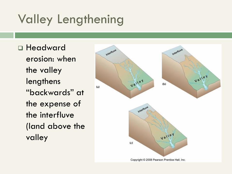
Valley Lengthening
Headward
erosion: when
the valley
lengthens
“backwards” at
the expense of
the interfluve
(land above the
valley
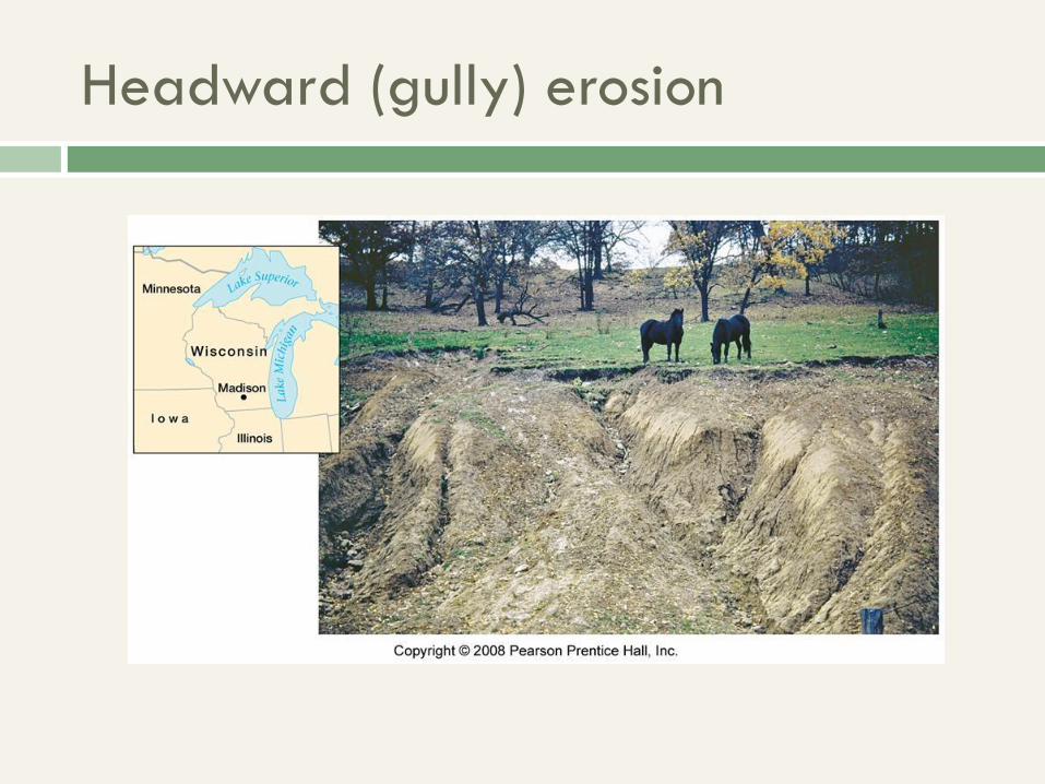
Headward (gully) erosion
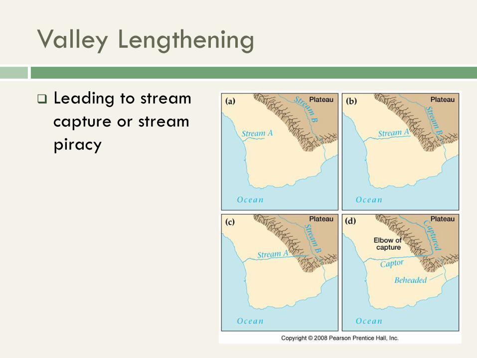
Valley Lengthening
Leading to stream
capture or stream
piracy
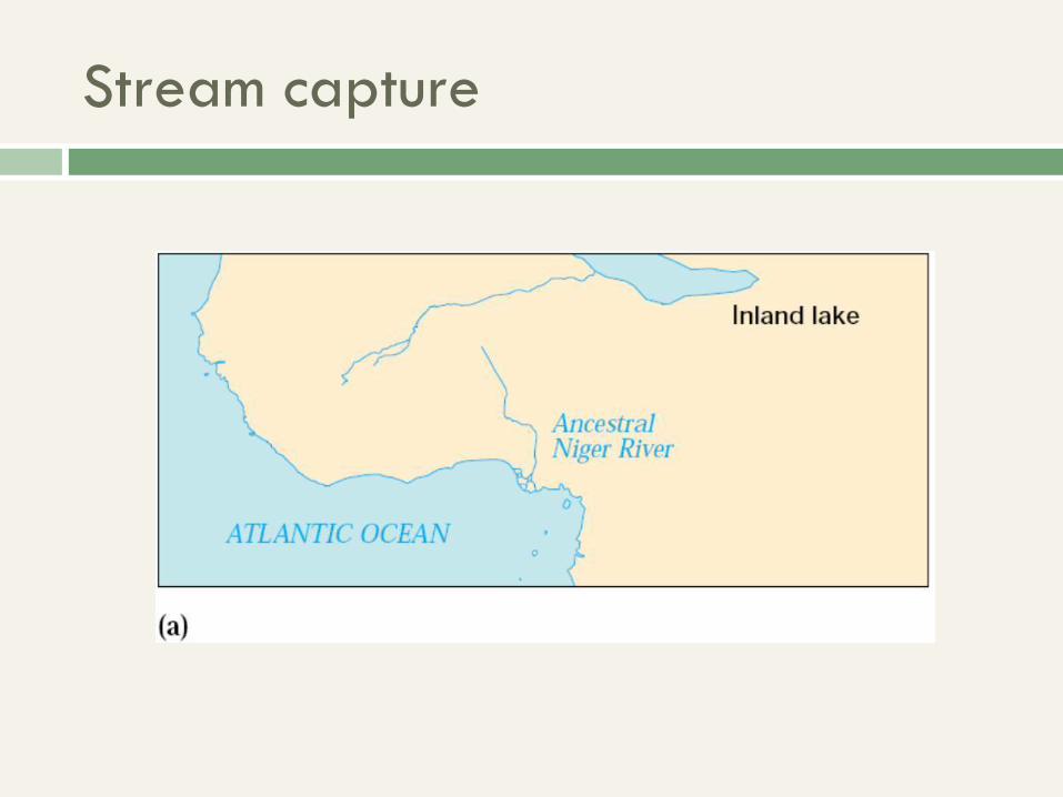
Stream capture
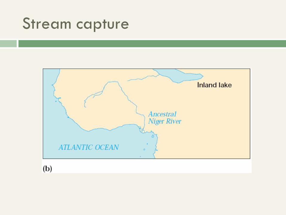
Stream capture
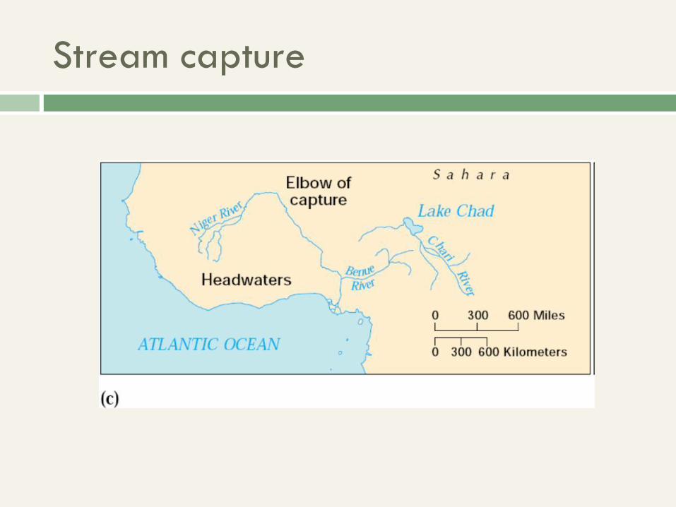
Stream capture
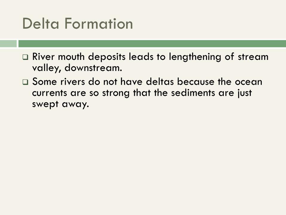
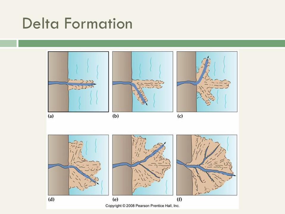
Delta Formation
River mouth deposits leads to lengthening of stream valley, downstream.
Some rivers do not have deltas because the ocean currents are so strong that the sediments are just swept away.
Delta Formation
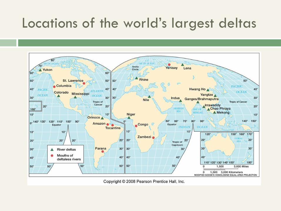
Locations of the world’s largest deltas
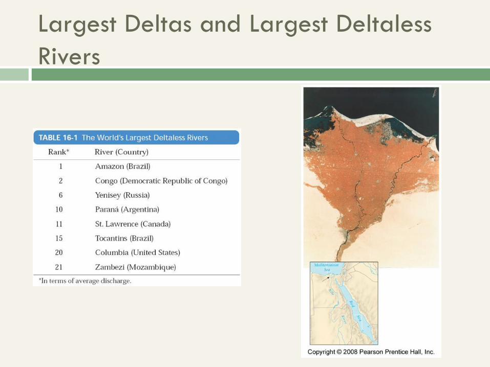
Largest Deltas and Largest Deltaless
Rivers
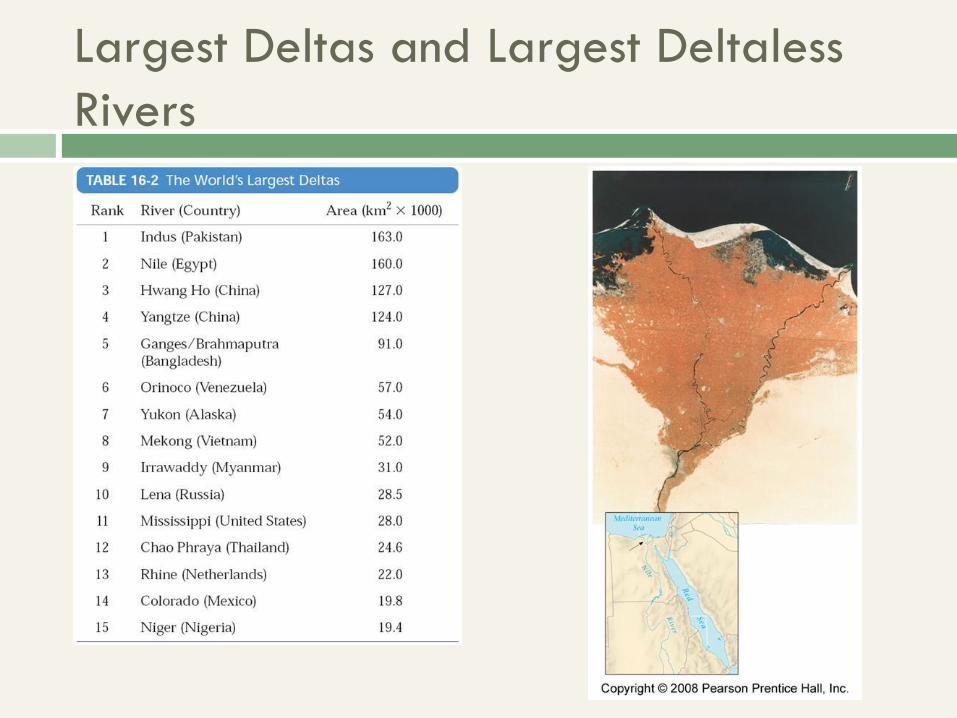
Largest Deltas and Largest Deltaless
Rivers
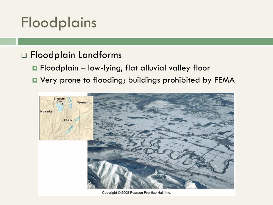
Floodplains
Floodplain Landforms
Floodplain – low-lying, flat alluvial valley floor
Very prone to flooding; buildings prohibited by FEMA
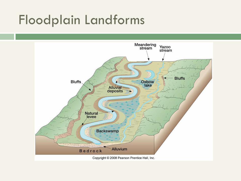
Floodplain Landforms
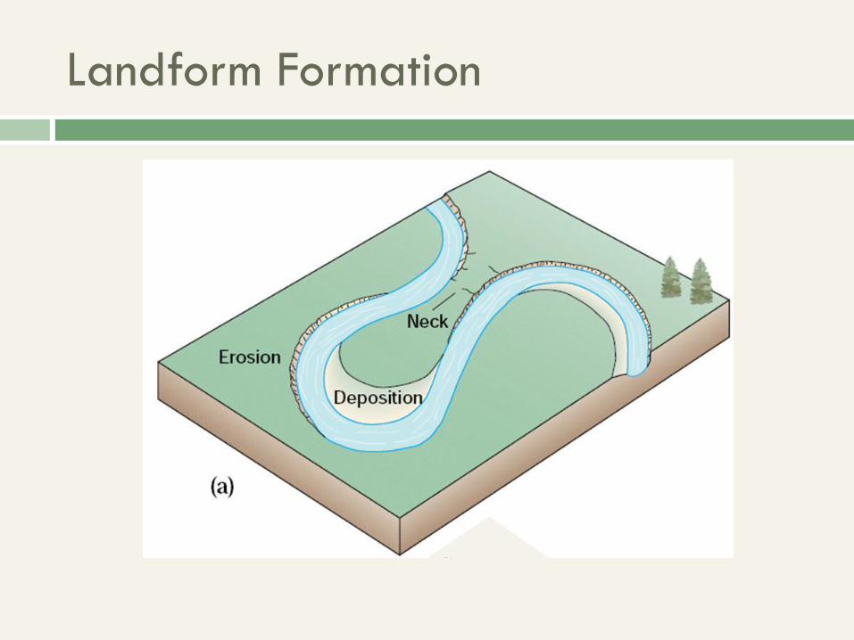
Landform Formation
Landform Formation
Landform Formation
Landform Formation
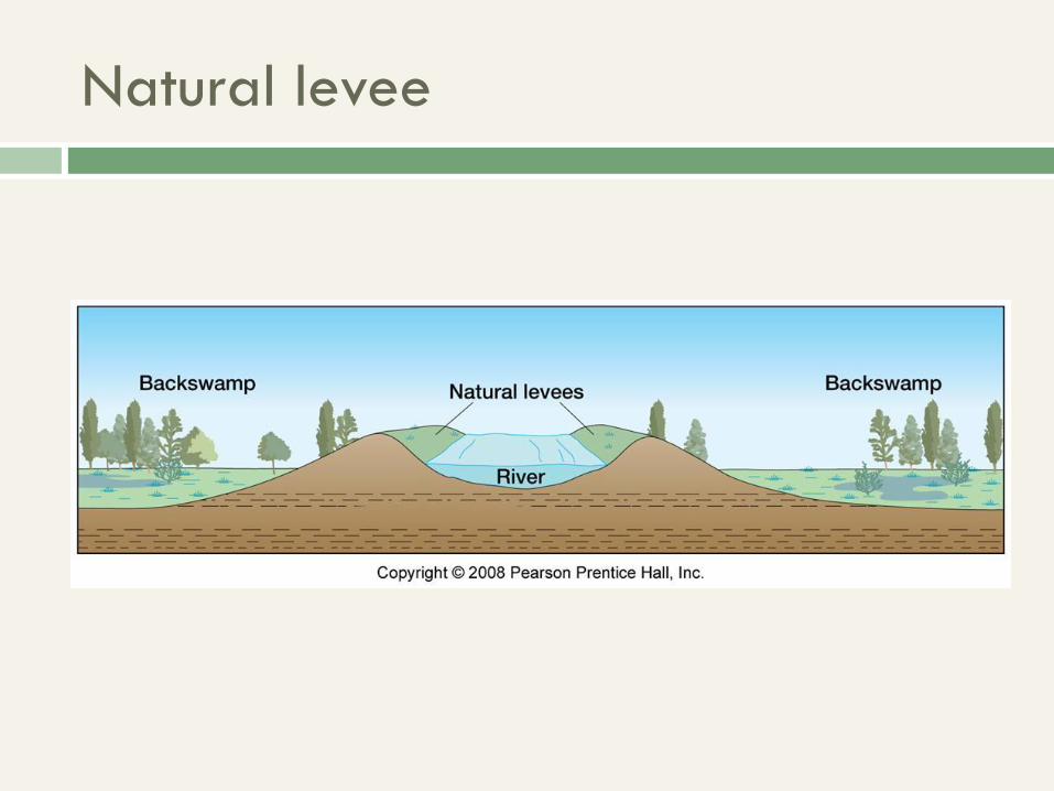
Natural levee
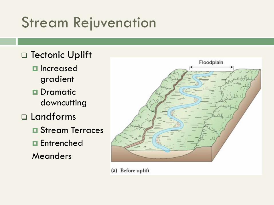
Stream Rejuvenation
Tectonic Uplift
Increased gradient
Dramatic downcutting
Landforms
Stream Terraces
Entrenched
Meanders
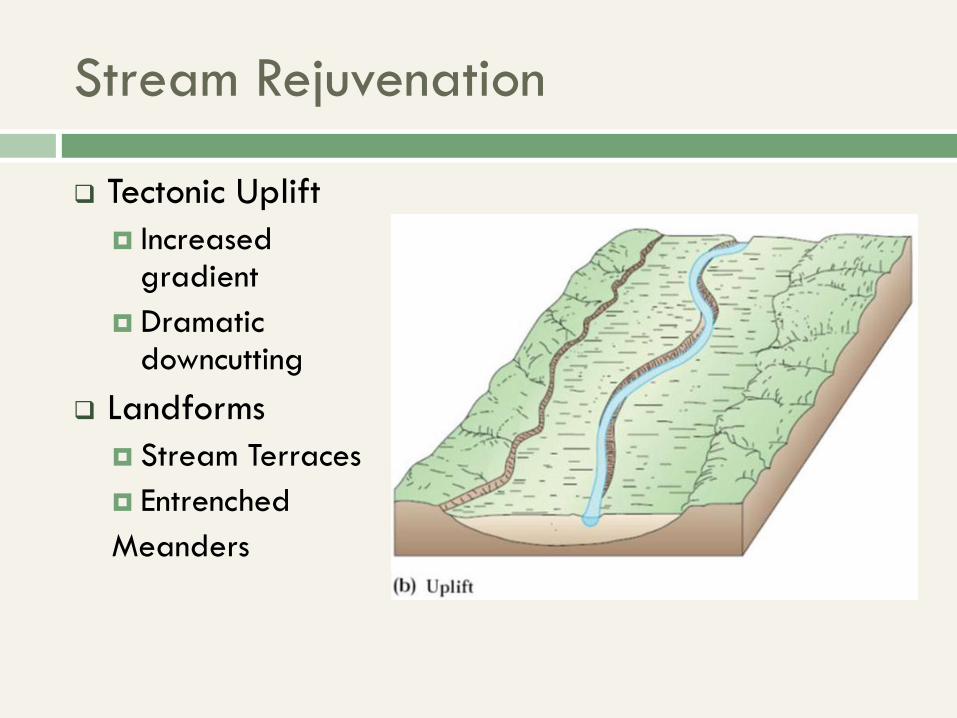
Stream Rejuvenation
Tectonic Uplift
Increased gradient
Dramatic downcutting
Landforms
Stream Terraces
Entrenched
Meanders
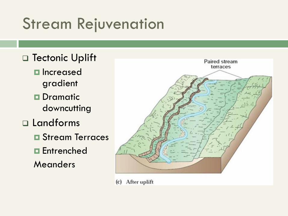
Stream Rejuvenation
Tectonic Uplift
Increased gradient
Dramatic downcutting
Landforms
Stream Terraces
Entrenched
Meanders
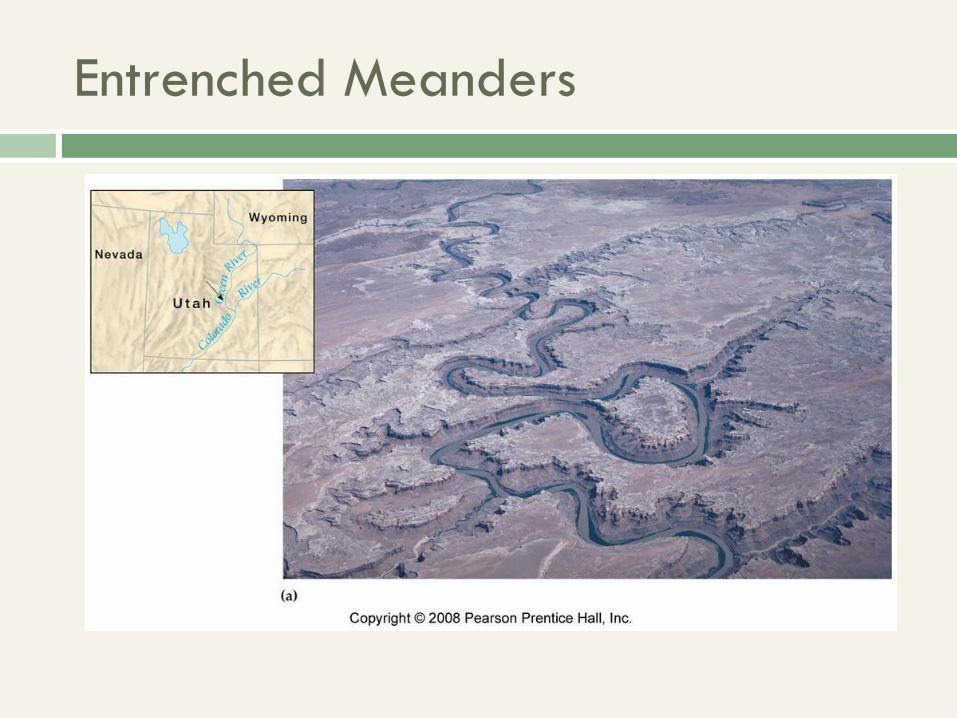
Entrenched Meanders
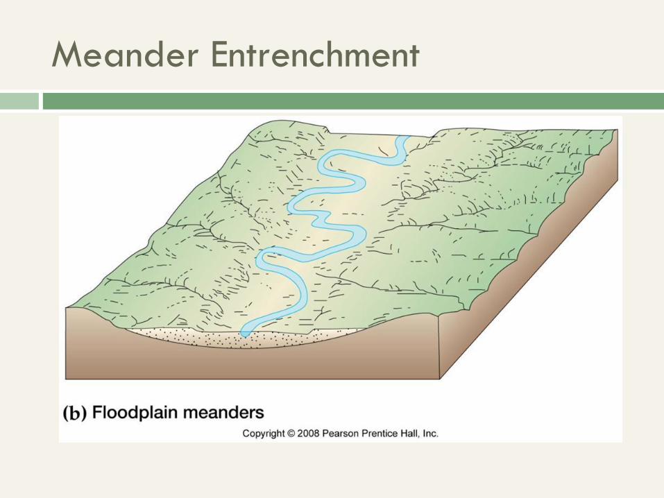
Meander Entrenchment
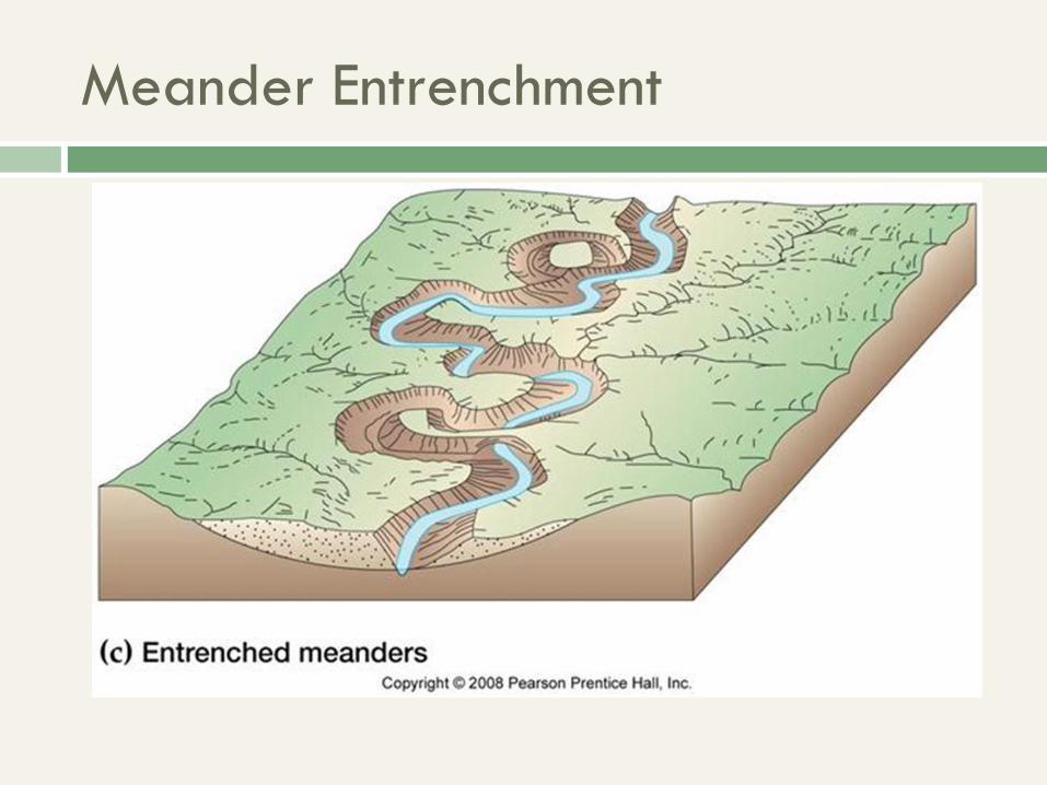
Meander Entrenchment
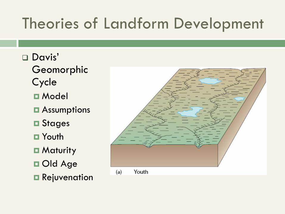
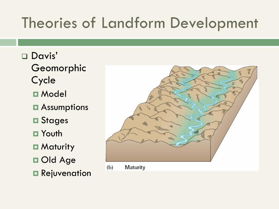
Theories of Landform Development
Davis’ Geomorphic Cycle
Model
Assumptions
Stages
Youth
Maturity
Old Age
Rejuvenation
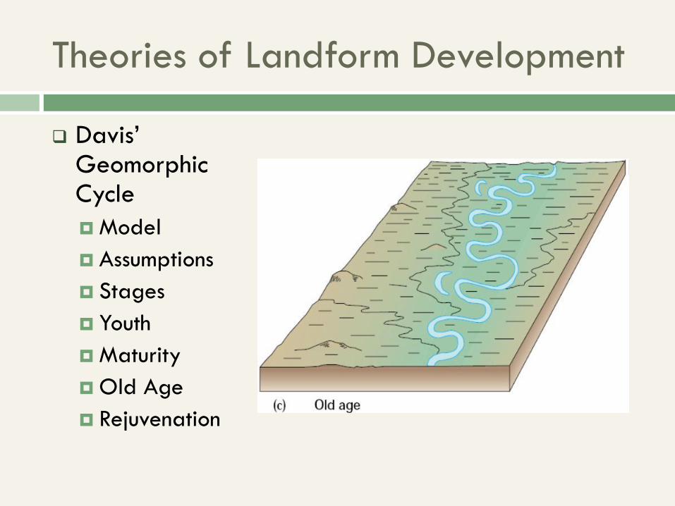
Theories of Landform Development
Davis’ Geomorphic Cycle
Model
Assumptions
Stages
Youth
Maturity
Old Age
Rejuvenation
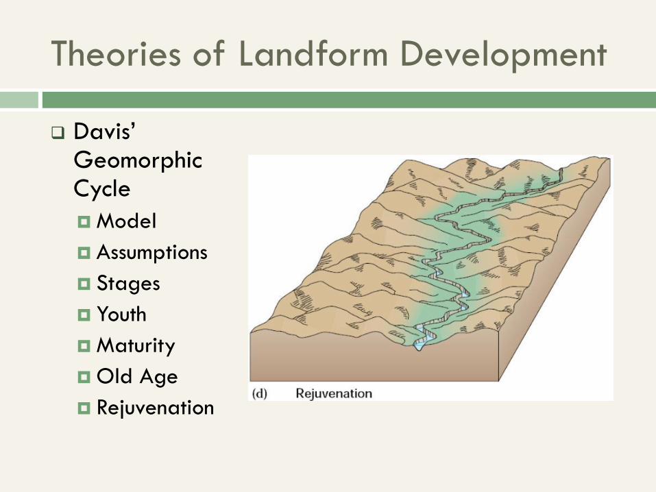
Theories of Landform Development
Davis’ Geomorphic Cycle
Model
Assumptions
Stages
Youth
Maturity
Old Age
Rejuvenation
Theories of Landform Development
Davis’ Geomorphic Cycle
Model
Assumptions
Stages
Youth
Maturity
Old Age
Rejuvenation