Embed Size (px)
Citation preview
Photogrammetry
Photogrammetry is the art and science of making accurate measurements by means of aerial photography (Jensen); or is the technique of obtaining reliable measurements of objects from their photographic images.
Analog photogrammetry is performed visually by humans and is used when data are in a hard-copy format.
Digital or analytical photogrammetry is performed with the aid of a computer using digitized aerial photography.
Photogrammetry
Some of the important measurements that can be obtained from a single vertical aerial photograph using either analog or digital photogrammetric techniques include:
• Scale of the photography • Object height (buildings, tree crowns…)• Object length• Area of an object or polygon• Perimeter of an object or polygon, and • Grayscale tone or color of an object• …
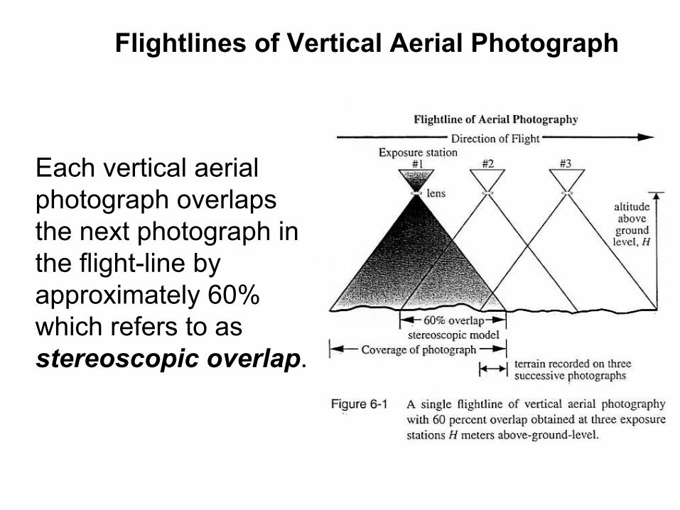
Each vertical aerial photograph overlaps the next photograph in the flight-line by approximately 60% which refers to as stereoscopic overlap.
Flightlines of Vertical Aerial Photograph

This overlap is very important because it provides at least two and sometimes three photographic views of each object on the ground along the flight-line.
Flight-line of Vertical Aerial Photograph

Most aerial photography projects require multiple flightlines of photography to cover the geographic area of interest.
Multiple flightlines with 20-30% sidelap (overlap between the flightlines)are commonly referred to as block of aerial photography.

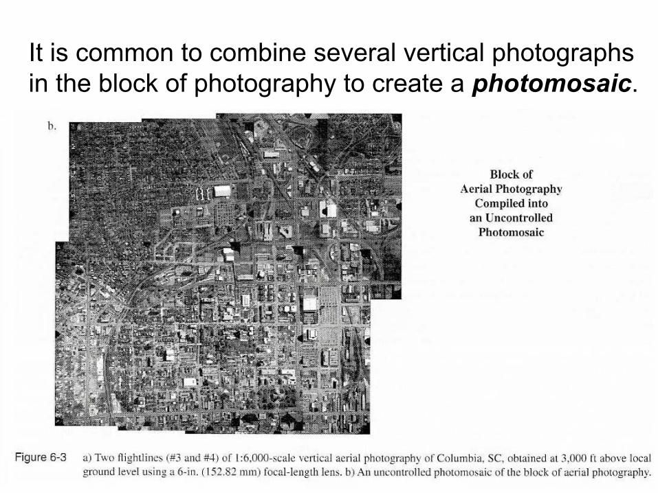
It is common to combine several vertical photographs in the block of photography to create a photomosaic.
It is common to combine several vertical photographs in the block of photography to create a photomosaic.
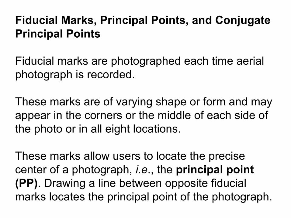
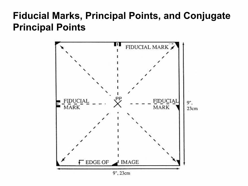
Fiducial Marks, Principal Points, and Conjugate Principal Points
Fiducial marks are photographed each time aerial photograph is recorded.
These marks are of varying shape or form and may appear in the corners or the middle of each side of the photo or in all eight locations.
These marks allow users to locate the precise center of a photograph, i.e., the principal point (PP). Drawing a line between opposite fiducialmarks locates the principal point of the photograph.
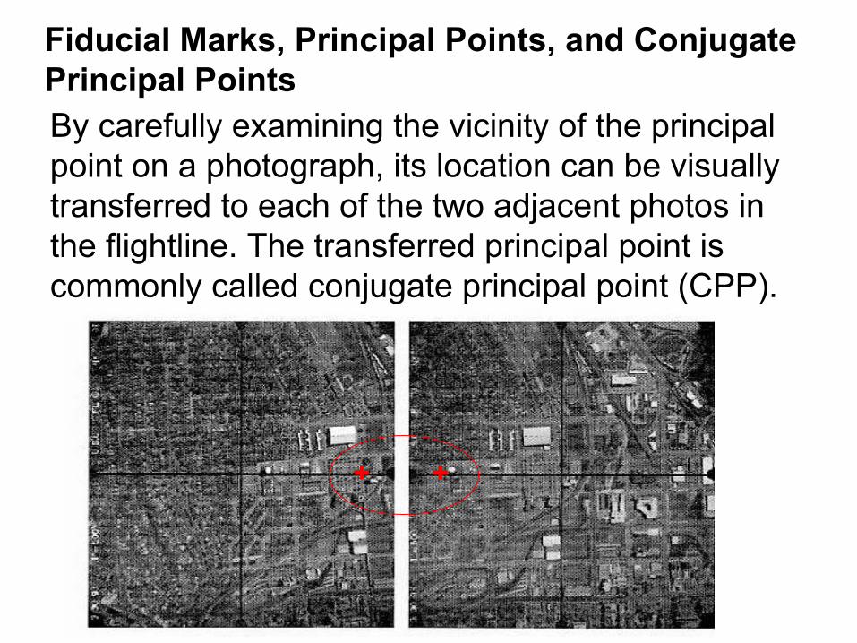
Fiducial Marks, Principal Points, and Conjugate Principal Points

Fiducial Marks, Principal Points, and Conjugate Principal PointsBy carefully examining the vicinity of the principal point on a photograph, its location can be visually transferred to each of the two adjacent photos in the flightline. The transferred principal point is commonly called conjugate principal point (CPP).
Fiducial Marks, Principal Points, and Conjugate Principal PointsBy carefully examining the vicinity of the principal point on a photograph, its location can be visually transferred to each of the two adjacent photos in the flightline. The transferred principal point is commonly called conjugate principal point (CPP).
++

Fiducial Marks, Principal Points, and Conjugate Principal PointsThe actual line of flight oppose to the desired line of flight) can be determined by laying out the photography and drawing a line through the principal points and conjugate principal points.
Real Flightline?
Wind DirectionDesired Flightline

Geometry of a Vertical Aerial Photograph
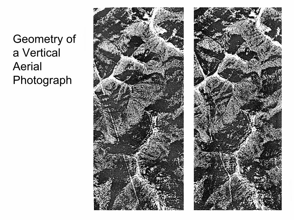
Geometry of a Vertical Aerial Photograph
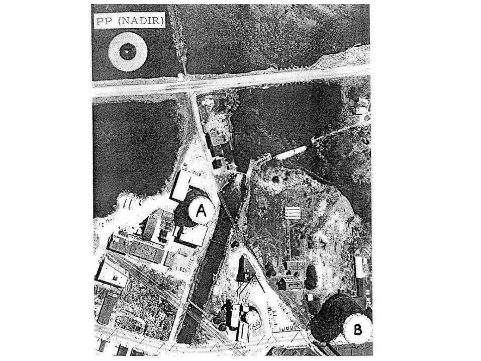
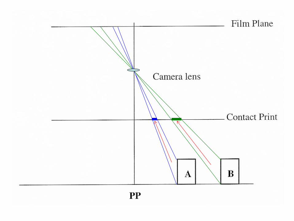
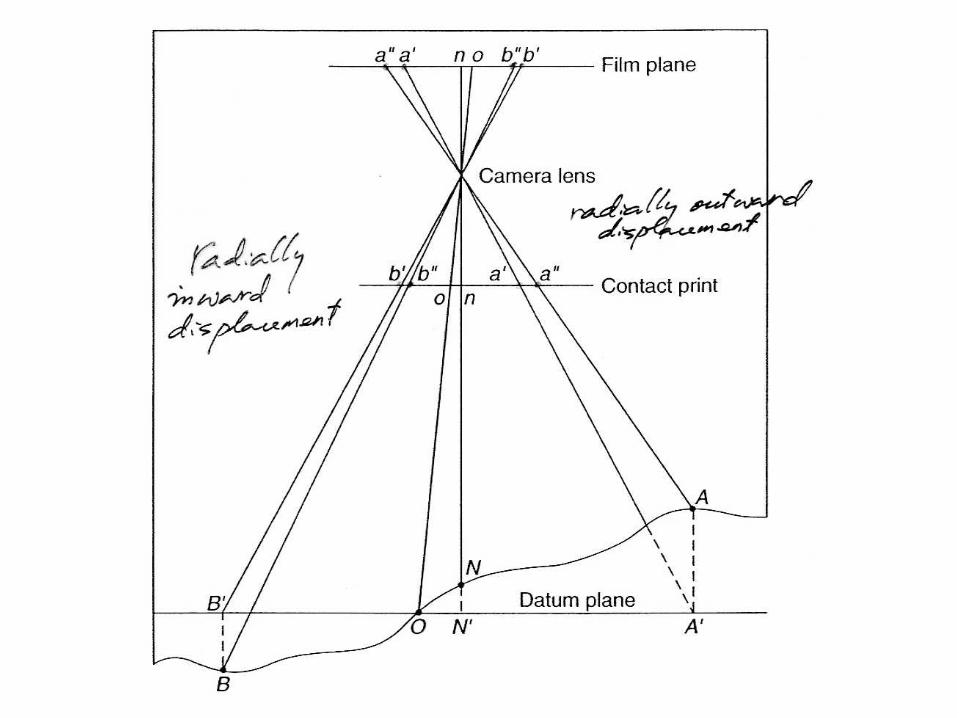
Image Displacement on Vertical Airphoto
In airphoto, central projection is applied. All objects are positioned as they were being viewed from the same point. This means that most of the ground objects on the airphoto have been shifted or displaced from their correct position.
This phenomena is called image displacement.
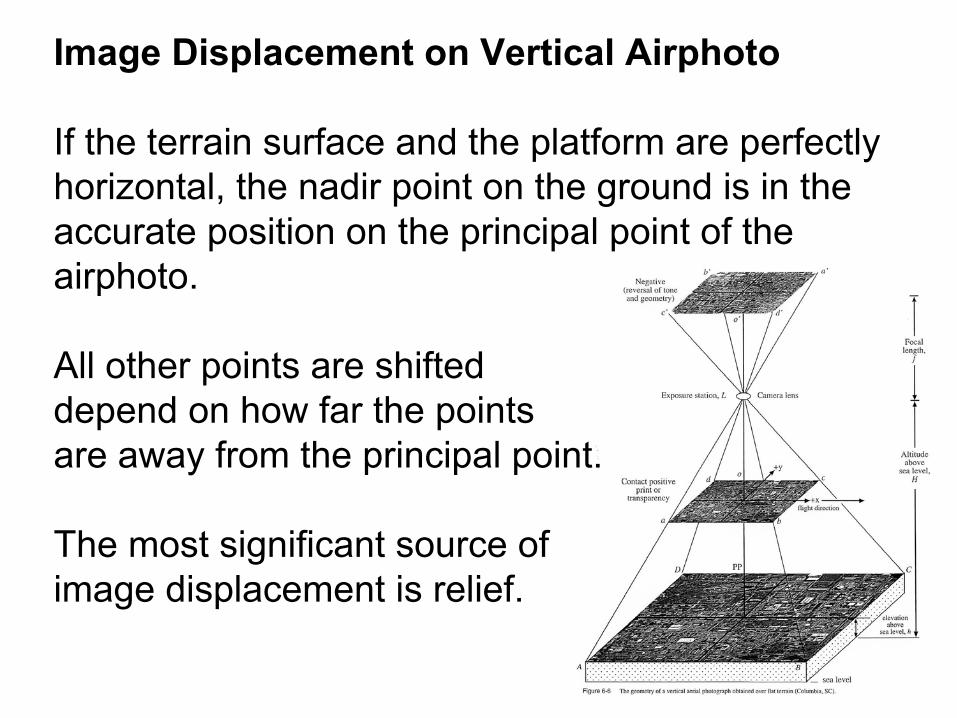
Image Displacement on Vertical Airphoto
If the terrain surface and the platform are perfectly horizontal, the nadir point on the ground is in the accurate position on the principal point of the airphoto.
All other points are shifted depend on how far the points are away from the principal point.
The most significant source of image displacement is relief.
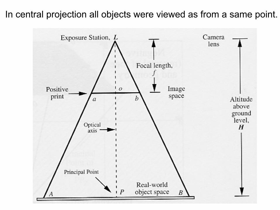
In central projection all objects were viewed as from a same point.

If the terrain surface are not flat?
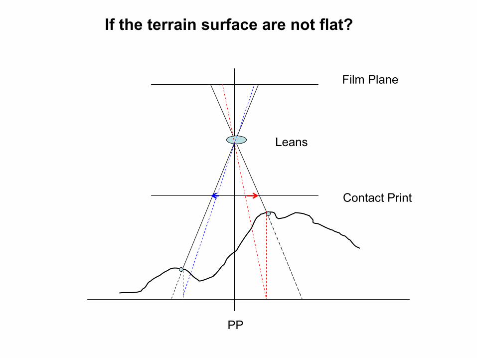
PP
Film Plane
Contact Print
Leans
If the terrain surface are not flat?
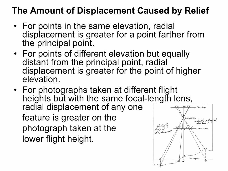
The Amount of Displacement Caused by Relief• For points in the same elevation, radial
displacement is greater for a point farther from the principal point.
• For points of different elevation but equally distant from the principal point, radial displacement is greater for the point of higher elevation.
• For photographs taken at different flight heights but with the same focal-length lens, radial displacement of any one feature is greater on the photograph taken at the lower flight height.
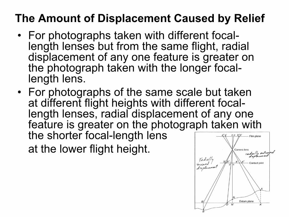
The Amount of Displacement Caused by Relief• For photographs taken with different focal-
length lenses but from the same flight, radial displacement of any one feature is greater on the photograph taken with the longer focal-length lens.
• For photographs of the same scale but taken at different flight heights with different focal-length lenses, radial displacement of any one feature is greater on the photograph taken with the shorter focal-length lens at the lower flight height.
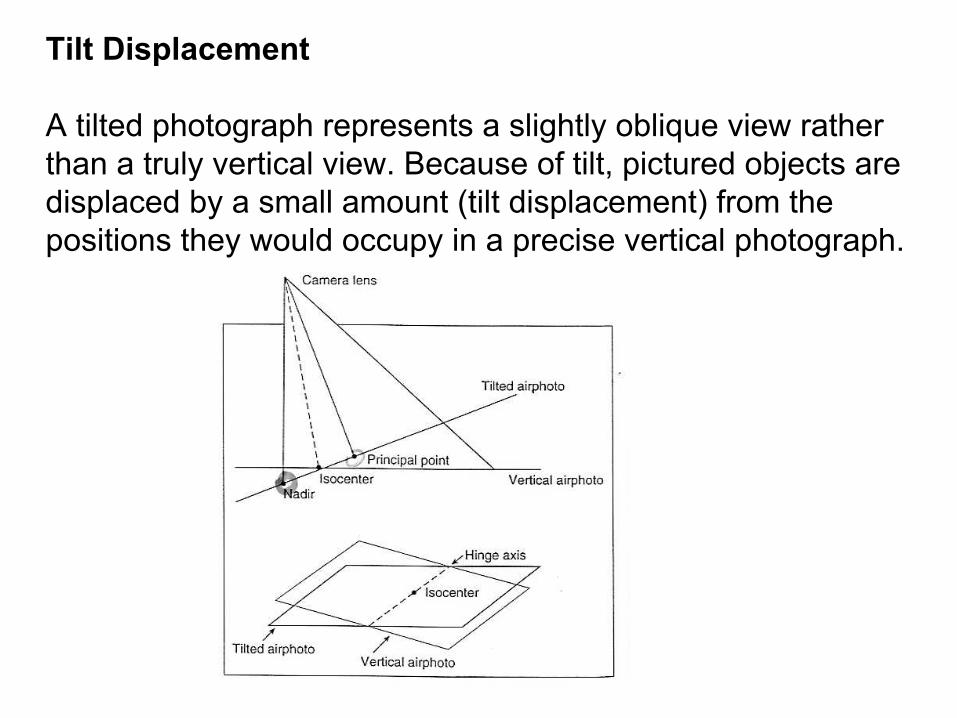
Tilt Displacement
A tilted photograph represents a slightly oblique view rather than a truly vertical view. Because of tilt, pictured objects are displaced by a small amount (tilt displacement) from the positions they would occupy in a precise vertical photograph.

Displacement is not necessarily the “bad thing”
• Helps to create 3-D view by stereoscope• Allows measurement of height of objects on the ground
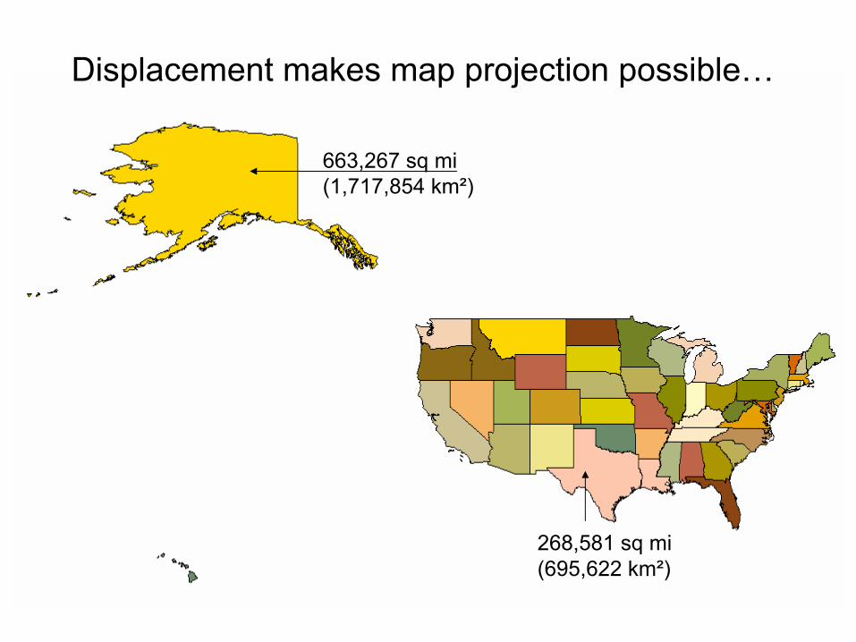
663,267 sq mi(1,717,854 km²)
268,581 sq mi(695,622 km²)
Displacement makes map projection possible…

Orthoimages are created from remotely sensed images. The geometry of an unrectified digital photography is changed from that of a conical bundle of rays to parallel rays that are orthogonal to the ground and to the image plane. Therefore, instead of having a perspective center, the viewing perspective is modeled as being an infinite distance from the ground.
Orthophoto and Digital Elevation Models
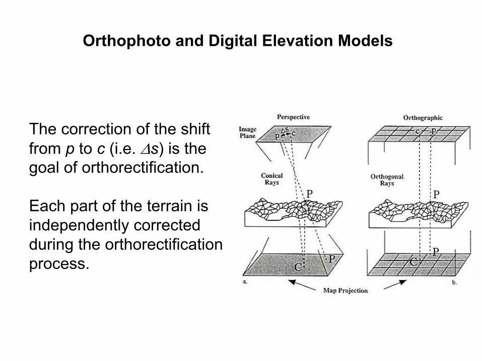
Orthophoto and Digital Elevation Models
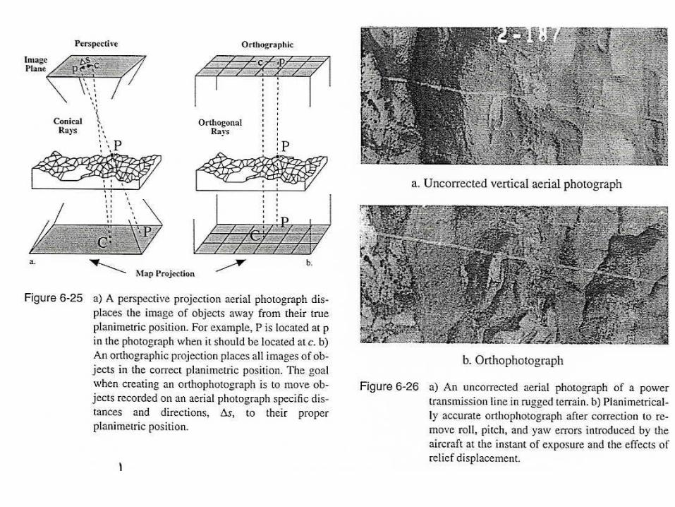
The correction of the shift from p to c (i.e. ∆s) is the goal of orthorectification.
Each part of the terrain is independently corrected during the orthorectificationprocess.

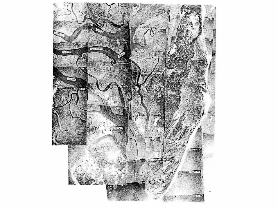
Airphoto Mosaics
An airphoto mosaic is an assemblage of two or more overlapping aerial photographs that form a composite view of the total area covered by the individual photographs. The three general categories are:
Controlled mosaics
They are assembled by cutting and fitting together the central portions of vertical airphotos to minimize radial displacements and to closely match ground control. When the terrain is flat, the controlled mosaics can be nearly as accurate as the planimetric map at the same scale.

Uncontrolled mosaics
They are assembled without ground control. Photographs are simply fitted to match pictorially without concern for scale variation or positional relationships. Uncontrolled mosaics can not be used for measuring distances or areas.

Orthophoto mosaics
The most highly controlled mosaics in terms of scale and positional accuracy are made from orthophotographs which the displacements have been removed. Precise measurement of distance and areas can be made directly on the mosaic.
A major advantage of all mosaics is that they provide an overview of the landscape where the continuity of features is maintained.