Embed Size (px)
Citation preview

People and Places in the WorldWorld Geography
7GRADE
CLUSTER
1
CLUSTER
7GRADE
1
WorldGeography
Cluster 1Learning
Experiences:Overview
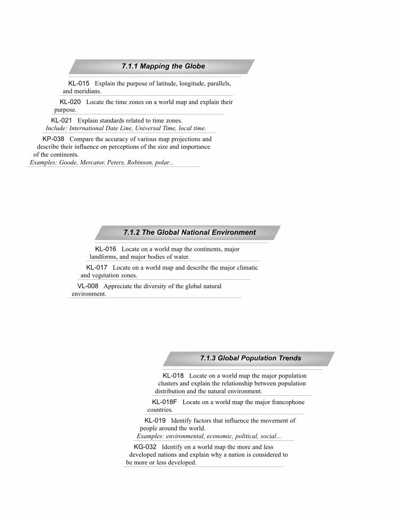
KL-016 Locate on a world map the continents, major
landforms, and major bodies of water.
KL-017 Locate on a world map and describe the major climatic
and vegetation zones.
VL-008 Appreciate the diversity of the global natural
environment.
7.1.2 The Global National Environment
KL-018 Locate on a world map the major population
clusters and explain the relationship between population
distribution and the natural environment.
KL-018F Locate on a world map the major francophone
countries.
KL-019 Identify factors that influence the movement of
people around the world.
Examples: environmental, economic, political, social...
KG-032 Identify on a world map the more and less
developed nations and explain why a nation is considered to
be more or less developed.
7.1.3 Global Population Trends
KL-015 Explain the purpose of latitude, longitude, parallels,
and meridians.
KL-020 Locate the time zones on a world map and explain their
purpose.
KL-021 Explain standards related to time zones.
Include: International Date Line, Universal Time, local time.
KP-038 Compare the accuracy of various map projections and
describe their influence on perceptions of the size and importance
of the continents.
Examples: Goode, Mercator, Peters, Robinson, polar...
7.1.1 Mapping the Globe
People and Places in the WorldWorld Geography
CLUSTER
7GRADE
1
60
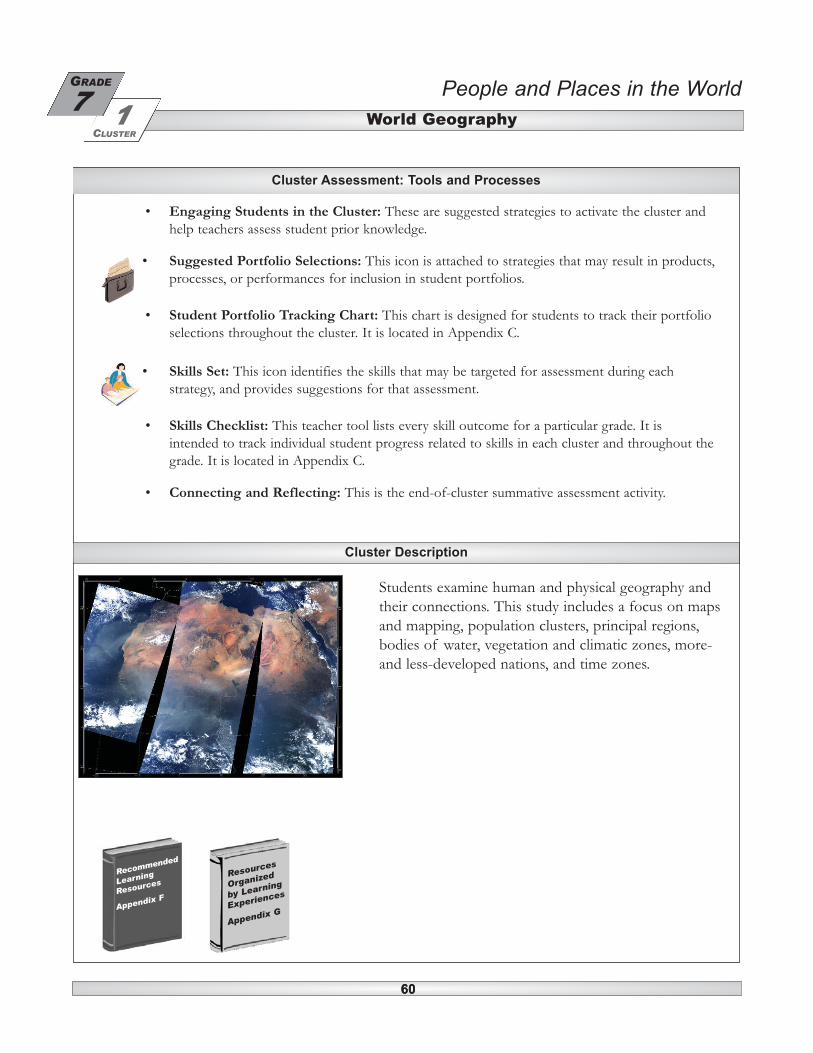
• Engaging Students in the Cluster: These are suggested strategies to activate the cluster andhelp teachers assess student prior knowledge.
• Suggested Portfolio Selections: This icon is attached to strategies that may result in products,processes, or performances for inclusion in student portfolios.
• Student Portfolio Tracking Chart: This chart is designed for students to track their portfolioselections throughout the cluster. It is located in Appendix C.
• Skills Set: This icon identifies the skills that may be targeted for assessment during eachstrategy, and provides suggestions for that assessment.
• Skills Checklist: This teacher tool lists every skill outcome for a particular grade. It isintended to track individual student progress related to skills in each cluster and throughout thegrade. It is located in Appendix C.
• Connecting and Reflecting: This is the end-of-cluster summative assessment activity.
60
Cluster Assessment: Tools and Processes
Cluster Description
Students examine human and physical geography andtheir connections. This study includes a focus on mapsand mapping, population clusters, principal regions,bodies of water, vegetation and climatic zones, more-and less-developed nations, and time zones.
Resources
Organized
by Learning
Experiences
Appendix G
Recommended
Learning
Resources
Appendix F

61
• Students explore the Earthcam website (http://search.earthcam.com/mapsearch/index.html) to viewup-to-the-minute images of places on the Earth.
• Using a wall map of the world, students use push-pins to identify places to which they have travelledor from which they have immigrated.
• Students post news headlines from around the world on a class bulletin board.
• Students look at the labels on their clothing, backpacks, school supplies, and other items in theclassroom to identify the countries of origin. (Use push-pins to add these places to the wall map ofthe world.)
• Students bring non-perishable food items from home to identify the country of origin of theproduct. (Use push-pins to add these places to the wall map of the world.) Consider donating thefood to a local shelter.
• Using prior knowledge, students identify extreme climates on a wall map of the world (e.g., wettest,driest, hottest, coldest...).
• Students discuss pavilions they have visited at Folklorama or at other local ethnic celebrations.
• Students contribute photos of their families engaged in cultural celebrations and/or other images ofcultural celebrations for a class bulletin board entitled “Peoples of the World.”
• Create a bulletin board display of foreign words (e.g., fjord, pajamas, zephyr, tsunami...) and havestudents identify the country of origin.
• Have students play a game using an atlas or globe. One student says one country name and the nextstudent says a country that begins with the last letter of the prior word (e.g., Canada – Azerbazhan,Azerbazhan – Netherlands...).
• Cut an oversize world map into puzzle pieces and give one piece to each student. Give students anallotted period of time to reassemble the map.
• Students view travel or documentary videos illustrating diverse ways of life in other places in theworld.
Engaging Students in the Cluster
Learning Experiences Summary
7.1.3 Global Population Trends
7.1.2 The Global Natural Environment
7.1.1 Mapping the Globe
People and Places in the WorldWorld Geography
7GRADE
CLUSTER
1
61
People and Places in the WorldWorld Geography
CLUSTER
7GRADE
1
62
Activate
Assessment Outcomes Strategies
62
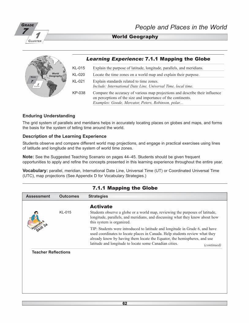
Enduring Understanding
The grid system of parallels and meridians helps in accurately locating places on globes and maps, and forms
the basis for the system of telling time around the world.
Description of the Learning Experience
Students observe and compare different world map projections, and engage in practical exercises using lines
of latitude and longitude and the system of world time zones.
Note: See the Suggested Teaching Scenario on pages 44–45. Students should be given frequent
opportunities to apply and refine the concepts presented in this learning experience throughout the entire year.
Vocabulary: parallel, meridian, International Date Line, Universal Time (UT) or Coordinated Universal Time
(UTC), map projections (See Appendix D for Vocabulary Strategies.)
7.1.1 Mapping the Globe
Learning Experience: 7.1.1 Mapping the Globe
KL-015 Explain the purpose of latitude, longitude, parallels, and meridians.
KL-020 Locate the time zones on a world map and explain their purpose.
KL-021 Explain standards related to time zones.
Include: International Date Line, Universal Time, local time.KP-038 Compare the accuracy of various map projections and describe their influence
on perceptions of the size and importance of the continents.
Examples: Goode, Mercator, Peters, Robinson, polar...
CLUSTER
7GRADE
1
WorldGeography
6262
KL-015 Students observe a globe or a world map, reviewing the purposes of latitude,
longitude, parallels, and meridians, and discussing what they know about how
this system is organized.
TIP: Students were introduced to latitude and longitude in Grade 6, and have
used coordinates to locate places in Canada. Help students review what they
already know by having them locate the Equator, the hemispheres, and use
latitude and longitude to locate some Canadian cities.
Skill 3
a
Teacher Reflections
(continued)

People and Places in the WorldWorld Geography
7GRADE
CLUSTER
1
63
Activate (continued)
7.1.1 Mapping the Globe
Assessment Outcomes Strategies
KL-015
KP-038
Students participate in a class discussion to compare and contrast the relative
merits of globes and maps (e.g., a map is more portable; a globe is a more accurate
representation of the spherical Earth. A globe is of a small scale, cannot show great
detail, and cannot display all the continents at once. Being flat, maps display
distorted representations of the continents. Maps must feature specific continents
more prominently than others; rotating globes do not.).
Following the discussion, collaborative groups of students use the provided BLM
to observe and compare two or three different world map projections. Each group
discusses their observations of the differences between world maps, generating
questions about the accuracy of various projections.
TIP: As students compare world maps in this activity, assess how well they recall
the names of the continents and oceans. Invite students to compare two or three
different wall map projections (or digital maps on the Internet) to the globe. Use
the following guiding questions to help students compare different representations
of the globe:
• What is the name of the projection used in the map?
• Are the shapes of oceans and continents different?
• Are the relative sizes of the oceans and continents changed?
• Do the distances between cities appear to be the same or different?
• Is Greenland larger or smaller than Africa on the map as compared to the globe?
• Does Greenland appear to be smaller or larger than Australia?
• What continent or country is placed at the centre of the map?
• What “message” does the map suggest about the continent or country in the
centre of the map?
• Are the parallels and meridians the same as on the globe?
Allow sufficient time for students to discuss their observations and to generate
their own questions about the perceptions created by different world map
projections. If possible, present to students an example of a map that challenges
standard geographical assumptions (e.g., a polar projection map; a Pacific-centred
map; an “upside-down” map with the South Pole at the top...).
Supporting websites can be found at <www4.edu.gov.mb.ca/sslinks/LEList>
Skill 7
b
BLM: Comparing Map Projections7.1.1a
(continued)
or
Appendix H: Teacher Notes 1: Map Projections (2 pages)TN1
People and Places in the WorldWorld Geography
CLUSTER
7GRADE
1
64
Activate (continued)
7.1.1 Mapping the Globe
Assessment Outcomes Strategies
KL-015
KL-020
KL-021
Students respond to the prompt, “What time is it in various cities of Canada?”
(e.g., If you wanted to phone a friend in Vancouver right now, what time would
it be there? What time would it be in Montréal?). In a guided discussion,
students explore the purpose of time zones and standards related to time zones,
and share what they know about time zones, their purposes, and how they work.
Guiding questions include:
• Why do we need time zones?
• Are time zones related to latitude and longitude?
• How many degrees complete a rotation of the Earth?
• How many time zones are there in the world?
• How many time zones are there in Canada?
• What time difference generally exists between two adjacent time zones?
• Is it earlier or later as you travel west? East?
• Where is the dividing line between east and west longitude?
• Is it the same date everywhere in the world?
TIP: Grade 7 students have not formally studied time zones in social studies, but
they will likely have some familiarity with the concept because of travel or
contact with friends and relatives in distant places. Encourage them to articulate
what they already know about the topic, and to generate questions by filling out
the first two columns of the KWL frame as suggested in BLM 7.1.1b. At the end
of the learning experience, students revisit the KWL frame to record what they
have learned.
Skill 6
c
BLM: KWL: Time Zones, Latitude and Longitude7.1.1b
Teacher Reflections
(continued)
or

People and Places in the WorldWorld Geography
7GRADE
CLUSTER
1
65
Activate (continued)
7.1.1 Mapping the Globe
Assessment Outcomes Strategies
KL-015
KL-020
KL-021
KP-038
Collaborative groups of students conduct an “Atlas Scavenger Hunt.” Using a
set of prepared questions, students locate information in their atlases to become
familiar with the use of the atlas and to prepare them to access information
related to the key concepts of this learning experience. Skill
7b
BLM: Getting to Know Your Atlas7.1.1c
KL-015
KL-020
KL-021
Assess student familiarity with the concept of the rotation of the Earth by
asking students to stand and to rotate 90º to the east, 180º to the east, and then
360º to the east (or in a clockwise direction). Students discuss the significance
of a complete rotation of the Earth on its axis in relation to time zones,
generating hypotheses about how many time zones there are and approximately
how many degrees of longitude separate them. (360º divided by 24 hours
equals 15º.)
TIP: Make connections to what students have learned in Grade 6 science about
the rotation of the Earth on its axis and the cycle of night and day (Grade 6
science, Cluster 4, 6-4-12).
Skill 1
Teacher Reflections
or
or
People and Places in the WorldWorld Geography
CLUSTER
7GRADE
1
66
Acquire
7.1.1 Mapping the Globe
Assessment Outcomes Strategies
KL-015
KP-038
Collaborative groups of students use a large orange or grapefruit as a model for
the Earth, drawing approximations of the Equator, the Tropics of Cancer and
Capricorn, and the polar circles. Students then draw four lines of longitude,
evenly spaced, connecting the poles. They may also draw a geometric shape
representing the overall contour of North America in the appropriate hemisphere.
Students then cut the orange carefully down from the North Pole to the South
Pole, pulling off the peel carefully without tearing it. If they try to spread the
peel to flatten it on the table, they will note that lines and shapes are distorted
and the peel warps and becomes crinkly. In order to get the peel to lie flat, they
will need to cut a small slit from each pole halfway towards the Equator.
Students discuss and reflect on what this tells them about the accuracy of map
projections (Will they always represent shape, size, distance and direction
accurately? Will they create certain perceptions of the world depending on how
they represent each continent?).
Skill 4
a
Teacher Reflections
(continued)
KL-015
KP-038
Present to the students a physical demonstration to explain that all map
projections create certain distortions in the process of representing a sphere on a
flat surface. This may be done by tracing the general contours of the continents
on an inflatable ball, and then deflating and flattening the ball. The flattened
surface will be distorted compared to the original sketch. Explain to students that
there are a variety of mathematical methods for the accurate representation of the
Earth as a two-dimensional map, but that each one has a certain degree of
compromise in distance, shape, size (area), or direction. Different map
projections have varying degrees of accuracy, are appropriate for different
purposes, and create certain perceptions of the world (i.e., relative importance of
countries and continents). Following the demonstration, students consult print or
Internet sources to compare the accuracy of different map projections and the
perceptions they can create.
TIP: Students may use BLM 7.1.1a to guide them in this activity.
Supporting websites can be found at <www4.edu.gov.mb.ca/sslinks/LEList>
Skill 7
b
BLM: Comparing Map Projections7.1.1a
or
Appendix H: Teacher Notes 1: Map Projections (2 pages)TN1
People and Places in the WorldWorld Geography
7GRADE
CLUSTER
1
67
Acquire (continued)
7.1.1 Mapping the Globe
Assessment Outcomes Strategies
KL-015
KL-020
KL-021
Using graph paper, students draw a grid representing the lines of latitude and
longitude that are found on a world map. They identify the following important
elements and indicate their measurement in degrees of latitude or longitude:
• Equator
• North Pole
• South Pole
• Prime Meridian
• Tropic of Cancer
• Tropic of Capricorn
• Arctic Circle
• Antarctic Circle
• Prime Meridian
• International Date Line
Students label the appropriate areas of their grid as the Northern Hemisphere,
the Southern Hemisphere, the Eastern Hemisphere, and the Western
Hemisphere. Students may refer to their atlases, and to other print or Internet
sources to help them complete the grid. In collaborative groups, students take
turns explaining the purpose of latitude, longitude, parallels, and meridians.
TIP: Circulate among the groups to pose guiding questions or to correct
misconceptions and errors. After the students have completed their grids,
practise applying latitude and longitude by reading out sets of coordinates and
having them identify them on their grids. Note that their world atlas includes an
alphanumeric grid for some maps. Students should also practise using this
system of locating places. (Alternately, recreate the grid in the gymnasium or
outdoors and have students physically demonstrate their knowledge.)
Supporting websites can be found at <www4.edu.gov.mb.ca/sslinks/LEList>
Skill 7
b
Teacher Reflections
(continued)
or
or
KL-015
KL-020
KL-021
Students carry out the same exercise as in the previous activity (i.e., drawing
the grid), using a grapefruit or a polystyrene foam ball to represent the Earth.
Collaborative groups may use their models to explain the purpose of latitude
and longitude, time zones, and standards related to time zones. Skill
7b

People and Places in the WorldWorld Geography
CLUSTER
7GRADE
1
68
Acquire (continued)
7.1.1 Mapping the Globe
Assessment Outcomes Strategies
or
KL-015 Students view an outline map of the world on an overhead projector. In a
guided discussion, highlight for students the lines representing the Equator, the
Prime Meridian, and the International Date Line. Indicate to students the
direction in which numbers increase pertaining to these lines. Inform students
that these are the lines that allow us to divide the world into zones known as the
Northern or Southern Hemispheres and the Eastern or Western Hemispheres.
Have the students predict the hemispheric locations of a number of coordinates
(e.g., 53º N – 20º E; 23.5º S – 42º W; 40º N – 115º E; 27º S – 28º E; 35º N –
68º E; 10º N – 67º W; 43º N – 122º E; 33.5º S – 151º E; 22º N – 40º E; 17.3º S
– 148.3º W).
TIP: Students may use their atlases to discover what population centres are at
these coordinates. Collaborative groups of students may follow up this exercise
by creating a game that requires other students to identify the hemisphere
indicated, and provides a bonus to those who are able to predict what
population centre or country is at the given coordinates.
Skill 7
b
Teacher Reflections
(continued)
People and Places in the WorldWorld Geography
7GRADE
CLUSTER
1
69
Acquire (continued)
7.1.1 Mapping the Globe
Assessment Outcomes Strategies
KL-015
KL-020
KL-021
Using print and electronic resources, collaborative groups of students gather
information about the purpose of world time zones and standards related to
time zones. A spokesperson for each group shares the results of their study with
the class, and the class discusses the meaning and applications of what they
have learned.
TIP: Refer students to their world atlases to find information on time zones, as
well as to world time-zone maps. After reviewing together the key concepts
related to time zones, carry out some examples of determining local time in a
variety of places compared to the current time in Winnipeg or to International
Time, and stating the time using the 24-hour clock.
Skill 9
i
BLM: Understanding and Using Time Zones 7.1.1d
BLM: Understanding and Using Time Zones—Key7.1.1e
or
KL-015
KL-020
KL-021
Collaborative groups of students record coordinates for two distinct places in
each of the continents of the world. They copy the coordinates onto separate
cards, and exchange cards with another group. Consulting a map of the world
as needed, each group determines the continent where one would find the place
that corresponds to that set of coordinates. Students may also specify the
country and the local time of that place relative to a given Universal Time.
TIP: Before carrying out this group activity, do some examples with the class,
helping students to identify locations on the world wall map (e.g., Locate the
following coordinates on the world map: 15º S, 30º E. [15º south latitude, 30º
east longitude] In which continent is it found? [Africa] In which country is it
found? [Zambia] If the time at Greenwich is 14:35 UT, what is the local time in
Zambia? [16:35]).
Skill 7
b
Teacher Reflections
or
People and Places in the WorldWorld Geography
CLUSTER
7GRADE
1
70
Apply
7.1.1 Mapping the Globe
Assessment Outcomes Strategies
KL-015
KL-020
KL-021
Collaborative groups of students plan and present a short oral presentation in
which they discuss and arrange an international telephone conference at a time
that is convenient to all parties, taking on the roles of individuals in various
countries around the world. Before presenting the scenario, each member of the
group must select a city and use the atlas to find and record its exact location
(i.e., city, coordinates of latitude and longitude, country). Students must
determine in which time zone the place is located and what the local time is
relative to Universal Time. The group decides on a time for the teleconference
using the standard of UT, discussing appropriate local times for each
participant. Groups present their simulations, and the rest of the class observes,
recording the times and verifying whether they have made any errors.
Skill 1
0a
or
KP-038 Students write a journal reflection about the influence of map projections on
their perceptions of the size and importance of the continents. Students may be
guided by questions such as:
• In my mental map of the world, which continent do I see as the largest?
• Which continent do I see as the smallest?
• Which continent do I see as the most far away from me?
• Which country do I visualize at the centre?
• What does this tell me about the places I consider the most important in the
world?
• How do maps influence my view of the world?
Students share their reflections with each other.
Skill 9
a
Teacher Reflections
(continued)

People and Places in the WorldWorld Geography
7GRADE
CLUSTER
1
71
Apply (continued)
7.1.1 Mapping the Globe
Assessment Outcomes Strategies
KL-015
KL-020
KL-021
Using an outline world map, collaborative groups of students draw the route for
a journey they would like to make. In an accompanying itinerary, they write up
the flying times to each destination, the latitude and longitude of each
destination, and local time at the time of arrival given a selected departure time
from Winnipeg. Students share their imaginary itineraries in small groups.
TIP: The purpose of this activity is to apply concepts related to latitude,
longitude, and time, rather than to plan the details of an entire journey. Develop
a framework for the activity with the class, or follow the suggested frame in
BLM 7.1.1g. Students may consult airline websites, and travel agency or
international travel information websites to estimate flying time between major
international cities.
Supporting websites can be found at <www4.edu.gov.mb.ca/sslinks/LEList>
Skill 4
BLM: Outline Map of the World—Countries7.1.1f
BLM: Travel Itinerary (2 pages)7.1.1g
KL-015
KL-020
KL-021
Students are provided with a set of untitled outline maps of various continents
or regions of the world (some maps may also be presented upside down).
Consulting the atlas or the globe, students add to each map a correct title, a
compass rose, and significant parallels and meridians. Students compare their
maps to make sure they have correctly named them and correctly indicated
measurements of latitude and longitude.
TIP: Visit the URL below to access outline maps.
Supporting websites can be found at <www4.edu.gov.mb.ca/sslinks/LEList>
Skill 7
b
or
Teacher Reflections
(continued)
or

People and Places in the WorldWorld Geography
CLUSTER
7GRADE
1
72
Apply (continued)
7.1.1 Mapping the Globe
Assessment Outcomes Strategies
KL-015
KP-038
Collaborative groups of students present an interactive multimedia presentation
to demonstrate how maps influence perceptions of the world, using examples of
digital maps and posing questions to the audience about the impressions created
by different maps.
TIP: Students may use digital examples of different map projections with
different centres, such as polar projections or Pacific-centred world maps.
Encourage students to articulate how maps influence their view of the world
(i.e., relative size and importance of the continents).
Skill 11
g
or
KL-015
KL-020
KL-021
KP-038
Collaborative groups of students create a brochure entitled “World Maps for
Dummies,” in which they present a set of illustrated instructions on how to use
latitude and longitude to describe location, how to use time zones and
International Time to calculate local time, as well as guidelines for comparing
the accuracy of world map projections. Skill 11
d
KL-015
KL-020
KL-021
KP-038
Students create a vocabulary cycle on poster paper, using words and images to
clearly illustrate the relationships that link all the key terms of this learning
experience.
TIP: Students should include in a vocabulary cycle all the terms listed in BLM
7.1.1h, and show what they understand to be the meaning of each term and the
relationships that link them.
Skill 5
BLM: Mapping the Globe: Key Concepts7.1.1h
Teacher Reflections
(continued)
or
or
People and Places in the WorldWorld Geography
7GRADE
CLUSTER
1
73
Apply (continued)
7.1.1 Mapping the Globe
Assessment Outcomes Strategies
KL-015
KL-020
KL-021
Students revisit the KWL chart they began in the Activating phase of this
learning experience, filling out the last column. In a discussion with a partner,
students reflect on what they have learned.
Skill 6
c
or
KL-015
KL-020
KL-021
Collaborative groups of students use world atlases to compile a list of 10 cities
in various regions of the world, recording on a separate sheet the exact
coordinates of latitude and longitude for each city. Groups then exchange their
lists with partner groups, and use a world map or globe to estimate the latitude
and longitude of each city on the list. They also determine the local time for
each city relative to a given Universal Time. Students assess their partner
group’s use of parallels and meridians to describe location, and their
application of standards related to time zones.
TIP: If the index of their world atlas does not indicate the exact latitude and
longitude of each place, students may research place names by region on the
Internet.
Supporting websites can be found at <www4.edu.gov.mb.ca/sslinks/LEList>
Skill 7
b
Teacher Reflections
or

People and Places in the WorldWorld Geography
CLUSTER
7GRADE
1
74
Activate
Assessment Outcomes Strategies
Enduring Understanding
The global environment is composed of diverse natural regions with characteristic landforms and bodies of
water, and distinct climate and vegetation patterns.
Description of the Learning Experience
Students consolidate and enrich their knowledge of the physical geography of the world through mapping
exercises, atlas exploration activities, and research into global climate and vegetation zones.
Vocabulary: climatic zones, vegetation zones, physical geography, human geography (See Appendix D for
Vocabulary Strategies.)
7.1.2 The Global Natural Environment
7.1.2 The Global Natural Environment
KL-016 Locate on a world map the continents, major landforms, and major bodies of
water.
KL-017 Locate on a world map and describe the major climatic and vegetation zones.
VL-008 Appreciate the diversity of the global natural environment. CLUSTER
7GRADE
1
WorldGeography
KL-016
KL-017
VL-008
Collaborative groups of students create a list of items to be found in a world atlas
and exchange the list with another group as part of an Atlas Treasure Hunt. The
list might include questions related to physical geography, such as major
landforms, bodies of water, climatic zones, and vegetation zones. After a
pre-determined period of time, students exchange their answers and verify the
number of items for which their partner group has been able to locate the
required information.
NOTE: Examples of the format and types of questions students may wish to
include are suggested in BLM 7.1.2a. Treasure hunt questions will vary
depending on the reference atlas used. Ensure that the groups that exchange
treasure hunt questions are using the identical atlas, as some elements are harder
to find in certain atlases.
Skill 7
b
BLM: Atlas Treasure Hunt—Physical Geography 7.1.2a
Teacher Reflections
(continued)
People and Places in the WorldWorld Geography
7GRADE
CLUSTER
1
75
Activate (continued)
7.1.2 The Global Natural Environment
Assessment Outcomes Strategies
KL-016
KL-017
VL-008
Collaborative groups of students are given a set of images of various
landscapes, bodies of water, landforms, vegetation zones, and climate zones.
Students sort these images into groups, giving a descriptive title to each group,
and predicting where in the world they might expect to see this type of natural
environment.
TIP: Students might be involved in gathering the images ahead of time. The
images may include travel photos, promotional tourism photos, and digital
photos obtained from Internet sites. It may also be useful to include a code or
symbol on the back of each picture to indicate the region from which it came. If
time does not permit the accumulation of an extensive image bank, students
may instead be asked to create an electronic portfolio, grouping together images
of the natural environment from various regions of the globe. They may present
their images as an electronic slideshow, inviting the class to identify each
photo’s region of origin.
Supporting websites can be found at <www4.edu.gov.mb.ca/sslinks/LEList>
Skill 6
f
or
KL-016
KL-017
VL-008
Using one blank outline map of the world per group, small groups of students
locate and label all the natural features they know (i.e., continents, oceans and
bodies of water, large islands and other landforms, mountain chains, deserts,
rainforests, plains...). Groups compare their maps with each other, adding
details and making corrections with the help of an atlas as needed. Students
assess their knowledge of the physical world and generate questions about
topics or regions they would like to research further.
TIP: This activity would also permit a discussion about the distinction between
physical geography and human geography. Encourage students to consider
what on the Earth’s surface would have been there even if human beings had
never inhabited the Earth (i.e., what we see on a physical map). Help them
brainstorm and identify the elements that are represented on a physical map of
the world.
Supporting websites can be found at <www4.edu.gov.mb.ca/sslinks/LEList>
Skill 7
b
BLM: Outline Map of the World—Continents7.1.2b
Teacher Reflections
(continued)
or

People and Places in the WorldWorld Geography
CLUSTER
7GRADE
1
76
Activate (continued)
7.1.2 The Global Natural Environment
Assessment Outcomes Strategies
or
KL-016
KL-017
VL-008
Students view and respond to a travel video featuring a distant region of the
world, discussing the features of the natural environment they found the most or
least appealing about this region. Students may record their impressions in the
first section of their Travel Portfolio. Skill
6g
KL-016 After taking a few moments to observe a globe, students sketch a freehand
mental map of the world on a sheet of graph paper. They begin by drawing some
parallels and meridians as lines of reference, and tracing the outlines of the
continents as relaxed geographic shapes. Students compare and discuss their
maps with a partner, sharing their observations about how they see the world.
Students retain these original maps for their Travel Portfolios.
NOTE: Learning Experience 7.4.1 will require students to repeat this activity
and create a new mental map of the world. Save these first attempts at mental
maps so students can observe their growth in map-making later in the year.
Before beginning this exercise, discuss with students the fact that we all have
mental maps of our surroundings. These spatial representations in our minds are
used to orient ourselves, to organize our perceptions, and to describe our
environment. We constantly correct and revise our mental maps based on
experience, observation, and knowledge passed on to us from others. Sometimes
we use tools such as maps, compasses, or GPS devices to help us visualize the
way the world is laid out. This concept is best reinforced by a short walk
through a local park or natural area, in which students orient themselves using
the sun and natural markers. (One group of students could be given compasses
to compare experiences.) Upon their return, students may be asked to draw a
sketch map of their route, and compare the accuracy of their maps.
As students attempt a freehand drawing of their mental map of the world,
encourage them to first visualize what they would like to sketch, and to strive
for a very general representation of the world (i.e., the relative location and scale
of the continents, oceans, and seas, and of those major landforms they already
know). They may self-assess the quality of their maps using BLM 7.1.2d.
Skill 7
a
BLM: Map the World in a Minute (2 pages)7.1.2c
BLM: My Mental Map of the World7.1.2d
or
People and Places in the WorldWorld Geography
7GRADE
CLUSTER
1
77
Acquire
7.1.2 The Global Natural Environment
Assessment Outcomes Strategies
KL-016
KL-017
VL-008
Consulting an atlas or world map as required, collaborative groups of students
discuss where in the world they would most like to travel or live, based only on
the features of the natural environment (i.e., latitude and longitude, landforms,
landscape, elevation, vegetation, climate, distances, natural phenomena, seasons,
and/or bodies of water). Each group attempts to come to a consensus about a
priority list of three places they prefer, and describe to the class the locations and
natural characteristics that attracted them to these places, locating each of them
on the world wall map. In a general class discussion, students consider questions
such as the following:
• What would they take to wear?
• What natural sites would they want to see?
• What physical features would they photograph?
• What types of outdoor activities would they engage in?
Students may record their ideas in a “Travel Hopes and Dreams” section of their
Travel Portfolio, reflecting on the role of the natural environment on human
activities and ways of life.
Skill 3
a
or
KL-016
KL-018
VL-008
Consulting a world atlas and other print and electronic resources as needed, pairs
of students complete a descriptive chart of the major climatic and vegetation
zones of the world. Students refine and correct their charts in a general class
discussion.
NOTE: Encourage students to make connections to and apply the knowledge
they are acquiring in their Grade 7 science class regarding ecosystems (Cluster 1,
7-1-02, 7-1-05). The general types suggested in BLM 7.1.2e are those used most
frequently; however, there are variations in the classification of natural regions,
and students should be made aware of this as they research the information.
Supporting websites can be found at <www4.edu.gov.mb.ca/sslinks/LEList>
Skill 11
a
BLM: Climatic Zones and Vegetation Zones (3 pages)7.1.2e
Teacher Reflections
(continued)
People and Places in the WorldWorld Geography
CLUSTER
7GRADE
1
78
Acquire (continued)
7.1.2 The Global Natural Environment
Assessment Outcomes Strategies
KL-016
VL-008
Using print and electronic resources, collaborative groups of students research
one of the traditional seven natural wonders of the world, or nominate their own
natural phenomenon as an additional member of this group. Students may use the
note-taking frame in BLM 7.1.2f to gather and record their information.
NOTE: Electronic images of the seven natural wonders of the world can be
found in the supporting website links at the URL below.
1. Mount Everest, Himalayas
2. The Northern Lights
3. Victoria Falls, Zimbabwe
4. Great Barrier Reef, Australia
Supporting websites can be found at <www4.edu.gov.mb.ca/sslinks/LEList>
Skill 11
a
BLM: A Natural Wonder of the World7.1.2f
5. Grand Canyon, Arizona
6. Paricutin Volcano, Mexico
7. The Harbour, Rio de Janeiro
or
KL-016
KL-017
VL-008
Consulting a world atlas and using a blank outline map of the world as a guide,
collaborative groups of students construct a poster-size map of the world
indicating the continents, major landforms, major bodies of water, and other
natural elements of their choice. Groups display and present their maps in a
Gallery Walk, discussing how each map reflects a certain “mental map” and
presents a particular view of the world.
TIP: Students should be able to locate the continents and oceans without referring
to a map. Help students work through the other elements suggested in the list in
BLM 7.1.2g by consulting the atlas index and using coordinates of latitude and
longitude or an alphanumeric grid to determine location. Encourage groups to
help one another to locate elements. While introducing mapping activities such as
this one throughout the year, ask students to begin by locating the elements they
already know without referring to the atlas, then adding elements based on their
use of the atlas. Students may periodically assess their geographic knowledge by
noting how many additional elements they are able to locate and describe without
referring to their atlases.
Skill 7
b
BLM: Outline Map of the World—Continents7.1.2b
BLM: World Map: Continents, Landforms, Bodies of Water (3 pages)7.1.2g
(continued)
or
People and Places in the WorldWorld Geography
7GRADE
CLUSTER
1
79
Acquire (continued)
7.1.2 The Global Natural Environment
Assessment Outcomes Strategies
BLM: Outline Map of the World—Continents7.1.2b
KL-016
KL-017
VL-008
Collaborative groups of students create a set of symbols to represent the various
climatic zones and vegetation zones of the world. Each group’s symbols are
displayed, and the class selects a set of symbols to use as a legend on a large-
scale class map of the world as an ongoing reference through the year. Skill
7a
or
KL-016
KL-017
VL-008
Using an outline map of the world, students label the continents, major bodies of
water, and major landforms. Using a colour-coded legend, they indicate on their
maps the major climatic and vegetation zones of the world. Using their
completed physical maps of the world and referring to a political map as needed
to identify specific countries, students create a comparison chart showing regions
of the world that have physical characteristics that are similar to those in Canada
and those that are different. Students exchange their observations with each other,
reflecting on the effects of the natural environment on ways of life (i.e., In those
regions with greater similarities in climate, location, landforms, or vegetation, are
there also greater similarities in ways of life?).
NOTE: The focus in this activity is on locating world climatic zones and
vegetation zones, as well as observing global patterns and connections (e.g..
effects on climate, vegetation and ways of life of latitude, proximity to the ocean,
elevation, proximity to a mountain range...).
Skill 7
a
Teacher Reflections
or

People and Places in the WorldWorld Geography
CLUSTER
7GRADE
1
80
Apply
7.1.2 The Global Natural Environment
Assessment Outcomes Strategies
KL-016
KL-017
VL-008
Students design an electronic travel agency brochure to promote a natural
adventure expedition in a selected region of the world. The brochure, intended to
attract the outdoors enthusiast, should include full geographic details: country,
continent, latitude and longitude, travel distance, major landforms and bodies of
water, elevation, climate and vegetation zones, and other physical features (e.g.,
natural phenomena, wildlife...).
TIP: Over the course of the year, students will frequently carry out research
using a variety of Internet sources, including government sites, organizational
and educational sites, and commercial sites. This activity offers the opportunity
to review with students how to critically assess the quality of Internet sites.
Insist that students always record the full addresses of websites, including the
title of the home page and the specific pages consulted, preferably using the
copy-and-paste function. Student should also cite the Internet sources of all
photographs and maps they include in their work. In this activity, students may
be asked to complete an Internet site evaluation form as a part of their research
(refer to BLM 7.1.1h). Encourage students to share addresses and relevant
information about reliable Internet sites with each other. Refer to the Manitoba
Education, Citizenship and Youth publication Literacy with ICT Across TheCurriculum for more detailed information regarding the ethics and responsibility
of ICT use.
Skill 11
d
BLM: Evaluating Internet Sites (3 pages)7.1.2h
or
KL-016
KL-017
VL-008
Collaborative groups of students share their research on a natural wonder of the
world as a multimedia presentation depicting an imaginary trip to that site.
Students should be encouraged to be creative in their presentation and include
relevant geographic detail, including the site location on a world map.
TIP: Students may refer to BLM 7.1.2f for required geographic information. See
the earlier Acquiring Strategy for a list of the seven natural wonders of the world.
Skill 11
g
BLM: A Natural Wonder of the World7.1.2f
Teacher Reflections
(continued)

People and Places in the WorldWorld Geography
7GRADE
CLUSTER
1
81
Apply (continued)
7.1.2 The Global Natural Environment
Assessment Outcomes Strategies
KL-016
KL-017
VL-008
Collaborative groups of students create an annotated collage of the natural
wonders of the world, using a world map as the background and including a
natural phenomenon of interest from each of the continents. The group’s work is
displayed and students circulate in a Carousel activity to view and respond to the
posters.
TIP: Prior to the activity, develop with the class a set of descriptive criteria for
the collage design, including geographical information, number of elements that
will be required, standards for design and creativity, and so on. Students will
then have consistent criteria to assess the quality of the posters as they circulate
to view them.
Skill 1
0c
or
KL-016
KL-017
VL-008
Students envision a backpack trip into a specific climate and vegetation zone in
a selected region of the world. They prepare a complete list of supplies and
practical considerations to guide the backpacker on this trip. Students share their
lists in collaborative groups, discussing the regions of the world they found to be
the most appealing, the most challenging, or the most different from their local
environment.
Skill 9
g
or
KL-016
KL-017
VL-008
Students create a class wall map of the world. As a class, students plan and
distribute tasks involved in adding details to an enlarged outline wall map of the
world. Each member of the class adds at least one element to the collective
map/collage (e.g., place name with latitude and longitude, name of continent or
body of water and related statistic, satellite image or photo of climate or
vegetation zone, name and brief description of natural wonder...).
TIP: This collaborative map is intended to serve as an ongoing reference to
students over the year. It needs to remain very clear and user-friendly, and
should include tips and reminders that will help students recall important
geographic facts. Emphasize the need to carefully plan and coordinate all
additions, and to consider the overall aesthetics and readability of the map, as
cartographers must always do. This may be done by collaboratively creating a
template or a set of guidelines and developing a system for approving materials
before permanently affixing them to the map.
Skill 7
a
Teacher Reflections
or
People and Places in the WorldWorld Geography
CLUSTER
7GRADE
1
82
Activate
Assessment Outcomes Strategies
Enduring Understanding
World population changes constantly, is distributed unevenly among countries and regions, and is influenced
by a variety of environmental, economic, political, and social factors.
Description of the Learning Experience
Students familiarize themselves with the political map of the modern world, examine world population
distribution, and consider distinctions between more- and less-developed nations.
Vocabulary: population distribution, density, more-developed nations, less-developed nations, immigration
push and pull factors, refugees (See Appendix D for Vocabulary Strategies.)
7.1.3 Global Population Trends
7.1.3 Global Population Trends
KL-018 Locate on a world map the major population clusters and explain the
relationship between population distribution and the natural environment.
KL-018F Locate on a world map the major francophone countries.
KL-019 Identify factors that influence the movement of people around the world.
Examples: environmental, economic, political, social... KG-032 Identify on a world map the more and less developed nations and explain why
a nation is considered to be more or less developed.
Note: Francophone learning outcomes are not intended for all students (see page 36 of the overview).
CLUSTER
7GRADE
1
WorldGeography
KL-018
KL-019
KG-032
Recalling what they know about the physical regions of the world, students
identify regions of the world in which they would not want to live because of
inhospitable natural conditions. Collaborative groups of students then view a
physical map of the world, reviewing its climate and vegetation zones. Based on
this information about the natural environment and their prior knowledge about
world population distribution, students in each group predict where they believe
the major population clusters of the world would most likely be found. Each
group shares the predictions with the class, discussing the relationship between
the natural environment and population distribution, and verifying predictions
with an atlas.
TIP: This activity offers the opportunity to discuss with students the elements of
physical geography—climate, landforms, vegetation, soils, water—and human
geography—population, settlement, cities, countries, political borders,
transportation, industry, agriculture, and human activity and movement—and to
differentiate between physical and political maps.
Supporting websites can be found at <www4.edu.gov.mb.ca/sslinks/LEList>
Skill 7
b
(continued)
People and Places in the WorldWorld Geography
7GRADE
CLUSTER
1
83
Activate (continued)
7.1.3 Global Population Trends
Assessment Outcomes Strategies
KL-018
KL-019
KG-032
Students engage in a population simulation and, in collaborative groups, focus
on world population distribution. To begin, a majority of the students in the class
are invited to gather in a relatively confined space in the classroom, marked out
by masking tape on the floor. The other members of the class are invited to
spread out in the surrounding space. Students are asked to imagine what this
scenario might tell them about world population distribution and density, and to
brainstorm factors that might influence population distribution/density. Then,
collaborative groups of students are asked to create a list of the major population
clusters in the world, using a consensus decision-making approach. Students
may consult a world political map to identify the countries in which each of the
major cities is located. Groups share their lists and verify their accuracy. In a
class discussion, students note and discuss patterns related to population clusters
and the natural environment.
TIP: Students will frequently be asked to work on reaching consensus
agreements within collaborative groups. This activity affords the opportunity to
review the principles of striving for consensus. (See TN-2 in Appendix H for a
detailed description.) Also note that students will find different data on different
websites regarding the ranking of population clusters. Discuss with students the
reasons why they may find discrepancies (e.g., population is constantly changing
because of birth rates, death rates, movement of people, sudden natural or
human disasters. Also, census years and procedures vary from country to
country; some countries include all the populated areas surrounding a large city
as a part of that agglomeration, while others do not...).
Skill 4
c
KL-018
KL-019
KG-032
Students brainstorm a list of reasons why people may choose to move away
from their countries of origin, and reasons why they are attracted to particular
countries like Canada. This list is recorded and posted, and students discuss the
effects of technological change (i.e., changes in transportation,
communication...) in increasing the movement of people around the world in the
contemporary era.
TIP: Students have explored examples of push and pull factors in immigration in
their study of the role of immigration in Canadian history (Grades 5 and 6).
Skill 2
or
(continued)BLM: World Population Clusters (2 pages)7.1.3
a
or
Appendix H: Teacher Notes 2: Consensus Decision Making (3 pages)TN2
People and Places in the WorldWorld Geography
CLUSTER
7GRADE
1
84
Activate (continued)
Acquire
7.1.3 Global Population Trends
Assessment Outcomes Strategies
KL-018
KL-019
KG-032
Students brainstorm a list of words that come to mind when they hear the terms
more-developed countries and less-developed countries, recording their ideas
under each of the two categories, and naming examples of countries (if they are
able). Working individually, students then complete an Anticipation Guide in
which they respond to a series of debatable general statements about more-
developed and less-developed nations. With a partner, students share their
responses to each statement, stating the reasons they believe what they do.
NOTE: Alert students to stereotypes or unfounded generalizations they may
have about less-developed countries and the meaning of development. Revisit
the Anticipation Guide later in the learning experience, discussing what students
have learned, and identifying reasons why they may have held certain
stereotypes to be true.
Skill 2
BLM: Anticipation Guide: More-Developed and Less-Developed Nations7.1.3b
BLM: Anticipation Guide: More-Developed and Less-Developed
Nations—Key Ideas
7.1.3c
KL-018
KL-019
KG-032
Students read and interpret statistical information about world population
distribution. Using an outline map of the world, students locate and illustrate
major population clusters, and indicate on their maps the characteristics of the
natural environment in the densely populated areas (e.g., climate, vegetation,
proximity to oceans, landforms...). Students may develop icons to represent
more- or less-developed nations. In a class discussion, students note patterns
they observe in the relationship between population distribution and the natural
environment.
TIP: Encourage students to develop a legend for their map that uses clear
symbols and colour codes, and to indicate on the map the names of the most
populated cities and countries of the world.
Supporting websites can be found at <www4.edu.gov.mb.ca/sslinks/LEList>
Skill 7
a
BLM: Outline Map of the World—Countries7.1.1f
Teacher Reflections
(continued)
or
People and Places in the WorldWorld Geography
7GRADE
CLUSTER
1
85
Acquire (continued)
7.1.3 Global Population Trends
Assessment Outcomes Strategies
KL-019
KG-032
Students generate questions to discuss with a refugee (or an individual
representing a refugee organization) who is invited to speak to the class about
the refugee experience (e.g., Why do people leave their home nation? Do they
choose Canada? Why? What problems do they have making the transition from
one nation to another?...).
Supporting websites can be found at <www4.edu.gov.mb.ca/sslinks/LEList>
Skill 1
or
KL-018
KL-019
KG-032
Using a list of push and pull immigration factors (see earlier Activating
Strategy), students classify the factors identified under given categories: political,
social, economic, environmental, and health. Collaborative groups of students
create an illustrated Mind Map summarizing the various factors that influence
the movement of people around the world, adding specific examples of countries
to which particular influences apply.
Skill 5
BLM: Influences on Population Movement7.1.3d
BLM: Influences on Population Movement—Key7.1.3e
Teacher Reflections
(continued)
or

People and Places in the WorldWorld Geography
CLUSTER
7GRADE
1
86
Acquire (continued)
7.1.3 Global Population Trends
Assessment Outcomes Strategies
KL-018
KL-019
KG-032
Collaborative groups of students use atlases to sort a list of countries into the
more-developed and less-developed nations of the world, and locate countries
on a political map of the world. As a class, students verify their lists and discuss
general trends they have observed in the distribution of more- and less-
developed nations of the world.
TIP: Begin this activity with a discussion about what students believe is meant
by the terms “more developed” and “less developed.” Encourage students to
focus on the main criteria used by the United Nations to determine which
nations are the least developed:
1. A large part of the population has a very low income.
2. People do not live as long on the average, they have a much lower nutritional
intake, and a larger part of the population is uneducated or illiterate.
3. The country’s economy is not based on manufactured products nor is it based
on export, and it does not involve a variety of types of goods (not
diversified).
Discuss with students why these factors are important in assessing the health
and well-being of a society.
Skill 6
a
BLM: Less Developed, More Developed—Key7.1.3g
BLM: Less Developed, More Developed 7.1.3f
Teacher Reflections
(continued)
or
KL-018
KL-019
KG-032
Students read an expository text about more-developed and less-developed
nations. Working in collaborative groups, they ensure that they understand the
defining factors of more- and less-developed nations in order to locate examples
of each type of nation on a world map and to complete a Concept Overview.
Supporting websites can be found at <www4.edu.gov.mb.ca/sslinks/LEList>
Skill 5
BLM: Concept Overview: What Is a More-Developed Country? 7.1.3h
or
BLM: Outline Map of the World—Countries7.1.1f

People and Places in the WorldWorld Geography
7GRADE
CLUSTER
1
87
Acquire (continued)
7.1.3 Global Population Trends
Assessment Outcomes Strategies
KL-018
KL-019
KG-032
Collaborative groups of students carry out an atlas hunt using questions related
to human geography, and create a chart or map to summarize their findings.
Groups share their charts and discuss what they have observed about the
relationship between human and physical geography (i.e., the influence of the
natural environment on population distribution and change among more-
developed and less-developed nations of the world).
TIP: BLM 7.1.3i may need to be modified to align with the student atlases. Have
students record in their Travel Portfolio interesting facts, observations, and
questions on the topic of population distribution and population movement
among more-developed and less-developed nations.
Skill 7
b
BLM: Atlas Hunt—Human Geography7.1.3i
or
KL-018
KL-019
KG-032
Using print and electronic resources, students gather information about refugees
(e.g., who they are, why they leave their countries, examples of where they
come from and where they go...). Students prepare a point-form report,
summarizing the information they have gathered and citing the complete details
of the sources they have consulted. Students share their information in
collaborative groups, identifying Canada’s role in receiving refugees, and
discussing the main factors that cause movement of refugees.
NOTE: The 1951 United Nations Convention relating to the Status of Refugees
defines a refugee as “a person who...owing to a well-founded fear of being
persecuted for reasons of race, religion, nationality, membership of a particular
social group, or political opinion, is outside the country of his nationality, and is
unable to or, owing to such fear, is unwilling to avail himself of the protection of
that country...”.
It may be useful to develop with the class a concise definition using the
students’ own words, based on this official definition. Discuss with students the
fact that there are many disagreements internationally as to who may qualify as a
refugee (i.e., a person who is seen as a hero in one country may be seen as a
criminal in another).
Skill 9
i
Teacher Reflections
(continued)
or

People and Places in the WorldWorld Geography
CLUSTER
7GRADE
1
88
Acquire (continued)
7.1.3 Global Population Trends
Assessment Outcomes Strategies
KL-018
KL-019
KG-032
Using newspapers, news magazines, or news websites, students select an article
about current issues related to the movement of people around the world (e.g.,
refugees, war, economic issues in less-developed countries, movement from
rural to urban areas, widening gaps between rich and poor countries of the
world...). Students use either the fact-based or issue-based frame (see BLM
7.1.3j) as a guide to analyzing the article they have selected, and share their
analysis in collaborative groups.
TIP: As a class, carry out a model analysis of an article (fact-based or issue-
based) before students do this task individually. Allow students the time to
exchange ideas on their articles in small groups or to present them to the class.
Students may retain articles to add to their Travel Portfolios. Help students
select articles that represent a range of issues, as well as articles that deal with
both positive and negative aspects of issues surrounding development and
population distribution.
Skill 9
i
BLM: Article Analysis—World Population Issues (2 pages)7.1.3j
or
KL-018
KL-019
KG-032
Using print and electronic resources, students gather information on the factors
that influence the movement of people from rural to urban areas in the world,
and note general trends toward the urbanization of the world’s population.
Students share their research in collaborative groups, discussing possible
negative and positive effects of urbanization on more-developed and less-
developed nations.
TIP: Note that the purpose of this learning experience is to help students
develop an overview of world geography. They will have the opportunity to do
more detailed case studies on particular countries or cities in Clusters 3 and 4.
Encourage them to begin thinking about regions that interest them, and to
generate and record in their Travel Portfolios questions for further inquiry.
Supporting websites can be found at <www4.edu.gov.mb.ca/sslinks/LEList>
Skill 11
a
Teacher Reflections
or

People and Places in the WorldWorld Geography
7GRADE
CLUSTER
1
89
Apply
7.1.3 Global Population Trends
Assessment Outcomes Strategies
KL-018
KL-019
KG-032
Collaborative groups of students design an annotated collage, illustrating the
advantages and disadvantages of living in a highly industrialized, highly
developed, and highly urbanized nation. Groups present and critique their
posters in a Gallery Walk, discussing what they believe to be the main
characteristics of life in more-developed nations as compared to less-developed
nations. In a guided class discussion, students consider the global responsibilities
these differences might entail.
TIP: Students will likely encounter some difficulty in listing the negative aspects
of living in an industrialized nation. Provide them with some assistance using
photos, images, or quotations from modern adolescent literature (e.g.,
anonymity, isolation, obsession with speed and efficiency, competitive lifestyle,
loss of culture and identity, community breakdown, impersonality, consumerism,
obesity, and other health concerns that result from over-consumption,
pollution...).
Skill 1
0c
or
KL-018
KL-019
KG-032
Collaborative groups of students find and conduct research on an organization
that assists refugees who settle in Canada, and do a multimedia presentation
about the work done by this organization. Following the presentations, the class
votes on a project they would like to undertake to support one of the
organizations presented. Students may present their proposal to the Student
Council, or plan their own fundraising, sponsorship, or awareness project.
Skill 7
e
or
KL-018
KL-019
KG-032
Collaborative groups of students create and present a mime or charade to
represent the key concepts introduced in this learning experience:
• population distribution
• population density
• urbanization
• factors influencing the movement of population
• refugees
• development
• industrialization
The class tries to guess the concepts being represented.
TIP: Review with students the nature of stereotypes, asking them to give
examples of stereotypes (i.e., all people in industrialized nations are rich;
technology solves all social problems; there is no modern technology in less-
developed nations...). Caution students to avoid using oversimplified
generalizations when they represent or discuss these concepts.
Skill 1
0a
(continued)
People and Places in the WorldWorld Geography
CLUSTER
7GRADE
1
90
Apply (continued)
7.1.3 Global Population Trends
Assessment Outcomes Strategies
KL-018
KL-019
KG-032
Students review and complete the Anticipation Guides they began in the
Activating phase of this learning experience, revising their initial ideas as
needed. In a plenary class discussion, misconceptions are cleared up and
students exchange ideas about what they have learned. Students retain their
Anticipation Guides in their Travel Portfolios. Skill 9
a
or
KL-018
KL-019
KG-032
Collaborative groups of students gather information comparing population
change (i.e., urbanization, major population clusters, population distribution in
relation to the natural environment, movement of people, and rate of population
growth) in both a more-developed country and a less-developed country of their
choice. Students select and design an appropriate format, including a world map
and charts or graphs that summarize their data, and share their information with
other groups.
NOTE: Establish clear parameters for this presentation before students begin
the work, keeping in mind that the purpose of this learning experience is to
develop an overview of world population trends. The concept of quality of life
will be examined in greater detail in Cluster 2.
Supporting websites can be found at <www4.edu.gov.mb.ca/sslinks/LEList>
Skill 4
a
or
KL-018
KL-019
KG-032
Students use email (or print letters) to engage in ongoing communication with a
person in another nation, exchanging information and ideas about ways of life
and cultural differences. Students create a short electronic or visual presentation
summarizing the information they have gathered about life in less-developed
nations, or in more densely populated regions of the world, and locating the
regions concerned on a world map.
TIP: Direct student exchange with students in less-developed nations is not
always a possibility because of language, technology, and security issues.
However, some recommended websites of international organizations are
accessible at the URL indicated below. Students may exchange ideas on issues
related to development with other youth in the world, or may obtain information
on student involvement in international development issues.
Supporting websites can be found at <www4.edu.gov.mb.ca/sslinks/LEList>
Skill 11
c
(continued)
or
People and Places in the WorldWorld Geography
7GRADE
CLUSTER
1
91
Apply (continued)
7.1.3 Global Population Trends
Assessment Outcomes Strategies
KL-018
KL-019
KG-032
Students present a persuasive speech regarding the responsibilities of more-
developed nations toward less-developed nations in the world, and encouraging
students to become aware of Canadian projects and initiatives in international
development. Students should use specific examples and locate the countries
involved on a map of the world. Skill 3
b
or
KL-018
KL-019
KG-032
Collaborative groups of students use an outline map of the world as background
to design a Mind Map illustrating world population trends in more- and less-
developed countries. The Mind Map should include specific examples of factors
that influence the movement of people around the world, and indicate the areas
of the world with the greatest density of population and the most rapid
population increase. Students’ Mind Maps are posted and students circulate to
view them, posing questions and exchanging ideas about the trends they have
noticed.
Skill 5
or
KL-019
KG-032
Collaborative groups of students create and present a role-play demonstrating the
factors that influence the movement of people around the world (e.g., a family
moving from a less-developed nation to a more-developed nation because of war
or economic conditions; a political refugee seeking asylum in a democratic
country; a woman seeking educational opportunities not available to her in her
country; families moving from rural to urban areas in search of increased
economic opportunities; a refugee monologue of his or her experiences…).
Skill 1
0a
or
KL-018
KL-019
KG-032
Students write a reflection in their Travel Portfolios based on what they have
learned in Cluster 1, responding to the following prompts:
• Which places or regions of the world would I most like to visit in a world
tour?
• Where are these places located, and what do I know about them?
• Why do these places or regions appeal to me?
TIP: Encourage students to include places in a variety of geographical regions,
including more- and less-developed nations, and more and less densely
populated areas. Pose guiding questions to help students identify specific
characteristics of the regions that interest them, and to generate questions to
guide further inquiry. As recommended with all the activities in this learning
experience, have students locate the countries or places involved using a map of
the world.
Skill 9
a
or

92
People and Places in the WorldWorld Geography
CLUSTER
7GRADE
1
7.1 World Geography
Student:
Using your “World Geography” portfolio, reflect on the many different environments in which
people live on Earth, and describe how this understanding has changed your view of the world and
its peoples.
Teacher Reflections
Connecting and Reflecting: End of Cluster
BLM: World Geography – Connecting and Reflecting7.1.3
k