Embed Size (px)
Citation preview

People and LandVolume 1, January 2016
Forgotten peace,
Lost archives,
Dung, Mud,
and more.
A publication by the RESILIENCE IN EAST AFRICAN LANDSCAPES research group

2 People and Land
Contents
REALers scoping the landscape for research ideas. Photo credit: Geert van der Plas
4 Forgotten Peace in Resource Use Resource use fosters peace among a diverse community
7 What is local? Who Belongs Here? Are you sure you know the answer to this complex question and is it as simple as people make it?
9 The Scope of the Scape Determining what a landscape is and what makes a landscape, is key to researchers, but far from an easy task
13 Raiders of the Lost Archives Archives hold many awaiting secrets
16 Dung! Landscape Modeller and Archaeologist Whisperer Dung is proving to be very interesting and influentialforfutureresearchprojects
20 History in the Mud Finding history where people do not usually expect it; in the smallest grains of soil
24 Life of a Pollen Grain The interesting life of pollen and the stories it can tell us
26 Looking into the Future This is not prediction of the future through visions, this is foresight through science
30 Cows and Calves Crossing the Bridge People endure many hardships to ensure that their herd survives, as families’ survival depends on them
33 The Power of Numbers Numbers are used as undeniable proof of evidence, but even they need to be critically thought about
36 The Steaming Landscape Electricity is important resource for Kenya andproducingitaprofitableendeavour.For some, though, that cost is too much

3Introduction
T he East African Rift Valley holds the vast history of humankind’s interaction with nature. Here,
webuilt our culture.We taught ourselves to hunt,to control fire, to use the landscape for our ownbenefit.Herewelearnedtocoexistwithotherpeoplewho share the land, and we learned to fight withthosepeopleoverit.Stilltoday,peoplehaveadeepconnectionwiththeland.Andstilltoday,thereexistsanendlessstruggletosurvive.
We–theresearchersoftheREALproject–cametogether from seven countries to explore this connectionbetweenthelandandpeople.Weformadiverse group of researchers, bringing in knowledge fromDenmark, Kenya, Tanzania, Slovenia, Ethiopia,Canada,andTheNetherlands.Weeachbringourownfieldofexpertisetothetable.Wehaveknowledgeofthe soil, the vegetation, the climate, the people, and nature.
Our research covers a wide range of topics, and here we have pooled our work and distilled it into these articles. It is a difficult task to meltour sometimes chaotic thoughts into a whole, but through constant self-reflection we forge aheaddownourindividualpaths.Ourgoalisthesame:tounderstand how people have shaped the land and howthelandhasshapedthepeople.Wedelveintothepasttoseehowwearrivedinthepresent.Andfromtherewetakealeapintothefuture.
Itisnotaneasytasktoaccomplish.Bookshavebeen written about the complex connections that
exist between people and land. And we do notpresume to bring the answers. But we do hopeto shed some light on the problem from our own differentperspectives.Westruggle,wefollowdeadendsandoccasionallywefalter.Suchisthewayofthe researcher. But in the end, whenwe combineour talents we will present a body of work that will enlighten others who work on the intersection of people and land. This magazine representsourfirst step towards thatgoal. It is ourfirst truecollaborative effort, where all our voices cometogether.Keepfollowingus,aswearebridgingthegaps between worlds of nature and culture, customs andmodernity,andconflictandharmony.
Inaddition toourcontributions to thescientificcommunity, this work will be a way for us to bring our research back to the place where it originated, thelocalcommunities.Wehopeitwill inspire localpeople and scientists alike to continue the hard work, topickupwherewe leftoffandtouse it tomakeeverybody’slifealittlebetter.
We are very proud to present you this specialmagazine. Within these pages you will find acollection of articles, produced by this enthusiastic team of young researchers. We hope you enjoyreadingthemasmuchasweenjoyedwritingthem!
Introducing People and Land
One hundred thousand years ago. Sapiens was sitting in the shade under an acacia tree overlooking the vast open savannah of East Africa. A group of gazelles was darting through the tall grass towards the river that meandered endlessly through the landscape. In the distance he spied a group of moving figures. Human hunters, from another group living to the north. He got up and hurried back to the village. His own group of hunters had to move out fast, to join their neighbours in the hunt.
Photo credit: Geert van der Plas
Resilience in East African Landscapes Initial Training Network
Find out more about us at: Layout: Nik Petek
www.real-project.eu Cover photo: Geert van der Plas

4 People and Land
H ave you ever wondered why scholars and the media have so much passion for violence?
Especially social scientists show overwhelming interest in studying resource-based violence in many partsofAfrica, themajority seeking toexplain thecauses of violence. The anthropology of conflictboasts a wide collection of studies in the last century, compared to the anthropology of peace and
Forgotten Peace in Resource Use
nonviolence.AnthropologistLeslieSponselconsidersthisuneveninterestinwarfareasstrange.
Intherunuptothe2013generalelectionsinKenya,apeculiar kindof tourism landed inNairobi.Here,a UK-based journalist observed how internationaljournalistscameto‘hunt’forviolence,eagertolinkit to state failure. Violence between communities,which often coincides with general elections in
Mwaka wa elfu moja mia tisa tisini na tatu (1993), ming’ang’anio ya rasilimali za ardhi ilipelekea ghasia kati ya wamaasai na wakikuyu kusini mwa bonde la ziwa Naivasha katika (sehemu zinazoitwa) Maiella na Enosupukia. Walakini, kwa kushangaza, siku hizi uhusiano kati ya Wamaasai na Wakikuyu ni wa amani. Majirani hawa sasa hutumia vilivyo juhudi zisizo za aina moja, za kijamii na kiuchumi, pamoja na maelewano ili kupunguza au kudidimiza mizozo. Pia, wakitumia kamati za amani kama wazee wa usalama (local peace commitee) na mpangilio wa Nyumba Kumi, majirani hawa wametilia maanani utimizaji au utekelezaji wa azimio la utulivu kuhusu mambo ya ardhi na mizozo mingine ya aina hii, na pia migogoro.
Licha ya vipingamizi visivyoweza kuepukika ambavyo hufanya sehemu ya muundo wa jamii, uhusiano wa kijamii na kiuchumi kama vile miingiliano katika ndoa, kodi za ardhi (kwa mfano umilikiaji wa ardhi), biashara (kama ya mifugo), huwawezesha majirani hawa kutumia, wote pamoja, rasilimali za ardhi zilizozozaniwa hapo awali, na kuchanganyikana, kwa amani katika kujihusisha kwenye uchumi wa masoko. Zaidi ya yote, mikakati au mienendo hii ya uhusiano huhimiza mshikamano na kuishi kwa pamoja.
Farming plots on rolling hills in Kenya. Land is a key resource in Kenya. Photo credit: Esther Nyambura

5Forgotten Peace
Farm plots in Mpeuti village, Enoosupukia. The land is mainly owned by Maasai (including Dorobo). Landowners lease farmland mainly to Kikuyu from Central Province (Kiambu, Murang’a, Nyeri). Photo credit: Esther Nyambura
Kenya, seemed inevitable in 2013. In addition, the2007/2008 post-election violence gave hope to the interested audience for the possibility of violence in 2013.However,theelectionswerepeaceful.TheUK-basedjournalistnotedthattheturnofeventscausedfrustration among those who had already predicted violence.
Of course, there are widespread instances of conflict and violence in much of the continent.Resources such as land and ethnic-based politics topthelistofcausalfactorsinKenya.Nevertheless,studies have shown that nonviolence and peaceful relationships between communities are the rule rather than the exception in much of Africa (and Kenya) and thepost-ColdWarworld.LeadingauthoritiesinEastAfrican studies interpret community relationships as waveringbetween conflict and coexistence,where,generally,coexistenceovertakesconflict.
Indeed, the existence of a community largelydependsonpeople’sabilitytocooperate.Thisoftenhappens through day-to-day social and economic interactions.Individualsandgroupsshareresources,including land, which, for many scholars, is the main cause of violent conflicts. They interact to earn aliving, mostly with little regard for ethnic notions, which‘should’setthemapart.Theyintermarryandraise children with mixed blood who, arguably, strengthen the bond between groups, resulting in
what anthropologists term conflicting loyalties. Inmany ways, ethnicity has not been a divisive tool but ratheraunifyingone.
Infact,groupsdonotactuallyhavetobe‘peaceful’toguaranteecooperation.Forinstance,somecommitto nonviolent behaviour following painful lessons of engaging in violent conflict. Studies show thatconflictinggroupsfindnon-violentwaystopreventand resolve pertinent problems affecting them,to enhance survival and adaptation. Cooperationis therefore an important aspect of adaptation.Anthropologists refer to these social and economic relationships and networks as cross-cutting ties, which encourage nonviolent behaviour. Althoughties and networks may breakdown, as expected in a normal society, community members often rebuild themornurturenewones.Itisthereforenosurprisethatviolentconflictsmaynotnecessarilyaccountforpermanentdisplacementofpopulations.
Intercommunity relationshipsdonot necessarilydiminish with instances of conflicts or violence.Likewise,antagonism,conflict,andviolencedonotalways account for lack of peace because peace is not theabsenceofviolence. Infact,scholars interestedin peace and nonviolence and those interested in conflict resolution agree that antagonism maycoexist with, and even help to construct, systems of peaceandnonviolence.
Kikuyu daki (temporary home) in Mpeuti village, Enoosupukia. Farmers negotiate with their Maa-speaking landlords to settle in rented farm plots. Photo credit: Eric Kioko
6 People and Land
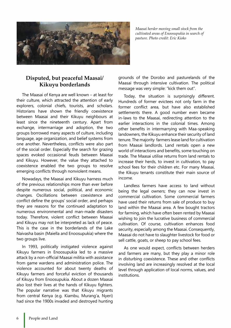
Disputed, but peaceful Maasai/Kikuyu borderlands
TheMaasaiofKenyaarewellknown–atleastfortheir culture, which attracted the attention of early explorers, colonial chiefs, tourists, and scholars.Historians have shown the friendly coexistencebetween Maasai and their Kikuyu neighbours at least since the nineteenth century. Apart fromexchange, intermarriage and adoption, the two groups borrowed many aspects of culture, including language, age organization, and belief systems from oneanother.Nevertheless, conflictswere alsopartofthesocialorder.Especiallythesearchforgrazingspaces evoked occasional feuds between Maasai and Kikuyu. However, the value they attached tocoexistence enabled the two groups to resolve emergingconflictsthroughnonviolentmeans.
Nowadays, the Maasai and Kikuyu harness much of the previous relationships more than ever before despite numerous social, political, and economic changes. Oscillations between coexistence andconflictdefinethegroups’socialorder,andperhapsthey are reasons for the continued adaptation to numerous environmental and man-made disasters today. Therefore, violent conflict between MaasaiandKikuyumaynotbeinterpretedaslackofpeace.This is the case in the borderlands of the LakeNaivasha basin (Maiella and Enoosupukia) where the twogroupslive.
In 1993, politically instigated violence againstKikuyu farmers in Enoosupukia led to a massive attackbyanon-officialMaasaimilitiawithassistancefromgamewardensandadministrationpolice.Theviolence accounted for about twenty deaths of Kikuyu farmers and forceful eviction of thousands ofKikuyufromEnoosupukia.AboutadozenMaasaialso lost their livesat thehandsofKikuyufighters.The popular narrative was that Kikuyu migrants from central Kenya (e.g. Kiambu,Murang’a, Nyeri)had since the 1900s invaded and destroyed hunting
grounds of the Dorobo and pasturelands of the Maasai through intensive cultivation. The politicalmessagewasverysimple:“kickthemout”.
Today, the situation is surprisingly different.Hundreds of former evictees not only farm in theformer conflict area, but have also establishedsettlements there. A good number even becamein-laws to the Maasai, redirecting attention to the earlier interactions in the colonial times. Amongother benefits in intermarryingwithMaa-speakinglandowners, the Kikuyu enhance their security of land tenure.Themajorityfarmersleaselandforcultivationfrom Maasai landlords. Land rentals open a newworldofinteractionsandbenefits,sometouchingontrade.TheMaasaiutilisereturnsfromlandrentalstoincrease their herds, to invest in cultivation, to pay schoolfeesfortheirchildrenetc.FormanyMaasai,the Kikuyu tenants constitute their main source of income.
Landless farmers have access to land withoutbeing the legal owners; they can now invest in commercial cultivation. Some commercial farmershave used their returns from sale of produce to buy landwithintheMaasaiarea.Afewboughttractorsfor farming, which have often been rented by Maasai wishingtojointhelucrativebusinessofcommercialcultivation. Of course, cultivation enhances foodsecurity,especiallyamongtheMaasai.Consequently,Maasai do not have to slaughter livestock for food or sellcattle,goats,orsheeptopayschoolfees.
Asonewouldexpect, conflictsbetweenherdersand farmers are many, but they play a minor role indisturbingcoexistence.Theseandotherconflictsinvolving land are increasingly resolved at the local level through application of local norms, values, and institutions.
Maasai herder moving small stock from the cultivated areas of Enoosupukia in search of pasture. Photo credit: Eric Kioko

7Who Belongs Here?
What is Local?W hat does it mean that something is local?
Isitthecontrastwiththebiggerglobalandregional that determines it or does it exist in its own right?Issomethinglocalifitlinkstotheregionalorglobal? Or is it only local if it can be seen in isolation fromtheoutsideworld?Isitactuallymeaningfultotalk of something local today when it is no longer meaningful to talk of closed systems where contact with a bigger system of governance and contact to relations outside the community is lacking? Today, even in the farthest corners of Kenya networks reach far outside the enclosed space with mobile phones andmore interaction ondifferent scales andwaysthan before. So perhaps we need a new term todenote‘thenewlocal.’
A Samburu woman in her local attire. However, both beads and cloth that adorn her were and are part of the global trade. Photo credit: Marie Gravesen
Neatly divided plots in Enoosupukia each with its own owner and lease. The people nevertheless grow similar things. Photo credit: Eric Kioko

8 People and Land
Who belongs here?T obeabletobelongtoacertainplaceorapieceoflandmeanstobeabletoclaimownershipofit.There
aredifferentwaystoargueforsuchanownershipclaim.Onewayistousestatutorylawwithprivateproperty rights and another one is to use customary rights with historical arguments that prove presence for thelongesttimeperiod.
As for the customary argument, if someone is evicted by others they could claim their land back by tracing their belongingfurtherbackthanthenewholdersoftheplace.Inthiscasetheevictedcouldtracetheir‘belonging’withburialsites,spaceforritualpracticesorimportantmeetingplaces.
Onbothsidesthepartiescouldstrengthentheargumentbyclaimingthelandscapeindifferentways.TheethnicgroupSamburu,whoarerelatedtotheMaasai,arepresentaspastoralistsinLaikipia,northernKenya.Forthem,youclaimlandbygrazingitwithyouranimals.Thiscreatesalandscapewithfewtreesandbushesbutmuchgrass,asthisiswhatisusefulforthepurposeofgrazing.TheideaofprivateownershipismeaninglesstotheSamburu,becauseuserrightstraditionallybelongtothecommunityasawhole.Instead,itisimportanttoacquireandmaintainaccesstoaplace.Contrastingly,forKikuyufarmersinLaikipia,theirwaysofclaimingtobelong to the land is by following the dominant discourse of statutory law that was established under colonial ruleandsimplybuyland.Byvirtueofapieceofpaperwithaplaceandatitledeedtheycouldthenclaimtobetherightfulownersof the land.Theywouldnotclaimownershipbycreatinggrazing landbut ratherbycreatingagriculturallandwithfencingtomarktheboundaries.Thetermsforthesetwoarguments,customaryandstatutory,arefundamentallydifferent.Thiscomplicatesandcontinuouslyignitesconflict.Theseconflictscanbeeitherpassivethroughprocessesofinclusionofsomeindividuals,e.g.throughcommunityfunctionswhileothersareexcluded,orattimestheconflictmayturnintoviolentclashes.
Example:Beforecolonialism,thelandinLaikipiawaspredominantlyusedbypastoralists.Duringthecolonialperiod,thelandwasexclusivelycontrolledby’whites’aspartoftheWhiteHighlands.Thecolonialadministrationhad little understanding for pastoralism because it was based on mobility, moral codes of access and community ownership rather thanstablesettlementand individualism.As thepastoralistsdidnot ‘own’ the land in thewesternsense,theyevictedthemandgaveprioritytothenon-pastoralistKikuyuasfarmlabour.TheKikuyuhadalready received basic western education from the missionaries and had a good understanding of cultivation - theywerethusmorelikethewhitesinmanyways.Towardsindependence,in1963,theinterestamongAfricancommunitiesin(re)gainingaccesstothelargeranchareasforvariouslivelihoodpracticeswasveryhigh.AfterIndependencetheKenyanandtheBritishGovernmentsdesignedarangeofsettlementschemestobuyoutthewhitelandownersandsubdividethelandtomeetthedemandforsmall-scalefarming.ManyKikuyuboughtland
through these schemes and are now in conflict with other communitieswith the other sense of ownership and way of claiming to belong to the land, such as the pastoralists who claim to have been present before the colonial power holders forcibly movedthem.
But which argument is better?Who belongs? Those who canhistorically claim to belong 120 years ago or those who bought land from the colonial settlers as private property?
Fencing is used to ascertain a claim to land and to border off the land, restricting access. Photo credit: Marie Gravesen
9Scope of the Scape
The Scope of the Scape
I t is a very human characteristic to be preoccupied with the categories into which we sort the world
aroundus.Definingthespaceandtimeinwhichourlives unfold gives us perspective and brings meaning to our existence. For instance, some scholars havenamed the time period that we live in today the Anthropocene.Theageofhumankind.
Just like the Anthropocene is one unit of classificationforthetimeinwhichwelive,landscapeisaunitofclassification for thespace inwhichwelive. Landscapes are studied from the perspectiveof geographers, urban planners, philosophers, environmentalists, paleoecologists, artists, and economists tonamebuta few.Yet landscapesaremorethanjustparcelsofland,theyaresymbolicallyimbued and multi-layered. People are constantlyrecreating and being redefined by the landscapesthey inhabit, and landscapes exist in our minds and memories just asmuch as they exist in space. Perhapsnow, more than ever, is the concept of landscape relevant, as all landscapes are equal parts cultural and natural in the age oftheAnthropocene.
Landscapes canstretch on to any number of horizons, and sometimes they are classified by whatthe eyes can see, the ears can hear, the nose
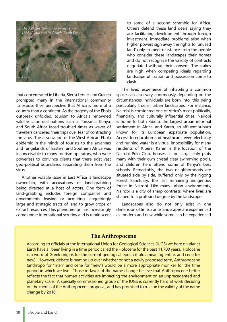
can smell, and the body can touch. For example,gazing up from the Amboseli basin in southern Kenya, the greens, blues, greys and snowy whites of Mt.Kilimanjaroformamajesticlandscapefeaturethesensescannotfailtotakein.HowevercartographersandpoliticiansdonotconsiderMt.Kilimanjarotobea feature of any Kenyan landscape, as since 1886 the volcano has been positioned within the borders of Tanzania.ThisisdespitethefactthatMt.Kilimanjaroplays a tremendously important role in regulating rainfall and water resource availability in Amboseli, andwithoutKilimanjarothebasinasweknowitcouldnotexist.Thefeaturesofalandscapearesometimesdetermined by our senses, and sometimes decided byoursystems.
The scope of a landscape varies so much dependingonwhereit’sbeingconceptualizedfrom.Recently, the severe outbreak of Ebola in 2014/2015
Gazing up at Mount Kilimanjaro from the Kenyan foothills. Photo credit: Anna Shoemaker
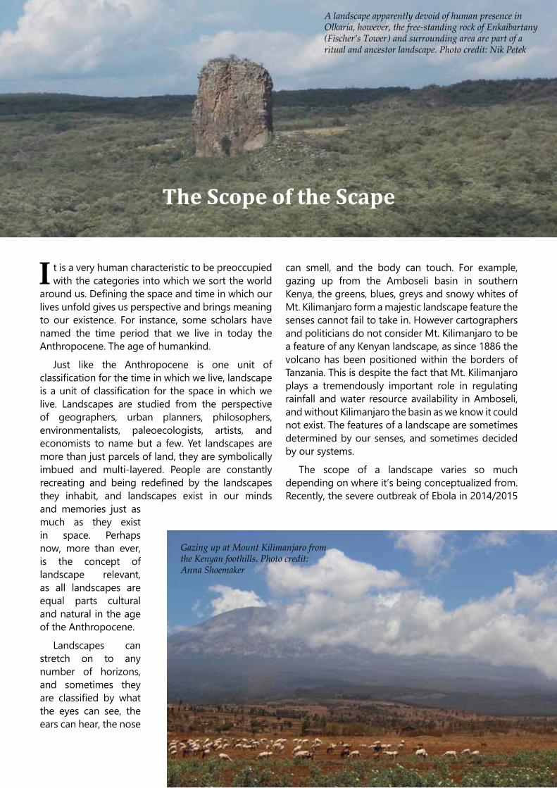
A landscape apparently devoid of human presence in Olkaria, however, the free-standing rock of Enkaibartany (Fischer’s Tower) and surrounding area are part of a ritual and ancestor landscape. Photo credit: Nik Petek
10 People and Land
thatconcentratedinLiberia,SierraLeone,andGuineaprompted many in the international community to expose their perspective that Africa is more of a countrythanacontinent.AsthetragedyoftheEbolaoutbreak unfolded, tourism to Africa’s renowned wildlife safari destinations such as Tanzania, Kenya, andSouthAfrica faced troubled timesaswavesoftravellers cancelled their trips over fear of contracting thevirus.TheassociationoftheWestAfricanEbolaepidemic in the minds of tourists to the savannas andrangelandsofEasternandSouthernAfricawasinconceivable to many tourism operators, who were powerless to convince clients that there exist vast geo-political boundaries separating them from the virus.
Another volatile issue in East Africa is landscape ownership, with accusations of land-grabbing being directed at a host of actors. One form ofland-grabbing includes foreign companies and governments leasing or acquiring staggeringly large and strategic tracts of land to grow crops or extractresources.Thisphenomenonhasincreasinglycome under international scrutiny and is reminiscent
to some of a second scramble for Africa.Others defend these land deals saying they are facilitating development through foreign investment. Immediate problems arise whenhigherpowerssignawaytherightsto‘unusedland’ only to meet resistance from the people who consider these landscapes their homes and do not recognize the validity of contracts negotiatedwithout their consent. The stakesare high when competing ideals regarding landscape utilization and possession come to clash.
The lived experience of inhabiting a common space can also vary enormously depending on the circumstances individuals are born into, this being particularly true in urban landscapes. For instance,Nairobi is considered one of Africa’s most politically, financially, and culturally influential cities. Nairobiis home to both Kibera, the largest urban informal settlement inAfrica, andKaren,anaffluent suburbknown for its European expatriate population.Access to education and healthcare, even electricity and running water is a virtual impossibility for many residents of Kibera. Karen is the location of theNairobi Polo Club, houses sit on large leafy plots many with their own crystal clear swimming pools, and children here attend some of Kenya’s best schools. Remarkably, the two neighborhoods aresituated sideby side, bufferedonly by theNgongForest Sanctuary, the last remaining indigenousforest in Nairobi. Like many urban environments,Nairobi is a city of sharp contrasts, where lives are shapedtoaprofounddegreebythelandscape.
Landscapes also do not only exist in onedimensionoftime.Somelandscapesareexperiencedas modern and new while some can be experienced
The AnthropoceneAccordingtoofficialsattheInternationalUnionforGeologicalSciences(IUGS)wehereonplanetEarthhaveallbeenlivinginatimeperiodcalledtheHoloceneforthepast11,700years.HoloceneisawordofGreekoriginsforthecurrentgeologicalepoch(holosmeaningentire,andcenefornew).However,debateisheatingupoverwhetherornotanewlyproposedterm,Anthropocene(anthropofor “man”andcene for “new”)wouldbeamoreappropriatemoniker for the timeperiodinwhichwelive.ThoseinfavorofthenamechangebelievethatAnthropocenebetterreflectsthefactthathumanactivitiesareimpactingtheenvironmentonanunprecedentedandplanetaryscale.AspeciallycommissionedgroupoftheIUGSiscurrentlyhardatworkdecidingon the merits of the Anthropocene proposal, and has promised to rule on the validity of the name changeby2016.
The Kenyan Tanzanian border since 1886. Photo credit: Google Earth Pro

11Scope of the Scape
as contemporary but imbued with historical, forgotten,andevenmythicalcharacter.Forinstance,StoneTowninZanzibarisbestknownasahistoricalsite, a 19th century center for the spice and slave trade.AlsoinTanzania,OlduvaiGorgeisalandscapeof discovery from which remains of some of the earliest human species have been found. MountKenyafigures intoKikuyu religious traditions,as itwas believed to be a sacred place inhabited by the godMweneNyaga. Of course all of these spacesendure today, but knowledge of their past continues toshapethem.
This imprint of time highlights another important aspectofthelandscape:Itisnotastaticentity,buta continuously changing and continuously evolving one.Thesechangesoccuracrossallofitsfacets;fromecology to culture, from local land use to political
boundaries. When looking at the landscape as awholeitisimportanttokeepthisinmind.Thevariousimpacts that have shaped the landscape over the centuriescontinuetodosonowandinthefuture.Changesinclimatewillinfluencethecompositionofthevegetation.Migrationofpastoralistswilldecreaseor increase the pressure put on the landscape by grazing.Politicaldecisionscanchangethepurposeof a piece of land. These changes can be slow orabrupt, theycanbemarginalortheycan influencethe lives of thousands of people. When speakingabout the concept of landscape it is important to understandthismultidimensionality.Alandscapeisacontinuum, a series of changes strung together and influencedbyamultitudeoffactorsbothnaturalandcultural.Whatweseetoday isbutasnapshotofalargerwhole.
The measured distance between the former tourist and ebola hotspots of Africa. Photo credit: Google Earth Pro
The proximity and void dividing Nairobi’s Karen and Kibera neighborhoods. Photo credit: Google Earth Pro
Maeneo hufanyiwa uchunguzi kulingana na mtazamo wa wanajiografia,wakuu wa mipango ya miji, wanafaisafa, wanamazingira, wasanii na wachumi-hawa wakiwa ni wachache tu miongoni mwa hao wanaohusika. Walakini maeneo siyo tu sehemu za-au mapande ya-ardhi bali yamejazana na ishara na pia yametokana na mipangilio ya safu nyingi chini ya ardhi. Watu wanaendelea kugeuza maeneo muda wote, na vilevile kutambulishwa na maeneo yenyewe wanamoishi-na tena maeneo hukaa katika fikra na kumbukumbu zetu sawa na kama vile yalivyo katika ardhi. Pengine sasa kuliko wakati mwingine wowote, mtazamo ule uliopo juu ya maeneo unahusika kwa vile maeneo yote ni sehemu zilizo sawa kwa utamaduni na uasili wakati huu na katika kipindi hiki. Maeneo ni aina za ardhi ambazo uzoefu wetu daima huunda, hubadilisha na hufanyiza tena. Eneo lolote lile lina hali ya-au uwezo wa-kuwa: huria, pa kushangaza, panapojulikana, pa hatari, salama, mjini, patupu, pako au penu, pangu, na petu. Maeneo yametokana na mipangilio ya safu chini ya ardhi, na upeo (au uwezo) wa eneo hutambulishwa na idadi yoyote ya viungo (au viunganishi), yaani yale yanayojihusisha pamoja na kuunda eneo.
12 People and Land
Landscapes are categories of space that ourexperiences endlessly configure, renegotiate, andremodel.Anyonelandscapehasthecapacitytobewild, beautiful, strange, familiar, dangerous, safe,
urban, empty, yours, mine, and ours. Landscapesarelayered,thescopeofthescapeisdefinedbyanynumberofconstructs.
Sunbirds on the banks of the Victoria Nile River in Murchison Falls National Park in Uganda. Photo credit: Nik Petek
About to find its next prey, the fish eagle flies out over Lake Baringo in Kenya’s Rift Valley. Photo credit: Geert van der Plas
13Raiders of the Lost Archives
Raiders of the Lost Archives: We are what we collect, we collect what we are
Njia mojawapo ya kuelewa na kutambua historia ya nyakati mbalimbali katika maisha ya binadamu ni kwa kutumia makavazi. Kuna imani iliyojengeka miongoni mwa watunza nyaraka kwamba kilichomo katika nyaraka ndicho kinachoonesha namna jamii fulani ilivyokuwa wakati nyaraka hizo zikitengenezwa. Hii ni kwasababu kile kinachokusanywa na kuhifadhiwa katika nyaraka kinatokana na vitu ambavyo jamii husika inavifanya. Imani hii ya watunza nyaraka inafanya makavazi kuonekana kama sehemu au chanzo kizuri kujifunzia na kuelewa mabadiliko ya jamii katika nyanja za kijamii, kiuchumi na kiutamaduni ambavyo jamii husika imevipitia. Makala hii inatoa maelezo kidogo kuhusiana na makavazi. Mkazo zaidi umejikita katika kuwafanya wasomaji wa makala ambao hawajawahi kutumia makavazi na wangependa kuzitumia baadae kwa ajili ya utafiti waweze kuelewa maana ya makavazi na aina zake, matumizi na changamoto za kuzitumia taarifa kutoka katika makavazi. Pia, makala hii inatarajia kuamsha ari ya matumizi ya makavazi kuvuka ulingo wa nyanja mbalimbali za kitaaluma.
O ne of the ways used to understand people’s history through time has been through the use
ofarchives.Thereisasharedbeliefamongarchiviststhat what is stored in the archives represents a particular past of a society, as what is collected for preservation in the archives comes from what the societywasdoing.Thismakesarchivesgoodsourcesfor understanding the social, economic and cultural diversities that a certain community has passed through.Thisarticleprovidesanecdotalinformationabout archives with emphasis on meaning and types, uses and challenges. The article hopes to informreaders who have not used archives before and would wishtousethemforresearch.Itisalsoexpectedtostimulatetheuseofarchivesacrossdisciplines.
Meaning and types of archives
Archives are simply documents that were produced by individuals, governments, companies or Non-Governmental Organisations (NGOs). Thedocuments were not meant for research but for the daily running of private and institutional activities.Any individual can create his or her own archive.For example, when individuals decide to keep their examination papers and records, love letters, daily diariesetc.Wecanevenaskourselves,forwhodowecreatearchives?Archivesarethereforeverybody.Anybody can create them and anybody can use them forvariouspurposes.
Because of the philosophies that guide thecreation of archives, researchers need to be extra carefulwhendealingwitharchivaldocuments. Theperson creating a particular document, let’s say a field diary, had certainmotives for doing so. Suchmotives were not necessarily the same as those being researched and they will not provide absolute information on a particular issue. Expressionsprovidedinarchivaldocumentsshouldbesubjectedto contextual understanding to grasp the intention of their creation. Without this, our research mayend up reproducing the voices of authors, instead of unravelling the information which we can use to strengthen research arguments. Therefore oneshould attempt to read the minds of the authors beforeentirelydealingwiththedocuments.Thiswillsimplify understanding the reasons for production ofsomedocuments.Whatshouldoneexpectwhenreading archives on cold war involvements? One is unlikely tofindanythingpositiveaboutAmerica inRussian archives and vice versa. But this does notmean that there were no positive things on either side. This is where the researcher’s eye needs tocome in. The researcher should not throwout thedocuments and just conclude they are one sided.It’sbettertousetheminclosereferencewithothersources–corroboratethesources.
Archivescanbeclassifiedintodifferentcategories.Wemayclassifythembythepeopleandinstitutionsthat created them, or the themes contained in
14 People and Land
them.Forexample,basedonwhocreatedthemwecanhaveprivateand individualarchives.Privateorindividual archives are created by individuals and are sometimes stored in private repositories or, if thecreatorwasaninfluentialmemberofaparticularsociety, theycanbestored inpublicarchives.Theymay include travel accounts, field diaries, personalletters,etc.Privatearchivescanbeusedforpeople’sbiographies or, in other cases, they may carry informationaboutaparticularcommunity. Inmostcases when these are stored in private repositories, the accessibility of these types of documents depends on the relationship established between the owner of the archives and the researcher. But when thesame archives are taken to the national or regional archives,accessoftenbecomeslessofaproblem.
On the other hand, institutional records, which might look something similar to the documents used byNGOsorcommercialcompanies,areproducedbyinstitutions and carry their histories, development records, challenges, future prospects and so on.For example, if your research concerns Christianity
in Eastern Africa, you will be required to locate the Missionariesʹrecordsindifferentarchives,whichmayinclude early records of Africa, owned by Missionary SocietiesandvisitingtheChurchMissionarySociety(CMS) archive in Birmingham. However, if theresearch is the on early experience of East African environments, it might be a good thing to visit the Royal Geographical Society in London. But for alltypes of archival resources, it is never surprising to findnothingrelevanttoyourresearch,asthecreatorshadnointentiontopreparethemforthispurpose.Also, as with individual archives, access to companies’ andNGOs’archivesmayalsobecomplicated.Someof these institutions are not comfortable opening up theirhistorytooutsiders.
The only reliable types of archives are the government archives. Access to these is grantedsubject to you following the rules and regulationsgoverningthem.Governmentarchivesareproducedbased on daily government activities. But theywill still bepoliticized.Governmentdocuments arenot “clean,” they just offer a different perspective
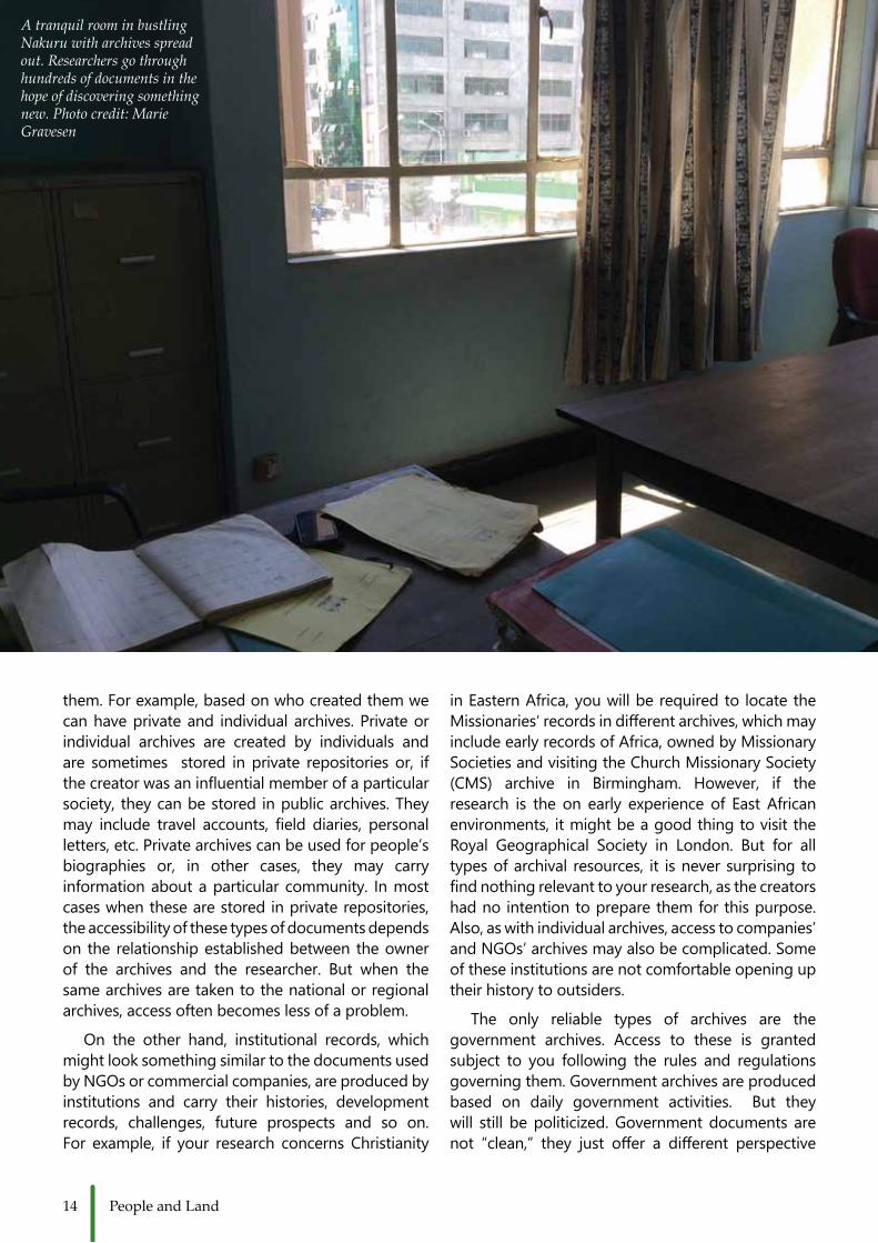
A tranquil room in bustling Nakuru with archives spread out. Researchers go through hundreds of documents in the hope of discovering something new. Photo credit: Marie Gravesen

15Raiders of the Lost Archives
on events than personal or institutional archives.They are also written by government officials forother government employees with either hidden or open intentions. It is thedutyof the researcher tounderstandthedocuments.
Inmostcasessuchdocumentsarestoredinthenationalarchives (buildingscreated for thespecificpurposeofstoringrecords–publicorprivate).Inthecase of the African continent, archives for the colonial period can be easily accessed in the archives of the formercolonialpowers.Forexample,forAnglophonecountries in Africa, the materials are found at the British National Archives – in Kew, formerly PublicRecordsOffice.NotallfilesareinEnglandbuttheyare better preserved than in the former colonies and caneasilybeobtainedandused.
Archival sources for all?
Traditionally, archives have been a working place for historians but contemporary academia encourages the use of a wide range of sources for academic works.Somepeoplemayask,forexample,whatuseare archives to a social anthropologist, archaeologist, linguistorevenanaturalscientist.Theanswerisassimple as asking the role of sources of information in research. Archives contain different informationthatcanbeusedinvariousdisciplines.Theycontainrecords, for example, that may have information on different diseases, occurrence patterns andtreatment.Theycantellcroporplanthistorieswhichare important and can provide anecdotal information useful to palaeoecologists, archaeologists, ecologists botanistsandsoon.Inthatway,theuseofarchivescan contextualize historical and non-historical data and thereby be used to triangulate/validate data.However, it is always a challenge to be specificenoughinhowtosearchinthearchives.
Challenges of using archives
It is not easyworkingwith archives. This is notbecause the materials are diverse and might be confusing, but as a result of technical and special challenges.Aresearcherneedstohavesomebasicskills to work with them and not everybody can interact with archives successfully. The researcher needs tounderstand how certain archives are organized, how theywork,andhowthedocumentsarearranged.Itis a little bit easier to work with archives that provide anonlinecataloguebecausetheresearchercanfindout what is housed in the archive without visiting the
archivephysically.Iftheresearchervisitsthearchiveunaware of this basic information, archival work can endupbeingfrustratingandback-breaking.Archivesare arranged into topics, regions, classes, series, folios etc. All these arrangements are not there becauseof fashion, but they stand out to help researchers simplifytheirsearchofdocuments.However,evenifone follows all the requirements as pre-requisite for starting archival research, it can rarely be guaranteed togetthedocumentsasindicatedinthecatalogues–especiallyinthedevelopingcountries.Somearchivesin developed countries are well endowed with information from within and outside their physical boundaries. Sometimes, a little bit of courage andhope need to be taken along when dealing with poorlyorganizedarchives.
Researchers should work with the materials available in the archives and find other sourceselsewhere to complement their work. There is nosource in research that can be considered superior orinferioroveranother.
Archives, more than just being a document storage, have also been a source of antique photographs of people and landscapes, like this one from Rhodes House in Oxford showing the ridge of the Rift Valley
16 People and Land
Dung! - Landscape modeller and archaeologist whisperer
W hen did you last think about poo? Poo does not make its way into mainstream conversation
easily, but perhaps it should. It is fascinating andholds the interest of many researchers who recognise that the most common occurrences are our most defining,eventhoughtheyfosterlittleattention.Pooissuchadefiningoccurrenceinhumansandanimalsalike, and it plays an ever more important role in our lives.Forexample,pooisareadilyavailablesourceof manure, it is a source of biogas energy when digested by bacteria, and it plays a vital role in the transformationofthelandscape.
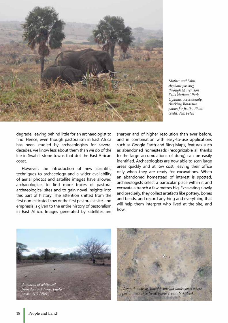
Thanks to elephant droppings, there is now a plentitudeofBorassuspalmsdottingthesavannahof the Murchison Falls National Park in Uganda.Elephants were consuming the fruit of the palm in South Sudan beforemaking their way to Uganda,transportingtheseedsintheirguts.Onceintheparkthe seeds were expelled with the droppings, giving the seeds a head startwith extra nutrients. In just
afewdecades,theBorassuspalmhasbecomeoneof themostcommontrees in thepark.Similarly inBaringo, Kenya, the plant Prosopis juliflora spread at an incredible pace because the plant’s pods are tastyfodderforgoats.Theseedsgerminateastheypass through thegoat and flourishwhen they aredeposited with goat droppings. In only 30 yearsBaringo became completely unrecognisable andgoat excrement played an important role in the spreadoftheplant.
Livestock dung, particularly that of cattle, alsoexhibits considerable force when shaping the landscape. Cattle are the most commonly keptlivestock in the world and to pastoralist communities in East Africa they are synonymous with wealth, prestige, and identity. A common practice amongpastoralists is to enclose their cattle within their homesteads into livestock pens, where dung accumulates for a few years. After the homesteadis abandoned, the mound of dung decays and
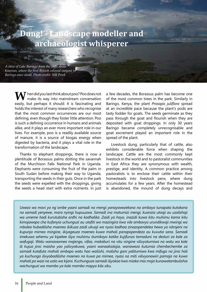
A view of Lake Baringo from the cliffs above Kiserian, where the first British colonial outpost in Baringo once stood. Photo credit: Nik Petek
Uwezo wa mavi ya ng`ombe yaani samadi na mengi yanayowezekana na ambayo tunapata kutokana na samadi yenyewe, mara nyingi hupuuzwa. Samadi ina matumizi mengi, kuanzia utoaji au uzalishaji wa umeme hadi kurutubisha ardhi na kadhalika. Zaidi ya hayo, inazidi kuwa kitu muhimu kama kitu kimojawapo cha kufanyia uchunguzi au utafiti wa mazingira kwa vile ambavyo urundikwaji mwingi wa mbolea hubadilisha maeneo ikikuza zaidi ukuaji wa nyasi kadhaa zinazopendelea hewa ya nitrojeni na kupunja mimea mingine, ikiyageuza maeneo kuwa mahali panapopendeza au kuvutia sana. Samadi imekuwa sehemu ya kipekee iliyo muhimu itumikayo katika kujifunza tamaduni na desturi za kale za wafugaji. Watu wanaosomea majengo, vifaa, makaburi na vitu vingine vilivyotumiwa na watu wa kale ili kujua jinsi maisha yao yalivyokuwa, yaani wanaakiolojia, wanaweza kutumia chembechembe za samadi kutafuta mahali ambapo watu hao waliishi, malisho gani yalitumiwa kwa mifugo na jinsi hali ya kuchunga ilivyobadilisha maeneo na kuwa pa mimea, nyasi na miti vilivyonawiri pamoja na kuwa mahali pa wazi na uoto wa kijani. Kuchunguza samadi iliyokaa kwa miaka mia moja kunawatambulishia wachunguzi wa mambo ya kale mambo mapya kila siku.

17The Power of Numbers
providesthesoilwithmuchneedednutrients.Afewyears later, the plants will colonise the abandoned homestead in a specific pattern, which will createa largecircularandopen feature in the landscape.The exact appearance and the vegetation within the abandoned homestead varies depending on where in East Africa you are. The best known feature iscalleda‘glade’,whichisanopenspacecharacterisedbyjuicygrassessurroundedbybushesandtrees.
Landscapes,characterisedbybarelandsordensebushes, can become remodelled with plant-rich patches dotting the land. Areas in Baringo in theKenyan Rift Valley, inhabited only 20 years ago, are now full of trees growing in circular fashion, making itclearlyvisiblewherepeoplebuilttheirhomesteads.Ingeneral,thesefeaturesenhanceenvironments.Forexample, the nutritious grasses of the glades attract large grazers like Thomson’s gazelle and wildebeest, and small animals like insects. The grasses andanimals combined create biodiversity hotspots, which promote the environment’s resilience against biodiversity loss. This is particularly importantwhen scientists are warning of the upcoming sixth mass extinction.More than justbeinganagentofvegetation change, dung can have a real impact on whole ecosystems, shaping animals‘ habitats andincreasingtheirchancesofsurvival.
The features born from abandoned homesteads can measure from tens of metres to over 200 metres wide. While most remain visible only for a fewdecades,onesuchfeatureinLaikipiaextraordinarilysurvived fora fewcenturies.Theenduringvisibilityof abandoned homesteads on the landscape is extremely useful for archaeologists interested in the livesofpastoralpeopleoverthemillennia.
Archaeologists study humans and the manifestations of the various societies and cultures they created across the world from the beginnings of the species Homo up until today,by looking at material remains left behind and the modifications to the land they lived on. Abranch of the discipline is pastoralist archaeology, which is concerned with understanding pastoral communities. In Africa, pastoralist archaeologyhas long been preoccupied with identifying the first appearance of domesticated livestock, thefirst ‘purelypastoral’ community, and the spreadofpastoralismacrossthecontinent.However,overthepastdecade,researchinterestshavediversifiedand archaeologists are much more motivated to understand pastoralism over the entirety of its history,ratherthanjustitsbeginnings.
The oldest evidence for pastoralism in East Africa comesfromtheshoresofLakeTurkanaanddatesto4500yearsago.Thepractice spreadquickly south,reaching southern Kenya and Northern Tanzania by 4000 years ago, and by 3500 years ago pastoralists alsosettledinwhatisnowTsavo.Pastoralistshaveleftbehind some remarkable archaeological sites, such asProlongedDrift,southofLakeNakuru inKenya,where over 225,000 stone artefacts and 165,000 bone fragments were found, or the stone pillar sites aroundLakeTurkanainKenya,whicharetheoldestfound instance of monumental architecture in East Africa.Unfortunatelyforarchaeologists,suchsitesareexceptionallyuncommon.Overmillennia,pastoralistshave left very feweasily identifiable tracesof theirpresence in East Africa. Many possessions weremadefromorganicmaterials.Bodieswereadornedwith leather, berries, ochre and clay, while houses werebuiltofmudandthatch.Thesematerialsquickly
18 People and Land
degrade, leaving behind little for an archaeologist to find.Hence,eventhoughpastoralisminEastAfricahas been studied by archaeologists for several decades, we know less about them than we do of the lifeinSwahilistonetownsthatdottheEastAfricancoast.
However, the introduction of new scientifictechniques to archaeology and a wider availability of aerial photos and satellite images have allowed archaeologists to find more traces of pastoralarchaeological sites and to gain novel insights into this part of history. The attention shifted from thefirstdomesticatedcoworthefirstpastoralistsite,andemphasis is given to the entire history of pastoralism in East Africa. Images generated by satellites are
sharper and of higher resolution than ever before, and in combination with easy-to-use applications suchasGoogleEarthandBingMaps,featuressuchas abandoned homesteads (recognizable all thanks to the large accumulations of dung) can be easily identified.Archaeologistsarenowabletoscanlargeareas quickly and at low cost, leaving their officeonly when they are ready for excavations. Whenan abandoned homestead of interest is spotted, archaeologists select a particular place within it and excavateatrenchafewmetresbig.Excavatingslowlyand precisely, they collect artefacts like pottery, bones and beads, and record anything and everything that will help them interpret who lived at the site, and how.
Mother and baby elephant passing through Murchison Falls National Park, Uganda, occassionaly checking Borassus palms for fruits. Photo credit: Nik Petek
A mound of white soil from decayed dung. Photo credit: Nik Petek
Vegetation circles like this one dot landscapes where pastoralists once lived. Photo credit: Nik Petek

19Dung!
Better satellite and aerial images also allowfor the identification of features associated withpastoralist settlements which can only be seen from a bird’s-eye view and are easily overlooked ontheground.Forinstance,atthesiteofIlchamusLeabori inBaringo,wherepastoralistsalso farmedextensively, easily visible lines of dense vegetation running across the landscape are signs of irrigation furrows.Buttheseareonlyclearlyvisiblefromtheair, and are hard to spot on the ground. Satelliteimages with clearly visible glades now allow archaeologists to study population movements across the landscape, building on understandings of how people come together, spread out, and relocate through time. This kindof information isimportant when reconstructing the evolution of environments, which have been shaped by humans, an important topic today in the age of increasing populationpressure.
Pastoral archaeologists have also long been interested in the bones of animals that have been excavatedfromasite.Peoplearetrainedtoidentifythe specific animal a bone is fromand evenhowoldtheanimalwas,itshealthandhowitwaskilled.Of course this skillwasneeded tofind theoldestdomesticated livestock. Additionally, bones andparticularly teeth, are used in sophisticated isotopic analyses to help archaeologists understand where an animal lived, what it ate, and even what the weatherwaslikeduringitslife!Archaeologistsarealso very keen at spotting changes in sediment
texture, colour, and composition, and all of these help to piece together what was happening at pastoralist sites centuries ago. Understanding thechemical signatures and microscopic appearance of soil from various parts of recently abandoned homesteads, like house floors and livestockenclosures, gives the basis for comparison with very old glades. Because dung impacts soil formationin a very unique way, archaeologists are also able to identify old and disappearing features based on theirchemicalsignature.
Working together, environmental researchersand archaeologists are able to do and know so much more since the importance of poo in ecosystems was realized. So, next time you are discoveringthe marvellous East African landscape and you come across a big pile of dung think to yourself:“In some years this couldmake beautiful grazingland for elephants, gazelles, and cattle. This areaisgoingtochangebecauseofdung.”Manyofthethings we consider commonplace and ignore, can be, and usually are, important for maintaining or transformingtheworldaroundus.Sointhefuturedonotunderestimatethepowerofdung.
Densely scattererd pottery tells archaeologists where to find settlements. Photo credit: Nik Petek
20 People and Land
I f someone asked you to tell them what the environments of northern Kenya looked like
hundreds of years ago and how people lived in those environments, it is more than likely that your face will become perplexed by the request.Howcouldyouknow,whenyouhaveneverseenorlivedit.Yourgrandparentscouldhave passed on to you some stories of the past, but those are only snippets of the whole story. Luckily, there is in fact a way to seethatpast!Thistextwilltakeyou,insearchforanswers,downtoyournearestlake.However,it is not at the lake shore, but the lake bottom thatthetreasureishidden.
These days we know a lot about lakes.Lakes are important components of anyenvironment. They provide habitats foraquatic organisms, such as fish, which arean important source of protein for many humans.Lakesalsoserveassourcesofwater,a crucial resource and a basic necessity for the survival of land animals andplants. Theoutstanding beauty of such large bodies of water makes them ideal spots for tourism and leisure activities, while hydroelectric dams and irrigation agriculture using lakes support various economies around the world. Thelist of socioeconomic, ecologic and aesthetic values that lakes provide for humans and for thewiderecosystemarecountless.
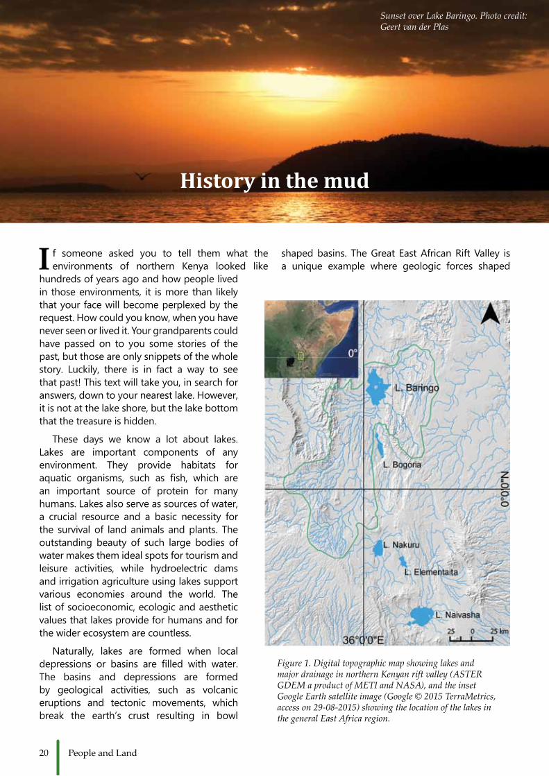
Naturally, lakes are formed when local depressions or basins are filled with water.The basins and depressions are formed by geological activities, such as volcanic eruptions and tectonic movements, which break the earth’s crust resulting in bowl
History in the mud
shapedbasins. TheGreat EastAfricanRiftValley isa unique example where geologic forces shaped
Figure 1. Digital topographic map showing lakes and major drainage in northern Kenyan rift valley (ASTER GDEM a product of METI and NASA), and the inset Google Earth satellite image (Google © 2015 TerraMetrics, access on 29-08-2015) showing the location of the lakes in the general East Africa region.
Sunset over Lake Baringo. Photo credit: Geert van der Plas
21History in the Mud
basins, which were later filled by fresh and salinewater.Forinstance,LakeTurkana,LakeBaringo,LakeBogoria,LakeNaivashaandLakeNakuruaresomeofthelakesinnorthernKenyanRiftValley(Figure1).Itis among these Rift Valley plains and lake shores that scientistsbelieveourfirsthumanancestorsevolvedand started producing and using tools to become greatplayersintheshapingofthelandscape.
As part of the global hydrologic cycle, lakes are important reservoirs of readily available water on continents. Following the natural slope of thelandscape, water flows into tectonic depressions,the low-points of landscapes, and through time developintolakes.Lakesystemsreceivewaterfromriverflows,groundwaterseepageandfromrainfall.Transported with water are also sediments and dissolvedminerals,whichendup inthe lakebasin.Basedonhow lakesreceive thematerials fromthesurrounding landscape, they can be an open basin
lake, with materials entering and partly leaving the basin through river outlets, or a closed basin lakewithout away for the sediments to flow out.Because lakesareso intricatelyconnectedwiththesurrounding land surfaces, of which they are the lowestpoint,theybecomethefinalrestingplacefororganic, inorganic and mineral matter transported through the river courses. Alongside water, windsalso transport small particles from around the lake basin intothe lake.Throughtime,thetransportedmatter gets deposited on the lake bed, making up layers and layers of colourful lake sediments (Figure 2c).Seenthroughaprofile,thesedimentmakesupa rainbow mud cake, made up of various greens, browns,blacks,greysandyellows.
The mud cake is a treasure trove in terms of wealth of information, especially for people interested in thepast.Thelayersandsedimentsatthebottomofthe lake have been accumulating for centuries and
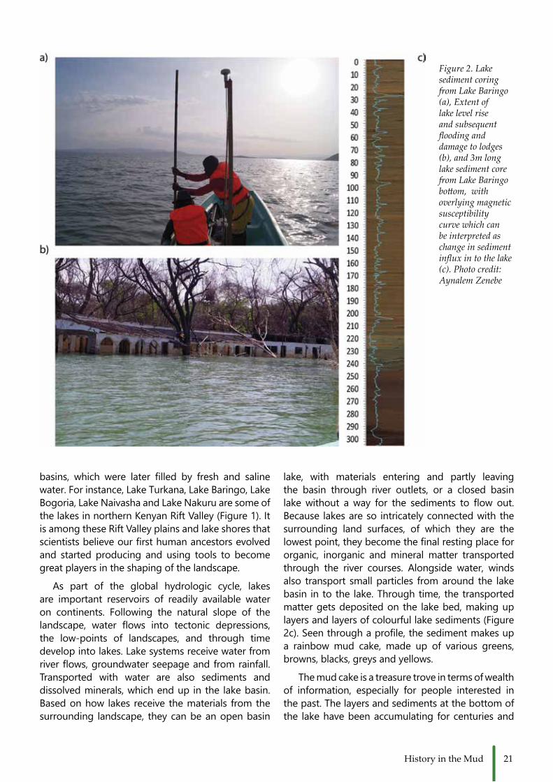
Figure 2. Lake sediment coring from Lake Baringo (a), Extent of lake level rise and subsequent flooding and damage to lodges (b), and 3m long lake sediment core from Lake Baringo bottom, with overlying magnetic susceptibility curve which can be interpreted as change in sediment influx in to the lake (c). Photo credit: Aynalem Zenebe

22 People and Land
contain stories from our history, with the youngest stories at the top of the lake bed, and the oldest at thebottom.Sincethesedimentsthatrush intothelake rarely leave, the information that they bring is locked at the bottom of the lake until the arrival of geologistsandecologists.Thesescientists takeoutthe undisturbed sediments from the lake bed to undertake a wide range of analyses that will help them unlock the environmental history of the lake catchment(Figure2a).
First they establish the age of the sediments in the core by radiocarbon dating. Establishing thetime frame is essential to know the chronological sequences of events. Next, they record themagnetic behaviour, colour, texture, and chemical characteristics like the concentration of minerals andorganicmatterinthecore.Plantpollenarealsopreserved within the cores, as well as animal and plant remains which were deposited in the lake with the sediment.Thephysicalandchemicalcharacteristicsof the sediment, and the biological remains trapped inside act as indicators of past environments. Forexample, higher concentrations of grass pollen and smaller amounts of tree pollen in a particular area of the core can indicate that the region was once more openandgrassythanitistoday.Mineralspresentinthe sediments can also tell us how the soils around the lake were once eroding, or how organically rich theywere.
You may ask why we are so concerned aboutthepast.Basedonobservationsof today,wehaveto understand the past to come up with sustainable solutions for the environmental problems that our generationisfacing.Understandingthepastiskeytoour understanding of the environmental and climate variabilitywewitnesstoday.AstheScottishgeologistJamesHuttonexplained:“…fromwhathasactuallybeen, we have data for concluding with regard to thatwhichistohappenthereafter…”.
Take for instance Lake Baringo in north centralKenya.Thislakehasseenlargefluctuationsinrecentlakelevels,attimesrecedingandattimesflooding.This has led to the question whether this was causedbyhumanactivitiesornaturalprocesses.Tounderstandmoreaboutpastlakelevelfluctuations,human activities, land degradation and soil erosion, we can use the techniques described above. Fromhistorical records we know that in the early 20th century, recurrent droughts and pressure from pastoralism caused severe soil erosion, in which large amounts of soil were being deposited in the
lake bed. Measuring the magnetic susceptibilityand analysing the geochemistry of the mud from Lake Baringo showed an accelerated sedimentdeposition. This started around the 1920s, whenpeople started accumulating larger herds of cattle andespeciallygoats.Goatsareparticularlyadaptedto dry environments and droughts, and can degrade the small vegetation that acts as an important cover for the loose soils of the Baringo lowlands.The information obtained from lake sediments can be crosschecked with historical records, which have documented similar stories. Such studies areinterested in retrieving uninterrupted information aboutpastlandscapechanges.
Learning frompastenvironmentalchangescanhelp strengthen present day policy and decisions about infrastructure development around lakes.An exemplary case from the recent Lake Baringofloodingcanbeseenfromthedamageitcausedtolodges, schools and farm lands in the surrounding lowlands(figure2b).Longtermenvironmentaldatais needed to have robust and informed policies on theuseofthelakeandthesurroundingecosystem.Historical and meteorological data sources are
Figure 3. The winding Perkerra River transporting mud to Lake Baringo and trapping a glimpse of the past along its way. Photo credit: Geert van der Plas

23History in the Mud
fragmentary inthispartofEastAfrica.Asaresult,such scientific researchon lake sediment archivescan provide crucial data about long term lake behaviour and more importantly, to understand the interaction between the lake and the surrounding landscape.
From the perspective of environmental research, lakes are very crucial sites and storytellers. When theright natural conditions are fulfilled, theyhold key information about the surrounding landscape changes and land use practices of past generations. Themud in lake beds can be regarded as a natural archive, a book in which the environmental history of the landscape iswritten.
Je, unajua jinsi hayo mazingira ya kaskazini mwa Kenya yalivyokuwa mamia ya miaka iliyopita? Kama ukijibu kuwa ‘nitajuaje wakati ambapo huko sijawahi kukuona ama kukaa’, basi katika kutafuta majibu yapasayo, habari hii itakupeleka hadi chini kabisa ya ziwa lililo karibu sana nawe ambapo ni mahali palipofichika hazina ya maarifa. Maziwa huhifadhi(au hutunza)elimu ya thamani kuhusu mazingira, katika sehemu ya chini kabisa ndani ya matope. Na hii inaweza kutufahamisha kuhusu mabadiliko ya kale yaliyotokea katika maeneo ya karibu-yaani maeneo yanayozingira au yanayozunguka mahali. Katika eneo la Afrika ya Mashariki tunaishi katika maeneo yasiyo tulivu. Tunahitaji kuelewa jinsi ambavyo mazingira ya asili yamekuwa yakibadilika huko nyuma na kutabiri au kukisia hali ya mbeleni. Maziwa yetu ni makavazi za asili zilizo muhimu na matope yaliyo chini ya ziwa yanaweza kuchukuliwa kama ni kitabu ambamo ndani yake imeandikwa historia ya mazingira.
Figure 4. Cattle herded in the swamps of Lake Baringo, which hold some of the valuable history in the mud. Photo credit: Aynalem Zenebe

24 People and Land
E ast Africa as it was a few thousand years ago is described as a lush
green landscape with many large lakes. It looked very different from today’s comparatively dry landscape. But how do we know what the landscape looked like thousands of years ago? We take a look at the life of a pollen grain, and how it will help us uncover the past.
Someplace, somewhere, sometime,a beautiful flower releases its pollengrains. They are the carriers for theplant’s next generation; tiny, microscopic reproduction cells that are released by the thousands. Pollen are picked upby the wind or by insects and taken to fertilize other flowers. Some pollenwill land intoa femaleflowerand thusfertilize it and produce the seeds that will growintoanewplant.Butmostofthepollen is blown away by the wind and neverfindsanotherflower.
Most plants produce a lot more pollen than needed to ensure reproduction and this fact is useful for us - the scientists who are interested in plant life. Thepollen, spread across kilometers by the wind, will sometimes end up in lakes or swamps.And if theconditions in theseplaces are right, it will be preserved thereforaverylongtime.Whatmakeslakes and swamps such excellent storage places? It is their ability to build up a
recordofeverythingitcollectsovertime.Pollen lands in a lake and sinks to the bottom. Here it will stay together withother material such as sand and clay to form the lake sediments. Year afteryear a new layer will be added, storing the remains of plants for hundreds and thousandsof years.Wecanaccess thisnatural archive with specialized coring equipment, taking out a tube of mud from the bottom. Because the newerlayers are placed on top of the older ones, wecanjourneybackintimethroughthecore with the youngest material at the topandtheoldestatthebottom–thegeologiclawofsuperposition.
Everyfloweringplantproducespollenand for every plant the pollen looks differently. These differences allow usto link the pollen to the correct plant.Whenwelookatthemodernvegetationwe can also recognize different typesof vegetation that are driven by environmentaldifferences.Theseincludesavanna, montane forests, rainforests, mangroves, tundras. These differenttypes of vegetation are characterized bydifferentplant types. It is importanttosorttheplantspecieswefindintheseseparate vegetation types, as they can giveusspecificinformationaboutvariousenvironmentalconditions.Eachtypecanbe linked to factors such as rainfall or
Life of a Pollen Grain
Coring: is the drilling of the sediment/soil to obtain a core sample (usually a cylindrical section). There are different methods of coring used depending on the environment. For example, use of a Russia D-corer in a small swamp or a Livingstone corer in a lake. The cores are retrieved in overlapping sections. When a core is retrieved radiocarbon dating can be carried out at different levels to determine the age of the organic material.
Processing: pollen processing involves use of various bases (KOH, NaOH) and acids (HCL, H2SO4) to breakdown the organic matter and have better visualisation of the POLLEN.
Photo credit: Nik Petek
From the swamp to the lab and then under a microscope. This is how pollen, a tiny piece of evidence, is retrieved.

25Life of a Pollen Grain
Identification and counting: using a high powered microscope to observe the pollen and preserved samples or photographs to identify the pollen, the pollen grains are counted. The data is then used to develop pollen diagrams which describe vegetation change along the layers and if the sediment is dated this gives vegetation change over time. Vegetation information is useful in inferring climatic and other climatic changes.
drought, temperature, and elevation. Itcan also indicate human impact in the form of grazing, agriculture, or urban development.This information is vitallyimportant to understand how an area has been changed in the past and what mayhappeninthefuture.
If we now take a slice out of oursedimentcoreandlookatthedifferentpollentypes,wecanseeallthedifferentplant species that lived in the area at that time.
Then we link them to specificvegetation types to reconstruct the vegetation in an area over time by analyzing slices of our core at regular intervals as we move down the core andbackintime.Afterouranalysisthecomposition of the vegetation is shown as the proportion of these differentvegetation types and we can see them
change over the length of the core and thus over the course of time. The waythe proportions of the vegetation types change relative to each other can now tell us something about the changes in the environment. Expansions of themontane forests can indicate a climate that gets wetter. Cultivated plantsappearing show the appearance of agriculture in the area. When we takeall this information together we can get a good idea of the history of an area.If we combine our information withother sources, other information taken from the core, historical records and archaeology, we can reconstruct the vegetation, the climate and the history ofhumanoccupationinaregion.
Afrika ya Mashariki kama ilivyokuwa miaka mingi iliyopita inaelezwa kama ni mahali palipokuwa na mimea, nyasi na miti vilivyonawiri, pamoja na maziwa mengi makubwa. Ilionekana kuwa tofauti sana na jinsi ilivyo hivi sasa ambapo ni eneo kavu. Lakini tunajuaje jinsi maeneo yalivyokuwa mnamo maelfu ya miaka iliyopita? Hivyo tunachunguza chembe ya mbelewele pamoja na jinsi itakavyotusaidia kutambua au kubaini hali ilivyokuwa zamani.
Photo credit: Esther Nyambura
26 People and Land
W hy is it important to predict future environmental changes? How do you even
go about forecasting these changes? What is theappropriate temporal coverage of future predictions? What outputs best describe future projections ofchange? The need to answer and understand these important questions has led to a growing body of interdisciplinaryresearchwithanobjectivetobetterpredictfutureenvironmentalchanges.Environmentalforecasting is a process based on assessing past and present environmental conditions and the processes of change which can then be used to inform the future onpotentialchanges. It ismainlydoneto increasethe understanding of past and present events and to help in decision making and strategic planning of future events. Specifically, it provides practicalinformation on the direction, speed and intensity of environmentalchange.
East Africa is known as the cradle of humankind, with Kenya having the oldest and largest collection ofhumanfossilsintheworld.Itishometoadiversegroup of people who are characterized by multiple languages, cultures, livelihoods and religions.Ecosystems in East Africa range from mountains, rivers,
the great lakes and deserts, and are distinguished byvaryingclimates,geology,topography,floraandfauna.MostofthelakesarefoundintheGreatRiftValley;whichdefinesasignificantportionoftheEastAfrican landscape running from Ethiopia through KenyaandTanzaniaintoMozambique.Additionally,EastAfricaisalsohometothebigfive:lion,leopard,elephant, rhinoandbuffalo;andrecordsanumberof endemic plant and animals species (Figure 1) with varyingconservationstatus.
Like other regions around the globe, EastAfrica has experienced rising temperature and changing rainfall patterns which affects the flowofecosystemfunctionsandservices. Inadditiontochanging climate, its population density has been increasing rapidlyover theyears.According to thePopulation Reference Bureau, the current (2014)human population in Kenya, Uganda and Tanzania is 43.2, 38.8 and 50.8 million people respectively.Theprojectedpopulation for these threecountriesin2050willbe81.3,104.1and129.4millionpeoplerespectively.Morethanhalfofthispopulationlivesin rural areas and depends on natural resources for their livelihoods.Forexample, localcommunities in
Looking into the Future
The silhouette of Acacias covering the wooded savannahs found across much of Kenya. Photo credit: Rebecca Kariuki

27Looking into the Future
East African rangelands have maintained pastoral livelihoodsforthousandsofyears(Figure2).Throughtheir migrations, which were dependent on the cyclic patterns of rainfall, they maintained the integrity of the rangelands by allowing the system to recover afteruse.
Over time, however, due to the increase of human population, change in land tenure systems and socio-economic development, most pastoral communities are now practicing mixed subsistence farming while others have completely changed to subsistence or cash crop farming. Moreover, pastoralists arenow building permanent settlement structures and social amenities further reducing their movements and changing their livelihoods. Changes in humanpopulation density coupled with climate and land use change by pastoral communities in rangelands leadstomodificationsoftheland-climatedynamicsofthisecosystem(Figure3).
A study on the long term dynamics of East African ecosystems in relation to changing climates, land use and human population can be used to show the resilienceoftheecosystemsovertimeandspace.Thisstudy can best be described using a multidisciplinary approach in combination with agent and process based models that would show long term changes, spanningoverseveralcenturies,overspace.
TheEUfundedREALprojectaimsatunearthingthechanges in time and space of human-environment interactions in East Africa using a multidisciplinary approach. Socio-ecological interactions arebeing studied over a range of temporal scales, starting from the past millennia until the present
day. Palaeoecological data from lake and swampsediment archives are being used to generate past ecosystem changes related to natural and human influences. Past human settlement and landscapemodifications will be added from archaeologicaldatainput.Thegoalofthesedataproxieswillbetoprovide information on past human-environmental interactions and coupled with present social-ecological dynamics, future scenarios of change can becreatedusingmodels.
Let’s talk about models
Modelsarerepresentationsofrealsystems.Theyare used as practical substitutes for real systems when it is easier to work with a substitute rather than a complexactualsystem.Manyofushaveusedmodelsconsciously or subconsciously. For example, thesimplifiedpicturesofthecomplexenvironmentsthatwe carry in our minds, or an economist’s graph, or an architect’sblueprintareexamplesofmodels.Modelsexplain how systems work, the interconnections in a system, the patterns and trends observed and theyprojectfuturechangesinasystemwhensomeaspectsof thesystemchange.Theyarenotmeantto predict reality as it should happen but are created to give possible directions and intensity of change if thecurrentstateofaffairscontinuesorifitchanges.Howdowetell thecharacteristicsofa realsystemthat can be included in a model? And what is the best temporal coverage of a model? To answer these questions, the purpose of the model should be well defined,atthebeginningoftheresearch,andusedasafilterthatwillignoreunimportantcharacteristics
ofasystemortreatthemlightly.
Models use equations to show theinterconnectionsinthesystem.Therearedifferenttypesofmodelsusing different approaches andlanguage. Environmental andsocial studies, which are conducted bytheREALproject,useagentandprocess based models to show the interactions between climate, landscapes and societies. Agentbased models treat individuals or agents independently in their interactions with each other and withthelocalenvironment.Processbased models use theoretical understanding of environmental processes and simulate detailed
Figure 1. Grevy’s Zebras (Equus grevyi) at Lewa Wildlife Conservancy, Laikipia, Kenya. The largest of all wild equines is endemic to northern Kenya and parts of Ethiopia. Photo credit: Rebecca Kariuki
28 People and Land
physical and biological interactions in the system.These models can be used independently or coupledtogether.Theyareusefulinenvironmentalforecasting due to their ability to be calibrated and validatedbypastandcurrentdata.Thismeansthathindcasting can be used for testing models using past data which is then used to inform the present and the future. This is very vital as according toSteve Jobs, 2005 “You cannot connect the dotslooking forward; you can only connect them looking
backwards. So youhave to trust that thedotswillsomehowconnectinyourfuture”.Connectingthesedots leads to practical environmental forecasting and creating future scenarios of human-environmental interactionsinEastAfrica.Ultimately,completingthefascinating and informative story of the resilience of themagnificent East African landscapes and itslovelyinhabitants.
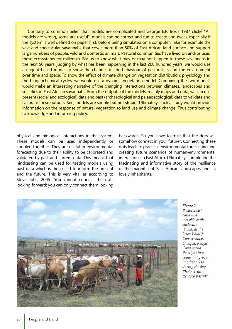
Figure 2. Pastoralists’ cows in a movable cattle enclosure (boma) at the Lewa Wildlife Conservancy, Laikipia, Kenya. Cows spend the night in a boma and graze in other areas during the day. Photo credit: Rebecca Kariuki
Contrary to commonbelief thatmodels are complicatedandGeorgeE.P.Box’s1987 cliché “Allmodelsarewrong,someareuseful”,modelscanbecorrectandfuntocreateandtweakespeciallyifthesystemiswelldefinedonpaperfirst,beforebeingsimulatedonacomputer.Takeforexamplethevast and spectacular savannahs that cover more than 50% of East African land surface and support largenumbersofpeople,wildanddomesticanimals.Pastoralcommunitieshavelivedonand/orusedtheseecosystemsformillennia.Forustoknowwhatmayormaynothappentothesesavannahsinthenext50years,judgingbywhathasbeenhappeninginthelast200hundredyears,wewouldusean agent based model to show the changes in the behaviour of pastoralists and the environment overtimeandspace.Toshowtheeffectofclimatechangeonvegetationdistribution,physiologyandthebiogeochemicalcycles,wewoulduseadynamicvegetationmodel.Combiningthetwomodelswould make an interesting narrative of the changing interactions between climates, landscapes and societiesinEastAfricansavannahs.Fromtheoutputsofthemodels,mainlymapsanddata,wecanusepresent (social and ecological) data and past (archaeological and palaeoecological) data to validate and calibratetheseoutputs.See,modelsaresimplebutnotstupid!Ultimately,suchastudywouldprovideinformationontheresponseofnaturalvegetationtolanduseandclimatechange.Thuscontributingtoknowledgeandinformingpolicy.
29Looking into the Future
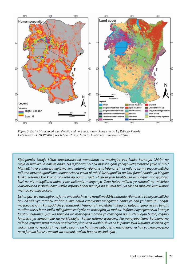
Figure 3. East African population density and land cover types. Maps created by Rebecca Kariuki Data source – UNEP/GRID, resolution - 2.5km; MODIS land cover, resolution - 0.5km
Kipingamizi kimoja kikuu kinachowakabili wanadamu na mazingira yao katika karne ya ishirini na moja ni badiliko la hali ya anga. Na je,lilianza lini? Ni mambo gani yanayolileta,matokeo yake ni nini? Maswali haya yanaweza kujibiwa kwa kutumia vifananishi. Vifananishi ni mifano kamili inayowakilisha mifumo inayoshughulikiwa inapoonekana kuwa ni rahisi kushughulika na kitu fulani badala ya kingine kuliko kutumia kile kilicho na utata au ugumu zaidi. Hueleza jinsi taratibu za uchunguzi zinavyofanya kazi na pia miingiliano baina yake vikitumia milinganyo. Tena hutoa mifano ya sampuli na mielekeo vilivyokwisha kushuhudiwa katika mfumo fulani pamoja na kukisia hali ya siku za mbeleni kwa kubuni mambo yatakayotokea.
Uchunguzi wa mazingira na jamii unaoedeshwa na mradi wa REAL hutumia vifananishi vinavyowakilisha hali na vile vya taratibu za hatua kwa hatua kuonyesha miingiliano baina ya hali ya hewa (au anga), maeneo na jamii katika Afrika ya mashariki. Vifananishi wakilishi huibua au hutoa mifano ya vitu binafsi au vifananishi huru katika miingiliano kati yake na mazingira ya mahali. Mifano inayoegemezwa kwenye taratibu hutumia ujuzi wa kawaida wa mazingira,mambo ya mazingira na huchipua(au hutoa) mifano fananishi ya kimaumbile na ya kibiolojia katika mfumo wenyewe. Na yanayopatikana kutokana na mifano yenyewe,hasa romani na vielelezo,vinaweza kuidhinishwa na kupimwa kwa kutumia vielelezo vya wakati huu na viwakilishi vya huko nyuma na hatimaye kubainisha miingiliano ya hali ya hewa,maeneo nazo jumuia kuhusu wakati wa zamani, wakati huu na wakati ujao.

30 People and Land
C owsneedgrass.Cowsneedwater.Andcowsneed salt. The same goes for goats, sheep,
camels and all other livestock, across the world.These resources are found on specific areas ofland distributed over the landscape, and are not always available at the same place or at the same time.Pastoralistsmovewiththeirlivestockacrossthese landscapes traversing distances in order to find the exact places for pasture and water fortheir herds and flocks. Pastoral landscapes areoften divided into wet season and dry season grazingareas.Thewetseasongrazingareashavegreen grass only during and shortly after the rains have started, whereas the dry season grazing areas have permanent water stocks, a higher rainfall,oradifferentgrazingmanagementsystemand therefore grass availability throughout the year.Dry seasongrazingareascanbe found, forinstance, along rivers or on higher altitudes where more rainfall occurs, but also on land that has been managed in such a way that grass is still available after a period without rain. Pastoral movement,
then, occurs between these so-called wet season and dry season grazing areas and also between dry season grazing areas, when pastures and water areexhausted.
Pastoralists have plenty of reasons and motives to follow certain routes - the pathways between the wet season and the dry season grazing areas - to reachspecificplaces.Theecologicalmotives,suchas available water points and abundance of grass to graze along the way; but also the existence of diseaseswhichneedtobeavoided.Oreconomicmotives,suchaslivestockmarkets.Therearealsosocial motives. For instance pastoralists oftenmove together and group their herds with others, especially when routes are followed by family and clan members. Lastly, political motives, whenimportantandinfluentialpoliticalleaderssupporttheir constituents to follow certain routes and to reach particular places, which is sometimes used for political gains; or to avoid routes and regions thatareusedbyotherclanssoastoevadeconflict.
Cows and Calves Crossing the Bridge
Cows crossing the bridge from Samburu to Laikipia. Photo credit: Annemiek Pas Schrijver
31Crossing the Bridge
This piece will focus on temporary pastoral movement and mobility encompassing the seasonal search for grass and water throughout the landscape resulting in specific pathways taken bypeople, and their animals. Letus take thecaseoftheSamburupastoralistslivingincentral-northernKenya,inSamburu,LaikipiaandIsioloCounty.TheSamburu are pastoralists closely related to theMaasai.TheybothspeakMaaandshareceremoniesand traditions such as the circumcision of their boys into warrior-hood and a social system promoting the power of elders. Obviously, there are majordifferencesbetween theSamburuand theMaasaiaswell,ofwhichthemaindifferenceisthedistancemovedwiththeircattletofindgreenpastures.
Although the highest percentage of Samburulive in Samburu County, overtime a number of Samburuhave moved southwards from Samburu County to settle inLaikipia County. In contrast,the Maasai of Laikipia livepredominantly in Laikipia.The landscape, vegetation, environmental conditions and land use in SamburuCounty, which is considered lowland where less rainfall occurs, demands an increased level of mobility in search for water and pasture. This is incontrast to the short distances moved by pastoralists living in Laikipia County, where thehigheraltitudeandadifferentrainfall pattern allow grass to grow throughout the year.As a result, the Samburupastoralists travel further to reach grass and water, and, hence, make use of large tracts oflandtomovethrough.
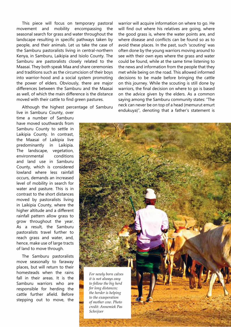
The Samburu pastoralistsmove seasonally to faraway places, but will return to their homesteads when the rains fall in their areas. It is theSamburu warriors who areresponsible for herding the cattle further afield. Beforestepping out to move, the
warriorwillacquireinformationonwheretogo.Hewill find out where his relatives are going, wherethe good grass is, where the water points are, and wherediseaseandconflictscanbefoundsoastoavoidtheseplaces.Inthepast,such‘scouting’wasoften done by the young warriors moving around to see with their own eyes where the grass and water could be found, while at the same time listening to the news and information from the people that they metwhilebeingontheroad.Thisallowedinformeddecisions to be made before bringing the cattle onthisjourney.Whilethescoutingisstilldonebywarriors,thefinaldecisiononwheretogoisbasedon the advice given by the elders. As a commonsayingamongtheSamburucommunitystates:“Theneck can never be on top of a head (memurut emurt endukuya)”, denoting that a father’s statement is
For newly born calves it is not always easy to follow the big herd for long distances; the herder is helping to the exasperation of mother cow. Photo credit: Annemiek Pas Schrijver

32 People and Land
finalandconclusive.The‘scouting’thesedaysoccursrather differently. With the existence of mobilephones and proper network all around SamburuCounty and beyond, information is exchanged betweentheyoungwarriorsbytextingandcalling.Therefore, the warriors do not physically check the situation anymore but rely on their friends’, age-mates’andclan-affiliates’opinions.Stilldependingon the advice given by the elders, the warriors will spend less time scouting the route and will decide wheretogo.
The warrior takes cattle in grouped herds, including his own cattle, the cattle of his father, and often cattle of uncles and brothers as well.Warriorsoftengotogetheringroupsofaboutfourorfiveherds.Eachwarriorisresponsibleforaherd,andoftena siblingwill assisthim lookingafter it.Warriors moving together come from the sameareaandmove togetherbecauseof safety issues.It is better to have a bigger herd andmore eyeswhen moving through areas with a high number ofwildlifeforexample.Moreover, inconflictareaswarriors group together and alternate herding and surveillance so as to improve security for both cattle andwarriors.Alongtheway,phonecallshavebeenmade to relatives to ask if it is ok that some warriors with cows are coming, and if they can sleep at their enkang(homestead)foranight.Thisisoftennotaproblem, as long as the warriors do not stay with theircowsformorethantwotothreedays.Assuch,thegroupkeepsonmovinguntiltheyfindthegrassthat they were looking for. The movement fromhomestead to the desired pasture takes about seven days and during those seven days government, community and private land are passed. Hence,depending on the relations and negotiations with these other land owners, the warriors may be allowed to graze their cattle on their land for a few days.ThesecommunitygrazingareascanbefoundwhentheSamburuwarriorsmovetothenorthandnorth-eastofSamburucounty.
Also, a large group of Samburu pastoralistswill move southwards, to Laikipia County. Land inLaikipiaCountyhoweverismostlyprivateland,usedfor farming, ranching, nature conservation, cities, infrastructureandurbandevelopment.Especiallytheranch and conservation areas hold grass for longer periods of time and are therefore useful and popular areas by the Samburu pastoralists during the dryseason.
Hence, Samburu pastoralists are not the only
land users in Laikipia. Moreover, they don’t onlypass through this highly diverse landscape but also needtouseitfortheprovisionofgrassandwater.As a result, there is a struggle over access to grass between private land owners and the Samburu,capableofcausingconflictduringthedryseasons.In most cases, however, the Samburu successfullynegotiate with the land users, such as the Maasai, the commercial cattle ranchers and nature conservancies and the maize farmers, to allow grazing. Goodrelations are needed so that the temporary visiting Samburu can access grass andwater for a limitedprice permonth per cow. In other cases, enteringprivate or community land without permission createsconflicts.Whentherains fallagain,backathome,theSamburuwarriorswillreturntoSamburuCounty, as there will be grass available and only daily movement with the cattle is needed. This isalso the time when most of the weddings and other ceremonies will take place, as there is milk and meat around, as well as the warriors who are needed for theceremonialsongsanddances.
When moving to and through such a diverselandscapefromSamburuintoLaikipia,thepastoralists,on their way to pasture, have to adapt, organize, and reorganize their movement and access strategies to find grazing for their livestock. Sometimes thishappens through negotiations, sometimes through clanandfamilyaffiliations,andsometimesthroughentering‘illegally’bynight.SuchseasonalmobilityispartandparceloftheSamburuwayoflife.Mobilityisembedded in the social, economic and political order of daily life, and persists throughout both internal andexternalchanges,difficultiesandrisks.
Wafugaji husafiri na mifugo yao katika maeneo, wakitembea safari ndefu ili kuwatafutia ng`ombe, mbuzi na kondoo wao malisho na maji. Ingawa maeneo, maarifa na matumizi ya ardhi na usimamizi wake vinabadilika, safari hizo bado zinaendelea kufanywa na ni muhimu kwa maisha. Makala hii inatumia mfano wa wafugaji wa Kisamburu wanaoishi Kenya-kaskazini ya kati, kueleza jinsi wafugaji hao wanavyosafiri katika maeneo yenye uasili tofauti mno na kisha yenye mipaka mipaka-kati ya nchi yao na nchi zingine na katika nchi yao kwenyewe.
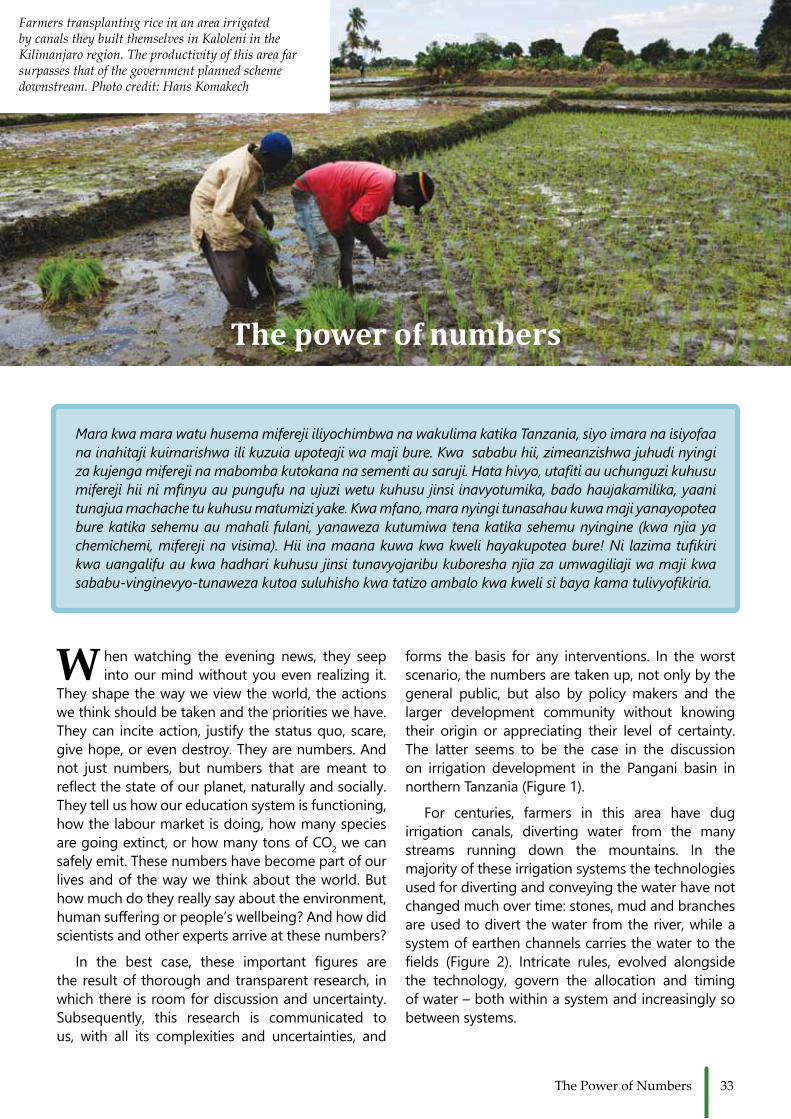
33The Power of Numbers
The power of numbers
forms the basis for any interventions. In theworstscenario, the numbers are taken up, not only by the general public, but also by policy makers and the larger development community without knowing their origin or appreciating their level of certainty.The latter seems to be the case in the discussion on irrigation development in the Pangani basin in northernTanzania(Figure1).
For centuries, farmers in this area have dug irrigation canals, diverting water from the many streams running down the mountains. In themajorityoftheseirrigationsystemsthetechnologiesused for diverting and conveying the water have not changedmuchovertime:stones,mudandbranchesare used to divert the water from the river, while a system of earthen channels carries the water to the fields (Figure 2). Intricate rules, evolved alongsidethe technology, govern the allocation and timing ofwater–bothwithinasystemandincreasinglysobetweensystems.
Mara kwa mara watu husema mifereji iliyochimbwa na wakulima katika Tanzania, siyo imara na isiyofaa na inahitaji kuimarishwa ili kuzuia upoteaji wa maji bure. Kwa sababu hii, zimeanzishwa juhudi nyingi za kujenga mifereji na mabomba kutokana na sementi au saruji. Hata hivyo, utafiti au uchunguzi kuhusu mifereji hii ni mfinyu au pungufu na ujuzi wetu kuhusu jinsi inavyotumika, bado haujakamilika, yaani tunajua machache tu kuhusu matumizi yake. Kwa mfano, mara nyingi tunasahau kuwa maji yanayopotea bure katika sehemu au mahali fulani, yanaweza kutumiwa tena katika sehemu nyingine (kwa njia ya chemichemi, mifereji na visima). Hii ina maana kuwa kwa kweli hayakupotea bure! Ni lazima tufikiri kwa uangalifu au kwa hadhari kuhusu jinsi tunavyojaribu kuboresha njia za umwagiliaji wa maji kwa sababu-vinginevyo-tunaweza kutoa suluhisho kwa tatizo ambalo kwa kweli si baya kama tulivyofikiria.
W hen watching the evening news, they seep intoourmindwithoutyouevenrealizingit.
They shape the way we view the world, the actions wethinkshouldbetakenandtheprioritieswehave.Theycan inciteaction, justifythestatusquo,scare,givehope,orevendestroy.Theyarenumbers.Andnot just numbers, but numbers that aremeant toreflectthestateofourplanet,naturallyandsocially.They tell us how our education system is functioning, how the labour market is doing, how many species are going extinct, or how many tons of CO2 we can safelyemit.Thesenumbershavebecomepartofourlivesandofthewaywethinkabouttheworld.Buthow much do they really say about the environment, humansufferingorpeople’swellbeing?Andhowdidscientists and other experts arrive at these numbers?
In the best case, these important figures arethe result of thorough and transparent research, in whichthereisroomfordiscussionanduncertainty.Subsequently, this research is communicated tous, with all its complexities and uncertainties, and
Farmers transplanting rice in an area irrigated by canals they built themselves in Kaloleni in the Kilimanjaro region. The productivity of this area far surpasses that of the government planned scheme downstream. Photo credit: Hans Komakech

34 People and Land
However, their existence is not uncontested.Already in colonial times this system of water abstraction was accused by colonial powers of worsening water shortages. At that time, thesituation was remarkably similar to the current challenges: water was a scarce resource, withdifferent sectors claiming a stake. Downstreamhydropower generation was given priority over agricultural and urban use, and there was a continuous search for more water sources. Evenmore so, the water department already indicated in 1952 that no more water use permits should be given to irrigation systems, something which has provenuntenableinthedecadesafter.Apartfromsearching for new water sources through repeated hydrological research, a strong focus lay on monitoringandcontrollingwaterabstraction. Thefarmerbuiltsystemsdidnotfitwellintothisstrategy.Theirmultitude,interconnectedness,andunofficialcharacter made it difficult for the authorities tomeasureorcontrolwaterflows. Inaddition,manycanals leaked large amounts of water, which ran back to the river, into another canal or seeped into theground.
This apparent lack of structure and “proper”,western engineering caused colonial engineers to
labelthesefarmerbuiltcanalsystemsasinefficient,meaning that the percentage of water that is lost is high. This label has proven to be surprisinglypersistent, showing up in plan after plan, report after report, leading up all the way to the most recent irrigationpolicy from2010. It is frequentlymentioned as the main reason for intervening in these farmer managed systems, resulting in water fees, concrete structures and government initiated watermanagement organizations. All in all, largesums of donor and government money are being spent, under the assumption that this will improve theselowefficiencies.
Nowhere is thecatch:whengoingback intheliteratureinanattempttofindtheoriginalresearchshowing these low efficiencies (10%-30%), onerunsintoadeadend.Almostnoempiricalstudieswere done to analyze the efficiencies of differentirrigation canals in Tanzania; the rare exceptions often being vague about their methods and specificresearchconditions,soitbecomesdifficultto generalize. Reports make references to otherreports, which reference again another, but at the base of it all is nothing more than an impression from a single author. Through repetition, thisimpression becomes a fact, informing government
Figure 2. Farmer dug canals leading water to the fields. Photo credit: Chris de Bont

35The Power of Numbers
and donor policy and spending and rigorously impactingwatermanagementontheground.
This is not to say that these farmer-built canals do not lose water along the way, but that we do not really know the extent and impact of these losses.Watermightreturntotheriver,beusedbyanother farmer or resurface further downstream throughsprings(Figure3).Ifthisisthecase,whatdoes efficiency really mean? If the argument ofenhancing low efficiencies is that, by changingfarmer-managed irrigation systems to match western ideas of proper engineering we save water, a better understanding of when water is actually lostcouldhaveamajorimpact.
Furthermore, is the focus on preventing losses the only right one? What about the farmers’capability to make sure that water is delivered according to schedule, so that water delivery is reliable and can enable planning of crops?Whatabouttheoverheadcostsofmanagingwater?Whatabout the fairness and equality of water access within a system? All these aspects are as much part of the overall irrigation performance as the amount of water that seeps from the canals, and are at the heartofwhetherasystemissuccessfulornot.
Figure 3. One farmer’s loss is the other one’s gain. Photo credit: Chris de Bont
Thefocusondoubtfulnumbersofefficiencyoffarmer-built irrigation canals is a powerful political tool in supporting certain ideas of what good water management looks like, but it obscures the complexity of these canals and the challenges of researchersinassessingtheirperformance.
Sonexttimeyouhearanumber,anumberwhichtries to tell you something about the world and possible pathways to improvement, consider this:who came up with that number, how did they do it, and does it tell you the whole story?

36 People and Land
E lectricityisoneofthemostsignificantinventionsever made. It is crucial in our everyday life
regardlessofourstatusinsociety.Electricityisusedfor running machines in industries for the production of goods that we require, in hospitals for medical equipment, in agricultural production, lighting and fordomesticpurposessuchascookingandheating.Those who live or have experienced life in Eastern Africa are familiar with, or perhaps have their own, ‘blackout’ stories: From students studying for finalexaminations the night before; academics hoping to submit their research grant applications online before the deadline; an individual taking a hot shower on a cold morning when the blackout hits, to corporate entities that run into millions of shillings worth of losses due to power outages. Power rationingand frequent blackouts disrupt schedules, cause inconveniencesandgreatlosses.
Kenya has for many decades contended with electricity shortages. There are two explanationsfor this situation: one, Kenya derives most of herelectricity from hydropower, which is dependent upon climatic conditions. For example, during droughts,water levels in major dams decline and electricityproductionsubsequentlydeminishes.Ifthisdroughtpersists, measures such as rationing have to be put in place to balance between power production and
supply and to ensure that electricity is distributed fairly among the entire population. The droughtsof 1998-2000, 2004/2005 and 2009 resulted in big economiclossesofmorethan$2.8billion.Secondly,the electricity production also utilizes fossil fuels.Duetofluctuationsinglobaloilprices,thisisoftenveryexpensive.Today,only8.1%ofthepopulationinKenyahasaccesstoelectricity.
The Kenyan government, through its ambitious Vision 2030 policy, has stipulated that the pathway to economic prosperity, environmental and social wellbeing, isbyadoptinggreenenergysolutions.Greenenergyherereferstomethodsofelectricityproduction that have low or no carbon emissions, meaning that less fossil fuels or none, will be used. As a result, renewable energy sources suchas solar,windandgeothermalarepromoted.Theother advantage is that with this kind of energy it is possible for the country to be involved in the global carbon market, which refers to trading in carbon with, for example, developed countries whose carbon dioxide emissions exceed the internationally required standards. The thought behind this isthat electricity production from green sources is themostcosteffective;thismeansthatthecostofelectricity will decline and therefore more people will have access to it. Also, the current problems
The Steaming Landscapes
The harvesting of geothermal springs in Olkaria gives the appearance of smoke coming out from the ground, but the geothermal plant also creates a noisy environment. Photo credit: Christin Adongo

37Steaming landscapes
of power rationing will be reduced or better still, eliminated.
One way that the government is trying to switch to green energy is by encouraging geothermal powerproductioninthecentralRiftValley.Researchhas indicated that the potential of this region for sustainableelectricityproductionishigh.Thisisdueto the unique volcanic geological formations, which makes it possible to harness steam in sufficientquantitiesforelectricityproduction.Ofthepotentialgeothermal areas, the Olkaria geothermal field,most of which lies within the Hellʹs Gate NationalPark, isrankedfirst. It isalsohere inOlkariawheregeothermal power production is already ongoing.Todate,therearefiveoperationalplantsinOlkaria,whichcontributeabout180MW.Thisby far isstilllow compared to the Kenyan population electricity demandof1,354MW.
Plans to increase this production are already being implemented in the Greater Olkaria GeothermalArea, which comprises the Olkaria volcanic complex, LongonotandMountSuswa. It isexpectedthatby2018,electricityproductionwillreach1260MW.Thisenergy development is anticipated to benefit notonly the local communities but also the country as awhole.
However, these scenic, literally steaminglandscapes, which are also potential geothermal project areas, have been home to communitieswhohavelivedoffitforgenerations.TheKikunyuki,a Maasai sub-clan, for instance, occupies most of OlkariaandSuswa.TheseMaasaistillmovebetweenthe lowlands and highlands with their livestock, in
search for water and pasture depending on whether itisrainyordry.
InSuswa,thegeothermalsteamisalsothemajorsource of domestic water. Red and white ochreformedinassociationwiththissteamisasignificantrequirementforMaasairitualsandceremonies.Theproduction of electricity by geothermal sources requiresextensivepiecesofland.Itsimplementation,therefore, no doubt impacts not only the ecology of the area but also, the social organization, livelihood and cultural practices of these inhabitant communities.
Already, the pastoralists of Olkaria have lost more than1700haoftheirgrazinglandandfivevillageshave been resettled in contested and fragile areas,
Ili kutoa au kuzalisha umeme, nchi nyingi katika eneo la Afrika ya Mashariki ikiwemo Kenya, hutegemea nguvu za maporomoko ya maji na za vitu vinavyotupatia moto kama vile makaa ya mawe,mafuta (petroli) na gesi ambavyo vyenyewe vimetokana na mabaki ya kale ya wanyama na mimea. Hata hivyo hali ya anga inayobadilikabadilika mno, ikipelekea kutokea kwa ukame mwingi wa mara kwa mara ukifuatana na kushuka na kupanda kwa bei za mafuta duniani, vimekuwa na matokeo kadhaa katika uwanja au sekta ya nishati, yaani nguvu kama zile za umeme, gesi na kadhalika. Basi kwa ajili ya kuwa na hali au njia ya kudumu na salama katika maendeleo ya uchumi, hali nzuri ya mazingira na jamii, Kenya imo katika mpango au mchakato wa kutoka katika chanzo chake cha nishati (au nguvu) na badala yake kufuata njia zingine zilizopo ambazo ni za kulinda au kuhifadhi uasili na mazingira kama vile nguvu za mvuke kutoka ardhini, nguvu za jua na za upepo. Utoaji wa umeme kwa njia ya mvuke katika bonde la ufa la kati ni aina ya nishati iliyokwisha kukua na kuendelea zaidi kuliko aina nyingine yoyote katika Kenya. Na hili halilingani tu na hoja inayotolewa sasa juu ya upunguzaji wa mabadiliko ya hali ya anga duniani bali pia inatarajiwa kuimarisha usalama wa mazingira. Hata hivyo utekelezwaji wa miradi hii ya mvuke umekuwa na matokeo kadhaa ya manufaa na ya madhara kwa wakaaji wa maeneo.
The current and potential geothermal areas in Kenya. Source: AFD, 2014

38 People and Land
which do not support pastoralism. A particularconcern for these Maasai is the inaccessibility of their cultural areas, which they used during ceremonies, prayersorrituals.Someofthesesignificantareashavealsobeenrenamed.This totheMaasaimeansthattheirsiteshavebeenstolenfromthem.Forexample,the stone tower called Enkaibartany, named after the mythology of a marriage procession and where child-naming ceremonies would be performed, has been renamed Fischer’s Tower. Several other sites,including an important gorge – Orjorowa, thatlinks the highland and lowland and which served asan important livestockgrazingroute –arenowinaccessible. There are also health concerns frompollution:highsulphurdioxideemissions,brinespillsandprolongednoiseexceeding105db.
The fact that the Maasai occupying these areas do not legally own the land has brought a lot of contention especially insofar as compensation and resettlementforgeothermalharvestingisconcerned.
The ecological environment has not been spared either; the long winding networks of pipes, wells and road networks construction for the industry have already reduced the vegetation cover by more than 30%. Drilling activities insensitive ecological areas have destroyed the nesting grounds of the bearded Vulture, which has now disappeared from the area. RuppelsVultures on the other hand have been pushed totheendangeredlist.TheHell’sGateNationalPark, a protected biodiversity conservation area where drilling for geothermal began, is already so degraded from the geothermal industry that it facesdegazzetementthreats.
Although this development has been largely associated with undesirable impacts to the local communities, some positive initiatives have been appreciated.Anewroadnetworktothedrillingsitesconnects the previously cut-off Masai population,tonearbymarkets,afewcasualjobsareavailabletothe inhabitants and the companies are promoting education by paying some teachers and offeringlimited sponsorship to bright but poor students.The locals view these benefits, compared to theother social, environmental, cultural and economic concernsofthegeothermalproductionasnegligible.
This geothermal development, seen as a pathway to development, has re-ignited the struggle and conflict over natural resources, experienced sincecolonialandpost-independencetimesinKenya.Thequestion then begs, is there not a way for geothermal development and the local communities to coexist? Asmuchas thisproject isof immensesignificanceboth at the global and national scales, its implication for local livelihoods and environment should not be ignored.
A displaced woman in Olkaria. Photo credit: Christin Adongo
Livestock in Olonongot village, Olkaria with geothermal steam in the background. Photo credit: Christin Adongo

39Acknowledgements
P eople and Land isaproductoftheResilienceinEastAfricanLandscapesproject.Wewouldliketothank:JohnIssittforassistinginthecollaborativewritingofPeopleandLand,Marija
Petekforassistingwiththeproduct layout,andSamuelAdongofortheSwahili translations.TheREALprojectisaMarieCurieInitialTrainingNetwork,grantnumberGA606879, funded by theEuropeanCommissionundertheSeventhFrameworkProgramforresearch,technologicaldevelopment,anddemonstration.AffiliateinstitutionsoftheREALprojectparticipantsincludeThe University of Warwick, Ghent University, University of Cologne, Stockholm University,UppsalaUniversity,L’EcoledesHautesEtudesenScienceSocialesandUniversityofYork.TheREALproject isalsosupported in largepartbyourofficialassociatepartners:MountKenyaUniversity, JomoKenyattaUniversity,UniversityofDaresSalaam, theNationalMuseumsofKenya,InstitutFrançaisdeRechercheenAfrique,theBritishInstituteinEasternAfrica,theYorkInstituteforTropicalEcosystems,theResilienceCollapseandReorganizationProject,theAfricanConservation Center, Northern Rangelands Trust, Bayer CropScience, Space for Giants, andconsultantsatU&We.ObjectivesoftheREALprojectareonlymadepossiblewiththecontinuedparticipation and assistance of the communities in East Africa in which participants work, for this wethankyou.
The REAL Early Stage Researchers at the mid-term meeting in Gent, Belgium
Contributors to this issue of People and Land are:ChristineAdongo,MaximillianJ.Chuhila,ColinCourtney-Mustaphi,ChrisdeBont,MarieGravesen,RebeccaKariuki,EricM.Kioko,EstherNyambura,AnnemiekPasSchrijver,NikPetek,AnnaShoemaker,GeertvanderPlas,andAynalemZenebeDegefa.

Back cover photo: Nik Petek ISBN: 978-0-9573771-5-8 Printed at: Tiskarna Radovljica, Slovenia; www.tkr.si


![Copy of SHERIA YA MTOTO YA MWAKA 2014[1] YA MTOTO YA MWAKA 2014[1].pdf · 94. Wajibu wa Serikali za Mtaa kuwalinda watoto na kukuza maelewano baina ya wazazi na watoto. 95. Wajibu](https://img.pdfslide.us/doc/110x75/5c7968bf09d3f2c9458c2ef9/copy-of-sheria-ya-mtoto-ya-mwaka-20141-ya-mtoto-ya-mwaka-20141pdf-94-wajibu.jpg)