Embed Size (px)
DESCRIPTION
This Annual Report documents a variety of accomplishments of Pennsylvania trail groups in the year 2012 as described by the Pennsylvania Trails Advisory Committee and its partners. It showcases successes and illustrates progress toward developing a statewide land and water trail network, one that promotes recreation, transportation and healthy lifestyles.
Citation preview

PENNSYLVANIA TRAILS ADVISORY COMMITTEE
Bridge over CSX R.R. Tracks, Schuylkill River Trail, Philadelphia
February 2013 Year 2012 Annual Report
This Annual Report documents a variety of accomplishments of
Pennsylvania trail groups in the year 2012 as described by the
Pennsylvania Trails Advisory Committee and its partners. It showcases
successes and illustrates progress toward developing a statewide
land and water trail network, one that promotes recreation,
transportation and healthy lifestyles.
Pennsylvania Trails Advisory Committee • 2012 Annual Report
Page 1
Pennsylvania Trails Advisory Committee 2012 ANNUAL REPORT
In 1992, the Pennsylvania Recreational Trails Advisory
Board (PARTAB) was created to comply with federal
legislation governing recreational trails funding. The
legislation requires states to have an advisory
committee that represents both motorized and
nonmotorized trail users and provides guidance in the
administration of the recreational trails program.
In 2009 the Commonwealth released its 2009-2013
Statewide Comprehensive Outdoor Recreation Plan
(SCORP) which called for the creation of a statewide
trails committee to help implement a land and water
trail network for recreation, transportation and healthy
lifestyles.
In 2012, after a year of planning and deliberations
with trail stakeholders throughout the state, the PARTAB
was expanded to assist the Commonwealth in carrying
out the goals and recommendations of the SCORP while
continuing to meet the requirements of the federal
Recreational Trails Program.
A major responsibility of the Committee is to present an
annual report to the Secretary of the Department of
Conservation and Natural Resources (DCNR). The annual
report details major trail accomplishments that occurred
during the year.
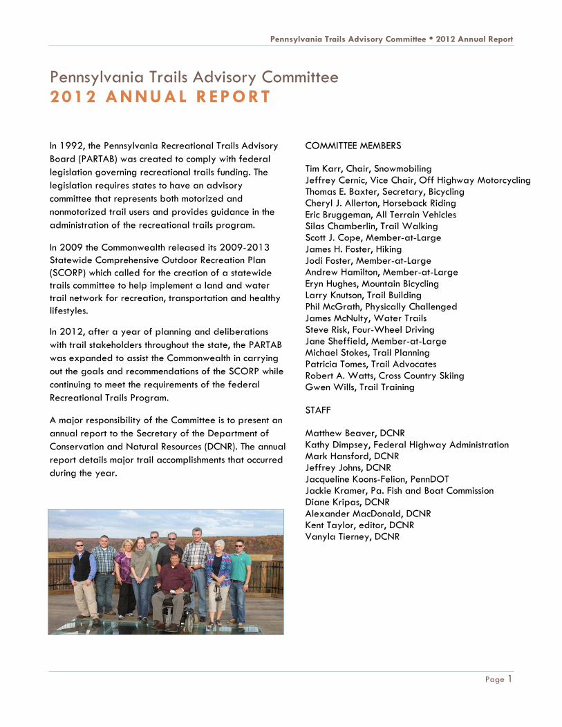
COMMITTEE MEMBERS Tim Karr, Chair, Snowmobiling Jeffrey Cernic, Vice Chair, Off Highway Motorcycling Thomas E. Baxter, Secretary, Bicycling Cheryl J. Allerton, Horseback Riding Eric Bruggeman, All Terrain Vehicles Silas Chamberlin, Trail Walking Scott J. Cope, Member-at-Large James H. Foster, Hiking Jodi Foster, Member-at-Large Andrew Hamilton, Member-at-Large Eryn Hughes, Mountain Bicycling Larry Knutson, Trail Building Phil McGrath, Physically Challenged James McNulty, Water Trails Steve Risk, Four-Wheel Driving Jane Sheffield, Member-at-Large Michael Stokes, Trail Planning Patricia Tomes, Trail Advocates Robert A. Watts, Cross Country Skiing Gwen Wills, Trail Training STAFF Matthew Beaver, DCNR Kathy Dimpsey, Federal Highway Administration Mark Hansford, DCNR Jeffrey Johns, DCNR Jacqueline Koons-Felion, PennDOT Jackie Kramer, Pa. Fish and Boat Commission Diane Kripas, DCNR Alexander MacDonald, DCNR Kent Taylor, editor, DCNR Vanyla Tierney, DCNR

Pennsylvania Trails Advisory Committee • 2012 Annual Report
Contents Page 2
CONTENTS BY REGION
Western Region
Airport Link Trail • Armstrong Trail - Great
American Clean-up • Blairsville Riverfront Trail •
Great Allegheny Passage • Kiski River Trail • Kiski-
Conemaugh Water Trail E-Interpretation Project •
Laurel Highlands Bicycle Trails • Mon Valley Bike
Tour • Montour Trail • Redbank Valley Trail –
Armstrong Trail • September 11th National
Memorial Trail Ride • Trail Assistance Mini-Grant
Program • Trans Allegheny Trails Promotion • 2012
Greenway Sojourn
Northwestern Region
Anders Run Natural Area Trail Improvements •
Clarion Highlands Trail • Franklin Connector Trail •
Kinzua Valley Trail Cache Quest • McClintock Trail •
Queen City Trail • Railroad Bridge Walkway over
Oil Creek • Samuel Justus and Allegheny River Trails
• Upper Shenango River Water Trail
North Central Region
Bloody Skillet All-Terrain Vehicle Trails • Pine Creek
Trail Connector • Snow Shoe Rails to Trails
South Central Region
Appalachian Trail • Hanover Trolley Trail • Hidden
Creek Path • Highspire Reservoir Park •
Hollidaysburg YMCA Day Camp Adventure •
Juniata River Water Trail Interpretive Panel • Lower
Trail – Mount Etna Bridge • Lower Trail Video •
Lykens Valley Rail Trail • Mainline Canal Greenway
GeoTrail • Mid State Trail • Northwest Lancaster
County River Trail • Six-To-Ten Trail • Reeds Gap
Spur Trail
Northeastern Region
Countryside Conservancy Trolley Trail • D&L Trail •
Eastern Pennsylvania Greenways and Trails Summit •
Heritage Towns and Tours Program • Jordan Creek
Greenway
Southeastern Region
Bartram’s Mile • Coventry Woods Trail • Cynwyd
Heritage Trail • 58th Street Greenway • Mason
Dixon Greenway South • Schuylkill River Parks
Connector Bridge • Schuylkill River Trail
Statewide
ExplorePAtrails.com Mobile Website • Keystone
Trails Association—Trail Care Events • Pennsylvania
Water Trails Economic Impact Study • Sensible,
Courteous, Off-Road Enthusiasts (SCORE) • Trails to
Watch in 2013
2012 SUMMARY STATISTICS
New trail miles added 74 miles
DCNR trail grant projects
completed 88 projects
DCNR and local expenditures on
completed trail grant projects $58 million
Counties with DCNR trail grant
projects completed 30 counties
Volunteer hours reported More than
4,000 hours
Unique visitors to
ExplorePAtrails.com 50,832 visitors

Pennsylvania Trails Advisory Committee • 2012 Annual Report
A Statewide Network of Trails Page 3
INTRODUCTION
Simply put, trails, both large and small, make up the backbone of Pennsylvania’s “green infrastructure.” These
trails bring health and economic benefits, invigorated communities, improved quality of life, and generally
make the state a better place to live, work and play for citizens, visitors and future generations.
In 2012, trails were built, restored, celebrated, and reimagined by hundreds of volunteers, stakeholders and
user groups who share the grand vision of a seamless, statewide network of trails and work tirelessly to make
this vision a reality. Countless hours of dedicated work by trail crews, planners, funding agencies, local project
sponsors, trail users and volunteers were logged during 2012. Under DCNR’s Community Conservation
Partnership Program 88 trail projects, representing more than $58 million in state and local grant funds were
completed.
A STATEWIDE NETWORK OF TRAILS
In 2012, teams of trail builders across Pennsylvania added more than 74 new miles of trail, gaining on an
ambitious goal set forth in the state’s 2001 Greenways Action Plan to connect every community to a trail. Some
of these notable accomplishments are described in the following pages.
Airport Link Trail
Project Location: Allegheny County
Description: The “airport link,” a 6-mile spur off the Montour Trail near
mile-marker eight, has expanded the trail for recreational users and
created an important connection for commuters.
The idea for a link between the Montour Trail and Pittsburgh International Airport was first brought up in 2000. The trail now serves shoppers at the airport mall, employees, travelers and hotel guests with a place to recreate, and it offers employees a safe and convenient option for commuting.
The Allegheny Trail Alliance, which promotes the Great Allegheny Passage (GAP) between Washington, D.C. and Pittsburgh, sees Pittsburgh as a crucial hub for a trails network that is expanding in all directions. The Montour Trail connects to the GAP, offering users an alternate route that bypasses a number of on-road sections through Pittsburgh.
"This new connection to the Montour Trail is a huge step toward making Pittsburgh and western Pennsylvania accessible for bicycle touring," says Mary Shaw, a long-distance cyclist and rail-trail guidebook author.
Sponsor: Allegheny Trail Alliance
Submitted by: Jake Lynch, Allegheny Trail Alliance
Back to Contents
Roy Weil and Mary Shaw install signs
for a new airport connector trail.

Pennsylvania Trails Advisory Committee • 2012 Annual Report
A Statewide Network of Trails Page 4
Montour Trail
Project Location: Allegheny County, South Park Township, Montour Trail mileposts 38.2 to 39.0
Description: This project consisted of constructing a trail between Triphammer Road and Piney Fork Road. A
new ramp was completed between Triphammer Road and an existing bridge across Piney Fork Creek at the
western end of the project area. Another ramp was excavated from the trail right-of-way to Piney Fork Road
at the eastern end of the project area. This trail replaces an existing on-road detour over narrow hilly roads.
Volunteers graded 0.6 mile of trail, widened narrow areas using rock and 440 cubic yards of donated soil, and laid 1,240 tons of donated asphalt millings to create a stable base over 3,100 feet of trail.
Contractor Mingo Creek Construction completed a ramp from Triphammer Road to the Piney Fork Bridge. They built 12-foot high wing walls to contain the ramp at the bridge. The contractor then excavated a 500-foot ramp at a 4% grade from the trail to Piney Fork Road, removing over 4,000 cubic yards of rock and soil. Both segments were paved with asphalt. In 2013, the trail will be surfaced with crushed limestone; fences, gates and bollards will be installed.
Sponsor: Montour Trail Council
Submitted by: David Oyler, Montour Trail Council
Back to Contents
Asphalt paving of Triphammer Ramp on the Montour Trail

Pennsylvania Trails Advisory Committee • 2012 Annual Report
A Statewide Network of Trails Page 5
Kiski River Trail
Project Location: Armstrong County, Apollo Borough and Kiskiminetas Township
Description: The Roaring Run Watershed Association extended its trail, formerly called the Roaring Run
Trail, 0.8 miles northward into Apollo Borough. This new addition joined two trails, now collectively called the
Kiski River Trail. Part of the Pittsburgh-to-Harrisburg Main Line Canal Greenway, the Kiski River Trail creates
a link from Apollo to the Roaring Run Recreation Area which features a 1.5-mile spur trail called the Rock
Furnace Trail and several other adjoining hiking and mountain biking trails.
Trail amenities include new kiosks with maps and other information based on designs in the Kiski Valley
Greenway, Trails, and Downtown Connectivity Study. The kiosks orient trail users to community businesses,
services, and points of interest.
Sponsor: Roaring Run Watershed Association
Submitted by: Laura Hawkins, Allegheny Ridge Corporation
Back to Contents
Kiski River Trail in Apollo
Overview map of Kiski River Trail system

Pennsylvania Trails Advisory Committee • 2012 Annual Report
A Statewide Network of Trails Page 6
Redbank Valley Trail - Armstrong Trail
Project Location: Armstrong, Clarion, and Jefferson counties
Description: The Allegheny Valley Land Trust (AVLT) along with volunteer assistance from the Redbank
Valley Trails Association (RVTA) and the Armstrong Rails to Trails Association (ARTA) has railbanked 98 miles
of inactive railroad corridors for interim trail use until the corridor is needed for the railroad. The original 52-
mile Armstrong Trail acquisition was litigated for 16 years before the court finally ruled that the Allegheny
Valley Land Trust had properly railbanked the corridor and was the owner of the right-of-way. In the process,
nine miles of the railbanked corridor have been reactivated for railroad use by the Kiski Junction Railroad.
This action opened up 89 miles of rail trail to be improved and maintained by RVTA, ARTA, and AVLT. One
of the goals of the project was to develop sustainable trail improvements and maintenance so that the trails
can continue to expand as important assets in the region.
Volunteers improved drainage, implemented vegetative controls, and most importantly, RVTA and ARTA
combined to install over 25 miles of limestone trail surface material on the Armstrong and Redbank Valley
Trails in 2012.
The project has had a great impact on municipalities, counties, local organizations, businesses, and the public.
All partnered to assist in creating the trail network. Businesses are starting or relocating close to the trails.
Organizations such as youth groups, YMCAs, Rotary Clubs, and HEALTHY Armstrong are holding events on the
trails. Volunteers continuously make improvements to the trails.
Sponsor: Allegheny Valley Land Trust, Redbank Valley Trails Association, and the Armstrong Rails to Trails
Association
Submitted by: Ron Steffey, Allegheny Valley Land Trust
Back to Contents
AmeriCorps Team members make improvements along the Armstrong Trail.

Pennsylvania Trails Advisory Committee • 2012 Annual Report
A Statewide Network of Trails Page 7
Six-To-Ten Trail
Project Location: Blair County, Allegheny Portage Railroad National Historic Site
Description: The National Park Service (NPS) formally
opened its 10-mile-long Six-To-Ten Trail on June 11, 2012.
The NPS, DCNR and the Allegheny Ridge Corporation all
collaborated to make the combined hiking and multi-use trail
a reality.
The Six-To-Ten Trail opened a significant segment of the
Main Line Canal Greenway to the public while connecting to
a Pennsylvania State Game Commission designated route,
adding to the opportunities for off-road bicycling and
horseback riding along the Allegheny Front.
Sponsor: Allegheny Ridge Corporation
Submitted by: Jane Sheffield, Allegheny Ridge Corporation
Clarion Highlands Trail
Project Location: Clarion County, east of Van and west of Clarion Borough
Description: The Allegheny Valley Trails Association (AVTA) continued to expand the regional trail system in
northwestern Pennsylvania by opening and improving two
miles of the Clarion Highlands Trail (CHT). The CHT extends
the Sandy Creek Trail in Venango County into Clarion
County. In addition, this trail connects with State Game Lands
#45. AVTA has cleared, leveled, and improved drainage
along the trail.
Sponsor: Allegheny Valley Trails Association
Submitted by: Debra Frawley, Council on Greenways and
Trails
Back to Contents
A hiking section of the Six-to-Ten Trail
Grading equipment used to improve the Clarion
Highlands Trail corridor

Pennsylvania Trails Advisory Committee • 2012 Annual Report
A Statewide Network of Trails Page 8
Franklin Connector Trail
Project Location: Venango County, Cranberry Township and City of Franklin.
Description: The City of Franklin made improvements to 0.4 miles of its Riverfront Park walking paths, making
a multi-use trail that connects the Allegheny River Trail trailhead on one side of the river to the downtown
business district on the other side. Access to the bridge was improved and connecting paths were built in the
city park. Work included widening the walkway and installing signage. A welcome garden is planned for
2013.
This project provided a more visible route from the trail to the town and safe access for trail users.
Sponsor: City of Franklin
Submitted by: Debra Frawley, Council on Greenways and Trails
Back to Contents
New and improved multi-use path through Riverfront Park in Franklin

Pennsylvania Trails Advisory Committee • 2012 Annual Report
A Statewide Network of Trails Page 9
McClintock Trail
Project Location: Venango County, Oil City and Cornplanter Township.
Description: The southern terminus of
McClintock Trail is located on North Seneca
Street in Oil City at the “White Bridge” on
the edge of the downtown business district.
The trail meanders north to the historic
McClintock Well #1 on Waitz Road in
Cornplanter Township where it joins the
northern segment of McClintock Trail (a
share-the-road segment of trail) that was
completed in 2009.
Significant progress was made on the
McClintock Trail project in 2012. The Oil
Region Alliance entered into a license
agreement with the railroad to construct 1.7
miles of the McClintock Trail within the
railroad right-of-way.
The McClintock Trail links trail users to historic sites and closes an important gap in the Erie-To-Pittsburgh Trail
system. It connects the Justus Trail, which spans from the west side to the north end of Oil City, to the northern
segment of McClintock Trail and Oil Creek State Park.
Sponsor: Oil Region Alliance of Business, Industry and Tourism
Submitted by: Kim Harris, Oil Region Alliance of Business, Industry and Tourism
Back to Contents
McClintock Trail groundbreaking ceremony

Pennsylvania Trails Advisory Committee • 2012 Annual Report
A Statewide Network of Trails Page 10
Queen City Trail Extension
Project Location: Crawford County, City of Titusville, Oil Creek Township, and Hydetown Borough.
Description: The Oil Region Alliance of
Business, Industry and Tourism assisted
Crawford County in negotiating the
acquisition of the right-of-way for the
southern segment of the Queen City Trail
from South Martin Street to Perry Street,
the location of the historic Perry Street
Station which houses the northern National
Oil Heritage Region Area visitor center.
A key link of the Erie to Pittsburgh Trail,
the Queen City Trail is surfaced with
smooth asphalt, excellent for walking and
bicycling and consistent with other similarly
high quality trails in the Oil Region
National Heritage Area.
Crawford County received DCNR funding
for the acquisition of 0.3 miles of right-of-way. PennDOT provided funding for construction.
Community support for the project is strong and growing. A Trail Town study is underway in Titusville to
develop a plan for trail user amenities and communications with businesses in town.
Sponsor: Oil Region Alliance of Business, Industry & Tourism
Submitted by: Kim Harris, Oil Region Alliance of Business, Industry and Tourism
Back to Contents
Queen City Trail planning team reviews the alignment of the trail
extension.
Pennsylvania Trails Advisory Committee • 2012 Annual Report
A Statewide Network of Trails Page 11
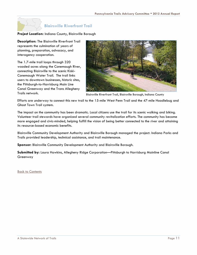
Blairsville Riverfront Trail
Project Location: Indiana County, Blairsville Borough
Description: The Blairsville Riverfront Trail
represents the culmination of years of
planning, preparation, advocacy, and
interagency cooperation.
The 1.7-mile trail loops through 320
wooded acres along the Conemaugh River,
connecting Blairsville to the scenic Kiski-
Conemaugh Water Trail. The trail links
users to downtown businesses, historic sites,
the Pittsburgh-to-Harrisburg Main Line
Canal Greenway and the Trans Allegheny
Trails network.
Efforts are underway to connect this new trail to the 15-mile West Penn Trail and the 47-mile Hoodlebug and
Ghost Town Trail system.
The impact on the community has been dramatic. Local citizens use the trail for its scenic walking and biking.
Volunteer trail stewards have organized several community revitalization efforts. The community has become
more engaged and civic-minded, helping fulfill the vision of being better connected to the river and attaining
its resource-based economic benefits.
Blairsville Community Development Authority and Blairsville Borough managed the project. Indiana Parks and
Trails provided leadership, technical assistance, and trail maintenance.
Sponsor: Blairsville Community Development Authority and Blairsville Borough.
Submitted by: Laura Hawkins, Allegheny Ridge Corporation—Pittsburgh to Harrisburg Mainline Canal
Greenway
Back to Contents
Blairsville Riverfront Trail, Blairsville Borough, Indiana County

Pennsylvania Trails Advisory Committee • 2012 Annual Report
A Statewide Network of Trails Page 12
Bloody Skillet All-Terrain Vehicle Connector Trail
Project Location: Centre and Clinton counties, Sproul State Forest, Orviston, Pa.
Description: This project connected the Bloody Skillet All-Terrain Vehicle (ATV) area in the Sproul State Forest
to Snow Shoe Township roads and the Snow Shoe Rails to Trails Association (SSRTA) multi-use trail system. In
2012, 6.6 miles of trail were completed. The trail now utilizes state forest lands and township roads that are
open to ATVs, connecting approximately 44 miles of trails.
The section of trail on State Forest Land descends into the Beech Creek Valley where a bridge was
constructed to carry it across an existing abandoned railroad crossing. The trail then crosses Two-Rock Run
and continues up the other side of the Beech
Creek Valley towards the Bloody Skillet ATV
Riding area.
The trail is near Orviston, Pa. which at one time
had a brick factory that used clay from the
present-day Bloody Skillet ATV riding area. An
ATV trail head is located on land that was
formerly part of the old brick factory.
Sponsor: DCNR Bureau of Forestry, Sproul
State Forest
Submitted by: Robert S. Fitterling, DCNR
Bureau of Forestry
Back to Contents
New bridge on Bloody Skillet ATV Connector Trail

Pennsylvania Trails Advisory Committee • 2012 Annual Report
A Statewide Network of Trails Page 13
Jersey Shore Pine Creek Trail Connector
Project Location: Lycoming County, Jersey Shore, Pine Creek Rail Trail.
Description: This project added 1.5 miles to the Pine Creek Rail Trail, extending it to approximately 64 miles
in length. The connector trail reaches from the edge of the borough into the downtown area, connecting the
DCNR trailhead on the outskirts of town to the Susquehanna River and downtown businesses. Built in
partnership with PennDOT and the Lycoming Community Foundation, the trail is maintained by Jersey Shore
Borough. The project had important support from the SEDA COG Joint Rail Authority and Lycoming County.
This project was the result of a trail feasibility study completed in 2011.
Local residents are using the trail to get to town
for shopping and for extending their bicycle or
pedestrian travel. The trail extension fills an
important gap and helps achieve the goal of
connecting trails with residents and
neighborhoods.
Sponsors: DCNR, PennDOT, Lycoming County,
Lycoming Community Foundation, Jersey Shore
Borough, SEDA COG
Submitted by: Wes Fahringer, DCNR Bureau of
Recreation and Conservation
Back to Contents
The Pine Creek Rail Trail is now connected to Jersey Shore, Pa.
and the Susquehanna River.

Pennsylvania Trails Advisory Committee • 2012 Annual Report
A Statewide Network of Trails Page 14
Hanover Trolley Trail
Project Location: York County, Jackson Township, Hershey Road to Martin Road.
Description: This project included engineering and construction of 0.8 miles of trail with associated drainage
system, fencing, and signage. In addition, improvements were made to a 43-space parking area, including
asphalt paving, line markings, construction, and native plantings on a berm separating the parking area from
an active rail line. The new trail section connects to a section built in 2008 and provides a direct connection to
Spring Grove Borough, the Spring Grove Area Recreation Center, and Windy Hill Senior Center.
The project is attracting large numbers of users from Spring Grove Borough. Seniors from the Windy Hill
Senior Center can easily access the trail, and an active group of “Trolley Trotters” walk the trail every
Wednesday morning. Families pushing baby strollers
and dog walkers are a common sight on the trail.
Spring Grove Area Recreation Commission held its
annual 5 km race entirely on the trail for the first time
in 2012 and avoided using borough streets.
Sponsors: York County Rail Trail Authority
Submitted by: Gwen Loose, York County Rail Trail
Authority
Back to Contents
A family enjoys a late afternoon winter walk on the
newest section of the Hanover Trolley Trail.

Pennsylvania Trails Advisory Committee • 2012 Annual Report
A Statewide Network of Trails Page 15
Hidden Creek Path
Project Location: Cumberland County, Silver Spring Township, Hidden Creek Park, Mechanicsburg
Description: This project involved construction of a soft landscaped pathway along the Conodoguinet Creek.
It extended an existing trail an additional 0.25 miles along a scenic reach of the creek.
This work, carried out by the Silver Spring Township Parks and Recreation Department, serves a new
residential neighborhood adjacent to the park. The increased access to the creek has created new
opportunities for families and youth to experience nature in a safe and attractive environment. A connection
is planned that would allow residents of
the neighborhood to walk to shopping
areas.
Sponsor: Silver Spring Township Parks
and Recreation
Submitted by: Jeff Williams, Silver
Spring Township Parks and Recreation
Back to Contents
Hidden Creek Path follows Conodoguinet Creek.

Pennsylvania Trails Advisory Committee • 2012 Annual Report
A Statewide Network of Trails Page 16
D&L Trail
Project Locations: Luzerne County and Carbon County
Description: The 9.7 miles of the Black Diamond section of the Delaware and Lehigh (D&L) Trail along with
the new Black Diamond Trailhead near White Haven in Luzerne County is the D&L’s largest trail project to
date. This is the first section of D&L Trail that is not adjacent to the Lehigh or Delaware Rivers. Built on the
old Lehigh Valley Railroad bed, it meanders through the woods, passing wildlife, lakes, ponds and overlooks
into the Wyoming Valley.
In addition, the completion of a 2.5-mile section of trail from the Lehighton Trailhead to East Penn Township
was led by the Borough of Lehighton. Access to the Pennsylvania Turnpike bridge project allowed Walsh
Construction, the Turnpike contractor, to complete this section of the trail. This kind of creative and
collaborative approach may be the key to completing the remaining sections of trail as well as future
upgrades and ongoing maintenance.
Projects planned for the next two to three years include the Freemansburg Towpath, pedestrian crossings and
tunnels in Bucks County, and several miles of trail between Allentown and Northampton all of which are gaps
identified in the Pennsylvania Outdoor Recreation Plan.
Sponsors: Carbon County, DCNR, PennDOT, Delaware & Lehigh National Heritage Corridor
Submitted by: H. Scott Everett, Delaware & Lehigh National Heritage Corridor
Back to Contents
Groundbreaking on the Black Diamond section of the D & L Trail
Pennsylvania Trails Advisory Committee • 2012 Annual Report
A Statewide Network of Trails Page 17
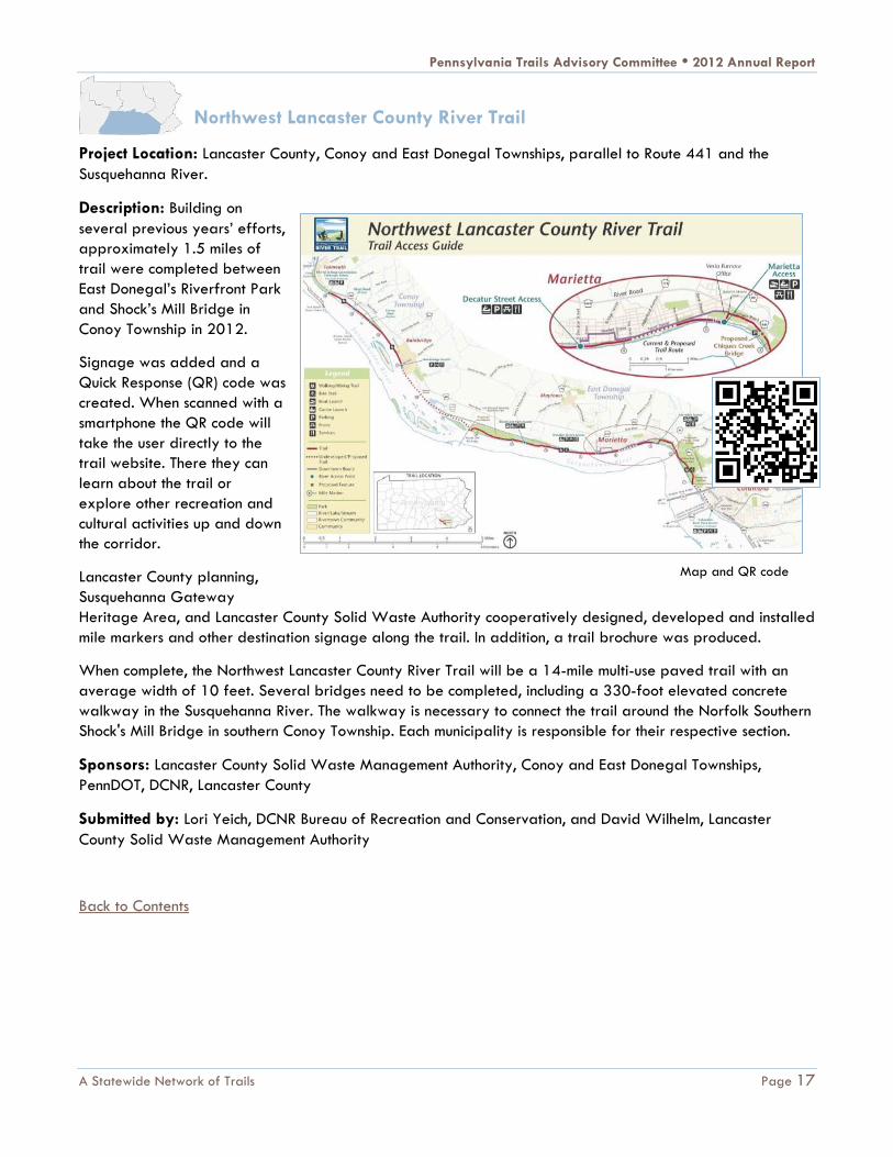
Northwest Lancaster County River Trail
Project Location: Lancaster County, Conoy and East Donegal Townships, parallel to Route 441 and the
Susquehanna River.
Description: Building on
several previous years’ efforts,
approximately 1.5 miles of
trail were completed between
East Donegal’s Riverfront Park
and Shock’s Mill Bridge in
Conoy Township in 2012.
Signage was added and a
Quick Response (QR) code was
created. When scanned with a
smartphone the QR code will
take the user directly to the
trail website. There they can
learn about the trail or
explore other recreation and
cultural activities up and down
the corridor.
Lancaster County planning,
Susquehanna Gateway
Heritage Area, and Lancaster County Solid Waste Authority cooperatively designed, developed and installed
mile markers and other destination signage along the trail. In addition, a trail brochure was produced.
When complete, the Northwest Lancaster County River Trail will be a 14-mile multi-use paved trail with an
average width of 10 feet. Several bridges need to be completed, including a 330-foot elevated concrete
walkway in the Susquehanna River. The walkway is necessary to connect the trail around the Norfolk Southern
Shock's Mill Bridge in southern Conoy Township. Each municipality is responsible for their respective section.
Sponsors: Lancaster County Solid Waste Management Authority, Conoy and East Donegal Townships,
PennDOT, DCNR, Lancaster County
Submitted by: Lori Yeich, DCNR Bureau of Recreation and Conservation, and David Wilhelm, Lancaster
County Solid Waste Management Authority
Back to Contents
Map and QR code

Pennsylvania Trails Advisory Committee • 2012 Annual Report
A Statewide Network of Trails Page 18
Lykens Valley Rail Trail
Project Location: Dauphin County
Description: In 2012, Dauphin County developed 4 miles of
the new Lykens Valley Rail Trail in Lykens Borough and
Wiconisco.
In addition, the county is nearing completion of a section of the
trail further to the east through Pennsylvania State Game
Lands to the Schuylkill County line. This segment is
approximately 3.6 miles and extends from Mountain Street in
Wiconisco Township to Race Street in Williams Township.
Sponsors: Dauphin County
Submitted by: Lori Yeich, DCNR
Highspire Reservoir Park Trail
Project Location: Dauphin County, Highspire Borough
Description: This project took a long-abused wetland and, with minimal alterations to the land, introduced a
one-mile trail of packed surfaces and boardwalks to raise awareness of the wetland, encourage its
preservation, connect low- and middle-income residents to the community, and encourage exercise.
Highspire Reservoir Park has become a mecca for residents - many of whom live along its borders. Adjoining
property owners have constructed private paths to access the
walkway. A group of walkers has become the “eyes and
ears” on the trail, reporting issues to authorities. Garbage is
no long dumped into the wetlands.
Sponsors: Dauphin County Parks and Recreation, Highspire
Borough
Submitted by: Carl Dickson, Dauphin County Parks and
Recreation
Back to Contents
Lykens Valley Rail Trail
Highspire Reservoir Park Trail and adjacent wetlands

Pennsylvania Trails Advisory Committee • 2012 Annual Report
A Statewide Network of Trails Page 19
Mason Dixon Greenway South
Project Location: Chester County, London Britain Township
Description: The Mason Dixon Greenway South project is part of long-range plan for White Clay Creek
Preserve in Pennsylvania and Delaware. A new parking lot was developed with interpretive gardens and an
informational kiosk. A new, 0.3-mile non-motorized paved trail meanders through meadows to a creek area.
There is a trail for people in wheelchairs through a wooded area with picnic benches and scenic overlooks. In
addition, 0.9 miles of grassed pathways are maintained for passive recreation.
Sponsors: Chester County, London Britain Township
Submitted by: Carolyn Wallis, DCNR Bureau of Recreation and Conservation
Back to Contents
London Britain Township’s new Mason Dixon Greenway South

Pennsylvania Trails Advisory Committee • 2012 Annual Report
A Statewide Network of Trails Page 20
Countryside Conservancy Trolley
Trail
Project Location: Lackawanna County, Glenburn Township
Description: The Countryside Conservancy, a nonprofit
organization dedicated to protecting lands and waters in and
near the Tunkhannock Creek Watershed, is working to turn a
14-mile section of the Northern Electric Street Railway
interurban trolley line between Scranton, Lake Winola and
Montrose into a non-motorized recreational trail.
After more than a decade of planning, ground was broken
for a 3-mile walking and biking path from Clark Summit to
Dalton. The Trolley Trail is being constructed in phases and
will eventually connect to Lake Winola in Wyoming County.
Dozens of supporters have turned out to celebrate the
project. People who are helping to create the new trail say it
will mean a lot to people, young and old throughout the area.
"That they can walk places again, that they don't have to be
out on the highways, that they can reconnect with
neighborhoods and that they can get exercise," local resident
Cheryl Ellsworth said.
Sponsor: Countryside
Conservancy
Submitted by: Eric Deabill,
pahomepage.com
Back to Contents
Countryside Conservancy Trolley Trail map
Rendering of the Countryside Conservancy Trolley Trail

Pennsylvania Trails Advisory Committee • 2012 Annual Report
A Statewide Network of Trails Page 21
Schuylkill River Trail – Port Richmond
Project Location: Philadelphia, Port Richmond
Description: State and local officials broke ground in 2012 on a new segment of the Delaware River
Greenway, a multi-use trail threading through Philadelphia and linking its residents and visitors to the
rebounding Delaware River.
“The Port Richmond Trail will offer pedestrians, bicyclists and others safer, more aesthetically pleasing travel
and access to the river,” DCNR Deputy Secretary John Giordano said, speaking at the groundbreaking at
Pulaski Park along the trail. “DCNR is proud to unite with its partners behind the goal of connecting
communities to the nearby Delaware River.”
DCNR consistently has invested in trailhead development and park renovations along the Delaware, including
$200,000 for design of the Port Richmond Trail. This project, featuring new paving and landscaping, stretches
more than 1.5 miles.
Sponsors: DCNR, Delaware River City Corporation, East Coast Greenway, City of Philadelphia, William
Penn Foundation and the Delaware Valley Regional Planning Commission.
Submitted by: Carolyn Wallis, DCNR Bureau of Recreation and Conservation
Back to Contents
Congresswoman Allyson Schwartz speaking at the Port Richmond ground breaking

Pennsylvania Trails Advisory Committee • 2012 Annual Report
A Statewide Network of Trails Page 22
Bartram’s Mile
Project Location: Philadelphia, 53rd Street & Bartram's Drive
Description: This 0.3 mile trail
was completed in 2012. It
connects Bartram's Garden
facilities to the Schuylkill River
and is the first phase of the
Bartram's Mile that will be
completed over the next few
years. The trail will eventually
connect Greys Ferry to 56th
Street and Lindbergh Boulevard.
This trail was funded by a
Transportation Investment
Generating Economic Recovery
(TIGER) grant received by the
City of Philadelphia with the
assistance of the Pennsylvania
Environmental Council and the
Bicycle Coalition of Greater
Philadelphia.
Sponsors: City of Philadelphia
Submitted by: Andy Hamilton, East Coast Greenway Alliance
Back to Contents
Bartram’s Mile (phase 1) with a view of Center City Philadelphia in the distance

Pennsylvania Trails Advisory Committee • 2012 Annual Report
A Statewide Network of Trails Page 23
Cynwyd Heritage Trail
Project Location: Montgomery County, Lower Merion Township
Description: The Cynwyd Heritage
Trail transformed an abandoned
rail line into a 2.5-mile
contemporary linear park that
connects the community with its
heritage and other natural and
recreational amenities. Constructed
along the former SEPTA Cynwyd
regional rail line, the trail provides
connections to neighborhoods,
commercial areas, parks, and
institutional properties.
The trail is the first phase of a plan
aimed to connect the growing
regional trail system. A key design
feature is that the trail is both a
paved main trail and a secondary
gravel trail. Environmental
sustainability was an important design consideration. Stormwater is captured and directed into swales and
rain gardens.
The abandoned Barmouth Station was redeveloped into an attractive trailhead, and the historic Cynwyd
Station was preserved. The creation and continued development of the trail has been an extraordinary
collaborative effort and is the result of years of planning by the township and many public and private
stakeholders. Key to the trail completion was the creation of The Friends of the Cynwyd Trail, a volunteer
group that assists the township in advocating and maintaining the trail. The township secured funding for this
project from various sources and partnered with numerous organizations, businesses, and community groups.
Thousands of hours of volunteer labor have contributed to the trail's success. This popular trail provides a new
public open space, connects the community to its cultural heritage, and is an important future link in the
regional trail system.
Sponsors: Lower Merion Township
Submitted by: Christopher Leswing, Lower Merion Township
Back to Contents
The Cynwyd Heritage Trail is popular with walkers and bicyclists.
Pennsylvania Trails Advisory Committee • 2012 Annual Report
A Statewide Network of Trails Page 24
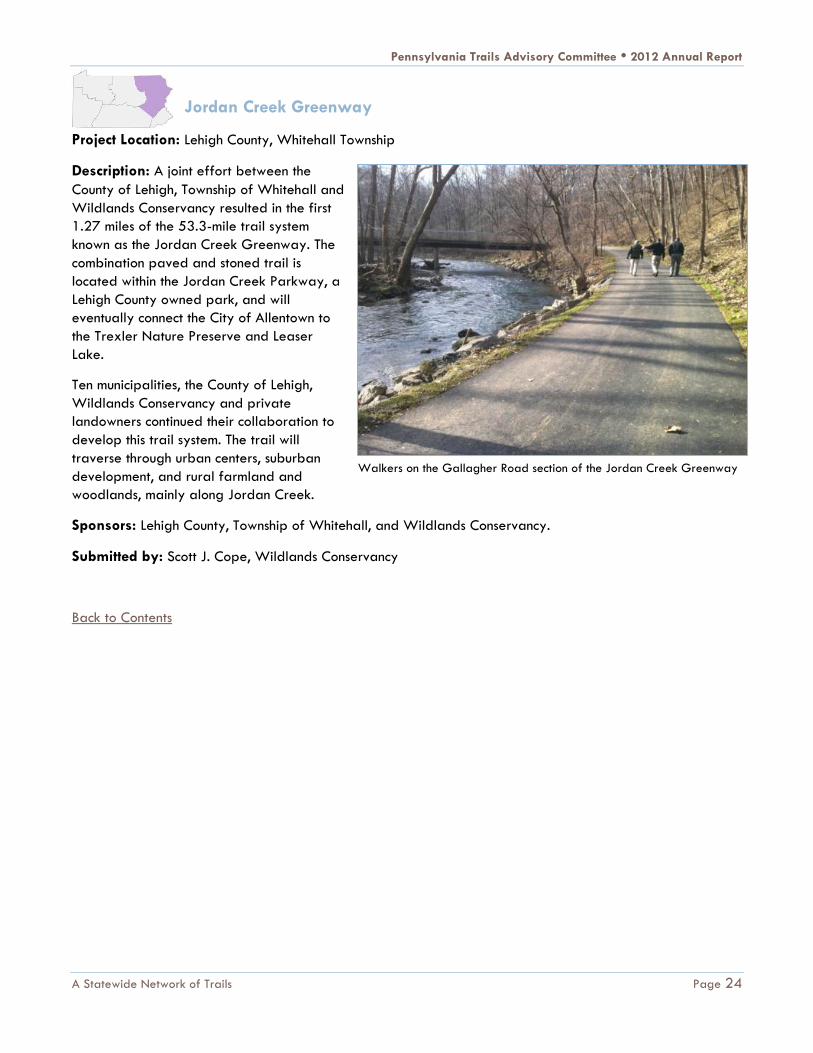
Jordan Creek Greenway
Project Location: Lehigh County, Whitehall Township
Description: A joint effort between the
County of Lehigh, Township of Whitehall and
Wildlands Conservancy resulted in the first
1.27 miles of the 53.3-mile trail system
known as the Jordan Creek Greenway. The
combination paved and stoned trail is
located within the Jordan Creek Parkway, a
Lehigh County owned park, and will
eventually connect the City of Allentown to
the Trexler Nature Preserve and Leaser
Lake.
Ten municipalities, the County of Lehigh,
Wildlands Conservancy and private
landowners continued their collaboration to
develop this trail system. The trail will
traverse through urban centers, suburban
development, and rural farmland and
woodlands, mainly along Jordan Creek.
Sponsors: Lehigh County, Township of Whitehall, and Wildlands Conservancy.
Submitted by: Scott J. Cope, Wildlands Conservancy
Back to Contents
Walkers on the Gallagher Road section of the Jordan Creek Greenway

Pennsylvania Trails Advisory Committee • 2012 Annual Report
Healthy, Safe and Accessible Trails Page 25
HEALTHY, SAFE AND ACCESSIBLE TRAILS
Pennsylvania trail partners organized and carried out many needed trail maintenance and improvement
projects in 2012. The following section describes several of these trail rehabilitation projects conducted over
the past year.
Mid State Trail
Project Location: Bedford County, Southampton and Colerain townships, 20 miles southwest of Everett.
Description: The Mid State Trail Association, a volunteer stewardship organization for Pennsylvania's longest
footpath, worked with staff of Buchanan
State Forest and the Keystone Trails
Association’s volunteer Trail Crew to
complete the relocation of Mid State
Trail (MST) south and north of the former
fire tower site on Martin Hill. The south
side relocation moved the MST’s western
route, also known as the Great Eastern
Trail, off a road and away from power
lines in the Martin Hill Wild Area. The
north side relocation moved the path off
a 45% grade, the steepest incline of the
entire MST in Pennsylvania.
The relocation moved the MST route,
over its highest point, from a monotonous
road walk and exceptionally steep
power line/fire break route onto a
gentler slope. The scenic, single-track
path passes two springs, a majestic stand of white pines, deep thickets of laurel and rock oak (evidence of
past fires in one of the driest parts of Pennsylvania), all at nearly the highest elevation in Pennsylvania's Ridge
and Valley physiographic province. These improvements were consistent with trail design practices commonly
used for the Great Eastern Trail, a footpath network from Alabama to New York State.
Sponsor: Mid State Trail Association
Submitted by: Peter Fleszar, Mid State Trail Association
Back to Contents
The Mid State Trail Relocation at Martin Hill

Pennsylvania Trails Advisory Committee • 2012 Annual Report
Healthy, Safe and Accessible Trails Page 26
Appalachian Trail
Project Location: Cumberland County, Middlesex Township.
Description: Cumberland Valley Appalachian Trail Club (CVATC) and its partners completed the renovation
of a bridge and boardwalk north of the Scott Farm in Middlesex Twp., Cumberland County, Pa. The bridge is
located on the Appalachian Trail between Bernheisel Bridge Road and Sherwood Drive.
Originally constructed in 2007, the bridge
had sustained repeated flood damage.
Renovations included raising a walkway to
the level of the main bridge, extending the
walkway to the north and south, and making
repairs to the bridge decking and railings.
The bridge was tested by Hurricane Sandy
about a week after the renovations were
completed. Floodwaters rose to just a few
inches below the renovated bridge. Most of
the old bridge would have been submerged
and probably damaged.
CVATC credits the Appalachian Trail
Conservancy’s Mid-Atlantic Trail Crew and
Club volunteers for their excellent work in
carrying out the project. The Mid-Atlantic office of the Appalachian Trail Conservancy provided funding for
the materials. For additional information, visit CVATC's website www.cvatclub.org
Sponsors: Cumberland Valley Appalachian Trail Club, Appalachian Trail Conservancy
Submitted by: Jim Foster, CVATC
Back to Contents
Appalachian Trail boardwalk under construction

Pennsylvania Trails Advisory Committee • 2012 Annual Report
Healthy, Safe and Accessible Trails Page 27
Trail Assistance Mini-Grant Program
Project Location: Fayette and Allegheny counties
Description: The mini-grant program managed by the Rails-to-Trails Conservancy (RTC) was begun as a way
to assist trail organizations or municipalities who need to make small repairs and improvements to their trail
outside of the regular DCNR grant schedule and well below the higher dollar amounts usually requested on
the major grants. The Trail Mini-Grant Program
is driven by existing RTC projects, primarily the
Greenway Sojourn but also other regional trail
networks that are being developed in the state.
In 2012, the following trail mini-grants were
awarded, all within the area of the 2012
Greenway Sojourn route:
Great Allegheny Passage: The Yough River
Trail Council (YRTC) resurfacing approximately
two miles of the limestone tread between mile-
markers 85.5 and 87.5 of the Great Allegheny
Passage with match money provided by the
YRTC.
Steel Valley Trail: The Steel Valley Trail Council installed 110 new rebounding traffic delineators along a
bike lane section of the Great Allegheny Passage in Munhall, Pa. to protect users from vehicular traffic.
Sheepskin Trail: The Dunbar Historical Society in partnership with the Fayette County Career and Technical
Institute built two sheltered picnic tables and installed them at the Dunbar trailhead of the Sheepskin Trail. In-
kind labor was used to provide the required match.
Indian Creek Hike & Bike Trail: A new deck and railing was built for the Section 7 Bridge of the Indian Creek
Valley Hike and Bike Trail with volunteer labor and cash match provided by the Mountain Watershed
Association.
Indian Creek Hike & Bike Trail: An engineering firm was hired to provide a required evaluation of the
structural capacity for the existing abutments and piers of the Dumbauld Bridge in Springfield Township. A
cash match was provided by the Redevelopment Authority of the County of Fayette.
Three Rivers Heritage Trail: Two separate mini-grants were awarded to Friends of the Riverfront for the
design and installation of six new map signs and two interpretive panels along the trail. Match funds were
provided by Richard King Mellon Foundation and Colcom Foundation.
Sponsor: Rails-to-Trails Conservancy
Submitted by: Pat Tomes, RTC
Back to Contents
Indian Creek Hike & Bike Trail Section 7 bridge improvement

Pennsylvania Trails Advisory Committee • 2012 Annual Report
Healthy, Safe and Accessible Trails Page 28
Keystone Trails Association—Reeds Gap Spur Trail
Project Location: Mifflin and Centre counties, between Reeds Gaps State Park and Poe Paddy State Park
Description: In the southwest corner of Bald Eagle State Forest east of Milroy, the 13-mile Reeds Gap Spur
Trail begins in Reeds Gap State Park. It continues northeast along the ridge of Thick Mountain, then drops
over the north side of the mountain and passes through the Bear Gap Picnic area. The trail continues up and
over Strong Mountain and White Mountain where it skirts the western edge of the White Mountain Wild Area,
ending in Poe Paddy State Park.
The trail, which is partly hiking only and partly multi-use, had not been maintained for several years and was
essentially abandoned. In 2011 the Keystone Trails Association (KTA) Trail Care Program contacted Bald
Eagle State Forest and worked with the DCNR Bureau of Forestry to reopen and blaze the trail. KTA
scheduled trail care weekend activities in the fall of 2012 intended for clearing fallen and overgrown brush
and repainting blazes. KTA Trail Care is a volunteer program which has worked to build and maintain hiking
trails throughout Pennsylvania for over three decades.
Due to the efforts of KTA volunteers, the Reeds Gap Spur trail
is now entirely open and blazed for use connecting two of
central Pennsylvania's outstanding state parks.
Sponsors: Keystone Trails Association, DCNR Bureau of
Forestry
Submitted by: Edward Lawrence, KTA
Back to Contents
Keystone Trails Association Trail Care volunteer

Pennsylvania Trails Advisory Committee • 2012 Annual Report
Healthy, Safe and Accessible Trails Page 29
Keystone Trails Association—Trail Care Events
Project Locations: Statewide
Description: One of the most important and rewarding aspects of involvement with KTA is volunteering to
help maintain Pennsylvania's extensive system of hiking trails. Each year, on designated weekends between
March and November, dedicated trail care volunteers gather, and, equipped with blaze paint, limb loppers,
pulaskis and brush cutters, clear and upgrade hiking trail corridors and pathways. Many participants choose
to camp on Friday and Saturday evenings and work on Saturdays and Sundays.
In 2012 nineteen Keystone Trail Association trail care events were held with 156 total participants who
contributed 3,464 volunteer hours of labor.
Long distance hiking trails that have
benefited from KTA’s Trail Care program
include the Mid State Trail, the Horse Shoe
Trail, the Thunder Swamp Trail, the North
Country Trail, the Donut Hole Trail, the Chuck
Keiper Trail, the Allegheny Front Trail, the
Standing Stone Trail, the Tuscarora Trail and
the Bear Run Nature Preserve trail system.
State forests and state parks that were
enhanced by KTA’s Trail Care in 2012
include Bald Eagle, Buchanan, Delaware,
Loyalsock, Moshannon, Rothrock, Sproul,
Tiadaghton, Tioga, and Tuscarora State
Forests and Colonel Denning, Cowans Gap,
French Creek; Gifford Pinchot, Greenwood
Furnace, Moraine, McConnells Mill, Nockamixon and Penn Roosevelt State Parks.
In other more extensive trail care activities, volunteers chose one or more of five trail crew opportunities in
June, spending a full week doing trail work. The trail care program is for all ages and abilities, with no prior
experience or special skills necessary, and participants are welcome to sign up for the days and times their
schedules allow. Most trail care events have camping or cabin facilities available.
Sponsors: Keystone Trails Association, DCNR Bureaus of State Parks and Forestry
Submitted by: Curt Ashenfelter, Keystone Trails Association
Back to Contents
Trail Care volunteers logged 3,464 hours in 2012.

Pennsylvania Trails Advisory Committee • 2012 Annual Report
Healthy, Safe and Accessible Trails Page 30
Upper Shenango River Water Trail
Project Location: Mercer and Crawford counties, Jamestown and Greenville, Pa.
Description: The goal of the project was to designate the upper reaches of the Shenango River as an official
Pennsylvania Fish & Boat Commission Water Trail. One of the conditions of this designation was the removal
of deadfall, debris, and downed trees for 23 river miles.
Prior to this effort, safe paddling of the river was either impossible or severely limited. After the work was
completed, paddlers could enjoy its entire length without any obstructions or portages. Three “floats” were
organized to introduce the improved water trail to the community; 420 people participated. Others now use
the river regularly during the paddling season. A naturalist from Pymatuning State Park led tours on the river,
and high school science classes are helping measure changes in water quality and quantity.
Sponsors: Shenango River Watchers, Lions Clubs of Greenville and Jamestown, Northwest Pennsylvania
Regional Planning and Development Commission
Submitted by: Hugh Clark, Shenango River Watchers
Back to Contents
Shenango River Water Trail clean-up and restoration

Pennsylvania Trails Advisory Committee • 2012 Annual Report
Healthy, Safe and Accessible Trails Page 31
Laurel Highlands Bicycle Trail Building and Maintenance
Project Location: Cambria, Blair, Bedford, Indiana, Somerset, Westmoreland counties; Highland Park,
Johnstown, Blue Knob Resort, Blue Knob State Park, Shawnee State Park, Yellow Creek State Park, and
Forbes State Forest
Description: The Laurel Highlands On and Off Road Bicycling Association (LHORBA) is responsible for the
building and maintenance of over a dozen trail areas. At Shawnee State Park, club members, REI employees
and local residents worked with the state park regional manager to test erosion on existing trails and develop
a test trail that could withstand use during severe rain and snow conditions.
At Blue Knob Resort, members compiled 62 hours of volunteer time to clean up after hurricane Sandy and
carry out general maintenance on roughly 14 miles of biking, hiking, and cross country ski trails throughout the
year. Member volunteers contributed 115 hours at Blue Knob State Park, removing downed trees and other
debris from storms in 2012. Highland Park received LHORBA sponsored trail maintenance on over 13 miles of
trails with armoring of several wet areas, cutting of tree falls, bench cutting improvements on several trails,
and placing much needed signage
throughout the park.
At Yellow Creek State Park, LHORBA
volunteers worked over 200 hours
throughout the summer, constructing a new
one-mile beginner bike trail. LHORBA is also
working with officials to establish on and off
road connections with the Flight 93 National
Memorial near Shanksville, Pa.
LHORBA's trail building and maintenance
activities have had a significant impact on
nearby communities. At Shawnee State
Park, club volunteers worked to preserve
wide trails for snowmobiles and single track
trails for bicyclists, hikers and cross country
skiers.
Blue Knob Resort and Blue Knob State Park
now have trails that are regularly enjoyed by visitors. LHORBA members volunteered their time to assist in the
park's Beginner Mountain Bike Program. At Highland Park the community utilizes numerous trails for biking,
hiking, and nature discovery walks. Yellow Creek State Park trail building efforts and maintenance provides
the mountain biking community an opportunity to hold monthly races, beginner programs for both men and
women, hiking, and orienteering.
Sponsor: Laurel Highlands On and Off Road Bicycling Association
Submitted by: Cathy A. Vore, Laurel Highlands On and Off Road Bicycling Association
Back to Contents
LHORBA members work to improve mountain biking trails.

Pennsylvania Trails Advisory Committee • 2012 Annual Report
Healthy, Safe and Accessible Trails Page 32
Lower Trail – Mount Etna Bridge
Project Locations: Blair County, Catharine Township
Description: After more than two decades of use, the decks on the bridges carrying the Lower Trail over the
Frankstown Branch of the Juniata River were badly deteriorated. Funding from DCNR and PennDOT’s federal
Transportation Enhancements program made it possible to re-deck the 240-foot bridge with an innovative
fiberglass-resin material
developed by a local firm for the
military. The total cost of the
project was $103,300.
Re-decking of the Mt. Etna Bridge
on the Lower Trail eliminated
safety hazards caused by
deteriorating boards and loose
nails and eliminated the need for
future routine maintenance.
The Lower Trail is a central link
along the Pittsburg-to-Harrisburg
Main Line Canal Greenway.
Sponsors: Rails to Trails of Central
Pennsylvania, Inc., DCNR
Submitted by: Ethan Imhoff, Rails
to Trails of Central Pennsylvania,
Inc.
Back to Contents
Mount Etna Bridge re-decked with fiberglass-resin planks

Pennsylvania Trails Advisory Committee • 2012 Annual Report
Healthy, Safe and Accessible Trails Page 33
Anders Run Natural Area Trail Improvements
Project Location: Warren County, Brokenstraw Township
Description: During the summer of 2012, in a cooperative inter-agency effort, the Allegheny National Forest
offered the services of their Student Conservation Crew (SCC) to the Cornplanter Forest District to complete
trail re-routing and improvement work at the Anders Run Natural Area. New segments of the trail were cut
along hillsides, using switchbacks to ease the grade and mitigate the trail's original steep design. The SCC
also placed gravel on portions of the trail needing additional stability and re-marked the trail system
according to the Bureau of Forestry’s updated marking guidelines.
The newly improved trail system has received numerous positive reviews on the forest district's trail registry.
The trail system is now easier to use and environmentally sustainable.
Sponsor: DCNR Bureau of Forestry,
Cornplanter State Forest
Submitted by: Scott E. Rimpa,
DCNR Bureau of Forestry
Back to Contents
Anders Run Natural Area Trail Improvements

Pennsylvania Trails Advisory Committee • 2012 Annual Report
Healthy, Safe and Accessible Trails Page 34
Armstrong Trail - Great American Clean-up
Project Location: Clarion County, Brady Township, Phillipston.
Description: The Armstrong Rails to Trails Association (ARTA) sponsored a day long clean-up of two illegal
dumpsites along the Armstrong Trail. The activity took place in the town of Phillipston around mile 66 on May
5, 2012. More than 20 volunteers turned out to fill a roll-off dumpster provided by Waste Management.
Several volunteers brought their personal trucks and bulldozers to aid in the effort. In addition to the dumpsite
clean-up, litter pick-up was conducted south along the trail to the Brady tunnel at mile 64.9.
Every year, the ARTA participates in the Great American Clean-up and other environmental programs. The
trail corridor is owned by the Allegheny Valley Land Trust (AVLT). The ARTA provides volunteer labor to carry
out tasks essential to improving and promoting the trail. This project not only enhanced the aesthetics of the
trail by removing unsightly trash that had built up over decades but it also brought a great sense of pride to
those who participated. This project sets the stage for a larger effort to improve the trail between Rimer and
Phillipston.
Sponsor: Armstrong Rails to Trails Association
Submitted by: Toni Henry, Armstrong Rails to Trails Association
Back to Contents
Volunteers work to maintain the Armstrong Tail.

Pennsylvania Trails Advisory Committee • 2012 Annual Report
Healthy, Safe and Accessible Trails Page 35
Samuel Justus and Allegheny River Trails
Project Location: Venango County, Oil City, Franklin, Cranberry Township
Description: The Samuel Justus Trail (SJT) and the Allegheny River Trail (ART) are the oldest, completed
sections of the Erie-to-Pittsburgh Trail. These local trails were showing signs of deterioration. The Allegheny
Valley Trails Association, in partnership with Cranberry Township which owns and operates the SJT,
rehabilitated 7 miles of trail surface. A request was made to PennDOT District 1-0 for advice. The pavement
experts agreed that the useful life of the surface was nearing its end, but there was still a good base. They
recommended a topcoat and assisted with planning documents. With local and state grant funding, a new
surface was constructed. Allegheny Valley Trails Association (AVTA) plans to continue the process in 2013 for
a total of 10 miles of new surface.
These sections of trail will have a
lifespan of 10 to 20 years. Trail users
have commented on the high quality
of the trails, and these sections of trail
are often used for community events
and fundraisers.
Sponsor: Allegheny Valley Trails
Association
Submitted by: Debra Frawley,
Council on Greenways and Trails
Back to Contents
Bicyclists on repaved sections of the Allegheny River Trail

Pennsylvania Trails Advisory Committee • 2012 Annual Report
Healthy, Safe and Accessible Trails Page 36
Railroad Bridge Pedestrian Walkway over Oil Creek
Project Location: Venango County, Oil City, between Relief Street and Seneca Street
Description: The city reconnected the trail between the north and south sides of town over Oil Creek. The
structural integrity of the walkway on the railroad bridge that
crosses Oil Creek had deteriorated and was no longer safe.
Repairs were completed and the bridge was opened for use in
fall 2012.
This crossing is part of the Erie-to-Pittsburgh Trail and connects
the two downtown business districts to the trail. This project
prompted the new Main Street Committee to consider
requirements for Trail Town designation.
Sponsor: Allegheny Valley Trails Association
Submitted by: Debra Frawley, Council on Greenways and
Trails
Snow Shoe Rails to Trails
Resurfacing
Project Location: Centre County, Snow Shoe Township, Clarence
Road to Gillentown Trailhead
Description: The Snow Shoe Rails to Trails Association (SSRTA)
used a DCNR grant to apply a driving surface aggregate to 4
miles of the trail. SSRTA preforms regular maintenance along the
trail, especially in eroding areas caused by heavy usage and
rainfall.
Non-motorized usage of the trail was enhanced for walking, jogging, bicycling and horseback riding. The
aggregate reduced the amount dust and provided a desirable hard packed surface. A local restaurant along
the trail has become favorite destination for trail users.
Sponsor: Snow Shoe Rails to Trails Association
Submitted by: Trilby Mayes, Snow Shoe Rails to Trails Association
Back to Contents
State and local officials inspect the bridge over
Oil Creek.

Pennsylvania Trails Advisory Committee • 2012 Annual Report
Healthy, Safe and Accessible Trails Page 37
Coventry Woods Trail
Project Location: Chester County,
North Coventry. The trail is located
near St. Peter's Historic Village off
Route 23 approximately 8 miles
west of Route 100. It is also near
French Creek State Park and St.
Peter's Road.
Description: As illustrated in the
map below, with the trails shown in
dotted lines, North Coventry
Township has developed
approximately 10 miles of hiking
trails in and around Coventry
Woods Park. The township is
currently working on a bridge that
is needed to cross Pigeon Creek
near Cherry Hill Lane for the
Coventry Woods Trail. Boy Scouts implemented a self-guided tour on the Pigeon Creek Trail, highlighting
significant environmental and historical points of interest on the trail. In addition, there are plans for
directional signage, trail blazing, maintenance, and new trail development. Organization: Scouts of America,
North Coventry Parks and Recreation, Natural Lands Trust.
The hiking trails are used regularly by the community for increased exercise, enjoyment of nature, and stress
management. When completed, the trails will connect with the Schuylkill River Trail and French Creek State
Park Trails, filling trail gap #15 identified in the Pennsylvania
Outdoor Recreation Plan.
Sponsors: Great Valley District, Boy Scouts of America, North
Coventry Parks and Recreation, Natural Lands Trust (map credit).
Submitted by: Phil McGrath, Pennsylvania Trails Advisory
Committee, Great Valley District, Boy Scouts of America
Back to Contents
North Coventry Township Hiking Trails
North Coventry’s natural wonder

Pennsylvania Trails Advisory Committee • 2012 Annual Report
Healthy, Safe and Accessible Trails Page 38
Schuylkill River Trail – Schuylkill River Parks Connector Bridge
Project Location: Philadelphia
Description: Construction was completed
in 2012 on a pedestrian bridge that
spans the railroad from Schuylkill Banks
to Schuylkill River Park. The project
included intensive community involvement
in the design process. The bridge is a 95-
foot long truncated arch truss structure
with a 12-foot wide pathway. There are
10-foot wide ADA accessible ramps on
the approaches with a total of 3
overlooks. Architectural lighting and
enhancements were included in the
project.
This project resolves the safety concerns
of the City and CSX with respect to
providing convenient access to the
Schuylkill Banks. The Schuylkill River
Parks Connector Bridge received federal
stimulus funding through the Transportation Improvements Generating Economic Recovery (TIGER) program
and a Transportation Enhancement Grant from PennDOT. The connector bridge was completed and opened to
the public in October of 2012.
Design of this pedestrian bridge was funded by the Pew Charitable Trusts and the City of Philadelphia, and
performed by HNTB Corporation with landscaping designed by Menke and Menke Landscape Architects.
Sponsor: City of Philadelphia
Submitted by: Carolyn Wallis, DCNR Bureau of Recreation and Conservation
Back to Contents
Connector Bridge over CSX railroad tracks in Philadelphia

Pennsylvania Trails Advisory Committee • 2012 Annual Report
Promoting Pennsylvania’s Trails Page 39
PROMOTING PENNSYLVANIA’S TRAILS
The following section describes activities that drew public attention to Pennsylvania’s trails in 2012, appealing
to people of all ages and abilities, demonstrating the economic and health benefits of trails, and building
local support and capacity.
2012 Greenway Sojourn
Project Location: Washington, D.C. to Pittsburgh
Description: Rails-to-Trails
Conservancy's 2012 Greenway
Sojourn, June 17-24, returned
to two of the most famous long-
distance trails—the Great
Allegheny Passage (GAP) and
the Chesapeake & Ohio Canal
National Historic Park (C&O
Canal towpath).
On this memorable adventure,
Sojourners pedaled 335 miles
from Washington, D.C., to
Pittsburgh, Pa. Beginning in
historical Georgetown in our
nation's capital, riders followed
the C&O Canal towpath
through the Potomac River
Valley, the pastoral scenery
broken only by the lock houses
and aqueducts along the route,
remarkably well-preserved artifacts of America's
transportation history. 240 riders from 30 states
completed the 2012 Greenway Sojourn from D.C. to
Pittsburgh.
Sponsor: Rails-to-Trails Conservancy
Submitted by: Pat Tomes, RTC
Back to Contents
Seventeen participants seventy years and older participated in the 2012 Greenway
Sojourn.

Pennsylvania Trails Advisory Committee • 2012 Annual Report
Promoting Pennsylvania’s Trails Page 40
Pennsylvania Water Trails Economic Impact Study
Project Location: Statewide
Description: On behalf of the Pennsylvania Water
Trails Partnership, the Pennsylvania Legislative
Budget and Finance Committee (LB & FC) contracted
with a consultant to conduct a case study of the
economic impact of Pennsylvania’s water trails on the
state economy. This was a recommendation of the
2009-2013 Statewide Comprehensive Outdoor
Recreation Plan. Four of the state’s 21 water trails
were selected for the study: the Schuylkill,
Susquehanna—North Branch, Juniata, and Three
Rivers. This study is part of an ongoing effort to
promote, maintain, and expand the large network of
designated water trails across the state.
The study was conducted for six weeks from the end of July to September 2012. The results are weighted
according to the visitation numbers during the sampling timeframe. The condensed sampling period was taken
into consideration in the analysis.
The goals of the study were to:
Increase knowledge of the economic impact of the Commonwealth’s 21 water trails on the state
economy.
Estimate and gain a better understanding of the direct, indirect, and induced economic impacts of
expenditures by water trail visitors.
The report provides information to project managers who are implementing water trail projects. Following are
some of the highlights:
Based on the weighted survey results, there were approximately 3,530 visitors to Pennsylvania’s four
surveyed water trails during the six-week sampling period. Roughly 38 percent of all visitors to the
four water trails during the sampling period were first-time visitors.
The total economic output generated by all visitors to the four surveyed water trails over a six-week
period was $731,000. This is the standard measure for determining the overall economic impact of a
recreational resource.
The total Gross State Product (GSP) generated by all visitors during the six-week period was
$593,000.
The total employment generated from the weighted impact of the water trail visitors over the six-
week period was estimated to be 11 full-time, year-round jobs.
Sponsor: Pennsylvania Environmental Council
Submitted by: Hannah E. Hardy, Pennsylvania Environmental Council
Back to Contents
Paddlers on the Three Rivers Water Trail

Pennsylvania Trails Advisory Committee • 2012 Annual Report
Promoting Pennsylvania’s Trails Page 41
Kiski-Conemaugh Water Trail E-Interpretation Project
Project Location: Somerset, Cambria, Westmoreland, Indiana, and Armstrong counties, along the 88 miles of
the Kiski-Conemaugh Rivers
Description: Allegheny Ridge Corporation carried out the Kiski-Conemaugh Water Trail E-interpretation
Project in 2012, as part of its Pittsburgh-to-Harrisburg Main Line Canal Greenway initiative. The project
complements the printed Kiski-Conemaugh Water Trail Map and Guide, using e-marketing and interpretation
via mobile devices, social networking and web-based information. The project was funded by the
Westmoreland County Tourism Grant Program and through the Laurel Highlands Conservation Landscape
Initiative, through the Lincoln Highway Heritage Corridor of the Pennsylvania Heritage Areas Program, under
the Department of Conservation and Natural Resources.
Outcomes included a smartphone app/mobile website; quick response (QR) codes to access the app and
other partner web sites; traditional interpretive panels in river towns; interactive web-based maps; an e-
marketing/social media strategy to stimulate target audience traffic to the app, web maps and Facebook
page, and to enhance the
interrelatedness of communities
along the river corridor.
Technology has made it possible to
connect aspects of resource-based
community development in exciting
and direct ways. The app/mobile
website enhances the experience
of water trail users by highlighting
natural features, recreation
destinations, heritage sites, points
of interest, and businesses and
services in river/trail towns.
Historic photos of communities
along the river were collected and
are included in the app. Environmental messages run across the bottom of the screen to remind users of the
importance of stewardship and local conservation partnerships. The interactive web maps were designed to
assist in trip planning for local residents and visitors. The products developed through this project provided
communities along the Kiski-Conemaugh Rivers with marketing and interpretive tools for outdoor recreation
enthusiasts and heritage travelers.
Sponsor: Allegheny Ridge Corporation - Pittsburgh-to-Harrisburg Main Line Canal Greenway
Submitted by: Laura Hawkins, Allegheny Ridge Corporation
Back to Contents
Paddlers float the Kiski-Conemaugh Rivers Water Trail.

Pennsylvania Trails Advisory Committee • 2012 Annual Report
Promoting Pennsylvania’s Trails Page 42
Great Allegheny Passage
Project Location: Allegheny County
Description: Groundbreaking took
place on one of the last remaining
mile-long gaps in the Great Allegheny
Passage, a 141-mile bicycle trail from
Pittsburgh to Cumberland, Md.
When completed in 2013, the Great
Allegheny Passage will offer an
uninterrupted path to Maryland where
the trail links up with the Chesapeake
& Ohio Canal Towpath.
Sandwiched between railroad tracks
and Sandcastle Park, this final link
culminates years of negotiations, led
by Linda McKenna Boxx, president of
the Allegheny Trail Alliance.
Former Pittsburgh mayor and bicycling
enthusiast Tom Murphy credited
tenacity and vision. “Some people just
saw an abandoned railroad line,
maybe a symbol of the decline of the
industrial base. And others saw a
huge opportunity,” Murphy says.
Sponsor: Allegheny Trail Alliance
Submitted by: Hannah E. Hardy,
Pennsylvania Environmental Council
Back to Contents
Great Allegheny Passage Groundbreaking: (L-R County Councilwoman
Danko, Mayor Dindak, County Executive Fitzgerald, Mayor Bodnar, Former
Mayor Tom Murphy, Mayor Esper, Council Councilman Macey)
Pennsylvania Trails Advisory Committee • 2012 Annual Report
Promoting Pennsylvania’s Trails Page 43
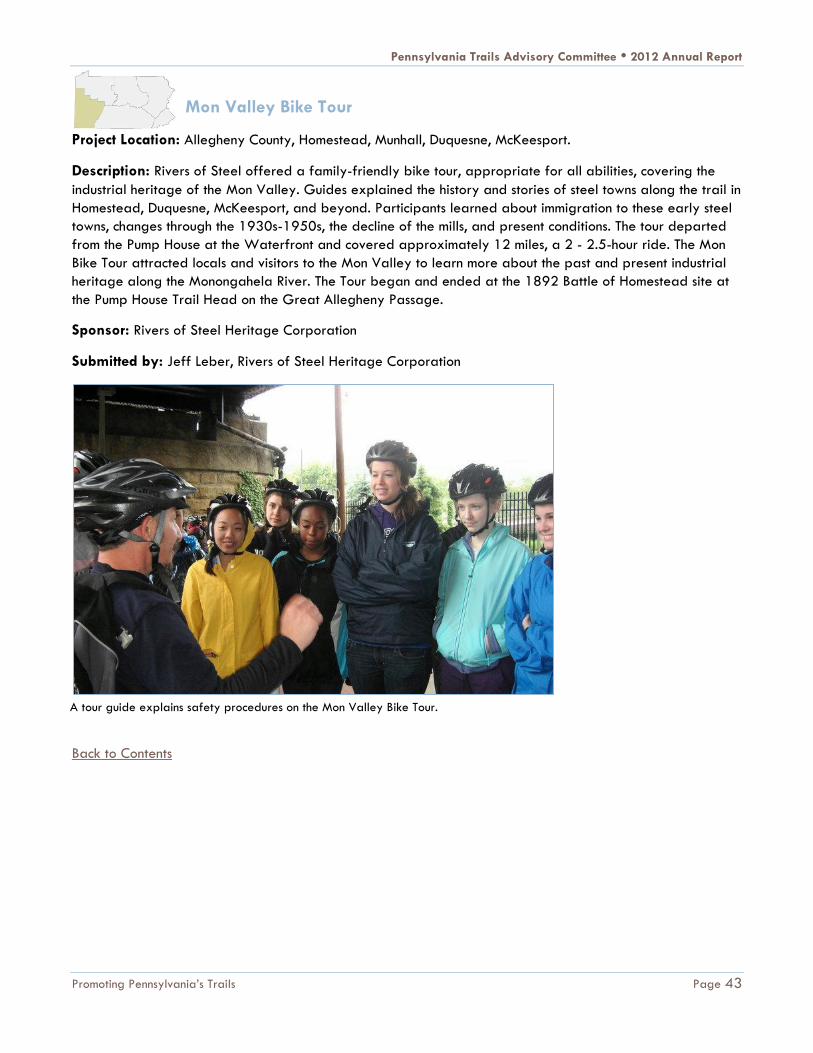
Mon Valley Bike Tour
Project Location: Allegheny County, Homestead, Munhall, Duquesne, McKeesport.
Description: Rivers of Steel offered a family-friendly bike tour, appropriate for all abilities, covering the
industrial heritage of the Mon Valley. Guides explained the history and stories of steel towns along the trail in
Homestead, Duquesne, McKeesport, and beyond. Participants learned about immigration to these early steel
towns, changes through the 1930s-1950s, the decline of the mills, and present conditions. The tour departed
from the Pump House at the Waterfront and covered approximately 12 miles, a 2 - 2.5-hour ride. The Mon
Bike Tour attracted locals and visitors to the Mon Valley to learn more about the past and present industrial
heritage along the Monongahela River. The Tour began and ended at the 1892 Battle of Homestead site at
the Pump House Trail Head on the Great Allegheny Passage.
Sponsor: Rivers of Steel Heritage Corporation
Submitted by: Jeff Leber, Rivers of Steel Heritage Corporation
Back to Contents
A tour guide explains safety procedures on the Mon Valley Bike Tour.
Pennsylvania Trails Advisory Committee • 2012 Annual Report
Promoting Pennsylvania’s Trails Page 44
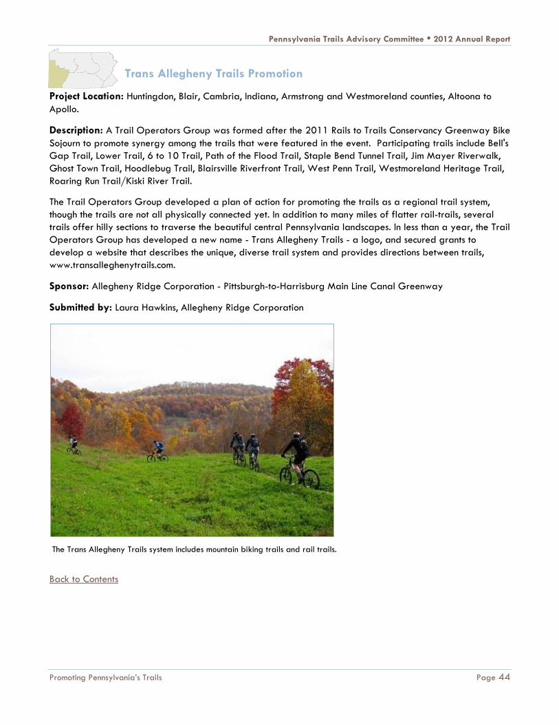
Trans Allegheny Trails Promotion
Project Location: Huntingdon, Blair, Cambria, Indiana, Armstrong and Westmoreland counties, Altoona to
Apollo.
Description: A Trail Operators Group was formed after the 2011 Rails to Trails Conservancy Greenway Bike
Sojourn to promote synergy among the trails that were featured in the event. Participating trails include Bell's
Gap Trail, Lower Trail, 6 to 10 Trail, Path of the Flood Trail, Staple Bend Tunnel Trail, Jim Mayer Riverwalk,
Ghost Town Trail, Hoodlebug Trail, Blairsville Riverfront Trail, West Penn Trail, Westmoreland Heritage Trail,
Roaring Run Trail/Kiski River Trail.
The Trail Operators Group developed a plan of action for promoting the trails as a regional trail system,
though the trails are not all physically connected yet. In addition to many miles of flatter rail-trails, several
trails offer hilly sections to traverse the beautiful central Pennsylvania landscapes. In less than a year, the Trail
Operators Group has developed a new name - Trans Allegheny Trails - a logo, and secured grants to
develop a website that describes the unique, diverse trail system and provides directions between trails,
www.transalleghenytrails.com.
Sponsor: Allegheny Ridge Corporation - Pittsburgh-to-Harrisburg Main Line Canal Greenway
Submitted by: Laura Hawkins, Allegheny Ridge Corporation
Back to Contents
The Trans Allegheny Trails system includes mountain biking trails and rail trails.
Pennsylvania Trails Advisory Committee • 2012 Annual Report
Promoting Pennsylvania’s Trails Page 45
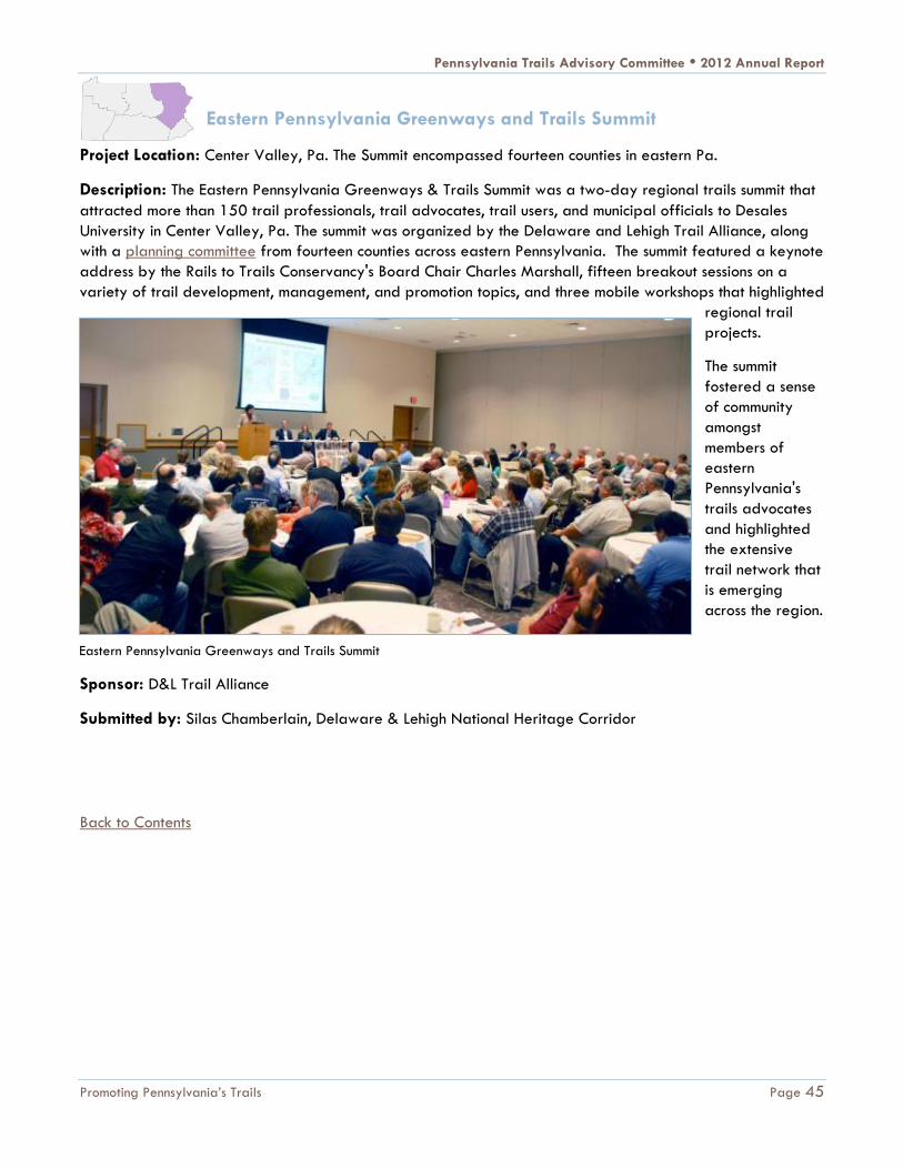
Eastern Pennsylvania Greenways and Trails Summit
Project Location: Center Valley, Pa. The Summit encompassed fourteen counties in eastern Pa.
Description: The Eastern Pennsylvania Greenways & Trails Summit was a two-day regional trails summit that
attracted more than 150 trail professionals, trail advocates, trail users, and municipal officials to Desales
University in Center Valley, Pa. The summit was organized by the Delaware and Lehigh Trail Alliance, along
with a planning committee from fourteen counties across eastern Pennsylvania. The summit featured a keynote
address by the Rails to Trails Conservancy's Board Chair Charles Marshall, fifteen breakout sessions on a
variety of trail development, management, and promotion topics, and three mobile workshops that highlighted
regional trail
projects.
The summit
fostered a sense
of community
amongst
members of
eastern
Pennsylvania's
trails advocates
and highlighted
the extensive
trail network that
is emerging
across the region.
Sponsor: D&L Trail Alliance
Submitted by: Silas Chamberlain, Delaware & Lehigh National Heritage Corridor
Back to Contents
Eastern Pennsylvania Greenways and Trails Summit

Pennsylvania Trails Advisory Committee • 2012 Annual Report
Promoting Pennsylvania’s Trails Page 46
Sensible, Courteous, Off-Road Enthusiasts (SCORE)
Project Location: Statewide
Description: The Pennsylvania Off-
Highway Vehicle Association (PaOHV)
worked to create a traveling classroom
and training curriculum that set the stage
for the future of ATV safety training in
Pennsylvania.
Thanks, in part, to funding received from
a DCNR grant, PaOHV expanded its
Rules of the Trail program which is a
continuation of the nationally recognized
Sensible, Courteous, Off-Road Enthusiasts
(SCORE) rider training program. The
PaOHV worked in coordination with the
Pennsylvania Trails Foundation to create
the Rules of the Trail program which uses
state of the art technology to train
motorized users and non-users with the
ATV simulator (see picture). The ATV
simulator allows participants to
experience proper safety techniques necessary to operate an ATV while learning about trail sustainability,
environmental stewardship and trail etiquette.
The new safety training curriculum is part of a presentation given to attendees of the Rules of the Trail safety
training program. PaOHV volunteers anticipate using the ATV simulator and the Rules of the Trail traveling
classroom extensively during 2013 and beyond.
Sponsor: Pennsylvania Off-Highway Vehicle Association (PaOHV)
Submitted by: Eric Bruggeman, PaOHV
Back to Contents
Student uses the ATV simulator. Source: Chris McNeil

Pennsylvania Trails Advisory Committee • 2012 Annual Report
Promoting Pennsylvania’s Trails Page 47
Lower Trail Video
Project Location: Blair and Huntingdon counties
Description: Rails to Trails of Central Pennsylvania,
with funding from Explore Altoona, the local destination
marketing organization, developed a three minute
video of the Lower Trail to be posted on the Explore
Altoona, ExploePAtrails.com YouTube channel and the
Lower Trail web sites.
The video provides a visual description of the Lower
Trail and the outdoor activities enjoyed there. Its
presence on various web sites expands the exposure of
the Lower Trail and will attract additional visitors to the
Huntingdon/Blair County area.
Sponsor: Rails to Trails of Central Pa., Inc.
Submitted by: Ethan Imhoff, Rails to Trails of Central Pa., Inc.
Hollidaysburg YMCA Day Camp Adventure
Project Location: Blair County, Williamsburg
Description: The Allegheny Ridge Corporation, through its
Main Line Canal Greenway initiative joined with the
Hollidaysburg YMCA and Rails to Trails of Central Pa. to
provide a day of cycling on the Lower Trail. Local bike
shops and the Blair County Bicycle Club joined in making the
experience available to youngsters attending the Y's
Summer Day Camp program.
A dozen children and their counselors took part in the late
summer ride. All agreed it was a great experience and
introduced the campers to a nearby outdoor recreation
resource. The sponsors of the event, including the YMCA, are
planning to repeat it in 2013.
Sponsor: Allegheny Ridge Corporation
Submitted by: Jane Sheffield, Allegheny Ridge Corporation
Back to Contents
Lower Trail video helps promote the trail.
YMCA summer day campers on the Lower Trail

Pennsylvania Trails Advisory Committee • 2012 Annual Report
Promoting Pennsylvania’s Trails Page 48
Mainline Canal Greenway GeoTrail
Project Location: Allegheny, Westmoreland, Armstrong, Indiana, Cambria, Blair, Huntingdon, Mifflin, Juniata,
Perry, and Dauphin counties
Description: The Allegheny Ridge Corporation maintains the Main Line Canal GeoTrail, a series of 31
geocaches stretching across 320 miles of the Main Line Canal Greenway. The GeoTrail encourages
technology-savvy enthusiasts to experience the outdoors while increasing awareness of the Greenway and
focusing on its heritage.
Over a thousand geocachers participated in the
GeoTrail during 2012, leaving feedback on-line in log
books included with each cache.
Sponsor: Allegheny Ridge Corporation
Submitted by: Jane Sheffield, Allegheny Ridge
Corporation
Kinzua Valley Trail Cache Quest
Project Location: McKean County, Lafayette Township, Westline
Description: The Kinzua Valley Trail Club created the Kinzua Cache
Quest in an effort to highlight the trail's natural beauty and diversity.
The Kinzua Cache Quest involves having participants find four caches
hidden along the trail and record a secret code contained in each
cache. The participants then send the codes to the trail club and are
rewarded with a “geocoin.” The program gives participants an
incentive to explore the entire length of the trail and gives them a
connection to the trail and the trail organization. You can find more
information at http://kinzuavalleytrail.org/geocache.
Sponsor: Kinzua Valley Trail Club
Submitted by: Joe Lanich, Kinzua Valley Trail Club
Back to Contents
Geocacher locates a Main Line Canal GeoTrail cache.
Kinzua Valley Trail Cache Quest brochure

Pennsylvania Trails Advisory Committee • 2012 Annual Report
Promoting Pennsylvania’s Trails Page 49
Juniata River Water Trail Interpretive Panel
Project Location: Perry County, Duncannon
Description: The Allegheny Ridge Corporation funded the design and production of an interpretive panel for
Duncannon Borough, matching those previously installed along the Juniata River Water Trail. The panel
provides information on the water trail, the Main Line Canal Greenway and offers safety tips for boaters.
The Juniata River Water Trail panel increases the
awareness of residents and visitors to Duncannon of the
opportunities afforded by the water trail and the Main
Line Canal Greenway.
Sponsor: Allegheny Ridge Corporation
Submitted by: Jane Sheffield, Allegheny Ridge
Corporation
Back to Contents
Juniata River Water Trail interpretive panel

Pennsylvania Trails Advisory Committee • 2012 Annual Report
Promoting Pennsylvania’s Trails Page 50
Heritage Towns and Tours Program
Project Location: Schuylkill County: Schuylkill Haven and Pottsville; Berks County: Hamburg and Exeter;
Montgomery County: Pottstown and Norristown; Chester County: East Pikeland & Phoenixville; Philadelphia
County: East Falls, Manayunk, Historic Germantown
Description: The Schuylkill River Heritage Area's Heritage Towns & Tours initiative assists communities along
the Schuylkill River Trail in attracting trail users to downtowns, restaurants, shops, historic sites and other
attractions. The program strives to increase visitors to trail towns and improve the economies of participating
municipalities.
Two types of grants are offered through the Heritage Towns and Tours program. Heritage Action Plan grants
assist communities in developing a Heritage Action Plan using the Heritage Towns and Tours Toolkit. Grant
recipients are awarded $2,000 to support creation of
a plan, and receive up to $5,000 in consultant support
while developing the plan. All recipients who have
completed a Heritage Action Plan are then eligible for
an implementation grant of up to $25,000 to
implement specific items outlined in the plan.
In addition to the grants, any interested community or
organization can purchase a Heritage Towns and Tours
Toolkit, available on DVD for $5 through the Schuylkill
River Heritage Area website. The grants are made
possible through funding from the William Penn
Foundation and the Pennsylvania Department of
Conservation and Natural Resources.
Since the program was initiated in 2011, the Schuylkill
River Heritage Area has provided Heritage Action Plan
grants to 12 communities and implementation grants to nine communities located along the Schuylkill River
land and water trails. The grants support communities with projects in three areas: improving connections
between trails and towns, creating an identity and a sense of place, and marketing themselves as
destinations. Examples of projects funded by the grants include the design, fabrication and installation of
wayfinding and/or interpretive signs in several communities; striping bike lanes and adding kiosks with
information about downtown Pottstown; adding landscaping and designing a mural arts program in
Manayunk. More information is available at http://www.schuylkillriver.org/Heritage_Towns_Tours.aspx.
Sponsor: Schuylkill River Heritage Area
Submitted by: Laura Catalano, Schuylkill River Heritage Area
Back to Contents
Signage installed as part of the Heritage Towns and
Tours Program

Pennsylvania Trails Advisory Committee • 2012 Annual Report
Promoting Pennsylvania’s Trails Page 51
58th Street Greenway
Project Location: Philadelphia, connecting Historic Bartram's Garden to Cobbs Creek Park
Description: The Pennsylvania Environmental Council (PEC) is helping the City of Philadelphia coordinate
completion of the 58th Street Greenway. The greenway is a community-designed, multi-use trail project to
create a safer, more attractive and economically active corridor for residents and businesses around 58th
Street in Southwest Philadelphia. A 1.5-mile trail will connect historic Bartram's Garden to Cobbs Creek Park.
PEC has been protecting and restoring the natural and built environment through innovation education and
advocacy for over 40 years. One of PEC's major initiatives has been developing greenway corridors
throughout the Philadelphia area. PEC has been leading the development of the 58th Street Greenway since
2009 in order to connect a key link in the Circuit (Greater Philadelphia's Regional Trail Network).
Starting in the fall of 2009, PEC rallied local residents,
institutions, business owners, clergy, and school
administrators to work with traffic engineers to design
the trail through a series of nine community meetings.
The final design for the greenway combined a 10 foot
wide paved trail with new trees, pedestrian-scale
lighting, benches, way-finding signage, traffic calming
and innovative bicycle safety measures, and green
stormwater management structures.
While the trail was under construction this past year,
PEC partnered with Neighborhood Bike Works to help
educate neighborhood youth and adults on proper
bicycle maintenance and safe riding habits in
anticipation of the greenway opening in early 2013.
Children who successfully completed the program got to take home the bike they repaired over the eight
week course.
PEC also partnered with uGO: A Community Wellness Venture to organize an active-living program that
brought seventy-five community residents together to stretch, walk, exercise, to Zumba® or do line dancing at
Myers Recreation Center. The program encouraged participation from the young and old, with ages ranging
from teenager to septuagenarian.
"I feel better walking. I haven’t done it for so long I had forgotten how fun it is," said longtime resident Ella
Johnson, "I wish it had been going on a long time ago. We need this, us older folks."
Neighborhood organizations are now working on developing future greening projects, bicycling clubs, and
better connecting senior citizens and children to the trail.
Sponsor: Pennsylvania Environmental Council
Submitted by: Jeff Knowles, Pennsylvania Environmental Council
Back to Contents
Neighborhood Bike Works opens recreation opportunities
for local kids on the 58th Street Greenway.

Pennsylvania Trails Advisory Committee • 2012 Annual Report
Promoting Pennsylvania’s Trails Page 52
September 11th National Memorial Trail Ride
Project Location: Somerset County
Description: On September 29, 2012, bicyclists rode the 22-mile distance between Flight 93 National
Memorial and the Great Allegheny Passage in Rockwood, Pa. This was an exploratory effort to scout out the
best possible route for a key segment of the September 11th National Memorial Trail through the Laurel
Highlands.
The larger goal of the project is to develop a national multi-state trail connecting the three national memorials
honoring those lost on September 11, 2001 at the World Trade Center in New York City, the Pentagon in
Washington, D.C. and the Flight 93 crash site near Shanksville, Pa.
Sponsor: September 11th National Trail Alliance
Submitted by: David Brickley, September 11th National Trail Alliance
Bicyclists began the 22-mile ride at the Flight 93 National Memorial.
Back to Contents

Pennsylvania Trails Advisory Committee • 2012 Annual Report
Promoting Pennsylvania’s Trails Page 53
ExplorePAtrails.com Mobile Website
Project Location: Statewide
Description: Since late in 2009, DCNR, in partnership with
Western Pennsylvania Conservancy, Rails-to-Trails
Conservancy, Keystone Trails Association, and more than a
thousand trail stewards and volunteers, have powered the one-
stop website, www.ExplorePAtrails.com. This website, designed
for desktop internet users, provides resources for searching,
viewing, mapping, and sharing information about
Pennsylvania’s extensive network of trails.
But with more than 400 million smart phones sold in 2012,
mobile computing has quickly become the norm. More than
13,000 visitors used mobile devices to request information on
ExplorePAtrails.com.
In response, DCNR launched the ExplorePAtrails.com Mobile
Website in October 2012. This gave users of smart phones
and tablets a better way of getting trails information. The new
mobile-friendly website allows users to search, map and share
trails information while on the go. Trails enthusiasts can now
find a trail or connect and share with Facebook friends while
on the road or on the trail. All the data and information
available on ExplorePAtrails.com for desktop is now available
for mobile users.
Join other smart phone and tablet users by visiting
ExplorePAtrails.com to view and share maps, photos, tweets,
Facebook posts, calendar events and YouTube videos. To find out
more, visit the site or contact [email protected].
Sponsor: DCNR Bureau of Recreation and Conservation
Submitted by: Kent Taylor, DCNR
Back to Contents
LEADING THE WAY
As has been described in this report, much work is being done to develop, maintain and promote trails under
the leadership of the Pennsylvania Trails Advisory Committee. These actions include organizing trail work
crews, constructing additional trail miles, improving trail access, leading trail sojourns, building useful trail
websites and mobile apps, guiding trail construction and funding, and posting signage for trail users. Trail
Visit ExplorePAtrails.com Mobile today!

Pennsylvania Trails Advisory Committee • 2012 Annual Report
Promoting Pennsylvania’s Trails Page 54
projects will continue to build on connections, lessons learned, and ideas shared at summits, workshops, and
volunteer trainings in 2013.
In 2012, trail leaders came together to form the Pennsylvania Trails Advisory Committee, helping to guide the
future of trails in the state. Trail experts and decision-makers will continue to support the process, and
together will achieve the vision of a trail in every community throughout the Commonwealth. Partner
organizations across the state will promote these trails and jointly sponsor training for trail construction and
maintenance. The Committee will continue to carry out action items in the Outdoor Recreation Plan, and as one
of the committee members stated, "Like the plan itself, the group’s success is dependent upon an enthusiasm
for the work, active participation and implementation of ideas."
For more information, visit www.dcnr.state.pa.us/brc/recreation/trails/index.htm or
www.paoutdoorrecplan.com. For free information about trails in Pennsylvania, visit www.ExplorePAtrails.com.
“I feel better walking. I haven’t done it for so long. I had forgotten how fun it is. I wish it had been going on a long time ago.”
-Ella Johnson, longtime resident of Philadelphia speaking about the 58th Street Greenway
Girl Scouts work on trailhead improvement project on the Lackawanna Heritage Valley Trail.

Pennsylvania Trails Advisory Committee • 2012 Annual Report
Page 55
APPENDIX: TRAILS TO WATCH IN 2013
Trail County(s)
Anthracite Outdoor Adventure Area Northumberland
Bensalem Greenway - Delaware River Trail Bucks
Chester Valley Trail, Bridgeport Chester
D & L Trail, Mountain Top to White Haven Luzerne
Delaware Water Gap to Portland Monroe and Northampton
Enola Low Grade Trail Lancaster
Jordan Creek Greenway, South Whitehall and Whitehall townships Lehigh
Lackawanna River Heritage Trail, Archbald and Jermyn Boroughs Lackawanna
Lebanon Valley Rail Trail Lebanon
Mingo Creek Multi-Use Trail Washington
Musser Gap Greenway Centre
Northwest Lancaster County River Trail, Shocks Mill Bridge Lancaster
Oil Creek Trail, Memorial Landing Venango
Panhandle Trail Allegheny and Washington
Redbank Valley Rail Trail Clarion and Armstrong
Rock Run Recreation Area Cambria and Clearfield
Route 202 Parkway Trail Bucks
Schuylkill River Trail and Cynwyd Trail, Manayunk Bridge Extension Philadelphia and Montgomery
Schuylkill River Trail, Phoenixville Borough and East Pikeland Township Chester
Seaway Trail Extension Erie
Spring Garden Street Greenway Philadelphia
West Creek Recreational Trail Cameron and Elk
Back to Contents