Embed Size (px)
Citation preview
PennDOT Connectivity Handbook
PennDOT Connectivity Handbook
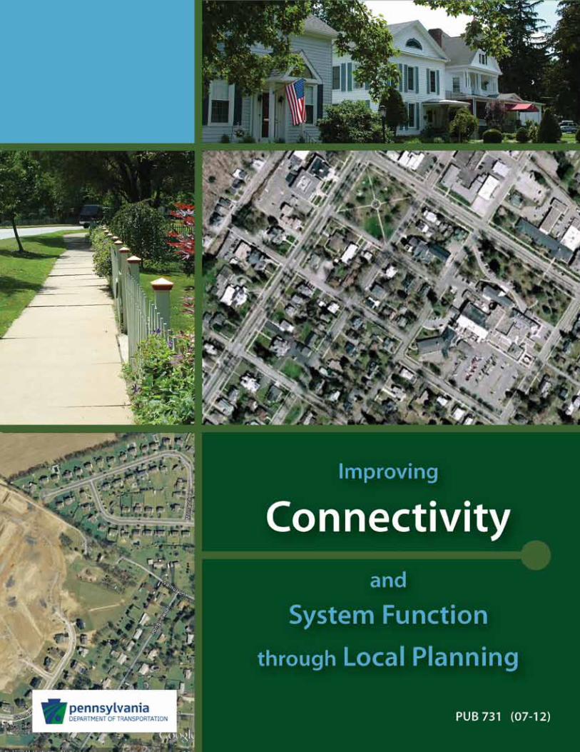
This handbook is intended as a resource for Pennsylvania’s county and municipal leaders and professional planners who seek practical guidance in more effectively implementing the land use and transportation recommendations from their comprehensive plan. Specifically, this handbook is designed to provide the guidance necessary to enhance vehicular, bicycle, and pedestrian connectivity, thereby improving overall transportation system functionality and safety.
Due to the broad range of issues and potential actions relating to connectivity, this handbook was developed through the collaboration of several different organizations—the Pennsylvania Department of Transportation, Pennsylvania Department of Community and Economic Development, Pennsylvania State Association of Boroughs, Pennsylvania State Association of Township Supervisors, Pennsylvania Chapter of the American Planning Association, and the Lehigh Valley Planning Commission. Representatives from these organizations provided input and review comments, enabling the development of this handbook as part of a continuing effort to collectively encourage more effective implementation of comprehensive planning.
As is the case with any guidebook that relates directly to language in the Municipalities Planning Code or other legislation, the potential for various legal interpretations clearly exists. Municipalities are encouraged to seek legal counsel before adopting any ordinances.
As Pennsylvania’s various government entities work together to more effectively plan and implement those plans, we are supporting our individual missions as well as advancing shared goals—strengthening communities, conserving resources, and making the most of infrastructure investments.
Special thanks to the Lehigh Valley Planning Commission for helping to bring the issue of connectivity to the forefront and their assistance in the development of this guidance.
PennDOT Connectivity Handbook
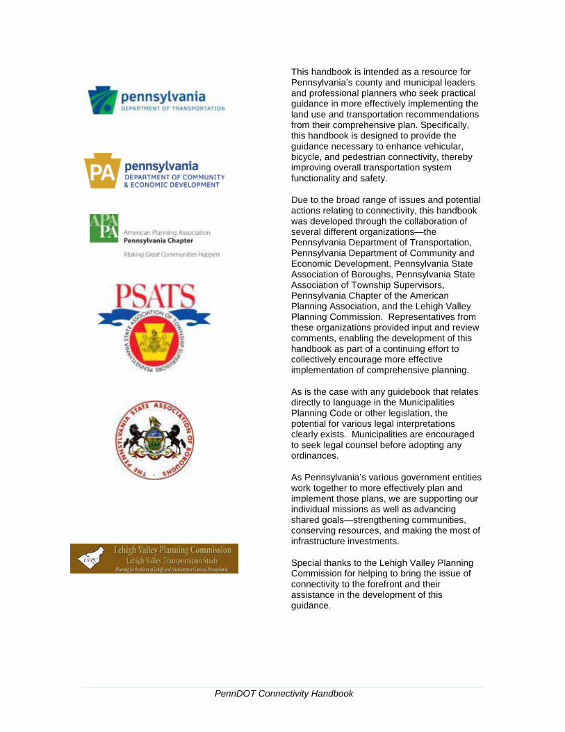
Contents
1. Introduction ..................................................................................................... 1
Background ............................................................................................................ 1
Benefits and Challenges of Effectively Managing Transportation Systems ...... 2
The Importance of Providing a Balanced System ................................................ 2
2. Local and Regional Planning to Improve Connectivity and Transportation System Function ............................................................................................. 5
Assessing Current and Future Connectivity ........................................................ 5
Comprehensive Plans ............................................................................................ 7
Bicycle/Pedestrian Plans and Studies .................................................................. 9
Long-Range Transportation Plans ...................................................................... 11
Traffic Impact Studies and Fees .......................................................................... 11
3. Effective Strategies for Improving System Connectivity and Function ... 14
Regulating Connectivity ...................................................................................... 14
Managing Connectivity ........................................................................................ 25
Appendices ....................................................................................................... 31
Standalone Connectivity Model Ordinance ........................................................ 33
Model Subdivision & Land Development Ordinance Language........................ 38
Model Zoning Ordinance Language .................................................................... 43
PennDOT Connectivity Handbook | page 1
PennDOT Connectivity Handbook | page 1
1. Introduction
Background Communities experiencing significant growth in population, employment, or traffic—and those with existing traffic congestion problems—often struggle with ways to provide improved system function when financial constraints and/or physical limitations preclude the addition of lanes or other major system improvements. The popularity of the recent Official Map Handbook (Publication 703), which provides one tool for improving transportation system connectivity, underscores the fact that municipalities are seeking cost effective strategies for improving the function of their existing transportation system facilities. This handbook, part of PennDOT’s series of transportation and land use handbooks, is aimed at supporting local governments in the shared goal of improving system connectivity and multimodal system function through local planning.
Connectivity has been defined in the transportation context as the measurement of “a system of streets with multiple routes and connections serving the same origins and destinations.” Simply stated, a high degree of connectivity means there are many ways to get from Point A to Point B. True connectivity may be different for various modes due to the number of factors that affect non-motorized connectivity such as topography, trails, sidewalks, bike lanes, etc., that do not necessarily affect motorized connectivity.
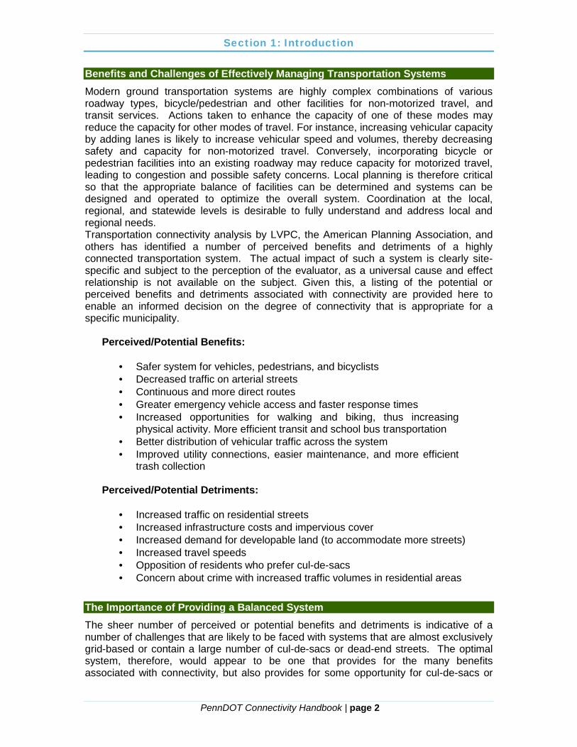
The Lehigh Valley Planning Commission (LVPC) prepared “Street Connectivity – Improving the Function and Performance of Your Local Streets” in 2011. This PennDOT handbook builds upon LVPC’s efforts by expanding the inventory of practices and tools across the Commonwealth. For those interested, the LVPC document does an excellent job of tracing the history of connectivity in Pennsylvania, from the early, highly interconnected grid system in Philadelphia, through the transition to curvilinear streets with many cul-de-sacs, to the “back to the future” movement of traditional neighborhood developments that seek to recreate the grid system of some of Pennsylvania’s oldest communities.
In addition to building upon LVPC’s efforts, this handbook helps integrate the guidance provided through several previous handbooks in PennDOT’s Planning Series. The intent is to support PennDOT’s ongoing efforts to integrate transportation and land use planning, and to enable PennDOT and municipalities to jointly plan for transportation system improvements and alleviate congestion along major transportation corridors.
Section 1: Introduction
PennDOT Connectivity Handbook | page 2
Benefits and Challenges of Effectively Managing Transportation Systems Modern ground transportation systems are highly complex combinations of various roadway types, bicycle/pedestrian and other facilities for non-motorized travel, and transit services. Actions taken to enhance the capacity of one of these modes may reduce the capacity for other modes of travel. For instance, increasing vehicular capacity by adding lanes is likely to increase vehicular speed and volumes, thereby decreasing safety and capacity for non-motorized travel. Conversely, incorporating bicycle or pedestrian facilities into an existing roadway may reduce capacity for motorized travel, leading to congestion and possible safety concerns. Local planning is therefore critical so that the appropriate balance of facilities can be determined and systems can be designed and operated to optimize the overall system. Coordination at the local, regional, and statewide levels is desirable to fully understand and address local and regional needs. Transportation connectivity analysis by LVPC, the American Planning Association, and others has identified a number of perceived benefits and detriments of a highly connected transportation system. The actual impact of such a system is clearly site-specific and subject to the perception of the evaluator, as a universal cause and effect relationship is not available on the subject. Given this, a listing of the potential or perceived benefits and detriments associated with connectivity are provided here to enable an informed decision on the degree of connectivity that is appropriate for a specific municipality.
Perceived/Potential Benefits: · Safer system for vehicles, pedestrians, and bicyclists · Decreased traffic on arterial streets · Continuous and more direct routes · Greater emergency vehicle access and faster response times · Increased opportunities for walking and biking, thus increasing
physical activity. More efficient transit and school bus transportation · Better distribution of vehicular traffic across the system · Improved utility connections, easier maintenance, and more efficient
trash collection
Perceived/Potential Detriments: · Increased traffic on residential streets · Increased infrastructure costs and impervious cover · Increased demand for developable land (to accommodate more streets) · Increased travel speeds · Opposition of residents who prefer cul-de-sacs · Concern about crime with increased traffic volumes in residential areas
The Importance of Providing a Balanced System The sheer number of perceived or potential benefits and detriments is indicative of a number of challenges that are likely to be faced with systems that are almost exclusively grid-based or contain a large number of cul-de-sacs or dead-end streets. The optimal system, therefore, would appear to be one that provides for the many benefits associated with connectivity, but also provides for some opportunity for cul-de-sacs or
Section 1: Introduction
PennDOT Connectivity Handbook | page 3
dead-end streets where site conditions or residents’ concerns dictate such roadways. To this end, many of the examples provided in this document attempt to encourage connectivity through various incentives or may discourage cul-de-sacs, but typically provide for a balanced approach to improve connectivity and the overall operation of a given transportation system. There is general consensus in the existing literature on connectivity that some degree of traffic calming is desirable in systems that have a high degree of connectivity. Traffic calming refers to any of a collection of techniques for reducing speeds and improving safety. Therefore, traffic calming issues, approaches, and measures are also discussed in this handbook.
PennDOT Connectivity Handbook | page 4
2.
PennDOT Connectivity Handbook | page 5
3. Local and Regional Planning to Improve Connectivity and Transportation System Function
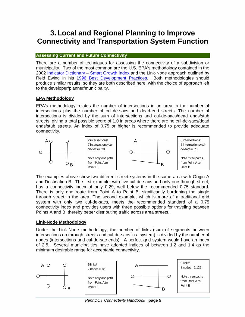
Assessing Current and Future Connectivity There are a number of techniques for assessing the connectivity of a subdivision or municipality. Two of the most common are the U.S. EPA’s methodology contained in the 2002 Indicator Dictionary – Smart Growth Index and the Link-Node approach outlined by Reid Ewing in his 1996 Best Development Practices. Both methodologies should produce similar results, so they are both described here, with the choice of approach left to the developer/planner/municipality. EPA Methodology EPA’s methodology relates the number of intersections in an area to the number of intersections plus the number of cul-de-sacs and dead-end streets. The number of intersections is divided by the sum of intersections and cul-de-sacs/dead ends/stub streets, giving a total possible score of 1.0 in areas where there are no cul-de-sacs/dead ends/stub streets. An index of 0.75 or higher is recommended to provide adequate connectivity. The examples above show two different street systems in the same area with Origin A and Destination B. The first example, with five cul-de-sacs and only one through street, has a connectivity index of only 0.29, well below the recommended 0.75 standard. There is only one route from Point A to Point B, significantly burdening the single through street in the area. The second example, which is more of a traditional grid system with only two cul-de-sacs, meets the recommended standard of a 0.75 connectivity index and provides users with three possible options for traveling between Points A and B, thereby better distributing traffic across area streets. Link-Node Methodology Under the Link-Node methodology, the number of links (sum of segments between intersections on through streets and cul-de-sacs in a system) is divided by the number of nodes (intersections and cul-de-sac ends). A perfect grid system would have an index of 2.5. Several municipalities have adopted indices of between 1.2 and 1.4 as the minimum desirable range for acceptable connectivity.
A A
B
2 intersections/ 7 intersections+cul-de-sacs = .29 Note only one path from Point A to Point B
6 intersections/ 8 intersections+cul-de-sacs = .75 Note three paths from Point A to Point B
6 links/ 7 nodes = .86 Note only one path from Point A to Point B
9 links/ 8 nodes = 1.125 Note three paths from Point A to Point B
B
A
B B
A

Section 2: Local and Regional Planning to Improve Connectivity
PennDOT Connectivity Handbook | page 6
Using the same examples provided under the EPA methodology, the first system still gives an index well below the desired range with 6 links and 7 nodes, at 0.86. The second example illustrates 9 links and 8 nodes, for an index of 1.125, which is still below the recommended minimum, but much closer to the desired range. This comparison of methodologies seems to indicate that the Link-Node approach may be slightly more stringent than the EPA methodology, but such a conclusion may be site-specific. Given the slightly different outcomes between the two methodologies, municipalities wishing to regulate connectivity may want to test the two methodologies and determine which works best in defining the desired level of connectivity and/or determine the minimum indices to be used. Municipalities may also want to provide developers the option of selecting between the methodologies with the recommended ranges defined locally or in this publication. Incorporating a connectivity analysis into the subdivision/land development review process can be as simple as incorporating a small section on connectivity into a county or municipal subdivision and land development ordinance (SALDO). The Division of Planning within the Kentucky Transportation Cabinet has developed model ordinance language that uses the link-node approach, but this could easily be modified to use either methodology and any desired index value:
To provide adequate internal connectivity within a subdivision or planned development, the street network shall have a minimum connectivity index of [1.40]. The desired minimum connectivity index is [1.60]. The connectivity index is defined as the number of street links divided by the number of nodes and link ends (including cul-de-sacs and sharp curves with 15 mph design speed or lower).
Should a county or municipality wish to regulate connectivity through their SALDO, they may want to also incorporate key definitions such as “connectivity,” “connectivity index,” “link,” “node,” and other key terms. It may also be advisable to add a statement of purpose that addresses potential connectivity benefits such as those identified below. This purpose statement was taken from the Kentucky Model Street Connectivity Standards Ordinance:
The purpose of this ordinance includes the support of the creation of a highly connected transportation system to:
(a) Provide choices for drivers, bicyclists, and pedestrians; (b) Promote walking and bicycling; (c) Connect neighborhoods to each other and to destinations
such as schools, parks, shopping, libraries, and post offices among others;
(d) Provide opportunities for residents to increase their level of physical activity each day by creating walkable neighborhoods with adequate connections to destinations;
(e) Reduce vehicle miles traveled and travel time to improve air quality and mitigate the effects of auto emissions on the health of residents;
(f) Reduce emergency response times; (g) Increase effectiveness of municipal service delivery; and (h) Restore arterial street capacity to better service regional long-
distance travel needs.
Section 2: Local and Regional Planning to Improve Connectivity
PennDOT Connectivity Handbook | page 7
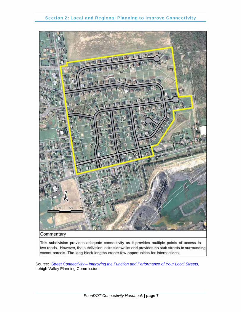
Source: Street Connectivity – Improving the Function and Performance of Your Local Streets, Lehigh Valley Planning Commission
Section 2: Local and Regional Planning to Improve Connectivity
PennDOT Connectivity Handbook | page 8
Comprehensive Plans Transportation and land use need to be considered together for Pennsylvania municipalities to achieve quality of life objectives for their communities. Transportation systems serve communities in various ways: the regional transportation system provides the mobility to travel throughout the region quickly, whereas the local network provides travelers access to the places that they want to go—home, work, school, shopping, appointments, activities, etc. Pennsylvania municipalities should consider how their transportation system meets both the mobility and accessibility needs of the community. Municipal land use policies help shape and rearrange the origins and destinations of travel and can either support or hinder mobility and accessibility. Transportation operates most efficiently when it provides a connected network of transportation modes serving a mix of land uses in close proximity. This type of system provides the traveler with a host of options and makes it possible to make fewer, shorter trips and be less dependent on a personal automobile.
A variety, or mix, of land uses, and an increase in land use densities (buildings closer together), can lead to shorter trip distances, a better blend of jobs and housing within a community, and an increase in the use of alternative modes of transportation (walking, bicycling, transit) because different destinations are closer together. A corner store within walking distance of one’s home, for example, means that picking up a bottle of milk can be pleasant exercise rather than requiring another trip to the supermarket by car. Designing our communities to encourage walking and biking can promote physical activity and lead to healthier lifestyles. Also, by providing a range of transportation choices beyond the automobile, individuals who do not drive are provided with new travel opportunities, and congestion and pollution can be eased. By contrast, separating land use types and/or reducing densities can increase the dependency on motorized transportation, thereby increasing congestion and/or the demand for additional roadways.
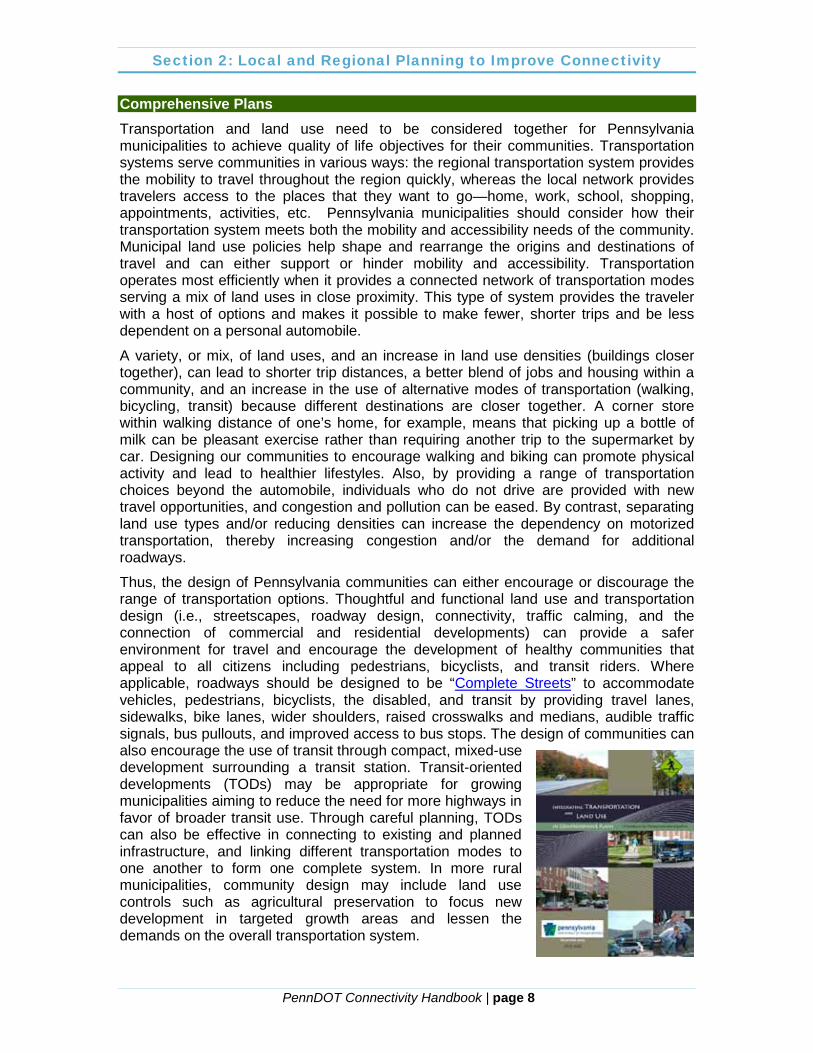
Thus, the design of Pennsylvania communities can either encourage or discourage the range of transportation options. Thoughtful and functional land use and transportation design (i.e., streetscapes, roadway design, connectivity, traffic calming, and the connection of commercial and residential developments) can provide a safer environment for travel and encourage the development of healthy communities that appeal to all citizens including pedestrians, bicyclists, and transit riders. Where applicable, roadways should be designed to be “Complete Streets” to accommodate vehicles, pedestrians, bicyclists, the disabled, and transit by providing travel lanes, sidewalks, bike lanes, wider shoulders, raised crosswalks and medians, audible traffic signals, bus pullouts, and improved access to bus stops. The design of communities can also encourage the use of transit through compact, mixed-use development surrounding a transit station. Transit-oriented developments (TODs) may be appropriate for growing municipalities aiming to reduce the need for more highways in favor of broader transit use. Through careful planning, TODs can also be effective in connecting to existing and planned infrastructure, and linking different transportation modes to one another to form one complete system. In more rural municipalities, community design may include land use controls such as agricultural preservation to focus new development in targeted growth areas and lessen the demands on the overall transportation system.
Section 2: Local and Regional Planning to Improve Connectivity
PennDOT Connectivity Handbook | page 9
Publication 688, Integrating Transportation and Land Use in Comprehensive Plans, goes into extensive detail on how to complete a comprehensive planning process that fully integrates transportation and land use. It provides information on data sources, public and agency involvement, and scenario planning to help ensure that land use planning and growth management occurs in a manner that is consistent with the characteristics and capacity of the transportation infrastructure. This handbook builds upon Publication 688 by providing a series of tools relating to system connectivity that can be an integral part of a comprehensive plan implementation program.
As has been emphasized in Publications 688, 662 (Improving the Land Use-Transportation Connection through Local Implementation Tools), and 575 (Developing Regional Long-Range Plans), comprehensive plans at the municipal and county level provide important building blocks for long-range transportation plans and can establish important local mechanisms for managing land use and securing transportation system improvements. Municipalities and counties can incorporate the connectivity analysis described in the previous section as part of the comprehensive planning process, and then adopt the implementation mechanisms described later in this handbook to help meet connectivity goals. By analyzing and planning for connectivity at the
municipal level, regionally connected systems become possible, thereby improving the function of the transportation system and overall quality of life.
Bicycle/Pedestrian Plans and Studies Improvements to street connectivity can promote pedestrian and bicycle travel. An interconnected network can provide more direct routes and therefore reduce the distance for pedestrians and bicyclists to reach local destinations. Allowing a mix of land uses within an area can provide multiple destination choices within a reasonable distance for non-motorized modes of transportation. Typically, a reasonable distance for walking is ¼ to ½ mile, and bicycling destinations should be within 5 miles. Ultimately, enhancing bicycle and pedestrian connectivity may also help facilitate an increase in active transportation choices and encourage healthy lifestyles. There are a number of strategies that can be applied to improve connections for non-motorized, active modes of transportation. Connectivity for bicycles and pedestrians can be dramatically different than for motor vehicles, as it includes not only roadways but also sidewalks, trails, greenways, etc. However, land development patterns have a similar impact on bicycle/pedestrian connectivity, with more dense and/or mixed use patterns typically resulting in shorter trip distances and a higher degree of connectivity. Plans or studies for connectivity of bicycle and pedestrian facilities can be done in a number of ways. Municipalities with fairly dense development and extensive sidewalks may be primarily interested in analyzing the existence and condition of sidewalks. More rural municipalities may be more interested in greenway and trail development to improve access to natural areas and other facilities. As such, there is no universal Commonwealth-sponsored guidance on the subject of bicycle and pedestrian planning. However, there are a number of available guidebooks on the issue, including the
Section 2: Local and Regional Planning to Improve Connectivity
PennDOT Connectivity Handbook | page 10
Chester County Planning Commission’s Trail and Path Planning – A Guide for Municipalities. Also, the Department of Conservation and Natural Resources (DCNR) provides technical and/or financial assistance for greenway or trail planning. PennDOT, through the federal Safe Routes to School (SRTS) program, encourages the completion of “walkability audits” as part of the SRTS planning process. The primary purpose behind these audits is to identify near-, medium-, and long-term strategies and projects to make it safer and easier for students to ride a bike or walk to school. Such audits could be initiated within the “travel shed” for schools and expanded throughout a municipality. Walkability audits may be particularly beneficial in more urbanized cities and
boroughs where nearly built-out conditions may limit the potential for vehicular connectivity improvements, and residents are already more likely to use bicycle or pedestrian facilities for shopping, recreation, etc. Completing the walkability audit process as outlined under the SRTS program can help with the development of more effective maintenance programs for sidewalks and similar facilities and can provide the data collection and planning necessary when funding programs are available to improve the overall system. Another potential tool for analyzing bicycle or pedestrian connectivity is the “Pedestrian Route Directness” (PRD) index as proposed by Hess in “Measures of Connectivity” (1997). PRD is the ratio of route distance to straight-line distance for two selected points. The lowest possible value is 1.00, where the most direct travel route is equivalent to the “as the crow flies” distance. The INDEX model proposed by Criterion Planners-Engineers (2001) recommends a PRD of 1.2-1.5, with values greater than 1.6 described as “indirect.” The limitation of the PRD index is that it requires the selection of origin and destination points, which introduces a certain degree of subjectivity into the calculation. Also, beyond the formal “directness of route” calculated, factors such as topography, traffic volumes and controls, etc., are likely to have a dramatic effect on the actual route taken and therefore true bicycle/pedestrian connectivity. Despite these limitations, the PRD index can be an effective planning tool. One of the primary issues arising in urban or suburban areas where sidewalks are a major component of the pedestrian connectivity system is the maintenance of sidewalks, which is the responsibility of the property owner. Some municipalities, including Derry Township in Dauphin County, have collectively bid for sidewalk maintenance/construction and allow residents to participate in the program in an effort to reduce the cost to the property owner. Similar programs could be undertaken in other municipalities to reduce the financial burden associated with maintaining connectivity resources.
Section 2: Local and Regional Planning to Improve Connectivity
PennDOT Connectivity Handbook | page 11
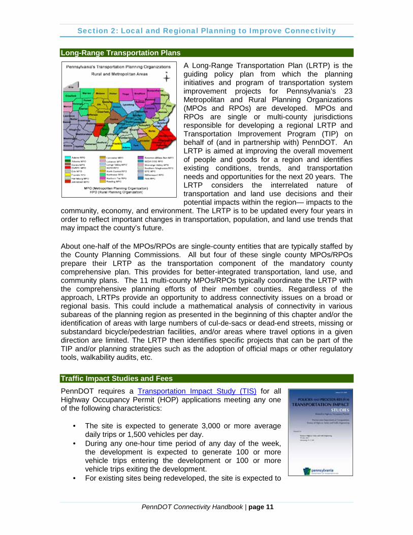
Long-Range Transportation Plans A Long-Range Transportation Plan (LRTP) is the guiding policy plan from which the planning initiatives and program of transportation system improvement projects for Pennsylvania’s 23 Metropolitan and Rural Planning Organizations (MPOs and RPOs) are developed. MPOs and RPOs are single or multi-county jurisdictions responsible for developing a regional LRTP and Transportation Improvement Program (TIP) on behalf of (and in partnership with) PennDOT. An LRTP is aimed at improving the overall movement of people and goods for a region and identifies existing conditions, trends, and transportation needs and opportunities for the next 20 years. The LRTP considers the interrelated nature of transportation and land use decisions and their potential impacts within the region— impacts to the
community, economy, and environment. The LRTP is to be updated every four years in order to reflect important changes in transportation, population, and land use trends that may impact the county’s future. About one-half of the MPOs/RPOs are single-county entities that are typically staffed by the County Planning Commissions. All but four of these single county MPOs/RPOs prepare their LRTP as the transportation component of the mandatory county comprehensive plan. This provides for better-integrated transportation, land use, and community plans. The 11 multi-county MPOs/RPOs typically coordinate the LRTP with the comprehensive planning efforts of their member counties. Regardless of the approach, LRTPs provide an opportunity to address connectivity issues on a broad or regional basis. This could include a mathematical analysis of connectivity in various subareas of the planning region as presented in the beginning of this chapter and/or the identification of areas with large numbers of cul-de-sacs or dead-end streets, missing or substandard bicycle/pedestrian facilities, and/or areas where travel options in a given direction are limited. The LRTP then identifies specific projects that can be part of the TIP and/or planning strategies such as the adoption of official maps or other regulatory tools, walkability audits, etc.
Traffic Impact Studies and Fees PennDOT requires a Transportation Impact Study (TIS) for all Highway Occupancy Permit (HOP) applications meeting any one of the following characteristics:
· The site is expected to generate 3,000 or more average daily trips or 1,500 vehicles per day.
· During any one-hour time period of any day of the week, the development is expected to generate 100 or more vehicle trips entering the development or 100 or more vehicle trips exiting the development.
· For existing sites being redeveloped, the site is expected to
Section 2: Local and Regional Planning to Improve Connectivity
PennDOT Connectivity Handbook | page 12
generate 100 or more additional trips entering or exiting the development during any one-hour time period of any day of the week.
· In the opinion of PennDOT, the development or redevelopment is expected to have a significant impact on highway safety or traffic flow, even if the above warrants are not met.
PennDOT may require a more generalized Transportation Impact Assessment (TIA) if the above warrants are not met, but there are factors relating to location of a proposed access and site configuration, congestion, or safety concerns. Whether or not PennDOT requires a TIS or TIA, municipalities are authorized by the Municipalities Planning Code (MPC) to require such studies as part of the subdivision or land development approval process. In order to do so, municipalities must incorporate such a requirement into their subdivision and land development and/or zoning ordinance. Municipalities wishing to add such a requirement to their ordinances should consider using the PennDOT requirements as the basis for the studies. This will help ensure consistency between local and state requirements.
The PennDOT TIS guidelines do not include requirements for the analysis of connectivity. However, the Link-Node methodology is referenced as a tool to be used in establishing assumptions that may be used in a TIS/TIA. Enhancing connectivity is also recommended to be considered as an alternative to capacity-adding projects. Municipalities choosing to adopt their own TIS/TIA guidelines may follow this approach or may establish minimum connectivity standards as part of their ordinance requirements. Examples of such requirements are included in the next chapter of this handbook. Traffic impact studies are also often completed to establish anticipated trip generation rates needed to calculate transportation impact fees in those municipalities where the necessary studies and
ordinances have been adopted. As outlined in PennDOT Publication 639, the Municipalities Planning Code requires that a Roadway Sufficiency Analysis and Capital Improvements Plan be developed before impact fees can be calculated and levied. The intent is to confirm that the scope and cost of transportation system improvement projects are appropriate for maintaining an acceptable level of service as development occurs. As such, consideration should be given to potential connectivity enhancement measures as a viable means of improving system function with future development. Developers may also propose connectivity enhancement as a mitigation measure, potentially reducing or eliminating the impact fees that would otherwise be assessed.

PennDOT Connectivity Handbook | page 13

PennDOT Connectivity Handbook | page 14
4. Effective Strategies for Improving System Connectivity and Function
Regulating Connectivity Once a municipality has effectively planned for their transportation system and determined that enhancing connectivity is consistent with their vision for an integrated transportation-land use future development scenario, the next challenge is to effectively regulate for the desired outcome. There are a number of tools available to a municipality or county as enabled through the MPC. These may include a separate connectivity ordinance, incorporating connectivity requirements into a Subdivision and Land Development Ordinance (SALDO) or zoning ordinance, and/or through the adoption of an Official Map. These options are discussed here along with examples from across Pennsylvania and applicable examples from other states. The appendix includes model ordinance language that has been extracted from the various examples researched. It must be understood that the regulation of connectivity for motorized versus non-motorized travel may be significantly different and that municipalities may want to focus on specific modes for enhancing connectivity. Regulating connectivity for bicycle/pedestrian facilities should be geared toward establishing a bikeable/walkable network that offers reasonable route directness (the distance a bicyclist/pedestrian would travel between two points) with appropriate levels of non-motorized accommodation at intersections, whether non-signalized or signalized. At signalized intersections, pedestrian signal heads and push buttons can be required to provide an increased level of safety for bicyclists/pedestrians. This is especially important in locations where crossings are excessively long, or signal phasing dictates the need for bicyclists/pedestrians to fully understand when it is appropriate for them to cross. Striped crosswalks at non-signalized intersections can be required to provide the most basic level of accommodation, indicating where bicyclists/pedestrians should cross. These also help remind drivers to watch for pedestrians and bicyclists. Managing Cul-de-sacs through Subdivision Ordinances The MPC, in Section 503, enables municipalities to adopt and enforce subdivision and land development ordinances that contain provisions to regulate street systems by including:
…Provisions governing the standards by which streets shall be designed, graded and improved, and walkways, curbs, gutters, street lights, fire hydrants, water and sewage facilities and other improvements shall be installed as a condition precedent to final approval of plats in accordance with the requirements of section 509. The standards shall insure that the streets be improved to such a condition that the streets are passable for vehicles which are intended to use that street: Provided, however, That no municipality shall be required to accept such streets for public dedication until the streets meet such additional standards and specifications as the municipality may require for public dedication.
Section 3: Strategies for Improving Connectivity
PennDOT Connectivity Handbook | page 15
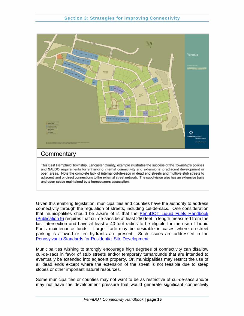
Given this enabling legislation, municipalities and counties have the authority to address connectivity through the regulation of streets, including cul-de-sacs. One consideration that municipalities should be aware of is that the PennDOT Liquid Fuels Handbook (Publication 9) requires that cul-de-sacs be at least 250 feet in length measured from the last intersection and have at least a 40-foot radius to be eligible for the use of Liquid Fuels maintenance funds. Larger radii may be desirable in cases where on-street parking is allowed or fire hydrants are present. Such issues are addressed in the Pennsylvania Standards for Residential Site Development. Municipalities wishing to strongly encourage high degrees of connectivity can disallow cul-de-sacs in favor of stub streets and/or temporary turnarounds that are intended to eventually be extended into adjacent property. Or, municipalities may restrict the use of all dead ends except where the extension of the street is not feasible due to steep slopes or other important natural resources. Some municipalities or counties may not want to be as restrictive of cul-de-sacs and/or may not have the development pressure that would generate significant connectivity

Section 3: Strategies for Improving Connectivity
PennDOT Connectivity Handbook | page 16
improvement through the SALDO process. Restrictions on the use of cul-de-sacs are still recommended to improve the overall function of the transportation system over the long term. Penn State’s Pennsylvania Standards for Residential Site Development suggests that the maximum length of a cul-de-sac be limited to no more than required for 30 dwelling units or the International Fire Code’s 750 feet. Allowing for longer roadways or higher numbers of dwelling units can lead to significant safety concerns and higher traffic volumes on the cul-de-sac, thereby reducing system connectivity and defeating one of the main purposes of this type of street.
Regardless of the approach selected by the county or municipality for restricting the use of cul-de-sacs, Section 503 of the MPC provides for the issuance of waivers in the event that site or project-specific conditions warrant relief from the restrictions. This enables municipalities or counties to take a fairly restrictive approach in the ordinance and evaluate its application on a case-by-case basis. Specifically, the MPC provides for SALDO provisions:
…for administering waivers or modifications to the minimum standards of the ordinance in accordance with section 512.1, when the literal compliance with mandatory provisions is shown to the satisfaction of the governing body or planning agency, where applicable, to be unreasonable, to cause undue hardship, or when an alternative standard can be demonstrated to provide equal or better results.
Non-motorized travel should also be considered when using a SALDO to regulate connectivity, with block length being one of the most important considerations. Suburban communities with a maximum block length of 600 feet, and urban communities with a maximum block length of 400 feet, provide sensible pedestrian connectivity. General planning literature suggests providing pedestrian/bicycle connections every 300 to 500 feet; the Smart Transportation Guidebook recommends the lower end of this scale. These connections do not necessarily need to be street connections, but can be mid-block, short-cut multi-use paths (aka core circulation trails) or sidewalks. Multi-use paths typically serve both pedestrians and bicyclists and connect residential neighborhoods with destinations in suburban and rural contexts. It is important to provide an appropriate buffer distance between multi-use paths that run parallel to the roadway and controlled pedestrian crossings to facilitate safe travel conditions. Recommended design standards for pedestrian and bicycle access can be found in PennDOT’s Design Manual 2 (Pub 13M), Appendix S of Pub 10X, the Smart Transportation Guidebook (2008), and the Pennsylvania Standards for Residential Site Development (2007) report.
Pedestrian Route Directness is expressed as a ratio of walking route distance to straight line distance between the same two
points. The closer to 1.0, the more direct the route.
– Smart Transportation Guidebook
Section 3: Strategies for Improving Connectivity
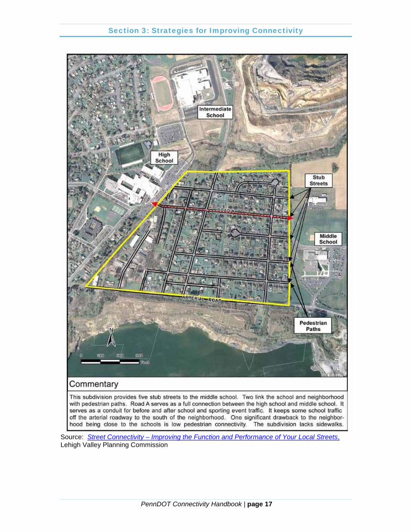
PennDOT Connectivity Handbook | page 17
Source: Street Connectivity – Improving the Function and Performance of Your Local Streets, Lehigh Valley Planning Commission
Section 3: Strategies for Improving Connectivity
PennDOT Connectivity Handbook | page 18
There are also opportunities to encourage and facilitate pedestrian and bicycle connections within existing subdivisions with contemporary cul-de-sac street designs. Communities with existing cul-de-sac, or dead-end streets, can create a “live-end street” by installing a multi-use path or trail that connects the cul-de-sac to a neighboring street or other nearby cul-de-sac for use by pedestrians and bicyclists. These connections can facilitate non-motorized travel without opening existing cul-de-sac streets to automobile traffic in neighborhoods opposed to a new street connection. The “live-end street” can also be used in areas where the topography or other constraints do not allow for a street connection. Where appropriate, they may be designed for vehicles for emergency access-only purposes. Rights-of-way for this type of connection can be acquired through the municipality’s implementation of an Official Map or land acquisition/easement negotiations with existing property owners. The municipalities listed below have incorporated various means of regulating connectivity through their SALDO. Each municipality name links to the municipal website, where more detail on their SALDO provisions may be found. Cranberry Township, Butler County, PA, identifies cul-de-sac streets in Chapter 22 of their SALDO as a special purpose street and does not recommend approval when a through-street is considered to be a more practical option by the Township’s Planning Advisory Committee. Chapter 17 of the SALDO provides construction standards for sidewalks and trails. Convenient and safe pedestrian circulation is to be provided between parking areas, buildings, public transportation, and residential neighborhoods. Recreational trails are to be provided in all residential developments containing 10 or more units and are to link internal common open space areas as well as nearby neighborhoods parks and existing/proposed trails. Peters Township, Washington County, PA, prohibits dead-end streets and limits cul-de-sac streets to 600 feet in length through the SALDO. Dead-end streets are only permitted when future access is planned to an adjoining property or for temporary staging purposes. The SALDO also encourages pedestrian and bicycle connectivity:
§78. Sidewalks and Pedestrian/Bike Accessways. A. Sidewalks - Paved sidewalks shall be provided in the vicinity of schools, along heavily traveled streets and other locations where the Planning Commission recommends them for public safety. All land developments shall provide sidewalks in areas of anticipated pedestrian use. B. Pedestrian/Bike Accessways - Pedestrian/bike accessways must be required between public rights-of-way whenever necessary to facilitate residents' access to other public rights-of-way and to give access to community facilities, such as parks, playgrounds or schools.
Pocopson Township, Chester County, PA, outlines sidewalk and trail provisions in the Township SALDO for new subdivision or land development. Article VI requires developers to provide sidewalks and trails around high pedestrian traffic areas as well as in locations where connections or links to the existing trail and bikeway system are deemed appropriate.

Section 3: Strategies for Improving Connectivity
PennDOT Connectivity Handbook | page 19
Section 190-31 Sidewalks shall be provided, in areas of high potential pedestrian use, such as the vicinity of schools, commercial centers, or high-density residential development. In addition, trails shall be provided in cluster developments to provide access to and across common open space areas. The Board of Supervisors shall also require land proposed for subdivision or land development to provide trails in accordance with the comprehensive trail and bikeway system (as defined in § 250-6 of Chapter 250, Zoning) or provide links to the system, and to identify such public use trails on the plan.
Fort Collins, Colorado: Fort Collins promotes bicycling as a way of life. In order to accommodate this lifestyle, the city devotes a section of their Land Use Code to ensure a local interconnected street system is designed with all users (automobile, bicycle, pedestrian, and transit) in mind. Article 3, Division 3.6.3 outlines the street pattern and connectivity standards and emphasizes that the local street system shall provide multiple direct connections to and between local destinations such as parks, schools, and shopping. The local street system of any proposed development is required to be designed with consideration of all modes of transportation. No examples of Pennsylvania municipalities regulating a connectivity index within their SALDO could be identified during the development of this handbook. However, such regulation appears to be enabled through the Municipalities Planning Code. Given this enabling legislation, the following example from Cary, North Carolina, is provided to illustrate how connectivity index language can be incorporated into a municipal or county SALDO. Town of Cary, North Carolina: The Town of Cary, NC, requires new development designs to consider pedestrians and bicyclists. Chapter 7: Development and Design Standards, Section 7.10, Connectivity, of the land development ordinance provides standards to ensure pedestrian and bicycle connectivity is included in new development plans. The purpose of this section is to provide choices for drivers, bicyclists, public transit passengers, and pedestrians; promote walking, bicycling, and public transit; connect neighborhoods to each other and to local destinations such as schools, parks, and shopping centers; etc. In addition to an interconnected street network, this section also requires non-motorized connections where the required street connectivity index cannot be achieved.
Any residential development shall be required to achieve a connectivity index of 1.2 or greater unless the Planning Director determines that this requirement is impractical due to topography, existing development, and/or natural features. In the event that this requirement is waived, a six (6)-foot pedestrian trail shall be provided to link any cul-de-sacs within a residential development in which the required connectivity index has been waived.
Section 3: Strategies for Improving Connectivity
PennDOT Connectivity Handbook | page 20
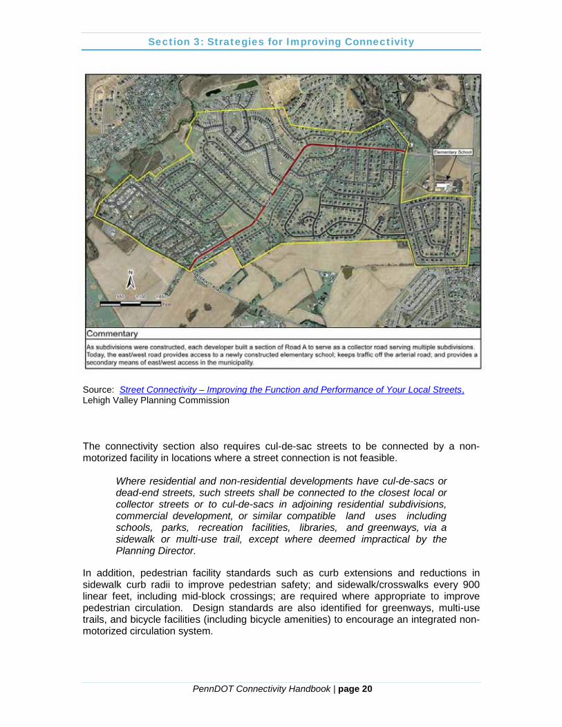
Source: Street Connectivity – Improving the Function and Performance of Your Local Streets, Lehigh Valley Planning Commission The connectivity section also requires cul-de-sac streets to be connected by a non-motorized facility in locations where a street connection is not feasible.
Where residential and non-residential developments have cul-de-sacs or dead-end streets, such streets shall be connected to the closest local or collector streets or to cul-de-sacs in adjoining residential subdivisions, commercial development, or similar compatible land uses including schools, parks, recreation facilities, libraries, and greenways, via a sidewalk or multi-use trail, except where deemed impractical by the Planning Director.
In addition, pedestrian facility standards such as curb extensions and reductions in sidewalk curb radii to improve pedestrian safety; and sidewalk/crosswalks every 900 linear feet, including mid-block crossings; are required where appropriate to improve pedestrian circulation. Design standards are also identified for greenways, multi-use trails, and bicycle facilities (including bicycle amenities) to encourage an integrated non-motorized circulation system.
Section 3: Strategies for Improving Connectivity
PennDOT Connectivity Handbook | page 21
Zoning and Cul-de-sac Management The MPC, in Section 604, enables municipalities to adopt and enforce zoning ordinances that contain provisions to regulate street systems by including:
…Provisions designed to promote, protect and facilitate…coordinated and practical community development and proper density of population; emergency management and operations;…transportation…
Given this enabling legislation, municipalities and counties have the authority to address connectivity through the adoption of zoning ordinances in addition or as an alternative to regulation through their SALDO. The most common reason for a municipality to regulate connectivity through a zoning ordinance would be to focus the regulation on a particular zoning district or development type as opposed to having municipality-wide regulation for all uses. For instance, several municipalities regulate connectivity only in their Village Overlay or Traditional Neighborhood Development (TND) districts due to the allowances for higher densities and mixed uses that may be found in these districts and the resulting impact on the transportation system and other infrastructure. Alternatives may include incorporating connectivity regulations into all residential districts, higher density residential districts, commercial/office districts, etc. Controls desired for the municipality as a whole are probably best located in a municipal or county SALDO or separate connectivity ordinance. Should a developer or property owner seek relief from any connectivity regulations in a zoning ordinance, a variance is requested from the Zoning Hearing Board (ZHB), which is a body appointed by the governing body in accordance with Article IX of the MPC. The ZHB may grant a variance when all of the following findings are made, where relevant in a given case:
1. That there are unique physical circumstances or conditions, including irregularity, narrowness, or shallowness of lot size or shape, or exceptional topographical or other physical conditions peculiar to the particular property and that the unnecessary hardship is due to such conditions and not the circumstances or conditions generally created by the provisions of the zoning ordinance in the neighborhood or district in which the property is located.
2. That because of such physical circumstances or conditions, there is no possibility that the property can be developed in strict conformity with the provisions of the zoning ordinance and that the authorization of a variance is therefore necessary to enable the reasonable use of the property.
3. That such unnecessary hardship has not been created by the appellant. 4. That the variance, if authorized, will not alter the essential character of the
neighborhood or district in which the property is located, nor substantially or permanently impair the appropriate use or development of adjacent property, nor be detrimental to the public welfare.
5. That the variance, if authorized, will represent the minimum variance that will afford relief and will represent the least modification possible of the regulation in issue.
Section 3: Strategies for Improving Connectivity
PennDOT Connectivity Handbook | page 22
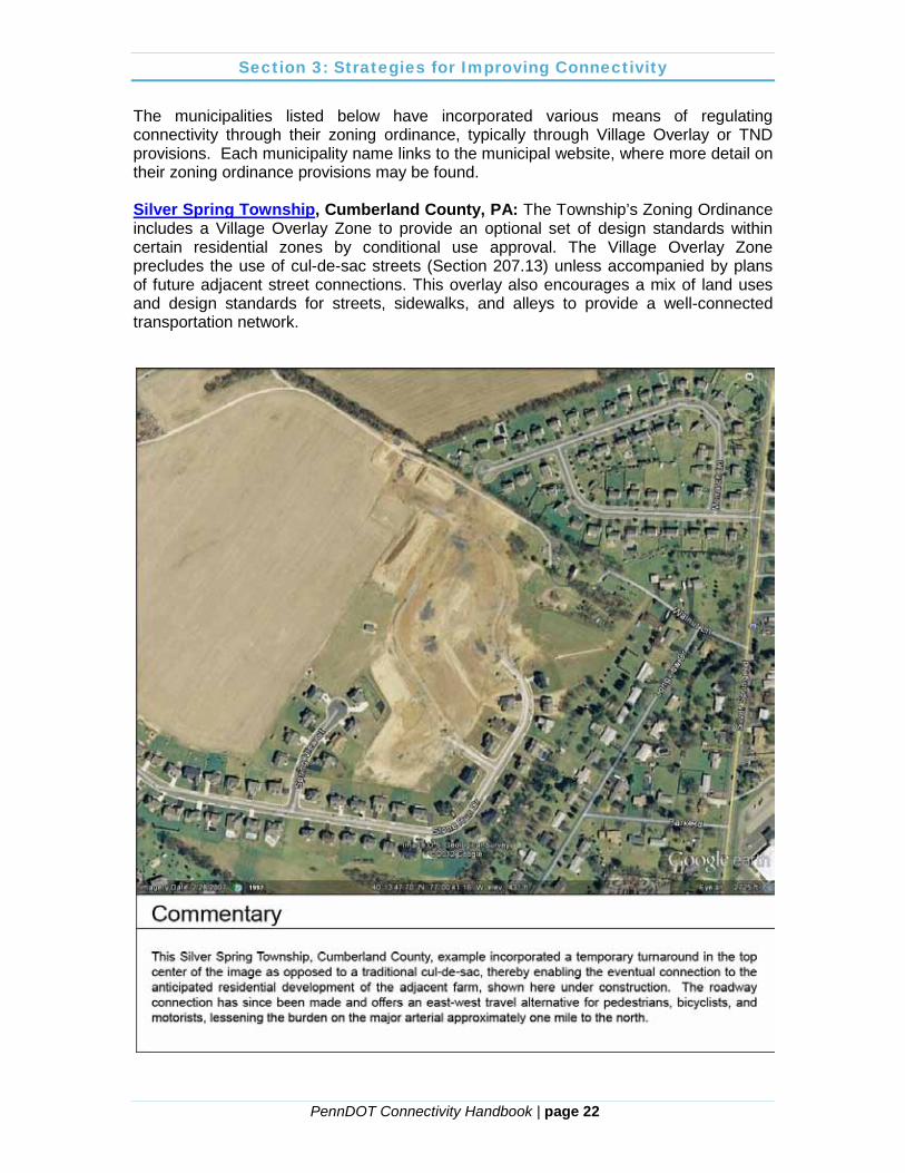
The municipalities listed below have incorporated various means of regulating connectivity through their zoning ordinance, typically through Village Overlay or TND provisions. Each municipality name links to the municipal website, where more detail on their zoning ordinance provisions may be found. Silver Spring Township, Cumberland County, PA: The Township’s Zoning Ordinance includes a Village Overlay Zone to provide an optional set of design standards within certain residential zones by conditional use approval. The Village Overlay Zone precludes the use of cul-de-sac streets (Section 207.13) unless accompanied by plans of future adjacent street connections. This overlay also encourages a mix of land uses and design standards for streets, sidewalks, and alleys to provide a well-connected transportation network.

Section 3: Strategies for Improving Connectivity
PennDOT Connectivity Handbook | page 23
City of Coatesville, Chester County, PA: The City of Coatesville’s Zoning Ordinance contains a Traditional Neighborhood Development Overlay District (Article XVIII) to promote revitalization and redevelopment efforts within the community. Development standards require an interconnected network of streets and alleys in all new developments, and the avoidance of mid-block driveways to preserve the streetscape. New development in the TND district requires a street, alley, and streetscape plan and pedestrian access plan:
(b) Street, alley, and streetscape plan [1] A separate plan sheet shall be submitted to depict the proposed
interconnected street and alley network. Such plan shall indicate all street widths and rights-of-way widths.
(c) Pedestrian access plan [1] A separate plan sheet shall be submitted to depict the proposed
interconnected network for pedestrian access, including sidewalks and other pathways.
Portland, Oregon: The Portland Planning and Zoning Code, Chapter 33.654, provides the rights-of-way requirements and standards, including pedestrian connectivity, for the City. The code requires direct routes for bicycles and pedestrians from residential areas to neighborhood facilities, such as schools and parks. In all zoning districts, except industrial, through streets and pedestrian connections are required. The code provides specific approval criteria, including: Through streets should generally be provided no more than 530 feet apart and pedestrian connections
should generally be provided no more than 330 feet apart. Through street and pedestrian connections should generally be at least 200 feet apart. Characteristics of the site, adjacent sites, and vicinity are to be considered, including…..whether existing dwelling units on- or off-site obstruct the expected path of a through street or pedestrian connection. Alternative locations or designs of rights-of-way should be considered that avoid existing dwelling units. However, provision of through streets or pedestrian connections should take precedence over protection of existing dwelling units where the surrounding transportation system will be significantly affected if a new through street or pedestrian connection is not created; and….Pedestrian connections should take the most direct route practicable. Users should be able to see the ending of the connection from the entrance point, if possible.
Source: Portland Planning and Zoning Code, Section 33.654.120
Section 3: Strategies for Improving Connectivity
PennDOT Connectivity Handbook | page 24
Additional consideration is given to non-motorized access. Where dead-end streets are permitted, future extension must be considered by extending street and pedestrian connections to the boundary of the development site. In addition, the use of common greens—routes that provide for pedestrian and bicycle access, but not vehicle access—are also permitted by the code to promote non-motorized access and connectivity while providing for a shared open space for abutting properties. Approval criteria and figures depicting a conceptual common green are included in the code. Using Official Maps to Manage Connectivity
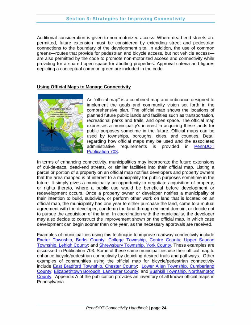
An “official map” is a combined map and ordinance designed to implement the goals and community vision set forth in the comprehensive plan. The official map shows the locations of planned future public lands and facilities such as transportation, recreational parks and trails, and open space. The official map expresses a municipality’s interest in acquiring these lands for public purposes sometime in the future. Official maps can be used by townships, boroughs, cities, and counties. Detail regarding how official maps may be used and the associated administrative requirements is provided in PennDOT Publication 703.
In terms of enhancing connectivity, municipalities may incorporate the future extensions of cul-de-sacs, dead-end streets, or similar facilities into their official map. Listing a parcel or portion of a property on an official map notifies developers and property owners that the area mapped is of interest to a municipality for public purposes sometime in the future. It simply gives a municipality an opportunity to negotiate acquisition of property, or rights thereto, where a public use would be beneficial before development or redevelopment occurs. Once a property owner or developer notifies a municipality of their intention to build, subdivide, or perform other work on land that is located on an official map, the municipality has one year to either purchase the land, come to a mutual agreement with the developer, condemn the land through eminent domain, or decide not to pursue the acquisition of the land. In coordination with the municipality, the developer may also decide to construct the improvement shown on the official map, in which case development can begin sooner than one year, as the necessary approvals are received. Examples of municipalities using this technique to improve roadway connectivity include Exeter Township, Berks County; College Township, Centre County; Upper Saucon Township, Lehigh County; and Shrewsbury Township, York County. These examples are discussed in Publication 703. Some of these same municipalities use their official map to enhance bicycle/pedestrian connectivity by depicting desired trails and pathways. Other examples of communities using the official map for bicycle/pedestrian connectivity include East Bradford Township, Chester County; Lower Allen Township, Cumberland County; Elizabethtown Borough, Lancaster County; and Bushkill Township, Northampton County. Appendix A of the publication provides an inventory of all known official maps in Pennsylvania.
Section 3: Strategies for Improving Connectivity
PennDOT Connectivity Handbook | page 25
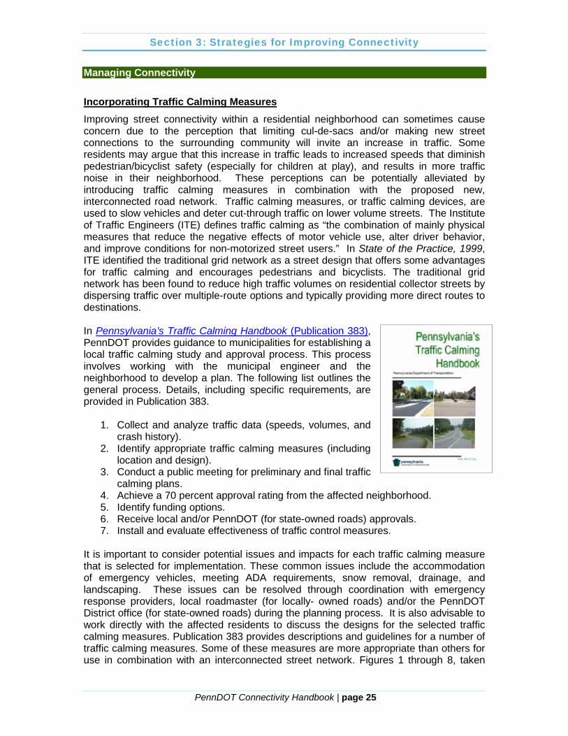
Managing Connectivity Incorporating Traffic Calming Measures Improving street connectivity within a residential neighborhood can sometimes cause concern due to the perception that limiting cul-de-sacs and/or making new street connections to the surrounding community will invite an increase in traffic. Some residents may argue that this increase in traffic leads to increased speeds that diminish pedestrian/bicyclist safety (especially for children at play), and results in more traffic noise in their neighborhood. These perceptions can be potentially alleviated by introducing traffic calming measures in combination with the proposed new, interconnected road network. Traffic calming measures, or traffic calming devices, are used to slow vehicles and deter cut-through traffic on lower volume streets. The Institute of Traffic Engineers (ITE) defines traffic calming as “the combination of mainly physical measures that reduce the negative effects of motor vehicle use, alter driver behavior, and improve conditions for non-motorized street users.” In State of the Practice, 1999, ITE identified the traditional grid network as a street design that offers some advantages for traffic calming and encourages pedestrians and bicyclists. The traditional grid network has been found to reduce high traffic volumes on residential collector streets by dispersing traffic over multiple-route options and typically providing more direct routes to destinations. In Pennsylvania’s Traffic Calming Handbook (Publication 383), PennDOT provides guidance to municipalities for establishing a local traffic calming study and approval process. This process involves working with the municipal engineer and the neighborhood to develop a plan. The following list outlines the general process. Details, including specific requirements, are provided in Publication 383.
1. Collect and analyze traffic data (speeds, volumes, and crash history).
2. Identify appropriate traffic calming measures (including location and design).
3. Conduct a public meeting for preliminary and final traffic calming plans.
4. Achieve a 70 percent approval rating from the affected neighborhood. 5. Identify funding options. 6. Receive local and/or PennDOT (for state-owned roads) approvals. 7. Install and evaluate effectiveness of traffic control measures.
It is important to consider potential issues and impacts for each traffic calming measure that is selected for implementation. These common issues include the accommodation of emergency vehicles, meeting ADA requirements, snow removal, drainage, and landscaping. These issues can be resolved through coordination with emergency response providers, local roadmaster (for locally- owned roads) and/or the PennDOT District office (for state-owned roads) during the planning process. It is also advisable to work directly with the affected residents to discuss the designs for the selected traffic calming measures. Publication 383 provides descriptions and guidelines for a number of traffic calming measures. Some of these measures are more appropriate than others for use in combination with an interconnected street network. Figures 1 through 8, taken
Section 3: Strategies for Improving Connectivity
PennDOT Connectivity Handbook | page 26
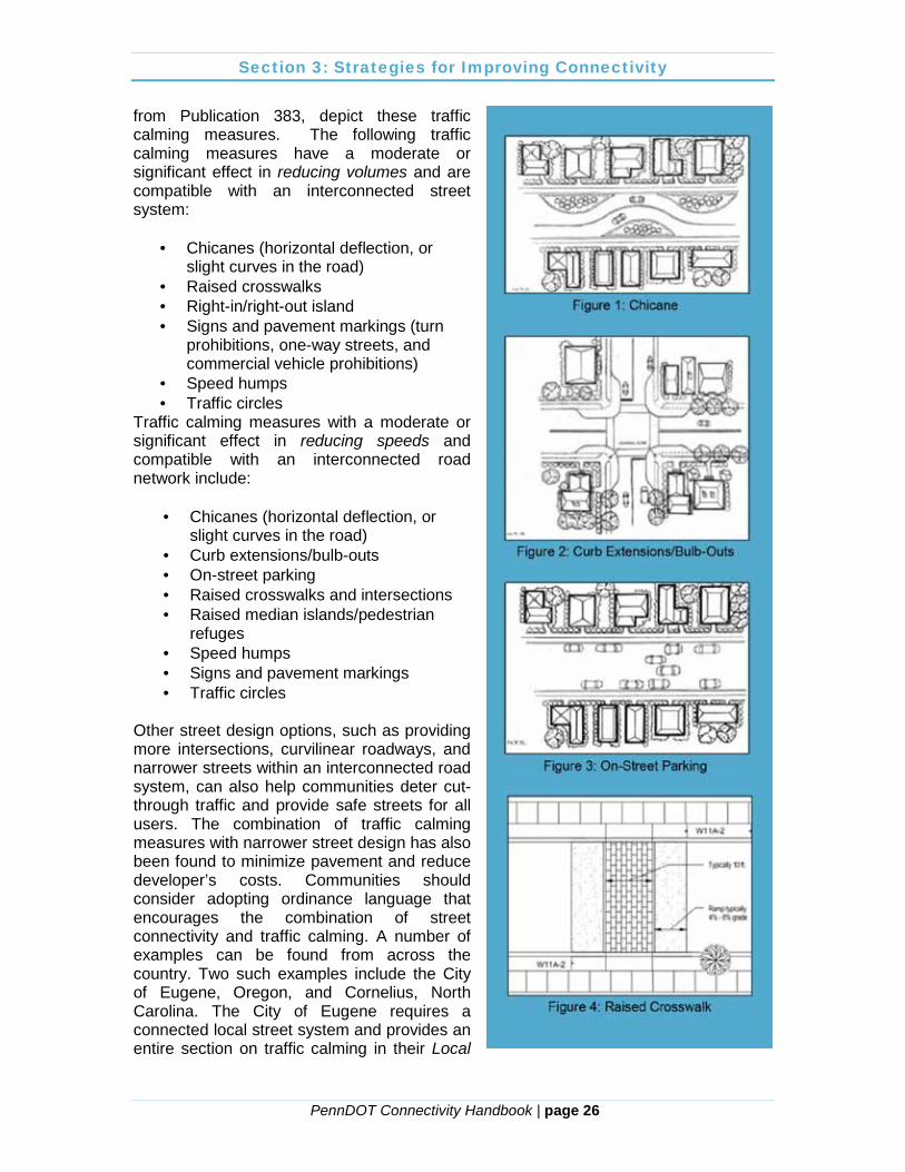
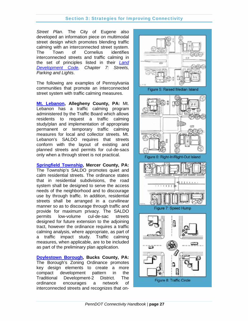
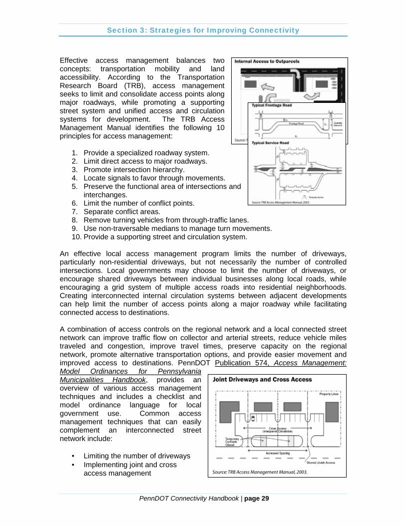
from Publication 383, depict these traffic calming measures. The following traffic calming measures have a moderate or significant effect in reducing volumes and are compatible with an interconnected street system:
· Chicanes (horizontal deflection, or slight curves in the road)
· Raised crosswalks · Right-in/right-out island · Signs and pavement markings (turn
prohibitions, one-way streets, and commercial vehicle prohibitions)
· Speed humps · Traffic circles
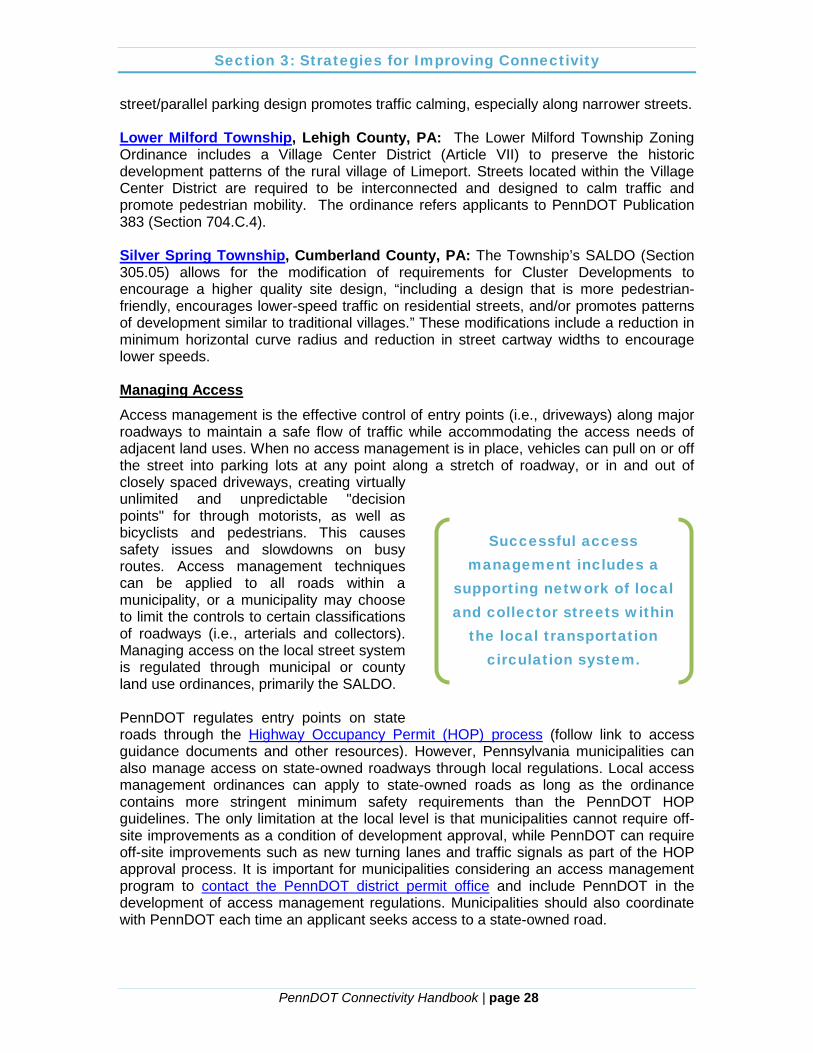
Traffic calming measures with a moderate or significant effect in reducing speeds and compatible with an interconnected road network include:
· Chicanes (horizontal deflection, or slight curves in the road)
· Curb extensions/bulb-outs · On-street parking · Raised crosswalks and intersections · Raised median islands/pedestrian
refuges · Speed humps · Signs and pavement markings · Traffic circles
Other street design options, such as providing more intersections, curvilinear roadways, and narrower streets within an interconnected road system, can also help communities deter cut-through traffic and provide safe streets for all users. The combination of traffic calming measures with narrower street design has also been found to minimize pavement and reduce developer’s costs. Communities should consider adopting ordinance language that encourages the combination of street connectivity and traffic calming. A number of examples can be found from across the country. Two such examples include the City of Eugene, Oregon, and Cornelius, North Carolina. The City of Eugene requires a connected local street system and provides an entire section on traffic calming in their Local
Section 3: Strategies for Improving Connectivity
PennDOT Connectivity Handbook | page 27
Street Plan. The City of Eugene also developed an information piece on multimodal street design which promotes blending traffic calming with an interconnected street system. The Town of Cornelius identifies interconnected streets and traffic calming in the set of principles listed in their Land Development Code, Chapter 7: Streets, Parking and Lights. The following are examples of Pennsylvania communities that promote an interconnected street system with traffic calming measures. Mt. Lebanon, Allegheny County, PA: Mt. Lebanon has a traffic calming program administered by the Traffic Board which allows residents to request a traffic calming study/plan and implementation of appropriate permanent or temporary traffic calming measures for local and collector streets. Mt. Lebanon’s SALDO requires that streets conform with the layout of existing and planned streets and permits for cul-de-sacs only when a through street is not practical. Springfield Township, Mercer County, PA: The Township’s SALDO promotes quiet and calm residential streets. The ordinance states that in residential subdivisions, the road system shall be designed to serve the access needs of the neighborhood and to discourage use by through traffic. In addition, residential streets shall be arranged in a curvilinear manner so as to discourage through traffic and provide for maximum privacy. The SALDO permits low-volume cul-de-sac streets designed for future extension to the adjoining tract, however the ordinance requires a traffic calming analysis, where appropriate, as part of a traffic impact study. Traffic calming measures, when applicable, are to be included as part of the preliminary plan application. Doylestown Borough, Bucks County, PA: The Borough’s Zoning Ordinance promotes key design elements to create a more compact development pattern in the Traditional Development-2 District. The ordinance encourages a network of interconnected streets and recognizes that on-
Section 3: Strategies for Improving Connectivity
PennDOT Connectivity Handbook | page 28
street/parallel parking design promotes traffic calming, especially along narrower streets. Lower Milford Township, Lehigh County, PA: The Lower Milford Township Zoning Ordinance includes a Village Center District (Article VII) to preserve the historic development patterns of the rural village of Limeport. Streets located within the Village Center District are required to be interconnected and designed to calm traffic and promote pedestrian mobility. The ordinance refers applicants to PennDOT Publication 383 (Section 704.C.4). Silver Spring Township, Cumberland County, PA: The Township’s SALDO (Section 305.05) allows for the modification of requirements for Cluster Developments to encourage a higher quality site design, “including a design that is more pedestrian-friendly, encourages lower-speed traffic on residential streets, and/or promotes patterns of development similar to traditional villages.” These modifications include a reduction in minimum horizontal curve radius and reduction in street cartway widths to encourage lower speeds. Managing Access Access management is the effective control of entry points (i.e., driveways) along major roadways to maintain a safe flow of traffic while accommodating the access needs of adjacent land uses. When no access management is in place, vehicles can pull on or off the street into parking lots at any point along a stretch of roadway, or in and out of closely spaced driveways, creating virtually unlimited and unpredictable "decision points" for through motorists, as well as bicyclists and pedestrians. This causes safety issues and slowdowns on busy routes. Access management techniques can be applied to all roads within a municipality, or a municipality may choose to limit the controls to certain classifications of roadways (i.e., arterials and collectors). Managing access on the local street system is regulated through municipal or county land use ordinances, primarily the SALDO. PennDOT regulates entry points on state roads through the Highway Occupancy Permit (HOP) process (follow link to access guidance documents and other resources). However, Pennsylvania municipalities can also manage access on state-owned roadways through local regulations. Local access management ordinances can apply to state-owned roads as long as the ordinance contains more stringent minimum safety requirements than the PennDOT HOP guidelines. The only limitation at the local level is that municipalities cannot require off-site improvements as a condition of development approval, while PennDOT can require off-site improvements such as new turning lanes and traffic signals as part of the HOP approval process. It is important for municipalities considering an access management program to contact the PennDOT district permit office and include PennDOT in the development of access management regulations. Municipalities should also coordinate with PennDOT each time an applicant seeks access to a state-owned road.
Successful access management includes a
supporting network of local and collector streets within
the local transportation circulation system.
Section 3: Strategies for Improving Connectivity
PennDOT Connectivity Handbook | page 29
Effective access management balances two concepts: transportation mobility and land accessibility. According to the Transportation Research Board (TRB), access management seeks to limit and consolidate access points along major roadways, while promoting a supporting street system and unified access and circulation systems for development. The TRB Access Management Manual identifies the following 10 principles for access management:
1. Provide a specialized roadway system. 2. Limit direct access to major roadways. 3. Promote intersection hierarchy. 4. Locate signals to favor through movements. 5. Preserve the functional area of intersections and
interchanges. 6. Limit the number of conflict points. 7. Separate conflict areas. 8. Remove turning vehicles from through-traffic lanes. 9. Use non-traversable medians to manage turn movements. 10. Provide a supporting street and circulation system.
An effective local access management program limits the number of driveways, particularly non-residential driveways, but not necessarily the number of controlled intersections. Local governments may choose to limit the number of driveways, or encourage shared driveways between individual businesses along local roads, while encouraging a grid system of multiple access roads into residential neighborhoods. Creating interconnected internal circulation systems between adjacent developments can help limit the number of access points along a major roadway while facilitating connected access to destinations. A combination of access controls on the regional network and a local connected street network can improve traffic flow on collector and arterial streets, reduce vehicle miles traveled and congestion, improve travel times, preserve capacity on the regional network, promote alternative transportation options, and provide easier movement and improved access to destinations. PennDOT Publication 574, Access Management: Model Ordinances for Pennsylvania Municipalities Handbook, provides an overview of various access management techniques and includes a checklist and model ordinance language for local government use. Common access management techniques that can easily complement an interconnected street network include:
· Limiting the number of driveways · Implementing joint and cross
access management
Section 3: Strategies for Improving Connectivity
PennDOT Connectivity Handbook | page 30
· Limiting access to outparcels · Increasing driveway spacing · Managing signalized intersection spacing · Managing left turns and auxiliary lanes · Providing frontage/service roads · Using an official map
Following are examples of Pennsylvania communities that have an access management program and encourage street connectivity. Springfield Township, Mercer County, PA, provides access management standards within the township SALDO that are applicable to specified arterial and collector roads that are experiencing significant commercial development. These standards include limiting the number of new access points; requiring turn lanes, connection spacing, and joint and cross access; and specifying minimum driveway throat length. Cul-de-sac streets are permitted, however they are to be placed adjacent to property lines and rights-of-way to allow future extension of the street to the adjoining property. North Lebanon Township, Lebanon County, PA, permits cul-de-sac streets only upon approval by the Board of Supervisors. An access management section was added to the SALDO in 2007. This section includes a number of access management techniques as well as requirements of developments generating more than 500 trips per day to provide pedestrian connections to adjoining land uses.
§620. Pedestrian Connections. Land uses generating more than five hundred (500) trips per day shall provide pedestrian connections from their side or rear yards to adjoining land uses when possible. The intent of this Section is to shorten pedestrian trips between abutting pedestrian generators, such as retail centers and multi-family residential developments. This requirement may be waived for connections between pedestrian generators and properties with single-family and two-family residences. These direct pedestrian connections shall be provided in addition to the installation of sidewalks along the front of the property. (Ord. 5-2007,12/17/2007, §T)
Lebanon County, PA, adopted an access management ordinance in 2007 as part of the County SALDO. This ordinance is a comprehensive set of access management criteria applicable to properties with frontage along roadways classified as arterial or major collector roadways within the County, and within municipalities under the jurisdiction of the County Planning Department for subdivision, land development, or building permit activities. The County SALDO also provides standards for cul-de-sac streets, limiting their length to 600 feet and their use to locations with a maximum number of residential units based on unit type. Other street designs (such as through or looped streets) are to be used where possible.

PennDOT Connectivity Handbook | page 31
5. Appendices
PennDOT Connectivity Handbook | page 32
Appendices Three options are provided in this appendix for municipalities wishing to regulate transportation system connectivity in their county or municipality:
· Standalone connectivity ordinance; · Subdivision and land development ordinance amendment; and · Zoning ordinance amendment.
Municipalities or counties wishing to incorporate connectivity language into their ordinances should determine which approach works best based on their existing regulatory framework and goals. Disclaimer: Please note that the model ordinance language provided in this appendix is meant to serve only as a guideline in structuring county or municipal ordinances. Governing bodies should not adopt the ordinance without first following the procedures outlined in the applicable municipal code and/or Municipalities Planning Code and consulting with their solicitor.

Appendices
PennDOT Connectivity Handbook | page 33
Standalone Connectivity Model Ordinance Disclamer: Please note that this model ordinance is meant to serve only as a guideline in structuring your municipal ordinance. Municipal officials should not adopt the ordinance without first following the procedures outlined in the Municipalities Planning Code and consulting with the municipal solicitor. The following model ordinance language is based on the “Street Connectivity Zoning and Subdivision Model Ordinance” prepared by the Kentucky Transportation Cabinet Division of Planning (March 2009) and has been customized for Pennsylvania. There are a number of options incorporated into the model ordinance that may be modified based on local preference. These options are typically written with a red font. In addition, there are a number of places where the ordinances should be customized to reflect the name of the municipality/county and locally determined standards. These are shown in a blue font. Purpose Insert Name of County or Municipality hereby finds and determines that an interconnected street system is necessary in order to protect the public health, safety, and welfare in order to ensure that streets will function in an interdependent manner and to provide continuous and comprehensible traffic routes. Therefore, the purpose of this ordinance is to support of the creation of a highly connected transportation system to:
(a) Provide options for motorists, bicyclists, and pedestrians; (b) Reduce emergency service response times; (c) Improved municipal service delivery; (d) Enhance arterial street capacity to better service regional travel needs; (e) Promote walking and bicycling within the community; (f) Connect neighborhoods to each other and to destinations such as
schools, parks, shopping, libraries, and post offices among others; (g) Provide opportunities for residents to increase their level of physical
activity by offering walkable neighborhoods with adequate connections to destinations within a close proximity; and
(h) Reduce vehicle miles traveled and travel time to improve air quality and mitigate the effects of auto emissions on the health of residents.
Definitions:
ACCESSWAY - a vehicular travel lane, such as a driveway, shared driveway, or aisle in an off-street parking area, which is interconnected to adjoining streets and/or alleys
Appendices
PennDOT Connectivity Handbook | page 34
ALLEY – a thoroughfare, publicly or privately owned, other than a side street, which affords only a secondary means of access to abutting property and is not intended for general traffic circulation ADT – average daily traffic CARTWAY – the improved or paved portions of a street available for vehicular or other traffic; the portion or portions between curbs where curbs are used CONNECTIVITY – the measurement of a system of streets with multiple routes and connections serving the same origins and destinations CONNECTIVITY INDEX – the measurement of the extent of interconnections within the transportation system as calculated in accordance with this ordinance. A higher number indicates a higher level of connectivity. CUL-DE-SAC – A single access local street intersecting another at one end and terminating in a bulb or other style of vehicular turn-around at the other end. The length of a permitted cul-de-sac street shall be measured from the centerline intersection with the through street to the center point of the turnaround end. LINK – a segment of road between two intersections or from an intersection to a cul-de-sac/stub-out, including road segments leading from the adjoining highway network or adjacent development. LIVE-END STREET – a multi-use path or trail that connects a cul-de-sac street to a neighboring street or other nearby cul-de-sac for use by pedestrians and bicyclists NODE – intersections and cul-de-sacs, not including the end of a stub-out at the property line or intersection with the adjoining highway network. PEDESTRIAN AND BICYCLE ACCESSWAYS – right-of-way dedicated for use by non-motorized traffic to access other rights-of-way or parcels dedicated to public use RIGHT-OF-WAY – total width of land dedicated as a street, alley, pedestrian/bicycle access or for other public purposes STREET – includes street, avenue, boulevard, road, highway, freeway, parkway, lane, alley, viaduct, and any other ways, whether public or private, used or intended to be used by vehicular traffic or pedestrians STREET, SINGLE ACCESS – A street which has access to an existing public road and circulation system only at one point. A single access street includes cul-de-sacs, loop roads, and stub streets. STUB STREET – a local or collector single access street designed to connect to future local streets on adjacent properties. A stub street does not end in a cul-de-sac. TEMPORARY STREET – A strip of land over which there is a public or private right-of-way intended to serve temporarily as a means of vehicular access to and frontage for abutting properties, as well as general traffic circulation.
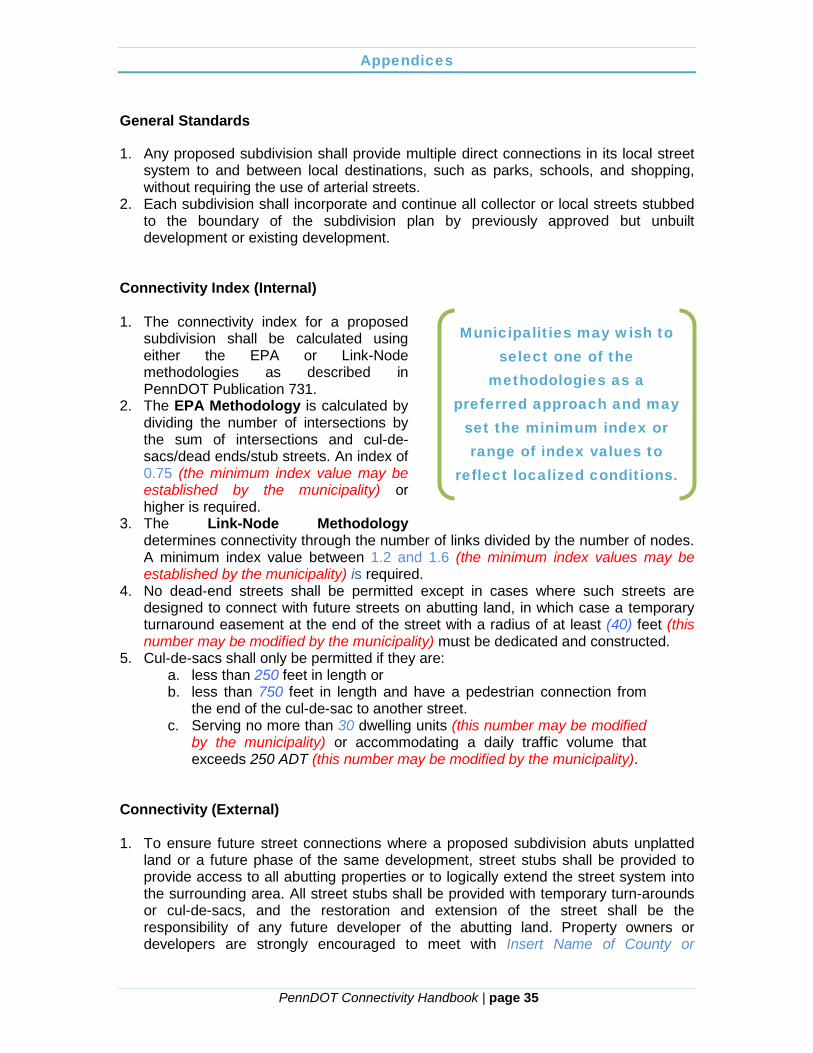
Appendices
PennDOT Connectivity Handbook | page 35
General Standards
1. Any proposed subdivision shall provide multiple direct connections in its local street system to and between local destinations, such as parks, schools, and shopping, without requiring the use of arterial streets.
2. Each subdivision shall incorporate and continue all collector or local streets stubbed to the boundary of the subdivision plan by previously approved but unbuilt development or existing development.
Connectivity Index (Internal) 1. The connectivity index for a proposed
subdivision shall be calculated using either the EPA or Link-Node methodologies as described in PennDOT Publication 731.
2. The EPA Methodology is calculated by dividing the number of intersections by the sum of intersections and cul-de-sacs/dead ends/stub streets. An index of 0.75 (the minimum index value may be established by the municipality) or higher is required.
3. The Link-Node Methodology determines connectivity through the number of links divided by the number of nodes. A minimum index value between 1.2 and 1.6 (the minimum index values may be established by the municipality) is required.
4. No dead-end streets shall be permitted except in cases where such streets are designed to connect with future streets on abutting land, in which case a temporary turnaround easement at the end of the street with a radius of at least (40) feet (this number may be modified by the municipality) must be dedicated and constructed.
5. Cul-de-sacs shall only be permitted if they are: a. less than 250 feet in length or b. less than 750 feet in length and have a pedestrian connection from
the end of the cul-de-sac to another street. c. Serving no more than 30 dwelling units (this number may be modified
by the municipality) or accommodating a daily traffic volume that exceeds 250 ADT (this number may be modified by the municipality).
Connectivity (External) 1. To ensure future street connections where a proposed subdivision abuts unplatted
land or a future phase of the same development, street stubs shall be provided to provide access to all abutting properties or to logically extend the street system into the surrounding area. All street stubs shall be provided with temporary turn-arounds or cul-de-sacs, and the restoration and extension of the street shall be the responsibility of any future developer of the abutting land. Property owners or developers are strongly encouraged to meet with Insert Name of County or
Municipalities may wish to select one of the
methodologies as a preferred approach and may
set the minimum index or range of index values to
reflect localized conditions.
Appendices
PennDOT Connectivity Handbook | page 36
Municipality prior to the submission of a preliminary plan to coordinate the location(s) of the planned street system.
Commentary: A street stub may either be a local road, collector, or frontage road. The property owner/developer should take into account the purpose of each stub and future traffic patterns that may exist once adjacent land develop occurs and a street connection is made. Cut-through traffic and speeding on local residential streets should be discouraged through proper location and inclusion of traffic calming measures. In contrast, collectors and frontage roads should have logical, direct routes that make cross parcel driving possible. This may include a road that traverses the land from one property line to the opposite property line. 2. Streets within and contiguous to the subdivision shall be coordinated with other
existing or planned streets within the general area as to location, widths, grades, and drainage. Such streets with shall be aligned and coordinated with existing or planned streets in existing or future adjacent or contiguous to adjacent subdivisions. All streets, alleys, and pedestrian pathways in any subdivision or site plan shall connect to other streets and to existing and projected streets outside the proposed subdivision or other development.
3. Upon extension of an existing temporary cul-de-sac, local streets shall be designed to calm traffic speeds and promote pedestrian movement. Applicants shall incorporate appropriate measures as identified in the Traffic Calming Handbook (PennDOT Publication 383).
4. Street connections shall be spaced at intervals not to exceed [660] feet (1/8 mile) along each boundary that abuts potentially developable or redevelopable land. Blocks longer than [400] feet in length shall have a mid-block pedestrian pathway connecting adjacent blocks.
Commentary: Minimizing the block length of local streets allows better access for pedestrians, bicyclists, and automobiles. The number may be changed to lower than 660 feet. The appropriate length may be determined based from a typical block length based on historical precedence in the area. It is common for American cities to have block lengths between 200 and 400 feet. Bicycle and Pedestrian Connectivity
1. Bicycle lanes, where required, shall be placed in the outside lane of a roadway,
adjacent to the curb or shoulder. When on-street parking is permitted, the bicycle lane shall be between the parking lane and the outer lane of moving vehicles. The lanes shall be delineated with markings, preferably striping.
2. Sidewalks and pedestrian paths shall be provided to promote a healthy pedestrian circulation network. Sidewalks shall be designed in accordance with the standards outlined in Reference applicable section of the applicable county or municipal SALDO.
3. In residential developments, sidewalks shall be placed parallel to the street within the right-of-way unless a waiver has been granted to preserve topographical or natural features, or to provide visual interest, or unless the applicant shows that an alternative pedestrian system provides safe and convenient circulation.
4. For residential developments containing 10 or more units (this number may be modified by the municipality), pedestrian and bicycle accessways shall be provided

Appendices
PennDOT Connectivity Handbook | page 37
to connect common open space areas, neighborhood parks, and existing or proposed trails.
5. Maximum block length shall be 400 to 600 feet (these numbers may be modified by the municipality), or a mid-block pedestrian connection shall be provided when feasible to provide for sensible pedestrian connectivity.
6. (OPTIONAL) The Governing Body shall require land proposed for subdivision or land development to include trails or links to the system in accordance with the Insert Name of County or Municipality pedestrian and bicycle circulation plan.

Appendices
PennDOT Connectivity Handbook | page 38
Model Subdivision & Land Development Ordinance Language Disclamer: Please note that this model ordinance is meant to serve only as a guideline in structuring your municipal ordinance. Municipal officials should not adopt the ordinance without first following the procedures outlined in the Municipalities Planning Code and consulting with the municipal solicitor. The following model language provides an example of text that can be inserted in a municipal or county Subdivision and Land Development Ordinance (SALDO) to address connectivity. There are a number of options incorporated into the model ordinance that may be modified based on local preference. These options are typically written with a red font. In addition, there are a number of places where the ordinances should be customized to reflect the name of the municipality/county and locally determined standards. These are shown in a blue font. Purpose: (municipalities that choose to regulate connectivity may want to amend their current SALDO Purpose Statement language to include all or part of the text below) The purpose of this ordinance includes the support of the creation of a highly connected transportation system to:
(i) Provide options for motorists, bicyclists, and pedestrians; (j) Reduce emergency service response times; (k) Improved municipal service delivery; (l) Enhance arterial street capacity to better service regional travel needs; (m) Promote walking and bicycling within the community; (n) Connect neighborhoods to each other and to destinations such as
schools, parks, shopping, libraries, and post offices among others; (o) Provide opportunities for residents to increase their level of physical
activity by offering walkable neighborhoods with adequate connections to destinations within a close proximity; and
(p) Reduce vehicle miles traveled and travel time to improve air quality and mitigate the effects of auto emissions on the health of residents.
Definitions: (municipalities that choose to regulate connectivity may want to amend their existing SALDO definitions to include all or part of the text below if such definitions do not already exist) ACCESSWAY – a vehicular travel lane, such as a driveway, shared driveway or aisle in an off-street parking area, which is interconnected to adjoining streets and/or alleys ALLEY – a thoroughfare, publicly or privately owned, other than a side street, which affords only a secondary means of access to abutting property and not intended for general traffic circulation

Appendices
PennDOT Connectivity Handbook | page 39
ADT – average daily traffic CARTWAY – the improved or paved portions of a street available for vehicular or other traffic; the portion or portions between curbs where curbs are used CONNECTIVITY – the measurement of a system of streets with multiple routes and connections serving the same origins and destinations CONNECTIVITY INDEX – the measurement of the extent of interconnections within the transportation system as calculated in accordance with this ordinance. A higher number indicates a higher level of connectivity. CUL-DE-SAC STREET – a single access local street intersecting another at one end and terminating in a bulb or other style of vehicular turn-around at the other end LIVE-END STREET – a multi-use path or trail that connects a cul-de-sac street to a neighboring street or other nearby cul-de-sac for use by pedestrians and bicyclists OFFICIAL MAP – an official map, as authorized by Article IV of the Pennsylvania Municipalities Planning Code, which shows locations of proposed public streets, pedestrian ways, public parks, and other public facilities PEDESTRIAN AND BICYCLE ACCESSWAYS – right-of-way dedicated for use by non-motorized traffic to access other rights-of-way or parcels dedicated to public use RIGHT-OF-WAY – total width of land dedicated as a street, alley, pedestrian/bicycle access or for other public purposes STREET – includes street, avenue, boulevard, road, highway, freeway, parkway, lane, alley, viaduct and any other ways used or intended to be used by vehicular traffic or pedestrians whether public or private STREET, SINGLE ACCESS – A street which has access to an existing public road and circulation system only at one (1) point. A single access street includes cul-de-sacs, loop roads, and stub streets. STUB STREET – a local or collector single access street which is designed to connect to future local streets on adjacent properties. A stub street does not end in a cul-de-sac. TEMPORARY STREET – A strip of land over which there is a public or private right-of-way intended to serve temporarily as a means of vehicular access to and frontage for abutting properties, as well as general traffic circulation.
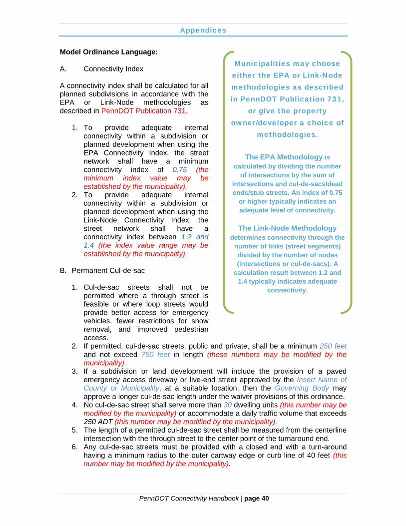
Appendices
PennDOT Connectivity Handbook | page 40
Model Ordinance Language:
A. Connectivity Index A connectivity index shall be calculated for all planned subdivisions in accordance with the EPA or Link-Node methodologies as described in PennDOT Publication 731.
1. To provide adequate internal connectivity within a subdivision or planned development when using the EPA Connectivity Index, the street network shall have a minimum connectivity index of 0.75 (the minimum index value may be established by the municipality).
2. To provide adequate internal connectivity within a subdivision or planned development when using the Link-Node Connectivity Index, the street network shall have a connectivity index between 1.2 and 1.4 (the index value range may be established by the municipality).
B. Permanent Cul-de-sac
1. Cul-de-sac streets shall not be
permitted where a through street is feasible or where loop streets would provide better access for emergency vehicles, fewer restrictions for snow removal, and improved pedestrian access.
2. If permitted, cul-de-sac streets, public and private, shall be a minimum 250 feet and not exceed 750 feet in length (these numbers may be modified by the municipality).
3. If a subdivision or land development will include the provision of a paved emergency access driveway or live-end street approved by the Insert Name of County or Municipality, at a suitable location, then the Governing Body may approve a longer cul-de-sac length under the waiver provisions of this ordinance.
4. No cul-de-sac street shall serve more than 30 dwelling units (this number may be modified by the municipality) or accommodate a daily traffic volume that exceeds 250 ADT (this number may be modified by the municipality).
5. The length of a permitted cul-de-sac street shall be measured from the centerline intersection with the through street to the center point of the turnaround end.
6. Any cul-de-sac streets must be provided with a closed end with a turn-around having a minimum radius to the outer cartway edge or curb line of 40 feet (this number may be modified by the municipality).
Municipalities may choose either the EPA or Link-Node methodologies as described in PennDOT Publication 731,
or give the property owner/developer a choice of
methodologies.
The EPA Methodology is calculated by dividing the number
of intersections by the sum of intersections and cul-de-sacs/dead ends/stub streets. An index of 0.75
or higher typically indicates an adequate level of connectivity.
The Link-Node Methodology
determines connectivity through the number of links (street segments) divided by the number of nodes (intersections or cul-de-sacs). A
calculation result between 1.2 and 1.4 typically indicates adequate
connectivity.

Appendices
PennDOT Connectivity Handbook | page 41
7. At the end of any permitted cul-de-sac street, the Insert Name of County or Municipality may require a snow storage easement. This easement shall be free of driveways, parking, and shall be designed to allow proper drainage of melting snow.
C. Temporary Cul-de-sac
1. Where future extension of the cul-
de-sac is practical, the turnaround right-of-way shall be placed adjacent to the property line to permit future extension of the street into the adjoining tract.
2. Temporary cul-de-sac streets, public and private, shall be a minimum 250 feet and not exceed 750 feet in length (these numbers may be modified by the municipality).
3. Temporary cul-de-sac streets must be provided with a closed end with a turn-around having a minimum radius to the outer cartway edge or curb line of 40 feet (this number may be modified by the municipality). Temporary cul-de-sacs may have circular, “T” shaped, or “hammerhead” shaped turnarounds. Turnarounds shall be constructed completely within the right-of-way. The long dimension of the turnaround head shall have a minimum length of 50 feet (this number may be modified by the municipality). The use of such turnaround shall be guaranteed to the public until such time as the street is extended.
4. Upon extension of an existing temporary cul-de-sac, local streets shall be designed to calm traffic speeds and promote pedestrian movement. Applicants shall incorporate appropriate measures as identified in the Traffic Calming Handbook (PennDOT Publication 383).
D. Stub Street 1. The stub end of the stub street shall be extended to the property line and the
right-of-way shall be carried to the property line to permit future extension of the street into the adjoining tract.
2. Stub streets, public and private, shall be a minimum 250 feet and not exceed 750 feet in length (these numbers may be modified by the municipality).
E. Bicycle and Pedestrian Connectivity 1. Bicycle lanes, where required, shall be placed in the outside lane of a roadway,
adjacent to the curb or shoulder. When on-street parking is permitted, the bicycle
Liquid Fuels Funds cannot be applied to roads that do
not meet the following design criteria:
· Road or street must have the
capacity to be traveled safely at 15 mph.
· Must have a minimum right-of-way of 33 feet for townships, 16 feet for boroughs and cities, and a minimum 16 feet cartway width.
· Must have a minimum length of 250 feet.
· Must be connected to an existing Liquid Fuels road or state highway.
· Cul-de-sacs must have a minimum 40-foot radius.
Appendices
PennDOT Connectivity Handbook | page 42
lane shall be between the parking lane and the outer lane of moving vehicles. The lanes shall be delineated with markings, preferably striping.
2. Sidewalks and pedestrian paths shall be provided to promote a healthy pedestrian circulation network. Sidewalks shall be designed in accordance with the standards outlined in Section X (reference appropriate section of SALDO) of this ordinance.
3. In residential developments, sidewalks shall be placed parallel to the street within the right-of-way unless a waiver has been granted to preserve topographical or natural features, or to provide visual interest, or unless the applicant shows that an alternative pedestrian system provides safe and convenient circulation.
4. For residential developments containing 10 or more units (this number may be modified by the municipality), pedestrian and bicycle accessways shall be provided to connect common open space areas, neighborhood parks, and existing or proposed trails.
5. Maximum block length shall be 400 to 600 feet (these numbers may be modified by the municipality), or a mid-block pedestrian connection shall be provided when feasible to provide for sensible pedestrian connectivity.
6. (OPTIONAL) The Governing Body shall require land proposed for subdivision or land development to include trails or links to the system in accordance with the Insert Name of County or Municipality pedestrian and bicycle circulation plan.
F. Access Management (OPTIONAL)
1. Developers/property owners should incorporate applicable access management measures into subdivision and land development plans in accordance with PennDOT Publication 574. Any such measures should be coordinated with the Insert Name of County or Municipality and PennDOT as applicable.
2. Where permitted, alleys or service streets shall be provided to manage the number of access points to the street and reduce traffic conflicts.
3. Alleys or service streets shall be provided to move vehicular access to the rear of buildings and provide vehicular access to detached garages in the rear and provide access for deliveries and location of utilities, where feasible.
4. Alleys that are one-way and proposed for dedication shall be a minimum 12 feet cartway width and a two-way alley proposed for dedication shall have a minimum 16 feet cartway width.
Appendices
PennDOT Connectivity Handbook | page 43
Model Zoning Ordinance Language Disclamer: Please note that this model ordinance is meant to serve only as a guideline in structuring your municipal ordinance. Municipal officials should not adopt the ordinance without first following the procedures outlined in the Municipalities Planning Code and consulting with the municipal solicitor. The following options of sample language can be inserted into an existing zoning code to require enhanced street and pedestrian/bicycle connectivity within the appropriate zoning district(s) and/or zoning overlay district(s). Typically communities that choose to regulate connectivity through their zoning ordinance provide connectivity standards within a Traditional Neighborhood Development (TND) Zoning District. The following language can be used as part of a TND ordinance, however this language is not intended to be solely limited to TND ordinances, but rather applied to any zoning district in which the municipality chooses to limit the use of cul-de-sac streets and improve connectivity. Some example Pennsylvania communities that regulate connectivity through a zoning ordinance include Lower Milford Township, Silver Spring Township, Cranberry Township, and the City of Coatesville. There are a number of options incorporated into the model ordinance that may be modified based on local preference. These options are typically written with a red font. In addition, there are a number of places where the ordinances should be customized to reflect the name of the municipality/county and locally determined standards. These are shown in a blue font. Purpose/Community Objectives (Municipalities that choose to regulate connectivity in specific zoning districts may include all or part of the following purpose statement to the beginning of the zoning district(s) in which connectivity language will be inserted.) The purpose of this district includes the support of the creation of a highly interconnected network of streets, alleys, and sidewalks and a compatible mixture of land uses.
(a) Provide an appropriate mix of residential units for various income levels and commercial and workplace uses;
(b) Permit structures that provide for a mix of uses such as first floor retail and commercial space and residential units on the upper floors within the same building;
(c) Encourage locating residences, shops, offices, workplaces, public buildings, and parks within relatively close proximity to each other and within easily accessible and walkable distances.
(d) Provide travel options for motorists, bicyclists, and pedestrians; (e) Reduce emergency service response times; (f) Increase effectiveness of municipal service delivery; (g) Enhance arterial street capacity to better service regional travel needs; (h) Promote walking and bicycling within the community; (i) Connect neighborhoods to each other and to destinations such as
schools, parks, shopping, libraries, and post offices among others;

Appendices
PennDOT Connectivity Handbook | page 44
(j) Provide opportunities for residents to increase their level of physical activity by offering walkable neighborhoods with adequate connections to close-by destinations; and
(k) Reduce vehicle miles traveled and travel time to improve air quality and mitigate the effects of auto emissions on the health of residents.
Definitions (Municipalities that choose to regulate connectivity may want to amend their existing zoning definitions to include all or part of the text below if such definitions do not already exist.) CUL-DE-SAC STREET – A single access local street intersecting another at one end and terminating in a bulb or other style of vehicular turn-around at the other end. PEDESTRIAN AND BICYCLE ACCESSWAYS – right-of-way dedicated for use by non-motorized traffic to access other rights-of-way or parcels dedicated to public use STUB STREET – a local or collector single access street which is designed to connect to future local streets on adjacent properties. A stub street does not end in a cul-de-sac. TEMPORARY STREET – A strip of land over which there is a public or private right-of-way intended to serve temporarily as a means of vehicular access to and frontage for abutting properties, as well as general traffic circulation. TRAFFIC CALMING – The combination of primarily physical measures that reduce the negative effects of motor vehicle use by altering driver behavior, and improve conditions for non-motorized street users. General Standards (Municipalities should consider including the following ordinance language within the general standards section of the zoning district(s) for which they choose to regulate connectivity.)
· Where practicable, the design of new streets, alleys, and sidewalks within Insert name of applicable zoning district or overlay district should interconnect with existing nearby streets, alleys, and sidewalks. Cul-de-sac streets shall not be permitted. However, temporary turnaround streets or stub streets intended for connection to future streets may be permitted.
· Pedestrian and bicycle accessways
shall form an interconnected circulation network and serve to link different land uses, buildings, and lots together and provide a healthy pedestrian circulation network. All pedestrian and bicycle accessways shall be designed in accordance to
As this model language reads, a variance from the
Zoning Hearing Board would need to be granted to allow the construction of a cul-de-sac street within this zoning
district. Certain circumstances such as
environmental constraints or lot configuration may
result in the need for zoning relief.
Appendices
PennDOT Connectivity Handbook | page 45
the Insert Name of County or Municipality Subdivision and Land Development Ordinance (SALDO).
· Local streets within the Insert name of applicable zoning district or overlay district shall be designed to calm traffic speeds and promote pedestrian movement. Applicants shall incorporate appropriate measures as identified in the Traffic Calming Handbook (PennDOT Publication 383).
The County or Municipal SALDO contains street and pedestrian/bicycle facility
design standards. Standards for alleys, sidewalks, temporary
turnaround streets and stub streets should be identified
in the SALDO.