Embed Size (px)
Citation preview
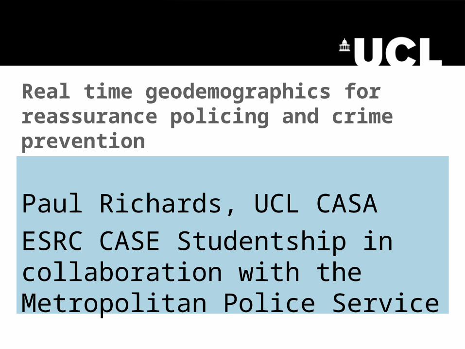
Paul Richards, UCL CASA
ESRC CASE Studentship in collaboration with the Metropolitan Police Service
Real time geodemographics for reassurance policing and crime prevention
Criminology,
Policing,
Information Systems &
Geography.
The Disciplines
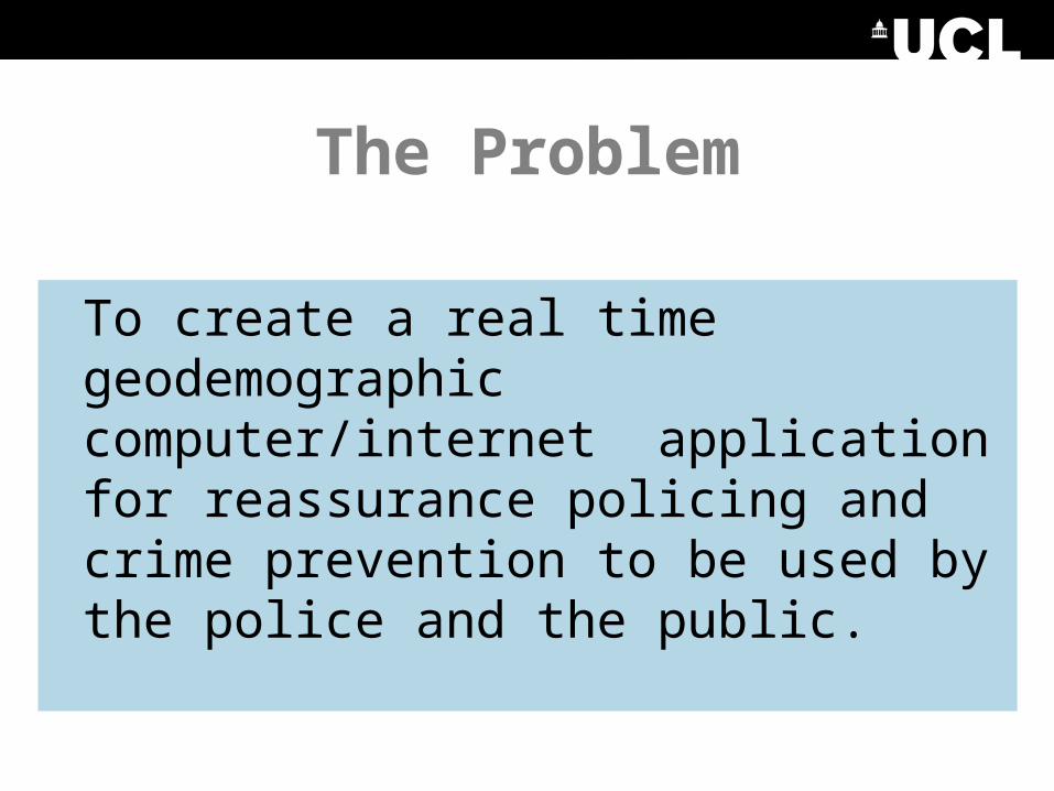
The Problem
To create a real time geodemographic computer/internet application for reassurance policing and crime prevention to be used by the police and the public.
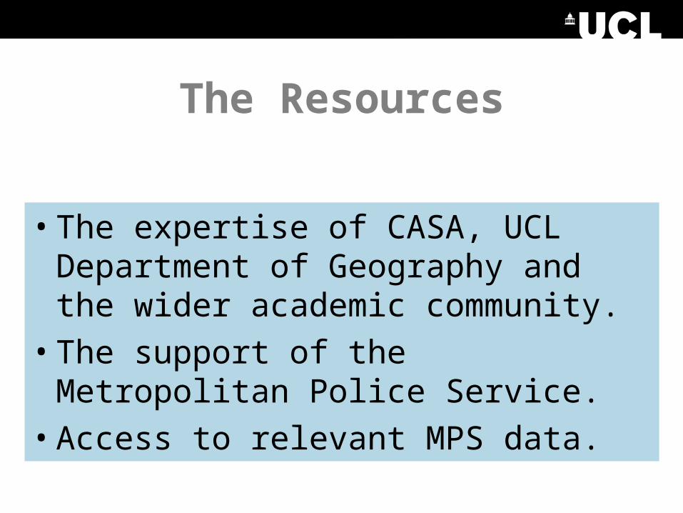
The Resources
• The expertise of CASA, UCL Department of Geography and the wider academic community.
• The support of the Metropolitan Police Service.
• Access to relevant MPS data.
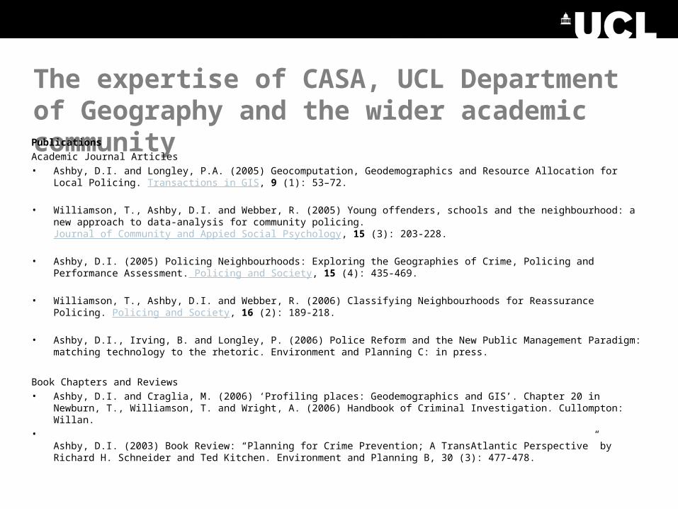
The expertise of CASA, UCL Department of Geography and the wider academic communityPublications
Academic Journal Articles• Ashby, D.I. and Longley, P.A. (2005) Geocomputation, Geodemographics and Resource Allocation for Local Policing.
Transactions in GIS, 9 (1): 53–72.
• Williamson, T., Ashby, D.I. and Webber, R. (2005) Young offenders, schools and the neighbourhood: a new approach to data-analysis for community policing. Journal of Community and Appied Social Psychology, 15 (3): 203-228.
• Ashby, D.I. (2005) Policing Neighbourhoods: Exploring the Geographies of Crime, Policing and Performance Assessment. Policing and Society, 15 (4): 435-469.
• Williamson, T., Ashby, D.I. and Webber, R. (2006) Classifying Neighbourhoods for Reassurance Policing. Policing and Society, 16 (2): 189-218.
• Ashby, D.I., Irving, B. and Longley, P. (2006) Police Reform and the New Public Management Paradigm: matching technology to the rhetoric. Environment and Planning C: in press.
Book Chapters and Reviews• Ashby, D.I. and Craglia, M. (2006) ‘Profiling places: Geodemographics and GIS’. Chapter 20 in Newburn, T.,
Williamson, T. and Wright, A. (2006) Handbook of Criminal Investigation. Cullompton: Willan. •
Ashby, D.I. (2003) Book Review: “Planning for Crime Prevention; A TransAtlantic Perspective” by Richard H. Schneider and Ted Kitchen. Environment and Planning B, 30 (3): 477-478.
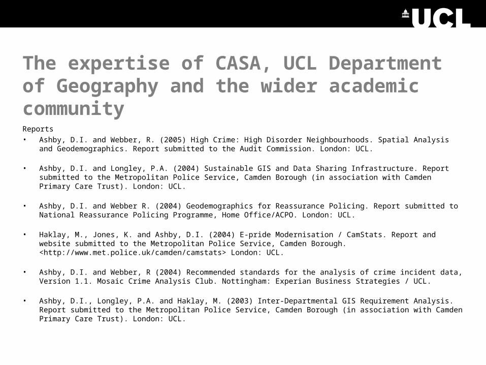
The expertise of CASA, UCL Department of Geography and the wider academic community
Reports• Ashby, D.I. and Webber, R. (2005) High Crime: High Disorder Neighbourhoods. Spatial Analysis and
Geodemographics. Report submitted to the Audit Commission. London: UCL.
• Ashby, D.I. and Longley, P.A. (2004) Sustainable GIS and Data Sharing Infrastructure. Report submitted to the Metropolitan Police Service, Camden Borough (in association with Camden Primary Care Trust). London: UCL.
• Ashby, D.I. and Webber R. (2004) Geodemographics for Reassurance Policing. Report submitted to National Reassurance Policing Programme, Home Office/ACPO. London: UCL.
• Haklay, M., Jones, K. and Ashby, D.I. (2004) E-pride Modernisation / CamStats. Report and website submitted to the Metropolitan Police Service, Camden Borough. <http://www.met.police.uk/camden/camstats> London: UCL.
• Ashby, D.I. and Webber, R (2004) Recommended standards for the analysis of crime incident data, Version 1.1. Mosaic Crime Analysis Club. Nottingham: Experian Business Strategies / UCL.
• Ashby, D.I., Longley, P.A. and Haklay, M. (2003) Inter-Departmental GIS Requirement Analysis. Report submitted to the Metropolitan Police Service, Camden Borough (in association with Camden Primary Care Trust). London: UCL.
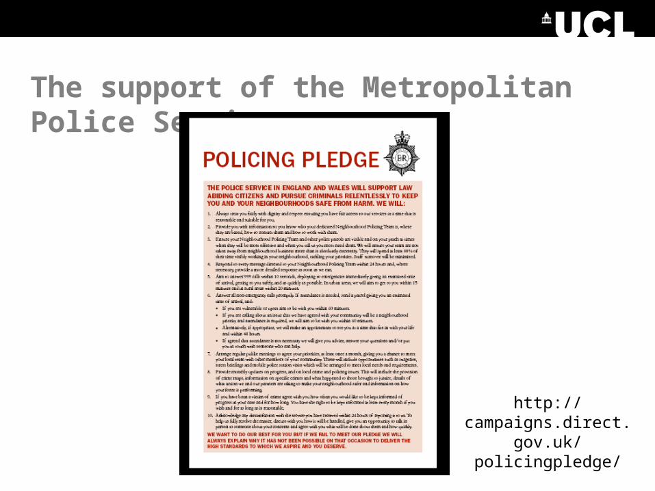
The support of the Metropolitan Police Service
http://campaigns.direct.gov.u
k/policingpledge/
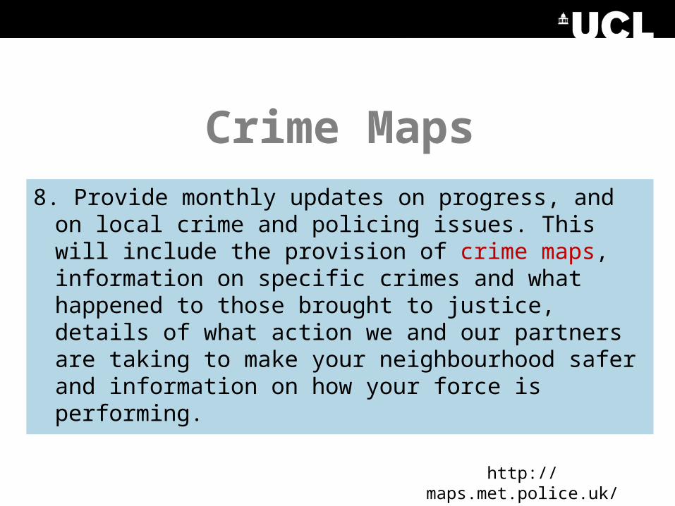
Crime Maps
8. Provide monthly updates on progress, and on local crime and policing issues. This will include the provision of crime maps, information on specific crimes and what happened to those brought to justice, details of what action we and our partners are taking to make your neighbourhood safer and information on how your force is performing.
http://maps.met.police.uk/
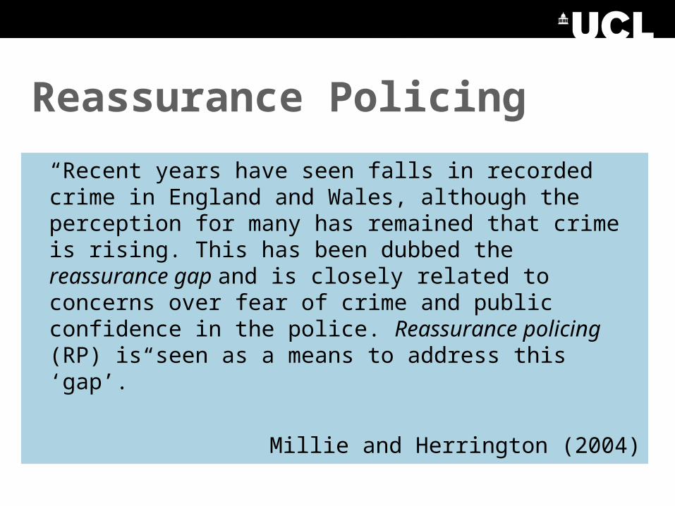
Reassurance Policing
“Recent years have seen falls in recorded crime in England and Wales, although the perception for many has remained that crime is rising. This has been dubbed the reassurance gap and is closely related to concerns over fear of crime and public confidence in the police. Reassurance policing (RP) is seen as a means to address this ‘gap’.”
Millie and Herrington (2004)
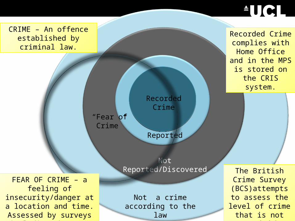
Recorded Crime
Reported
Not Reported/Discovered
Not a crime according to the law
CRIME – An offence established by criminal law.
“Fear of Crime”
FEAR OF CRIME – a feeling of insecurity/danger
at a location and time. Assessed by surveys
including the BCS.
Recorded Crime complies with
Home Office and in the MPS is stored
on the CRIS system.
The British Crime Survey
(BCS)attempts to assess the level of
crime that is not recorded by police
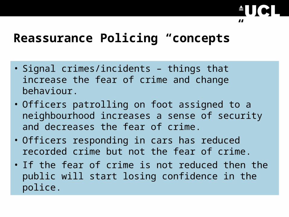
Reassurance Policing “concepts”
• Signal crimes/incidents – things that increase the fear of crime and change behaviour.
• Officers patrolling on foot assigned to a neighbourhood increases a sense of security and decreases the fear of crime.
• Officers responding in cars has reduced recorded crime but not the fear of crime.
• If the fear of crime is not reduced then the public will start losing confidence in the police.

How is this research going to change the price of fish?
OK that’s the history and the policy frame-work, what is this research going to do that is new and useful?
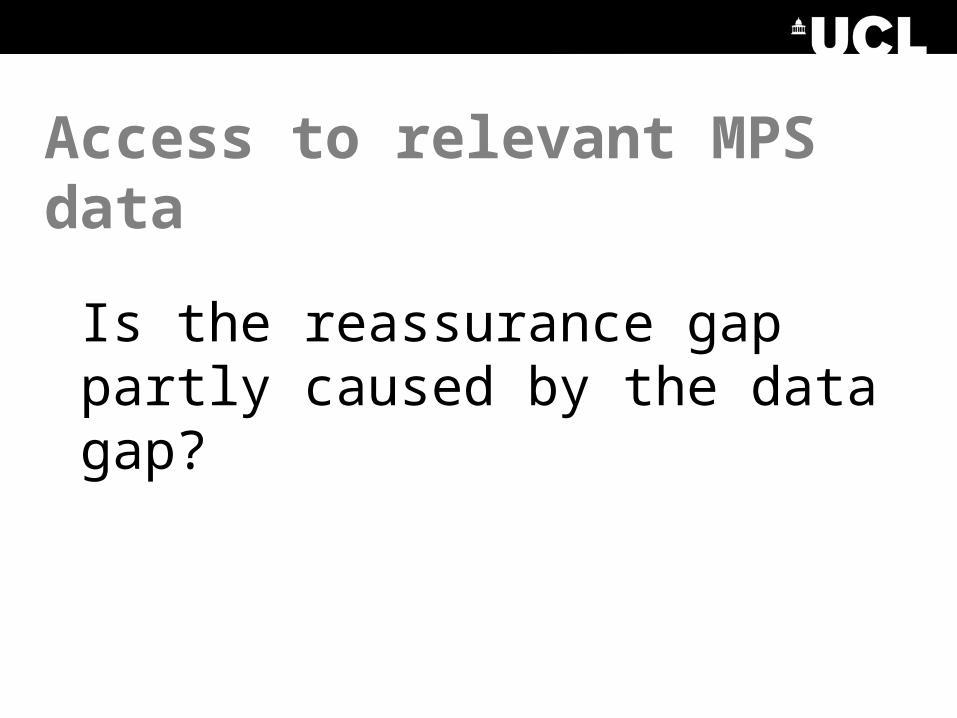
Access to relevant MPS data
Is the reassurance gap partly caused by the data gap?
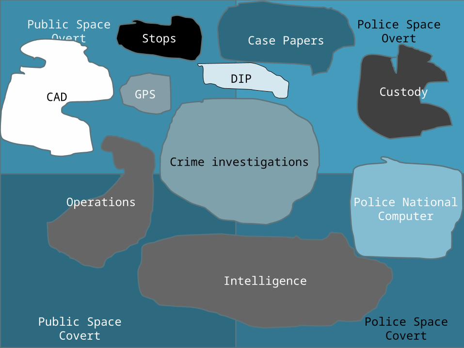
Public Space Overt
Public Space Covert
Police Space Overt
Crime investigations
CAD
Stops
CustodyGPS
Police National Computer
Intelligence
Operations
Case Papers
DIP
Police Space Covert
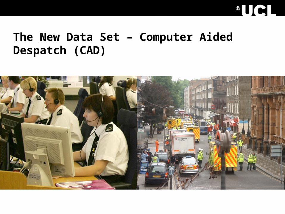
The New Data Set – Computer Aided Despatch (CAD)
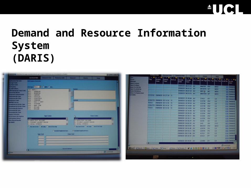
Demand and Resource Information System(DARIS)
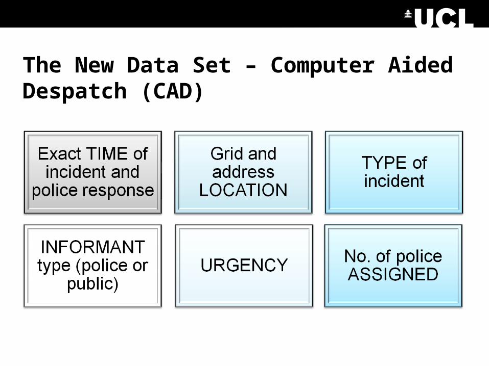
The New Data Set – Computer Aided Despatch (CAD)
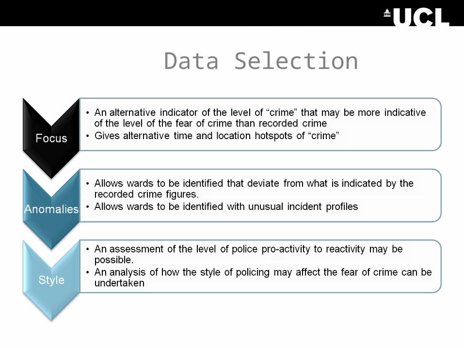
Data Selection
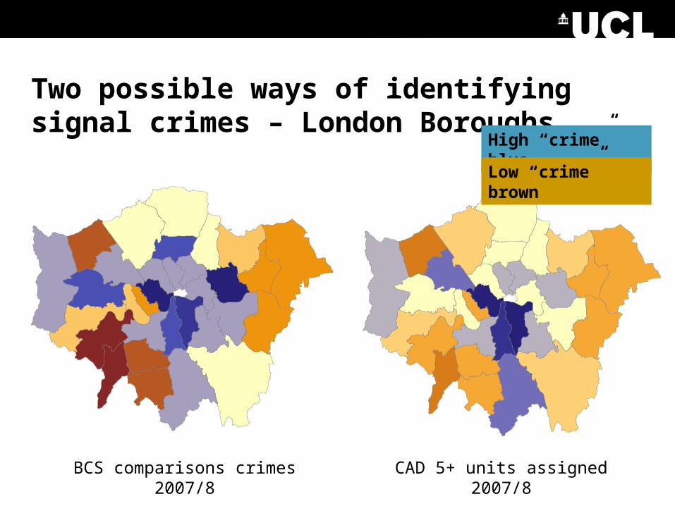
Two possible ways of identifying signal crimes – London Boroughs
BCS comparisons crimes 2007/8 CAD 5+ units assigned 2007/8
High “crime” blue
Low “crime” brown
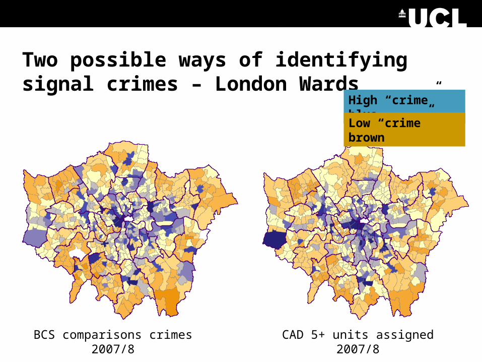
Two possible ways of identifying signal crimes – London Wards
BCS comparisons crimes 2007/8 CAD 5+ units assigned 2007/8
High “crime” blue
Low “crime” brown
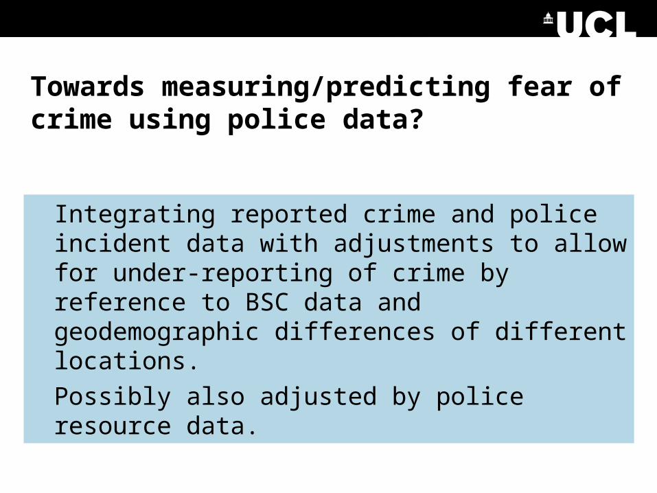
Towards measuring/predicting fear of crime using police data?
Integrating reported crime and police incident data with adjustments to allow for under-reporting of crime by reference to BSC data and geodemographic differences of different locations.
Possibly also adjusted by police resource data.
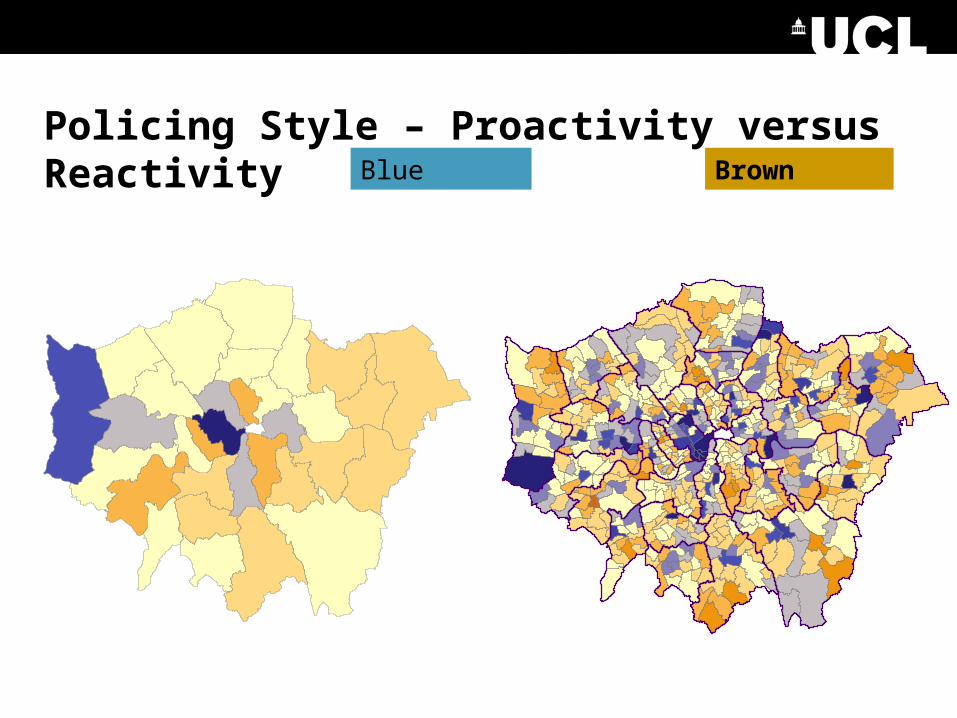
Policing Style – Proactivity versus ReactivityBlue Brown
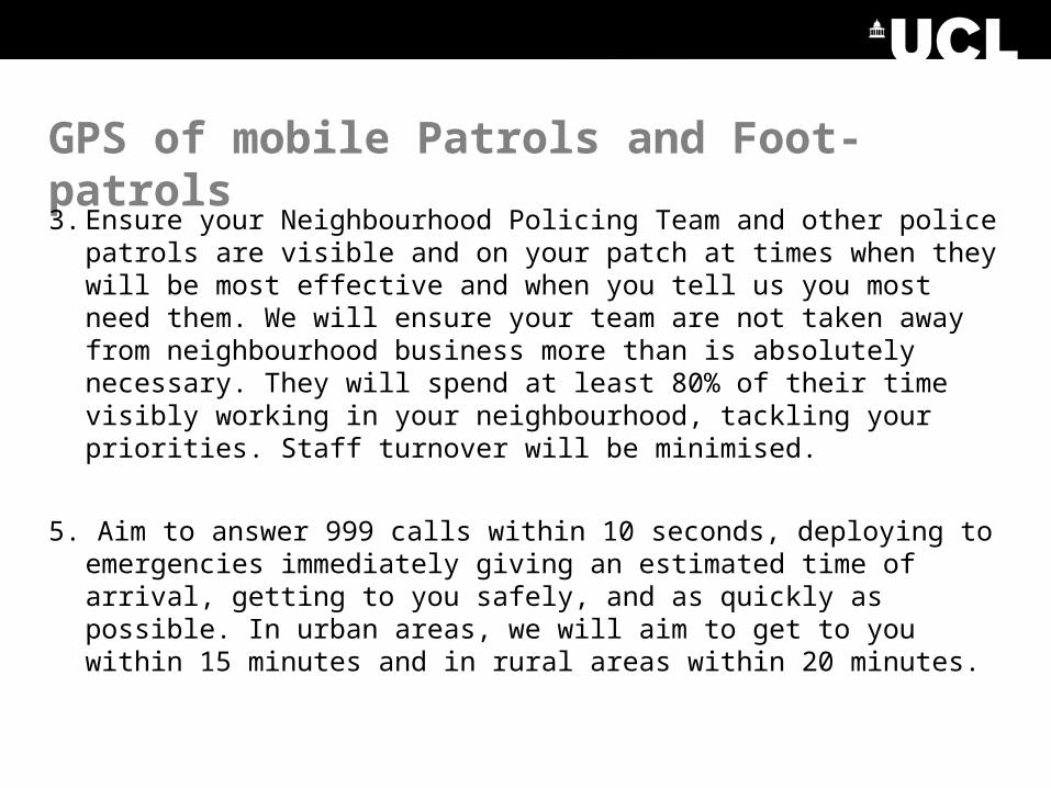
GPS of mobile Patrols and Foot-patrols
3. Ensure your Neighbourhood Policing Team and other police patrols are visible and on your patch at times when they will be most effective and when you tell us you most need them. We will ensure your team are not taken away from neighbourhood business more than is absolutely necessary. They will spend at least 80% of their time visibly working in your neighbourhood, tackling your priorities. Staff turnover will be minimised.
5. Aim to answer 999 calls within 10 seconds, deploying to emergencies immediately giving an estimated time of arrival, getting to you safely, and as quickly as possible. In urban areas, we will aim to get to you within 15 minutes and in rural areas within 20 minutes.
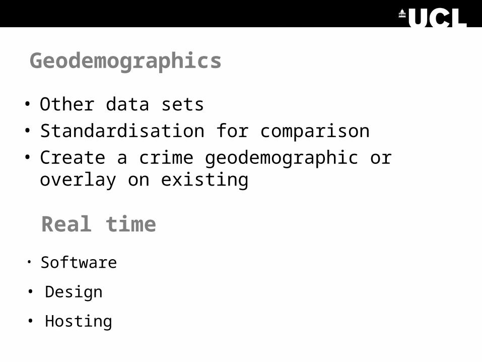
Geodemographics
• Other data sets• Standardisation for comparison• Create a crime geodemographic or overlay on
existing
Real time
• Software
• Design
• Hosting