Embed Size (px)
Citation preview

William Penn Real Estate AssociatesAssisting Buyers and Sellers in Southeastern and Central Pennsylvania for Over a Decade!
www.williampennassociates.com(717) 299-7070
1724 River RdMarietta, PA 17574Geographical Report
GIS Map Page(s)………………………………………………………………………………1
Property Data Sheet(s)……………………………………………………………………..…2
Parcel Map(s)…………………………………………………………………………………..3
Tax Card(s)……………………………………………………………………………………..4
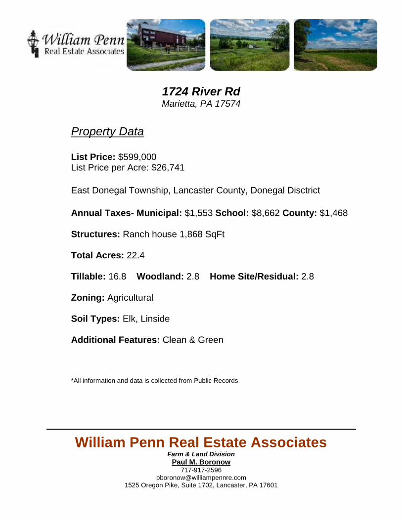
FEMA Flood Map Page(s)………………………………………………………………….…5
Soil Survey General Page(s)……………………………………………………….………6-7
Soil Survey Dwellings with Basements Page(s)………………………………………8-11
Farmland Classifications Page(s)………………………………………………….…..12-14
Soil Survey Non Irrigated Crop Yields Page(s)……………………………..………..15-18
Soil Descriptions Page(s)………………………………………………………………19-23
Paul M. Boronow
William Penn Real Estate AssociatesFarm & Land Division
Paul M. Boronow717-917-2596
[email protected] Oregon Pike, Suite 1702, Lancaster, PA 17601
1724 River RdMarietta, PA 17574
Property Data
List Price: $599,000List Price per Acre: $26,741
East Donegal Township, Lancaster County, Donegal Disctrict
Annual Taxes- Municipal: $1,553 School: $8,662 County: $1,468
Structures: Ranch house 1,868 SqFt
Total Acres: 22.4
Tillable: 16.8 Woodland: 2.8 Home Site/Residual: 2.8
Zoning: Agricultural
Soil Types: Elk, Linside
Additional Features: Clean & Green
*All information and data is collected from Public Records

William Penn Real Estate AssociatesAssisting Buyers and Sellers in Southeastern and Central Pennsylvania for Over a Decade!
www.williampennassociates.com(717) 299-7070
1724 River RdMarietta, PA 17574Geographical Report
GIS Map Page(s)………………………………………………………………………………1
Property Data Sheet(s)……………………………………………………………………..…2
Parcel Map(s)…………………………………………………………………………………..3
Tax Card(s)……………………………………………………………………………………..4
FEMA Flood Map Page(s)………………………………………………………………….…5
Soil Survey General Page(s)……………………………………………………….………6-7
Soil Survey Dwellings with Basements Page(s)………………………………………8-11
Farmland Classifications Page(s)………………………………………………….…..12-14
Soil Survey Non Irrigated Crop Yields Page(s)……………………………..………..15-18
Soil Descriptions Page(s)………………………………………………………………19-23
Paul M. Boronow

William Penn Real Estate AssociatesFarm & Land Division
Paul M. Boronow717-917-2596
[email protected] Oregon Pike, Suite 1702, Lancaster, PA 17601
1724 River RdMarietta, PA 17574
Property Data
List Price: $List Price per Acre: $ | List Price per Tillable Acre: $
East Donegal Township, Lancaster County, Donegal Disctrict
Annual Taxes- Municipal: $1,553 School: $8,662 County: $1,468
Structures: Ranch house 1,868 SqFt
Total Acres: 22.4
Tillable: 16.8 Woodland: 2.8 Home Site/Residual: 2.8
Zoning: Agricultural
Soil Types: Elk, Linside
Additional Features: Clean & Green
*All information and data is collected from Public Records

1724 RIVER RD
Scale 1:3,600 - 1 in = 300 ft Date Created: 10-Aug-16 12:28 PM
Source: Lancaster County GIS, Copyright (c) 2016. This map to be used for reference or illustrative purposes only. This map is not a legally recorded plan, survey, or engineering schematic and it is notintended to be used as such.For complete disclaimer see: co.lancaster.pa.us/gisdisclaimer

1724 RIVER RD
Scale 1:3,600 - 1 in = 300 ft Date Created: 10-Aug-16 12:27 PM
Source: Lancaster County GIS, Copyright (c) 2016. This map to be used for reference or illustrative purposes only. This map is not a legally recorded plan, survey, or engineering schematic and it is notintended to be used as such.For complete disclaimer see: co.lancaster.pa.us/gisdisclaimer

8/10/2016 flexmls
http://public.tax.flexmls.com/cgibin/mainmenu.cgi?cmd=url+other/popup/parcel_mapping.html&parcel_alpha1=1506876500000&ma_tech_id=20040823192259… 1/2
Address: 1724 RIVER RD PA Parcel: 1506876500000

8/10/2016 flexmls
http://public.tax.flexmls.com/cgibin/mainmenu.cgi?cmd=url+other/popup/parcel_mapping.html&parcel_alpha1=1506876500000&ma_tech_id=20040823192259… 2/2
Tax Record Report for Parcel 1506876500000 at 1724 RIVER RD, PA
Property AddressCounty Lancaster Owner InformationOwner Name FANTOM KEVIN R Owner Address FANTOM JANE K
4959 BOSSLER RDELIZABETHTOWN, PA 17022
CAMA InformationParcel Nbr 1506876500000 Property Class Agriculture Land Use Desc AG CROPS District 150East Donegal Twp School District Donegal Sale Date 11/1/2007Sale Price 1 Act 319 01Active Land Value 174,800 Building Value 218,500Total Value 393,300 Acreage 22.40 UtilitiesWater 04Well Sewer 04Septic Gas 01None Electric 02Hooked up Hydrant No
Residential and Other Common Record InfoMain Living Area 1,868 Upper Living Area 0Main Unfinished Area 0 Upper Unfin Area 0Ground Floor Area 0 Base Floor 0Bedrooms 3 Full Baths 1Half Baths 1 Num Frplc WD 0Num Frplc GS 0 Num Families 1Story Height 1 Year Built 2010Year Remodeled 0 Style 22Ranch Roofing 02Asphalt Shingles Basement Type 04FULL (no data) Basement Area 1,868 Heat Type 07Heat Pump Fuel Type 02Electric One Way Street No Mobile Home InfoPad Number 0 Registration Number 0MH Tip out area 0 Manufacturer 0
Tax records last updated Lancaster County: May 23, 2016; Lebanon County: May 23, 2016Information is deemed to be reliable, but is not guaranteed. See copyright notice.

Soil Map—Lancaster County, Pennsylvania
Natural ResourcesConservation Service
Web Soil SurveyNational Cooperative Soil Survey
8/10/2016Page 1 of 3
4436
340
4436
410
4436
480
4436
550
4436
620
4436
690
4436
760
4436
340
4436
410
4436
480
4436
550
4436
620
4436
690
4436
760
362100 362170 362240 362310 362380 362450 362520 362590 362660 362730 362800
362100 362170 362240 362310 362380 362450 362520 362590 362660 362730 362800
40° 4' 12'' N76
° 3
7' 1
'' W40° 4' 12'' N
76° 3
6' 3
1'' W
40° 3' 57'' N
76° 3
7' 1
'' W
40° 3' 57'' N
76° 3
6' 3
1'' W
N
Map projection: Web Mercator Corner coordinates: WGS84 Edge tics: UTM Zone 18N WGS840 150 300 600 900
Feet0 45 90 180 270
MetersMap Scale: 1:3,270 if printed on A landscape (11" x 8.5") sheet.

Map Unit Legend
Lancaster County, Pennsylvania (PA071)
Map Unit Symbol Map Unit Name Acres in AOI Percent of AOI
EcA Elk silt loam, 0 to 3 percentslopes
6.4 28.2%
EcB Elk silt loam, 3 to 8 percentslopes
10.0 44.3%
EcC Elk silt loam, 8 to 15 percentslopes
5.7 25.3%
Ln Lindside silt loam 0.5 2.2%
Totals for Area of Interest 22.5 100.0%
Soil Map—Lancaster County, Pennsylvania
Natural ResourcesConservation Service
Web Soil SurveyNational Cooperative Soil Survey
8/10/2016Page 3 of 3
Dwellings With Basements—Lancaster County, Pennsylvania
Natural ResourcesConservation Service
Web Soil SurveyNational Cooperative Soil Survey
8/10/2016Page 1 of 5
4436
340
4436
410
4436
480
4436
550
4436
620
4436
690
4436
760
4436
340
4436
410
4436
480
4436
550
4436
620
4436
690
4436
760
362100 362170 362240 362310 362380 362450 362520 362590 362660 362730 362800
362100 362170 362240 362310 362380 362450 362520 362590 362660 362730 362800
40° 4' 12'' N76
° 3
7' 1
'' W40° 4' 12'' N
76° 3
6' 3
1'' W
40° 3' 57'' N
76° 3
7' 1
'' W
40° 3' 57'' N
76° 3
6' 3
1'' W
N
Map projection: Web Mercator Corner coordinates: WGS84 Edge tics: UTM Zone 18N WGS840 150 300 600 900
Feet0 45 90 180 270
MetersMap Scale: 1:3,270 if printed on A landscape (11" x 8.5") sheet.

MAP LEGEND MAP INFORMATION
Area of Interest (AOI)Area of Interest (AOI)
SoilsSoil Rating Polygons
Very limited
Somewhat limited
Not limited
Not rated or not available
Soil Rating LinesVery limited
Somewhat limited
Not limited
Not rated or not available
Soil Rating PointsVery limited
Somewhat limited
Not limited
Not rated or not available
Water FeaturesStreams and Canals
TransportationRails
Interstate Highways
US Routes
Major Roads
Local Roads
BackgroundAerial Photography
The soil surveys that comprise your AOI were mapped at 1:15,800.
Warning: Soil Map may not be valid at this scale.
Enlargement of maps beyond the scale of mapping can causemisunderstanding of the detail of mapping and accuracy of soil lineplacement. The maps do not show the small areas of contrastingsoils that could have been shown at a more detailed scale.
Please rely on the bar scale on each map sheet for mapmeasurements.
Source of Map: Natural Resources Conservation ServiceWeb Soil Survey URL: http://websoilsurvey.nrcs.usda.govCoordinate System: Web Mercator (EPSG:3857)
Maps from the Web Soil Survey are based on the Web Mercatorprojection, which preserves direction and shape but distortsdistance and area. A projection that preserves area, such as theAlbers equal-area conic projection, should be used if more accuratecalculations of distance or area are required.
This product is generated from the USDA-NRCS certified data as ofthe version date(s) listed below.
Soil Survey Area: Lancaster County, PennsylvaniaSurvey Area Data: Version 12, Nov 16, 2015
Soil map units are labeled (as space allows) for map scales 1:50,000or larger.
Date(s) aerial images were photographed: Mar 26, 2011—Mar27, 2011
The orthophoto or other base map on which the soil lines werecompiled and digitized probably differs from the backgroundimagery displayed on these maps. As a result, some minor shiftingof map unit boundaries may be evident.
Dwellings With Basements—Lancaster County, Pennsylvania
Natural ResourcesConservation Service
Web Soil SurveyNational Cooperative Soil Survey
8/10/2016Page 2 of 5

Dwellings With Basements
Dwellings With Basements— Summary by Map Unit — Lancaster County, Pennsylvania (PA071)
Map unitsymbol
Map unit name Rating Componentname (percent)
Rating reasons(numericvalues)
Acres in AOI Percent of AOI
EcA Elk silt loam, 0 to3 percentslopes
Not limited Elk (85%) 6.4 28.2%
EcB Elk silt loam, 3 to8 percentslopes
Not limited Elk (85%) 10.0 44.3%
EcC Elk silt loam, 8 to15 percentslopes
Somewhatlimited
Elk (90%) Slope (0.63) 5.7 25.3%
Duffield (5%) Slope (0.63)
Shrink-swell(0.50)
Hagerstown (5%) Slope (0.63)
Shrink-swell(0.50)
Ln Lindside silt loam Very limited Lindside (85%) Flooding (1.00) 0.5 2.2%
Depth tosaturated zone(1.00)
Holly (12%) Flooding (1.00)
Depth tosaturated zone(1.00)
Nolin (1%) Flooding (1.00)
Depth tosaturated zone(0.35)
Newark (1%) Flooding (1.00)
Depth tosaturated zone(1.00)
Totals for Area of Interest 22.5 100.0%
Dwellings With Basements— Summary by Rating Value
Rating Acres in AOI Percent of AOI
Not limited 16.3 72.5%
Somewhat limited 5.7 25.3%
Very limited 0.5 2.2%
Totals for Area of Interest 22.5 100.0%
Dwellings With Basements—Lancaster County, Pennsylvania
Natural ResourcesConservation Service
Web Soil SurveyNational Cooperative Soil Survey
8/10/2016Page 3 of 5

Description
Dwellings are single-family houses of three stories or less. For dwellings withbasements, the foundation is assumed to consist of spread footings of reinforcedconcrete built on undisturbed soil at a depth of about 7 feet.
The ratings for dwellings are based on the soil properties that affect the capacity ofthe soil to support a load without movement and on the properties that affectexcavation and construction costs. The properties that affect the load-supportingcapacity include depth to a water table, ponding, flooding, subsidence, linearextensibility (shrink-swell potential), and compressibility. Compressibility is inferredfrom the Unified classification of the soil. The properties that affect the ease andamount of excavation include depth to a water table, ponding, flooding, slope, depthto bedrock or a cemented pan, hardness of bedrock or a cemented pan, and theamount and size of rock fragments.
The ratings are both verbal and numerical. Rating class terms indicate the extentto which the soils are limited by all of the soil features that affect the specified use."Not limited" indicates that the soil has features that are very favorable for thespecified use. Good performance and very low maintenance can be expected."Somewhat limited" indicates that the soil has features that are moderatelyfavorable for the specified use. The limitations can be overcome or minimized byspecial planning, design, or installation. Fair performance and moderatemaintenance can be expected. "Very limited" indicates that the soil has one or morefeatures that are unfavorable for the specified use. The limitations generally cannotbe overcome without major soil reclamation, special design, or expensiveinstallation procedures. Poor performance and high maintenance can be expected.
Numerical ratings indicate the severity of individual limitations. The ratings areshown as decimal fractions ranging from 0.01 to 1.00. They indicate gradationsbetween the point at which a soil feature has the greatest negative impact on theuse (1.00) and the point at which the soil feature is not a limitation (0.00).
The map unit components listed for each map unit in the accompanying Summaryby Map Unit table in Web Soil Survey or the Aggregation Report in Soil Data Viewerare determined by the aggregation method chosen. An aggregated rating class isshown for each map unit. The components listed for each map unit are only thosethat have the same rating class as listed for the map unit. The percent compositionof each component in a particular map unit is presented to help the user betterunderstand the percentage of each map unit that has the rating presented.
Other components with different ratings may be present in each map unit. Theratings for all components, regardless of the map unit aggregated rating, can beviewed by generating the equivalent report from the Soil Reports tab in Web SoilSurvey or from the Soil Data Mart site. Onsite investigation may be needed tovalidate these interpretations and to confirm the identity of the soil on a given site.
Rating Options
Aggregation Method: Dominant Condition
Component Percent Cutoff: None Specified
Dwellings With Basements—Lancaster County, Pennsylvania
Natural ResourcesConservation Service
Web Soil SurveyNational Cooperative Soil Survey
8/10/2016Page 4 of 5

Farmland Classification—Lancaster County, Pennsylvania
Natural ResourcesConservation Service
Web Soil SurveyNational Cooperative Soil Survey
8/10/2016Page 1 of 4
4436
340
4436
410
4436
480
4436
550
4436
620
4436
690
4436
760
4436
340
4436
410
4436
480
4436
550
4436
620
4436
690
4436
760
362100 362170 362240 362310 362380 362450 362520 362590 362660 362730 362800
362100 362170 362240 362310 362380 362450 362520 362590 362660 362730 362800
40° 4' 12'' N76
° 3
7' 1
'' W40° 4' 12'' N
76° 3
6' 3
1'' W
40° 3' 57'' N
76° 3
7' 1
'' W
40° 3' 57'' N
76° 3
6' 3
1'' W
N
Map projection: Web Mercator Corner coordinates: WGS84 Edge tics: UTM Zone 18N WGS840 150 300 600 900
Feet0 45 90 180 270
MetersMap Scale: 1:3,270 if printed on A landscape (11" x 8.5") sheet.

MAP LEGENDArea of Interest (AOI)
Area of Interest (AOI)
SoilsSoil Rating Polygons
Not prime farmland
All areas are primefarmlandPrime farmland if drained
Prime farmland ifprotected from flooding ornot frequently floodedduring the growing seasonPrime farmland if irrigated
Prime farmland if drainedand either protected fromflooding or not frequentlyflooded during the growingseasonPrime farmland if irrigatedand drainedPrime farmland if irrigatedand either protected fromflooding or not frequentlyflooded during the growingseason
Prime farmland ifsubsoiled, completelyremoving the rootinhibiting soil layerPrime farmland if irrigatedand the product of I (soilerodibility) x C (climatefactor) does not exceed 60Prime farmland if irrigatedand reclaimed of excesssalts and sodiumFarmland of statewideimportanceFarmland of localimportanceFarmland of uniqueimportanceNot rated or not available
Soil Rating LinesNot prime farmland
All areas are primefarmlandPrime farmland if drained
Prime farmland ifprotected from flooding ornot frequently floodedduring the growing seasonPrime farmland if irrigated
Prime farmland if drainedand either protected fromflooding or not frequentlyflooded during the growingseasonPrime farmland if irrigatedand drainedPrime farmland if irrigatedand either protected fromflooding or not frequentlyflooded during the growingseasonPrime farmland ifsubsoiled, completelyremoving the rootinhibiting soil layerPrime farmland if irrigatedand the product of I (soilerodibility) x C (climatefactor) does not exceed 60
Prime farmland if irrigatedand reclaimed of excesssalts and sodiumFarmland of statewideimportanceFarmland of localimportanceFarmland of uniqueimportanceNot rated or not available
Soil Rating PointsNot prime farmland
All areas are primefarmlandPrime farmland if drained
Prime farmland ifprotected from flooding ornot frequently floodedduring the growing seasonPrime farmland if irrigated
Prime farmland if drainedand either protected fromflooding or not frequentlyflooded during the growingseason
Prime farmland ifirrigated and drainedPrime farmland ifirrigated and eitherprotected from floodingor not frequently floodedduring the growingseasonPrime farmland ifsubsoiled, completelyremoving the rootinhibiting soil layerPrime farmland ifirrigated and the productof I (soil erodibility) x C(climate factor) does notexceed 60Prime farmland ifirrigated and reclaimed ofexcess salts and sodiumFarmland of statewideimportanceFarmland of localimportanceFarmland of uniqueimportanceNot rated or not available
Water Features
Farmland Classification—Lancaster County, Pennsylvania
Natural ResourcesConservation Service
Web Soil SurveyNational Cooperative Soil Survey
8/10/2016Page 2 of 4

Farmland Classification
Farmland Classification— Summary by Map Unit — Lancaster County, Pennsylvania (PA071)
Map unit symbol Map unit name Rating Acres in AOI Percent of AOI
EcA Elk silt loam, 0 to 3percent slopes
All areas are primefarmland
6.4 28.2%
EcB Elk silt loam, 3 to 8percent slopes
All areas are primefarmland
10.0 44.3%
EcC Elk silt loam, 8 to 15percent slopes
Farmland of statewideimportance
5.7 25.3%
Ln Lindside silt loam All areas are primefarmland
0.5 2.2%
Totals for Area of Interest 22.5 100.0%
Description
Farmland classification identifies map units as prime farmland, farmland ofstatewide importance, farmland of local importance, or unique farmland. It identifiesthe location and extent of the soils that are best suited to food, feed, fiber, forage,and oilseed crops. NRCS policy and procedures on prime and unique farmlandsare published in the "Federal Register," Vol. 43, No. 21, January 31, 1978.
Rating Options
Aggregation Method: No Aggregation Necessary
Tie-break Rule: Lower
Farmland Classification—Lancaster County, Pennsylvania
Natural ResourcesConservation Service
Web Soil SurveyNational Cooperative Soil Survey
8/10/2016Page 4 of 4

Yields of Non-Irrigated Crops (Map Unit): Alfalfa hay (Tons)—Lancaster County, Pennsylvania
Natural ResourcesConservation Service
Web Soil SurveyNational Cooperative Soil Survey
8/10/2016Page 1 of 4
4436
340
4436
410
4436
480
4436
550
4436
620
4436
690
4436
760
4436
340
4436
410
4436
480
4436
550
4436
620
4436
690
4436
760
362100 362170 362240 362310 362380 362450 362520 362590 362660 362730 362800
362100 362170 362240 362310 362380 362450 362520 362590 362660 362730 362800
40° 4' 12'' N76
° 3
7' 1
'' W40° 4' 12'' N
76° 3
6' 3
1'' W
40° 3' 57'' N
76° 3
7' 1
'' W
40° 3' 57'' N
76° 3
6' 3
1'' W
N
Map projection: Web Mercator Corner coordinates: WGS84 Edge tics: UTM Zone 18N WGS840 150 300 600 900
Feet0 45 90 180 270
MetersMap Scale: 1:3,270 if printed on A landscape (11" x 8.5") sheet.

MAP LEGEND MAP INFORMATION
Area of Interest (AOI)Area of Interest (AOI)
SoilsSoil Rating Polygons
<= 4.50
> 4.50 and <= 5.00
Not rated or not available
Soil Rating Lines<= 4.50
> 4.50 and <= 5.00
Not rated or not available
Soil Rating Points<= 4.50
> 4.50 and <= 5.00
Not rated or not available
Water FeaturesStreams and Canals
TransportationRails
Interstate Highways
US Routes
Major Roads
Local Roads
BackgroundAerial Photography
The soil surveys that comprise your AOI were mapped at 1:15,800.
Warning: Soil Map may not be valid at this scale.
Enlargement of maps beyond the scale of mapping can causemisunderstanding of the detail of mapping and accuracy of soil lineplacement. The maps do not show the small areas of contrastingsoils that could have been shown at a more detailed scale.
Please rely on the bar scale on each map sheet for mapmeasurements.
Source of Map: Natural Resources Conservation ServiceWeb Soil Survey URL: http://websoilsurvey.nrcs.usda.govCoordinate System: Web Mercator (EPSG:3857)
Maps from the Web Soil Survey are based on the Web Mercatorprojection, which preserves direction and shape but distortsdistance and area. A projection that preserves area, such as theAlbers equal-area conic projection, should be used if more accuratecalculations of distance or area are required.
This product is generated from the USDA-NRCS certified data as ofthe version date(s) listed below.
Soil Survey Area: Lancaster County, PennsylvaniaSurvey Area Data: Version 12, Nov 16, 2015
Soil map units are labeled (as space allows) for map scales 1:50,000or larger.
Date(s) aerial images were photographed: Mar 26, 2011—Mar27, 2011
The orthophoto or other base map on which the soil lines werecompiled and digitized probably differs from the backgroundimagery displayed on these maps. As a result, some minor shiftingof map unit boundaries may be evident.
Yields of Non-Irrigated Crops (Map Unit): Alfalfa hay (Tons)—Lancaster County, Pennsylvania
Natural ResourcesConservation Service
Web Soil SurveyNational Cooperative Soil Survey
8/10/2016Page 2 of 4
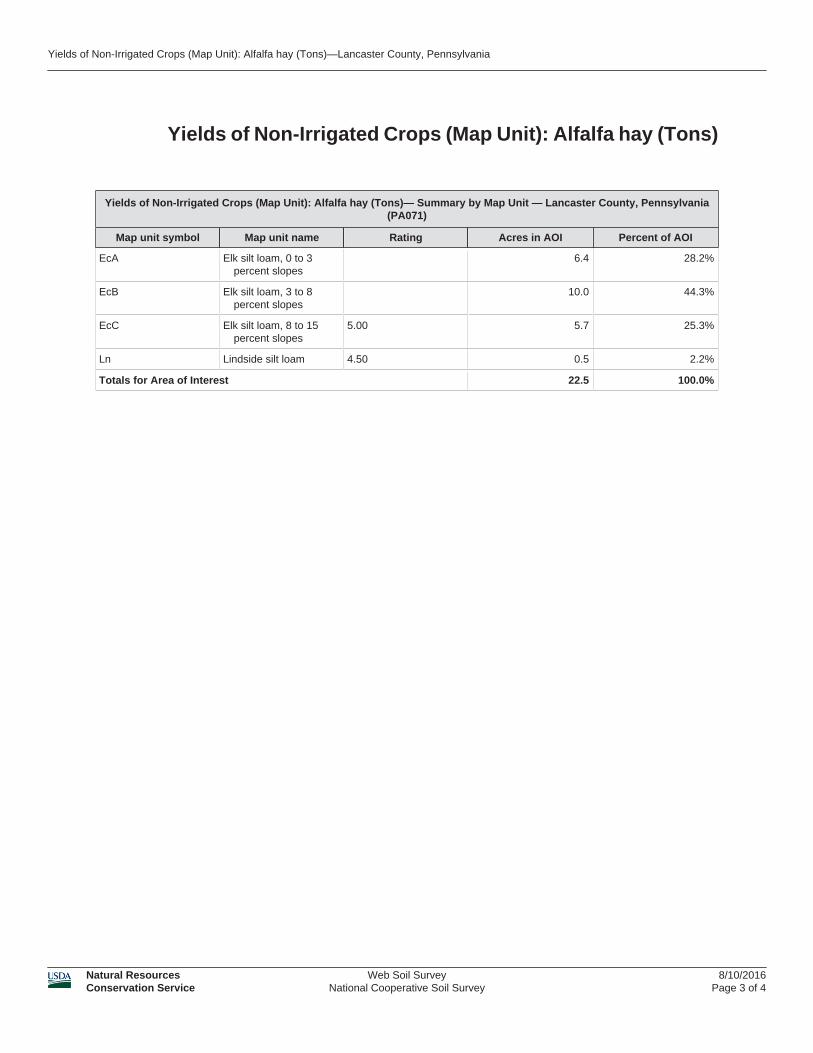
Yields of Non-Irrigated Crops (Map Unit): Alfalfa hay (Tons)
Yields of Non-Irrigated Crops (Map Unit): Alfalfa hay (Tons)— Summary by Map Unit — Lancaster County, Pennsylvania(PA071)
Map unit symbol Map unit name Rating Acres in AOI Percent of AOI
EcA Elk silt loam, 0 to 3percent slopes
6.4 28.2%
EcB Elk silt loam, 3 to 8percent slopes
10.0 44.3%
EcC Elk silt loam, 8 to 15percent slopes
5.00 5.7 25.3%
Ln Lindside silt loam 4.50 0.5 2.2%
Totals for Area of Interest 22.5 100.0%
Yields of Non-Irrigated Crops (Map Unit): Alfalfa hay (Tons)—Lancaster County, Pennsylvania
Natural ResourcesConservation Service
Web Soil SurveyNational Cooperative Soil Survey
8/10/2016Page 3 of 4

Description
These are the estimated average yields per acre that can be expected of selectednonirrigated crops under a high level of management. In any given year, yields maybe higher or lower than those indicated because of variations in rainfall and otherclimatic factors.
In the database, some states maintain crop yield data by individual map unitcomponent and others maintain the data at the map unit level. Attributes areincluded in this application for both, although only one or the other is likely to containdata for any given geographic area. This attribute uses data maintained at the mapunit level.
The yields are actually recorded as three separate values in the database. A lowvalue and a high value indicate the range for the soil component. A "representative"value indicates the expected value for the component. For these yields, only therepresentative value is used.
The yields are based mainly on the experience and records of farmers,conservationists, and extension agents. Available yield data from nearby areas andresults of field trials and demonstrations also are considered.
The management needed to obtain the indicated yields of the various cropsdepends on the kind of soil and the crop. Management can include drainage,erosion control, and protection from flooding; the proper planting and seeding rates;suitable high-yielding crop varieties; appropriate and timely tillage; control ofweeds, plant diseases, and harmful insects; favorable soil reaction and optimumlevels of nitrogen, phosphorus, potassium, and trace elements for each crop;effective use of crop residue, barnyard manure, and green manure crops; andharvesting that ensures the smallest possible loss.
The estimated yields reflect the productive capacity of each soil for the selectedcrop. Yields are likely to increase as new production technology is developed. Theproductivity of a given soil compared with that of other soils, however, is not likelyto change.
Rating Options
Crop: Alfalfa hay
Yield Units: Tons
Aggregation Method: No Aggregation Necessary
Tie-break Rule: Higher
Yields of Non-Irrigated Crops (Map Unit): Alfalfa hay (Tons)—Lancaster County, Pennsylvania
Natural ResourcesConservation Service
Web Soil SurveyNational Cooperative Soil Survey
8/10/2016Page 4 of 4

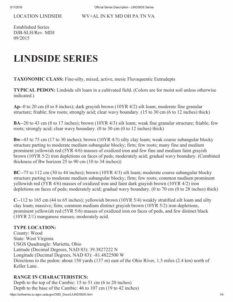
2/11/2016 Official Series Description - ELK Series
https://soilseries.sc.egov.usda.gov/OSD_Docs/E/ELK.html 1/3
LOCATION ELK KY+MD MO PA TN VA WV
Established SeriesRev. JAK-JMR08/2004
ELK SERIES
The Elk series consists of very deep, well drained, moderately permeable soils formed in mixed alluviumfrom limestone, siltstone, shale, sandstone, and loess. Slopes commonly range from 0 to 12 percent, butthe range extends to 40 percent. Near the type location, the average annual temperature is 57 degrees F.,and the average annual precipitation is 46.3 inches.
TAXONOMIC CLASS: Fine-silty, mixed, active, mesic Ultic Hapludalfs
TYPICAL PEDON: Elk silt loam--cultivated. (Colors are for moist soil unless otherwise stated.)
Ap--0 to 9 inches; brown (10YR 4/3) silt loam; weak fine granular structure; very friable; many roots;moderately acid; abrupt smooth boundary. (7 to 12 inches thick)
BA--9 to 14 inches; brown (7.5YR 4/4) silt loam; weak medium subangular blocky structure; friable;common roots; moderately acid; gradual smooth boundary. (0 to 10 inches thick)
Bt1--14 to 30 inches; brown (7.5YR 4/4) silty clay loam; moderate medium subangular blocky structure;friable; common roots; thin patchy faint brown (7.5YR 4/3) clay films; few fine black (10YR 2/1)manganese concretions; strongly acid; gradual smooth boundary.
Bt2--30 to 42 inches; strong brown (7.5YR 5/6) silty clay loam; few fine faint pale brown (10YR 6/3)mottles; moderate medium subangular blocky structure; firm; few roots; thin patchy distinct brown(7.5YR 5/4) clay films; few fine black (10YR 2/1) manganese concretions; strongly acid; clear smoothboundary. (Combined thickness of the Bt horizons is 10 to 40 inches or more)
C--42 to 69 inches; yellowish brown (10YR 5/6) silty clay loam; common medium distinct pale brown(10YR 6/3) and common medium faint light yellowish brown (10YR 6/4) mottles; massive; friable; fewfine black (10YR 2/1) manganese concretions; moderately acid.
TYPE LOCATION: Madison County, Kentucky; 6.5 miles southwest of Richmond on north side ofCurtis Pike about 3 miles south of Barnes Mill Road; on east side of house; 1/2 mile south of confluenceof Silver Creek and Taylor Fork. USGS Richmond South Quad, (Latitude: 37 degrees, 42 minutes, 18seconds N; Longitude: 84 degrees, 22 minutes, 26.6 seconds W)
RANGE IN CHARACTERISTICS: Solum thickness ranges from 40 to 60 inches or more. Depth tobedrock is greater than 5 feet. Fragments range from 0 to 5 percent in the solumn and ranges from 0 to 35percent in the C horizon. Reaction ranges from slightly acid through very strongly acid in the A and Bthorizons and from slightly acid through strongly acid in the C horizon.
The Ap horizon has hue of 10YR or 7.5YR, value of 4 or 5, and chroma of 2 to 4. Texture is silt loam,loam, or silty clay loam.

2/11/2016 Official Series Description - ELK Series
https://soilseries.sc.egov.usda.gov/OSD_Docs/E/ELK.html 2/3
The Bt horizon has hue of 10YR or 7.5YR, value of 4 or 5, and chroma of 4 to 6. Some pedons havemottles in shades of gray in the lower part. Texture is mainly silt loam or silty clay loam, but ranges tosilty clay in the lower part. The upper part has few to common mottles in shades of brown and the lowerpart has mottles in shades of brown or gray.
The C horizons have hue of 10YR to 5YR, value of 4 or 5, and chroma of 4 to 8. Texture of the fine earthfraction is silt loam or silty clay loam. Some pedons have C horizons with stratified layers of fine sandyloam, loam, clay loam, or silty clay. Some pedons have mottles in shades of gray.
A lithologic discontinuity is evident in some pedons below 50 inches, but it is not a requirement of theseries.
COMPETING SERIES: These are the Eilertsen, Elkinsville, Parke, Pike, Rosine, Stonehead, Vernonia,and Wellston series in the same family and the Armour, Ashton, and Wheeling series in related families.Eilertsen soils have dark colored surface layers. Elkinsville soils have more sand in the lower part of thesola. Parke soils are formed in loess capped outwash materials. Rosine and Stonehead soils have moreclay in the lower part of the sola, and are underlain by interbedded shale siltstone, and sandstone.Vernonia soils are in a cooler climate. Wellston soils have 5 to 40 percent coarse fragments in the lowerpart of the solum and 20 to 80 percent in the C horizon. Armour soils have mean annual soil temperatureshigher than 59 degrees F. Ashton soils have base saturation above 60 percent and a thicker darker surfacehorizon. Wheeling soils have more than 15 percent coarser than very fine sand within the control section.
GEOGRAPHIC SETTING: Elk soils are on stream terraces. Slopes commonly range from 0 to 12percent, but the range allows up to 40 percent. The soils have formed in mixed alluvium from soilsdeveloped in residuum from limestone, siltstone, shale, sandstone, or loess. Near the type location, theaverage annual temperature is 57 degrees F., and the average annual precipitation is 46.3 inches.
GEOGRAPHICALLY ASSOCIATED SOILS: These are the competing Ashton and Wheeling seriesand the Huntington, Nolin, Sciotoville, Otwood, and Weinbach series. Huntington and Nolin soils are onflood plains and lack argillic horizons. Sciotoville, Otwood, and Weinbach soils have fragipans.
DRAINAGE AND PERMEABILITY: Well drained. Runoff is negligible to medium. Permeability ismoderate.
USE AND VEGETATION: Largely in cultivated crops, principally corn, tobacco, small grains,soybeans, and hay or pasture. Native forest has oaks, elms, walnut, hickory, and ash as the dominantspecies.
DISTRIBUTION AND EXTENT: Kentucky, Pennsylvania, Maryland, Virginia, West Virginia, andpossibly Missouri and Tennessee. Extent is moderate.
MLRA SOIL SURVEY REGIONAL OFFICE (MO) RESPONSIBLE: Morgantown, West Virginia
SERIES ESTABLISHED: Coffee County, Tennessee; 1908.
REMARKS: Diagnostic horizons recognized in this pedon are:
Ochric epipedon: 0 to 9 inches (Ap)
Argillic horizon: 14 to 42 inches (Bt1, Bt2)
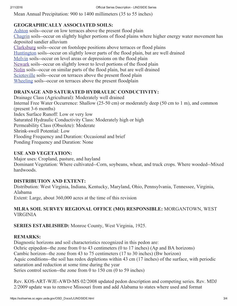
2/11/2016 Official Series Description - LINDSIDE Series
https://soilseries.sc.egov.usda.gov/OSD_Docs/L/LINDSIDE.html 1/4
LOCATION LINDSIDE WV+AL IN KY MD OH PA TN VA
Established SeriesDJB-SLH/Rev. MDJ09/2015
LINDSIDE SERIES
TAXONOMIC CLASS: Fine-silty, mixed, active, mesic Fluvaquentic Eutrudepts
TYPICAL PEDON: Lindside silt loam in a cultivated field. (Colors are for moist soil unless otherwiseindicated.)
Ap--0 to 20 cm (0 to 8 inches); dark grayish brown (10YR 4/2) silt loam; moderate fine granularstructure; friable; few roots; strongly acid; clear wavy boundary. (15 to 30 cm (6 to 12 inches) thick)
BA--20 to 43 cm (8 to 17 inches); brown (10YR 4/3) silt loam; weak fine granular structure; friable; fewroots; strongly acid; clear wavy boundary. (0 to 30 cm (0 to 12 inches) thick)
Bw--43 to 75 cm (17 to 30 inches); brown (10YR 4/3) silty clay loam; weak coarse subangular blockystructure parting to moderate medium subangular blocky; firm; few roots; many fine and mediumprominent yellowish red (5YR 4/6) masses of oxidized iron and few fine and medium faint grayishbrown (10YR 5/2) iron depletions on faces of peds; moderately acid; gradual wavy boundary. (Combinedthickness of Bw horizon 25 to 90 cm (10 to 34 inches))
BC--75 to 112 cm (30 to 44 inches); brown (10YR 4/3) silt loam; moderate coarse subangular blockystructure parting to moderate medium subangular blocky; firm; few roots; common medium prominentyellowish red (5YR 4/6) masses of oxidized iron and faint dark grayish brown (10YR 4/2) irondepletions on faces of peds; moderately acid; gradual wavy boundary. (0 to 70 cm (0 to 28 inches) thick)
C--112 to 165 cm (44 to 65 inches); yellowish brown (10YR 5/4) weakly stratified silt loam and siltyclay loam; massive; firm; common medium distinct grayish brown (10YR 5/2) iron depletions,prominent yellowish red (5YR 5/6) masses of oxidized iron on faces of peds, and few distinct black(10YR 2/1) manganese masses; moderately acid.
TYPE LOCATION: County: Wood State: West Virginia USGS Quadrangle: Marietta, Ohio Latitude (Decimal Degrees, NAD 83): 39.3827222 N Longitude (Decimal Degrees, NAD 83): -81.4822500 W Directions to the pedon: about 150 yards (137 m) east of the Ohio River, 1.5 miles (2.4 km) north ofKeller Lane.
RANGE IN CHARACTERISTICS: Depth to the top of the Cambic: 15 to 51 cm (6 to 20 inches) Depth to the base of the Cambic: 46 to 107 cm (19 to 42 inches)

2/11/2016 Official Series Description - LINDSIDE Series
https://soilseries.sc.egov.usda.gov/OSD_Docs/L/LINDSIDE.html 2/4
Solum Thickness: 63 to 152 cm (25 to 60 inches) Depth to Bedrock: Greater than 165 cm (65 inches)
Depth Class: Deep or very deep Depth to Seasonal High Water Table: 35 to 60 cm (14 to 24 inches), December through April
Rock Fragment Content: 0 to 5 percent, by volume, within a depth of 102 cm (40 inches) and from 0 to30 percent, by volume, below 102 cm
Soil Reaction: Strongly acid through slightly alkaline in the upper part, unless limed, and moderately acidthrough slightly alkaline in the lower part of the profile
Fine-Earth Fraction: Averages 18 to 35 percent clay and less than 15 percent sand in the particle sizecontrol section
Range of Individual Horizons:
Ap horizon: Color--hue of 7.5YR or 10YR, value of 3 through 5, and chroma of 2 or 3. Dry value is 6 or more.
Undisturbed areas have a thin A horizon with hue of 7.5YR or 10YR, value of 2 or 3, and chroma of 1through 3.
Texture (fine-earth fraction)--silt loam, silty clay loam, or loam
BA, Bw, and BC horizons: Color--hue of 7.5YR through 2.5Y, value of 4 or 5, and chroma of 3 through 6, above a depth of 51
centimeters (20 inches) and 1 through 4 below. Some pedons have moist value of 3 and chroma of 2where dry value is 6 or more.
Texture (fine-earth fraction)--silt loam or silty clay loam, and in some pedons there are thin strata of veryfine sandy loam, fine sandy loam, loam, or clay loam
Redoximorphic features--iron depletions with chroma of 2 or less typically occur in the Bw horizon
C horizon: Color--hue of 7.5YR through 2.5Y, value of 4 through 6, and chroma of 1 through 4, except chroma of 6
and 8 are allowed if colors are mixed Texture (fine-earth fraction)--silty clay loam, silt loam, loam, clay loam, very fine sandy loam, fine sandy
loam, and sandy loam and may be stratified
COMPETING SERIES: Boonewood soils--are moderately deep to bedrock
Hemlock soils--often have carbonates in the series control section Hontas soils--have low chroma matrix colors or low chroma mottles dominant on faces of peds in the B
or C horizons within a depth of 102 cm from the surface Senecaville soils--have a hue of 5YR or redder throughout the B horizon
GEOGRAPHIC SETTING:
Landscape: River valley or Hills Landform: Flood plain
MLRA(s): 111, 114, 115, 120, 121, 122, 123, 124, 125, 126, 127, 128, 129, 133, 134, 147, 148 Geomorphic Component: Base slope
Hillslope Profile Position: Toe slope Parent Material: Alluvium derived from limestone and/or calcareous sedimentary rocks on hills
Slope: 0 to 3 percent Elevation: 30 to 550 meters (100 to 1800 feet)
Frost-free period: 150 to 255 days Mean Annual Air Temperature: 8 to 14 degrees C. (45 to 57 degrees F.)
2/11/2016 Official Series Description - LINDSIDE Series
https://soilseries.sc.egov.usda.gov/OSD_Docs/L/LINDSIDE.html 3/4
Mean Annual Precipitation: 900 to 1400 millimeters (35 to 55 inches)
GEOGRAPHICALLY ASSOCIATED SOILS: Ashton soils--occur on low terraces above the present flood plain
Chagrin soils--occur on slightly higher portions of flood plains where higher energy water movement hasdeposited sandier alluvium
Clarksburg soils--occur on footslope positions above terraces or flood plains Huntington soils--occur on slightly lower parts of the flood plain, but are well drained
Melvin soils--occur on level areas or depressions on the flood plain Newark soils--occur on slightly lower to level portions of the flood plain
Nolin soils--occur on similar parts of the flood plain, but are well drained Sciotoville soils--occur on terraces above the present flood plain
Wheeling soils--occur on terraces above the present floodplain
DRAINAGE AND SATURATED HYDRAULIC CONDUCTIVITY: Drainage Class (Agricultural): Moderately well drained
Internal Free Water Occurrence: Shallow (25-50 cm) or moderately deep (50 cm to 1 m), and common(present 3-6 months)
Index Surface Runoff: Low or very low Saturated Hydraulic Conductivity Class: Moderately high or high
Permeability Class (Obsolete): Moderate Shrink-swell Potential: Low
Flooding Frequency and Duration: Occasional and brief Ponding Frequency and Duration: None
USE AND VEGETATION:
Major uses: Cropland, pasture, and hayland Dominant Vegetation: Where cultivated--Corn, soybeans, wheat, and truck crops. Where wooded--Mixed
hardwoods.
DISTRIBUTION AND EXTENT: Distribution: West Virginia, Indiana, Kentucky, Maryland, Ohio, Pennsylvania, Tennessee, Virginia,
Alabama Extent: Large, about 360,000 acres at the time of this revision
MLRA SOIL SURVEY REGIONAL OFFICE (MO) RESPONSIBLE: MORGANTOWN, WESTVIRGINIA
SERIES ESTABLISHED: Monroe County, West Virginia, 1925.
REMARKS:
Diagnostic horizons and soil characteristics recognized in this pedon are: Ochric epipedon--the zone from 0 to 43 centimeters (0 to 17 inches) (Ap and BA horizons)
Cambic horizon--the zone from 43 to 75 centimeters (17 to 30 inches) (Bw horizon) Aquic conditions--the soil has redox depletions within 43 cm (17 inches) of the surface, with periodic
saturation and reduction at some time during the year Series control section--the zone from 0 to 150 cm (0 to 59 inches)
Rev. KOS-ART-WJE-AWD-MS 02/2008 updated pedon description and competing series. Rev. MDJ2/2009 update was to remove Missouri from and add Alabama to states where used and format