Embed Size (px)
Citation preview

www.AdirondackWild.org
Pathways to a Connected Adirondack Park:Practical Steps to Better Land Use Decisions
by Michael W. Klemens, Ph.D., Landscape Conservation Advisor, Adirondack Wild: Friends of the Forest Preserve Copyright: Adirondack Wild: Friends of the Forest Preserve, 2017
The lead author of this report is Adirondack Wild’s Landscape Conservation Advisor, Michael W. Klemens, Ph.D. Dr. Klemens is a conservation biologist with research interests in biogeography and ecology of amphibians and reptiles, ecologically informed land use planning, and the conservation biology of freshwater turtles and tortoises. He founded the Metropolitan Conservation Alliance (MCA), a consortium of municipalities, planners and scientists working together to improve the stewardship of natural resources in the Hudson Valley and Connecticut. MCA and Dr. Klemens earned an achievement award from the American Planning Association recognizing accomplishment in integrating complex ecological data into the land-use decision-making process. In 2011, Adirondack Wild: Friends of the Forest Preserve retained Dr. Klemens as an expert witness at the Adirondack Club and Resort adjudicatory hearing.
In addition to his consultancy with Adirondack Wild, Dr. Klemens is a Research Associate in Herpetology at the American Museum of Natural History and serves
as gubernatorial appointee to the Connecticut Siting Council which determines the placement of telecommunications and energy generation facilities statewide within Connecticut. He is the Chair of the Planning and Zoning Commission in his home town of Salisbury, CT, and has worked for many years with the Wildlife Conservation Society, the Cary Institute of Ecosystem Studies and served as a consultant for various government agencies and not-for-profit organizations.
Dr. Klemens worked closely with Adirondack Wild’s Staff Partners David Gibson, Dan Plumley and Ken Rimany in the writing and preparation of this document and benefited greatly from the input of Adirondack Wild’s board members and advisors, who also provided very helpful comments, suggestions and edits. These included Chris Amato, Peter Brinkley, Tom Cobb, Carl George, Terry Jandreau, John Johanson, James Jordan and Suzanne Roberson. We thank them specifically, but also recognize our entire Board of Directors and Advisory Council for their suggestions and comments throughout the project.
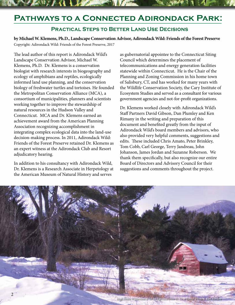
High Peaks Wilderness in far background from Rt. 73 in Keene. Photo © Ken Rimany2
Pathways to a Connected Adirondack Park:Practical Steps to Better Land Use Decisions

1
Because of the complex ecological and public policy issues presented in this document we also made extensive use of outside peer reviewers. We gratefully acknowledge the following for their assistance:
Eric Davison, Davison Environmental; Michale Glennon, Ph.D., Wildlife Conservation Society; Hank Gruner, Connecticut Science Center (retired); Heidi Kretser, Ph.D., Wildlife Conservation Society; and Dennis Quinn, CTHerpconsultant, LLC. In addition, an anonymous resident of the Adirondack Park with extensive planning experience provided important commentary and suggestions that greatly improved the draft.
The content and opinions expressed in this document are solely those of Adirondack Wild and should not be construed as being those of the peer reviewers.
We are additionally thankful for the publication’s lead designer, Jesse Gigandet, and for the production talents of Miller Printing, Amsterdam, New York.
We acknowledge the sustained grant support of the Bay and Paul Foundations which has funded much of Dr. Klemens’ work with Adirondack Wild. Their grant support has resulted in this publication and Adirondack Park at a Crossroad: A Road Map for Action (2015), as well as other initiatives and projects consistent with Adirondack Wild’s mission and purpose.
This publication is also made possible thanks to the generous financial support of the following organizations and individuals:
▶ Overhills Foundation ▶ Camp Fire Conservation Fund ▶ Ed Petty and the Fund in memory of Ferne
Hastings and Clarence A. Petty ▶ Furthermore: A Program of the
J.M. Kaplan Fund ▶ Eric Johanson ▶ Adirondack Wild’s Johanson Family Fund ▶ The Walbridge Fund ▶ Patagonia Environmental Grants ▶ Wells Fargo Advisors
3
FUNDING SUPPORT
Cover: Scenic vista of the High Peaks Wilderness near Lake Placid. Photo © Ken Rimany

In 2015 Adirondack Wild released Adirondack Park at a Crossroad: A Road Map for Action. This report documented why the Adirondack Park is far less protected than is commonly assumed and called for much higher standards for protection, improved planning using conservation design principles, and offered recommendations for policy reforms. This opened the door for more fruitful discussions concerning challenges facing the Adirondack Park, including the need for new conservation subdivision design legislation affecting the Park’s most impactful private land subdivisions. However, this and other needed changes in Park policies and laws will require broad political support to be implemented. Meanwhile, the Park remains vulnerable to misguided actions and policies that threaten to derail more than a century of stewardship on behalf of the people of New York State, and indeed, the world.
Adirondack Wild recognizes that identification of problems is merely the beginning. We have the equally important obligation of identifying a practical path to their solution. Pathways To a Connected Adirondack Park is intended to provide a series of stand-alone analyses and land use planning tools at different scales to address and begin to resolve the difficult issues identified in our Adirondack Park at a Crossroad publication. We begin our series with an analysis of how best to use the various tools of conservation science to inform development planning within the Adirondack Park.
Mink Pond, Minerva. Photo © Ken Rimany.
From Crossroad to Pathways
4
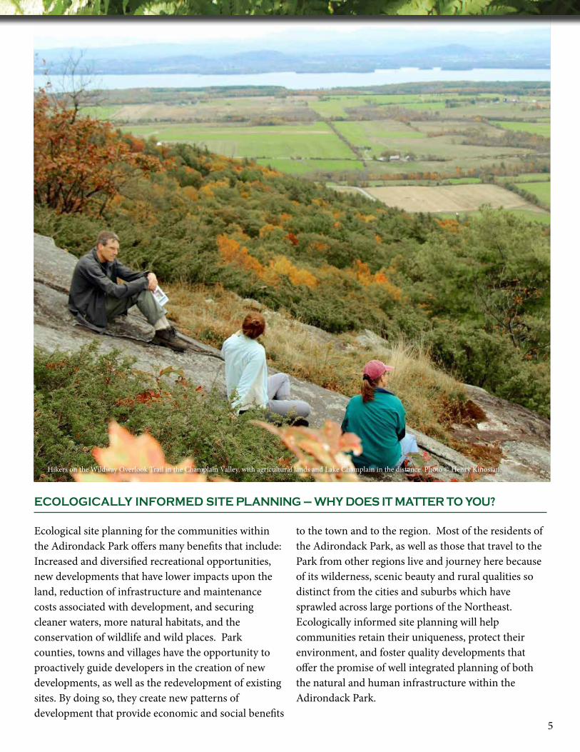
Hikers on the Wildway Overlook Trail in the Champlain Valley, with agricultural lands and Lake Champlain in the distance. Photo © Henry Kinosian.
5
Ecological site planning for the communities within the Adirondack Park offers many benefits that include: Increased and diversified recreational opportunities, new developments that have lower impacts upon the land, reduction of infrastructure and maintenance costs associated with development, and securing cleaner waters, more natural habitats, and the conservation of wildlife and wild places. Park counties, towns and villages have the opportunity to proactively guide developers in the creation of new developments, as well as the redevelopment of existing sites. By doing so, they create new patterns of development that provide economic and social benefits
to the town and to the region. Most of the residents of the Adirondack Park, as well as those that travel to the Park from other regions live and journey here because of its wilderness, scenic beauty and rural qualities so distinct from the cities and suburbs which have sprawled across large portions of the Northeast. Ecologically informed site planning will help communities retain their uniqueness, protect their environment, and foster quality developments that offer the promise of well integrated planning of both the natural and human infrastructure within the Adirondack Park.
ECOLOGICALLY INFORMED SITE PLANNING – WHY DOES IT MATTER TO YOU?
Far from being a theoretical exercise, the information contained in the following pages is a microcosm of my own personal journey from a museum-based research scientist into the realm of ecology and applied science and public policy. This journey has been driven by my love of nature and wilderness, coupled with my faith in human beings to make better choices and decisions if properly informed of the consequences and benefits of their actions. As a research herpetologist I have studied the distributions of amphibians and reptiles in New England and New York. Conventional wisdom assumed the occurrences of these species were governed by such well-understood factors as habitat type, elevation, geology, and post glacial dispersal patterns. And while I acknowledged that certain developed areas were inhospitable to many of these animals, I wasn’t prepared for what my twenty years of sampling and the accompanying analyses began to show: that another very important driver of the distribution of amphibians and reptiles were human land use patterns, including the arrangement of roads and the frequency of human-induced landscape disturbances. My work demonstrated that in New England and New York amphibians and reptiles were excellent indicators of landscape scale impacts that affected environmental quality. As such they were truly the proverbial “Canary in the Mine Shaft.” When habitats began to deteriorate for many species of amphibians and reptiles, they became less viable for many other species, including humans. This discovery was a prelude to today’s ecological discussions of the effects of fragmentation and sprawl, especially the disconnection between the readily visible footprint of a development versus the hidden ecological footprint which is many orders of magnitude greater in extent.
These discoveries, made over three decades ago, served as the foundation of much of my subsequent research and life’s work. Simply stated, since human activities so profoundly affect the natural world, why can’t the human intelligence and technology which drive destructive trends in land use be better applied or retooled through education and information to create human landscapes that are more in harmony with the natural world? In my work, I often describe the problems that have occurred in a region like the Adirondack Park or Tarangire National Park in Tanzania (where I worked in the 1990s) because I believe that to change how a society deals with its responsibilities to the natural world it must first come to understand the problems that past land-use patterns and practices have created. Only from that understanding and the confidence that it engenders can the impetus to create better models of sustainability and stewardship find a solid footing.
This is the purpose of this discussion: to inform individuals and agencies of the problems, and from that knowledge foster a dialogue and game plan of actions that ultimately enhances responsible ecological citizenship at all levels of governance in the Adirondack Park.
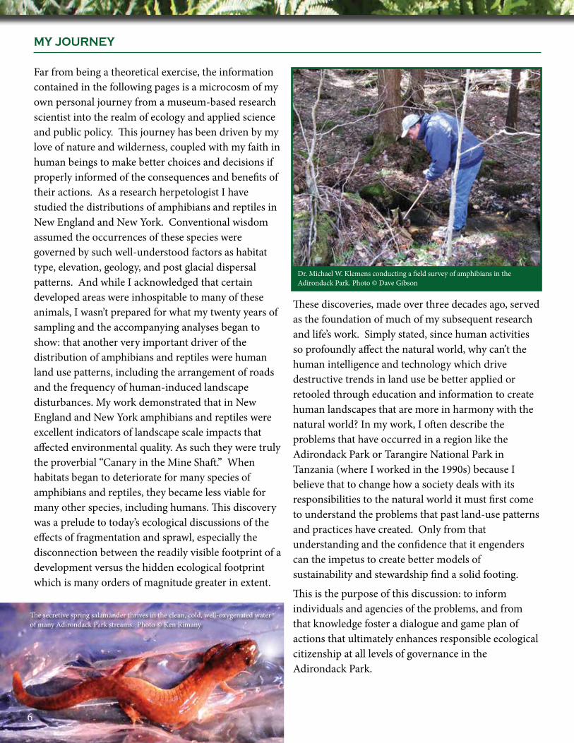
Dr. Michael W. Klemens conducting a field survey of amphibians in the Adirondack Park. Photo © Dave Gibson
The secretive spring salamander thrives in the clean, cold, well-oxygenated water of many Adirondack Park streams. Photo © Ken Rimany
6
MY JOURNEY
If a single word can adequately describe the ecological challenges faced by the Adirondack Park, that word is fragmentation. Habitat fragmentation is a threat to a region’s ecological continuum which is a measure of its interconnectedness to surrounding areas and its ability to withstand damaging changes, or its resiliency. Fragmentation occurs when natural or human processes break large contiguous areas of open space into ever-smaller, isolated patches. In the Adirondack Park, human activities are the dominant and primary drivers of habitat fragmentation, creating simplified landscapes that interfere with ecosystem processes, disrupt species movements, and cause the loss of critical habitats. This in turn leads to the loss of ecosystem services that human communities within the Adirondack Park depend upon including clean water, flood control, forest product production as well as diminished outdoor recreational opportunities, especially hunting and fishing. The disruption of the ecological continuum (i.e., the interconnectedness and its corresponding resiliency) at a scale of thousands upon thousands of acres poses the largest all-
encompassing threat to the Adirondack Park. Interconnectedness is essential to allowing the evolutionary processes of adaption and dispersion to continue as they have for millennia. Interconnectedness of the Adirondack Park facilitated the successful recolonization (through natural migration) of moose back into the Park. Ecosystems, species, and genetic diversity are not static, and continually evolve in response to change. This is increasingly important in this era of dramatic global climate change as species and ecosystems will have to rearrange themselves upon the landscape, and can only do so in a landscape that is ecologically inter-connected. Fragmentation is described as an all-encompassing threat precisely because it amplifies the effects of a series of hazards to the ecological continuum, such as the deleterious landscape-scale effects of climate change, the misguided management of recreational access to wilderness areas, the lack of cumulative ecological impact analyses, and the character and placement of development projects, whether a single home or a large scale subdivision.
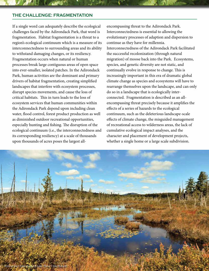
Browns Tract Pond, Raquette Lake. Photo © Ken Rimany.7
THE CHALLENGE: FRAGMENTATION
The question is often asked, why should we be so concerned about fragmentation and development in a 6,000,000-acre landscape? It is precisely because a landscape of this size and integrity is so very rare and unique that one must consider all impacts, great and small, as contributors to its overall health. Who is to say where the tipping point may be? Who is to say how many poorly planned developments the Adirondack Park can absorb before it begins to unravel ecologically? If ever there was a case for the use of the
precautionary principle (the concept of “do no harm”) in land-use planning, the Adirondack Park by virtue of its size is its poster child. The precautionary principle factors in not only what we know, but also what we presently don’t know, but suspect may be true. To paraphrase the naturalist Aldo Leopold’s A Sand County Almanac, the first step in intelligent ecological tinkering is to keep all the pieces. These important considerations are undoubtedly very challenging for those trying to view development in the Adirondack Park through the traditional land-use decision making lens.
Yet, if we take the time and effort to understand fragmentation at different scales, and then adjust land-use and development patterns to accommodate ecological integrity, the Adirondack Park will continue to be a vast north woods ecosystem that successfully serves multiple interests. Those interests include not only wilderness and wildlife, but working forests, outdoor recreation, and vibrant human communities, all existing within and dependent upon the Adirondack Park. Absent an overarching ecological understanding of landscape integrity and interconnectedness, the Adirondack Park will suffer a steady loss of its resiliency, a death by a thousand cuts, affecting all who value and depend upon this vast forest for their welfare and survival.
Fragmentation
▶ Reduces ecological diversity and therefore reduces natural capital resiliency
▶ Increases pollution (e.g., water, light, and noise) and therefore reduces resiliency of natural capital
▶ Fosters a disconnect between human communities, as well as between humans and nature
▶ Creates non-sustainable patterns of growth that require continuous infusions of capital
▶ Creates technological dependency increasing societal vulnerability to stochastic (= random) events
▶ Compromises human health, both physical and emotional8
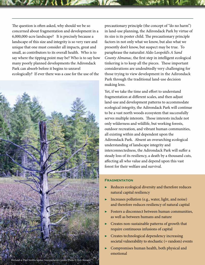
Wetland at Paul Smiths Visitor Interpretative Center. Photo © Ken Rimany
1
Effective Planning: Wildlife, plants, and eco-systemic change moves across the landscape like a sheet of water flowing across a gently sloping field. But the common conceptions of wildlife corridors, underpasses, and overpasses have ingrained a skewed view of how ecosystems respond to change and how they stay connected and functional over time. While corridors, overpasses, and underpasses may move wildlife safely through key constriction points (e.g., over a highway), this is only a small part of the equation. The much larger problem is maintaining a landscape that feeds into those corridors in as unfragmented a condition as possible. While a corridor may be measured in feet and acres, the landscape that feeds that corridor is measured in square miles and thousands upon thousands of acres.
In order to plan for and understand the challenges of fragmentation one needs to consider each project, whether a single home or a large subdivision, from three levels, colloquially the macro, meso, and micro landscape levels. Each level has a different set of considerations and each level provides opportunities for creative planning and mitigation. Also each level has different stakeholders and decision-makers. These
concepts are neither new nor radical. They are in fact the foundation of SEQRA, the New York State Environmental Quality Review Act, that recognizes that impacts occur at different scales with different effects. Together, they form what are termed cumulative impacts. To the untrained eye, all can seem well in a landscape that is a mixture of development and forest. But this is what I so often refer to as the illusion of “green,” because while vegetated, the system is often stressed and dysfunctional. It is a challenge to impart to the general populace that while trees and vegetation present themselves as green and therefore ecologically friendly, in order to understand the true health of the system one most look much more closely and carefully.
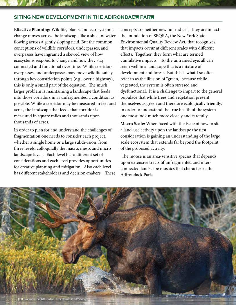
Macro Scale: When faced with the issue of how to site a land-use activity upon the landscape the first consideration is gaining an understanding of the large scale ecosystem that extends far beyond the footprint of the proposed activity.
The moose is an area-sensitive species that depends upon extensive tracts of unfragmented and inter-connected landscape mosaics that characterize the Adirondack Park.
Bull moose in the Adirondack Park. Photo © Jeff Nadler9
SITING NEW DEVELOPMENT IN THE ADIRONDACK PARK
While we are easily able to discern the development footprint, a corresponding ecological footprint encompasses a much larger area where the impacts of that development resonate deep into the ecosystem. To understand this in a readily intuitive manner, consider an interstate highway such as the Adirondack Northway. While the Northway offers great benefits for travel and commerce, it forms a near impenetrable barrier for most wildlife dispersal. To the untrained eye the actual impact zone of the Northway, the development footprint, is confined to the roadway, shoulder, and the embankment adjacent to the highway. However, the impacts of this roadway on wildlife, the ecological footprint, extend a half mile if not more on either side. These impacts include loss of wildlife through mortality, noise, light, and other pollutants, as well as invasive plant establishment. So in order to understand the impacts of any proposed action, we need to understand the ecosystem into which it will be embedded.
Meso (= intermediate) Scale: This is the scale at which most planners review new land uses and development. At this scale it is critical to understand the species occurring on the site, what their movements are, and the connection between wetland and upland habitats.
The development area needs to be placed in a portion of the development parcel so as to minimize the impacts to the adjacent ecosystem (i.e., the macro scale discussed above). Spread out dispersed development characterizes rural sprawl and has impacts similar to those caused by the Adirondack Northway previously discussed. This is where the role of conservation design comes into play. Very simply stated conservation design seeks to shrink the ecological footprint of a proposed development through innovative planning and site design techniques. While the developed footprint and the ecological footprint are never equal, the goal of conservation design is to try to bring the ecological footprint into closer harmony with that of the developed footprint, while maintaining the development values of the parcel.
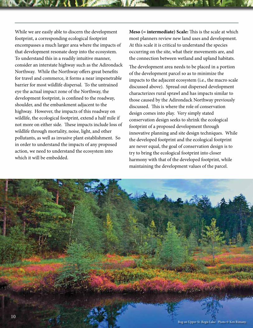
Bog on Upper St. Regis Lake. Photo © Ken Rimany.10
There are a host of techniques that can be used to accomplish these goals, including clustering, development lots without front, side, and rear yard zoning setbacks (also referred to as zero lot line developments) that allow much more efficient use of limited land resources in hamlets and similar developed areas, as well as incentive-based hamlet redevelopment standards, to name but a few. Another challenge is that some of the more innovative land use cluster techniques and low impact conservation designs are usually not the site plan standard. These ecologically beneficial forms of development usually require extra steps in the permitting and review process. If a community is serious about implementing these “green design standards” they should become the default site plan standards and the more conventional, sprawl type of development only be permitted if the applicant demonstrates that the site cannot be developed in an ecologically friendly manner.
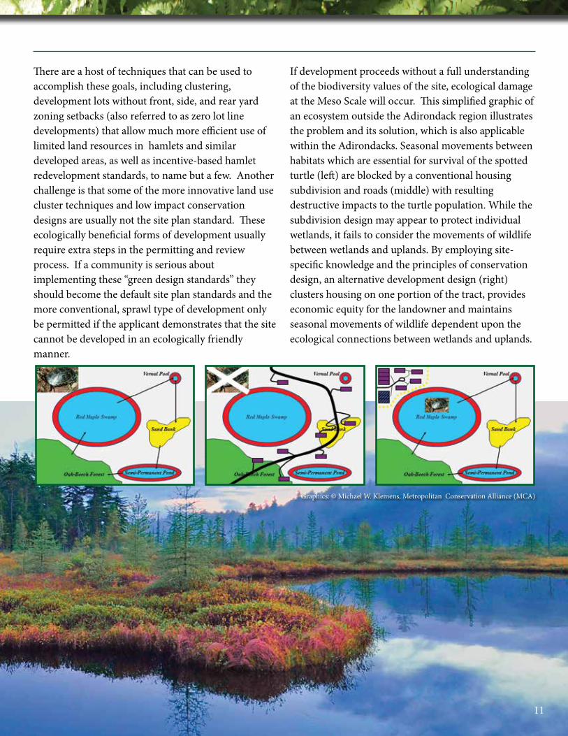
If development proceeds without a full understanding of the biodiversity values of the site, ecological damage at the Meso Scale will occur. This simplified graphic of an ecosystem outside the Adirondack region illustrates the problem and its solution, which is also applicable within the Adirondacks. Seasonal movements between habitats which are essential for survival of the spotted turtle (left) are blocked by a conventional housing subdivision and roads (middle) with resulting destructive impacts to the turtle population. While the subdivision design may appear to protect individual wetlands, it fails to consider the movements of wildlife between wetlands and uplands. By employing site-specific knowledge and the principles of conservation design, an alternative development design (right) clusters housing on one portion of the tract, provides economic equity for the landowner and maintains seasonal movements of wildlife dependent upon the ecological connections between wetlands and uplands.
Graphics: © Michael W. Klemens, Metropolitan Conservation Alliance (MCA)
11
Frogs and salamanders, which are a vital component of the Adirondack forest food chain, are also greatly affected by Meso Scale land-use decisions. Species such as the wood frog, essential for nutrient cycling and energy transfer within the forest biome occur in meta-populations (a biologically connected group of populations occurring in close geographic proximity to one another). The survival of these meta-populations requires clusters of wetlands and their surrounding upland habitats.
Micro Scale: The final scale is the site plan design level. So much of what is built creates serious impediments to movement of wildlife around a house or building, which in turn fragments the built landscapes, and impedes movements of wildlife within the Adirondack Park. Curbs and catch basins, coupled with hydrodynamic separators to remove suspended solids from storm water, kills millions of amphibians, insects, reptiles and small mammals every year. Simple ways to avoid these types of mortality utilizing a variety of
site design techniques include: Curb-less road systems that are crowned to shed water into roadside
depressions or swales which naturally clean the runoff and allow unimpeded wildlife movements; downward-directed exterior lighting sources of low lumen intensity that shield disruptive light spillage from adjacent wetlands and forests; and simple wildlife
excluders built into pool fences that eliminates the impact of in-ground swimming pools that serve as ecological sinks or traps by capturing and killing many small creatures.
When one thoughtfully considers all three scales of potential fragmentation in each project, one may achieve a more modest ecological footprint from development. An achievable goal, these considerations should be at the forefront of each and every decision made by the APA, and also at the local municipal level. If each project that is designed and executed in the Adirondack Park is done with these principles in mind, the resiliency and interconnectedness of the six-million acre Adirondack Park will remain as a highly functional ecosystem for future generations.
This illustrates the problems of Micro Scale site design. Here, a stormwater collection drain traps and kills large numbers of small animals. Many small creatures, at the base of the food chain, including the masked shrew, white-footed mouse, and American toad are a vulnerable to the effects of poorly-planned Micro Scale development. Low Impact Development (LID) stormwater management can eliminate the mortality of wildlife by using curb less roads and swales to manage stormwater flows.
Illustration: Michael W. Klemens, MCA
12
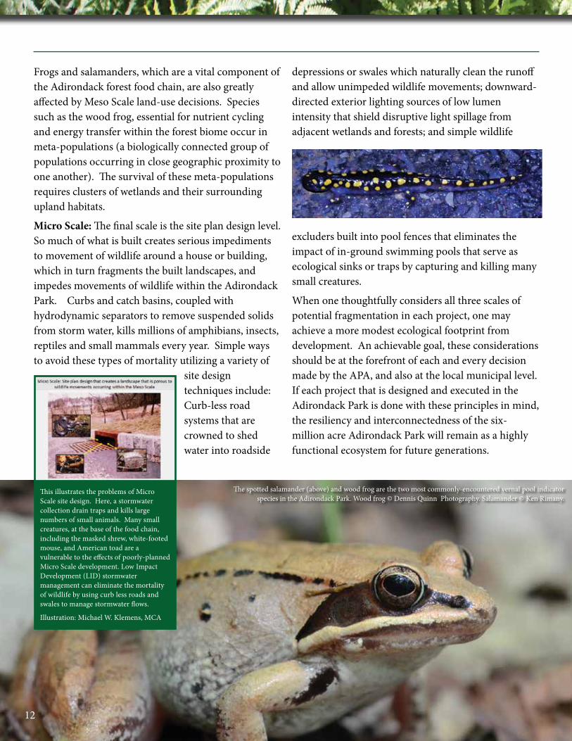
The spotted salamander (above) and wood frog are the two most commonly-encountered vernal pool indicator species in the Adirondack Park. Wood frog © Dennis Quinn Photography. Salamander © Ken Rimany.

Redevelopment and retrofitting of existing developments is another important goal where ecosystems can be reconnected and resiliency increased.
Hamlets: Historically, human settlements in the Adirondack Park were mostly centered in the lower lying river valleys and on lakes where level land, more moderate climate, and easy access to transportation were possible. Wildlife, plants, and ultimately ecosystems had to move through narrow areas that are densely developed from one upland area to another. This results in high impacts and low protection in a number of important habitat types that occur primarily in these low-lying areas (e.g., floodplain forest). The Adirondack Park is not unique in this phenomenon. In the Blue Ridge Mountains of Virginia, for example, national forests cloak the slopes, but the intermontane valleys are almost exclusively devoted to human activities including settlements and
agriculture. Because of their position within the river valleys and lake shores, hamlets can serve as constriction points to the flow of species and ecosystem functions. Much as wildlife corridors and overpasses and underpasses funnel wildlife across major highways, we need a similar strategy to allow the movement through these densely developed areas. The catastrophic flooding caused by Hurricane Irene in 2011 has prompted a reevaluation of the relationship of the hamlets to the riparian systems that they are situated along. From this destruction comes an important opportunity to rethink the built infrastructure along these waterways, and to allow ecological functions to exist in a less impeded and constricted manner than in the past. This directly benefits recreational use of waterways and improve fisheries habitat, which in turn enhances tourism and economic revitalization of Adirondack communities.
13
REDEVELOPMENT AND RETROFITTING EXISTING DEVELOPMENTS WITHIN THE ADIRONDACK PARK
Northville, NY. Photo © Ken Rimany

Online Tools for Local Land Use Planning
WCS (Wildlife Conservation Society) in the Adirondacks provides this excellent example of Strategy 1: Know Your Resources. WCS North America Program in the Adirondacks has worked for many years to understand the challenges associated with humans and wildlife sharing the same landscape. As a result, WCS provides resources to meet these challenges and mitigate negative consequences from changes in land use, particularly from residential development. One of the most important information needs in New York State is that of readily available data concerning the natural resources found locally in a town or county. Ecologically informed site planning begins with knowing your resources. To that end, WCS created an online gallery for New York (New York State Tools for Land Use Planning), which is a set of tools to assist municipalities throughout the state to visualize their natural resources, learn about the extent and condition of those resources, and understand the ways in which they can be protected in the context of development. The New York Gallery was supported by the North Atlantic Landscape Conservation Cooperative (NALCC), an applied science and management collaborative working together to address increasing land use pressures and widespread resource threats and uncertainties amplified by a rapidly
changing climate. NALCC compiles, synthesizes, and makes available information, data, science and tools in scales and formats needed by partners. The New York Gallery brings some of these powerful regional datasets to the local level and demonstrates the ways in which they can be used by municipalities. Once logged on to the New York Gallery, anyone with an internet connection can explore, use, download, and create maps from 10 New York-wide datasets ranging from Ecological Systems to Significant Habitats to Riparian Areas, Large Forest Blocks, Ecological Integrity, and Resilience. The map gallery is housed at the NALCC Conservation Planning Atlas on Databasin (nalcc.databasin.org). Conservation Profiles for 9 municipal case studies can be accessed on this site to demonstrate the variety of available maps and information. The documents, tutorials, supporting resources and conservation profiles are meant to help municipalities to visualize the role each individual town plays in maintaining important ecological functions at a landscape scale. Nature tends to operate on bigger scales than that at which we often focus in local planning; a broader view can make our collective efforts to protect these important places and processes much more effective. Please explore at nalcc.databasin.org/galleries.
Working with the river – Streambank revegetation and riparian habitat restoration project along the East Branch of the Ausable River. These activities restore resilience to erosion while maintaining river-floodplain connection, thereby allowing flood energy to naturally dissipate within the floodplain instead of directing it all downstream. Pool-riffle habitats within the river maintained for trout populations and wood turtles. Photo © Ken Rimany
Working against the river – Heavy equipment raises the river bank, cuts the river off from its floodplain (where flood energy is naturally dissipated) deepens the channel, destroys fish and turtle habitats and directs more destructive flood energy downstream, thereby threatening homes and infrastructure there. Photo © Dan Plumley
Rivers: A new focus on allowing the natural flooding processes the room to move and spread out into the floodplain helps reduce flooding impacts to local communities and increases resiliency of both the human communities and their surrounding ecosystems. By restoring the riparian corridor by using ecologically sound techniques as has occurred in Keene Valley along the East Branch of the Ausable
River, natural processes are allowed to occur unencumbered by manmade hardscapes. At the same time valuable habitat for many species is created and a natural dispersal corridor is established through a hamlet. This is one type of ecological reconnection that can occur in developed landscapes which increases the value of these rivers for both recreational and wildlife use.
14

Culverts and Bridges: Another opportunity occurs where round pipe culverts channel streams to flow under roadways. Invariably over time, a stream scour will be created on the downstream end of the pipe, leaving a drop in the stream that can range from one to several feet. This effectively breaks the ability of fish and other aquatic organisms to disperse upstream. Many types of animals become disoriented in curved culvert pipes. These culverts can be replaced by square box concrete culverts that also leave the natural stream bottom intact and allow for the dispersal of organisms up and down stream. An opportune time to replace
these old pipe culverts is when the road is resurfaced. However, because of the limited amount of impact to the road bed these can be done at other times too. It is also advisable to greatly oversize these box culverts to allow for high volume water events that are becoming the “new normal” due to climate change. Large box culverts do double duty as wildlife underpasses on these roads which enhance not only ecological function but also fishing and recreational uses which in turn results in more tourism and income to local communities.
Before concluding with recommended steps that can enhance local land use decisions, it’s important to recognize the many people and organizations in the Adirondack Park who know the benefits of enhancing wildlife connectivity and infrastructure resilience in our floodplains and are already doing something about it. For example, it is encouraging to see the ongoing work in the Ausable River watershed by many partnering agencies to replace old pipe culverts with square box and other types of culverts. These new culverts are already enabling more water to pass in flood situations and affording stream and bank organisms to move unhindered up and downstream.
The wood turtle is a long-lived, slow maturing reptile that is restricted to the low lying riparian valleys of the Adirondack Park. It is especially vulnerable to road mortality and armoring of river banks. River restoration projects directly benefit the survival of this rare species in the Adirondack Park. Photo © Dennis Quinn Photography
1Great blue heron. Photo © Ken Rimany.
15
Use of Best Practices
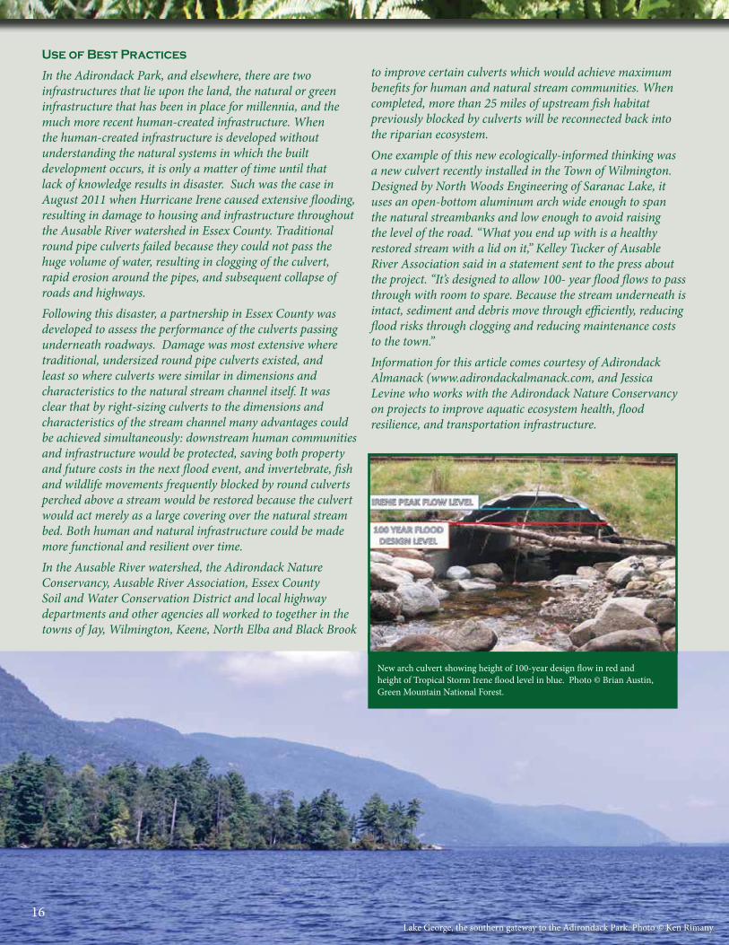
In the Adirondack Park, and elsewhere, there are two infrastructures that lie upon the land, the natural or green infrastructure that has been in place for millennia, and the much more recent human-created infrastructure. When the human-created infrastructure is developed without understanding the natural systems in which the built development occurs, it is only a matter of time until that lack of knowledge results in disaster. Such was the case in August 2011 when Hurricane Irene caused extensive flooding, resulting in damage to housing and infrastructure throughout the Ausable River watershed in Essex County. Traditional round pipe culverts failed because they could not pass the huge volume of water, resulting in clogging of the culvert, rapid erosion around the pipes, and subsequent collapse of roads and highways. Following this disaster, a partnership in Essex County was developed to assess the performance of the culverts passing underneath roadways. Damage was most extensive where traditional, undersized round pipe culverts existed, and least so where culverts were similar in dimensions and characteristics to the natural stream channel itself. It was clear that by right-sizing culverts to the dimensions and characteristics of the stream channel many advantages could be achieved simultaneously: downstream human communities and infrastructure would be protected, saving both property and future costs in the next flood event, and invertebrate, fish and wildlife movements frequently blocked by round culverts perched above a stream would be restored because the culvert would act merely as a large covering over the natural stream bed. Both human and natural infrastructure could be made more functional and resilient over time. In the Ausable River watershed, the Adirondack Nature Conservancy, Ausable River Association, Essex County Soil and Water Conservation District and local highway departments and other agencies all worked to together in the towns of Jay, Wilmington, Keene, North Elba and Black Brook
to improve certain culverts which would achieve maximum benefits for human and natural stream communities. When completed, more than 25 miles of upstream fish habitat previously blocked by culverts will be reconnected back into the riparian ecosystem. One example of this new ecologically-informed thinking was a new culvert recently installed in the Town of Wilmington. Designed by North Woods Engineering of Saranac Lake, it uses an open-bottom aluminum arch wide enough to span the natural streambanks and low enough to avoid raising the level of the road. “What you end up with is a healthy restored stream with a lid on it,” Kelley Tucker of Ausable River Association said in a statement sent to the press about the project. “It’s designed to allow 100- year flood flows to pass through with room to spare. Because the stream underneath is intact, sediment and debris move through efficiently, reducing flood risks through clogging and reducing maintenance costs to the town.”Information for this article comes courtesy of Adirondack Almanack (www.adirondackalmanack.com, and Jessica Levine who works with the Adirondack Nature Conservancy on projects to improve aquatic ecosystem health, flood resilience, and transportation infrastructure.
New arch culvert showing height of 100-year design flow in red and height of Tropical Storm Irene flood level in blue. Photo © Brian Austin, Green Mountain National Forest.
Lake George, the southern gateway to the Adirondack Park. Photo © Ken Rimany.16
1
The following recommendations have been implemented, in part or entirely, in different areas of New York State. Adirondack Wild is not inventing the wheel here, but rather looking to export these models of successful locally-based land-use planning to the 102 towns and villages and twelve counties of the Adirondack Park. We recognize that funding will be needed to implement all ten recommended actions in each locality. Yet, many of the discrete actions can be accomplished with relatively little cost. Rather, they require constituency building and sweat equity at the local level with assistance from state agencies, conservation and land use groups, as well as the private sector, including chambers of commerce and philanthropic agencies.
For example, over the last fifteen years the DEC Hudson River Estuary Program has focused on public and private partnerships to improve land-use decision making in New York’s Hudson Valley south of Albany. For a relatively modest investment of State and private funds, the towns in that region have increased their ecological literacy and are making land-use decisions that focus on long term vision for many as opposed to short term gain for a few. The Metropolitan Conservation Alliance (formerly based at the Wildlife Conservation Society) has worked with both Hudson
River Estuary Program and the Pace Land Use Law Center to develop citizen science programs to gather data, and then to translate those data into local ordinances and land use plans. The Land Use Leadership Alliance at Pace University has worked with groups of local leaders throughout the Hudson Valley, training them on how to use information, how to resolve conflicts, and how to create more sustainable patterns of growth.
What all of these programs have in common is that they usually began with a nucleus of towns that concentrate around a specific watershed or similar shared resource. These intermunicipal efforts are very important as they are able to gather ecological data much more cost-effectively and efficiently crossing municipal boundaries. This type of cooperation is viewed by many as actually strengthening home rule. By engaging with contiguous towns on the multi-town inventory and planning efforts, the needs of all the member towns are articulated and understood by one another.
We provide the following recommendations to you, our neighbors and colleagues in the Adirondack Park, as a sensible approach to strengthening ecologically-informed land-use decision making at the local and regional level.
17
TEN STRATEGIES TO ENSURE BETTER LOCAL LAND-USE DECISIONS IN THE ADIRONDACK PARK
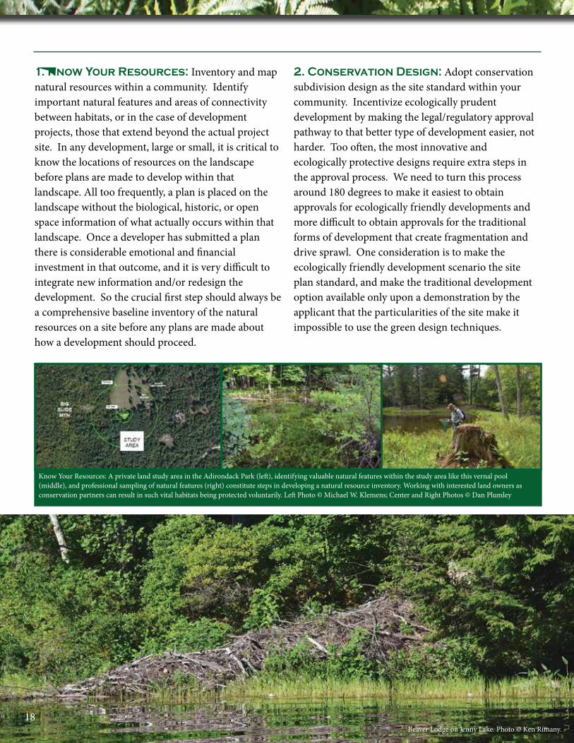
1. Know Your Resources: Inventory and map natural resources within a community. Identify important natural features and areas of connectivity between habitats, or in the case of development projects, those that extend beyond the actual project site. In any development, large or small, it is critical to know the locations of resources on the landscape before plans are made to develop within that landscape. All too frequently, a plan is placed on the landscape without the biological, historic, or open space information of what actually occurs within that landscape. Once a developer has submitted a plan there is considerable emotional and financial investment in that outcome, and it is very difficult to integrate new information and/or redesign the development. So the crucial first step should always be a comprehensive baseline inventory of the natural resources on a site before any plans are made about how a development should proceed.
2. Conservation Design: Adopt conservation subdivision design as the site standard within your community. Incentivize ecologically prudent development by making the legal/regulatory approval pathway to that better type of development easier, not harder. Too often, the most innovative and ecologically protective designs require extra steps in the approval process. We need to turn this process around 180 degrees to make it easiest to obtain approvals for ecologically friendly developments and more difficult to obtain approvals for the traditional forms of development that create fragmentation and drive sprawl. One consideration is to make the ecologically friendly development scenario the site plan standard, and make the traditional development option available only upon a demonstration by the applicant that the particularities of the site make it impossible to use the green design techniques.
Know Your Resources: A private land study area in the Adirondack Park (left), identifying valuable natural features within the study area like this vernal pool (middle), and professional sampling of natural features (right) constitute steps in developing a natural resource inventory. Working with interested land owners as conservation partners can result in such vital habitats being protected voluntarily. Left Photo © Michael W. Klemens; Center and Right Photos © Dan Plumley
Beaver Lodge on Jenny Lake. Photo © Ken Rimany.18

Use of Conservation Design
This example of Strategy 2 comes from the NYS Adirondack Park Agency. Originally, the private landowner asked the NYS Adirondack Park Agency (APA) to approve numerous long, linear lots with lengthy driveways to distant houses far from the local highway. The lots ran right up against a Wilderness Area. The problem for the APA was that all of the private land was zoned as Resource Management where the legal priority is to “protect the delicate physical and biological resources, encourage proper and economic management of forest, agricultural and recreational resources and preserve the open spaces that are essential and basic to the unique character of the park.” Ultimately, after several years of review and amendment the APA permit was presented as a “model for conservation design of development, impact avoidance, and protection of large, contiguous tracts in land classified as Resource Management.” The APA permit redesigned the subdivision so that it concentrated housing development, clustering the eight building lots near roads and existing infrastructure on 348 acres in Resource Management, but leaving 86 % of the project site as blocks of contiguous open space, conserved either as wetland or for the practice of forestry and open space recreation adjacent to a public Wilderness Area (APA Project Permit 2001-76).
Persek subdivision in Horicon as proposed by a private applicant to APA in 2001, a traditional suburban design showing long, linear lots with lengthy driveways to distant houses, fragmenting Resource
Management land into smaller pieces, and impacting the entire tract, including the adjacent Wilderness Area (in blue).
Persek subdivision as permitted by APA in 2004 employing conservation design principles of smaller, clustered lots and building footprints, short, shared driveways near existing roads and utilities, leaving most of
Resource Management (green) as contiguous, undivided open space suitable for forestry and recreation and compatible with adjacent Wilderness Area.
1Boreas Ponds from Allen Mountain Summit. Photo © Jesse Gigandet.
19
3. Stakeholders: If a lighter development footprint within your community is the goal, then all stakeholders should be on board. For example, if the goals are lower impact roadways that protect the environment by reduced coverage standards, or shared roadways/driveways for multiple houses, these standards should not conflict with the safe passage of
emergency vehicles. If a community wishes to reduce its development footprint, it will need to involve all those parties that have control or a voice in infrastructure development. This may also require rewriting sections of various ordinances and local laws to ensure they do not conflict with the goals of reducing the developed footprint.
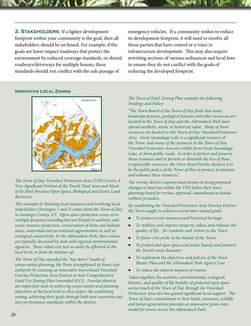
Innovative Local Zoning
The Town of Day Viewshed Protection Area (VPA) Covers A Very Significant Portion of the Town’s Total Area and Much of Its Most Precious Open Space, Biological and Scenic Land ResourcesThis example of knowing local resources and involving local stakeholders (Strategies 1 and 3) comes from the Town of Day in Saratoga County, NY. Open space protection zones serve multiple purposes including but not limited to aesthetic and scenic resource protection, conservation of biota and habitat areas, watershed and recreational opportunities as well as ecological connectivity. In the Adirondack Park, these values are typically discussed by state and regional environmental agencies. These values can just as easily be affirmed at the local level, or from the bottom-up.The Town of Day upended the “top-down” model of conservation planning; the Town strengthened its home rule authority by enacting an innovative town-based Viewshed Overlay Protection Area District in their Comprehensive Land Use Zoning Plan (amended 2012). Overlay districts are important tools in achieving conservation and planning objectives at the local level as they respect the underlying zoning, achieving their goals through both new incentives and new performance standards within the district.
The Town of Day’s Zoning Plan contains the following Findings and Policy:“The Town Board of the Town of Day finds that many landscape features, geological features and other resources are located in the Town of Day and the Adirondack Park have special aesthetic, scenic or historical value. Many of these resources are located in this Town of Day Viewshed Protection Area. Great Sacandaga Lake is a significant resource of the Town, and many of the resources in the Town of Day Viewshed Protection Area are visible from Great Sacandaga Lake, or from public roads. In order to protect and preserve those resources and to prevent or diminish the loss of those irreplaceable resources, the Town Board hereby declares it to be the public policy of the Town of Day to protect, perpetuate and enhance these resources.”The overlay district requires land owners to bring proposed changes in land use within the VPA before their town planning board for review, approval, amendment or denial without prejudice.By establishing the Viewshed Protection Area Overlay District the Town sought to achieve several inter-related goals:
▶ To protect scenic resources and historical heritage. ▶ To stabilize and improve property values and enhance the
quality of life…for residents and visitors to the Town. ▶ To foster civic pride in the beauty of the Town. ▶ To protect and open space and scenic beauty and preserve
the Town’s rural character. ▶ To implement the objectives and policies of the Town
Master Plan and the Adirondack Park Agency Law. ▶ To reduce the adverse impacts of erosion.
Taken together, the aesthetic, environmental, ecological, historic, and quality of life benefits of protected open space across much of the Town of Day through the Viewshed Protection Area law has gained significant local support. The Town of Day’s commitment to their lands, resources, wildlife and future generations provides an innovative grass-roots model for towns across the Adirondack Park.
20
Community training about stream restoration led by Trout Unlimited and U.S. Fish and Wildlife Service following an historic 2011 flood in the Ausable River watershed. Photo © Dave Gibson
Local Leadership
The support and engagement of local leaders is essential to creating better patterns of development and stewardship within the Adirondack Park region. There are many examples of local leadership and the case of the Town of Greig is just one of many we could have selected. Greig is located in Lewis County at the western border of the Adirondack Park. Town Supervisor Marilyn Patterson’s fifteen-year journey to secure the protection of subterranean waters within her town illustrates important and unsung accomplishments of local leaders and communities. Marilyn recognized as a citizen and then as an elected leader how vital it was to protect her town’s watersheds and the quality of its water resources. She went the extra mile to protect her town and the Adirondack Park’s water resources for present and future generations. Patterson worked tirelessly with her neighbors and other community leaders to defeat the so-called “Smoke” project which would have permitted a commercial water extraction operation to thwart Greig’s town planning regulations and exploit critically valuable local aquifer waters lying beneath the forested watershed of the western Adirondacks. The hotly contested water extraction proposal was to commercially draw, pipe, truck and sell spring water at a rate of approximately 200 gallons per minute. Many hundreds of thousands of gallons of fresh water from the local aquifer would have been sold, significantly threatening freshwater and other natural and cultural resources. Resulting impacts to private wells, groundwater, biologically active vernal pools and other forest natural resources led to sustained activity to defend the Town’s water resources as a public trust and to pass more protective local zoning laws. The Town has been repeatedly sued by the proposal’s sponsor. Local and State courts have upheld Greig’s authority to regulate commercial water extraction within its borders. Supervisor Patterson embodies a model of aquifer stewardship for the entire Adirondack Park and across the state. Patterson emphasizes that: “Our town and the Adirondack Park’s water resources are the true life-blood of both the area’s environment and its economy. Protecting water quantity and water quality has been a priority of my administration and my community even before the controversial water project was first announced in 2001. I am proud to have seen through to a successful conclusion our legal fight to sustain the Town’s zoning to protect our water.”
4. Training: Ensure that board members and other local decision-makers are adequately trained and familiar with conservation and development objectives. As these individuals change over time, a sustained commitment will be needed to training and access to up-to-date new information on land use and development techniques for those individuals charged with fashioning the future of our communities.
21
Eastern tiger swallowtail. Photo © Ken Rimany.
5. Consistent Standards: Establish and incorporate uniform standards for the collection of baseline natural resource data. Over time, doing so will shift the conversation from whether or not the data were collected correctly and with sufficient effort, to a much more productive dialogue about the actual planning and design implications of those data.
6. Outside Assistance: Complex biological and engineering data are often challenging for local decision-makers to interpret. While it is often possible to obtain some pro bono guidance from State agencies, conservation groups, or universities, it is prudent that a community have the ability to hire an outside expert to help them review complex applications. To do this they must have a charge-back provision within their local laws that allows the municipality to hire experts, and charge the customary and reasonable costs of expert advice back to an applicant.
7. Start Early: Encourage pre-application meetings and foster public involvement. The earlier all stakeholders meet and express their viewpoints, goals, and desires the more responsive a project will be to the needs of the environment, the community, and the applicant. In every land use consideration there are three basic areas where problems can arise: in the substantive science, in the procedure, and in a stakeholder’s perception of how their needs are being met/addressed/listened to within the process or, in other words, in the
psychology. Over and over again, it is the feeling of the public’s disenfranchisement and marginalization that fuels some of the most acrimonious debates over various land use
projects. Local and State officials can alleviate these perceptions by encouraging early and substantive public participation. Doing so in no way diminishes the rights of an individual to develop property, but allows for better communication and direction for a more meaningful and productive process and outcome.
8. Best Practices: In tandem with Conservation Design and Cluster Development are the creative use of various Best Management and Best Development Practices (BMP/BDP), which allow for development to proceed in a manner that minimizes fragmentation and reduces the mortality rates of wildlife within and passing through a developed area. One example of these BDPs is Calhoun and Klemens’ vernal pool manual. (Note: A bibliography of selected BMP/BDPs is found in Appendix 1 of this report). Many of these practices are particularly useful at the site plan phase of a development, or the micro scale (of fragmentation) that is spoken to earlier in this publication. The use of Low Impact Design stormwater management techniques is one very important BMP that should be used in the Adirondack Park.
22
Michael W. Klemens, MCA
Seasonally dry vernal pool, Jay Mountain Wilderness Area. Photo © Dan Plumley.
9. After-the-Fact Approval Conditions: Decision-makers should avoid the temptation to remedy incomplete or defective applications with post-approval conditions. For example, if an application lacks complete natural resource data or soil data for septic system engineering designs, it is senseless to approve that application and collect those data later. Why? If the biological data are being provided in an application to help fashion the development in the lowest impact manner possible, those data are needed beforehand to inform the design phase, not be collected after the design has been approved and permitted.
Another problem of imposing many conditions to an approved project is that it places a greater burden on the agencies and local towns to actually monitor and enforce those conditions. It is much more appropriate to respect the public interest in community well-being and ecological integrity to deny without prejudice applications that are deficient in data or analyses, than to clumsily condition them into some sort of quasi-compliant form.
10. Engage Landowners: Encourage local land owners to become cooperative stewards. Engage private landowners in priority conservation areas to promote ecologically friendly land-use practices. The majority of the low-lying intermontane riparian valley habitats are privately owned in a variety of small and large land holdings. As discussed earlier, these areas are crucial wildlife habitats and corridors that connect habitats to one another, and allow for natural processes of change to occur by facilitating the passage of animals and plants. A public education and outreach effort, both at the local and regional level can begin to engage landowners as cooperative stewards, managing their land holdings in a manner that enhances the biological values and resiliency of these areas.
Adirondack Wild Partners discussing habitat protection with a Park landowner. Photo © Ken Rimany.23
Michael W. Klemens, MCA
Seasonally dry vernal pool, Jay Mountain Wilderness Area. Photo © Dan Plumley.
1
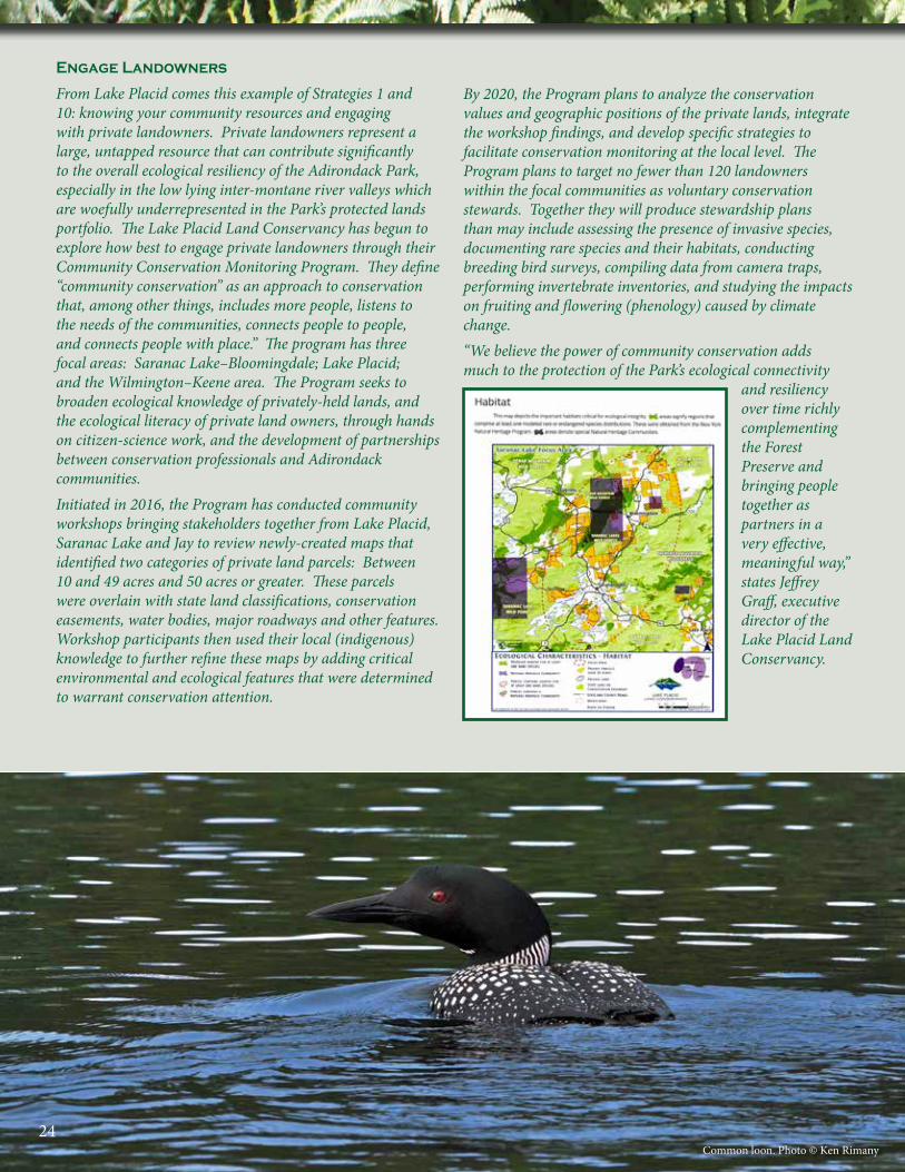
Engage Landowners
From Lake Placid comes this example of Strategies 1 and 10: knowing your community resources and engaging with private landowners. Private landowners represent a large, untapped resource that can contribute significantly to the overall ecological resiliency of the Adirondack Park, especially in the low lying inter-montane river valleys which are woefully underrepresented in the Park’s protected lands portfolio. The Lake Placid Land Conservancy has begun to explore how best to engage private landowners through their Community Conservation Monitoring Program. They define “community conservation” as an approach to conservation that, among other things, includes more people, listens to the needs of the communities, connects people to people, and connects people with place.” The program has three focal areas: Saranac Lake–Bloomingdale; Lake Placid; and the Wilmington–Keene area. The Program seeks to broaden ecological knowledge of privately-held lands, and the ecological literacy of private land owners, through hands on citizen-science work, and the development of partnerships between conservation professionals and Adirondack communities.Initiated in 2016, the Program has conducted community workshops bringing stakeholders together from Lake Placid, Saranac Lake and Jay to review newly-created maps that identified two categories of private land parcels: Between 10 and 49 acres and 50 acres or greater. These parcels were overlain with state land classifications, conservation easements, water bodies, major roadways and other features. Workshop participants then used their local (indigenous) knowledge to further refine these maps by adding critical environmental and ecological features that were determined to warrant conservation attention.
By 2020, the Program plans to analyze the conservation values and geographic positions of the private lands, integrate the workshop findings, and develop specific strategies to facilitate conservation monitoring at the local level. The Program plans to target no fewer than 120 landowners within the focal communities as voluntary conservation stewards. Together they will produce stewardship plans than may include assessing the presence of invasive species, documenting rare species and their habitats, conducting breeding bird surveys, compiling data from camera traps, performing invertebrate inventories, and studying the impacts on fruiting and flowering (phenology) caused by climate change.“We believe the power of community conservation adds much to the protection of the Park’s ecological connectivity
and resiliency over time richly complementing the Forest Preserve and bringing people together as partners in a very effective, meaningful way,” states Jeffrey Graff, executive director of the Lake Placid Land Conservancy.
Common loon. Photo © Ken Rimany24
GLOSSARY OF KEY TERMS
Development Footprint: The portion of a building lot that is covered with structures and accessory structures, roads, driveways, and other built structures. These are collectively termed “hardscape.”
Ecological Continuum: A wide expanse of varied habitat types arranged along a gradient, be it from lowland to highlands, or along river corridors.
Ecological Footprint: The area beyond the Development Footprint, where direct and indirect impacts of the development extend into adjacent undeveloped lands, affecting the Ecosystem. This area of impact is much larger than the actual area developed.
Ecological Sinks and Traps: Areas that attract individuals of a species to forage or breed, but because of their locations and/or physical characteristics actually result in mortality. The term sink is generally restricted for use in the context of Meta-populations, but both sinks and traps operate essentially in the same manner. For example, a rut in a woods road may hold sufficient water to allow amphibians migrating between populations to breed, but would dry up rapidly, killing the eggs and tadpoles. As this is causing mortality within a Meta-population, this would be correctly referred to as a sink. Examples of ecological traps include a hawk or owl being attracted to the grassy edges and median of a highway to hunt for small mammals, being struck by a motor vehicle as it swoops down to catch a mouse. Another type of ecological trap is a sandy embankment alongside a busy roadway attracting nesting turtles. Some of the nesting females are crushed on the road as well as many of the newly-hatched turtles, which must cross the road back to the nearby wetland.
Ecosystem and Ecosystem Services: The wide array of interacting habitat types and interacting species that comprise the web of life. Ecosystems provide many services to human communities including clean air, clean water, flood control, and carbon sequestration—the process by which atmospheric carbon is held in the tissues of plants, especially trees, which buffers excess atmospheric carbon, which in turn reduces the rate of climate change.
Ecosystemic Change: The natural processes of how Ecosystems evolve over time. Ecosystemic change includes changes in habitat known as “ecological succession.” One example of this is the natural conversion over time of an open meadow to a shrubby meadow to young forest to mature second-growth forest.
Fragmentation: The dividing up of large natural habitats into smaller, isolated blocks of land through the process of development, road building, and other human activities. Fragmentation reduces the ability of many species to move across the landscape in response to human impact, as well as natural changes in the Ecosystem or Ecosystemic Change.
Interconnectedness: The recognition that habitats and species all connect with one another. Fragmentation reduces interconnectivity, and therefore reduces both the ability of Ecosystems to function at full capacity and which reduces Ecosystem Services available to human communities.
25
Monarch butterfly. Photo © Ken Rimany.
Meta-population: The understanding that disjunct populations of the same species that exist in a geographic area have mechanisms to allow for the transfer of individuals between habitat patches is the foundation of the meta-population concept. This is essential to maintaining genetic diversity (through the exchange of individuals between populations) and allowing species to populate/repopulate new areas that become available due to Ecosystemic Change or human activities.
Macro-Scale Landscape: A planning scale of analysis that looks at the larger ecosystem into which an individual development project is situated which is the foundation of cumulative impact analyses.
Meso-Scale Landscape: A planning scale of analysis that focuses on the scale of the individual development site and contiguous parcels of land with an eye toward lessening the impact of the overall development.
Micro-Scale Landscape: A planning scale of analysis that looks at how roads, catch basins, walls, swimming pools, and other structures are placed on an individual house lot with an eye toward lessening the impact of that development and avoiding the creation of Ecological Sinks and Traps.
Precautionary Principle: The concept that in the absence of knowledge or conclusive proof one makes a decision that is cautious respecting what is unknown as opposed to ignoring the absence of data. When engaging in land-use decisions, the absence of information should be viewed as a reason to either gather the necessary data, or make a cautious decision that assumes that the development site has important ecological values. Too often, the reverse occurs, the absence of data is taken as a green light to allow overdevelopment, which creates Fragmentation and results in the loss of Ecosystem Services.
Resiliency: The ability for an Ecosystem to recover from impacts, including climate change and random events such as floods, fires and other disturbances that are not part of the seasonal cycles of change. Such disruptions are referred to as Stochastic Events. Fragmentation reduces resiliency. Resiliency when used as a planning term also means creating/redeveloping human communities that are able to withstand the effects of climate change. This is accomplished by moving structures out of the 500-year floodplain, and factoring stormwater calculations to account for the changed patterns of rainfall that accompanies climate change.
Beaver Mt, Minerva. Photo © Ken Rimany26

1
Riparian: Areas associated with a river or large stream system, which includes not only the flowing water, but adjacent habitats such as floodplains and wet meadows, as well as floodplain Vernal Pools.
Stochastic Events: Random disruptive events, not part of an annual or seasonal cycle. These include major floods, forest fires, and tornado/wind blowdowns.
Vernal Pool: A small seasonally filled wetland or ponded watercourse set in forested landscapes that serves as breeding habitat for a variety of amphibians. Vernal pools can exist alone, or embedded in a larger wetland or floodplain. In most instances, vernal pools dry completely or nearly completely each year rendering them fishless and accelerating the decomposition of nutrients (especially leaf fall) within the pools.
Wildlife Corridor: Areas on the landscape that serve as migratory and dispersal pathways for wildlife. These can include ridgelines and Riparian corridors, but can also include a diversity of land features (e.g., unbroken forest) that span both long and shorter distances. Wildlife corridors exist at different scales on the landscape dependent upon the species they serve. Corridors for amphibian migration to and from a Vernal Pool may be as little as a thousand linear feet, whereas corridors for large area-sensitive species such as moose are measured in tens of thousands of acres.
Zero Lot Line Development: A type of development in which the Development Footprint extends to the edge of the lot. This technique is often used as a way to cluster homes on a small portion of the land and leave large areas of open space surrounding the development. Apart from the benefits to human inhabitants of these communities, such developments foster the protection of Ecosystems.
27
Photo © Jesse Gigandet
APPENDIXSUGGESTED READINGS
Adirondack Wild: Friends of the Forest Preserve. 2015. Adirondack Park at a Crossroad: A Road Map for Action. 37 pp.
Arendt, Randall. 2015. Rural by Design: Planning for Town and Country. American Planning Association Planners Press. 552 pp.
Calhoun, A. J. K. and M. W. Klemens. 2002. Best Development Practices (BDPs) for Conserving Pool-breeding Amphibians in Residential and Commercial Developments. MCA Technical Paper No. 5, Metropolitan Conservation Alliance, Wildlife Conservation Society, Bronx, NY.
Calhoun, A. J. K., Miller, N., and M. W. Klemens. 2005. Conservation strategies for pool-breeding amphibians in human-dominated landscapes. Wetlands Ecology and Management 13: 291-304.
Daly, J. and M. W. Klemens. 2005. Integrating Conservation of Biodiversity into Local Planning. pp. 313-334 In Johnson, E. A. and M. W. Klemens. Nature in Fragments: The Legacy of Sprawl. Columbia University Press, NY.
Glennon, M.J., and H.E. Kretser. 2013. Size of the ecological effect zone associated with exurban development in the Adirondack Park, N.Y. Landscape and Urban Planning 112:10-17.
Glennon, M.J., and H.E. Kretser. 2016. State of the birds in exurbia. Adirondack Journal of Environmental Studies 20:49-66.
Glennon, M.J., H.E. Kretser, and J.A. Hilty. 2014. Identifying common patterns in diverse systems: effects of exurban development on birds of the Adirondack Park and the Greater Yellowstone Ecosystem, USA. Environmental Management 55:453 – 466.
Johnson, E. and M. W. Klemens (eds). 2005. Nature in Fragments: The Legacy of Sprawl. Columbia University Press, NY 382 pp.
Klein, M. S., M. W. Klemens, and D. H. Merriam. 2006. Where’s Waldo? Finding federal wetlands after the Rapanos decision. Zoning and Planning Law Report 29(8):1-16.
28Big Brook, Town of Long Lake. Photo © Ken Rimany.
Klemens, M. W. and E. A. Johnson. 2005. Creating a Framework for Change. pp. 349-362 In Johnson, E. A. and M. W. Klemens. Nature in Fragments: The Legacy of Sprawl. Columbia University Press, NY.
Mahaney, Wende S. and M. W. Klemens. 2008. Vernal pool conservation policy: The federal, state, and local context. pp. 193-212 In: Calhoun A. J. K and P. G deMaynadier. Science and Conservation of Vernal Pools in Northeastern North America. CRC Press, Taylor & Francis Group, Boca Raton, London & New York.
Perlman, D.L., and J. Milder. 2004. Practical Ecology for Planners, Developers, and Citizens. Island Press.
Planimetrics and Trinkaus Engineering, LLC. 2010, 2015. Plainville: Low Impact Development and Stormwater Management Design Manual. 179 pp. https://www.plainvillect.com/sites/plainvillect/files/uploads/low impact development stormmwater management design manual. pdf
Smith, Z. P., M. Glennon, L. Karasin, S. Reed and H. Kretser, eds. 2012. Protecting Wildlife Connectivity Through Land Use Planning: Best Management Practices and the Role of Conservation Development. Wildlife Conservation Society, Adirondack Program Technical Paper #4. https://programs.wcs.org/data/doi/ctl/view/mid/33065/pubid/DMX1631400000.aspx
Wildlife Conservation Society. 2009. Make Room for Wildlife: A Resource for Local Planners and Communities in the Adirondacks. Wildlife Conservation Society, Saranac Lake, NY. https://programs.wcs.org/data/doi/ctl/view/mid/33065/pubid/DMX549500000.aspx
Wildlife Conservation Society. 2013. Make Room for Wildlife: A Resource for Landowners in the Northern Forest. Wildlife Conservation Society, Saranac Lake, NY. https://northamerica.wcs.org/About-Us/Publications/Categoryid/169.aspx
29White pine. Photo © Ken Rimany.
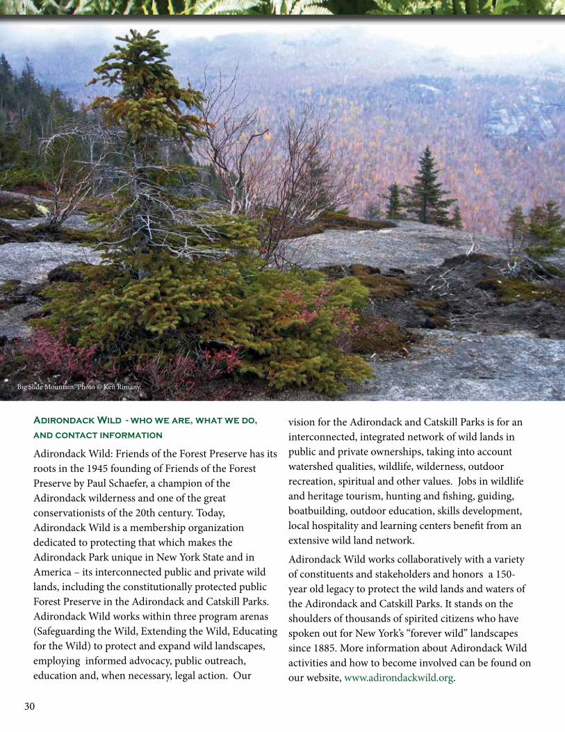
Adirondack Wild - who we are, what we do,
and contact information
Adirondack Wild: Friends of the Forest Preserve has its roots in the 1945 founding of Friends of the Forest Preserve by Paul Schaefer, a champion of the Adirondack wilderness and one of the great conservationists of the 20th century. Today, Adirondack Wild is a membership organization dedicated to protecting that which makes the Adirondack Park unique in New York State and in America – its interconnected public and private wild lands, including the constitutionally protected public Forest Preserve in the Adirondack and Catskill Parks. Adirondack Wild works within three program arenas (Safeguarding the Wild, Extending the Wild, Educating for the Wild) to protect and expand wild landscapes, employing informed advocacy, public outreach, education and, when necessary, legal action. Our
vision for the Adirondack and Catskill Parks is for an interconnected, integrated network of wild lands in public and private ownerships, taking into account watershed qualities, wildlife, wilderness, outdoor recreation, spiritual and other values. Jobs in wildlife and heritage tourism, hunting and fishing, guiding, boatbuilding, outdoor education, skills development, local hospitality and learning centers benefit from an extensive wild land network.
Adirondack Wild works collaboratively with a variety of constituents and stakeholders and honors a 150-year old legacy to protect the wild lands and waters of the Adirondack and Catskill Parks. It stands on the shoulders of thousands of spirited citizens who have spoken out for New York’s “forever wild” landscapes since 1885. More information about Adirondack Wild activities and how to become involved can be found on our website, www.adirondackwild.org.
30
Big Slide Mountain. Photo © Ken Rimany.
31“Cree,” a gray wolf residing at the Adirondack Wildlife Refuge and Rehabilitation Center in Wilmington. Photo © Ken Rimany.
Managing Partner
David H. Gibson
Partners
Daniel R. PlumleyKenneth J. Rimany
LandscaPe conservation advisor
Michael W. Klemens, Ph.D.
Honorary cHair Peter Brinkley
officers Terry Jandreau Chair / Interim Treasurer
Christopher Amato Vice Chair
Suzanne Roberson Secretary
directors
Donald BrightmanHelen ChaseThomas CobbCarl GeorgeJames JordanMargaret SchadlerAnne Weld
advisory counciL
Stephen Blackmer John JohansonRoger MarshallMichael WashburnEdward Zahniser
Adirondack Wild: Friends of the Forest PreserveFounded 1945
PO Box 9247 • Niskayuna NY 12309
www.AdirondackWild.org
All rights reserved © 2017 Adirondack Wild: Friends of the Forest Preserve.