Embed Size (px)
Citation preview

Participatory Mapping andParticipatory Mapping andParticipatory Mapping and Volunteered Geographic InformationParticipatory Mapping and Volunteered Geographic InformationSeth Peery, Sr. GIS Architect
Social Media for Planning April 22, 2011Virginia Tech Geospatial Information Sciences

OverviewOverviewOverviewOverview• Overlaps between GIS and “social media”
• Participatory Mapping and Citizen Sciencep y pp g• Public Participation GIS• Volunteered Geographic Information• Mashups and Web Servicesp
• Applications• Popular examples• Virginia Tech participatory mapping projectsVirginia Tech participatory mapping projects
• Best practices • Design considerations for collecting data from the public• Validity and use of VGI• Validity and use of VGI
2
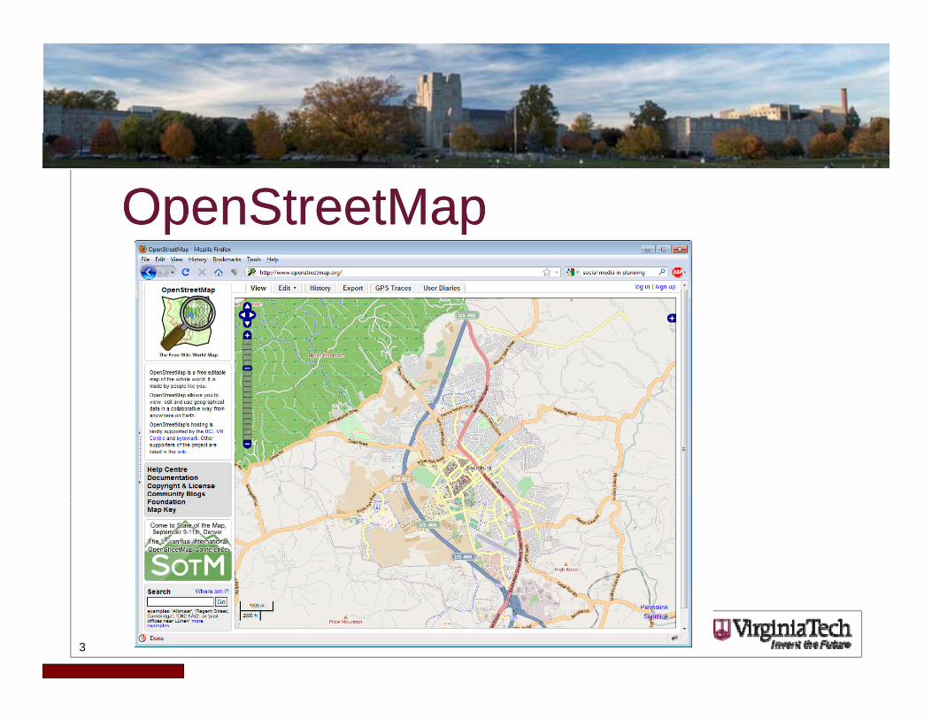
OpenStreetMapOpenStreetMapOpenStreetMapOpenStreetMap
3
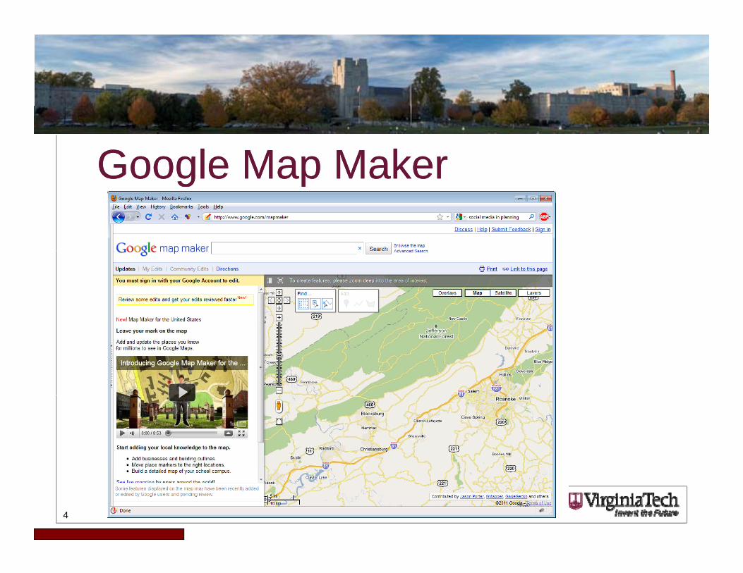
Google Map MakerGoogle Map MakerGoogle Map MakerGoogle Map Maker
4
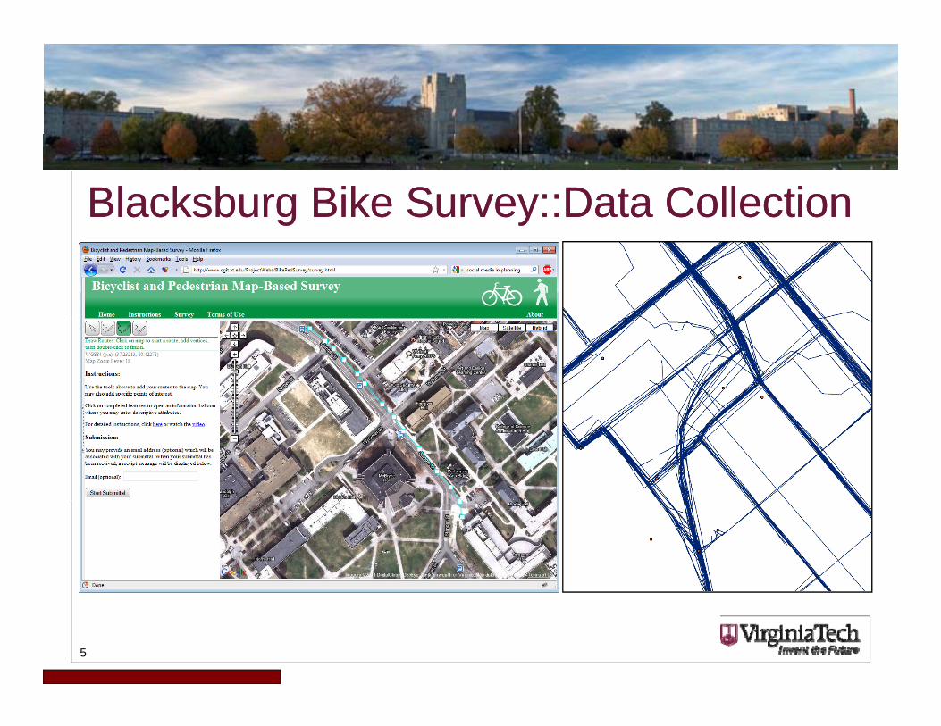
Blacksburg Bike Survey::Data CollectionBlacksburg Bike Survey::Data Collection
5
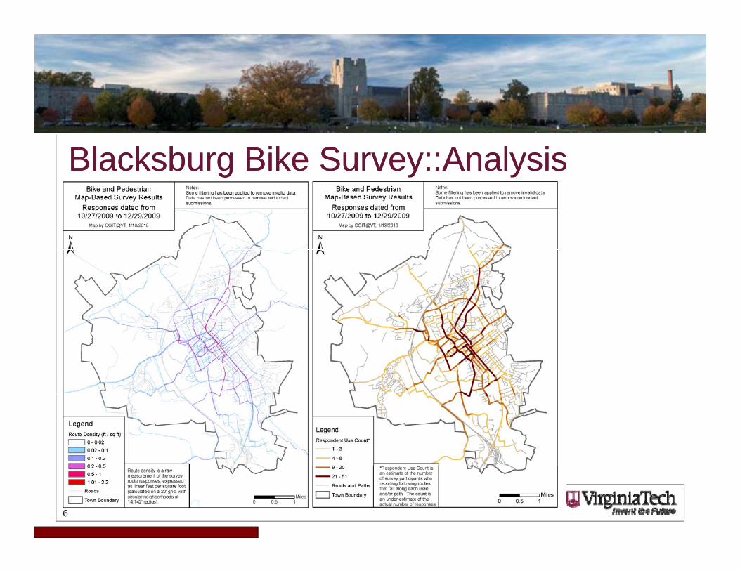
Blacksburg Bike Survey::AnalysisBlacksburg Bike Survey::Analysis
6

Virginia Tech eCorridors Broadband MapVirginia Tech eCorridors Broadband Map
• Started in 2006
• Combines NDT with a Google Maps front-end
• Nearly 5000 data points to date, and growing
7http://www.ecorridors.vt.edu/maps/broadbandmap
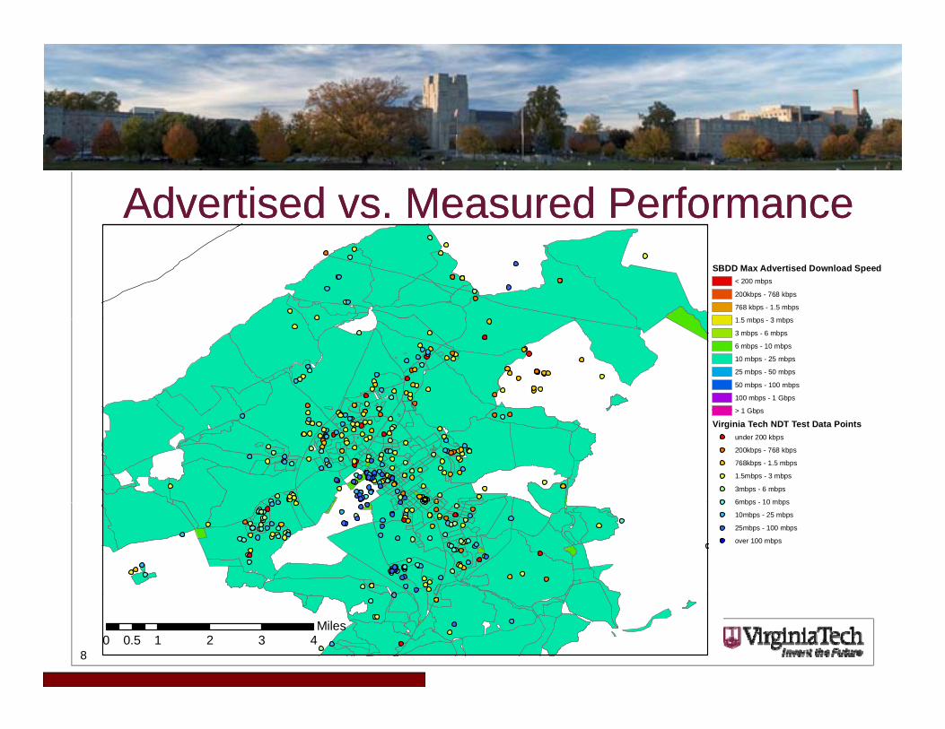
Advertised vs. Measured PerformanceAdvertised vs. Measured PerformanceSBDD Max Advertised Download Speed
< 200 mbps
200kbps - 768 kbps
768 kbps - 1.5 mbps
1 5 mbps 3 mbps1.5 mbps - 3 mbps
3 mbps - 6 mbps
6 mbps - 10 mbps
10 mbps - 25 mbps
25 mbps - 50 mbps
50 mbps - 100 mbps
100 mbps - 1 Gbps
> 1 Gbps> 1 Gbps
Virginia Tech NDT Test Data Pointsunder 200 kbps
200kbps - 768 kbps
768kbps - 1.5 mbps
1.5mbps - 3 mbps
3mbps - 6 mbps
6mbps - 10 mbps6mbps - 10 mbps
10mbps - 25 mbps
25mbps - 100 mbps
over 100 mbps
80 1 2 3 40.5
Miles
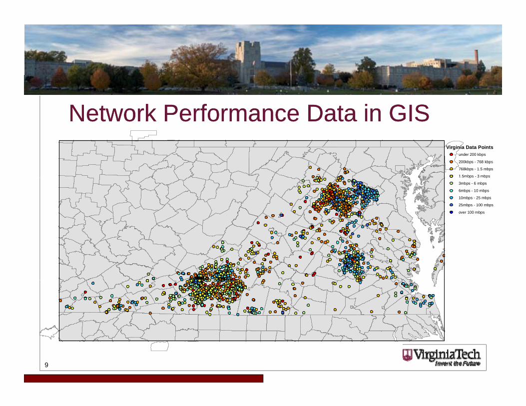
Network Performance Data in GISNetwork Performance Data in GISVirginia Data Points
under 200 kbps
200kbps - 768 kbps
768kbps - 1.5 mbps
1.5mbps - 3 mbps5 bps 3 bps
3mbps - 6 mbps
6mbps - 10 mbps
10mbps - 25 mbps
25mbps - 100 mbps
over 100 mbps
9
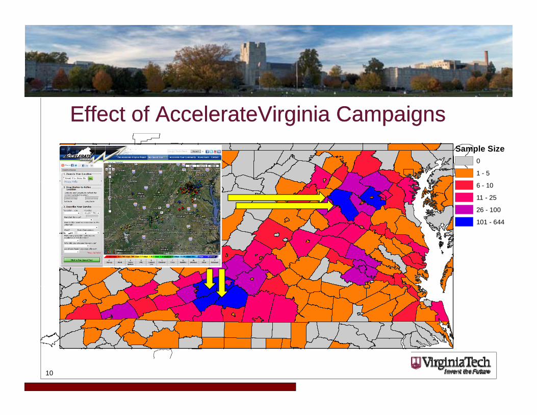
Effect of AccelerateVirginia CampaignsEffect of AccelerateVirginia CampaignsSample Size
0
1 - 5
6 - 10
11 - 25
26 - 100
101 - 644
10

Generalization by Areal UnitGeneralization by Areal Unit
Vi i i D t P i t
CountiesBlocks
Virginia Data Pointsunder 200 kbps
200kbps - 768 kbps
768kbps - 1.5 mbps
1.5mbps - 3 mbps
3mbps - 6 mbps
6mbps - 10 mbps
10mbps 25 mbps10mbps - 25 mbps
25mbps - 100 mbps
over 100 mbps
Average DownloadAvg_downlo
no data
under 200 kbps
200 kbps - 768 kbps200 kbps - 768 kbps
768kbps - 1.5 mbps
1.5 mbps - 3 mbps
3 mbps - 6 mbps
6 mbps - 10 mbps
10 mbps - 25 mbps
25 mbps - 100 mbps
over 100 mbps
11
over 100 mbps
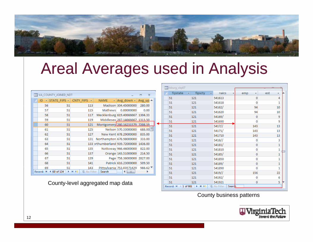
Areal Averages used in AnalysisAreal Averages used in Analysisg yg y
County-level aggregated map data
County business patterns
12
y p
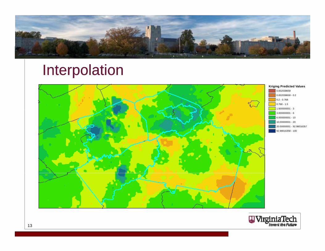
InterpolationInterpolationKriging Predicted Values
0.002038659
0.002038659 - 0.2
0.2 - 0.768
0.768 - 1.5
1.500000001 - 3
3.000000001 - 6
6.000000001 - 10
10.00000001 - 20
20.00000001 - 92.98016357
92.98016358 - 100
13

Economic Development ResearchEconomic Development Research
14
Designing Interfaces for VGIDesigning Interfaces for VGIDesigning Interfaces for VGIDesigning Interfaces for VGI• CONSTRAIN USER INPUT as much as possible!• List boxes are preferable to free-form text• Collect as much metadata as you can (IP, timestamp, zoom level, other map
variables) for later filtering use• “Users are evil” – protect against SQL injection (but also junk data)… validate,
validate!• Decide on level of isolation between the users and the data
– Writing directly to production – Writing to a staging DB
Human approval required first (Moderation)– Human approval required first (Moderation)• All VGI is spatial, but not all VGI is GIS – ESRI stack vs. traditional DBs (e.g.,
MySQL)• Protection of PII (and… getting useful data vs. getting a usefully large sample
15
size)• Spatial unit of VGI – smaller is better
Data Ingestion and AnalysisData Ingestion and AnalysisData Ingestion and AnalysisData Ingestion and Analysis• Workflow depends on research questions and software platform for
analysis• Data may have been collected in different format than required for
analysis• For GIS, we can ingest csv/txt as XY data – more direct import into
SAS/SPSS/R/etcSAS/SPSS/R/etc.• Need to eliminate outliers and obvious errors – use as much metadata
as you can – but note impacts of doing this on sample size• Spatial generalization points to polygons averages sums• Spatial generalization – points to polygons, averages, sums.• Suitability for interpolation?• Mapping underlying pattern vs. mapping the distribution of
responsesresponses
16
Validity ThreatsValidity ThreatsValidity ThreatsValidity Threats• VGI/geospatial crowdsourcing methodologically similar to a survey instrument• Sampling bias – spatial/other• Precision/accuracy of VGI spatial data• Correctness of attribute data (assertion)• Credibility of VGI [1] y
• Authority vs. credibility• Uniqueness, situation, formal training• Perception of accuracy and provenance
• User input mistakes vs systematic abuse (astroturfing)• User input mistakes vs. systematic abuse (astroturfing)• Identification and filtering of outliers• Uncertainty and how to quantify it
[1] Flanagin, A. J. and M. J. Metzger (2008). "The credibility of volunteered geographic information." GeoJournal 72: 137.
17

Contact InformationContact InformationContact InformationContact Information
Seth PeerySeth PeerySenior GIS Architect, Enterprise GISVirginia Tech Geospatial Information Sciences2060 Torgersen Hall (0197), Blacksburg, VA 24061(540) 231-2178sspeery@vt [email protected]://gis.vt.edu