Embed Size (px)
Citation preview

Eija Honkavaara, Anttoni Jaakkola, Roope Näsi, Tomi Rosnell
Part I Data collection
3D Modeling andVirtual Worlds
*Lingli Zhu
Remote SensingElectronics
*Yuwei Chen
Mobile Mapping &Laser Scanning
*Anttoni Jaakkola
Spectrophotogrammetry*Eija Honkavaara
Research Groups
Head of department,Prof. Juha Hyyppä
Generate dataShape: Terrain model, Canopymodel
Volume mapping etc.
SpectrumClassification of materials etc.
Passive and active sensors
Space basedobservations
Ground basedobservations
Airborneobservations
Remote sensing technologies

UAS
Satellite
Airborne
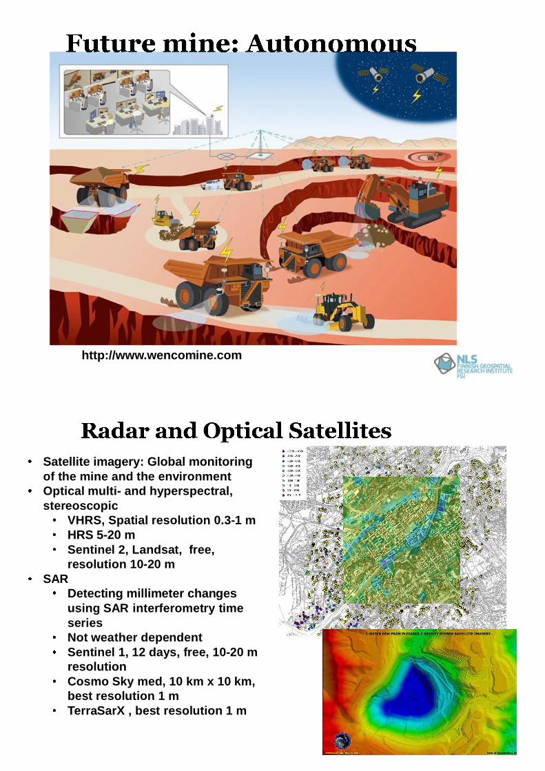
Terrestrial
Large
Small
HighLow
Coverage
Flexibility
Remote sensing application potential
Sensor technologies-Optical imaging-Photogrammetry-Laser scanning-Hyperspectral imaging-Thermal imaging
Improving the productivityMapping the quality and amount of oreMeasuring the bulk material volume, the open pit volume
Risk management in mine operation: Landslides, Traffic, BlastingMonitoring of environmental impacts
Water management: Monitoring the enrichment pool, mine waterrunoff forecasting, forecasting disturbancesMonitoring the nature and biodiversity, the growth and healthy oftrees
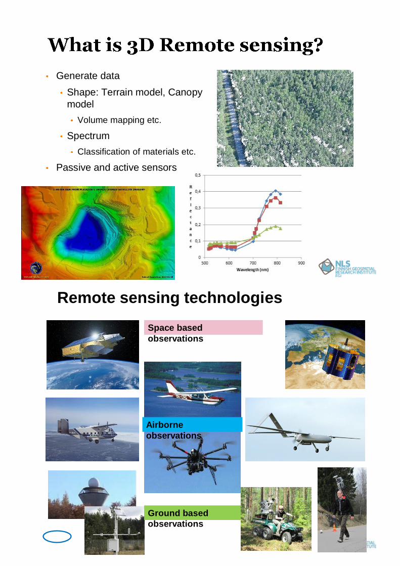
Improving the level of automation, Autonomous mineData capture -> Data processig -> Model generation -> Analysis
http://www.wencomine.com
8
Satellite imagery: Global monitoringof the mine and the environmentOptical multi- and hyperspectral,stereoscopic
VHRS, Spatial resolution 0.3-1 mHRS 5-20 mSentinel 2, Landsat, free,resolution 10-20 m
SARDetecting millimeter changesusing SAR interferometry timeseriesNot weather dependentSentinel 1, 12 days, free, 10-20 mresolutionCosmo Sky med, 10 km x 10 km,best resolution 1 mTerraSarX , best resolution 1 m

9
Images and 3D pointclouds 1 to 1000 points /mAccuracy 1 cm to 20 cmWell-known technologyLow to high altitudeimaging
Also hyperspectralAccuratematerialclassificationIdentification ofanomalies
31.1.12
3D point clouds 0.5 to 100points /m2;
As an example the NationalLaser Scanning model withpoint density of 0.5 points/m2
Terrain and canopy modelsAccuracy 1 cm to 20 cm welldefined, hard surfacesDay and night, Highly waterresistant, Not in rain or smogWider area measurementsIn future also Multi spectrallaser scanning

Low cost technologyAccurate 3D pointclouds, color images,Repetitivemeasurements <dailyresolutionAlso hyperspectraland thermal Rapidly developingtechnology
31.1.12
New and rapidlydevelopingtechnologyVery high density 3Dpoint cloud data,e.g. 1000 points/m2Rapidly developingtechnologyRepetitivemeasurements<daily resolution
13
Static and mobileVery high density 3D point clouddataRapidly developing technologyRepetitive measurements

Volume comparisonAfter point-to-point matching, an area with commoncoverage was cut in TLS, UAV lidar and UAV photo data
Height 9 m (out of 15 m)Area 2300 m2 (out of 4400 m2)
Volumes:TLS 15860 m3
UAV lidar 15809 m3
UAV photo 15849 m3
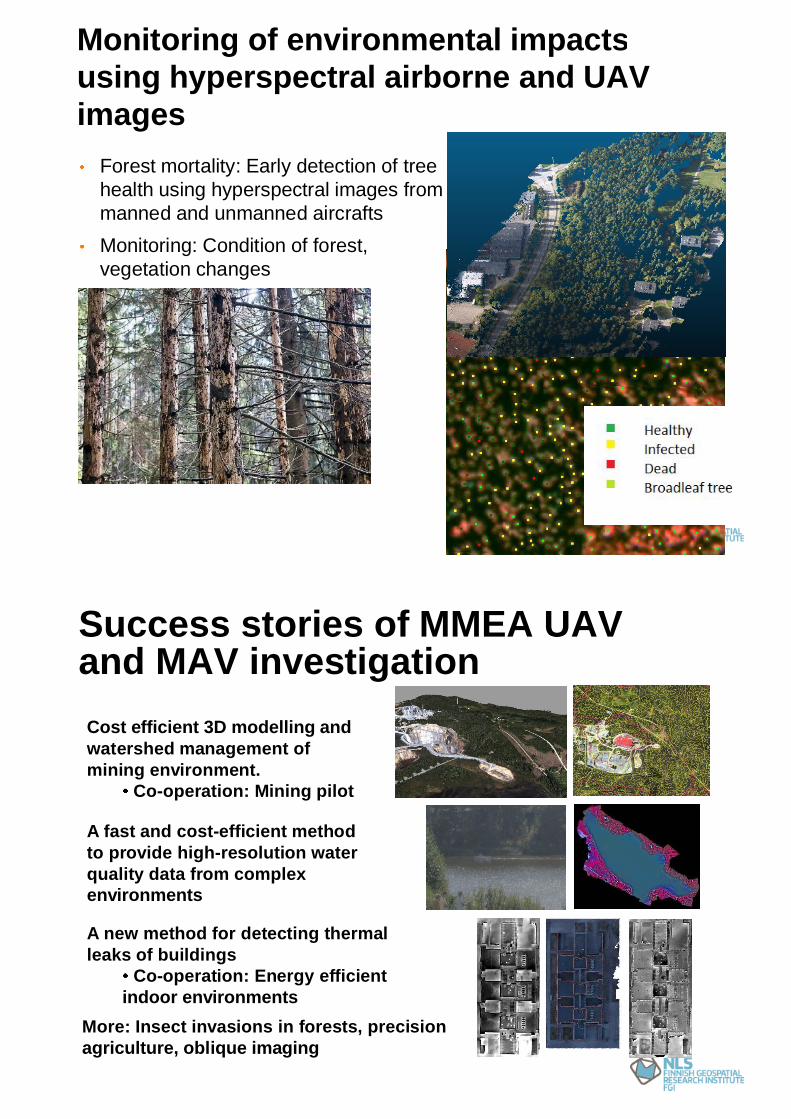
Monitoring of environmental impactsusing hyperspectral airborne and UAVimages
Forest mortality: Early detection of treehealth using hyperspectral images frommanned and unmanned aircraftsMonitoring: Condition of forest,vegetation changes
17
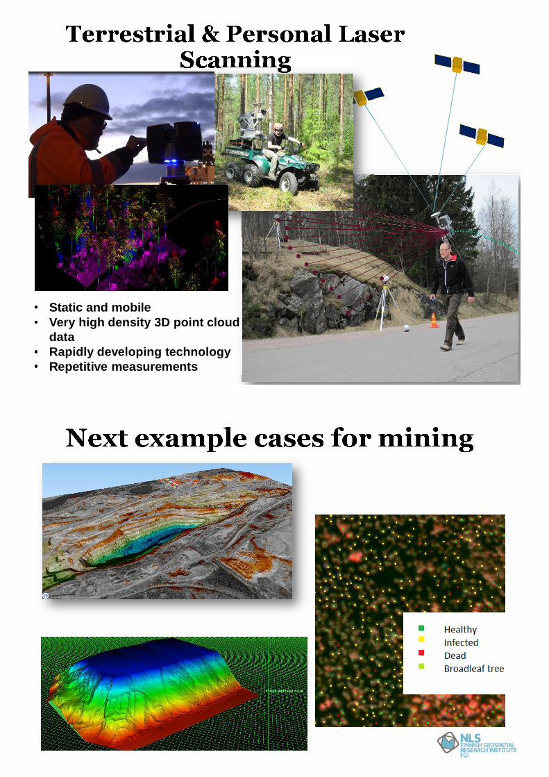
Success stories of MMEA UAVand MAV investigationCost efficient 3D modelling andwatershed management ofmining environment.
Co-operation: Mining pilot
A fast and cost-efficient methodto provide high-resolution waterquality data from complexenvironments
A new method for detecting thermalleaks of buildings
Co-operation: Energy efficientindoor environments
More: Insect invasions in forests, precisionagriculture, oblique imaging
New data capture technology provides new possibilities forimproving productivity, safety and environmental monitoring ofminesFuture monitoring integrates satellites, airborne, UAV andterrestrial technologiesAlso indoor 3D mappingTowards autonomous mineDepartment of Remote Sensing and Photogrammetry focusesfuture remote sensing measurement and analysis technologies.
Suitables also for monitoring of open pit mines and undergroundmines, as well as assessment of environmental impacts