Embed Size (px)
Citation preview

Post-Construction Stormwater Management Requirements for Development Projects in the Central Coast Region
User Guide for Municipal Implementation
February 2013

User Guide for Municipal ImplementationThe Central Coast Post-Construction Stormwater Management Requirements (PCRs) become effective on September 6, 2013. Before that date, there are several tasks that municipalities must undertake to prepare for implementation, including development or acquisition of:
new procedures to identify applicable projects and associated PCRs, updates to local regulations, new approvals needed from the Water Board, and tracking and reporting procedures.
This document outlines and briefly describes tasks that municipalities need to complete in order to implement the PCRs. Table 1 summarizes the tasks described in this User Guide.
Table 1. Summary of Municipal Tasks to Support Implementation of PCRs
Task Category Task # Task Page #New Procedures to Identify Applicable Projects and Associated PCRs
1.1 Create a matrix, flow chart, or similar system to help a user identify projects subject to the PCRs and the specific requirements
2
1.2 Create a project locator map that allows users to identify the associated Watershed Management Zone (WMZ)
3
1.3 Create a map reference tool that allows users to identify any adjustments to the PCRs applicable to the project
4
1.4 Create a reference tool to identify the appropriate 85th or 95th percentile, 24-hour storm event that applies to the project
6
Updates to Local Regulations
2.1 Create an enforceable mechanism to implement the PCRs for applicable projects
6
2.2 Create the requirements and mechanisms for long-term ownership of, and responsibility for, structural Stormwater Control Measures (SCMs)
7
2.3 Create the legal authority for site access needed for structural SCM inspection
7
Tracking and Reporting Templates and Procedures
3.1 Develop guidance to communicate reporting requirements to the project applicant
8
3.2 Develop a checklist or similar tool for municipal staff to verify correct design and construction of structural SCMs
8
1
Task Category Task # Task Page #3.3 Develop an Operations & Maintenance (O&M)
database to track SCM facilities for private and public projects
8
3.4 Develop tools (documents, spreadsheets, etc.) to document project information that is required as part of the municipality’s Annual Report.
8
New Approvals Needed from the Water Board
4.1 If appropriate, develop proposals to request modified PCRs for Urban Sustainability, Watershed/Regional, or Special Circumstances (Historic Lake or Wetland areas)
9
Task 1: New Procedures to Identify Applicable Projects and Associated PCRs
Determining whether a project is subject to the Central Coast PCRs and, if so, what those PCRs are, is the first procedural task for a proposed new or redevelopment project. A flow chart or similar decision tool is often used by municipal staff and project applicants to determine project applicability and associated PCRs. The Water Board’s PCRs are dictated by geographic Watershed Management Zones (WMZs); also, in some cases, PCRs are adjusted for certain types of projects. Consequently, staff members need specific mapped information to identify the correct PCRs.
Task 1.1: Create a tool that allows users to determine whether a project is subject to the PCRs and, if so, identifies the specific PCRs for that project
The amount of new and replaced impervious surface, the type of project (new or redevelopment), and the location of the project are the primary determinants of whether a project is subject to PCRs and the nature of the applicable PCRs. A flow chart or similar decision tool is a helpful way to make this determination. Exemptions should be identified early in the decision tool to identify projects that, at first glance, may seem to trigger PCRs, but because of certain characteristics are fully exempt from the PCRs. Any adjustments to the PCRs that may apply to a project should be included in the
2
Keep in MindIt’s always a good idea to review the actual PCRs to identify any task items that may not be covered in this document. Most tasks listed in this guide need to be conducted by every municipality. Some tasks, such as development of proposals for Urban Sustainability Areas, are optional and are noted as such.

flow chart (i.e., for projects affected by Special Circumstances, Watershed or Regional Plans, or Urban Sustainability Areas).
The flow charts and at-a-glance matrix provided in Attachment A provide examples of how a tool might be configured to identify projects subject to the PCRs.
Task 1.2: Create a project locator map that allows users to identify the WMZ associated with the project
The Water Board has defined ten WMZs in the Central Coast Region. Each WMZ is associated with specific water quality and flow control requirements, so it’s necessary to identify the WMZ in which the project is located.
Figure 1. Watershed Management Zone Identification
Creating a tool such as a GIS layer that combines the WMZ data with municipal parcel data will allow users to identify the project’s WMZ. WMZ data are available electronically, under the heading “Spatial Data Coverages,” at:
http://www.waterboards.ca.gov/centralcoast/water_issues/programs/stormwater/docs/lid/lid_hydromod_charette_index.shtml
If you do not have GIS resources, a simple parcel/WMZ overlay map can be created using a mapping tool such as Google Earth and the WMZ map layers. The downside to this approach is that generalized mapping tools will not include parcel numbers or information specific to the municipality, and may be challenging to use efficiently.
3
Keep in MindA municipality can integrate other related elements, such as local flood control requirements, in the flow chart to comprehensively identify stormwater-related requirements for the project.Although this guide describes a flow chart or similar tool, other formats can be created to determine PCRs. The City of Santa Rosa, for example, uses an online questionnaire completed by the project applicant (http://ci.santa-rosa.ca.us/doclib/documents/worksheetfinal2fillin.pdf). The important thing is to develop a tool that works for your municipality.

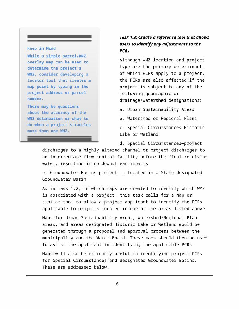
Task 1.3: Create a reference tool that allows users to identify any adjustments to the PCRs
Although WMZ location and project type are the primary determinants of which PCRs apply to a project, the PCRs are also affected if the project is subject to any of the following geographic or drainage/watershed designations:
a. Urban Sustainability Areas
b. Watershed or Regional Plans
c. Special Circumstances—Historic Lake or Wetland
d. Special Circumstances—project discharges to a highly altered channel or project discharges to an intermediate flow control facility before the final receiving water, resulting in no downstream impacts
e. Groundwater Basins—project is located in a State-designated Groundwater Basin
As in Task 1.2, in which maps are created to identify which WMZ is associated with a project, this task calls for a map or similar tool to allow a project applicant to identify the PCRs applicable to projects located in one of the areas listed above.
Maps for Urban Sustainability Areas, Watershed/Regional Plan areas, and areas designated Historic Lake or Wetland would be generated through a proposal and approval process between the municipality and the Water Board. These maps should then be used to assist the applicant in identifying the applicable PCRs.
Maps will also be extremely useful in identifying project PCRs for Special Circumstances and designated Groundwater Basins. These are addressed below.
Special Circumstancesa. Project discharges to a highly altered channel
b. Project discharges to an intermediate flow control facility
4
Keep in MindWhile a simple parcel/WMZ overlay map can be used to determine the project’s WMZ, consider developing a locator tool that creates a map point by typing in the project address or parcel number.There may be questions about the accuracy of the WMZ delineation or what to do when a project straddles more than one WMZ. Attachment B provides some guidance for these situations.

Figure 2 shows an example of a regulated project that discharges to a concrete-lined channel (or storm drain) that is continuous from the point of discharge to the receiving water. In this example, the receiving water is the ocean, but it could be a large lake or river. This project may be subject to adjusted PCRs due to these characteristics. Likewise, the presence of a flow control facility between the project and the receiving water may warrant alternative PCRs (Figure 3).
Figure 2. Project Discharges to a Concrete-Lined Channel or Storm Drain that is Continuous to the Ocean
Figure 3. Project Discharges to an Intermediate Flow Control Facility before Discharging to a Stream Channel
5

Options for mapping these designations include:
1. Project-by-project mapping, in which the project applicant delineates the downstream routing of project runoff to justify a Special Circumstances situation (highly altered channel or intermediate flow control facility).
2. Mapping undertaken by the municipality to identify the entire drainage area that discharges to a Special Circumstances situation (highly altered channel or intermediate flow control facility).
Groundwater BasinsInformation delineating state-designated Groundwater Basins can be accessed at the California Department of Water Resources (DWR) website:
www.water.ca.gov/groundwater/bulletin118/gwbasin_maps_descriptions.cfm.
If there is uncertainty regarding the accuracy of the DWR delineation, there are two options:
1. Use local information to improve accuracy.
2. Realizing that the DWR data is accurate at a regional scale, use the guidance provided in Attachment B regarding WMZ boundaries to create a justifiable and consistent protocol when addressing project-scale Groundwater Basin delineations.
Task 1.4: Create a reference tool to identify the appropriate 85th or 95th percentile, 24-hour storm event that applies to the project
The Water Board will provide a reference tool for determining rainfall depths in March 2013.
Task 2: Updates to Local Regulations
The municipality must have the regulatory authority to legally implement the PCRs. This regulatory authority typically exists in the appropriate municipal code and ordinance structure. Tasks involved in updating local regulations are described below.
Task 2.1: Create an enforceable mechanism to implement the PCRs for applicable projects
There are several acceptable approaches to meeting the requirements for approving new or modified enforceable mechanisms, depending on circumstance.
6
Keep in MindReview the actual PCRs to ensure proper delineation and application of the Special Circumstance and Groundwater Basin designations.
1. Municipalities can incorporate the detailed requirements of the PCRs into ordinance by reference.
2. For communities in the Coastal Zone, the Water Board does not require the ordinance be approved by California Coastal Commission (CCC) or adopted into a Local Coastal Plan (LCP) or land use code. Compliance with CCC requirements is a matter between the municipality and the CCC.
3. The Water Board does require communities in the Coastal Zone to have an ordinance or other equivalent enforceable mechanism in effect throughout their permit
area by September 6, 2013. These communities may implement the PCRs in the Coastal Zone as conditions of approval on regulated projects.
4. Similarly, noncoastal communities must have an ordinance or other equivalent enforceable mechanism in effect throughout the Permit area by September 6, 2013.
Task 2.2: Create the requirements and mechanisms for long-term ownership of, and responsibility for, structural Stormwater Control Measures (SCMs)
Consult municipal or county counsel to determine the appropriate strategy for completing this task.
Task 2.3: Create the legal authority for site access needed for SCM inspections
Consult municipal or county counsel to determine the appropriate strategy for completing this task.
Task 3: Tracking and Reporting Templates and Procedures
Various tracking and reporting mechanisms need to be developed so that the municipality can comply with PCRs. The PCRs include two types of reporting requirements: 1) those that municipalities will require of project applicants and 2) those that the Water Board requires of the municipalities. The first type ensures that the municipality receives all the information it needs from a project applicant to determine whether the project has complied with the applicable requirements, whereas the second type allows the Water Board to evaluate the municipalities’ compliance with the Phase II General Stormwater Permit. Meeting these reporting requirements entails tracking and documenting the details of projects subject to the PCRs.
The following tasks are intended to differentiate the individual components of a comprehensive reporting process that meets the requirements of the PCRs.
7
Keep in Mind:The schedule to update local codes and ordinances in time for required implementation needs to accommodate necessary local governmental processes, such as City Council review and adoption.

Task 3.1: Develop guidance to communicate reporting requirements to the applicant
A combination of flow charts, “at-a-glance” requirements, and templates or guidelines can be provided to project applicants to ensure that they understand what is expected of the projects they propose. To assist the applicant in providing the information that you will need to assess their compliance, you may want to provide them with a Stormwater Control Plan template. The Water Board’s Guidance for Developing Stormwater Control Plans, which can be adapted as a template, will be available on the Board’s Website.
Task 3.2: Develop a checklist or similar tool for municipal staff to verify correct design and construction of structural SCMs
Many good examples of verification checklists are available. One series of checklists that can be used by both municipal inspectors and maintenance personnel is available in the City of Santa Barbara Storm Water BMP Guidance Manual, Appendix H: Facility Inspection and Maintenance Checklists (GeoSyntec Consultants, July 2008).
http://www.santabarbaraca.gov/Resident/Community/Creeks/Low_Impact_Development.htm
Task 3.3: Develop an Operations & Maintenance (O&M) database to track SCM facilities for private and public projects
Section E of the PCRs contains the specific requirements for this important part of implementing post-construction stormwater requirements that rely on structural SCMs. Over time, each municipality must be able to revisit a project’s SCMs to confirm that they are being operated and maintained as intended. A database populated with project-specific O&M information will support your ability to do this. The database is updated with project information each time a project is approved. The database can then be queried in the future to review compliance with the terms of O&M agreements. Electronic databases, including searchable spreadsheets, are appropriate for meeting this requirement of the PCRs.
Task 3.4: Develop tools (documents, spreadsheets, etc.) to document project information that is required as part of the municipality's Annual Report
Stormwater Control Plans are the source of project information that will be summarized in a municipality’s Annual Report. For municipalities with very few projects each year, there may be no need to develop anything beyond a simple spreadsheet containing the relevant project information specified for each Performance Requirement (#2–#4). For municipalities with more development activity, adapting the software already in place for project tracking may be the most efficient way to proceed. Since each municipality approaches project tracking differently, it’s a good idea to contact Water Board staff to discuss the options that you are considering.
8

Annual reporting is required for other aspects of a Municipal Stormwater Management Program, as specified by the Phase II General Stormwater Permit. Use of an annual reporting template to integrate the PCR reporting requirements with the other Phase II reporting requirements can help ensure that all relevant information is documented.
Task 4: New Approvals Needed from the Water Board
Task 4.1: If appropriate, develop proposals to request modified PCRs for Urban Sustainability, Watershed/Regional, or Special Circumstances (Historic Lake or
Wetland areas)
Before using modified PCRs for Urban Sustainability Areas, Watershed or Regional Plan areas, or Special Circumstances (Historic Lake or Wetland) areas, you must develop a proposal, as described in the PCRs, to be reviewed by the Central Coast Water Board Executive Officer. Obtain Water Board approval before using PCRs adjusted for these special designations.
9
Keep in MindConsider consolidating similar reporting needs, such as those for development projects or stormwater programs, to reduce effort.Similarly, identify other relevant tracking needs or opportunities, such as retrofit structural SCMs.

Attachment A
Contents
1. Examples of flow charts used to determine whether a project is subject to the PCRs
Figure A1. Initial Screening for All Development Projects Figure A2. Requirements for Small to Moderate Development Projects Figure A3. Requirements for Large Development Projects Figure A4. Detached Single-Family Residential Projects
2. At-a-Glance Post-Construction Stormwater Requirements
A10
A11

A12

A13

A14

At-a-Glance Post-Construction Stormwater Requirements
Performance Requirement Impervious Threshold
Applicability to …Requirements
New Development Redevelopment
No. 1Site Design and
Runoff Reduction(∮ B.2)
≥ 2,500 sf new/replaced imp. surface
(total over entire site),including single-family
residences (SFRs)
Entire regulated project site(∮ B.1.c)
Entire regulated project site(∮ B.1.d)
Implement at least these design strategies: Limit disturbance to creeks and drainage features Minimize compaction of permeable soils Limit clearing and grading of vegetation Minimize impervious surfaces Implement at least one of the runoff reduction
measures in ∮ B.2.v
No. 2Water Quality
Treatment(∮ B.3)
≥ 5,000 sf new/replacednet impervious area*
anddetached SFRs w/
≥ 15,000 sf new/replaced net impervious area
(*Defined in ∮ B.3.a.i)
Entire Equivalent Impervious Surface Area (EISA)* (∮
B.1.c)
(*Defined in Attachment E)
Entire EISA (∮ B.1.d);OR
Only new and replaced imp. surface if runoff can be separated from existing imp. surface
1. Treat runoff onsite, using by preference: LID designed to retain runoff equal to runoff
volume of 85th%, 24-hr storm (∮ B.3.b.i) Biofiltration treatment systems achieving criteria
listed in ∮ B.3.b.ii Non retention-based treatment systems
achieving criteria listed in ∮ B.3.b.iii2. Submit Stormwater Control Plan (∮ B.3.c)
No. 3Runoff Retention
(∮ B.4)
Detached Single-Family Residential Projects:
≥ 15,000 sf Net Impervious Area in WMZs 1, 2, 5, 6, &
8; and portions of WMZs 4, 7, & 10 that overlie
designated Groundwater Basins
All Other Projects:≥ 15,000 sf new/replaced
imp. surface in WMZs 1, 2, 5, 6, & 8; and portions of
WMZs 4, 7, & 10 that overlie designated
Groundwater Basins
Project’s entire EISA (∮ B.1.c)UNLESS
Technical infeasibility limits onsite compliance (∮ C.1.c)
AND 10% of EISA is dedicated
to retention-based measures
Project’s entire EISA, except that: Projects outside a USA* may
multiply replaced imp. surface by 0.5 (∮ B.4.b.i);
Projects in a USA need not retain more runoff from replaced imp. surface than was retained pre-project (∮ B.4.b.ii)
UNLESS (∮ B.4.e) … Technical infeasibility limits
onsite compliance (∮ C.1.c)AND
10% of EISA is dedicated to retention-based measures
(*Urban Sustainability Area; defined in ∮ C.3)
Implement LID design standards listed in ∮ B.4.d to achieve the following:1. In WMZ 1 and portions of 4, 7, & 10 overlying
Groundwater Basins: Prevent discharge from 95th%, 24-hr event, using
infiltration2. In WMZ 2:
Prevent discharge from 95th%, 24-hr event, using storage, harvesting, infiltration, and/or evapotranspiration
3. In WMZs 5 & 8: Prevent discharge from 85th %, 24-hr event, using
infiltration4. In WMs 6 & 9:
Prevent discharge from 85th%, 24-hr event, using storage, harvesting, infiltration, and/or evapotranspiration
Use Attachment D to determine sizing and design requirements, or a calibrated continuous simulation model that optimizes onsite runoff volume retention (∮ B.4.d.vi)Reporting requirements listed in ∮ B.4.f
No. 4Peak
Management(∮ B.5)
≥ 22,500 sf new/replaced imp. surface in WMZs 1, 2,
3, 6, & 9Project’s entire EISA
Only to additional runoff generated by increased imp.
surfaces on the regulated project site
1. Post-development peak flows shall not exceed pre-project peak flows for the 2- through 10-year events.
2. Reporting requirements listed in ∮ B.5.b

Performance Requirement Description Requirements
No. 5Special
Circumstances (see ∮ B.6)
Permittee (MS4) may designate projects ≥ 15,000 sf as subject to Special Circumstances. This designation exempts the project from the Runoff Retention and/or Peak Management requirements where the requirements would be ineffective to maintain or restore beneficial uses of receiving waters, as under the following conditions (∮ B.6):
Highly altered channels (∮ B.6.a.i) Intermediate flow control facility (∮ B.6.a.ii) Historic Lake or Wetland (∮ B.6.a.iii)
1. Highly altered channels and/or intermediate flow control facility, for projects creating/replacing ≥ 22,500 sf imp. area (∮ B.6.b): In WMZs 1, 2, 5, & 8, and portions of WMZs 4, 7,
& 10 overlying a designated Groundwater Basin:- Water quality treatment requirements- Runoff retention requirements
In WMZs 3, 6, & 9, and portions of WMZs 4, 7, & 10 not overlying a designated Groundwater Basin:- Water quality treatment requirements
2. Historic Lake and Wetland (∮ B.6.c): Projects creating/replacing ≥ 15,000 sf and <
22,500 sf imp. area:- Water quality treatment requirements- Detain runoff so post-project peak discharge
rate does not exceed pre-project rate for all runoff up to 95th% 24-hr storm
Projects creating/replacing ≥ 22,500 sf imp. area:- Water quality treatment requirements- Detain runoff so post-project peak discharge
rate does not exceed pre-project rate for all runoff up to 95th% 24-hr storm and the 2- through 10-year storms
Provide documentation justifying designation (∮ B.6.d)
Alternative Compliance
(see ∮ C)
Offsite features may be used to satisfy requirements under the following circumstances:1. Onsite compliance is technically infeasible (as described in ∮ C.1)2. The permittee is implementing an approved watershed or regional plan (see ∮ C.2)3. The project is in an approved USA (see ∮ C.3)4. Other situations as approved by the Central Coast Regional Water Quality Control Board
(CCRWQCB) Executive Officer (EO) (∮ C.4)
Alternative compliance area must be in the same watershed, or approved by the CCRWQCB EO
Complete alternative compliance features as soon as possible, and not more than 4 years after occupancy of the project
Permittee must collect funds to construct the offsite feature
Field Verification(see ∮ D)
Establish and implement a mechanism to verify that structural controls are designed and constructed to meet requirements. Verify that structural controls meet requirements prior to granting occupancy.
Operations & Maintenance
(see ∮ E)
Require O&M plans and agreements that clearly establish responsibility for all structural controls on private and public regulated projects. Develop a database with the information listed in ∮ E.3.
Reporting Requirements
(see ∮ F)
Submit a sample of the checklist the permittee will use to ensure implementation of site design and runoff reduction requirements. Report the information listed in ∮ F.2 for all regulated projects subject to Performance Requirements 2, 3, 4, and 5) in Annual Reports.

Attachment B: Delineation and Application of Watershed Management Zones
The WMZs were delineated at a regional scale and, although highly accurate, there may be a need to reevaluate those delineations in some cases. Another complexity arises when identifying the PCRs that apply to a project that is located in more than one WMZ. This attachment provides guidance for these situations.
Refining WMZ Delineation
WMZs were identified using the best available GIS information for the region. In most
locations, conditions are relatively uniform over a large area, and the mapping is quite accurate. However, in other locations, complex geology, flat topography with indeterminate drainage pathways, or artificial drainage courses may create conditions in which the regional WMZ designation is not appropriate. Where a municipality believes that the mapped WMZ designation is in error, site-specific geologic or topographic investigations, conducted at an appropriate scale to demonstrate those conditions, should be developed. The following table should be used to justify the designation of an alternative WMZ delineation.
In Table B1, each WMZ, represented by a number, is associated with a unique combination of geology, topography, and “direct” receiving water type (i.e., the first surface-water body reached by the stormwater discharge). Asterisks indicate WMZs for which management strategies will differ given the presence (*) or absence of an underlying groundwater basin.
B1
Keep in MindIn all cases, target the most protective and appropriate requirements when determining which PCRs apply to a project. Essentially, err on the side of caution.

Table B1. Correlation of WMZ Delineations with Physical Features
DIRECT RECEIVING WATER
PHYSICAL LANDSCAPE ZONE
Geology and Slope ClassStream Wetland Lake
Lake, w/GW Basin
Large Rivers & Marine Nearshore
Rivers & Marine, w/GW
Basin
Franciscan mélange 0-10% 3 3 4 4 4 4
Franciscan mélange 10-40% 9 9 10 10 10 10
Franciscan mélange >40% 6 9 10 10 7 7
Pre-Quaternary crystalline 0-10% 3 3 4 4 4 4
Pre-Quaternary crystalline 10-40% 9 9 10 10 10 10
Pre-Quaternary crystalline >40% 6 9 10 10 7 7
Quaternary deposits 0-10% 1 1 4 4* 4 4*
Quaternary deposits 10-40% 1 1 4 4* 4 4*
Quaternary deposits >40% 5 8 10 10* 7 7*
Late Tertiary sediments 0-10% 1 1 4 4* 4 4*
Late Tertiary sediments 10-40% 1 1 4 4* 4 4*
Late Tertiary sediments >40% 5 8 10 10* 7 7*
Early to Mid-Tertiary sed. 0-10% 1 1 4 4* 4 4*
Early to Mid-Tertiary sed. 10-40% 2 2 10 10* 10 10*
Early to Mid-Tertiary sed. >40% 5 8 10 10* 7 7*
B2

Identifying PCRs for Projects Located in More than One WMZ
In some cases, a project may span more than one WMZ. The small rectangles in the figure below represent parcels. Notice that the boundary between WMZs 1 and 2 cuts through several parcels, so that each of those parcels contains a portion of both WMZ 1 and WMZ 2. If project PCRs are based on WMZ delineations, then which PCRs are applicable to the project?
This determination is the responsibility of the municipality. The key is to:
develop a protocol for determining the appropriate PCRs, apply the protocol consistently, and document the PCR determination applied to the project.
Here are a few considerations for developing a protocol for projects that span more than one WMZ:
The percent coverage of each WMZ. In the example below, the project is predominantly in WMZ 1. For small parcels, it may be reasonable to apply only WMZ 1 PCRs to the site.
B3

The size of the project. The example below represents a large project, such as a residential subdivision, that straddles two WMZs. Given the size of the project and potential impacts on downstream receiving waters, it may be appropriate to require two different sets of PCRs for the project. In such a case, the project applicant may need to route stormwater using the correct stormwater controls for the WMZ.
B4