Embed Size (px)
Citation preview
Pág 1
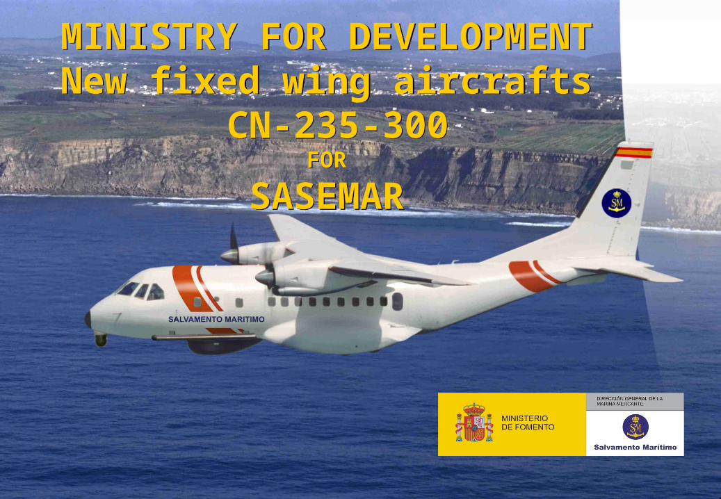
MINISTRY FOR DEVELOPMENTNew fixed wing aircrafts
CN-235-300FOR
SASEMAR
MINISTRY FOR DEVELOPMENTNew fixed wing aircrafts
CN-235-300FOR
SASEMAR

Pág 2
MARITIME SURVEILLANCE MISSIONS
Pág 2
Search and Rescue (SAR)Safety at SeaEnvironmental Protection and SurveillanceMaritime Traffic Monitoring
Missions to be performed by
SASEMAR
Pág 3
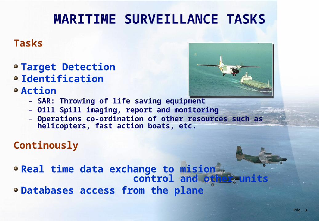
MARITIME SURVEILLANCE TASKS
Tasks
Target DetectionIdentification Action
– SAR: Throwing of life saving equipment – Oill Spill imaging, report and monitoring – Operations co-ordination of other resources such as
helicopters, fast action boats, etc.
Continously
Real time data exchange to mision control and other unitsDatabases access from the plane
Pág. 3
Pág 4
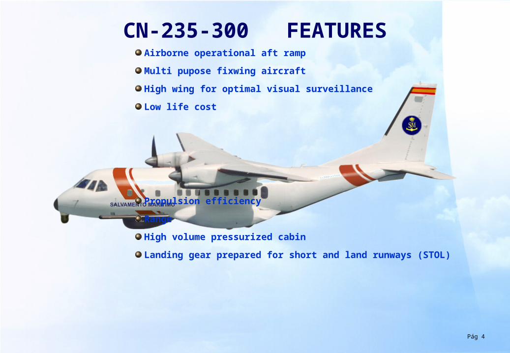
CN-235-300 FEATURESAirborne operational aft ramp
Multi pupose fixwing aircraft
High wing for optimal visual surveillance
Low life cost
Propulsion efficiency
Range
High volume pressurized cabin
Landing gear prepared for short and land runways (STOL)
Pág 5
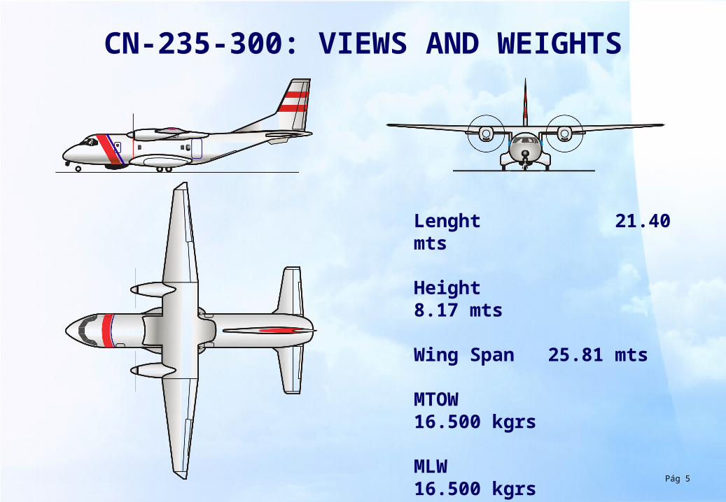
CN-235-300: VIEWS AND WEIGHTS
Lenght 21.40 mts
Height 8.17 mts
Wing Span 25.81 mts
MTOW 16.500 kgrs
MLW 16.500 kgrs
Max. Fuel 5.264 lts
Pág 6
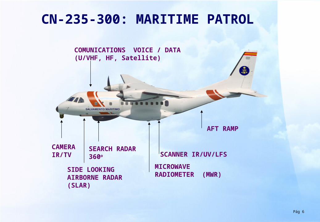
CN-235-300: MARITIME PATROL
CAMERA IR/TV
SEARCH RADAR 360o
COMUNICATIONS VOICE / DATA(U/VHF, HF, Satellite)
AFT RAMP
SIDE LOOKING AIRBORNE RADAR (SLAR)
SCANNER IR/UV/LFS
MICROWAVE RADIOMETER (MWR)
Pág 7
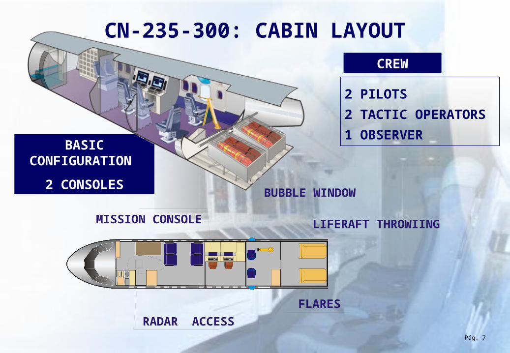
CN-235-300: CABIN LAYOUT
BUBBLE WINDOW
LIFERAFT THROWIING
FLARES
RADAR ACCESS
MISSION CONSOLE
Pág. 7
2 PILOTS
2 TACTIC OPERATORS
1 OBSERVER
CREW
BASIC CONFIGURATION
2 CONSOLES
Pág 8
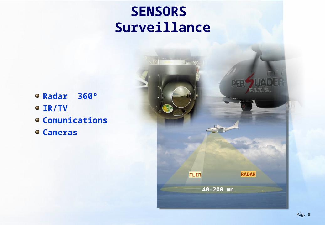
SENSORS Surveillance
RADAR
40-200 mn
Radar 360ºIR/TVComunications Cameras
FLIR
Pág. 8
Pág 9
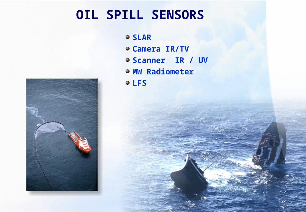
SLARCamera IR/TVScanner IR / UV MW RadiometerLFS
OIL SPILL SENSORS
Pág. 9
Pág 10
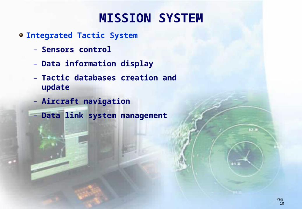
MISSION SYSTEMIntegrated Tactic System
– Sensors control
– Data information display
– Tactic databases creation and update
– Aircraft navigation
– Data link system management
Pág. 10
Pág 11
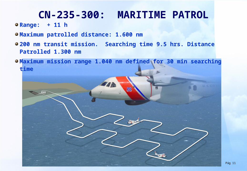
CN-235-300: MARITIME PATROLRange: + 11 h
Maximum patrolled distance: 1.600 nm
200 nm transit mission. Searching time 9.5 hrs. Distance Patrolled 1.300 nm
Maximum mission range 1.040 nm defined for 30 min searching time
Pág 12
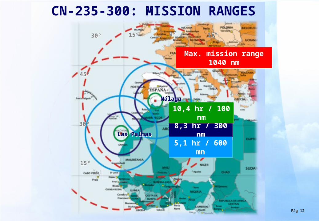
CN-235-300: MISSION RANGES
8,3 hr / 300 nm
8,3 hr / 300 nm
10,4 hr / 100 nm
10,4 hr / 100 nm
5,1 hr / 600 mn
5,1 hr / 600 mn
30º30º
45º45º
30º30º
0º0º15º15º
15º15º
Pág 12
Max. mission range1040 nm
Max. mission range1040 nm
15º15º
MálagaMálaga
Las PalmasLas Palmas
Pág 13
BASE
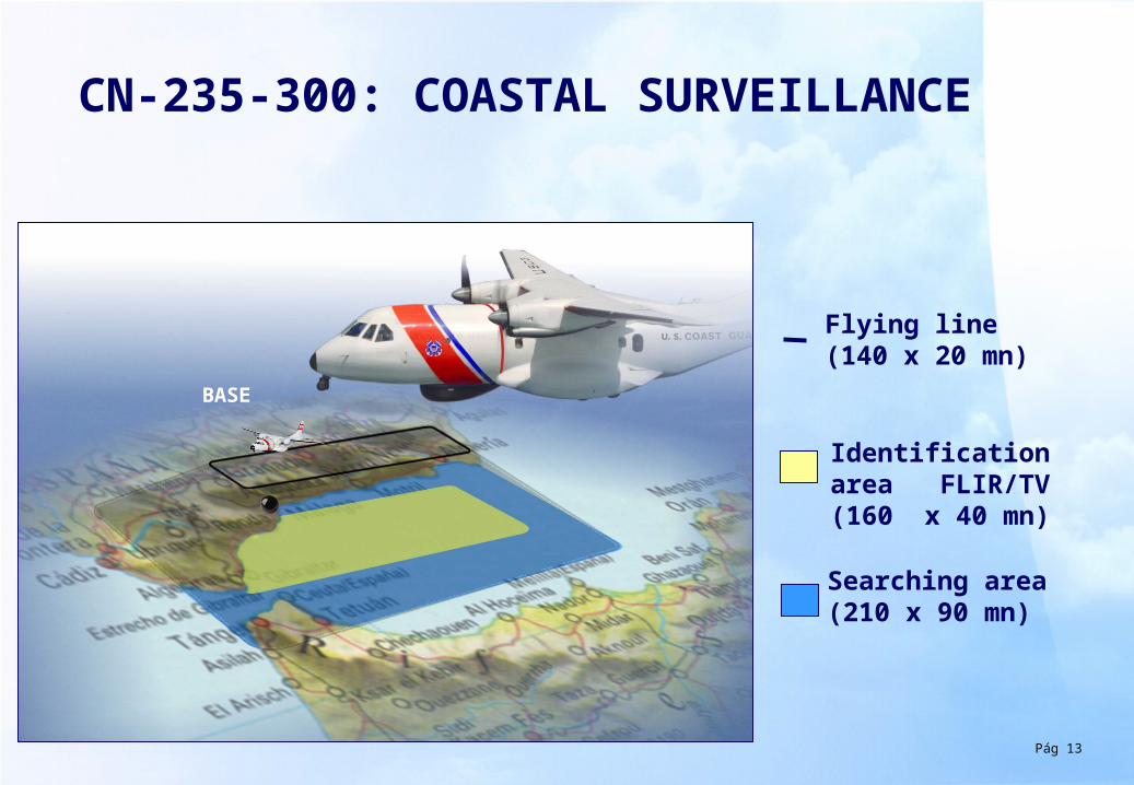
CN-235-300: COASTAL SURVEILLANCE
Flying line (140 x 20 mn)
Identification area FLIR/TV (160 x 40 mn)
Searching area (210 x 90 mn)
Pág 14
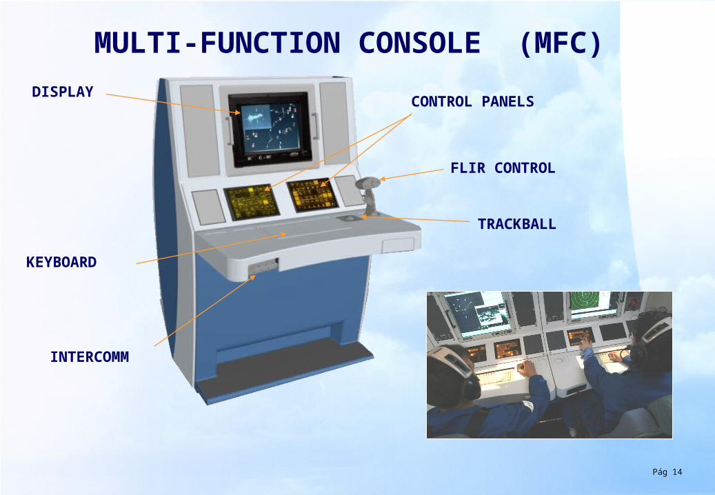
MULTI-FUNCTION CONSOLE (MFC)
DISPLAYCONTROL PANELS
KEYBOARD
TRACKBALL
FLIR CONTROL
INTERCOMM
Pág 15
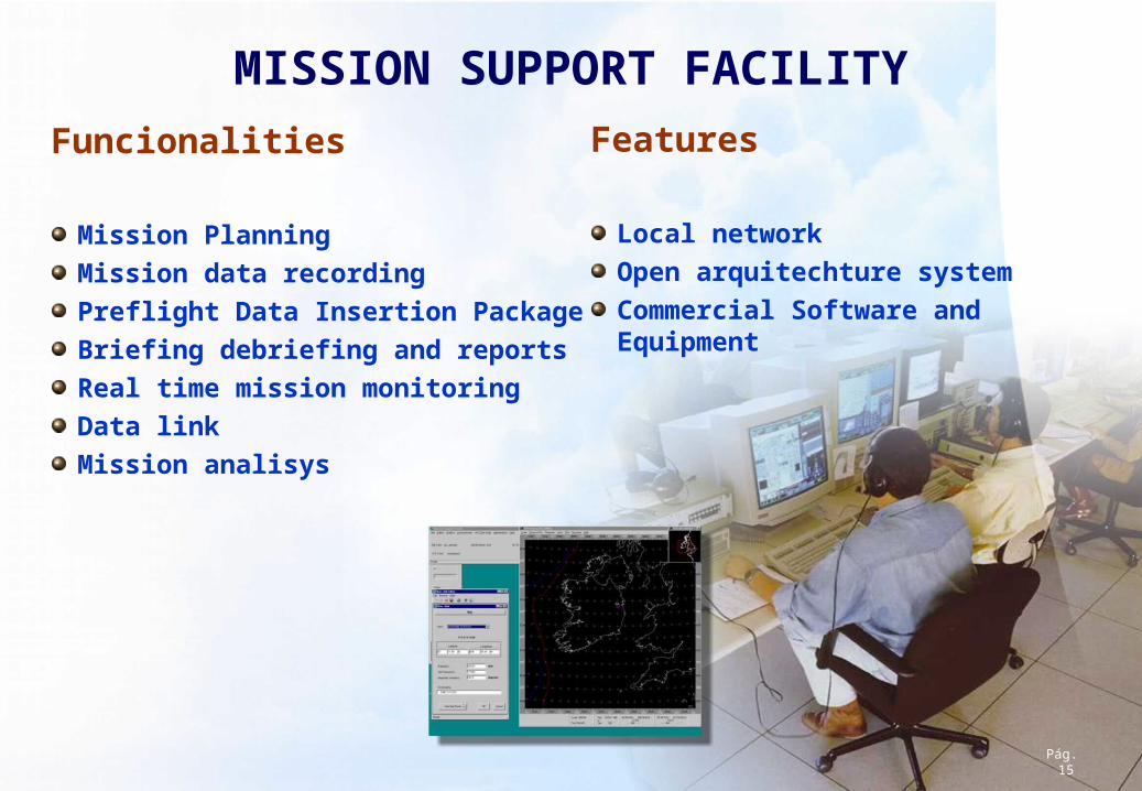
MISSION SUPPORT FACILITY
Funcionalities
Mission PlanningMission data recordingPreflight Data Insertion Package Briefing debriefing and reportsReal time mission monitoringData linkMission analisys
Features
Local networkOpen arquitechture systemCommercial Software and Equipment
Pág. 15
Pág 16