Embed Size (px)
Citation preview
PACIFIC OCEANTEACHER GUIDE
PACIFIC OCEANACTIVITIES OVERVIEW
Use this helpful overview to decide which activities to do with your students based on their grade/readiness level and the amount of time you have available.
An Introduction to the Pacific Ocean
Shake & Bake: Earthquakes and Volcanoes of the Pacific. . . . . . . . . . . . . . . . . . . . . Grades K-4Time Needed: 45 minutesLearn where volcanoes and earthquakes occur in the Pacific by acting out these geological events on the giant map.
Simon Says….Explore!. . . . . . . . . . . . . . . . . . . . . . . . . . . . . . . . . . . . . . . . . . . . . . . . . . . . . . . Grades K-8Time Needed: 15 minutes and up (activity is flexible as to grade level, size of group, and amount of time). Play this popular and fun game while exploring the Pacific Ocean. (Can be used as a pre-assessment or post-assessment tool.)
Trench – Trench – Rise! . . . . . . . . . . . . . . . . . . . . . . . . . . . . . . . . . . . . . . . . . . . . . . . . . . . . . . Grades 3-5Time Needed: 45 minutesPlay a fun game that locates the trenches of the Pacific and the directional movement of the oceanic plates.
Animals & Plants of the Pacific. . . . . . . . . . . . . . . . . . . . . . . . . . . . . . . . . . . . . . . . . . . . . . . Grades 3-5Time Needed: 45 minutesPlace photo cards of marine iguanas, blue fin tunas, giant squid and twenty-one other animals and plants on their correct habitat in this fun game in which you learn how animals and plants adapt to their habitats.
Cities in the Sea: Coral Reefs of the Pacific. . . . . . . . . . . . . . . . . . . . . . . . . . . . . . . . . . . Grades 3-8Time Needed: 45 minutesExplore the biodiversity of the Great Barrier, Galápagos, Hawaiian, and Kingman reefs by handling models, plotting colorful photo cards, and understanding the relationships between organisms in reef ecosystems.
Ocean Commotion: Currents and Gyres. . . . . . . . . . . . . . . . . . . . . . . . . . . . . . . . . . . . . . Grades 3-8Time Needed: 45 minutesCatch a wave! Act out the currents and gyres of the Pacific Ocean and see how the Pacific Garbage Patch formed.
The Deep and the Dark: Trenches of the Pacific. . . . . . . . . . . . . . . . . . . . . . . . . . . . . . . Grades 3-8Time Needed: 45 minutesDive deep into the dark floor of the Pacific and build block models demonstrating the depth of sixteen trenches. Compare the tallest ocean mountain to Mt. Everest.
Additional Activities. . . . . . . . . . . . . . . . . . . . . . . . . . . . . . . . . . . . . . . . . . . . . . . . . . . . . . . . . Grades K-8There’s so much more you can do. We invite you to try some of these, or use the props and cards provided to create your own!
Pacific Ocean Features
Glossary
Activities developed by by Mary Cahill, Dianne Lebryck, and Dan Beaupré.
PACIFIC OCEANINTRODUCTION
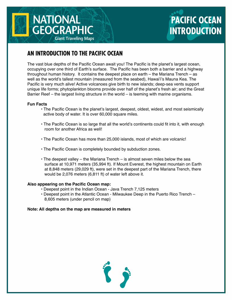
AN INTRODUCTION TO THE PACIFIC OCEAN
The vast blue depths of the Pacific Ocean await you! The Pacific is the planet’s largest ocean, occupying over one third of Earth’s surface. The Pacific has been both a barrier and a highway throughout human history. It contains the deepest place on earth – the Mariana Trench – as well as the world’s tallest mountain (measured from the seabed), Hawai’i’s Mauna Kea. The Pacific is very much alive! Active volcanoes give birth to new islands; deep-sea vents support unique life forms; phytoplankton blooms provide over half of the planet’s fresh air; and the Great Barrier Reef – the largest living structure in the world – is teeming with marine organisms.
Fun Facts • The Pacific Ocean is the planet’s largest, deepest, oldest, widest, and most seismically active body of water. It is over 60,000 square miles.
• The Pacific Ocean is so large that all the world’s continents could fit into it, with enough room for another Africa as well!
• The Pacific Ocean has more than 25,000 islands, most of which are volcanic!
• The Pacific Ocean is completely bounded by subduction zones.
• The deepest valley – the Mariana Trench – is almost seven miles below the sea surface at 10,971 meters (35,994 ft). If Mount Everest, the highest mountain on Earth at 8,848 meters (29,029 ft), were set in the deepest part of the Mariana Trench, there would be 2,076 meters (6,811 ft) of water left above it.
Also appearing on the Pacific Ocean map: • Deepest point in the Indian Ocean - Java Trench 7,125 meters • Deepest point in the Atlantic Ocean - Milwaukee Deep in the Puerto Rico Trench – 8,605 meters (under pencil on map)
Note: All depths on the map are measured in meters
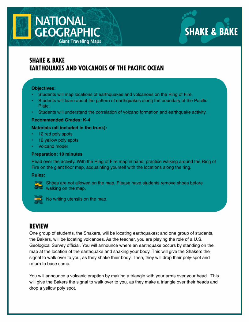
SHAKE & BAKEEARTHQUAKES AND VOLCANOES OF THE PACIFIC OCEAN
REVIEWOne group of students, the Shakers, will be locating earthquakes; and one group of students, the Bakers, will be locating volcanoes. As the teacher, you are playing the role of a U.S. Geological Survey official. You will announce where an earthquake occurs by standing on the map at the location of the earthquake and shaking your body. This will give the Shakers the signal to walk over to you, as they shake their body. Then, they will drop their poly-spot and return to base camp.
You will announce a volcanic eruption by making a triangle with your arms over your head. This will give the Bakers the signal to walk over to you, as they make a triangle over their heads and drop a yellow poly spot.
SHAKE & BAKE
Objectives: • Students will map locations of earthquakes and volcanoes on the Ring of Fire.• Students will learn about the pattern of earthquakes along the boundary of the Pacific
Plate.• Students will understand the correlation of volcano formation and earthquake activity. Recommended Grades: K-4Materials (all included in the trunk): • 12 red poly spots• 12 yellow poly spots• Volcano modelPreparation: 10 minutesRead over the activity. With the Ring of Fire map in hand, practice walking around the Ring ofFire on the giant floor map, acquainting yourself with the locations along the ring.Rules:
Shoes are not allowed on the map. Please have students remove shoes before walking on the map.
No writing utensils on the map.
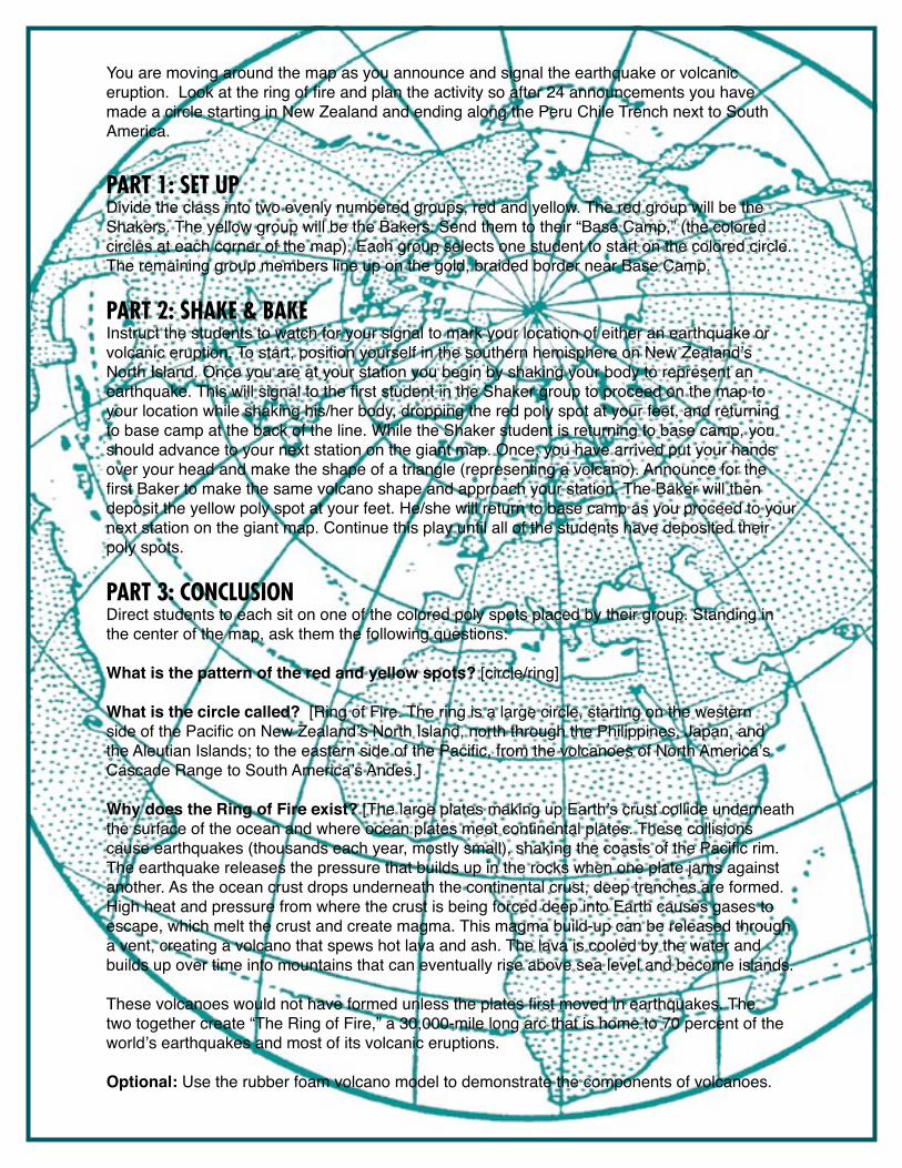
You are moving around the map as you announce and signal the earthquake or volcanic eruption. Look at the ring of fire and plan the activity so after 24 announcements you have made a circle starting in New Zealand and ending along the Peru Chile Trench next to South America.
PART 1: SET UPDivide the class into two evenly numbered groups, red and yellow. The red group will be the Shakers. The yellow group will be the Bakers. Send them to their “Base Camp,” (the colored circles at each corner of the map). Each group selects one student to start on the colored circle. The remaining group members line up on the gold, braided border near Base Camp.
PART 2: SHAKE & BAKEInstruct the students to watch for your signal to mark your location of either an earthquake or volcanic eruption. To start, position yourself in the southern hemisphere on New Zealand’s North Island. Once you are at your station you begin by shaking your body to represent an earthquake. This will signal to the first student in the Shaker group to proceed on the map to your location while shaking his/her body, dropping the red poly spot at your feet, and returning to base camp at the back of the line. While the Shaker student is returning to base camp, you should advance to your next station on the giant map. Once, you have arrived put your hands over your head and make the shape of a triangle (representing a volcano). Announce for the first Baker to make the same volcano shape and approach your station. The Baker will then deposit the yellow poly spot at your feet. He/she will return to base camp as you proceed to your next station on the giant map. Continue this play until all of the students have deposited their poly spots.
PART 3: CONCLUSIONDirect students to each sit on one of the colored poly spots placed by their group. Standing in the center of the map, ask them the following questions: What is the pattern of the red and yellow spots? [circle/ring]
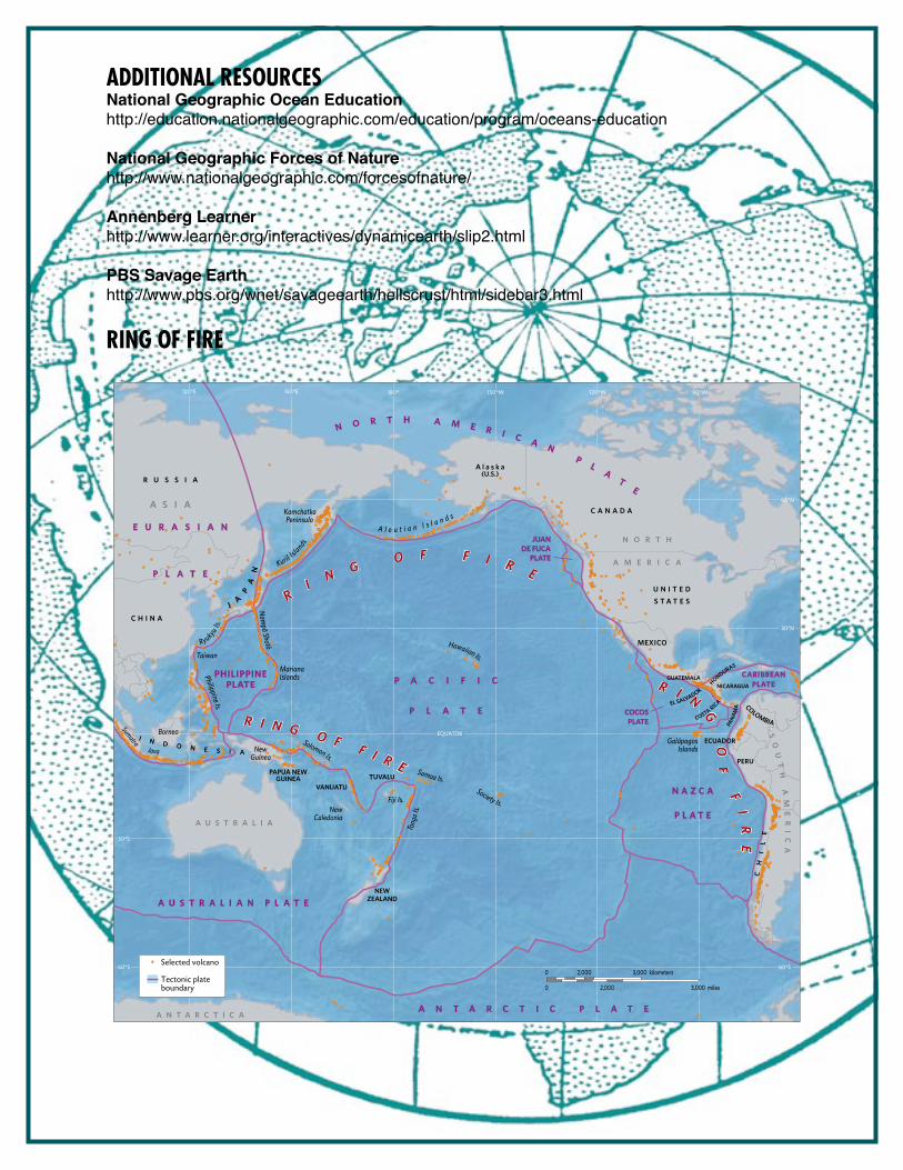
What is the circle called? [Ring of Fire. The ring is a large circle, starting on the western side of the Pacific on New Zealand’s North Island, north through the Philippines, Japan, and the Aleutian Islands; to the eastern side of the Pacific, from the volcanoes of North America’s Cascade Range to South America’s Andes.]
Why does the Ring of Fire exist? [The large plates making up Earth’s crust collide underneath the surface of the ocean and where ocean plates meet continental plates. These collisions cause earthquakes (thousands each year, mostly small), shaking the coasts of the Pacific rim. The earthquake releases the pressure that builds up in the rocks when one plate jams against another. As the ocean crust drops underneath the continental crust, deep trenches are formed. High heat and pressure from where the crust is being forced deep into Earth causes gases to escape, which melt the crust and create magma. This magma build-up can be released through a vent, creating a volcano that spews hot lava and ash. The lava is cooled by the water and builds up over time into mountains that can eventually rise above sea level and become islands.
These volcanoes would not have formed unless the plates first moved in earthquakes. The two together create “The Ring of Fire,” a 30,000-mile long arc that is home to 70 percent of the world’s earthquakes and most of its volcanic eruptions.
Optional: Use the rubber foam volcano model to demonstrate the components of volcanoes.
ADDITIONAL RESOURCESNational Geographic Ocean Educationhttp://education.nationalgeographic.com/education/program/oceans-education
National Geographic Forces of Naturehttp://www.nationalgeographic.com/forcesofnature/
Annenberg Learnerhttp://www.learner.org/interactives/dynamicearth/slip2.html
PBS Savage Earthhttp://www.pbs.org/wnet/savageearth/hellscrust/html/sidebar3.html
RING OF FIRE
Hawaiian Is.
A l e u t i a n I s l a n d s
Taiwan
BorneoSumatra
Java
MarianaIslands
Solomon Is.
NewCaledonia
Fiji Is.
GalápagosIslandsNew
Guinea
Philippine Is.
KamchatkaPeninsula
Society Is.
Samoa Is.
Nampo Shoto
Tong
a Is.
Ryukyu Is.
Kuril Islands
P A C I F I C
P L A T E
N A Z C A
P L A T E
A N T A R C T I C P L A T E
JUANDE FUCA
PLATE
A U S T R A L I A N P L A T E
PHILIPPINEPLATE
COCOSPLATE
N O R T H A M E R I C A N P
LA
TE
E U R A S I A N
P L A T E
CARIBBEANPLATE
RI N G O F F I R E
R I N
G
OF
F
IR
E
R I N G O F F I R E
R U S S I A
C H I N A
JA
PA
N
NEWZEALAND
U N I T E D
S T A T E S
A l a s k a(U.S.)
C A N A D A
GUATEMALA
EL SALVADOR
HONDURAS
NICARAGUA
COSTA RICA PA
NAM
A COLOMBIA
ECUADOR
VANUATU
PAPUA NEWGUINEA
I N D O N E S I A
TUVALU
MEXICO
PERU C
HI
LE
A U S T R A L I A
SO
UT
H
AM
ER
IC
A
A N T A R C T I C A
A S I A
N O R T H
A M E R I C A
30°S
60°S
EQUATOR
120°E 150°E 180° 150°W 120°W 90°W
60°N
30°N
60°SSelected volcano
Tectonic plateboundary
0
0 3,000 miles2,000
3,000 kilometers2,000
SIMON SAYS...EXPLORE!
INTRODUCTIONDepending on experience and prior knowledge, students may need a general introduction or tour of the Pacific Ocean map. This teacher-led activity can serve as an introduction or a review of some of the major geological features that the game will require students to visit. Walk over the map and show (or have selected students locate and stand on) the following:
SIMON SAYS…EXPLORE!
Objectives: • Students will utilize movement and map reading skills to locate and identify major
physical and geological features in the Pacific OceanRecommended Grades: K-8Materials (all included in the trunk): • Colored lanyards (red, blue, green, yellow)• Hourglass timerPreparation: 5 minutes• Choose the most appropriate Simon Says statement card for your group size and
familiarize yourself with statements appropriate for the student grade level.Rules:
Shoes are not allowed on the map. Please have students remove shoes before walking on the map.
No writing utensils on the map.
Galápagos IslandsHawaiian IslandsLine IslandsMariana TrenchChile Trench
Arctic CircleTropic of CancerTropic of CapricornEquator
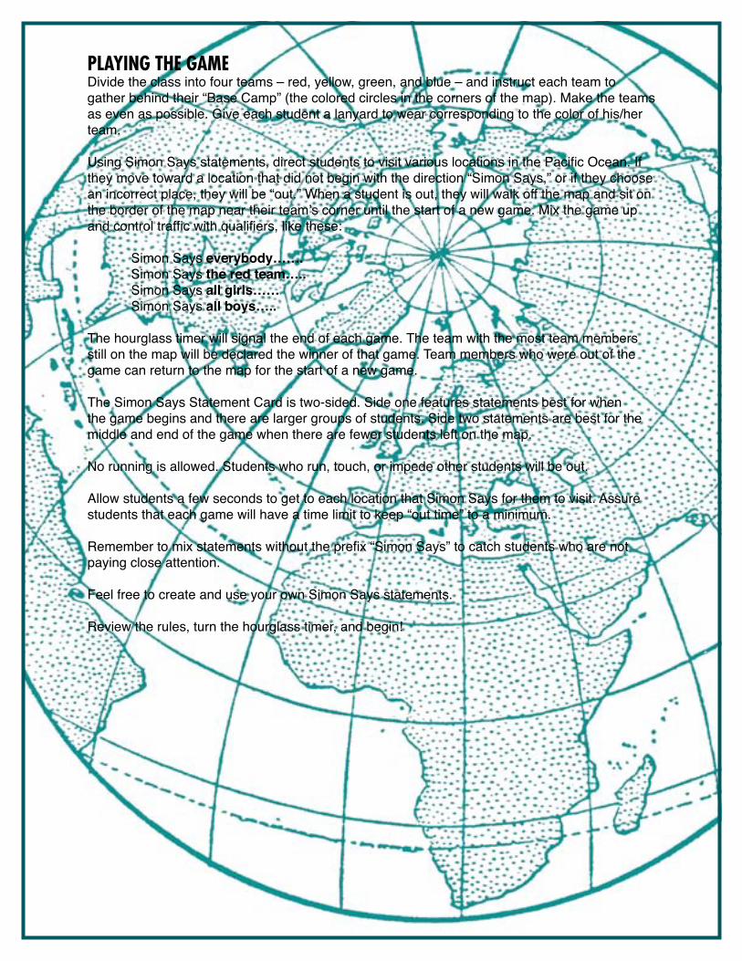
PLAYING THE GAMEDivide the class into four teams – red, yellow, green, and blue – and instruct each team to gather behind their “Base Camp” (the colored circles in the corners of the map). Make the teams as even as possible. Give each student a lanyard to wear corresponding to the color of his/her team.
Using Simon Says statements, direct students to visit various locations in the Pacific Ocean. If they move toward a location that did not begin with the direction “Simon Says,” or if they choose an incorrect place, they will be “out.” When a student is out, they will walk off the map and sit on the border of the map near their team’s corner until the start of a new game. Mix the game up and control traffic with qualifiers, like these:
Simon Says everybody……. Simon Says the red team….. Simon Says all girls…… Simon Says all boys…..
The hourglass timer will signal the end of each game. The team with the most team members still on the map will be declared the winner of that game. Team members who were out of the game can return to the map for the start of a new game.
The Simon Says Statement Card is two-sided. Side one features statements best for when the game begins and there are larger groups of students. Side two statements are best for the middle and end of the game when there are fewer students left on the map.
No running is allowed. Students who run, touch, or impede other students will be out.
Allow students a few seconds to get to each location that Simon Says for them to visit. Assure students that each game will have a time limit to keep “out time” to a minimum.
Remember to mix statements without the prefix “Simon Says” to catch students who are not paying close attention.
Feel free to create and use your own Simon Says statements.
Review the rules, turn the hourglass timer, and begin!
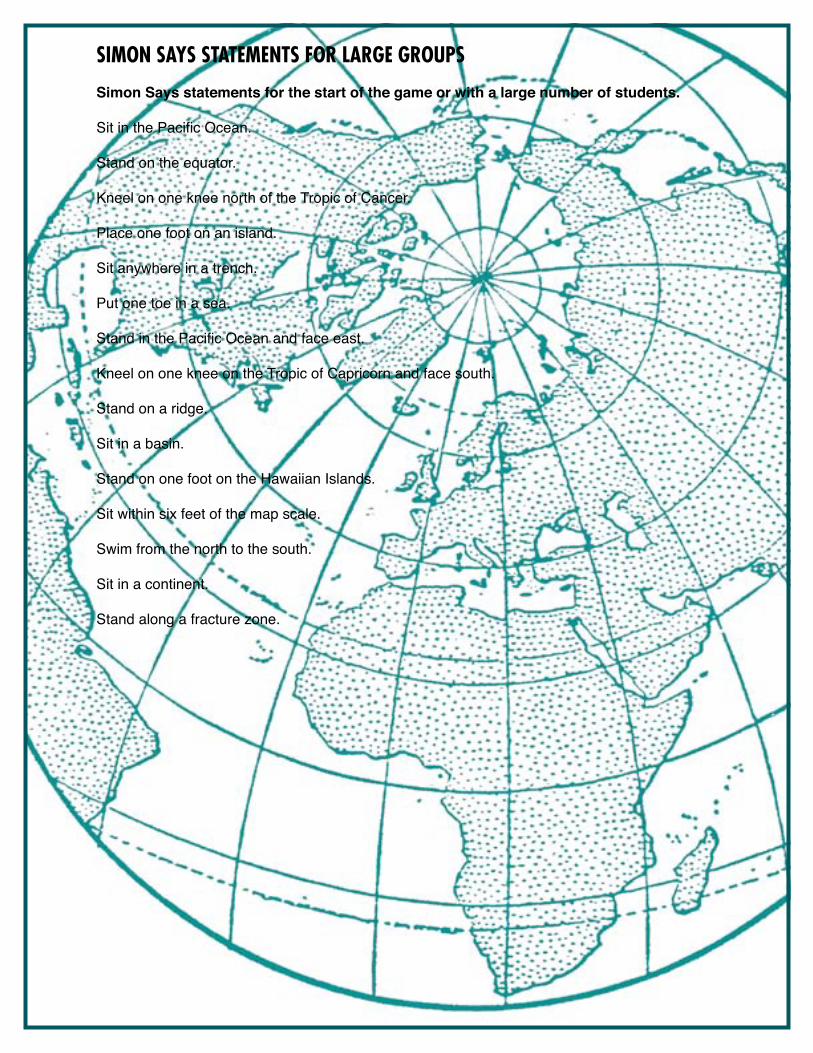
SIMON SAYS STATEMENTS FOR LARGE GROUPS
Simon Says statements for the start of the game or with a large number of students.
Sit in the Pacific Ocean.
Stand on the equator.
Kneel on one knee north of the Tropic of Cancer.
Place one foot on an island.
Sit anywhere in a trench.
Put one toe in a sea.
Stand in the Pacific Ocean and face east.
Kneel on one knee on the Tropic of Capricorn and face south.
Stand on a ridge.
Sit in a basin.
Stand on one foot on the Hawaiian Islands.
Sit within six feet of the map scale.
Swim from the north to the south.
Sit in a continent.
Stand along a fracture zone.
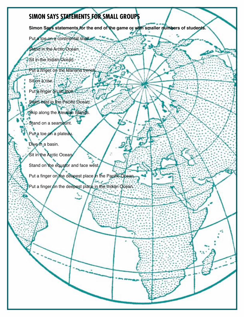
SIMON SAYS STATEMENTS FOR SMALL GROUPS
Simon Says statements for the end of the game or with smaller numbers of students.
Put a toe on a continental shelf.
Stand in the Arctic Ocean.
Sit in the Indian Ocean.
Put a finger on the Mariana trench.
Sit on a rise.
Put a finger on an atoll.
Swim east in the Pacific Ocean.
Skip along the Aleutian Islands.
Stand on a seamount.
Put a toe on a plateau.
Dive in a basin.
Sit in the Arctic Ocean.
Stand on the equator and face west.
Put a finger on the deepest place in the Pacific Ocean.
Put a finger on the deepest place in the Indian Ocean.
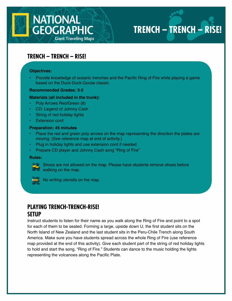
TRENCH – TRENCH – RISE!
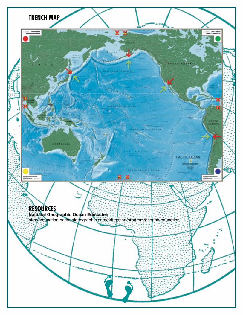
PlayINg TRENCH-TRENCH-RISE!SETUPInstruct students to listen for their name as you walk along the Ring of Fire and point to a spot for each of them to be seated. Forming a large, upside down U, the first student sits on the North Island of New Zealand and the last student sits in the Peru-Chile Trench along South America. Make sure you have students spread across the whole Ring of Fire (use reference map provided at the end of this activity). Give each student part of the string of red holiday lights to hold and start the song, “Ring of Fire.” Students can dance to the music holding the lights representing the volcanoes along the Pacific Plate.
TRENCH – TRENCH – RISE!
Objectives: • Provide knowledge of oceanic trenches and the Pacific Ring of Fire while playing a game
based on the Duck-Duck-Goose classic.Recommended Grades: 3-5Materials (all included in the trunk): • Poly Arrows Red/Green (8) • CD: Legend of Johnny Cash• String of red holiday lights • Extension cordPreparation: 45 minutes• Place the red and green poly arrows on the map representing the direction the plates are
moving. (See reference map at end of activity.) • Plug in holiday lights and use extension cord if needed. • Prepare CD player and Johnny Cash song “Ring of Fire” Rules:
Shoes are not allowed on the map. Please have students remove shoes before walking on the map.
No writing utensils on the map.
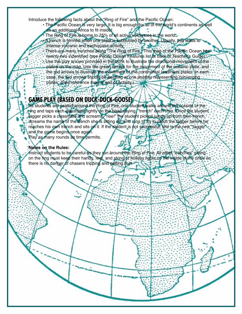
Introduce the following facts about the “Ring of Fire” and the Pacific Ocean: • The Pacific Ocean is very large. It is big enough for all of the world’s continents as well as an additional Africa to fit inside! • The Ring of Fire is home to 75% of all active volcanoes in the world. • A trench is formed when one plate is subducted by another. Usually, this leads to intense volcanic and earthquake activity. • There are many trenches along “The Ring of Fire.” This map of the Pacific Ocean has twenty-two indentified (see Pacific Ocean Features list at back of Teacher’s Guide). • Use the poly arrows provided in the trunk to illustrate the directional movement of the plates on the map. Use the green arrows for the movement of the oceanic plate, and the red arrows to illustrate the movement of the continental landmass plates. In each case, the two arrows should be pointing at one another representing converging plates. (See reference map at end of activity.)
gamE Play (baSEd oN dUCk-dUCk-gooSE)As students are seated around the Ring of Fire, one student walks around the outside of the ring and taps each classmate lightly on the head saying, “trench” each time. Once the student tagger picks a classmate and screams, “rise!” the student picked jumps up from their trench, screams the name of the trench she is sitting on, and runs to try to catch the tagger before he reaches his own trench and sits on it. If the student is not successful, she is the new “tagger” and the game begins once again. Play as many rounds as time permits.
Notes on the Rules:Instruct students to be careful as they run around the Ring of Fire. All other “trenches” sitting on the ring must keep their hands, feet, and string of holiday lights on the inside of the circle so there is no danger of chasers tripping and getting hurt.
TRENCH maP
RESoURCESNational Geographic Ocean Educationhttp://education.nationalgeographic.com/education/program/oceans-education
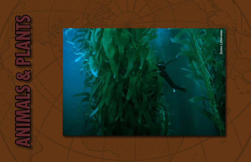
ANIMALS & PLANTS OF THE PACIFIC OCEAN
INTrOduCTION & STudENT PrEPArATIONStudents may first need a general introduction or tour of the Pacific Ocean map. This teacher-led activity can serve as an introduction or review of some of the major physical features of the Pacific Ocean. Walk over the map and show (or direct selected students to stand on) the following:
Trench: a deep, dark and cold area, usually long and V-shaped.Fracture Zone: a narrow rift (opening) on the ocean floor. Note the colors on the map represent ocean depth. Shallow water is light; deep water is dark blue. - Direct one-third of the class to stand on white areas they find. These regions are coastal areas, such as Australia’s Great Barrier Reef. - Direct one-third of the class to kneel in the deep ocean basins. This represents the habitat of the open ocean. - Direct one-third of the class to sit in the dark blue, representing the trenches and other deep areas.
ANIMALS & PLANTSOF THE PACIFIC OCEAN
Objectives: • Students will learn about several animals and plants that live in the Pacific Ocean. • Students will connect animals and plants to the specific habitats in which they live. Recommended Grades: 3-5Materials (all included in the trunk): • 24 small colored poly spots (7 brown, 4 yellow, 7 orange, 6 green)• 24 menu holders• 24 Animals & Plants photo cardsPreparation: 10 minutes• Place the 24 colored poly spots on the specific map locations (provided on the map key)• Place one menu holder on top of each poly spot• Review photo cards to become acquainted with the animals and plants and their habitatsRules:
Shoes are not allowed on the map. Please have students remove shoes before walking on the map.
No writing utensils on the map.
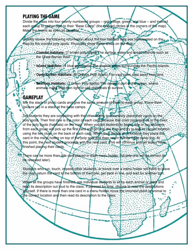
PLAyINg THE gAMEDivide the class into four evenly numbered groups – red, yellow, green, and blue – and instruct each group to gather next to their “Base Camp” (the colored circles in the corners of the map). Make the teams as even as possible.
Quickly review the following information about the four habitats they see represented on the map by the colored poly spots. Physically show these areas on the map.
• Coastal Habitats: (7 brown poly spots) The surface water and areas offshore such as the Great Barrier Reef.
• Island Habitats: (4 blue poly spots) The shallow areas surrounding the Pacific Islands.
• Open Ocean Habitats: (6 Orange Poly Spots) The vast open area away from land.
• Seafloor Habitats: (7 Green Poly Spots) The deepest part of the ocean, where animals make their own light or use chemicals to survive.
gAMEPLAy Mix the stack of photo cards and give the same amount of them to each group. Place them (picture up) in a stack at the base camps.
Tell students they are competing with the other teams to accurately place their cards on the poly spots. Their first clue is the color of each card,because that color corresponds to the color of the poly spots (habitats) on the map. When you tell students to begin, one or two students from each group will pick up the first card and go onto the map and try to find its correct location using the two clues on the back of each card. When they decide on a location they place the card in the menu holder on top of the poly spot and then return to their base camp line. At this point, the next student proceeds with the next card. This will continue until all teams have finished placing their cards.
There can be more than one card placed in each menu holder, but only one will be correct (to be revealed later).
Students who run, touch, impede other students, or knock over a menu holder will have to leave the map, return the card to the bottom of their pile, get back in line, and wait for another turn.
When all the groups have finished, ask individual students to sit by each animal or plant and read its description out loud to the class. If pressed for time, choose to read the descriptions yourself. If there is more than one card in a menu holder move the incorrect plant or animal to the correct location and then read its description to the class.

In conclusion, ask the students these questions: • Is there a pattern to where the animals are and where they are not? • Why do these patterns exist? [This may lead to a discussion about the amount of light and temperature animals need for survival. In general, animals will tend to live and survive in areas that fit their physical strengths and adaptations. For example, organisms that rely on plants for their food will live in shallow areas where plants can reach sunlight. Organisms that are designed to be fast swimmers will be best suited in the open ocean so they can swim fast to catch their prey. Organisms that live deep in the ocean have adapted by generating their own light (called bioluminescence), or possibly surviving on chemicals that come from deep hydrothermal vents.]
Give students time to explore the map with all the plants and animals displayed before collecting the photo cards and menu holders.
rESOurCESNational Geographic Ocean Educationhttp://education.nationalgeographic.com/education/program/oceans-education
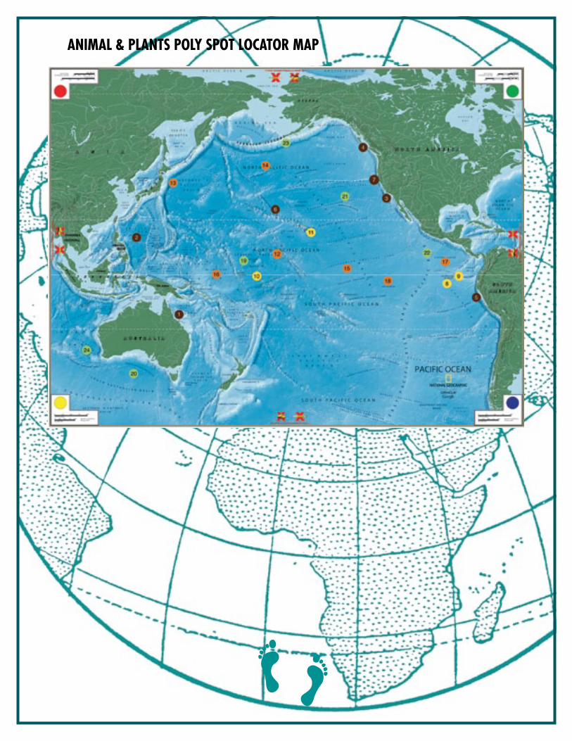
ANIMAL & PLANTS POLy SPOT LOCATOr MAP
CITIES IN THE SEA: CORALS REEFS OF THE PACIFIC
OvERvIEwStudents will study four coral reef ecosystems found in the Pacific Ocean. By observing the location and a sample of organisms found living around the reef, students will gain an understanding of coral reef biodiversity.
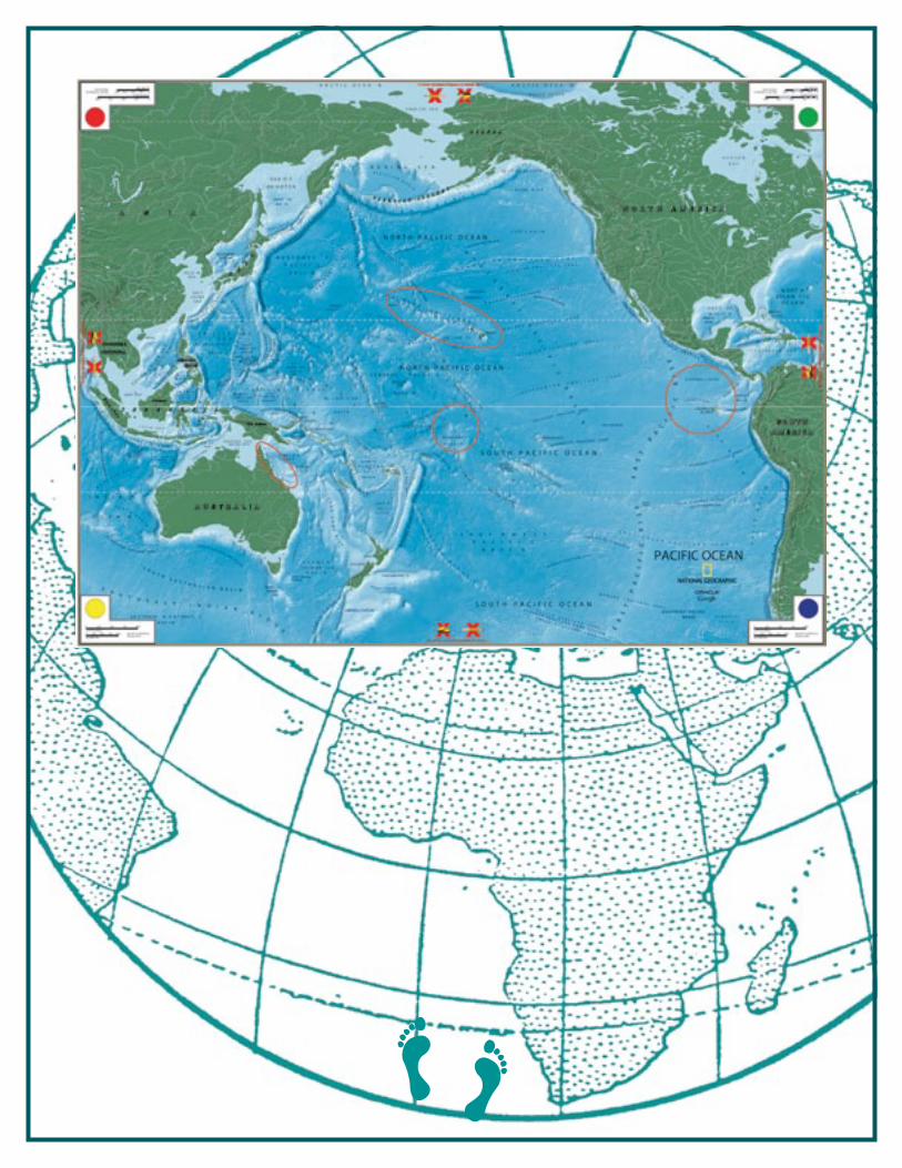
PART 1Gather students on the yellow braid edge around the map and have them observe the location of the four pieces of fringe on the map. They may be able to guess what the four pieces of fringe represent – coral reefs.
Ask students to note the location of the four reefs that will be studied in relation to the equator (near warmer water) and in relation to land/islands (in shallow water).
Divide the students into four evenly numbered groups and direct each group to one of the four reefs to study that reef in detail. Students should sit on the map in a circle around the coral reef they are studying.
CITIES IN THE SEA: CORALS REEFS OF THE PACIFIC
Objectives: • Students will locate coral reefs in the Pacific Ocean• Students will discover the biodiversity of a coral reef ecosystem• Students will understand the interrelationship of organisms living in a reef ecosystem Recommended Grades: 3-8Materials (all included in the trunk): • 4 pieces of red fringe • 4 Coral models • Coral Reef photo cards – large (4) • Coral Reef photo cards – small (48)• Menu holders (52)Preparation: 45 minutes• Read over the activity• Plot pieces of fringe for the four reef ecosystems: Great Barrier Reef, Kingman Reef,
Galápagos Islands, and Hawaiian Islands students will study: (see reference map at end of activity)
• Place reef cards, menu holders, and coral models near each reef ecosystemRules:
Shoes are not allowed on the map. Please have students remove shoes before walking on the map.
No writing utensils on the map.
PART 2 Instruct each group to do the following:
• One student reads to the group the description card for the reef so everybody understands its location. • Taking turns, each student picks up a reef card and a menu holder, reads aloud the name, and places the card around the reef. Students continue through the stack of coral reef cards until all cards have been read and placed on the reef. • Have students consider the relationship the organisms have to one another. - Are there organisms that are predators? - Which organisms are prey? - Do some organisms help each other?
PART 3Direct students to rotate as a group to each coral reef plotted on the map. As they visit each reef for five to ten minutes, ask them to think about the following questions:
• Which reef is the largest? [Great Barrier Reef] • Which reef is closest to land? [All are about equal distances from various locations along the shore. The Great Barrier Reef is closest to a continent. Kingman reef has the smallest amount of land near it; therefore it is considered one of the most pristine reefs.] • Is there particular organism found at each reef? [Zooxanthallae] • What is the top predator at each reef? [Sharks and large fish.] • What are similarities between all the coral reefs? [Great Barrier Reef and Galápagos Islands are closer to continents. Hawaiian reefs are the furthest from the equator.] • What are some differences?
After the students have rotated through all the coral reefs, direct them to sit around the edge of the giant map and share their observations. Bring to the students’ attention the relationship between coral animals and the zooxanthellae living inside them.
RESOURCESCoral Reef Alliancehttp://www.coral.org/resources/more_online_resources/#maps
National Geographichttp://education.nationalgeographic.com/education/program/oceans-educationhttp://ngm.nationalgeographic.com/ngm/0101/feature2/index.htmlhttp://news.nationalgeographic.com/news/2003/07/0714_030714_hawaiicoral.htmlhttp://ngm.nationalgeographic.com/2008/07/kingman-reef/warne-text
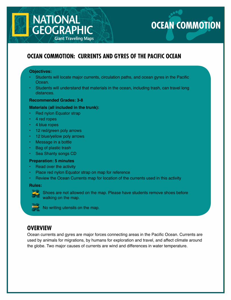
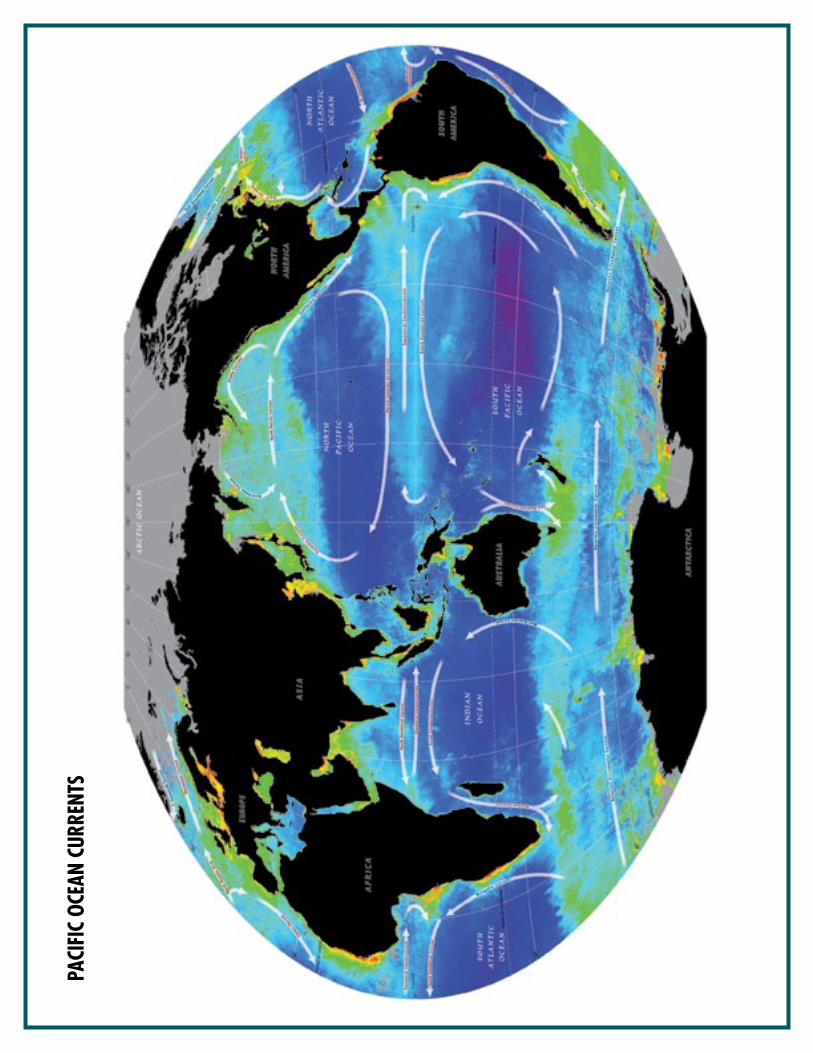
OCEAN COMMOTION: CURRENTS AND GYRES OF THE PACIFIC OCEAN
OvERvIEwOcean currents and gyres are major forces connecting areas in the Pacific Ocean. Currents are used by animals for migrations, by humans for exploration and travel, and affect climate around the globe. Two major causes of currents are wind and differences in water temperature.
OCEAN COMMOTION
Objectives: • Students will locate major currents, circulation paths, and ocean gyres in the Pacific
Ocean.• Students will understand that materials in the ocean, including trash, can travel long
distances.Recommended Grades: 3-8Materials (all included in the trunk): • Red nylon Equator strap • 4 red ropes • 4 blue ropes • 12 red/green poly arrows• 12 blue/yellow poly arrows• Message in a bottle• Bag of plastic trash• Sea Shanty songs CDPreparation: 5 minutes• Read over the activity• Place red nylon Equator strap on map for reference• Review the Ocean Currents map for location of the currents used in this activityRules:
Shoes are not allowed on the map. Please have students remove shoes before walking on the map.
No writing utensils on the map.
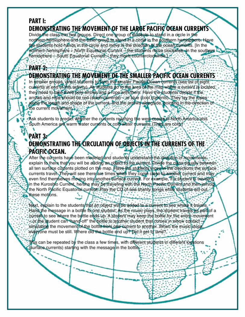
PART I: DEMONSTRATING THE MOvEMENT OF THE lARGE PACIFIC OCEAN CURRENTSDivide the class into two groups. Direct one group of students to stand in a circle in the northern hemisphere and the other group to stand in a circle in the southern hemisphere. Have the students hold hands in the circle and move in the direction of the ocean currents. [In the northern hemisphere – North Equatorial Current – the students move clockwise. In the southern hemisphere – South Equatorial Current – they move counterclockwise.]
PART 2: DEMONSTRATING THE MOvEMENT OF THE SMAllER PACIFIC OCEAN CURRENTS In smaller groups, direct students to form the smaller Pacific Ocean currents (see list of eight currents at end of this activity). As students go to the area of the map where a current is located, they need to take three poly arrows and a rope with them. Have the students decide if the arrows and rope should be red (warm currents) – or blue (cool currents). They lay the ropes along the length and shape of the current, and the arrows alongside, pointing in the direction of the current movement.
Ask students to predict whether the currents reaching the west coasts of North America and South America are warm water currents or cold water currents. [They are cold.]
PART 3: DEMONSTRATING THE CIRCUlATION OF ObjECTS IN THE CURRENTS OF THE PACIFIC OCEAN. After the currents have been modeled and students understand the direction of movements, explain to them that you will be adding an object to the current. Divide the class equally between all ten surface currents plotted on the map. Have the students move in the directions the surface currents travel. They will see there are times when they come close to another current and may even find themselves moving into another surface current. For example, if a student is traveling in the Kuroshio Current, he/she may be traveling with the North Pacific Current and then joining the North Pacific Equatorial current. Play the CD of sea shanty songs while students act out these motions.
Next, explain to the students that an object will be added to a current to see where it travels. Hand the message in a bottle to one student. As the music plays, the student travels as part of a current to see where the bottle ends up. A student may keep the bottle for the entire movement – or the student can “hand-off” the bottle to another student that comes in elbow contact – simulating the movement of the bottle from one current to another. When the music stops, everyone must be still. Where did the bottle end up? Did it get to land?
This can be repeated by the class a few times, with different students in different locations (surface currents) starting with the message in the bottle.
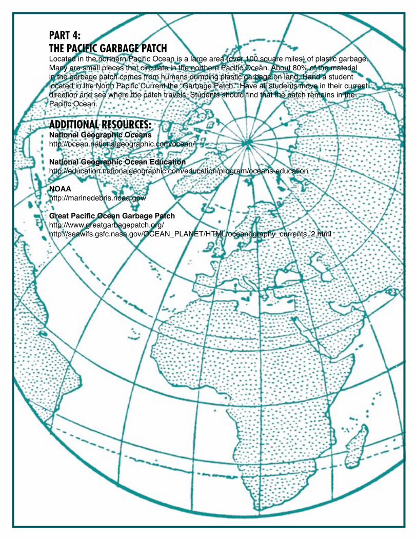
PART 4:THE PACIFIC GARbAGE PATCHLocated in the northern Pacific Ocean is a large area (over 100 square miles) of plastic garbage. Many are small pieces that circulate in the northern Pacific Ocean. About 80% of the material in the garbage patch comes from humans dumping plastic garbage on land. Hand a student located in the North Pacific Current the “Garbage Patch.” Have all students move in their current direction and see where the patch travels. Students should find that the patch remains in the Pacific Ocean.
ADDITIONAl RESOURCES: National Geographic Oceans http://ocean.nationalgeographic.com/ocean/
National Geographic Ocean Educationhttp://education.nationalgeographic.com/education/program/oceans-education
NOAAhttp://marinedebris.noaa.gov/
Great Pacific Ocean Garbage Patch http://www.greatgarbagepatch.org/http://seawifs.gsfc.nasa.gov/OCEAN_PLANET/HTML/oceanography_currents_2.html
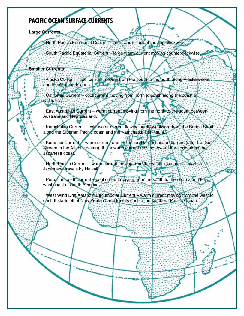
PACIFIC OCEAN SURFACE CURRENTS
Large Currents • North Pacific Equatorial Current – large warm current moving clockwise.
• South Pacific Equatorial Current – large warm current moving counterclockwise.
Smaller Currents
• Alaska Current – cool current moving from the south to the north along Alaska’s coast and the Aleutian Islands.
• California Current – cool current moving from north to south along the coast of California.
• East Australian Current – warm current moving from the north to the south between Australia and New Zealand.
• Kamchatka Current – cold-water current flowing south-westward from the Bering Strait, along the Siberian Pacific coast and the Kamchatka Peninsula.
• Kuroshio Current – warm current and the second largest ocean current (after the Gulf Stream in the Atlantic ocean). It is a warm current moving toward the north along the Japanese coast.
• North Pacific Current – warm current moving from the west to the east. It starts off of Japan and travels by Hawaii.
• Peru/Humboldt Current – cool current moving from the south to the north along the west coast of South America.
• West Wind Drift/Antarctic Circumpolar Current – warm current moving from the west to east. It starts off of New Zealand and travels east in the southern Pacific Ocean.
PACI
FIC
OCEA
N CU
RREN
TS
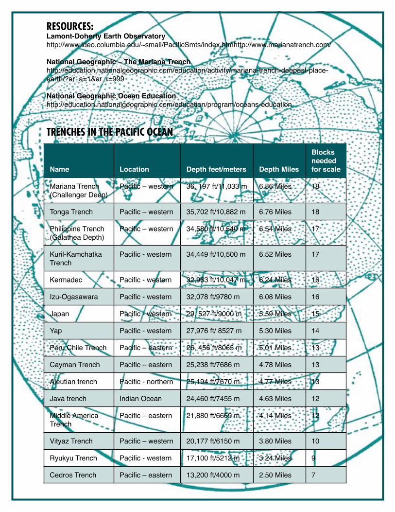
THE DEEP AND THE DARK: TRENCHES OF THE PACIFIC OCEAN
OvERvIEwIn four groups, students will locate the trenches found in the Pacific Ocean using the Trench Location cards. Once each location is established, students use blocks to build towers that symbolize how deep each trench is. Once the trenches are built, a small submarine will be placed near the tower, then a student will act as the submarine pilot and “descend” the depths of the trench all the way to the ocean floor. When finished, sixteen major trenches of the Pacific can be observed.
PART 1:Ask students to walk quietly around the map, focusing their attention on labeled features and color changes. Light colors symbolize shallow water; darker shades of blue symbolize deeper water levels. Tell the students they will be finding a number of trenches in the Pacific Ocean. Have the students walk east to west and north to south, exploring the whole map.
THE DEEP AND THE DARK
Objectives: • Students will identify and locate major trenches in the Pacific Ocean. • Students will create a scale model of ocean depths.• Students will compare ocean trenches to Hawaii’s Mauna KeaRecommended Grades: 3-8Materials (all included in the trunk): • Plastic building blocks (225) • Trench Location cards (16)• Submarine models (4)Preparation: 45 minutes• Read over the activity• Distribute Trench Location cards and submarines to each teamRules:
Shoes are not allowed on the map. Please have students remove shoes before walking on the map.
No writing utensils on the map.
PART 2: Divide the class into four teams – red, yellow, green, and blue – and instruct each team to line up on the gold-braided border near their “Base Camp” (the colored circles in the corners of the map).
Explain that each team will locate four trenches on the Pacific Ocean floor. Once each trench is located using a trench card, students will build a scale model showing how deep the trench is. The stacking blocks each represent 2,000 feet of depth. Remind students that even though they are building up, trenches go down.
Have one student from each team use the model submarine to probe to the depths of one trench built by his/her team. Ask students to share what they think explorers might find in the deep.
Once all the trenches have been located and modeled, direct students to sit around the edge of the map. Ask them these questions:
• Where are most of the trenches located? [More are on the western side of the Pacific.]
• What geologic phenomenon explains the making of a trench? [Introduce the term subduction zone. A subduction zone is where one of Earth’s tectonic plates moves underneath another plate. This can create a trench.
PART 3: Share the following information about the deepest part of the world’s oceans: The Mariana Trench is 1,580 miles long and 43 miles wide). The deepest section of this trench is Challenger Deep. It is named after the British ship Challenger II that surveyed the ocean and measured the depth of the trench in 1951. The first undersea vehicle – a submersible – that traveled to the depth of the trench was the Trieste, piloted by Jacques Piccard in 1960. It took five hours to descend to the ocean floor at Challenger Deep! The pressure on organisms that live at this depth is enormous, so most life forms found are very small microbes – too small to be seen without a microscope. However, due to the hydrothermal vents present (cracks in the ocean floor) scientists have found foraminifera, mussels, crabs, tube worms, giant clams, and some angler fish.
ACTIvITy ExTENSIONNow that the class has built models of the trenches of the Pacific, have one group build the largest and tallest mountain of the world – Mauna Kea. This mountain is one of the Hawaiian Islands, known as the Big Island. When measured from the sea floor it is 33,476 feet (10,203 meters), making it significantly taller than Mount Everest, which is 29,035 feet/ 8,850 meters. (Seventeen blocks will be used to make Mauna Kea and 15 blocks to make Mount Everest.) If the students want to mark (with a piece of tape) the water line on Mauna Kea, mark it at block #10 – 10 blocks would be below water and 7 blocks would be above water.
How much difference in height is there from the height of Mauna Kea to the depths of the Mariana Trench? [69,673 feet]
RESOuRCES: Lamont-Doherty Earth Observatoryhttp://www.ldeo.columbia.edu/~small/PacificSmts/index.htmhttp://www.marianatrench.com/
National Geographic – The Mariana Trenchhttp://education.nationalgeographic.com/education/activity/mariana-trench-deepest-place-earth/?ar_a=1&ar_r=999
National Geographic Ocean Educationhttp://education.nationalgeographic.com/education/program/oceans-education
TRENCHES IN THE PACIFIC OCEAN
Name Location Depth feet/meters Depth Miles
Blocks needed for scale
Mariana Trench (Challenger Deep)
Pacific – western 36, 197 ft/11,033 m 6.86 Miles 18
Tonga Trench Pacific – western 35,702 ft/10,882 m 6.76 Miles 18
Philippine Trench (Galathea Depth)
Pacific – western 34,580 ft/10,540 m 6.54 Miles 17
Kuril-Kamchatka Trench
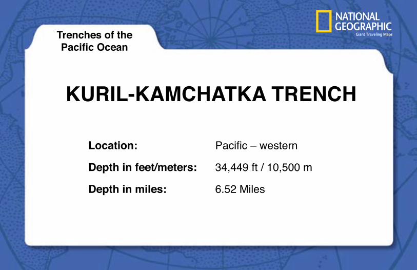
Pacific - western 34,449 ft/10,500 m 6.52 Miles 17
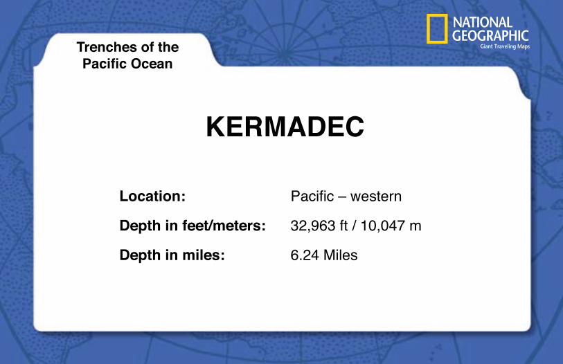
Kermadec Pacific - western 32,963 ft/10,047 m 6.24 Miles 16
Izu-Ogasawara Pacific - western 32,078 ft/9780 m 6.08 Miles 16
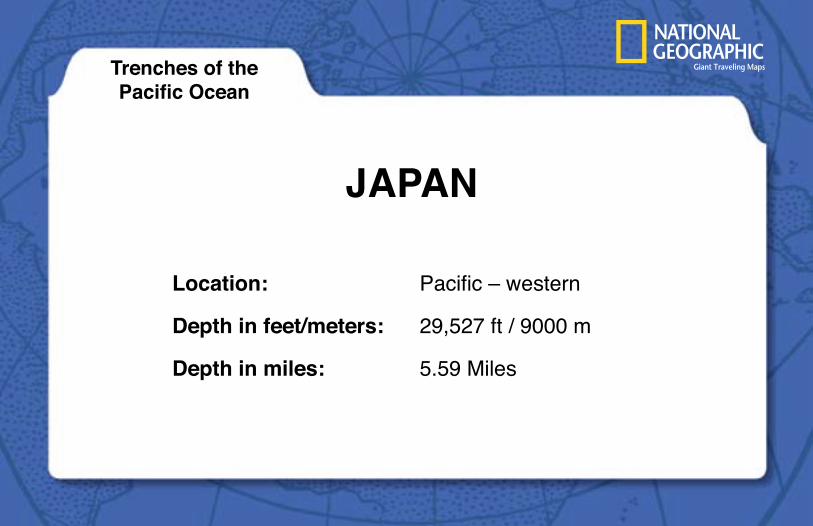
Japan Pacific - western 29, 527 ft/9000 m 5.59 Miles 15
Yap Pacific - western 27,976 ft/ 8527 m 5.30 Miles 14
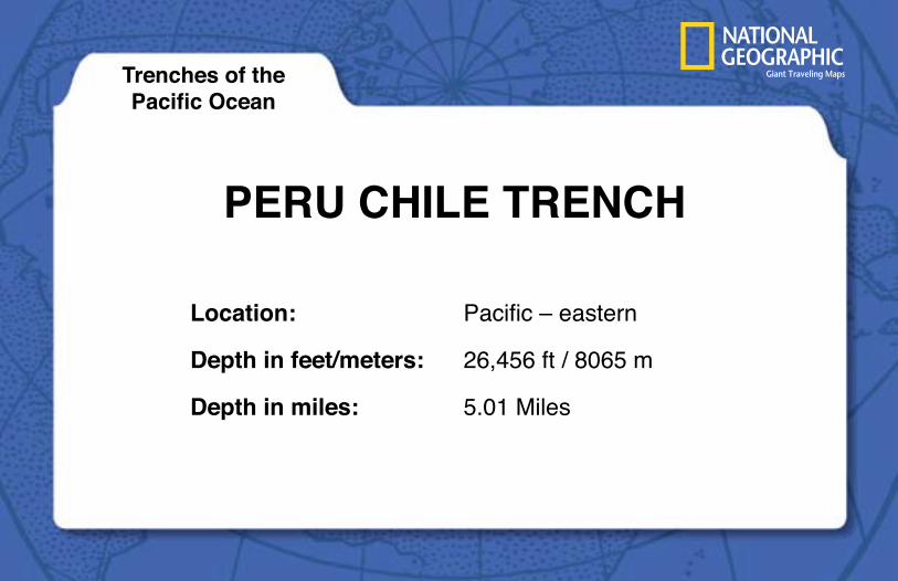
Peru Chile Trench Pacific – eastern 26, 456 ft/8065 m 5.01 Miles 13
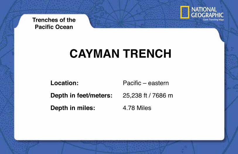
Cayman Trench Pacific – eastern 25,238 ft/7686 m 4.78 Miles 13
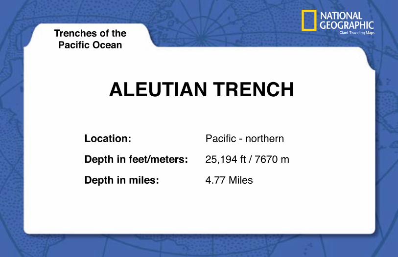
Aleutian trench Pacific - northern 25,194 ft/7670 m 4.77 Miles 13
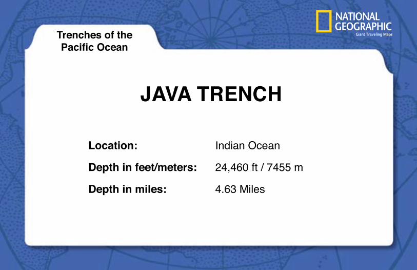
Java trench Indian Ocean 24,460 ft/7455 m 4.63 Miles 12
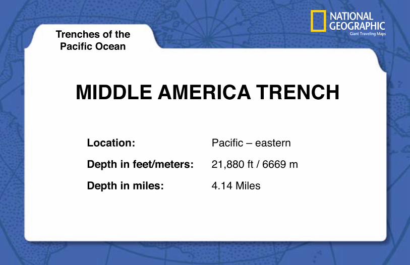
Middle America Trench
Pacific – eastern 21,880 ft/6669 m 4.14 Miles 12
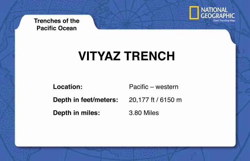
Vityaz Trench Pacific – western 20,177 ft/6150 m 3.80 Miles 10
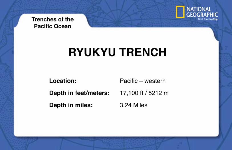
Ryukyu Trench Pacific - western 17,100 ft/5212 m 3.24 Miles 9
Cedros Trench Pacific – eastern 13,200 ft/4000 m 2.50 Miles 7
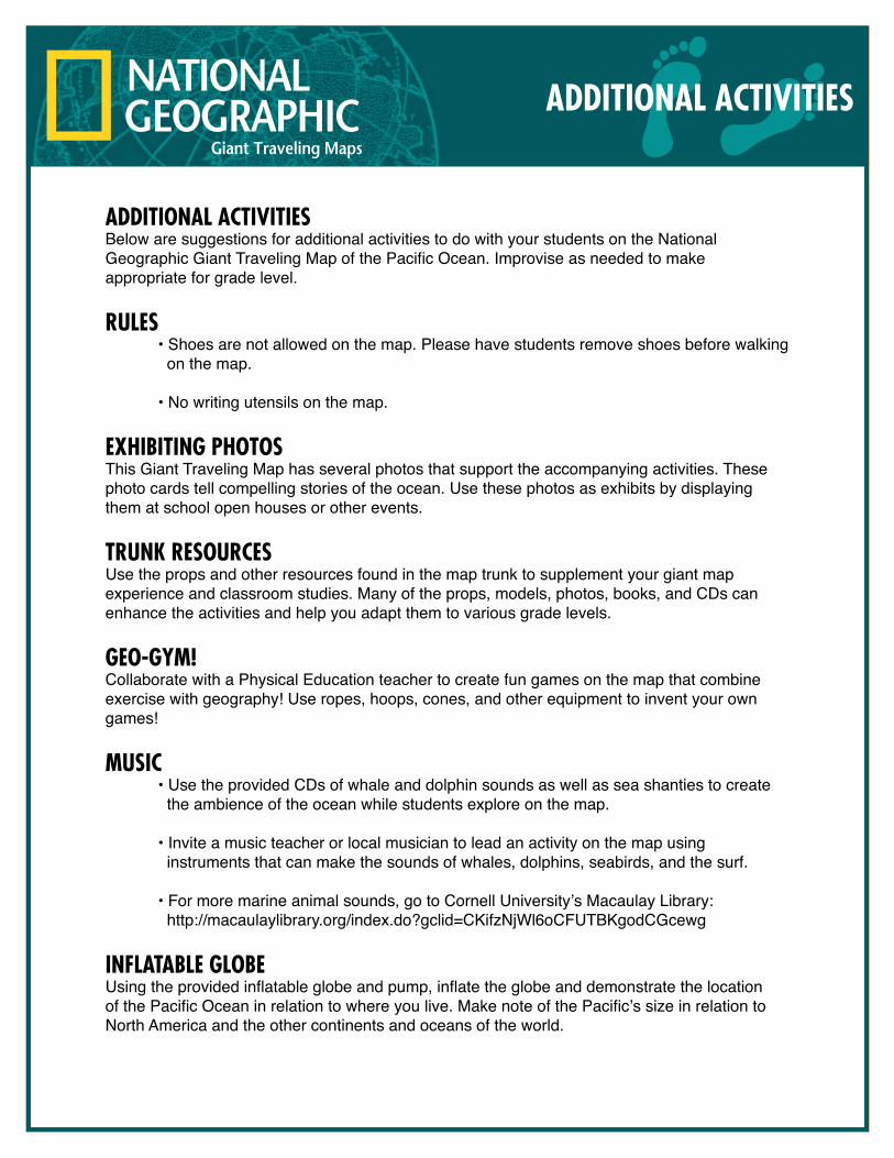
AdditionAl ActivitiesBelow are suggestions for additional activities to do with your students on the National Geographic Giant Traveling Map of the Pacific Ocean. Improvise as needed to make appropriate for grade level.
RUles • Shoes are not allowed on the map. Please have students remove shoes before walking on the map. • No writing utensils on the map.
exhibiting PhotosThis Giant Traveling Map has several photos that support the accompanying activities. These photo cards tell compelling stories of the ocean. Use these photos as exhibits by displaying them at school open houses or other events.
tRUnk ResoURcesUse the props and other resources found in the map trunk to supplement your giant map experience and classroom studies. Many of the props, models, photos, books, and CDs can enhance the activities and help you adapt them to various grade levels.
geo-gym!Collaborate with a Physical Education teacher to create fun games on the map that combine exercise with geography! Use ropes, hoops, cones, and other equipment to invent your own games!
mUsic • Use the provided CDs of whale and dolphin sounds as well as sea shanties to create the ambience of the ocean while students explore on the map.
• Invite a music teacher or local musician to lead an activity on the map using instruments that can make the sounds of whales, dolphins, seabirds, and the surf.
• For more marine animal sounds, go to Cornell University’s Macaulay Library: http://macaulaylibrary.org/index.do?gclid=CKifzNjWl6oCFUTBKgodCGcewg
inflAtAble globeUsing the provided inflatable globe and pump, inflate the globe and demonstrate the location of the Pacific Ocean in relation to where you live. Make note of the Pacific’s size in relation to North America and the other continents and oceans of the world.
AdditionAl Activities
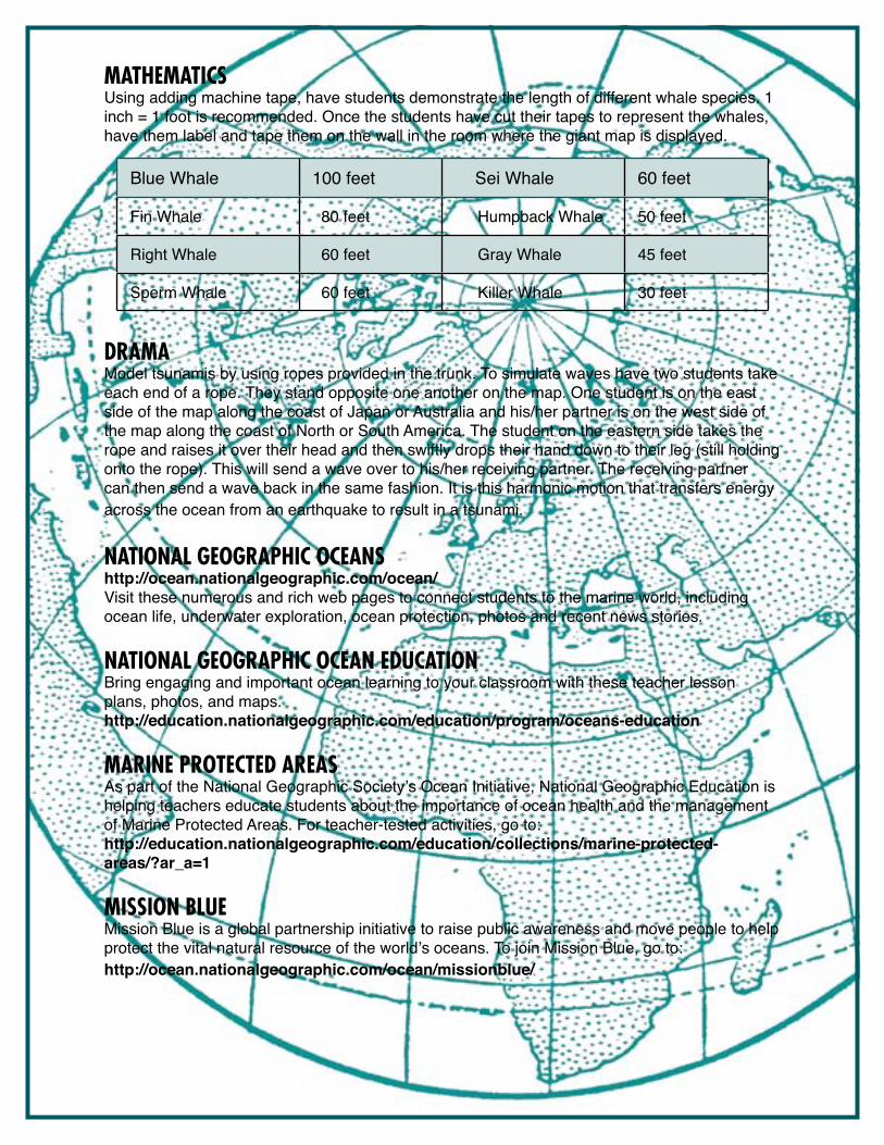
mAthemAticsUsing adding machine tape, have students demonstrate the length of different whale species. 1 inch = 1 foot is recommended. Once the students have cut their tapes to represent the whales, have them label and tape them on the wall in the room where the giant map is displayed.
dRAmAModel tsunamis by using ropes provided in the trunk. To simulate waves have two students take each end of a rope. They stand opposite one another on the map. One student is on the east side of the map along the coast of Japan or Australia and his/her partner is on the west side of the map along the coast of North or South America. The student on the eastern side takes the rope and raises it over their head and then swiftly drops their hand down to their leg (still holding onto the rope). This will send a wave over to his/her receiving partner. The receiving partner can then send a wave back in the same fashion. It is this harmonic motion that transfers energy across the ocean from an earthquake to result in a tsunami.
nAtionAl geogRAPhic oceAns http://ocean.nationalgeographic.com/ocean/Visit these numerous and rich web pages to connect students to the marine world, including ocean life, underwater exploration, ocean protection, photos and recent news stories.
nAtionAl geogRAPhic oceAn edUcAtion Bring engaging and important ocean learning to your classroom with these teacher lesson plans, photos, and maps.http://education.nationalgeographic.com/education/program/oceans-education
mARine PRotected AReAs As part of the National Geographic Society’s Ocean Initiative, National Geographic Education is helping teachers educate students about the importance of ocean health and the management of Marine Protected Areas. For teacher-tested activities, go to:http://education.nationalgeographic.com/education/collections/marine-protected-areas/?ar_a=1
mission blUe Mission Blue is a global partnership initiative to raise public awareness and move people to help protect the vital natural resource of the world’s oceans. To join Mission Blue, go to:http://ocean.nationalgeographic.com/ocean/missionblue/
Blue Whale 100 feet Sei Whale 60 feet
Fin Whale 80 feet Humpback Whale 50 feet
Right Whale 60 feet Gray Whale 45 feet
Sperm Whale 60 feet Killer Whale 30 feet
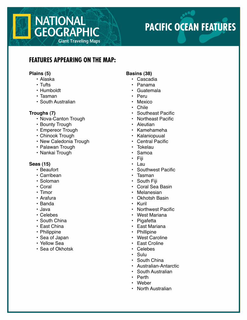
Features appearing on the map:
Plains (5)•Alaska•Tufts•Humboldt•Tasman•SouthAustralian
Troughs (7)•Nova-CantonTrough•BountyTrough•EmpereorTrough•ChinookTrough•NewCaledoniaTrough•PalawanTrough•NankaiTrough
Seas (15)•Beaufort•Carribean•Soloman•Coral•Timor•Arafura•Banda•Java•Celebes•SouthChina•EastChina•Philippine•SeaofJapan•YellowSea•SeaofOkhotsk
Basins (38)• Cascadia• Panama• Guatemala• Peru• Mexico• Chile• SoutheastPacific• NortheastPacific• Aleutian• Kamehameha• Kalaniopuual• CentralPacific• Tokelau• Samoa• Fiji• Lau• SouthwestPacific• Tasman• SouthFiji• CoralSeaBasin• Melanesian• OkhotshBasin• Kuril• NorthwestPacific• WestMariana• Pigafetta• EastMariana• Phillipine• WestCaroline• EastCroline• Celebes• Sulu• SouthChina• Australian-Antarctic• SouthAustralian• Perth• Weber• NorthAustralian
paciFic ocean Features
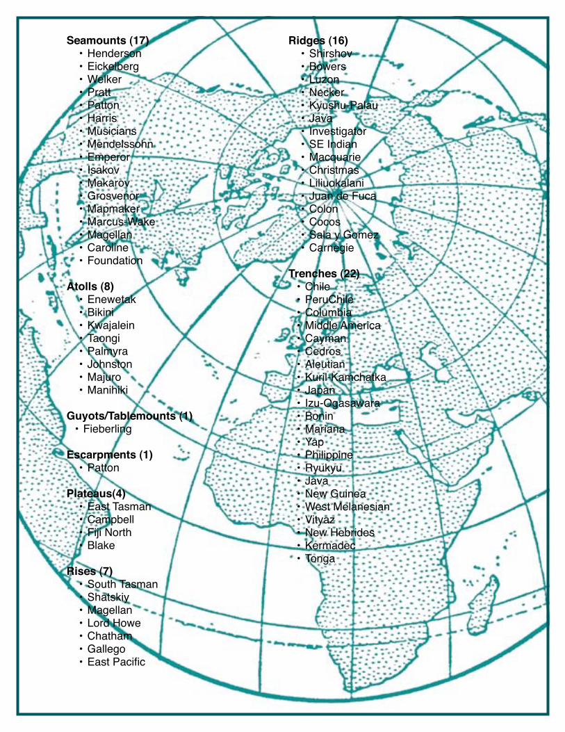
Seamounts (17)•Henderson•Eickelberg•Welker•Pratt•Patton•Harris•Musicians•Mendelssohn•Emperor• Isakov•Makarov•Grosvenor•Mapmaker•Marcus-Wake•Magellan•Caroline•Foundation
Atolls (8)•Enewetak•Bikini•Kwajalein•Taongi•Palmyra•Johnston•Majuro•Manihiki
Guyots/Tablemounts (1)•Fieberling
Escarpments (1)•Patton
Plateaus(4)•EastTasman•Campbell•FijiNorth•Blake
Rises (7)•SouthTasman•Shatskiy•Magellan•LordHowe•Chatham•Gallego•EastPacific
Ridges (16)•Shirshov•Bowers•Luzon•Necker•Kyushu-Palau•Java• Investigator•SEIndian•Macquarie•Christmas•Liliuokalani• JuandeFuca•Colon•Cocos•SalayGomez•Carnegie
Trenches (22)•Chile•PeruChile•Columbia•MiddleAmerica•Cayman•Cedros•Aleutian•Kuril-Kamchatka•Japan• Izu-Ogasawara•Bonin•Mariana•Yap•Philippine•Ryukyu•Java•NewGuinea•WestMelanesian•Vityaz•NewHebrides•Kermadec•Tonga
Fracture Zones (17)•EltaninSustem oHeezan oTharp•Agassiz•Menard•Challenger•Easter•Mendara•Marquesas•Galapagos•Clipperton•Clarion•Molokai•Murray•Pioneer•Mendocino•Surveyor
Islands (55)•JuanFernandez•SanFelix•SanAmbrosio•Easter•SalayGomez•Galapagos• IslasRevillagigedo• IslaGuadalupe•Kiritimati(Christmas)–LineIslands•Jarvis•PhoenixIslands oRawaki oNikumaroro•Marquesas•Pukapuka•CookIslands oMangaia oNassau•SocietyIslands oBoraBora oManuae oTahiti oAustralIslands •IslesMaria •Marotiri
•MarianaIslands–Guam•Guadalcanal•CarolineIslands•Palau•Solomon•LordHowe•Auckland•Campbell•Bounty•Chatham•Swains•Atafu•Tokelau•TongaIslands•SamoaIsland•FijiIslands•Wallis•Vanuatu•Tuvalu•Nanumea•Funafuti•Vancover•HaidaGwaii•Kodiak•Aleutian•Hawaii oMidway oOahu oHawaii oListanski•TuamotuArchipelago oMorane oPitcairn oHenderson oDucie oIslesGambier
AtollRing-shaped coral reef around an island creating a shallow lagoon.
BasinSaucer-like depressions in the oceans.
Continental ShelfPart of a continent submerged in a shallow sea.
EscarpmentAn area at the base of a continental slope where there is no rise.
Fracture zoneA narrow rift (opening) on the ocean floor.
Guyot (also called tablemount)Isolated underwater volcano with a flat top.
Gyre A large current in the ocean traveling in a circular path.
Hydrothermal ventA geyser on the sea floor that releases hot water.
IslandAn area of land completely surrounded by water.
PlainA large area of the sea floor with minor changes in elevation.
PlateauA flat highland usually having one steep side.
RidgeAn underwater mountain range.
RiseAn area of high ground at the base of a continental slope.
Glossary
SeaA section of the ocean marked off by a land boundary.
SeamountAn underwater mountain that remains below the surface of the sea. It may have a peak or a flat top.
SlopeInclined border of a continent and the ocean floor.
SubductionWhen one of Earth’s tectonic plates moves underneath another plate. This cancreate a trench.
Tablemount (also called a guyot)Isolated underwater volcano with a flat top.
TrenchA long, narrow ditch.
TroughA wide, deep depression in the ocean floor which is more shallow than a trench.
VolcanoA mountain or hill around a vent in Earth’s crust that releases magma or lava.
PACIFIC OCEAN TRUNK CONTENTSUpon receiving the map, please check the trunk for all contents on this list. If anything is missing or damaged, please call or email Liesl Pimentel immediately at 480/243-0753 or [email protected]
When you are done with the map, carefully check the trunk for all the contents on this list. Please report any missing or damaged items before the map is picked up.
Props• Lanyards: 10 each Red, Yellow, Blue, Green• Hourglass Timer• Poly Spots, large, red (12)• Poly Spots, large, yellow (12)• Poly Spots, small: 7 brown, 4 yellow, 7 orange,
6 green)• Volcano model• CD: Legend of Johnny Cash• CD: Sea Shanty songs • Red holiday lights• Extension cord• Menu Holders (52)• Coral Models (4)• Red fringe (4)• Red nylon Equator strap • Red ropes (4)• Blue ropes (4)• Red/green poly arrows (12)• Blue/yellow poly arrows (12)• Message in a bottle• Bag of plastic trash• Plastic building blocks (225) • Submarine models (4)• Inflatableglobe• Electric pump
Activity Binder Contents• Table of Contents• Introduction• Simon Says• Shake & Bake• Trench – Trench – Rise!• Animals&PlantsofthePacific• Cities in the Sea• Ocean Commotion• The Deep and the Dark• Additional Activities• PacificOceanFeatures• Glossary
Cards• Animals & Plants (24)• Coral Reef – large 4• Coral Reef – small 48• Trench Location (16)
Borrowers will be financially responsible for replacement costs of any missing or damaged items.
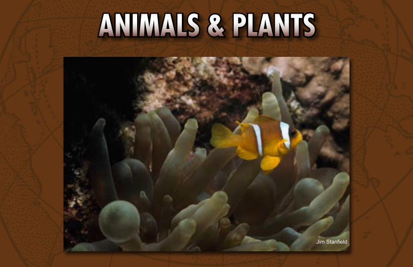
ANIMALS & PLANTS
Jim Stanfield
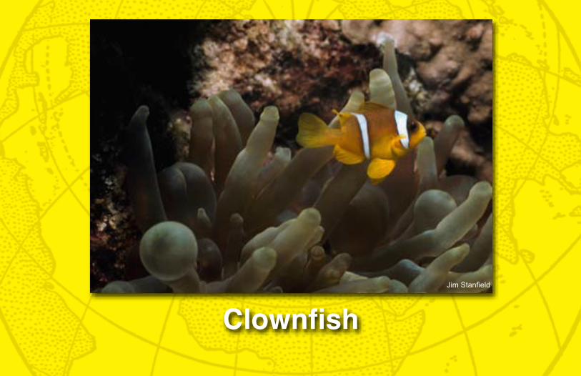
CLOWNFISHA clownfish is boldly colored and is comfortable next to an anemone in a coral reef. The stinging tentacles of the anemone protect the clownfish and her eggs. In turn the clownfish feed on small invertebrates that might harm the anemone.
Habitat location clues:• Look by Australia • Look by the Great Barrier Reef
Animals & Plants
ANIM
ALS
& PL
ANTS
iSto
ck
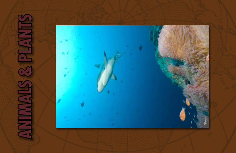
GrAy reeF SHArkWith a length of up to six feet, Gray Reef Sharks are the dominant shark species on the reef. Gray Reef Sharks are fast-swimming and very aggressive. Like other sharks, they are carnivores. These medium-size sharks are social during the day, stay in a small range within the reef, and can live up to twenty-five years in the wild.
Habitat location clues:• Look between southern China and northern Australia• Look in the Philippine Sea
Animals & Plants
ANIM
ALS
& PL
ANTS
Bat
es L
ittle
hale
s
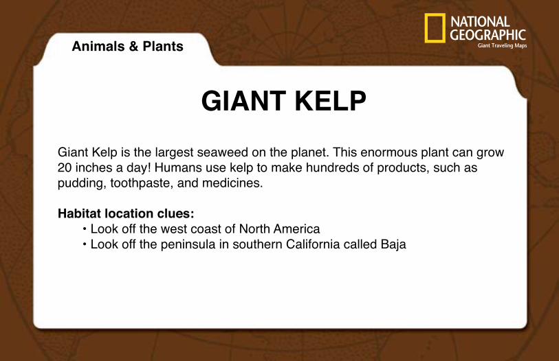
GIANt keLPGiant Kelp is the largest seaweed on the planet. This enormous plant can grow 20 inches a day! Humans use kelp to make hundreds of products, such as pudding, toothpaste, and medicines.
Habitat location clues:• Look off the west coast of North America• Look off the peninsula in southern California called Baja
Animals & Plants
ANIMALS & PLANTS
iStock
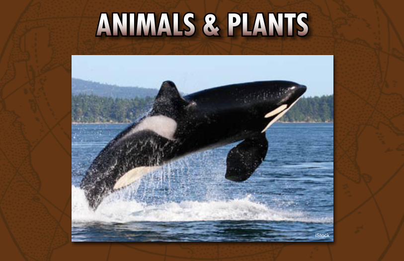
kILLer WHALeKiller Whales are also known as Orcas. Scientists who once opened up a dead killer whale found the bodies of thirteen dolphins and fifteen adult seals in its stomach. Killer whales have killer appetites!
Habitat location clues:• Look off the coast of North America by the U.S/Canadian border• Look by Vancouver Island
Animals & Plants
ANIMALS & PLANTS
iStock
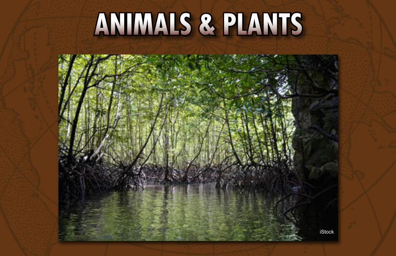
MANGrOve SWAMPMangrove trees thrive in the warm coastal areas of the Pacific. They can survive saltwater entering their roots. Mangrove trees are abundant and serve as shelter for many marine animals.
Habitat location clues:• Look at South America just off the green coastline• Look near the Mendana Fracture Zone
Animals & Plants
ANIMALS & PLANTS
Paul Zahl
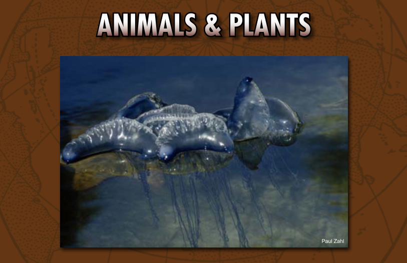
POrtuGueSe MAN-OF-WArThe Portuguese Man-of-War is a jelly-like animal that can wash up on the beach and sting with its tentacles. This can be very painful to predators. Their body is only one foot across. Their tentacles dangle below their translucent body to over 100 feet.
Habitat location clues:• Look in the middle of the Pacific Ocean for the Hawaiian Ridge• Look for the Tropic of Cancer, north of the Equator
Animals & Plants
ANIMALS & PLANTS
Bates Littlehales
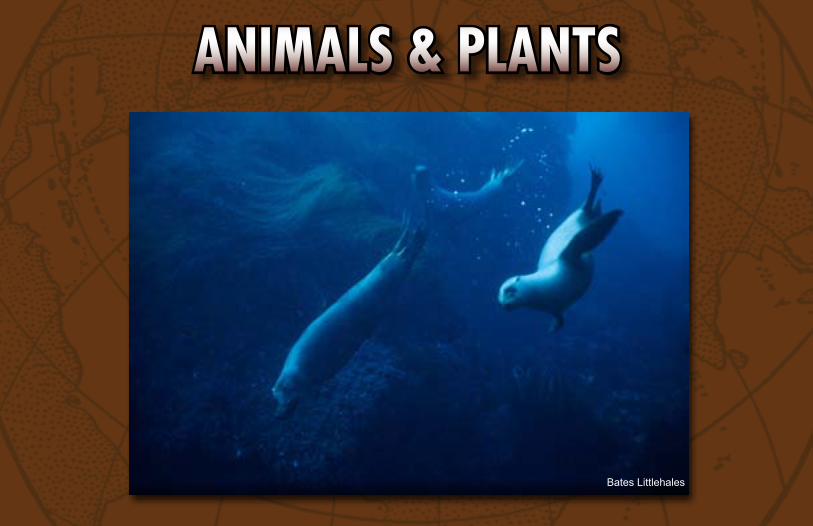
SeA LIONSea lions are marine mammals. They have external ear flaps, long front flippers, and have the ability to walk on all four flippers while on land. They live on the western shores of North America.
Habitat location clues:• Look in the North Pacific Ocean• Look near California by San Francisco in the Cascadia Basin
Animals & Plants
ANIMALS & PLANTS
James L. Stanfield
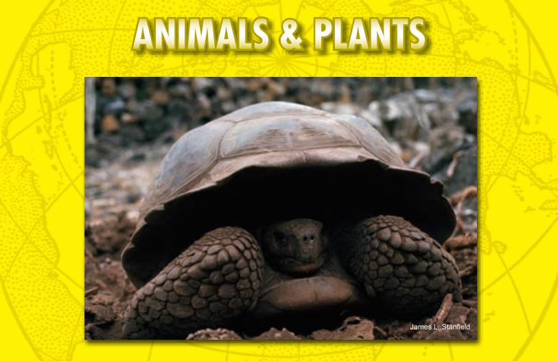
GIANt tOrtOISeThese unique animals belong to the most ancient group of reptiles on Earth, which first appeared about 250 million years ago. The Giant Tortoise is common to many islands, including the Galápagos, where their isolation has contributed to their giant size and the differences in species between islands. Giant Tortoises commonly live for more than 100 years.
Habitat location clues:• Look by the equator off of South America• Look in the Pacific Ocean for the Galápagos Islands
Animals & Plants
ANIMALS & PLANTS
David Doubilet
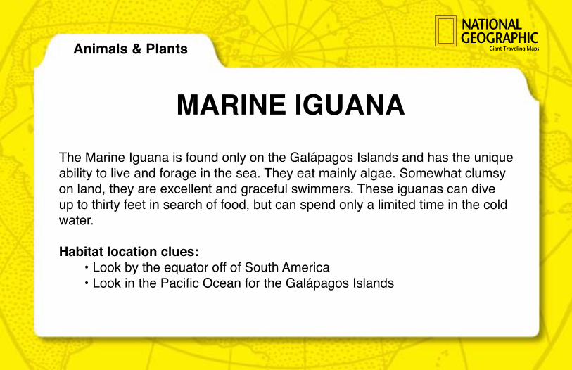
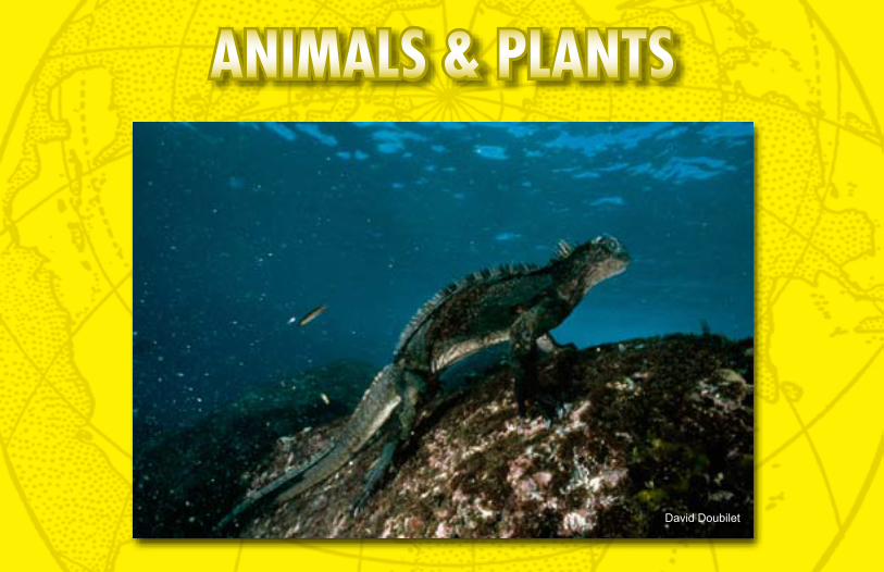
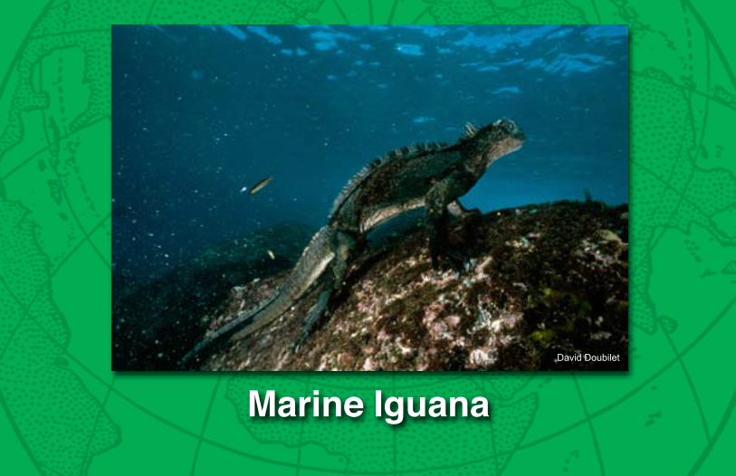
MArINe IGuANAThe Marine Iguana is found only on the Galápagos Islands and has the unique ability to live and forage in the sea. They eat mainly algae. Somewhat clumsy on land, they are excellent and graceful swimmers. These iguanas can dive up to thirty feet in search of food, but can spend only a limited time in the cold water.
Habitat location clues:• Look by the equator off of South America• Look in the Pacific Ocean for the Galápagos Islands
Animals & Plants
ANIMALS & PLANTS
Bates Littlehales
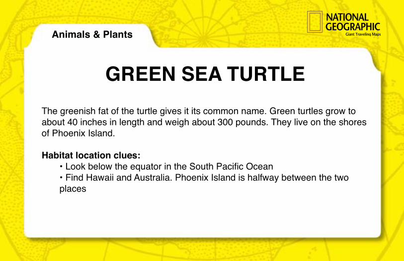
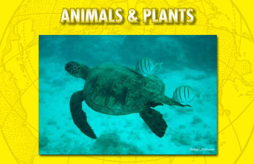
GreeN SeA turtLeThe greenish fat of the turtle gives it its common name. Green turtles grow to about 40 inches in length and weigh about 300 pounds. They live on the shores of Phoenix Island.
Habitat location clues:• Look below the equator in the South Pacific Ocean• Find Hawaii and Australia. Phoenix Island is halfway between the two places
Animals & Plants
ANIMALS & PLANTS
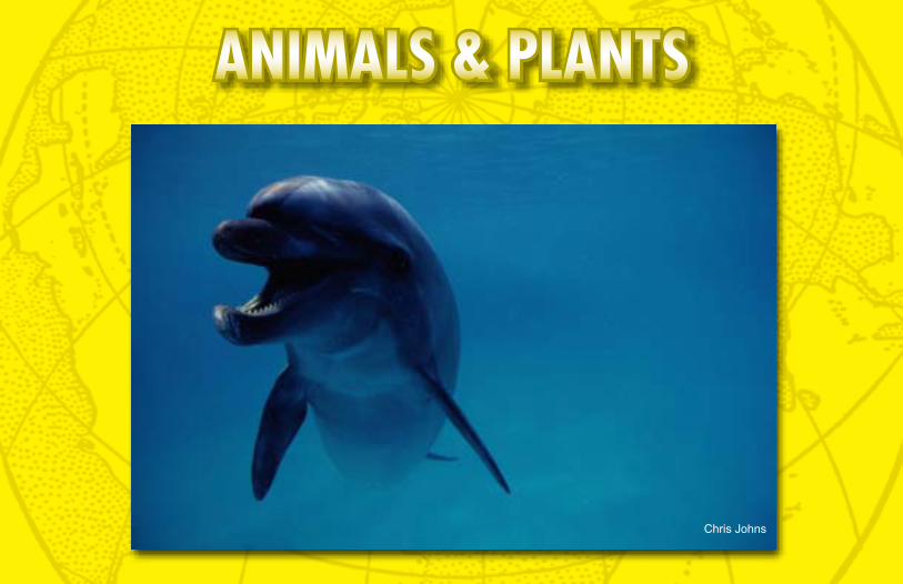
Chris Johns
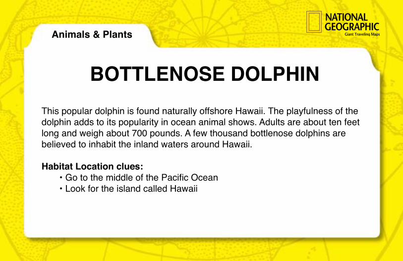
BOttLeNOSe DOLPHINThis popular dolphin is found naturally offshore Hawaii. The playfulness of the dolphin adds to its popularity in ocean animal shows. Adults are about ten feet long and weigh about 700 pounds. A few thousand bottlenose dolphins are believed to inhabit the inland waters around Hawaii.
Habitat Location clues:• Go to the middle of the Pacific Ocean• Look for the island called Hawaii
Animals & Plants
ANIMALS & PLANTS
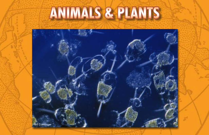
Bill Curtsinger
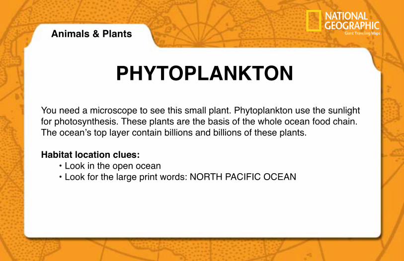
PHytOPLANktONYou need a microscope to see this small plant. Phytoplankton use the sunlight for photosynthesis. These plants are the basis of the whole ocean food chain. The ocean’s top layer contain billions and billions of these plants.
Habitat location clues:• Look in the open ocean • Look for the large print words: NORTH PACIFIC OCEAN
Animals & Plants
ANIMALS & PLANTS
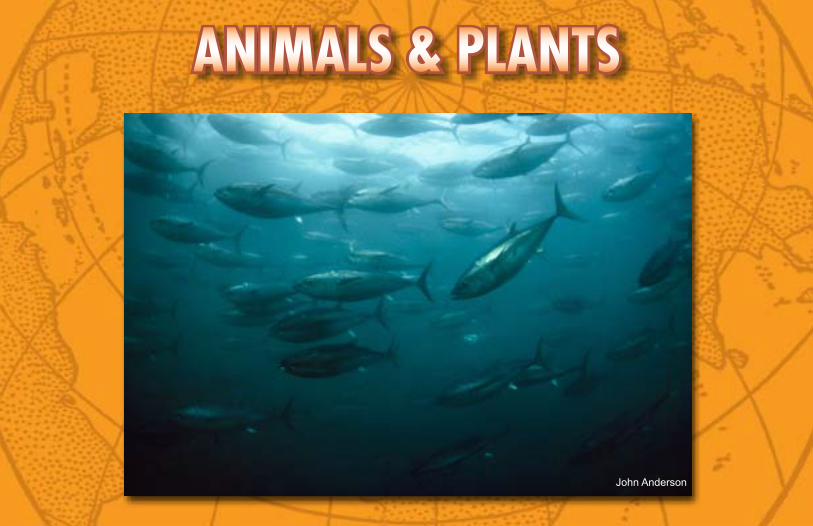
John Anderson
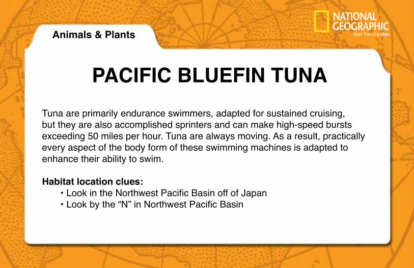
PACIFIC BLueFIN tuNATuna are primarily endurance swimmers, adapted for sustained cruising, but they are also accomplished sprinters and can make high-speed bursts exceeding 50 miles per hour. Tuna are always moving. As a result, practically every aspect of the body form of these swimming machines is adapted to enhance their ability to swim.
Habitat location clues:• Look in the Northwest Pacific Basin off of Japan• Look by the “N” in Northwest Pacific Basin
Animals & Plants
ANIMALS & PLANTS
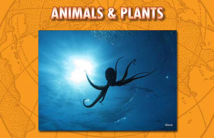
iStock
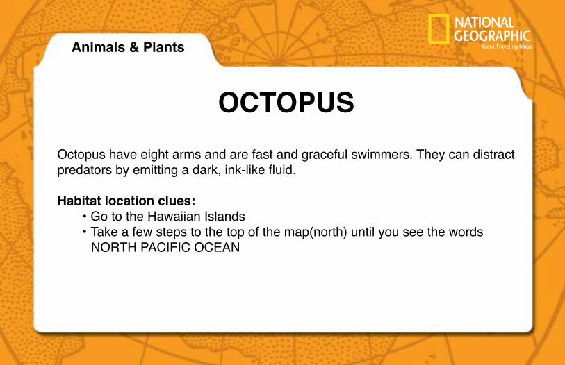
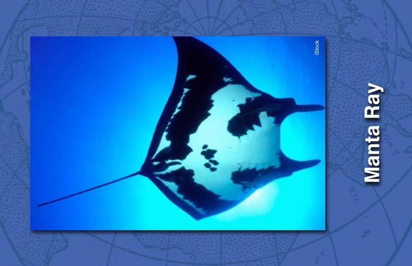
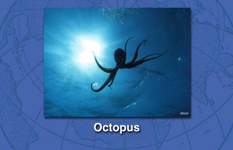
OCtOPuSOctopus have eight arms and are fast and graceful swimmers. They can distract predators by emitting a dark, ink-like fluid.
Habitat location clues:• Go to the Hawaiian Islands• Take a few steps to the top of the map(north) until you see the words NORTH PACIFIC OCEAN
Animals & Plants
ANIMALS & PLANTS
Dan Beaupré
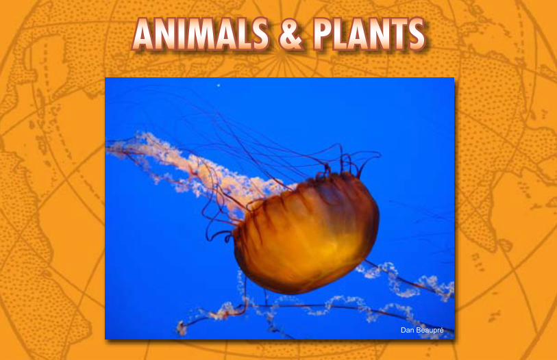
JeLLyFISHJellyfish are simple invertebrates. Many kinds of jellyfish have delicate, see-through bodies. They do not have a brain like humans. Instead, they have nerve receptors to help them react to their environment. When washed up on the beach they look like a blob. Jellyfish can range from the size of a human fingernail to over seven feet in diameter.
Habitat location clues:• Look on the western side and central part of the map • Look for the East Mariana Basin
Animals & Plants
ANIMALS & PLANTS
Tim Laman
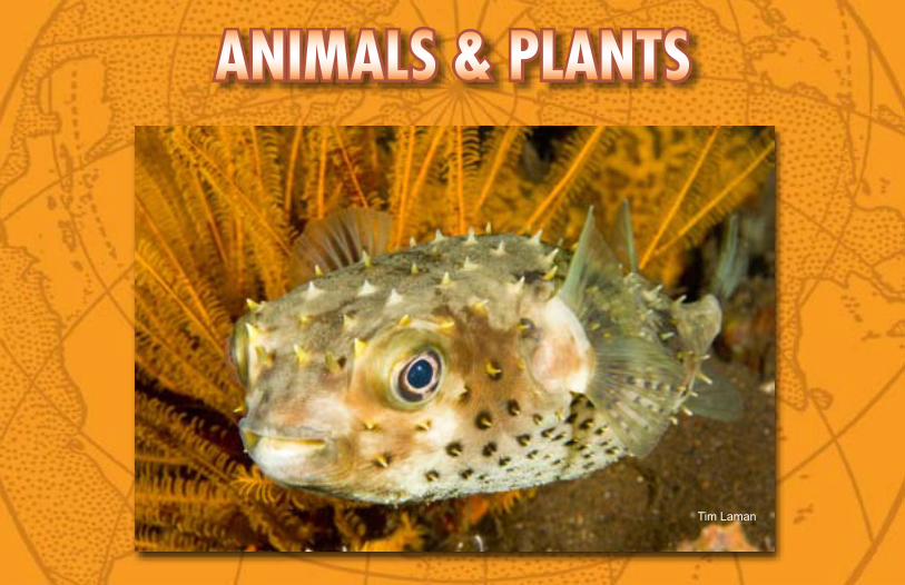
POrCuPINe FISHWhen a Porcupine Fish is scared, it pumps water into its body until it looks like a prickly soccer ball. The Porcupine Fish can weigh about five pounds and, when not scared, is 35 inches in length.
Habitat location clues:• Go to New Guinea just north of Australia• Take a few steps out and locate the Melanesian Basin
Animals & Plants
ANIMALS & PLANTS
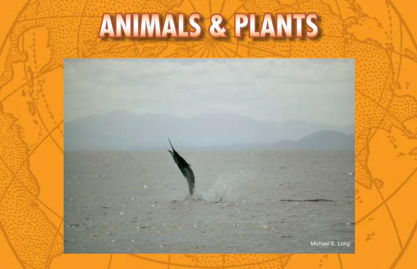
Michael E. Long
BLue MArLINThis large and beautiful fish is a striking blue color on top and a white-silver color on the bottom. The Blue Marlin has a fin on its back and a spear shaped upper jaw. The average size of the Blue Marlin is seven feet long, weighing 300 pounds.
Habitat location clues:• Go to Central America• Locate the Guatemala Basin
Animals & Plants
ANIMALS & PLANTS
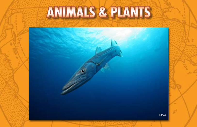
iStock
BArrACuDAThe Barracuda has an ultra-streamlined body and their strong tail muscles allow them to speed through the open ocean in pursuit of small fish. There are more than twenty different species of Barracuda. They grow to nearly six feet in length.
Habitat location clues:• Look in the South Pacific Ocean near the equator• Look on the Gallego Rise
Animals & Plants
ANIMALS & PLANTS
iStock
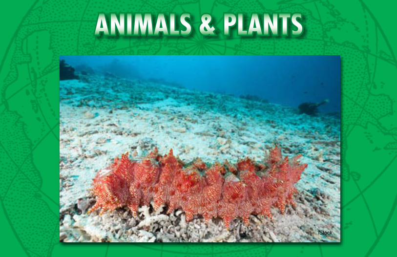
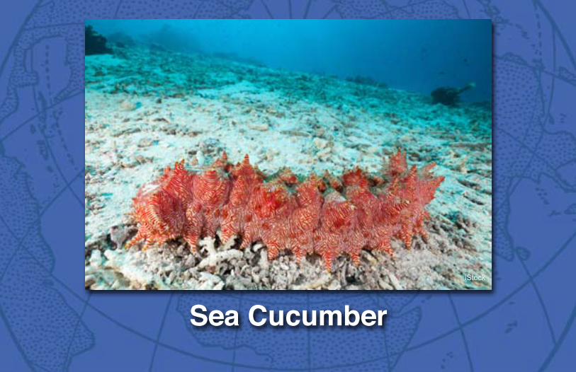
SeA CuCuMBerSea cucumbers wander widely over the seabed, sucking up the sediment and then extracting its organic content. They use their tube feet to move across the bottom while looking for food.
Habitat location clues:• Look near the Equator• Go north (top of the map) and find the Central Pacific Basin
Animals & Plants
ANIMALS & PLANTS
iStock
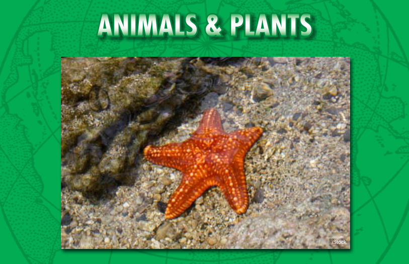
MOSAIC SeA StArThe super bright color of the Mosaic Sea Star serves as a warning that it contains poisons if attacked by an enemy. It has yellow raised ridges and is soft. The Mosaic Sea Star feeds mostly on sponges, and these may be the source of its poison.
Habitat location clues:• Find Australia• Go to the south shores of Australia
Animals & Plants
ANIM
ALS
& PL
ANTS
iSto
ck
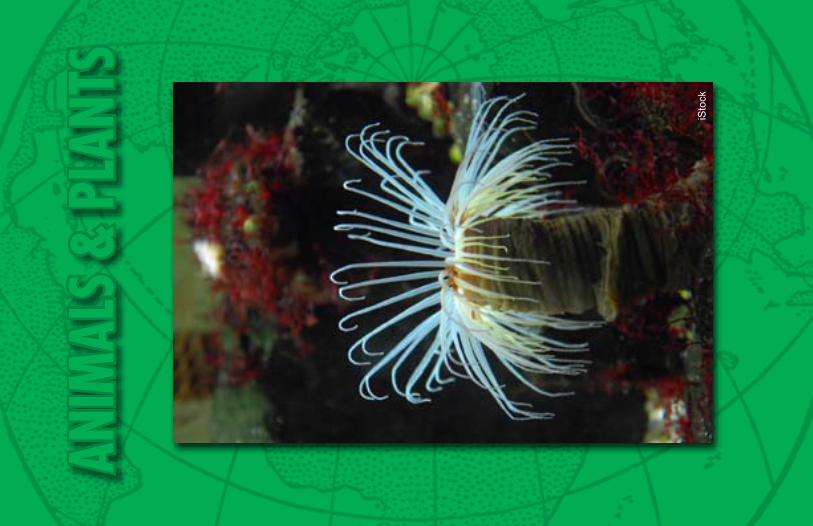
FeAtHer DuSter WOrM There are many remarkable forms of worms in the Pacific Ocean. The Feather Duster Worm permanently attaches itself to the seabed. It builds a tube around its body and the tentacles filter out particles in the water.
Habitat location clues:• Look in the North Pacific Ocean by the United States.• Look on the Murray Fracture Zone.
Animals & Plants
ANIM
ALS
& PL
ANTS
iSto
ck
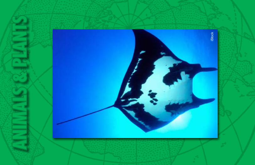
MANtA rAyThis ray is shaped like a giant flying saucer. It has huge triangular wings that move slowly up and down. The Manta Ray looks large and scary but is harmless; it eats only microscopic plankton and small fish.
Habitat location clues:• Go to the area where North and South America meet• Look for the East Pacific Rise
Animals & Plants
ANIMALS & PLANTS
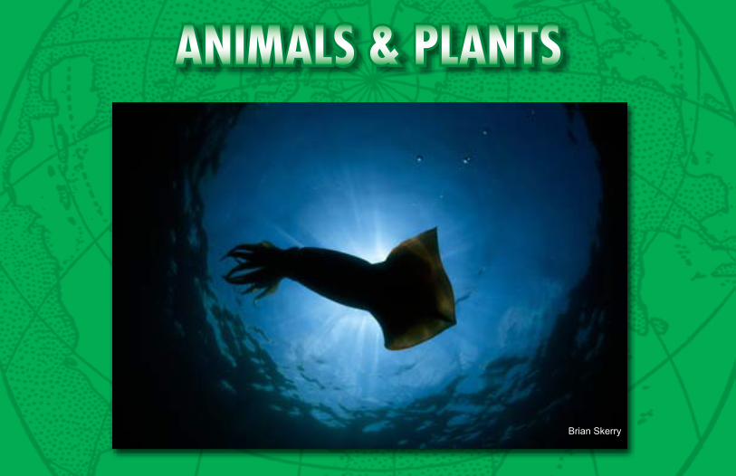
Brian Skerry
GIANt SquIDThis very long squid can reach a length of over 15 feet. It has a pair of eyes the size of dinner plates. Its tentacles have tiny teeth to help hold the food it captures. Habitat location clues:
• Look near Alaska• Look for the Aleutian Trench
Animals & Plants
ANIMALS & PLANTS
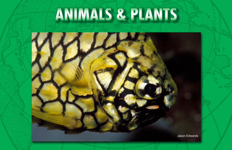
Jason Edwards
PINeAPPLe FISHThe Pineapple Fish has large thick yellow scales for protection. Each scale is outlined in black, resembling a pineapple skin. This fish has a pair of bioluminescent organs that glow deep in the ocean. It is up to nine inches long and can weigh up to one pound.
Habitat location clues:• Look in the southern hemisphere• Look on the southwestern coast of Australia in the Perth Basin
Animals & Plants
Coral reefsof the PaCifiC
Cities iN the sea:
Kingman Reef
This triangular shaped reef is the remnant of a volcano on the northern most part of the Line Islands. In 2009 it was designated a National Marine Monument by the United States. The dry land near the reef has very little life due to tides and wind. Since so few humans visit this reef, it has a much greater diversity of life than the reefs of Hawaii – which are 1,000 miles away. Kingman Reef is considered the most pristine reef in the world.
Reef building corals are found in water that is warm, clear, and salty. These corals provide a habitat to thousands of different species of animals ranging in size from large whales and sharks, to giant clams and eels, to small tropical fish, to microscopic algae.
Single-celled dinoflagellates, called zooxanthellae, live inside stony corals on a reef. The zooxanthellae use photosynthesis to make food. The zooxanthellae can get nitrogen from the stony corals and the corals get the carbohydrates they need from the zooxanthellae. Corals also use stinging tentacles to capture prey.
Cities iN the sea:Coral reefs
of the PaCifiC
Galápagos Reef
More than 120 islands, all formed by volcanoes, help form the base for these coral reefs. The reefs are few in number compared to other tropical areas of the Pacific Ocean. These reefs contain only a few species of coral.
Reef building corals are found in water that is warm, clear, and salty. Reef building corals provide a habitat to thousands of different species of animals ranging in size from large whales and sharks, to giant clams and eels, to small tropical fish, to microscopic algae.
Single-celled dinoflagellates, called zooxanthellae, live inside of stony corals on a reef. The zooxanthellae use photosynthesis to make food. The zooxanthellae can get nitrogen from the stony corals and the corals get the carbohydrates they need from the zooxanthellae. Corals also use stinging tentacles to capture prey.
In 1978 the Galápagos Islands became a World Heritage site.
Cities iN the sea:Coral reefs
of the PaCifiC
Great Barrier Reef
This is considered the largest reef ecosystem in the world and is so large that it is the only living thing visible from space. It runs parallel to the Australian coast, stretching over 1,800 miles. You can find more than 400 species of coral and more than 1,500 species of fish. A new fish species is found each year!
Reef building corals are found in water that is warm, clear, and salty. Reef building corals provide a habitat to thousands of different species of animals ranging in size from large whales and sharks, to giant clams and eels, to small tropical fish, to microscopic algae.
Single-celled dinoflagellates, called zooxanthellae, live inside of stony corals on a reef. The zooxanthellae use photosynthesis to make food. The zooxanthellae can get nitrogen from the stony corals and the corals get the carbohydrates they need from the zooxanthellae. Corals also use stinging tentacles to capture prey.
In 1981 UNESCO listed the Great Barrier Reef as a World Heritage site.
Cities iN the sea:Coral reefs
of the PaCifiC
Hawaiian Reefs
These reefs are considered young and not as well developed as other coral reefs. However, it is one of the largest, intact reef systems of the world. In 2006 the Papahanaumokuakea Marine National Monument was formed to protect this incredibly unique ecosystem. The Hawaiian Islands are formed by undersea volcanoes which extend more than 1,500 miles across the Pacific Ocean.
Reef building corals are found in water that is warm, clear, and salty. Reef building corals provide a habitat to thousands of different species of animals ranging in size from large whales and sharks, to giant clams and eels, to small tropical fish, to microscopic algae.
Single-celled dinoflagellates, called zooxanthellae, live inside of stony corals on a reef. The zooxanthellae use photosynthesis to make food. The zooxanthellae can get nitrogen from the stony corals and the corals get the carbohydrates they need from the zooxanthellae. Corals also use stinging tentacles to capture prey.
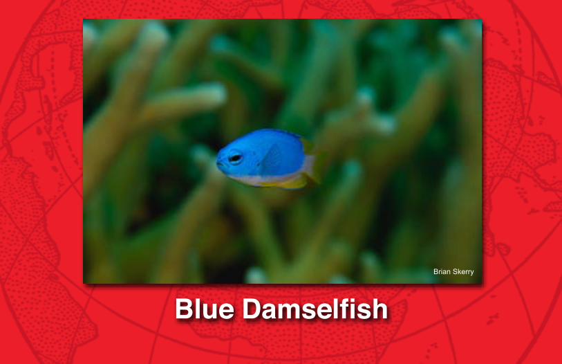
Blue DamselfishBrian Skerry

Coral reefs of the PaCifiC
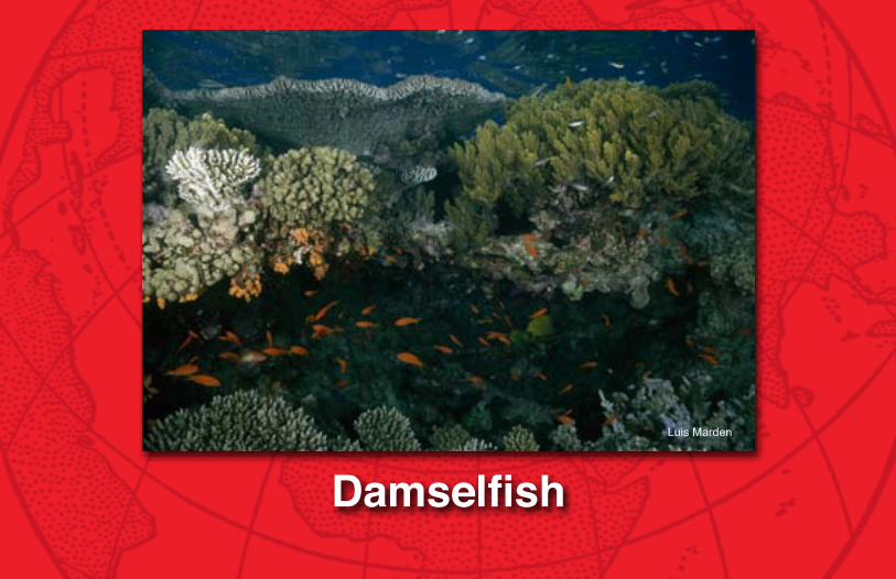
DamselfishLuis Marden

Coral reefs of the PaCifiC
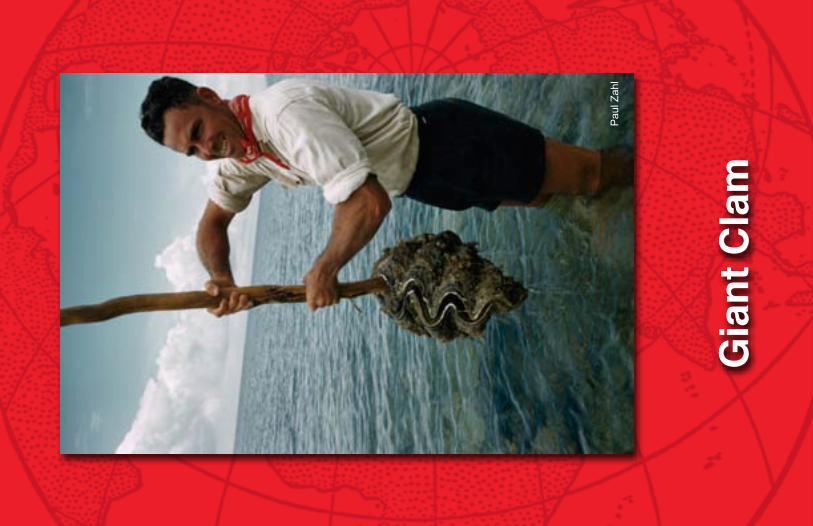
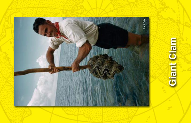
Gia
nt C
lam
Pau
l Zah
l

Coral reefs of the PaCifiC
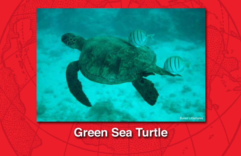
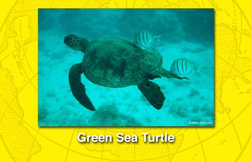
Green Sea TurtleBates Littlehales
Coral reefs of the PaCifiC
Gra
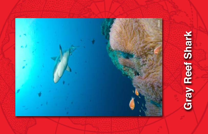
y R
eef S
hark
iSto
ck

Coral reefs of the PaCifiC
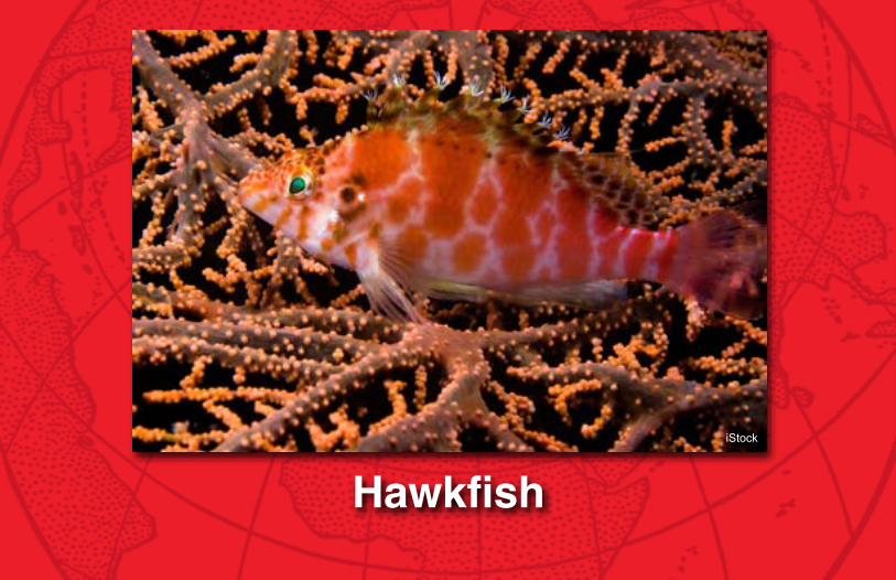
HawkfishiStock

Coral reefs of the PaCifiC
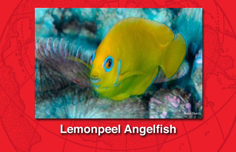
Lemonpeel AngelfishBrain Skerry

Coral reefs of the PaCifiC
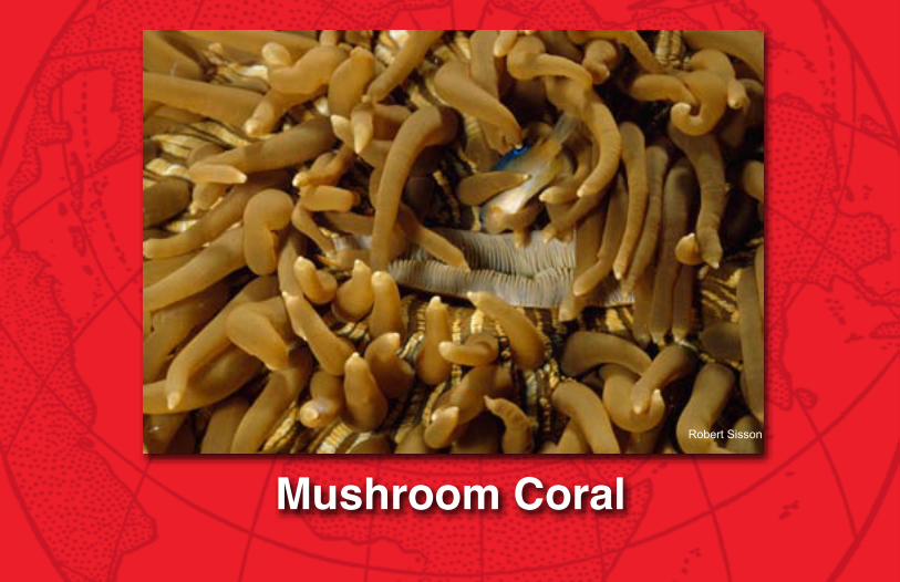
Mushroom CoralRobert Sisson

Coral reefs of the PaCifiC
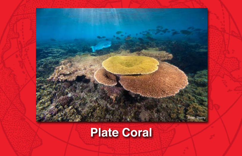
Plate CoralBrain Skerry

Coral reefs of the PaCifiC
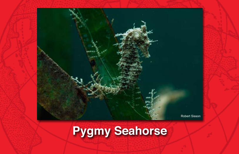
Pygmy SeahorseRobert Sisson

Coral reefs of the PaCifiC
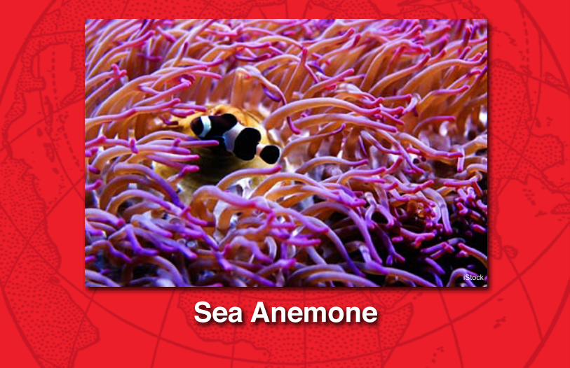
Sea AnemoneiStock

Coral reefs of the PaCifiC
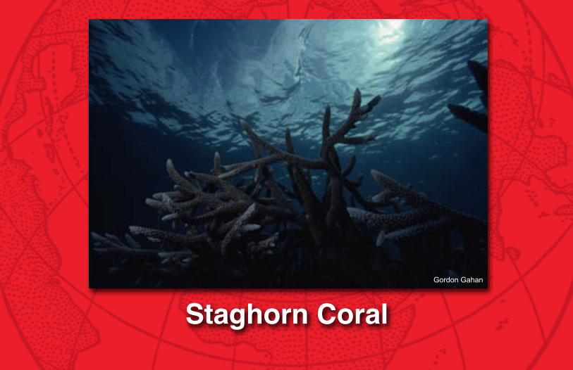
Staghorn CoralGordon Gahan

Coral reefs of the PaCifiC
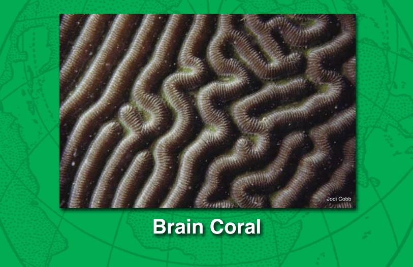
Brain CoralJodi Cobb
Coral reefs of the PaCifiC
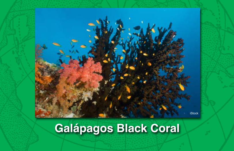
Galápagos Black CoraliStock
Coral reefs of the PaCifiC
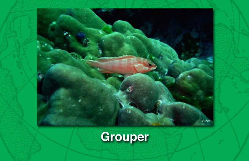
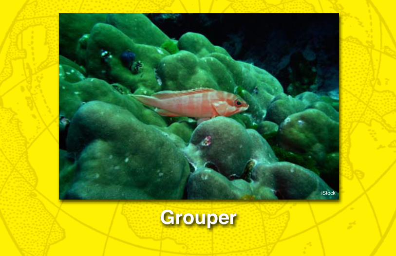
GrouperiStock

Coral reefs of the PaCifiC
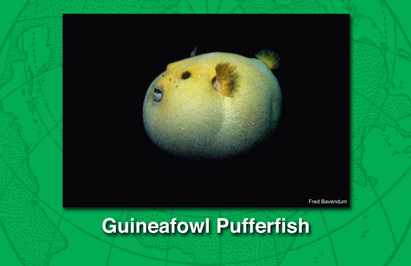
Guineafowl PufferfishFred Bavendum

Coral reefs of the PaCifiC
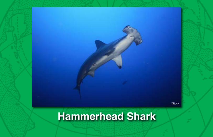
Hammerhead SharkiStock

Coral reefs of the PaCifiC
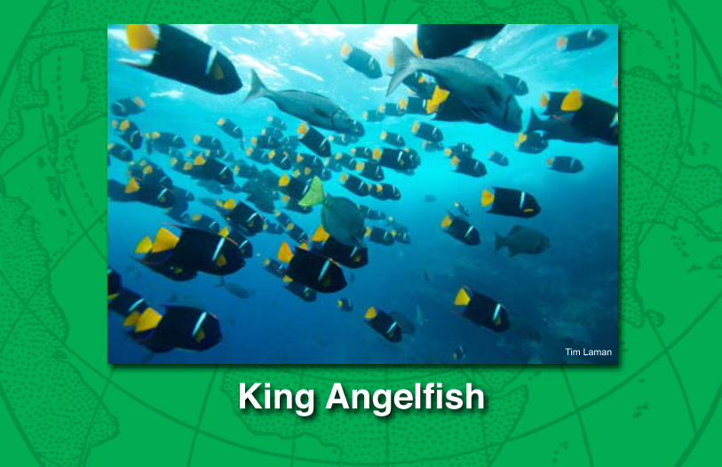
King AngelfishTim Laman

Coral reefs of the PaCifiC
Marine IguanaDavid Doubilet

Coral reefs of the PaCifiC
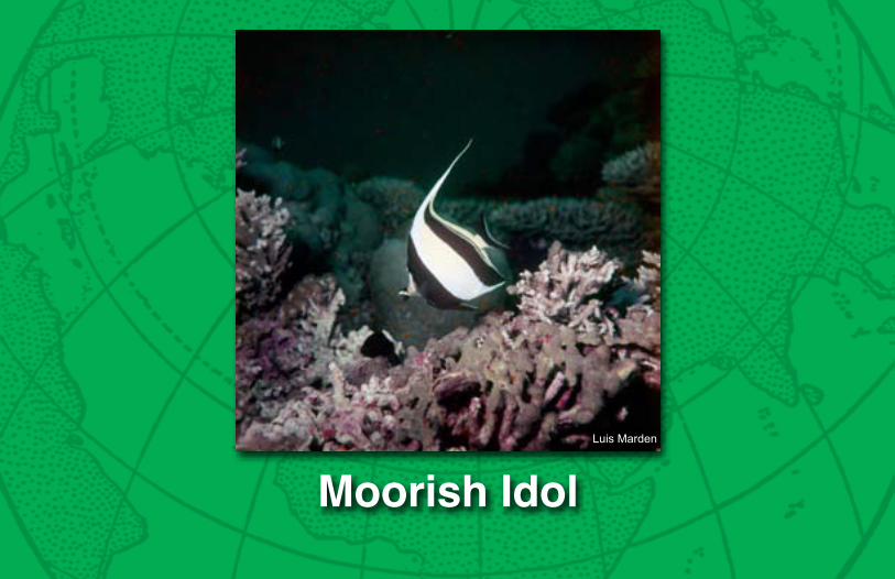
Moorish IdolLuis Marden

Coral reefs of the PaCifiC
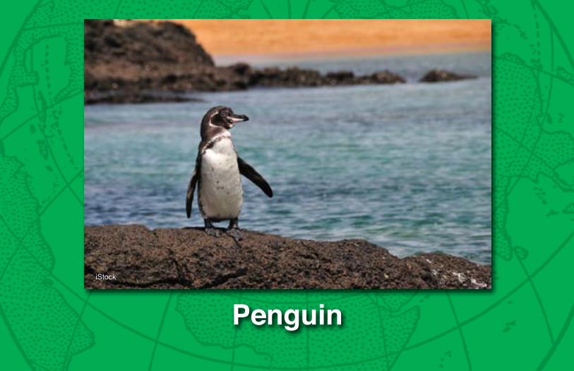
PenguiniStock

Coral reefs of the PaCifiC
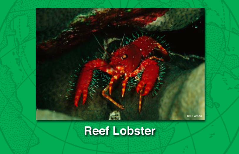
Reef LobsterTim Laman

Coral reefs of the PaCifiC
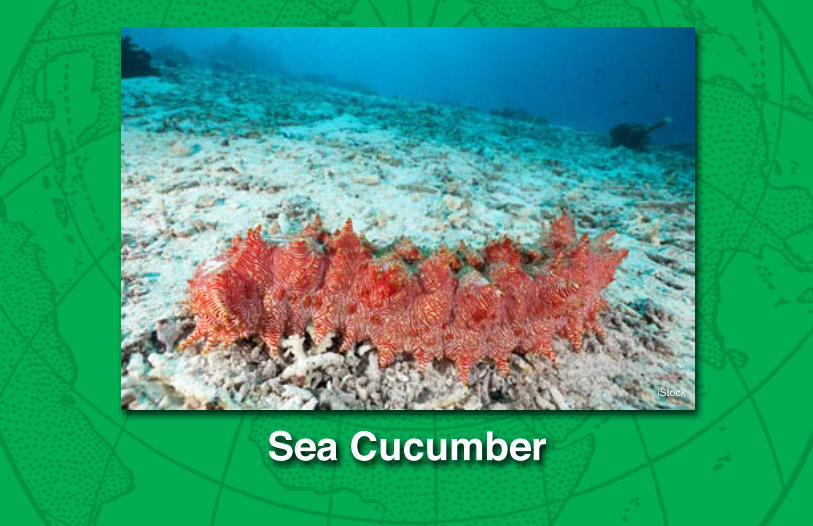
Sea CucumberiStock

Coral reefs of the PaCifiC
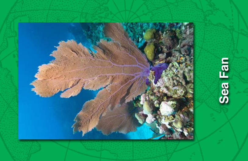
Sea
Fan
iSto
ck

Coral reefs of the PaCifiC
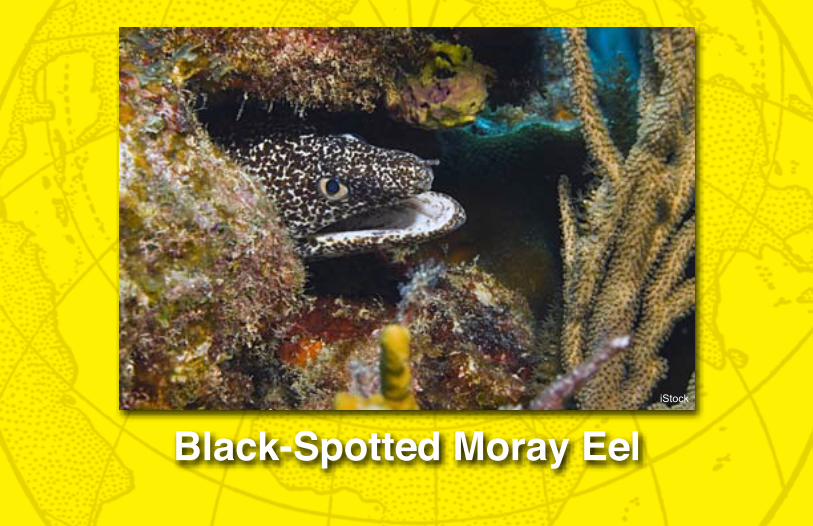
Animal NameBlack-Spotted Moray EeliStock
Coral reefs of the PaCifiCCoral reefs of the PaCifiC
ClownfishJim Stanfield

Coral reefs of the PaCifiC
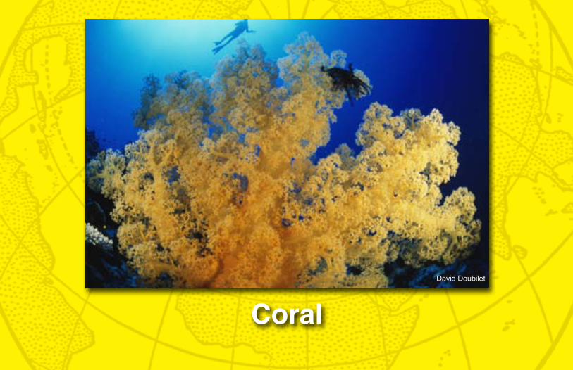
Coral David Doubilet

Coral reefs of the PaCifiC
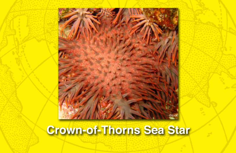
Crown-of-Thorns Sea StariStock

Coral reefs of the PaCifiC
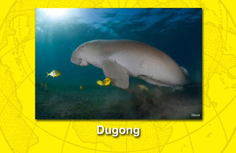
DugongiStock

Coral reefs of the PaCifiC
Gia
nt C
lam
Pau
l Zah
l

Coral reefs of the PaCifiC
Green Sea TurtleBates Littehales

Coral reefs of the PaCifiC
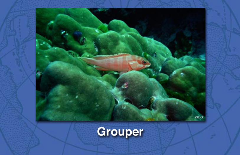
GrouperiStock
Coral reefs of the PaCifiC
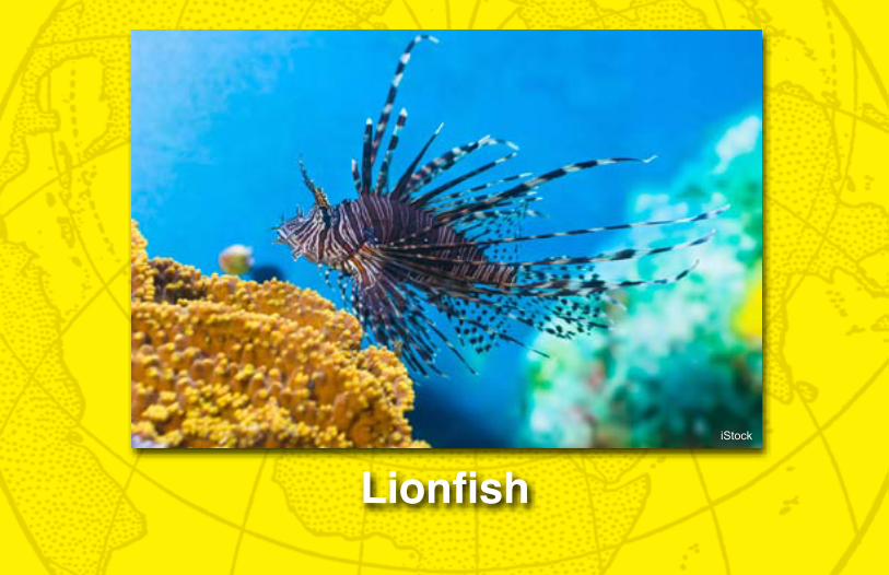
LionfishiStock

Coral reefs of the PaCifiC
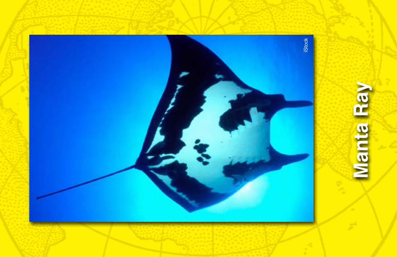
Man
ta R
ay
iSto
ck

Coral reefs of the PaCifiC
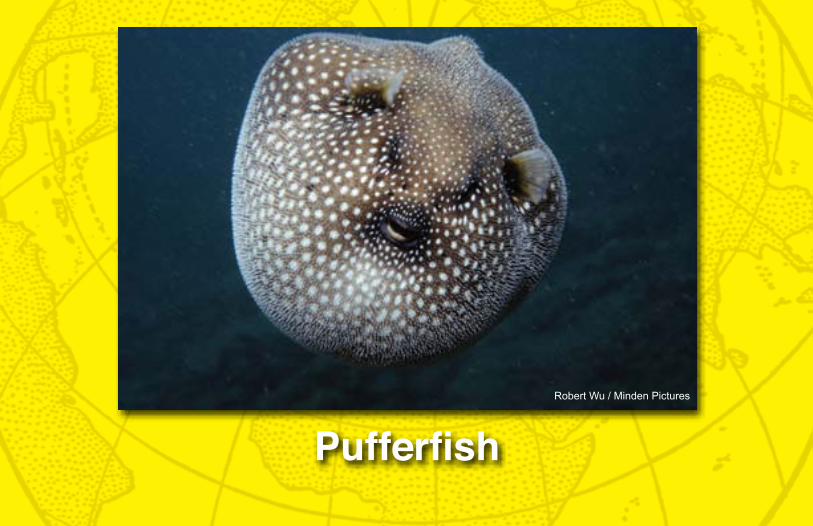
PufferfishRobert Wu / Minden Pictures

Coral reefs of the PaCifiC
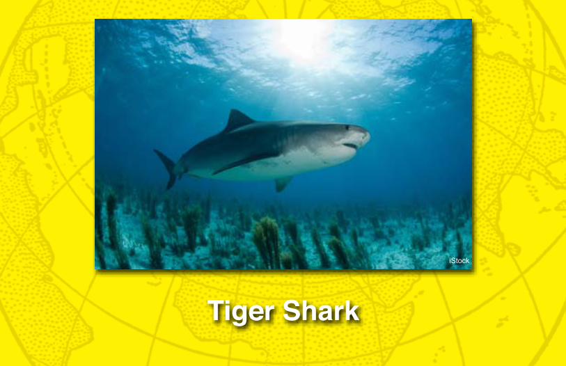
Tiger Shark
iStock

Coral reefs of the PaCifiC
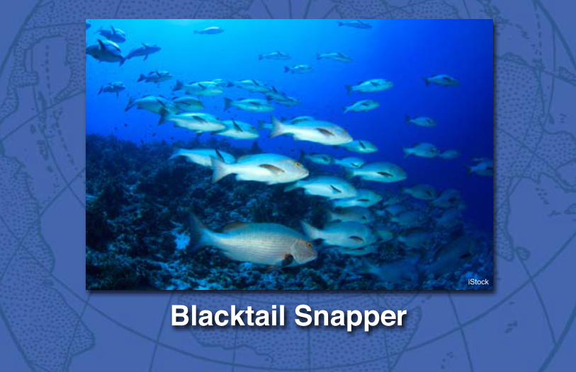
Animal NameBlacktail SnapperiStock
Coral reefs of the PaCifiCCoral reefs of the PaCifiC
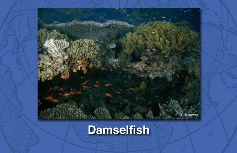
DamselfishLuis Marden

Coral reefs of the PaCifiC
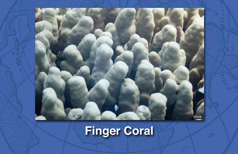
Finger CoraliStock
Coral reefs of the PaCifiC
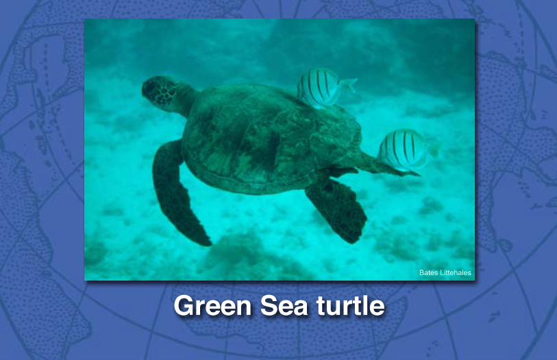
Green Sea turtleBates Littehales

Coral reefs of the PaCifiC
GrouperiStock

Coral reefs of the PaCifiC
Man
ta R
ay
iSto
ck

Coral reefs of the PaCifiC
OctopusiStock

Coral reefs of the PaCifiC
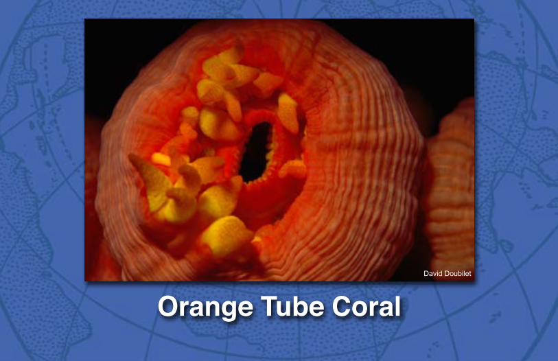
Orange Tube CoralDavid Doubilet

Coral reefs of the PaCifiC
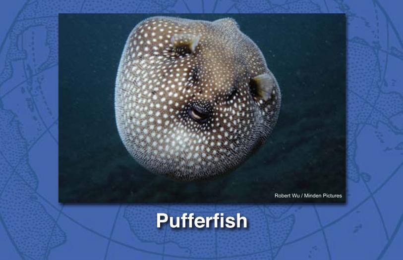
PufferfishRobert Wu / Minden Pictures

Coral reefs of the PaCifiC
Sea CucumberiStock

Coral reefs of the PaCifiC
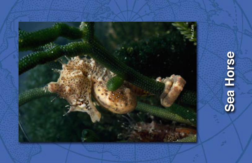
Sea
Hor
se
Pau
l Zah
l

Coral reefs of the PaCifiC
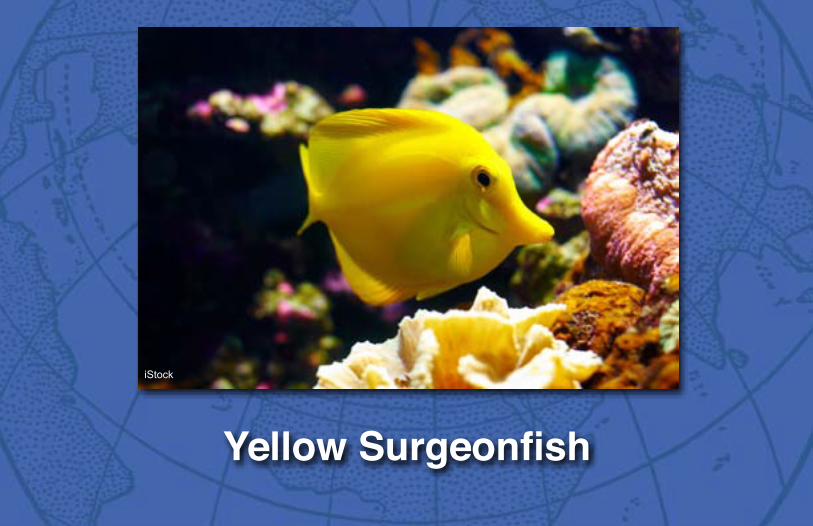
Yellow Surgeonfish
iStock

Coral reefs of the PaCifiC

Trenches of The Pacific ocean
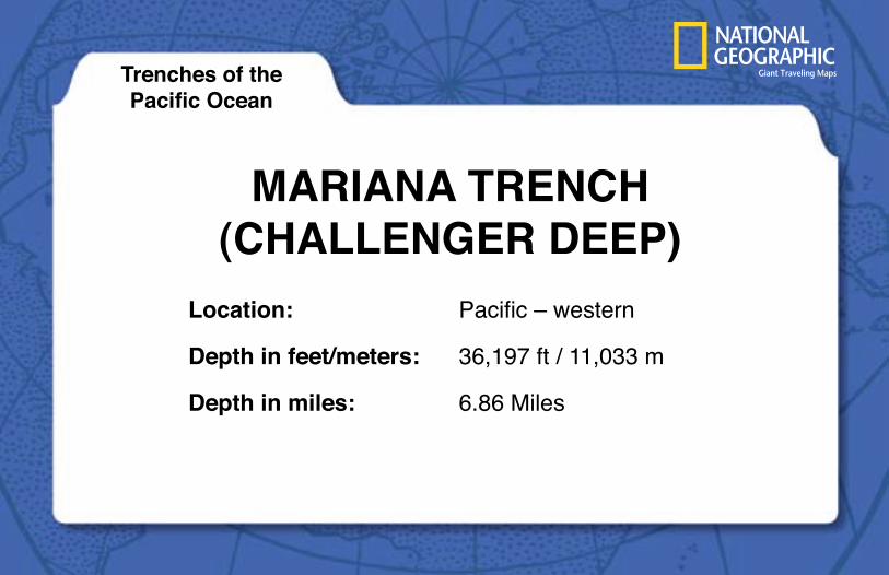
Mariana Trench(challenger Deep)
Trenches of thePacific Ocean
location:
Depth in feet/meters:
Depth in miles:
Pacific – western
36,197 ft / 11,033 m
6.86 Miles

Trenches of The Pacific ocean

TOnga Trench
Trenches of thePacific Ocean
location:
Depth in feet/meters:
Depth in miles:
Pacific – western
35,702 ft / 10,882 m
6.76 Miles

Trenches of The Pacific ocean

philippine Trench(galaThea DepTh)
Trenches of thePacific Ocean
location:
Depth in feet/meters:
Depth in miles:
Pacific – western
34,580 ft / 10,540 m
6.54 Miles

Trenches of The Pacific ocean
Kuril-KaMchaTKa Trench
Trenches of thePacific Ocean
location:
Depth in feet/meters:
Depth in miles:
Pacific – western
34,449 ft / 10,500 m
6.52 Miles

Trenches of The Pacific ocean
KerMaDec
Trenches of thePacific Ocean
location:
Depth in feet/meters:
Depth in miles:
Pacific – western
32,963 ft / 10,047 m
6.24 Miles

Trenches of The Pacific ocean

Izu-Ogasawara
Trenches of thePacific Ocean
location:
Depth in feet/meters:
Depth in miles:
Pacific – western
32,078 ft / 9780 m
6.08 Miles

Trenches of The Pacific ocean
Japan
Trenches of thePacific Ocean
location:
Depth in feet/meters:
Depth in miles:
Pacific – western
29,527 ft / 9000 m
5.59 Miles

Trenches of The Pacific ocean

Yap
Trenches of thePacific Ocean
location:
Depth in feet/meters:
Depth in miles:
Pacific – western
27,976 ft / 8527 m
5.3 Miles

Trenches of The Pacific ocean
peru chile Trench
Trenches of thePacific Ocean
location:
Depth in feet/meters:
Depth in miles:
Pacific – eastern
26,456 ft / 8065 m
5.01 Miles

Trenches of The Pacific ocean
caYMan Trench
Trenches of thePacific Ocean
location:
Depth in feet/meters:
Depth in miles:
Pacific – eastern
25,238 ft / 7686 m
4.78 Miles

Trenches of The Pacific ocean
aleuTian Trench
Trenches of thePacific Ocean
location:
Depth in feet/meters:
Depth in miles:
Pacific - northern
25,194 ft / 7670 m
4.77 Miles
Trenches of The Pacific ocean
Java Trench
Trenches of thePacific Ocean
location:
Depth in feet/meters:
Depth in miles:
Indian Ocean
24,460 ft / 7455 m
4.63 Miles

Trenches of The Pacific ocean
MiDDle aMerica Trench
Trenches of thePacific Ocean
location:
Depth in feet/meters:
Depth in miles:
Pacific – eastern
21,880 ft / 6669 m
4.14 Miles

Trenches of The Pacific ocean
viTYaz Trench
Trenches of thePacific Ocean
location:
Depth in feet/meters:
Depth in miles:
Pacific – western
20,177 ft / 6150 m
3.80 Miles

Trenches of The Pacific ocean
rYuKYu Trench
Trenches of thePacific Ocean
location:
Depth in feet/meters:
Depth in miles:
Pacific – western
17,100 ft / 5212 m
3.24 Miles

Trenches of The Pacific ocean

cedrOs Trench
Trenches of thePacific Ocean
location:
Depth in feet/meters:
Depth in miles:
Pacific – eastern
13,200 ft / 4000 m
2.50 Miles


![Indo-Pacific Climate Modes in Warming Climate: Consensus ...Indian Ocean dipole . Indian Ocean basin warming . Indo-western Pacific ocean ... [17], inducing a north Indian Ocean (NIO)](https://img.pdfslide.us/doc/110x75/611a7e4e613a58782f2e061c/indo-pacific-climate-modes-in-warming-climate-consensus-indian-ocean-dipole.jpg)