Embed Size (px)
Citation preview

FINAL REPORT
AIC 11-1003
PAPUA NEW GUINEA
ACCIDENT INVESTIGATION COMMISSION
AIRCRAFT ACCIDENT REPORT
Pacific Helicopters Ltd
P2-PHL
Eurocopter AS350 B2
4.5nm WSW of Baluan Island
Manus Province
PAPUA NEW GUINEA
13 February 2011

[ii]
The Papua New Guinea Accident Investigation Commission (AIC) was informed of the accident by the Civil Aviation Safety Authority of PNG on 13 February 2011, and commenced an on-site investigation.
This amended Report, made publicly available on 13 February 2017 was produced by the AIC, PO Box 1709, Boroko 111, Papua New Guinea. Paragraphs 1.6.3 and 1.6.4 were amended to correct the Engineering Order reference and the operator’s client details respectively.
The report is based upon the investigation carried out by the AIC, in accordance with Annex 13 to the Convention on International Civil Aviation, Papua New Guinea (PNG) Act, and Civil Aviation Rules. New Guinea (PNG) Civil Aviation Act 2000 (As Amended), Civil Aviation Rules, and the Commissions of Inquiry Act 1951. It contains factual information, analysis of that information, findings and safety action taken to address identified deficiencies.
Readers are advised that in accordance with Annex 13 to the Convention on International Civil Aviation, it is not the purpose of an AIC aircraft accident investigation to apportion blame or liability. The sole objective of the investigation and the Final Report is the prevention of accidents and incidents. (Reference: ICAO Annex 13, Chapter 3, paragraph 3.1.) Consequently, AIC reports are confined to matters of safety significance and may be misleading if used for any other purpose.
As the AIC believes that safety information is of greatest value if it is passed on for the use of others, readers are encouraged to copy or reprint for further distribution, acknowledging the AIC as the source.
When the AIC makes recommendations as a result of its investigations or research, safety is its primary consideration. However, the AIC fully recognizes that the implementation of recommendations arising from its investigations will in some cases incur a cost to the industry.
Readers should note that the information in AIC reports and recommendations is provided to promote aviation safety. In no case is it intended to imply blame or liability.
Approved
David Inau, ML
Chief Executive Officer
13 February 2017
[iii]
TABLE OF CONTENTS
TABLE OF Contents ............................................................................................ iii
FIGURES ................................................................................................................. v
TABLES .................................................................................................................. vi
INTRODUCTION ................................................................................................. vii
1 FACTUAL INFORMATION ......................................................................... 1
1.1 History of the flight ............................................................................... 1
1.2 Injuries to persons ................................................................................. 2
1.3 Damage to aircraft ................................................................................. 3
1.4 Other damage ........................................................................................ 3
1.5 Personnel information ........................................................................... 3
1.5.1 Pilot in command ................................................................. 3
1.6 Aircraft information .............................................................................. 4
1.6.1 Aircraft data ......................................................................... 4
1.6.2 Engine data .......................................................................... 4
1.6.3 Maintenance history ............................................................ 5
1.6.4 Weight and balance data ...................................................... 5
1.6.5 Fuel information .................................................................. 6
1.7 Meteorological information ................................................................... 7
1.8 Aids to navigation ................................................................................. 7
1.9 Communications .................................................................................... 7
1.9.1 Communications equipment ................................................ 7
1.9.2 Communications between PHL and other parties ............... 7
1.9.3 Emergency Locator Transmitter (ELT) ............................... 8
1.10 Aerodrome information ......................................................................... 8
1.11 Flight recorders ..................................................................................... 8
1.11.1 Sky Connect Tracking System ............................................ 8
1.12 Wreckage and impact information ........................................................ 9
1.13 Medical and pathological information ................................................ 10
1.14 Fire ...................................................................................................... 10
1.15 Survival aspects ................................................................................... 10
1.16 Tests and research ............................................................................... 11

[iv]
1.16.1 Simulated autorotation ....................................................... 11
1.16.2 Tail rotor examination ....................................................... 12
1.17 Organisational and management information ..................................... 12
1.17.1 The operator ...................................................................... 12
1.17.2 Operational aspects ............................................................ 12
1.18 Additional information ........................................................................ 13
1.19 Useful or effective investigation techniques ....................................... 14
2 ANALYSIS ..................................................................................................... 15
2.1 Analysis of the accident circumstances ............................................... 15
2.2 Analysis of other operational decisions ............................................... 15
3 CONCLUSIONS ............................................................................................ 16
3.1 Findings ............................................................................................... 16
3.1.1 Aircraft .............................................................................. 16
3.1.2 Crew/Pilot .......................................................................... 16
3.1.3 Flight operations ................................................................ 16
3.1.4 Operator ............................................................................. 17
3.1.4 Air Traffic Services ........................................................... 17
3.1.5 Flight recorders .................................................................. 17
3.1.5 Medical .............................................................................. 17
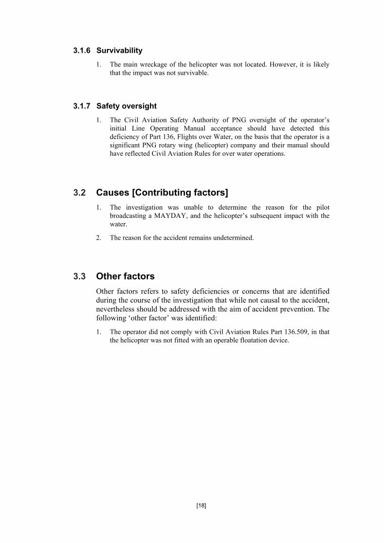
3.1.6 Survivability ...................................................................... 18
3.1.7 Safety oversight ................................................................. 18
3.2 Causes [Contributing factors] .............................................................. 18
3.3 Other factors ........................................................................................ 18
4 SAFETY ACTIONS AND RECOMMENDATIONS ................................. 19
4.1 Safety action ........................................................................................ 19
4.1.1 Safety action taken by Pacific Helicopters Ltd ................. 19

[v]
FIGURES
Figure 1: PHL’s track from Madang to the point of impact near Baluan Island.
Figure 2: The accident site photo taken about 35 minutes after the accident, showing the glassy surface of the water.
Figure 3: Spreadsheet supplied by Pacific Helicopters Ltd
Figure 4: PHL vertical profile using Sky Connect data
Figure 5: PHL plot using Sky Connect data
Figure 6: Items recovered from the ocean
Figure 7: Satellite tracking of the helicopter flight path

[vi]
TABLES
Table 1: Injuries to persons

[vii]
INTRODUCTION
SYNOPSIS
On 13 February 2011 local date, a Eurocopter AS-350 B2 helicopter, registered P2-PHL, owned and operated by Pacific Helicopters Ltd., departed Goroka at 22:01 UTC on a chartered positioning flight to Lorengau, Manus Province, with an en-route refueling stop at Madang. The pilot did not report any abnormalities with the helicopter during the flight to Madang. He added a further 346 L of fuel at Madang for the flight to Lorengau.
The pilot advised Madang Flight Information Service (FIS) of his departure intentions, and PHL departed Madang at 22:53, with the pilot reporting an estimated arrival time at Lorengau of 0045. He was advised by Madang FIS to provide operations normal reports at 23:09, 23:45, and 00:15, and reported climbing to 7,000 ft. At 00:31 the pilot broadcast a MAYDAY and said that he was ditching into the sea.
Madang FIS immediately declared a DISTRESS phase of Search and Rescue (SAR), and alerted the operator in Goroka, and other aircraft and helicopters operating in the Madang Flight Information Region (FIR) on 8837 kHz, and 120.1 MHz. Pacific Helicopters assisted the search by providing the GPS location of the crash site 02° 35′ 58.19′′ S, 147° 11′ 20.40′′ E. The pilot, the sole occupant, was not located.
The surface of the ocean was reported to be calm (glassy) with the sun’s reflection off the glassy surface at the time of the flight. This may have affected the pilot’s depth perception, particularly when nearing the surface.
The recorded tracking data showed that the helicopter made a 3,120.5 ft/min decent at a 101.5 kt true airspeed (TAS) to 236 ft, at which point the recorded speed was 71 kt. Witnesses reported seeing the descending helicopter’s nose lift, then lower again before it impacted the water. Based on the recorded data and the witness’ evidence, the likelihood of the pilot abruptly arresting the high rate of descent and attempting to flare the helicopter, could not be discounted. However, such an abrupt manoeuvre may have placed the helicopter into a situation where the main-rotor RPM may have decayed to a point beyond which the pilot could not maintain control of the helicopter, due to it being at a height from which recovery may not have been possible.
Searchers found 14 small pieces of wreckage from the fuselage and a number of emergency kit items from inside the cabin. A fractured tail-rotor blade was also floating on the surface at the same location. The engineering report into the tail-rotor blade fracture indicated that the tail rotor was rotating under power at the time of the impact. However, since there was no evidence of the fracture having been sustained by the blade striking any structure or substantively solid material, it is likely that the tail rotor was being driven by the main rotor blades during an auto-rotative descent.
The investigation was unable to determine the reason for the pilot broadcasting a MAYDAY, and the helicopter’s subsequent impact with the water. The reason for the accident remains undetermined.
Following the accident, the operator informed the Accident Investigation Commission that it had taken safety action by amending its Line Operations Manual to include compliance with CAR Part 136, and included a requirement for the fitment of a radio altimeter for all overwater flights, and pilots to complete radar altimeter assisted autorotation training.

[viii]

[1]
1 FACTUAL INFORMATION
1.1 History of the flight
On 13 February 2011 local date, a Eurocopter AS-350 B2 helicopter, registered P2-PHL, owned and operated by Pacific Helicopters Ltd., departed Goroka at 2201 UTC1 for Lorengau, Manus Province, with an en-route refueling stop at Madang. It was a chartered flight, with the pilot the sole occupant. The total fuel on board at Goroka was 216 kg (121 L); total freight weighed 42.2 kg, and the pilot’s personal baggage weighed 20 kg.
The pilot did not report experiencing any abnormalities with helicopter during the flight to Madang. He added a further 346 L of fuel at Madang for the flight to Lorengau.
The pilot advised Madang Flight Information Service (FIS) of his departure intentions, and PHL departed Madang at 22:53, with the pilot reporting an estimated arrival time at Lorengau of 00:45. He was advised by Madang FIS to provide operations normal reports at 23:09, 23:45, and 00:15, and reported climbing to 7,000 ft. At 00:31 the pilot broadcast a MAYDAY2 on his HF3 Radio and said that he was ditching into the sea.
Madang FIS immediately declared a DISTRESS phase of Search and Rescue (SAR) and alerted the operator in Goroka and other aircraft and helicopters operating in the Madang Flight Information Region (FIR) on 8837 kHz, and 120.1 MHz.
Google earth images modified by the PNG AIC
Figure 1: PHL’s track from Madang to the point of impact near Baluan Island.
1 The 24-hour clock, in Coordinated Universal Time (UTC), is used in this report to describe the local time as
specific events occurred. Local time in the area of the accident, Papua New Guinea Time (Pacific/Port Moresby Time) is UTC + 10 hours.
2 MAYDAY. International broadcast for urgent assistance, from French “m’aidez!” (Help me) usually broadcast on the radio frequency of 121.5 MHz.
3 High frequency (HF) is the range of radio frequency electromagnetic waves (radio waves) between 3 and 30 MHz.

[2]
Pacific Helicopters assisted the search by providing the GPS location of the crash site 02° 35′ 58.19′′ S, 147° 11′ 20.40′′ E. The operator’s helicopter fleet was fitted with the Sky Connect Tracking System4. Several aircraft and helicopters from other operators in the Madang area were also involved in the search.
Wreckage of the helicopter was located 4 nm WSW of Baluan Island. Only a few small pieces of wreckage and an oil slick were sighted. The search for the pilot and the helicopter was conducted over two days but the pilot was not found.
Figure 2: The accident site photo taken about 35 minutes after the accident, showing the glassy surface of the water.
The wreckage and items recovered included fuselage panels, first aid equipment, a life raft and a vest, and one tail-rotor blade.
1.2 Injuries to persons
Table 2: Injuries to persons
The pilot, a 57 year old Australian citizen was presumed to have been fatally injured in the accident.
4 Sky Connect Tracking System enables any equipped aircraft in the world to be tracked in real time via the
Iridium satellite network.
Injuries Flight crew Passengers Total in Aircraft
Others
Fatal 1 - 1 -
Serious - - - -
Minor - - - Not applicable
Nil Injuries - - - Not applicable
TOTAL 1 - 1 -

[3]
1.3 Damage to aircraft
The helicopter was not recovered. The investigation concluded that it was substantially damaged on impact with the water. The only evidence remaining was the debris found floating on the surface.
The wreckage was presumed to be on the ocean floor at a depth of approximately 700 m to 1,000 m.
1.4 Other damage
There was no other damage to property or the environment.
1.5 Personnel information
1.5.1 Pilot in command
Age : 57 years
Gender : Male
Nationality : Australian
Type of licences : PNG CPL and Australian ATPL
Valid to : perpetual
Licence numbers : PNG CPL No. P20084
: Australian ATPL No. 138756
Ratings : Single- and Multi-engines (Land)
BH206, HU50, BK117, AS350
Total flying time : 14,120.9 hours
Total on this type : 982.2 hours
Total hours PNG : 5,396.5 hours
Total hours twin : 1,255.7 hours
Total hours IFR : 120.0 hours
Total hours last 90 days : 112.9 hours
Total hours last 30 days : 30.7 hours
Last Competency Check : 26 February 2010
Medical class : one
Valid to : 27 September 2011
Medical limitation : nil

[4]
1.6 Aircraft information
1.6.1 Aircraft data
Aircraft manufacturer : Eurocopter
Model : AS350 B2
Serial number : 2923
Date of manufacture : 1996
Nationality and registration mark : PNG P2-PHL
Name of the owner : Pacific Helicopters Ltd.
Name of the operator : Pacific Helicopters Ltd.
Annual Maintenance Review : 31 May 2011 (expiry date)
Certificate of Airworthiness issued : 12 August 2006
Valid to : non-terminating
Certificate of Registration issued : 2 Aug 2006
Valid to : non-terminating
Total airframe hours at last inspection : 4,644.9 hours (at 5 Feb 2011)
Total airframe hours : 4,648.6 hours (at 11 Feb 2011)
Total hours since last inspection : 6.2 hours (incl est Goroka to accident)
Total airframe hours accident time : 4,651.1 hours
1.6.2 Engine data
Engine type : Turbo shaft
Manufacturer : Turbomeca
Model : Arriel 1D1
Serial number : 9668
Total engine hours : 4,708.5 hours (at 5 Feb 2011)
Total hours since last inspection : 6.2 hours (incl est Goroka to accident)
Total engine hours accident time : 4,714.7 hours
Total time since Overhaul : N/A

[5]
1.6.3 Maintenance history
The helicopter had undergone a 100/200/250 hourly airframe inspection, and a 100/150/ 500 hourly engine inspection, between 5 and 8 February 2011. The emergency first aid and survival kits were removed from the helicopter, checked, and refitted to the helicopter. The maintenance was recorded as follows:
5/1/11 (J/N- 38112) main fuel supply line from drain valve to combustion casing rubbing to NG tachometer. Removed and inspected fuel pipe within tolerance, adjust drain valve union for relocation
7/1/11 (J/N- 38114) cargo hook and basket installed iaw ICA-D350-607 On board Systems 120-104-01.
10/1/11 (J/N- 38116) 25/30 and 50 hrly Airframe and 30 hrly Engine inspection due carried out. Tail Rotor P.C.L inspection due carried out.
17/1/11(J/N- 38122) FCU to be removed for fault finding. FCU removed to fit to PHY. FCU from PHY fitted, characteristics checks found satisfactory. Work carried out W.R.T 73-21-00.
8/2/11 (J/N- 38136) 100/200/250 hrly Airframe and 100/150/500 hrly Engine due carried out W.R.T PNG CA rules.
9/2/11(J/N- 38138) GPX Survey Stringer installation carried out W.R.T AEA EO 11396.007/1.
1.6.4 Weight and balance data
The Pacific Helicopters Ltd., passenger/freight manifest document prepared prior to the flight listed the following:
DATE: 13/02/2011. A/C REG: P2-PHL. FROM: GOROKA. TO: MANUS.
Total freight 42.2 kg
(Two pumps, a ladder, two life jackets and a life raft)
Pilot baggage 20 kg
Total fuel 362 kg
Pacific Helicopters Ltd stated that aeromagnetic [survey] equipment was carried on the aircraft. The investigation was informed that the aeromagnetic equipment was owned by the client, GPX Surveys Pty Ltd.
During the investigation, Pacific Helicopters Ltd confirmed that the ‘manifest done prior to the flight was not detailed enough to prove weight and balance limitations were in accordance with the aircraft flight manual’. Figure 3 is a post-accident spreadsheet titled ‘PHL Weight and Balance 13-02-11’ prepared by Pacific Helicopters Ltd and supplied to the AIC:

[6]
Figure 3: Spreadsheet supplied by Pacific Helicopters Ltd
The spreadsheet showed that on departure from Madang, the helicopter was expected to have been 222 kg below the Flight Manual approved maximum all up weight (MAUW), and that at the time of the accident the helicopter was estimated to have been 467 kg below MAUW.
While these calculations show that the helicopter weight was at all times less than the approved MAUW, the investigation was unable to determine if it was within balance limitations. However, because it was flown for 98 min from Madang before the pilot broadcast the MAYDAY, it is likely that the helicopter was within balance limitations.
1.6.5 Fuel information
The fuel type used was JET-A1, otherwise known as AVTUR. Samples of fuel supplied to aircraft and helicopters on 13 February 2011, before and after PHL was refuelled, were checked. The aircraft and helicopters listed below were refuelled as follows:
P2-ANM DHC-8 at 20:06 with 496 L;
P2-PHL AS-350 B2 at 22:30 with 346 L
P2-HBH Bell 206L at 23:08 with 188 L
P2-AND Fokker 100 at 00:05 with 3,568 L
P2-HBT Bell 206L at 00:55 with 148 L
P2-PAN Bell 212 at 01:38 with 296 L
No fuel anomalies were reported by the operators of these aircraft and helicopters.

[7]
1.7 Meteorological information
The weather conditions on route were CAVOK5. Searchers arriving at the accident site about 30 min after the accident described the sea surface as flat and glassy (calm).
1.8 Aids to navigation
PHL was fitted with a Garmin GPS Map 196 navigation system.
1.9 Communications
1.9.1 Communications equipment
The aircraft was fitted with the following communications equipment:
a Bendix King KY196AX2 VHF radio;
a Tait T200 FM radio;
a CODAN HF2000 radio; and
a SKY Connect satellite phone.
1.9.2 Communications between PHL and other parties
The helicopter was operating under a flight plan filed with Madang FIS.
The Madang FIS Initial Notifications of Incidents record stated:
00:31 PHL broadcast MAYDAY and that he was ditching into the sea. One (1) POB [person on board].
Between 00:29 and 00:32 there were three known HF transmissions between Madang FIS and PHL, and PHL and another unknown aircraft. These conversations were overheard by another aircraft operating in the Mendi area and passed to Pacific Helicopters.
There were no reports of the pilot broadcasting the reason for the MAYDAY and/or the requirement to ditch into the sea.
The pilot of the aircraft in the Mendi area stated that communication between all parties and PHL lasted approximately 40 to 60 seconds.
5 CAVOK.. Ceiling and visibility OK. Visibility greater than 10 km; no clouds below 5000 ft or below the
highest minimum safe sector altitude whichever is highest; no significant weather.

[8]
1.9.3 Emergency Locator Transmitter (ELT)
The helicopter was fitted with an Artex C406-2HM Emergency Locator Transmitter (ELT). The Artex C406-2 HM transmits on all 3 emergency frequencies (121.5/243.0 and 406 MHz.)
The ELT automatically activates during a crash and transmits the standard swept tone on 121.5 and 243.0 MHz. It also transmits a 406 MHz encoded digital message to the Cospas/Sarsat satellite system. The AIC was advised that the ELT signal was observed between 10:29 and 10:31. No further signals were intercepted.
1.10 Aerodrome information
Not applicable.
1.11 Flight recorders
The aircraft was not fitted with a flight data recorder or cockpit voice recorder. Neither recorder was required by the PNG Civil Aviation Act and Civil Aviation Rules current at the time of the accident.
1.11.1 Sky Connect Tracking System
The helicopter’s flight data was tracked and recorded at regular intervals (averaging about every 2.1 min) via the Iridium satellite network, using the Sky Connect Tracking System.
The recorded data showed that at 00:28.38 the helicopter was tracking 013M and commenced climbing from 7,327 ft and was at 7,570 ft tracking 024M at 00:29.43 (1 min later). During the climb the speed decayed from 109 kt to 94 kt.
After passing through 7,570 ft at 00:29.43 the helicopter commenced a rapid decent. Recorded data ceased at 00:32.04 when the aircraft was descending through 236 ft and tracking 067M.
The helicopter descended 7,334 ft in 2.35 min and travelled a ground distance6 of 3.795 nm at a true air speed of 101.5 kt. The rate of descent was 3,120.5 ft/min (52.01ft/sec). At 00:32.04 the recorded speed was 71 kts.
At 0029.43 the Sky Connect Tracking System data recorded activation of ‘Button 8’. Event switch (Button) 8 is the manually operated emergency switch that, when activated, emits a distress signal which is received via satellite link at Pacific Helicopters headquarters in Goroka, Eastern Highlands Province.
6 The ‘ground’ distance travelled during the descent was 3.795 nm. The ‘air’ distance travelled in the descent
gradient 3.978 nm. See figure 4.

[9]
Figure 4: PHL vertical profile using Sky Connect data
Figure 5: PHL plot using Sky Connect data
1.12 Wreckage and impact information
There was a total of 14 pieces of the aircraft recovered, floating on the ocean surface. The debris field was compact indicating that it was likely that the helicopter was intact when it impacted the water.
The only wreckage located was small sections of fuselage panels, parts of the survival kit, a tail rotor blade, and oil slick. SAR teams could not locate the helicopter or the pilot.

[10]
The eight items recovered from the ocean surface that came from inside the helicopter indicated that either a door was opened prior to impact, or the impact caused a door/s to pop open, allowing the recovered items to be washed out of the aircraft cabin.
Figure 6: Items recovered from the ocean
The PNG AIC sent the tail-rotor blade to the Australian Transport Safety Bureau Engineering Laboratory in Canberra, Australia for analysis.
1.13 Medical and pathological information
The pilot was not located, therefore no medical or pathological investigation was conducted as a result of this occurrence.
1.14 Fire
Two witnesses fishing in the vicinity when the crash occurred said they saw no fire either inflight or post-impact.
1.15 Survival aspects
Within minutes of the pilot’s MAYDAY broadcast, the operator notified Madang FIS of the GPS location of the accident site, which was then transmitted to other aircraft in the area, or flying along the same track as PHL, requesting their assistance with the SAR.
The operator’s quick response to the pilot’s MAYDAY broadcast, and the use of the satellite tracking data, assisted the search teams to arrive at the crash site within 30 min.

[11]
The pilot of the first helicopter to arrive at the accident site reported that the wreckage field was still very contained, and sea conditions were such that, had the pilot managed to evacuate the aircraft after impact, he would most certainly have been seen from the air.
Figure 7: Satellite tracking of the helicopter flight path
1.16 Tests and research
1.16.1 Simulated autorotation
The operator conducted a test flight at the accident location on the day following the accident, using a Bell 212 helicopter. A simulated autorotation was flown at the same time of day (sun angle) and replicating the track flown by PHL.
The operator reported that the test flight established that ‘the sun’s reflection off the glassy surface up through the helicopter chin bubble on the right hand side created a condition that made it all but impossible for the pilot to establish any useful reference to carry out the vital last flaring actions to be able to carry out a successful autorotation onto the sea surface’.

[12]
1.16.2 Tail rotor examination
The fractured tail-rotor blade, recovered from the accident site, was sent to the Australian Transport Safety Bureau for analysis. The engineering report determined that:
The damage observed on the tail rotor blade at the blade root area was consistent with the blade entering the water while rotating and being positively driven (i.e. under power).
It was not possible to determine if the tail rotor was being driven by the engine or by the main rotor blades during an auto-rotative descent.
There was no evidence of the failure having been sustained by the blade striking any structure or substantively solid material.
1.17 Organisational and management information
1.17.1 The operator
Pacific Helicopters Ltd Airport Road Goroka
PO Box 342 Goroka Eastern Highlands Province Papua New Guinea
1.17.2 Operational aspects
Pacific Helicopters Ltd operates a varied fleet of both single- and twin-engine helicopters throughout PNG. The helicopters are mainly used in the charter category for mining contracts, charters and ad-hoc flights for clients throughout PNG. At the time of the accident it operated under PNG Civil Aviation Rules 91, 119, and 136.
Five days after the accident, the operator provided the following information in response to the AIC question regarding the absence of floats fitted to PHL for the flight to Manus Island:
After the contract7 had been signed, Flight Operations Management was presented with a request from the client for the use of a specific helicopter, that being P2-PHL. The reason for this request was that this aircraft was known to have low electronic noise interference with the Aeromagnetic equipment carried on the aircraft.
7 Refers to the contract between Pacific Helicopters and the client, for the Airborne Geophysical Survey
flights to be conducted over Manus Island.

[13]
It had been the intention of Flight Operations management to use P2-PHY for this contract as it was the only AS350 within the Pacific Helicopters fleet that had been set up and plumbed to have the emergency float kit attached and it is Pacific Helicopters stated objective to always operate to the highest safety standards possible.
The request to use P2-PHL instead of the float capable P2-PHY was carefully considered by Flight Operations, and after detailed discussions with the pilot that was to conduct the flight, and considering the following issues;
a) The aircraft requested was not being set up for the attachment of emergency floats.
b) Emergency floats not able to be fitted to any helicopter with a stinger modification attached.
c) The accepted and ongoing practice by both fixed wing and helicopter operators within Papua New guinea to operate over water for ferry flights under Rule Part 91.
It was decided to agree to the use of P2-PHL on this contract.
PHL was equipped with appropriate life preservers and a life raft in accordance with Civil Aviation Rule 91.525.
However, in using PHL for this charter operation, the operator did not comply with the requirement of Civil Aviation Rule 136.509 which stated:
136.509 Flights Over Water 8
A holder of an air operator certificate performing an air operation in a single engine helicopter must not operate over water more than 10 nm beyond auto-rotational distance from shore unless the helicopter is equipped with an operable flotation device.
Although the factors contributing to this accident were not known, on the day of the accident Pacific Helicopters grounded all AS350 BAs and B2s (those fitted with the same powerplant make and model as installed in PHL), and issued an engineering order for all these aircraft to undergo a general maintenance inspection before being released back into service. No defects that would affect the airworthiness of any of these helicopters were found.
1.18 Additional information
There were two fishermen from Baluan Island who reported witnessing the accident. One was interviewed on Baluan Island on the day after the accident, 14 February 2011, and the other was interviewed while he was in his canoe, with the same investigator in a banana boat alongside, about 5 km off Baluan Island.
8 A helicopter equipped with an operable floatation device, is separate from an occupant being required to
have a life preserving vest or access to a life raft.

[14]
One witness reported seeing the descending helicopter’s nose lift, then lower again before it impacted the water. The most significant detail to emerge from both interviews was that both fishermen were confident that the aircraft impacted the water in a nose-down attitude, estimated by the investigators to be 20 deg on the basis of their descriptions.
Both witnesses reported hearing attempted engine restarts, but this information and its reliability should be treated with caution.
Neither fisherman attempted to reach the accident site.
1.19 Useful or effective investigation techniques
The investigation was conducted in accordance with Papua New Guinea Civil Aviation Act, Commissions of Inquiry Act, the Civil Aviation Rules, and the PNG Accident Investigation Commission’s approved policies and procedures, and in accordance with the Standards and Recommended practices of Annex 13 to the Chicago Convention.

[15]
2 ANALYSIS
2.1 Analysis of the accident circumstances
The Australian Transport Safety Bureau (ATSB) engineering report into the tail-rotor blade fracture indicated that the tail rotor was rotating under power at the time of the impact. However, as reported by the ATSB, since there was no evidence of the fracture having been sustained by the blade striking any structure or substantively solid material, it is likely that the tail rotor was being driven by the main rotor blades during an auto-rotative descent.
The surface of the ocean was reported to be calm (glassy) at the time of the accident. On the day after the accident the pilot of a Bell 212 helicopter reported that the surface of the water at the accident site was still glassy.
The pilot’s feedback to the operator and subsequently to the AIC stated that the test flight established that ‘the sun’s reflection off the glassy surface up through the helicopter chin bubble on the right hand side created a condition that made it all but impossible for the pilot to establish any useful reference to carry out the vital last flaring actions to be able to carry out a successful autorotation onto the sea surface’.
The investigation concluded that if the pilot of PHL had been attempting an autorotation landing, his depth perception and therefore his ability to execute a successful ditching from an autorotation, particularly when nearing the sea surface, may have been adversely affected by the conditions of light and the glassy sea surface.
The recorded data showed that at 00:28.38 the helicopter commenced a climb from 7,327 ft and was at 7,570 ft at 00:29.43 (1 min later). During the climb the speed decayed from 109 kt to 94 kt. If the helicopter had sustained an engine failure, it is possible that the pilot was converting speed to height during that manoeuvre.
The analysis of the Sky Connect Tracking Data revealed that the rate of descent from 7,570 ft to 236 ft at 00:32:04 (when recorded data ceased) was 3,120.85 ft/min (52.01ft/sec) with the helicopter travelling a ground distance of 3.795 nm at a true air speed of 101.5 kt. At 00:32:04 the recorded speed was 71 kt. Based on this evidence, and the witness statements, the likelihood of the pilot abruptly arresting the high rate of descent and attempting to flare the helicopter could not be discounted. However, such an abrupt manoeuvre may have placed the helicopter into a situation where the main-rotor RPM may have decayed to a point beyond which the pilot could not maintain control of the helicopter, due to it being at a height from which recovery may not have been possible.
2.2 Analysis of other operational decisions
While not causal to this accident, the operator’s decision at the time of this accident to use helicopters not equipped with operable floatation devices on overwater flights, had the potential to adversely affect survivability in the event of a controlled water landing.

[16]
3 CONCLUSIONS
3.1 Findings
3.1.1 Aircraft
1. The helicopter was certified and maintained in accordance with existing PNG regulations and approved Civil Aviation Safety Authority of PNG procedures.
2. The helicopter was certified as being airworthy when dispatched for the flight.
3. The mass and the centre of gravity of the aircraft were within the prescribed limits.
4. There was no evidence of any pre-existing defects or malfunctions in the helicopter that could have contributed to the accident.
5. The fuel added at Madang was of the correct type and grade.
6. The Madang refuel supplier refuelled two aircraft and three helicopters (apart from PHL) a total of 4,696 L from the same fuel batch. No fuel anomalies were reported by the operators of these aircraft and helicopters.
7. The helicopter was structurally intact when it departed from Madang.
8. Apart from a few fuselage panels and items from inside the cabin, the helicopter was not located. It was determined to have been destroyed by the impact forces.
9. Witness reports indicated that there was no evidence of pre- or post-impact fire.
10. The helicopter was fitted with relevant communication and navigational aids including a satellite tracking device.
11. The helicopter was not equipped as per Civil Aviation Rule 136.509.
12. P2-PHL was operating under a flight plan filed with Madang Flight Service.
3.1.2 Crew/Pilot
1. The pilot was licensed, qualified and medically fit for the flight in accordance with existing Papua New Guinea Civil Aviation Act and Rules.
3.1.3 Flight operations
1. The pilot activated the Sky Connect Tracking System data system distress signal which was received via satellite link at Pacific Helicopters headquarters in Goroka, Eastern Highlands Province.

[17]
2. The pilot carried out normal radio communications with Madang Flight Information Service from departure from Madang until he broadcast the MAYDAY.
3. The flight tracking data showed that after the pilot broadcast the MAYDAY, the helicopter turned towards Baluan Island and rapidly descended into the water.
3.1.4 Operator
1. The operator’s Flight Operations Management was presented with a request from the client for the use of a specific helicopter for the charter contract, that being P2-PHL, as this aircraft was known to have low electronic noise interference with the aeromagnetic equipment carried on the aircraft.
2. The company senior management and the pilot knew the aircraft was not equipped with an operable floatation device when committing to the over-water flight.
3. The operator did not comply with Civil Aviation Rule 136.509.
4. The operator notified Madang Flight Information Service of the GPS location of the accident site, based on data from the Sky Connect satellite tracking system.
5. The operator’s quick response to the pilot’s MAYDAY broadcast and distress signal, by utilising the satellite tracking system data, assisted the search teams to arrive at the crash site within 30 min.
3.1.4 Air Traffic Services
1. There was normal communication between the helicopter and Madang Flight Information Service.
2. The DISTRESS phase of SAR was initiated and declared by Madang Flight Information Service immediately on advice from the operator.
3. Madang Flight Information Service promptly transmitted the accident location data, received from the operator, to other aircraft in the area, or flying along the same track as PHL, requesting their assistance with the SAR.
3.1.5 Flight recorders
1. The helicopter was not fitted with a flight data recorder or cockpit voice recorder. Neither recorder was required by the PNG Civil Aviation Act and Civil Aviation Rules current at the time of the accident.
3.1.5 Medical
1. The pilot was not located, therefore no medical or pathological investigation was conducted as a result of this occurrence.
[18]
3.1.6 Survivability
1. The main wreckage of the helicopter was not located. However, it is likely that the impact was not survivable.
3.1.7 Safety oversight
1. The Civil Aviation Safety Authority of PNG oversight of the operator’s initial Line Operating Manual acceptance should have detected this deficiency of Part 136, Flights over Water, on the basis that the operator is a significant PNG rotary wing (helicopter) company and their manual should have reflected Civil Aviation Rules for over water operations.
3.2 Causes [Contributing factors]
1. The investigation was unable to determine the reason for the pilot broadcasting a MAYDAY, and the helicopter’s subsequent impact with the water.
2. The reason for the accident remains undetermined.
3.3 Other factors
Other factors refers to safety deficiencies or concerns that are identified during the course of the investigation that while not causal to the accident, nevertheless should be addressed with the aim of accident prevention. The following ‘other factor’ was identified:
1. The operator did not comply with Civil Aviation Rules Part 136.509, in that the helicopter was not fitted with an operable floatation device.
[19]
4 SAFETY ACTIONS AND RECOMMENDATIONS
4.1 Safety action
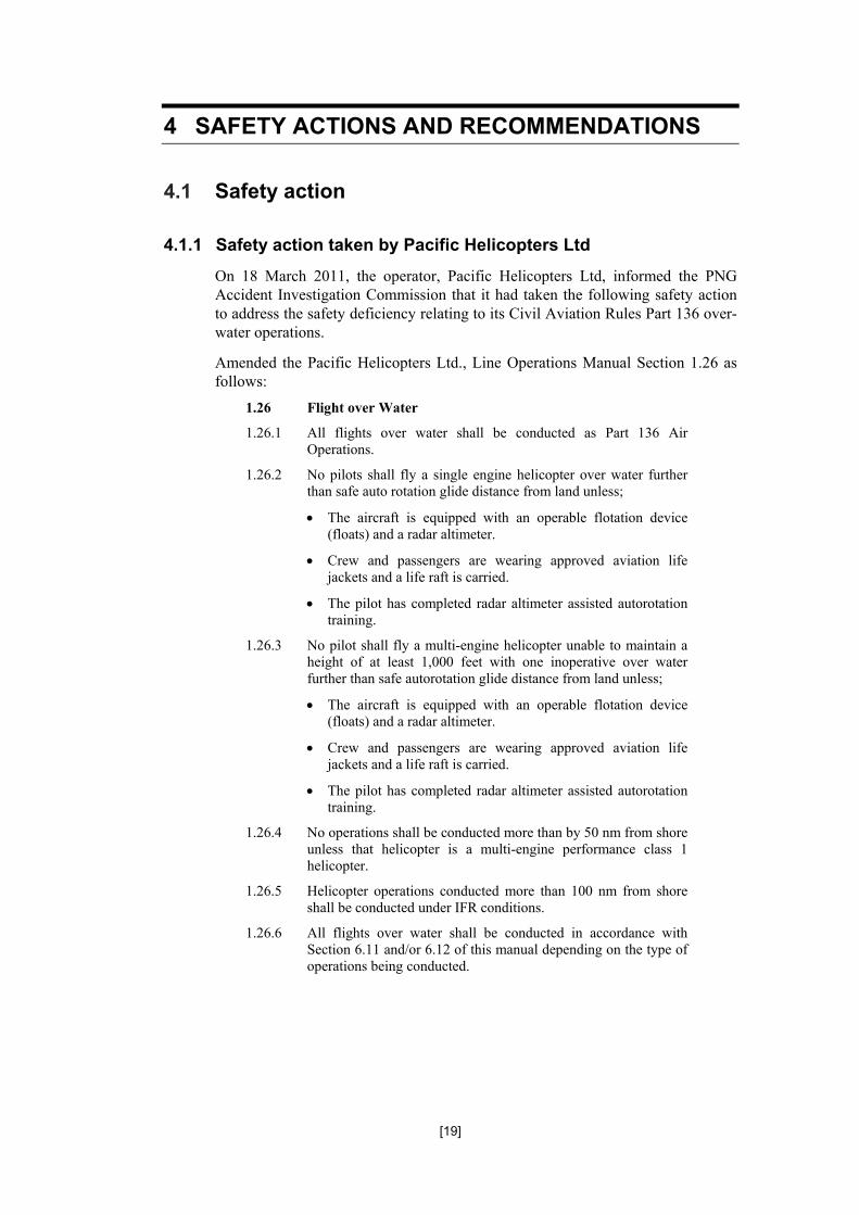
4.1.1 Safety action taken by Pacific Helicopters Ltd
On 18 March 2011, the operator, Pacific Helicopters Ltd, informed the PNG Accident Investigation Commission that it had taken the following safety action to address the safety deficiency relating to its Civil Aviation Rules Part 136 over-water operations.
Amended the Pacific Helicopters Ltd., Line Operations Manual Section 1.26 as follows:
1.26 Flight over Water
1.26.1 All flights over water shall be conducted as Part 136 Air Operations.
1.26.2 No pilots shall fly a single engine helicopter over water further than safe auto rotation glide distance from land unless;
The aircraft is equipped with an operable flotation device (floats) and a radar altimeter.
Crew and passengers are wearing approved aviation life jackets and a life raft is carried.
The pilot has completed radar altimeter assisted autorotation training.
1.26.3 No pilot shall fly a multi-engine helicopter unable to maintain a height of at least 1,000 feet with one inoperative over water further than safe autorotation glide distance from land unless;
The aircraft is equipped with an operable flotation device (floats) and a radar altimeter.
Crew and passengers are wearing approved aviation life jackets and a life raft is carried.
The pilot has completed radar altimeter assisted autorotation training.
1.26.4 No operations shall be conducted more than by 50 nm from shore unless that helicopter is a multi-engine performance class 1 helicopter.
1.26.5 Helicopter operations conducted more than 100 nm from shore shall be conducted under IFR conditions.
1.26.6 All flights over water shall be conducted in accordance with Section 6.11 and/or 6.12 of this manual depending on the type of operations being conducted.